|
Park Summaries
Québec
All text and photos are copyrighted by Parks Canada or the Canadian Register of Historic Places
(except as noted) and were extracted from either the Parks
Canada or Canada's Historic Places
Websites. Parks with a grey background are managed by Parks Canada.
©Parks Canada Agency / Agence Parcs Canada |
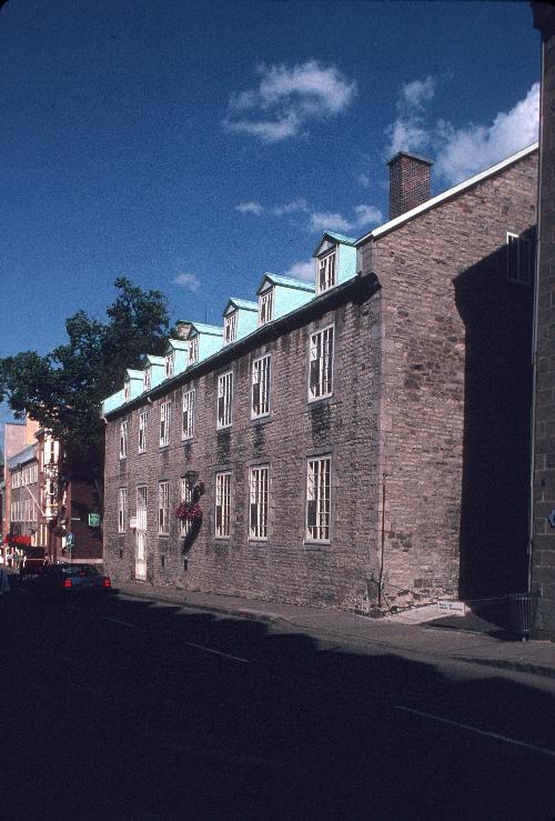
57-63 St. Louis Street National Historic Site of Canada
Québec, Québec
Part of an historic significant streetscape.
57-63 St. Louis Street is a grouping of three two and two-and-a-half-
storey early eighteenth and nineteenth century stone houses within the
walls of Quebec City's Upper Town at the foot of Cavelier du Moulin
Park, forming part of the panoramic townscape of old Quebec.
57-63 St. Louis Street was designated a National Historic Site of Canada
in 1969 because these buildings are part of an important urban panorama.
The heritage value of 57-63 St. Louis Street National Historic Site of
Canada resides in the consistent streetscape created by this grouping of
buildings originating in the French Regime, and their contribution to
the larger cultural landscape of Vieux Quebec. The site's value is
carried by the massing, materials, design, and craftsmanship of the
component parts of this streetscape and by its setting within the gates
of the old city. It is an important example of the continuity of 18th
century French Regime architectural and landscape values within the
historic townscape of Old Quebec.
59-61 St. Louis Street was built during the French Regime at the
beginning of the 18th century and was expanded in 1796. 57 and 63 St.
Louis Street, extensions dating from the beginning of the nineteenth
century, form with 59-61 St. Louis Street, a single property. In 1811,
the entire property was sold to the British government for use as an
officers' residence. The British also built a military hospital at the
south end of the property. The house and its annexes have continued to
reflect the architectural forms, materials, and spatial relationships of
the early nineteenth century.
|

©Parks Canada Agency / Agence Parcs Canada, 2002 |
Acton Vale Railway Station (Grand Trunk) National Historic Site of Canada
Acton Vale, Québec
Acton Vale Railway Station (Grand Trunk) National Historic Site of
Canada is a small passenger terminal located in the town of Action Vale,
Quebec. This picturesque, wooden building features a variety of
structural shapes and details including a turret, multi-paned windows,
rooftop dormers and high-pitched gables. Large brackets support the
overhanging eaves of the bellcast roof.
The Acton Vale Railway Station (Grand Trunk) expresses the development
of the Grand Trunk Company railway in Quebec. The design of this
building is based on a standard plan used by the Grand Trunk Railway
Company to build several stations between 1895 and 1905 on the line
connecting Montréal to Portland Maine. Formed in 1853, the Grand Trunk
Railway Company became part of the Canadian National Railway Company
after the latter was created in 1919. The heritage value of this site
resides in the surviving elements of its original design, materials and
decoration. It now functions as the town tourist office and exhibition
centre.
|

©Parks Canada Agency / Agence Parcs Canada |
Alert Hangar National Historic Site of Canada
La Baie, Québec
The Alert Hangar National Historic Site of Canada is situated at the
eastern end of the Canadian Forces Base (CFB) Bagotville, Quebec.
Located in the alert area at the end of the airstrip, it is composed of
four large steel hangars grouped two-by-two and set either side of a
smaller rectangular Domestic Centre. Each hangar features a steel gable
roof and two large, three-panel doors that open vertically at at the
front and back. The hangars are connected to the central domestic centre
by two covered passageways.
During the Cold War the Bagotville Alert Hangar formed part of a network
of five Canadian all-weather jet fighter bases designed to counter
surprise attacks by Soviet bombers. The Alert Hangar speaks to the
unique lifestyle of its occupants during the Cold War, when operational,
pilots and ground personnel spent up to a week at a time inside the
hangar. Pocket doors at each end of the building enabled pilots to take
off quickly in the event of an alert. Eating facilities and sleeping
quarters were located in the Domestic Centre a few metres from the armed
and prepared aircraft. Like their Second World War counterparts, the
Bagotville pilots had to be ready to jump into the cockpit at any
moment. The Cold War pilots lived in a constant state of alert for over
thirty years in structures reflecting the anticipated continuation of
wars. The Alert Hangar is based on the first model developed by the
Royal Canadian Air Force (RCAF) in the 1950s, and is one of the last
surviving examples of its type in Canada. Austere in appearance, it is
distinguished by its imposing size and its supremely functional
architecture.
|

©Parks Canada Agency / Agence Parcs Canada, 1993 |
Apitipik National Historic Site of Canada
Gallichan, Québec
Apitipik National Historic Site of Canada consists of an isolated
272-hectare archaeological site located in the municipality of
Gallichan, Quebec. The site sits at the eastern end of Lake Abitibi, at
the mouth of the Duparquet River, near the Ontario-Quebec border. Often
referred to as "Pointe Abitibi," the site is a traditional summering
area and sacred place for the Algonquin peoples of the region. Apitipik
includes nearly 30 archaeological sites recording 6000 years of human
occupation. The site also includes the remains of numerous trading posts
that operated from the 17th century onward.
The heritage value of Apitipik lies in its historical and archaeological
associations with the Abitibi Algonquin as reflected in the land itself
and in the above and below ground remains of human occupation. Apitipik
is a sacred place and a traditional summer gathering place for the
Apitipi8innik and their ancestors. It contains evidence of various
periods of occupation, dating as far back as 6000 years. For example,
the area contains specific paleo-historic sites that date from 4000 BCE
to 1100 CE, including the investigated sites of Ki8ack8e matcite8eia,
Bérubé, Margot, and Réal. Apitipik also includes numerous trading posts
related to the North West and Hudson's Bay Companies, which operated
from the 17th century onward. Apitipik is of spiritual and cultural
significance to both the Pikogan and Wahgoshig communities.
|

©Pierre Lahoud, 2010 |
Arvida Historic District National Historic Site of Canada
Arvida, Québec
The town of Arvida, located in the Saguenay—Lac-Saint-Jean region some
250 km north of Quebec City, was designed as a whole from the outset.
Its location was determined by the 1924 establishment of an Alcoa
aluminum plant, sited there to take advantage of the region's rich water
resources. Arvida was built to house the plant's large workforce and was
essentially constructed in three phases from 1925 to 1950. The perimeter
proposed in this application clearly reflects this planning and the
three phases of the construction. The main original features are still
extant and recognizable in their original locations.
The Arvida Historic District is of historical importance because:
laid out starting in 1925 according to the plans of architects
Brainerd and Skougor, the town of Arvida was completed in three
successive phases running until 1950, and constitutes an excellent
synthesis of the town planning concepts of the time, such as the City
Beautiful and garden city movements, that are expressed by an organic
layout following the lie of the land, a hierarchy of thoroughfares, and
a network of parks, green spaces, and plentiful trees;
Arvida is a well preserved example of a Canadian company town and is a
singular instance of planned quality worker housing, where a diversified
urban landscape was rapidly established through a wide variety of
housing styles, some of which constitute a particularly successful
manifestation of regionally inspired architecture;
associated with Canada's first aluminum complex, Arvida's expansion is
a testament to the growth and development of the country's aluminum
industry.
|

©Mechanics' Institute of Montréal Archives / Archives du Mechanics' Institute of Montréal, 1920 |
Atwater Library of the Mechanics' Institute of Montréal National Historic Site of Canada
Montréal, Québec
Atwater Library of the Mechanics' Institute of Montreal is located at
1200 Atwater Ave. on the corner of Tupper St. in Westmount. It is a
two-storey, brick, Beaux-Arts style building situated on a landscaped
lot facing Cabot Square.
Atwater Library was built by the Mechanics' Institute of Montreal in
1918-1920, almost a century after the organization began. The Mechanics'
Institute was an important social, cultural and educational movement
devoted to universal education and technical training which, during the
19th century, had many branches in Canada. It has roots in the adult and
community education traditions of 18th and 19th-century Great Britain.
Heritage value of the Atwater Library resides in its representation of
the role of Mechanics' Institutes in Canada, and particularly in
Montréal as illustrated by this building's physical embodiment of the
institute's principles and ideals and by its continuing operation as a
dual function library and meeting place. Value also resides in the
building's Edwardian-Baroque Beaux-Arts design, its composition, site
and setting.
|

©Parks Canada Agency / Agence Parcs Canada |
Banc de Pêche de Paspébiac National Historic Site of Canada
Paspébiac, Québec
Banc de Pêche de Paspébiac National Historic Site of Canada is an
inshore fisheries landscape containing 10 of the approximately 60
buildings that once stood on the sandspit surrounding the broad
barachois lagoon at Paspébiac on Québec's Gaspé peninsula. The buildings
use a simple classically derived vocabulary in the New England
tradition. The site was associated with the inshore fishery practiced in
the region for more than 150 years.
The heritage value of Banc de Pêche de Paspébiac National Historic Site
of Canada resides in the site's association with inshore fishery as
illustrated by its setting, structures and buildings. Most of the
surviving buildings originated in the 19th century and are associated
with the business complexes of two of the most powerful companies in
what was a deeply syndicated industry. The largest complex was built by
Charles Robin and Co., created in 1766 and variously known as Robin,
Pipon and Co., C. Robin and Co. Ltd., and the Charles Robin-Collas Co.
Ltd. as it continued to operate well into the 20th century. A second,
smaller complex was the premise of the Le Boutillier Brothers,
established in 1838. In 1964, fire destroyed most of the early
complexes, leaving only seven buildings and a powder magazine built by
Robin and three buildings constructed by Le Boutillier Brothers. Four of
these buildings also have been separately commemorated as Paspébiac
Buildings National Historic Site of Canada.
|
©Parks Canada Agency / Agence Parcs Canadav |
Bank of Montréal National Historic Site of Canada
Montréal, Québec
The Bank of Montréal is a late-19th-century bank building, built in the
Queen Anne Revival style. It is located at the corner of Notre-Dame and
Seigneurs streets in the city of Montréal.
The Bank of Montréal was designated a national historic site in 1990
because the building is a particularly good example of the Queen Anne
Revival Style, as expressed in commercial architecture.
Built for the bank of the same name, the Bank of Montréal building is a
rare surviving example of the Queen Anne Revival style applied to a
commercial building. Its use of Flemish motifs in imitation of a Flemish
public building is typical of the style.
|
©Parks Canada Agency / Agence Parcs Canada, 1989 |
Battle of Eccles Hill National Historic Site of Canada
Frelighsburg, Québec
Battle of Eccles Hill National Historic Site of Canada is located on a
hill near the Canada-United States border between Vermont and Quebec,
close to Frelighsburg, Quebec. It overlooks the battlefield where the
Battle of Eccles Hill took place in 1870. The field, over 3,000 square
metres, is surrounded by a fence on three sides and by a road on the
fourth, and includes a three-pound canon, remnants of the confrontation
and a commemorative granite monument dating back to 1902.
The historical value of the site lies in its association with the events
of the Battle of Eccles Hill. In 1870 the Fenians crossed the
Canada-United States border at the top of Eccles Hill and came up
against Canadian home guards and volunteers. This confrontation was
initiated by a group of Irish patriots exiled to the United States to
start a revolutionary movement for Ireland's independence. They wanted
to weaken England by attacking Canada, which proved to be a failure.
The site and the granite monument commemorating the event are located
relatively close to the battlefield and the Canadian positions, but the
battle took place just south of the Canada-United States border.
|

©Parks Canada Agency / Agence Parcs Canada, 2011 |
Battle of the Cedars National Historic Site of Canada
Les Cèdres, Québec
The Battle of the Cedars National Historic Site of Canada is located at
Les Cèdres, 52 km south-west of Montreal, Quebec, on the banks of the
St. Lawrence River. There are no visible remains of the battle, during
which British and Canadian forces defeated American forces that held a
post at Les Cèdres, on the 19th - 20th of May, 1776, and also defeated
the American reinforcements on the 21st of May, 1776. A Historic Sites
and Monuments Board of Canada plaque was erected in 1980 to commemorate
the battle site. Surrounded by a small fence, the cairn stands in a
small grassed plot at the edge of the Chemin du Fleuve surrounded by
farmland and trees.
In 1776, during the Revolutionary War (1775-1783), American soldiers
invaded Canada and occupied the city of Montreal. To protect their
western flank from British attacks the Americans established a small
outpost at Les Cèdres, Quebec. The Battle of the Cedars occurred when
British forces advanced from the Niagara region encountered this
American outpost. British Captain George Forster, commanding a
detachment of the 8th Regiment, was supported by Cayugas, Senecas and
Mississaugas under Captain Guillaume de Lorimier. During the battle the
Forster's forces were reinforced by 30 Canadians led by Captain J.B.
Testard de Montigny.
Captain Forster's force attacked the American outpost and after a short
siege the Americans surrendered. American reinforcements that arrived
the next day also surrendered when they encountered Captain Forster's
force. Though victorious in the Battle of the Cedars Captain Forster did
not have the resources to advance to Montreal which remained under
American occupation until June of 1776.
|

©Parks Canada Agency / Agence Parcs Canada, 1920 |
Battle of the Châteauguay National Historic Site of Canada
Allans Corners, Québec
Site of 1813 battle in defence of Lower Canada; War of 1812.
On October 26, 1813, the Canadian troops under the command of
Charles-Michel de Salaberry won an important victory over the invading
American forces led by General Wade Hampton.
The scene of this battle is located on the shores of the Châteauguay
River, 50 km southwest of Montréal, near the U.S.-Canada border.
Battle of the Châteauguay National Historic Site commemorates this feat
of arms and the role played by the different combatants in defending
Canada.
Battle of the Châteauguay National Historic Site of Canada is a small
fragment of a War of 1812 battlefield located on the banks of the
Châteauguay River at Allans's Corners in the municipality of Howick,
near Ormstown, some 50 kilometres south-west of Montréal.
Battle of the Châteauguay was declared a national historic site because
it was the site of a Canadian victory on 26 October 1813, and because of
the role French Canadian troops played in the defence of Canada against
American invasion during the War of 1812.
The heritage value of Battle of the Châteauguay National Historic Site
resides in its identity as a memorial remnant in the midst of the
legible, relatively undisturbed cultural landscape of the battlefield
which extends from the fork of the Châteauguay and Outardes Rivers to
that of the Châteauguay and English, covering an area of about 500
acres. The centre of the battlefield was located between Morrison Ford
and Round Point.
|

©Parks Canada Agency / Agence Parcs Canada, 1989 |
Battle of Lacolle National Historic Site of Canada
Notre-Dame-du-Mont-Carmel, Québec
Battle of Lacolle National Historic Site of Canada is located within a
suburb of the town of Lacolle, Quebec, just north of the border between
Canada and the United States. In March 1814, a small force composed of
the British garrison the 13th Regiment of Foot, Royal Marines, Canadian
Fencibles, Voltigeurs and Aboriginal warriors withstood an attack by
4,000 American soldiers. Resistance to the American forces centred at
the local mill on the river's southern bank and a blockhouse 200 metres
away on the northern bank. The mill's location on the Lacolle River is
marked by an HSMBC cairn next to the road.
The Battle of Lacolle, the final battle against the American invasion of
Lower-Canada during the War of 1812, is valued for its associations with
the protection of Canada. Following a previously unsuccessful attempt to
march into Montreal in 1812, Major-General James Wilkinson planned an
American invasion of Lower-Canada for March 1814. Major-General
Wilkinson crossed the frontier with an army of 4 000 men and headed
towards the Lacolle River where he had been defeated in 1812. On March
30th 1814, the Americans opened fire on the mill near the Lacolle River
where Major R.B. Handcock led a small force of approximately 500 men.
This force comprised a small British garrison of the 13th Regiment of
Foot, Royal Marines, Canadian Fencibles, Voltigeurs and Aboriginal
warriors. Major Handcock's forces withstood the attack on the fortified
mill. Daunted by Major Handcock's resistance, Major-General Wilkinson
gave up his incursion and retreated to the American border, thus ending
the last American invasion of Lower Canada during the War of
1812.
|

©Parks Canada Agency / Agence Parcs Canada, 2006 |
Battle of the Lake of Two Mountains National Historic Site of Canada
Montréal, Québec
Battle of the Lake of Two Mountains National Historic Site of Canada is
located on the western end of Montreal Island, on Lac des Deux
Montagnes, in Quebec. The site, of which there are no extant remains,
consists of a square plot of land centred around a Historic Sites and
Monuments Board of Canada (HSMBC) plaque commemorating the battle.
Following the Lachine Massacre of August 1689, the Iroquois that
remained in the area posed a threat to the residents of the Island of
Montréal and the surrounding villages. In October, Governor Denonville
dispatched a scouting party, composed of 28 "coureurs de bois" under the
command of Sieurs Dulhut and d'Ailleboust de Manthet. They encountered a
group of 22 Iroquois, resulting in a skirmish at Lac des Deux Montagnes.
The French party defeated the Iroquois and reported no casualties, which
restored the confidence of the inhabitants of the area.
|

©Parks Canada Agency / Agence Parcs Canada, 2007 |
Battle of the Restigouche National Historic Site of Canada
Pointe-à-la-Croix, Québec
Site of last naval battle in Seven Years' War.
The Battle of the Restigouche National Historic Site is located at the
mouth of the Restigouche River, at the far end of Chaleur Bay. It is
here that the last naval battle between France and Great Britain for
possession of the North American continent took place. The confrontation
finally ended on July 8, 1760, sealing the fate of New France forever
after. Vestiges of the frigate The Machault are on display at an
interpretation centre located on the site. The vessel was part of the
relief expedition dispatched from France to retake the city of Québec,
which had fallen to British arms the previous autumn. At this National
Historic Site, you will discover a splendid collection of artifacts
retrieved from the wreck. You will relive one of the little-known events
of the Seven Years' War in North America.
Battle of Restigouche National Historic Site of Canada is located at the
bottom of the Chaleur Bay, in the estuary of Restigouche River between
New Brunswick and Quebec. The site consists of in situ remains of two
French ships sunk by the British in the Battle of Restigouche, June 22
to July 8, 1760. The 350-ton Bienfaisant, a supply ship remains mostly
undisturbed, while part of the 550-ton Machault, an armed frigate, is
still underwater. A ballast dump, featuring a concentration of metal
materials from French ships, is also encompassed in the designation.
In 1760, a small French fleet, consisting of the Machault, the
Bienfaisant and the Marquis de Malauze, under Sieur François Chenard de
la Giraudais returned from an aid-seeking mission in France. Upon
reaching the St. Lawrence River and discovering that British
reinforcements had preceded them, the fleet sought refuge in Chaleur
Bay. Expecting the arrival of the French fleet, Captain Byron of the
British ship, Fame, departed from Louisbourg with a small fleet, meeting
the French who were accompanied by 300 Acadians and 250 Mi'kmaq on June
22 in the Restigouche River. In an effort to block the British attack,
the French built a battery at Pointe-à-la-Batterie under Donat de la
Garde.
In the evening of June 28 through 29, two British frigates, the Repulse
and the Scarborough succeeded in clearing a southern passage through the
chain of sunken hulks. Bypassing the French defences, the British were
able to destroy Pointe-à-la-Batterie, on July 2. On July 8, three
British ships, the Repulse, the Scarborough and a schooner again
bypassed the two chains of hulks sunk by the French. Facing the Machault
and the two French batteries at Pointe des Sauvages and Pointe de la
Mission, the Repulse was driven aground. However, without further
reinforcement the French were forced to set the severely depleted
Machault and the Bienfaisant ablaze in order to prevent capture. The
third French ship, the Marquis de Malauze, was set ablaze by British
captives on board once freed by their compatriots. In 1939, the wreck of
the Marquis de Malauze was removed by the Department of Transportation.
Since the 1960s, the wrecks have been the subject of several underwater
archaeological investigations.
|
|
Battle of Rivière des Prairies / Battle of Coulée Grou National Historic Site of Canada
Montréal, Québec
Battle of Rivière des Prairies / Battle of Coulée Grou National Historic
Site of Canada is located on a rolling, partially treed landscape near
the coast of the Island of Montréal in Québec. It was the site of a
battle between a group of Iroquois and a group of French settlers in
1690. There are no extant remains of the battle; however, the site is
marked by a Historic Sites and Monuments Board of Canada commemorative
plaque that is located approximately 60 metres from the creek on Gouin
Boulevard.
On July 2 1690, the Sieur de Colombet, a former lieutenant in the French
army, was alerted to the presence of a group of Iroquois on the nearby
Rivière des Prairies, prompting him to gather 25 settlers to
investigate. They traveled to the property of Jean Grou, near the creek
bearing his name, and fired on the canoes of the Iroquois, killing four.
The Iroquois, numbering roughly 100, landed and engaged in combat with
the French. In the ensuing battle 15 French and 30 Iroquois were killed
or taken prisoner.
|

©Parks Canada Agency / Agence Parcs Canada, 1989 |
Battle of September 6th, 1775 National Historic Site of Canada
Saint-Jean-sur-Richelieu, Québec
The Battle of September 6th, 1775 National Historic Site of Canada is
located in the town of Saint-Jean-sur-Richelieu 43 km south-east of
Montréal, Quebec. Situated near Rivière Bernier, formerly named
Montgomery Creek, the site is less than a kilometre from the Richelieu
River and is 1.6 km from Fort Saint-Jean National Historic Site of
Canada. There are no extant remains of the battle of September 6th,
1775, in which a patrol of Aboriginal warriors, many of them Mohawk, led
by a Grand Chief and two European Captains turned back an American
invasion force. Marked by a Historic Sites and Monuments Board of Canada
plaque, erected in 1929, the site is now a grassed area flanked by maple
trees adjacent to a private golf course.
In 1775, during the American Revolutionary War, an American army led by
Major-General Philip Schuyler, Colonel Benedict Arnold and Brigadier
General Richard Montgomery launched an invasion into British-Canada, in
an attempt to gain military control of the Province of Quebec.
Brigadier-General Montgomery led one half of the invasion force,
consisting of 1,500 soldiers, across the border and assembled on
Île-aux-Noix in the Richelieu River, north of Lake Champlain. On
September 6th, 1775 Montgomery and Major-General Schuyler sailed down
the Richelieu River intending to attack Fort Saint-Jean. After landing
on the west bank of the Richelieu, approximately 1.6 km from Fort
Saint-Jean, the invasion force was fired upon by a patrol of
approximately 100 Aboriginal warriors, many of them Mohawk, led by Grand
Chief Solsienhooane and captains Gilbert Tice and Guillaume de Lorimier.
During the battle, eight Americans were killed and nine were wounded
while the patrol of Tice and Lorimier suffered four dead and five
wounded, including Captain Tice. The Americans were forced to retreat to
Île-aux-Noix. Though successfully turned back on the night of September
6th the American force returned and succeeded in besieging Fort
Saint-Jean on September 13th for forty-five days until the fort
capitulated November 3rd, 1775. The American invasion of Canada
continued into the year 1776 until the arrival of British reinforcements
helped to successfully drive the invasion force back across the
border.
|
©Parks Canada Agency / Agence Parcs Canada, dossier 8400-153 |
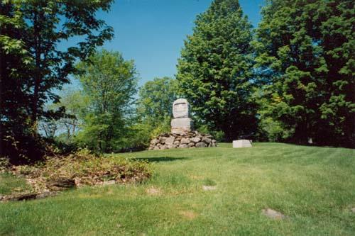
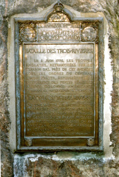
Battle of Trois-Rivières National Historic Site of Canada
Trois-Rivières, Québec
On June 8th, 1776, the British troops, entrenched on the low ground near
this place, under the command of General Simon Fraser, repulsed and
inflicted severe losses on an American column commanded by General
Thompson.
|
©Parks Canada Agency / Agence Parcs Canada, 2002 |
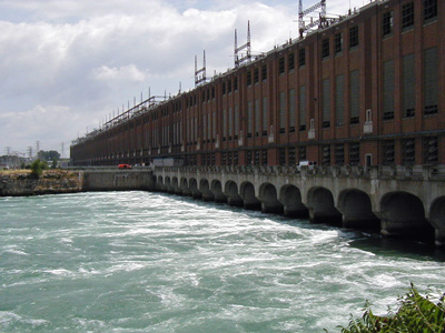
Beauharnois Power Development National Historic Site of Canada
Beauharnois, Québec
Socially, financially and politically important, 1929-32.
|

©Parks Canada Agency / Agence Parcs Canada, 1970 |
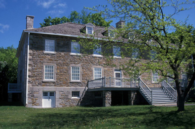
Bélanger-Girardin House National Historic Site of Canada
Beauport, Québec
The Bélanger-Girardin House is a steep-roofed, one-and-a-half-storey,
stone house, built in the early-18th century in the Québecois tradition.
It includes an attached shed, added in the early 19th century. The house
is located within the historic town of Beauport, just outside Québec
City in the St. Lawrence River Valley. The house is set within expansive
grassed grounds, adjacent to a convent, that give it a semi-rural
flavour.
Bélanger-Girardin House was designated a national historic site in 1982
because in both its structural evolution and its design, it is
representative of early French Regime houses erected in the countryside
near Québec City.
The Bélanger-Girardin house is a rare surviving example of a stone house
from the early part of the French regime. It is located in Beauport, one
of the first seigneuries of New France.
The present house was erected in two stages (ca. 1722-27 and ca. 1735),
adding to and eventually replacing a wood house built by the first
settler, Nicholas Bellanger, ca. 1673. The 1735 work was carried out by
a later owner, stonemason Jean Marcou. The remains of the original wood
structure are visible only in the interior and west walls of the present
stone house. Cléophas Girardin was a later occupant of the house.
The Bélanger-Girardin house is typical of rural Quebec domestic
architecture of the early 18th century in its form, materials,
proportions, openings and interior plan. It represents the transfer of
traditional domestic forms and construction methods from northern France
to the St. Lawrence Valley. The use of plaster roughcast to cover the
stone represents the adaptation of familiar forms and methods to the new
climate and geography of New France.
|

©Parks Canada Agency / Agence Parcs Canada, 1991 |
Berthier Railway Station (Canadian Pacific) National Historic Site of Canada
Sainte-Geneviève-de-Berthier, Québec
Berthier Railway Station is located several miles outside the town of
Sainte-Genevieve-de-Berthier along the Canadian Pacific Rail line. It is
a picturesque 1 1/2-storey late 19th-century railway station built in
wood.
Berthier Railway Station (Canadian Pacific) was designated a National
Historic Site in 1976 because it reflects the expansion of the Canadian
Pacific Railway.
Berthier Railway Station was built by the Quebec, Montreal, Ottawa and
Occidental (OMO&O) Railroad in 1877 as one of a series of small domestic
stations along its railway line along the St. Lawrence Valley between
Montreal and Quebec. The Canadian Pacific Railway acquired this line in
1885 to initiate improvement of its service to the Atlantic Ocean, and
it functioned as a CPR station for over a century. This building did not
meet the criteria to become a heritage railway station. The heritage
value of Berthier Railway Station resides in its function, its site, its
standard design and composition.
|

©Parks Canada Agency / Agence Parcs Canada, 1991 |
Beth Israël Cemetery National Historic Site of Canada
Québec, Québec
Beth Israël Cemetery National Historic Site of Canada occupies
approximately one acre of land in an area that marks the transition
between the commercial and residential sections of the city and of the
campus of Laval University, in the Sainte-Foy-Sillery district of the
City of Québec. The cemetery is rectangular in shape and is protected by
a low stonewall topped by an iron railing along René-Lévesque West
Boulevard and a snow fence along its other three sides. The cemetery's
layout is simple, with trees and shrubs, two walkways traversing the
property and a funeral home. The site is characterized by the spatial
organization of 300 or so tombstones, of simple and discreet design,
that bear Hebrew inscriptions and are arranged closely together in
linear rows. There are also numerous distinctive religious symbols,
specifically relating to the Jewish faith.
Since the latter half of the 19th century, most members of the Jewish
community in the City of Québec have been interred at the Beth Israel
Cemetery. The cemetery remains as a rare witness to the founding of a
community by the first Jewish settlers in the second half of the 18th
century. Although the Jewish presence in the City of Québec had been
long established, it was only in the mid 19th century that the community
grew large enough to found a congregation. Between 1840 and 1858, the
property was purchased by a Jewish merchant, consecrated and then
transferred to the Beth Israel Ohev Sholem congregation in 1894.
The cemetery contains about 300 headstones arranged closely together in
straight lines. This spatial organization is characteristic of all known
Jewish graveyards, and has its origins in the Judaic belief that burial
is the only sanctioned way to lay a person to rest. Consequently, the
space in a Jewish cemetery has always been accorded great value and must
not be wasted. Of equal importance is the profound conviction that in
death all humans are equal. Once inside a cemetery, all social
distinctions are erased and there are no preferred or reserved sites.
The rules governing the layout of the cemetery also apply to the design
of the markers. The majority of Jewish graves are marked by simple,
discrete stones and it was only in the late 19th century that markers in
the Greek Revival style, including obelisks, columns and broken columns,
were erected. Most plots in Beth Israel Cemetery are bounded by
retaining masonry walls, allowing for the lots to be elevated above
ground-level.
|
©Regimental Museum |
Black Watch (Royal Highland Regiment) of Canada Armoury National Historic Site of Canada
Montréal, Québec
Black Watch (Royal Highland Regiment) of Canada Armoury National
Historic Site of Canada is located on a busy thoroughfare at the centre
of Montréal, Québec. The irregularly- planned armoury consists of two
flat-roofed two-storey blocks at the front and rear joined by the large
gable-roofed drill hall between them. The symmetrical primary façade is
faced with rusticated and textured grey Montréal limestone and with
motifs suggestive of a Scottish baronial castle and the current and
previous names of the regiment in metal letters above the entrance. The
other three façades are of brick.
Since 1906, the armoury has been the home of the Black Watch, one of
Canada's oldest regiments. Created by Montréal's Scottish business
community in 1862 as the Royal Light Infantry, the regiment was raised
at the same time as five other infantry regiments as part of the rapid
expansion of Canada's Active Volunteer Militia. The Black Watch regiment
of Canada participated, along with its Scottish parent regiment, in the
Boer War, and both World Wars. Following the Second World War, the
regiment saw action in various other military and peacekeeping
operations up until 1970, when it was removed from the Regular Force,
leaving only its militia elements active.
In reference to the Scottish origins of the regiment, the primary façade
of the armoury was designed in the martial Scottish Baronial style, with
its associated military motifs, including towers, turrets, and an
imitation portcullis. Black Watch Armoury is one of six purpose-built
armouries in Montréal. Designed for storage and training, this armoury
and others of its type, with their drill, classroom and recreational
facilities, played an important role in the modernization of the
militia.
The Black Watch regiment and the armoury continue to play an important
role in the community, participating in many events that are well
attended by the public. The regiment is particularly well known for its
annual church parade, as well as its involvement in various other
parades throughout the year. The regiment also assists with a number of
charitable causes for veterans and affiliated organizations. The armoury
is regularly used for community and fundraising events and in support of
the Gaelic community, both in Montréal and the surrounding area.
|

©Parks Canada Agency / Agence Parcs Canada, Laura-Lee Bolger, 2005 |
Blanc-Sablon National Historic Site of Canada
Blanc-Sablon, Québec
Blanc-Sablon National Historic Site of Canada is located on the western
bank of the Blanc-Sablon River at its confluence with the Gulf of the
St. Lawrence on the Strait of Belle Isle, in Quebec. Vegetation in the
region is sparse and the area is covered by moss and a few small bodies
of water. The site encompasses over 60 archaeological sites relating to
its use as a centre for resource exploitation by successive cultural
groups from over the past nine millennia, including, Archaic (9000 —
3500 B.C.E.), Post-Archaic (3500-400 B.C.E), Dorset 500 B.C.E. — 1500
A.D., European (1500-1900 A.D.), and French and English Canadian.
The archaeological sites within Blanc-Sablon are demonstrative of the
continuous occupation of the Quebec-Labrador peninsula by the Inuit for
over 9000 years. The site is located on the banks of the Blanc Sablon
River, which lies between the Atlantic Ocean and the Gulf of the St.
Lawrence. The sheltered harbour into which the river flows benefits from
the cold Labrador Current, which stirs up nutrients, contributes to the
richness of the region's waters and attracts a variety of marine life.
The quantity and diversity of wildlife remains found at the site testify
to the importance of coastal resources, particularly seals, for the diet
of the area's inhabitants and explains why this area was occupied
repeatedly for millennia by many aboriginal peoples, including Archaic,
Post-Archaic, and Dorset.
Set against Mount Parent, a high rocky elevation, the site's uneven
terrain is made up of many marine beach terraces formed by receding
water, which resemble giant steps that lead down to the ocean. Around
7000 B.C.E., Aboriginal peoples began to inhabit the region and remains
of their encampments have been found on the terraces. Archaeological
remains found here provide evidence of regular occupation and of
Aboriginal societal evolution. Near the current shoreline, there is also
evidence of first contacts between Aboriginals and Europeans, as well as
a European and Euro-Canadian presence since the first half of the 16th
century.
|

©Parks Canada Agency / Agence Parcs Canada |
Bolton-Est Town Hall National Historic Site of Canada
East Bolton, Québec
Bolton-Est Town Hall National Historic Site of Canada consists of a
two-storey clapboard township hall building, located in the municipality
of Bolton-Est, Quebec. Although the building dates from the second half
of the 19th century and is very small in scale, Bolton-Est Town Hall has
a highly sophisticated architectural design. Designed to serve several
purposes, the Bolton-Est Town Hall contained facilities for town
administration and a courtroom.
The Municipal and Road Act for Lower Canada was passed in 1855,
resulting in the construction of many public buildings in the
English-speaking communities of rural Québec during the second half of
the 19th century. The Bolton-Est Town Hall was erected in 1867 and for
economic reasons, used a volunteer community workforce, was constructed
of locally obtained wood and was designed to serve various functions. It
housed a council chamber and a social meeting place; however, the
presence of a classroom on the ground floor is unique and distinguishes
the building from previous township halls in Canada. The Bolton-Est Town
Hall is also a rare example of a wood township hall that has preserved
some of its functions, its original appearance and its sophisticated
architecture. This structure stands as a graceful tribute to the
development of local self-government and to community spirit in
Canada.
|

©Library and Archives Canada/ Bibliothèque et Archives Canada, 1909-10 |
Bon-Pasteur Chapel National Historic Site of Canada
Québec, Québec
The Bon-Pasteur Chapel National Historic Site of Canada is part of a
complex of religious buildings in the city of Québec. The chapel is a
rectangular five-storey stone-faced building with a gable roof and is
part of the motherhouse of the Sisters of the Good Shepherd, like the
buildings flanking its sides. It is prized for its very fine interior
designed by Charles Baillargé.
The Bon-Pasteur Chapel was designated a national historic site of Canada
in 1975 because it is an outstanding example of religious architecture
in Québec.
The Bon-Pasteur Chapel, built between 1866 and 1868, was designed by the
noted Québec architect Charles Baillairgé as part of a group of
buildings forming the motherhouse of the Sisters of the Good Shepherd of
Québec. The chapel was enlarged in 1909-1910 with a new façade designed
by François-Xavier Berlinguet. The unaltered interior's strong vertical
lines, double row of galleries and interplay of curves lends emphasis to
the calm, spiritual qualities intended by the original architect. This
quality, along with the exceptional late 18th-century carved altars,
designed by Pierre-François Baillairgé, distinguishes the building as a
noteworthy example of church architecture in Québec.
|
©Parks Canada Agency / Agence Parcs Canada |
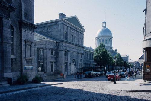
Bonsecours Market National Historic Site of Canada
Montréal, Québec
Bonsecours Market is a monumental, domed masonry building that stretches
a full city block in "Old Montréal". Built in the Neoclassical style and
located at the edge of the old port, it has become a symbol of the city.
Originally it housed the city's first city hall, together with a public
market, meeting and exhibition rooms, and a concert hall. Rehabilitated
in the mid-twentieth century, it now accommodates exhibitions, shops and
restaurants.
Bonsecours Market was designated a national historic site in 1984
because this imposing building, the largest town hall built in Canada
during the mid-19th-century, reflects the rise of Montréal to
metropolitan status; and because this Neoclassical building housed both
a market and public rooms and served for several years as Montréal's
city hall.
The heritage value of the site resides in its historical role in the
city of Montréal and in its imposing design and construction. Originally
constructed from 1844 to 1847 to designs by architect William Footner, a
concert hall was added in 1852 by architect George Browne. Inaugurated
in 1847 as a public market, the building also briefly housed the
Parliament of the Canadas in 1849, and served as Montréal's city hall
from 1852 to 1878. Bonsecours Market continued as Montréal's principal
public market for more than a hundred years.
|

©Parks Canada Agency / Agence Parcs Canada |
Cap-des-Rosiers Lighthouse National Historic Site of Canada
Gaspé, Québec
This thirty-seven metre high stone light-tower is perched atop rugged
cliffs near the village Cap-des-Rosiers, Québec. The exposed point of
land is at the mouth of the St. Lawrence River where it enters the Gulf
of St. Lawrence. Witness to many shipwrecks, the lighthouse continues to
guide ships navigating these treacherous waters. Tourists are welcome to
visit the lighthouse today.
The heritage value of Cap-des-Rosiers Lighthouse lies in its siting,
design, construction and materials. Its impressive height and tapering
profile are archetypical lighthouse qualities. Cap-des-Rosiers
Lighthouse was designed by John Page, Chief Engineer of the Department
of Public Works of the United Canadas, and built by contractor Charles
François-Xavier Baby in 1853-1858. Since 1858 it has operated using its
original optical apparatus although the technology of its light has
changed from a catadioptric fixed white light (1858-1903), incandescent
vapour petroleum light (1903-1921), a Canadian burner lamp (1921-1950),
a manually operated electric lamp (1950-1972), a partially automated
light (1972-1981), then a completely automated light (1981-2004). Its
tower was coated with stucco in 1861, 1881 and 1897, and repaired in
1929-30, 1954 and 1984. Windows were replaced in 1884, and its stonework
repaired in 1993.
|

©Parks Canada Agency / Agence Parcs Canada, 1991 |
Capitol Theatre / Québec Auditorium National Historic Site of Canada
Québec, Québec
The Capitol Theatre/ Quebec Auditorium National Historic Site of Canada
is a striking bow-fronted Beaux Arts-style theatre building on rue
Saint-Jean, just outside the Porte Saint-Jean in Quebec City.
The heritage value of the Capitol Theatre / Québec Auditorium lies in
the Beaux-Arts facade of the building, in the rich classical decor of
its interior, and in its design as a theatre and movie palace. Designed
by William S. Painter, and originally named the Auditorium of Québec,
this building began as a legitimate theatre in 1903, and soon added
vaudeville productions to its repertoire. In 1927 its interior was
radically altered by architects Thomas W. Lamb and Hélidore Laberge to
accommodate cinema, incorporating a new decor and a deep balcony. The
building was renamed the Capitol Theatre in the 1930s and used as a
cinema with occasional stage productions until the 1960s, then a movie
theatre only until 1982. In 1992 the Théâtre Capitol Theatre / Québec
Auditorium was restored and returned to operation as a legitimate
theatre.
|
©Parks Canada Agency / Agence Parcs Canada |
Carillon Barracks National Historic Site of Canada
Carillon, Québec
Early 19th-century stone military building.
Built between 1830 and 1837, the Carillon Barracks were erected during
the construction of the first Ottawa River canal system, a project
triggering a regional economic boom. The construction of this building
was probably undertaken in order to mitigate a lack ofhousing as the
site became a stopover.
During the events of 1837 and 1838, the British army requisitioned the
building and made the first renovations to it. Between 1840 and 1936,
the building was again used as a civil housing resource, as a hotel.
Since then, the building houses the museum of the Historical Society of
Argenteuil County.
Carillon Barracks National Historic Site of Canada is a two-storey stone
barracks in a vernacular version of British classical design located on
the main street of the village of Carillon, Quebec. It sits on land that
slopes gently for about 61 metres (200 ft.) down to the banks of the
Ottawa River at the foot of the Carillon Rapids. It is now operated as
the Carillon Museum.
The heritage value of Carillon Barracks National Historic Site of Canada
resides in its historical associations and in its excellent
representation of a dual Officers' Quarters and NCO's Barracks in the
British Classical tradition as illustrated by its site, setting, design
and materials. Construction of the Carillon Barracks began in 1836 under
its owner, former Deputy Commissary General C.J. Forbes, who had retired
to Carillon. Before it had been completed, it was leased by the British
Army during the 1837 Rebellion. During this period of civil disruption,
it housed troops called in to suppress the rebellion in the Comté des
Deux Montagnes. It also served as a stores depot for frontier garrisons
on the St. Lawrence Front. During the construction of the Carillon and
Chute-à-Blondeau canals, it was occupied, for a time, by Officers of the
Royal Staff Corps. After the military withdrew in 1840, the building
served as a hotel for many years. In 1938 it was restored to its 1837
appearance by Montreal architect and conservationist Percy Nobbs, and
has been subsequently used as the premises of the Carillon
Museum.
|
©Parks Canada Agency / Agence Parcs Canada |
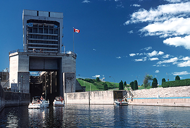
Carillon Canal National Historic Site of Canada
Carillon, Québec
Operational canal; site of two earlier canals, 1826-33.
The Carillon Canal, opened in 1833, bypasses the rapids of the Ottawa
River, especially those at Long Sault. Originally built for military
purposes, the canal was used for commerce from the outset.
Its location on the Ottawa River places it within the
Montreal-Ottawa-Kingston inland shipping route. The present-day canal is
used almost exclusively for pleasure boating, includes only one lock,
which raises and lowers boats 20 m in a single operation.
Carillon Canal National Historic Site of Canada is a canal now used for
recreational purposes, situated on the east side of the Ottawa River, 40
kilometres northwest of Montréal near the village of Carillon.
The heritage value of the Carillon Canal is reflected in the cultural
landscape directly associated with the construction and operation of the
canal including the land and water areas, which were modified and used
before 1960. The Carillon Canal was built in 1829-1833 by the Royal
Staff Corps of the British Army as a defence and immigration route,
enlarged in 1873-1882 to improve its facilities for commercial
navigation, then severely altered by the construction of a Hydro-Québec
dam in 1960-1963. Today it is used for pleasure craft.
|

©Parks Canada Agency / Agence Parcs Canada |
Cartier-Brébeuf National Historic Site of Canada
Québec, Québec
Wintering place of Jacques Cartier, 1535-36.
Cartier-Brébeuf National Historic Site of Canada commemorates the period
in 1535-1536 when Jacques Cartier and his shipmates wintered near the
Iroquoian village of Stadacona. The site also bears witness to the first
residence of the Jesuit missionaries, established in Québec in
1625-1626.
Located on the north shore of the Saint-Charles River in the heart of
Québec, the site is a magnificent urban park offering countless
opportunities for leisure and discovery.
Cartier-Brébeuf National Historic Site of Canada is a 6.8-hectare park
located on the north bank of the Saint Charles River in the Limoilou
district of Québec City. Originally located near the Iroquoian village
of Stadacona, the site commemorates the winter quarters of Jacques
Cartier and his companions in 1535-1536, and the first Jesuit missionary
residence in Quebec constructed during the period 1625-1626. Today,
grass, selective planting, mature trees, and walking and cycling paths
characterize the landscaped site. Other features include an exhibit on
the three voyages of the explorer Jacques Cartier, an interpretation
kiosk on the Jesuits, a longhouse surrounded by a stake palisade, and a
number of commemorative monuments, one of which represents the figures
of Jacques Cartier and the great chief Donnacona of Stadacona.
The heritage value of Cartier-Brébeuf National Historic Site of Canada
resides in the sense of place its location and historic monuments evoke.
This historic park originated in 1889 when the Saint Jean Baptiste
Society inaugurated a monument erected by the Cercle Catholique de
Québec to commemorate it as the site of Jacques Cartier's winter
quarters and Notre-Dame-des-Anges, the first Jesuit residence at Québec.
Since the missionary Jean de Brébeuf visited this residence, the park
was called Cartier-Brébeuf. It was transferred to the federal government
in 1957-58 as a national historic site of Canada. In 1971, a reservoir
was created in the park as an interpretation device that recalls the
former confluence between the Saint Charles River and the Lairet, a
river that is now channelled underground.
|
©Canadian Inventory of Historic Buildings / Inventaire des bâtiments historiques du Canada, 1966 |
Caughnawaga Mission / Mission of St. Francis Xavier National Historic Site of Canada
Kahnawake, Québec
Caughnawaga Mission / Mission of St. Francis Xavier National Historic
Site of Canada is located on the banks of the St. Lawrence Seaway in
Kahnawake Mohawk Territory, in Quebec. Jesuit Missionaries established
the mission in 1716-1718. The site comprises four components: the Saint
François Xavier Church (1845), the old presbytery (1716-1719) including
its west wing and corridor, the sacristy (1831-1832), and the museum
(1914). The mission is now located within the walls of Fort St-Louis
National Historic Site of Canada.
The mission of St. François-Xavier was first founded at La Prairie in
1667 by the Jesuits for the local Christian Iroquois. It was forced to
relocate several times due to economic concerns until finally settling
permanently in Kahnawake in 1716.
The oldest surviving building on the site is the old presbytery, which
was built between 1716 and 1719. The west wing, adjacent to the
presbytery, and the old church was constructed soon after, in 1720.
Until the fall of New France the Mohawks of Caughnawaga remained close
allies of the French. As a result of this alliance, in 1725 the French
built a palisade of wood, which was later replaced by stonework, to
protect the mission. The remains of this palisade define the limits of
Fort St-Louis National Historic Site of Canada, of which the mission is
a part. In 1831 both a new tower for the St. Francis Xavier church and a
sacristy were constructed for the instruction of the converted
Iroquois.
|

©Parks Canada Agency / Agence Parcs Canada, 1966 |
Caughnawaga Presbytery National Historic Site of Canada
Kahnawake, Québec
Caughnawaga Presbytery National Historic Site of Canada is located on
the south bank of the St. Lawrence Seaway in Kahnawake Mohawk Territory,
Quebec. The Presbytery, situated in the Mission of Caughnawaga, lies
west of the Church and comprises two connected stone houses, the
original Presbytery and the West House, also called the former Officers'
Mess, set in an L-shaped configuration. Attached to the church through a
corridor, the presbytery exemplifies architecture common to Québec in
the late 17th and early 18th century. The ensemble is set within the
perimeter of Fort St-Louis National Historic Site of Canada.
Jesuit missionaries founded the Mission of Caughnawaga at the French
colony of La Prairie in 1667 to minister to Iroquois Christians.
Nonetheless, it was displaced several times before coming to rest in
Kahnawake. The Presbytery is one of the main components of the complex,
and exemplifies architecture common in the province of Quebec in the
late 17th and early 18th centuries. The importance of the presbytery is
demonstrated in the good quality of craftsmanship, which is evident in
the interior and exterior detailing of the structure. The Presbytery
consists of two large, one-and-a-half-storey high stone buildings: the
original presbytery, with a shingled gable roof, and the West House
adjoining the south end of the residence. The semi-circular panel-heads
of its doors is unique to early Canadian houses.
The original presbytery, the larger of the two buildings, has on the
north elevation a glazed verandah with simple square posts and fretwork
brackets at the top. The original presbytery is a simple rectangle of
four bays, with a doorway to either end, and two widows between each
with a pair of twelve paned casements. A steeply pitched hipped roof,
covered in wood shingles, tops it. There are four dormers to the north,
two to the east, one to the west, and three to the south. The lone
chimneystack, made of brick, lies at the west end. The West House,
sometimes referred to as the Officers' House Mess, is one-and-a-half
storeys, and abuts the original presbytery on its southern wall. The
steeply pitched roof adorns a gable wall of stone to the north, the side
that adjoins the original presbytery.
|
©Parks Canada Agency / Agence Parcs Canada |
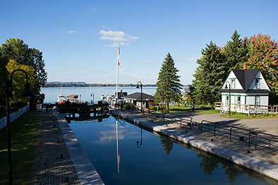
Chambly Canal National Historic Site of Canada
Chambly, Québec
Operational canal; nine locks, swing bridges.
The Chambly Canal, which opened along the Richelieu in 1843, played a
leading role in the Quebec forest products industry and in shipping
these products to the burgeoning United States market.
For over a century, heavily loaded barges travelled the Canal, a
distance of about 20 km. The nine locks allowed the barges to bypass
rapids and overcome a considerable difference in levels between the
Chambly basin and the Upper Richelieu.
Chambly Canal National Historic Site of Canada is located on the west
bank of the Richelieu River, south-east of Montréal, Quebec. Twenty
kilometres long, the Chambly Canal is a section of a waterway
constructed in the 19th century between Chambly and
Saint-Jean-sur-Richelieu on Québec's Richelieu River. The canal
constitutes part of an inland water transportation route joining
Montréal and New York City. The site includes the waterway itself, nine
locks, five weirs, two piers, dams, dikes and bridges, and several other
elements and buildings associated with the operation of the canal.
The heritage value of Chambly Canal lies in the longstanding
interrelationship between the composite parts of the canal's cultural
landscape, namely the Richelieu River, the canal route, the dam on Fryer
Island, and the buildings. The Chambly Canal was originally constructed
to bypass the Chambly Rapids on the Richelieu River. Designed by
engineer William R. Hopkins, it constituted eleven kilometres of canal
built against one river bank with a berm or embankment to maintain the
raised water, and an eight-kilometre cut parallel to the river. Built in
1831-1843 as a commercial route, it was altered in 1848-60, 1869-1880,
and 1880-1895, and restored by Parks Canada for recreational use in
1977-1980 and 1990.
|

©Parks Canada Agency / Agence Parcs Canada, 2008 |
Chapais House National Historic Site of Canada
Saint-Denis-De La Bouteillerie, Québec
Chapais House National Historic Site of Canada is located on a narrow
lot on the south shore of the St. Lawrence in the village of St. Denis,
Quebec. This rectangular two-and-a-half storey clapboard building with
rear wing, bellcast roof and dormers was for many years home to
Jean-Charles Chapais, a Father of Confederation, and his son, historian
Thomas Chapais. An excellent example of 19th-century Quebec
architecture, the house features clapboard siding, large balconies
surrounding the first floor terraces, winding staircases and
sophisticated interior finishes and details.
The house was built from 1832 to 1834 by Jean-Charles Chapais, who is
associated with the history and architecture of the building. While he
occupied the house, Chapais contributed actively to the economic and
cultural development of the Kamouraska region. Delegated to the Quebec
Conference and a Father of Confederation; he was appointed to the Senate
in 1868 and held the positions of Minister of Agriculture and Receiver
General in the MacDonald administrations. His son, Sir Thomas Chapais,
was knighted in 1935 for his work as a noted Canadian historian. He was
also a lawyer, journalist, member of the Legislative Council of Quebec,
and member of the Senate of Canada. Thomas Chapais was born and died in
this house.
The heritage value of Chapais House can also be found in its
architectural character, including its slightly curved bellcast roof,
its large balconies surrounding the first floor, its winding staircases
leading to the terraces, and its simply sculptured porticos. It also
includes woodwork, joinery, refined finishes, as well as interior
details that are exceptional for a house of this type.
|

©Parks Canada Agency / Agence Parcs Canada |
Château De Ramezay / India House National Historic Site of Canada
Montréal, Québec
Château De Ramezay / India House National Historic Site of Canada is a
private mansion situated on Notre-Dame Street east, in the Old Port of
Montréal, Quebec. First constructed in 1705, the stone building was
rebuilt after a fire in 1756. Surrounded by a small wall, the Château De
Ramezay / India House is a one-and-a-half storey stone building to which
was added an eastern extension with a conically- roofed tower in 1903.
The site also contains the Governor's garden, which was constructed at
the rear of the building in 2000.
The heritage value of the site resides in its political and mercantile
affiliations. Château De Ramezay / India House was first built for
Claude de Ramezay, who was the governor of Montreal from 1704 to 1724,
and the acting Governor General of New France for three years
(1714-1716). The construction of the building reflects the status and
financial situation of Montreal's governors who built their own private
mansions that French crown did not provide them.
From 1745 —1763, the building was used by the Compagnie des Indes
occidentales as a base of operations, during which time it was rebuilt
and enlarged after a fire in 1756. The trading company played an
important role in Canada's economic life, benefiting from a monopoly on
exported beaver pelts and on the imports of some textiles needed as
exchange merchandise.
From 1773-1844, during the Lower Canada period, the Château de Ramezay
became the official residence of the Governors-in-Chief of British North
America, excluding the period of American occupation from 1775 to 1776,
when it became the residence of successive American commanders. The
importance of the site is thus exhibited in the continuity of its usage.
In 1839, it housed the Executive Council and after 1849, the building
was used for other government offices, courts of law and schools. In
1895, the mansion was converted into the headquarters and museum of the
Antiquarian and Numismatic Society of Montréal.
|

©Parks Canada Agency / Agence Parcs Canada |
Château Frontenac National Historic Site of Canada
Québec, Québec
In the château style, Château Frontenac is an imposing hotel with five
brick and stone wings and a central tower erected in seven stages
between 1892 and 1993. It is prominently located on a cliff overlooking
the St. Lawrence River, within the Québec historic district.
The Château Frontenac was designated a national historic site because it
is an excellent example of a Chateau-style hotel.
The Château Frontenac was the first of a series of Chateau-style hotels
built by Canadian railway companies in the late 19th and early 20th
centuries to encourage tourists to travel on their railways. Popular
with the travelling public for their elaborate décor and comfortable
elegance, these hotels quickly became national symbols of quality
accommodation.
The Château Frontenac was the prototype for the Chateau-style railway
hotels that followed, and remained the purest expression of the Chateau
style among the group. Its fortress-like design, derived from the
medieval chateaux of France's Loire Valley and enhanced by its dramatic
cliff-top location, expressed the prevailing romantic view of Quebec as
a French medieval city. The hotel's picturesque eclecticism and rich
polychromatic surfaces reflected popular taste in Victorian
architecture. Construction began in 1892-93 for the Canadian Pacific
Railway to designs by architect Bruce Price. The hotel was enlarged in
1908-09 to designs by W.S. Painter, in 1920-24 to designs by Edward and
W.S. Maxwell, and in the 1990s by the Arcop Group.
|
©Parks Canada Agency / Agence Parcs Canada, NHS-images, 1988 |
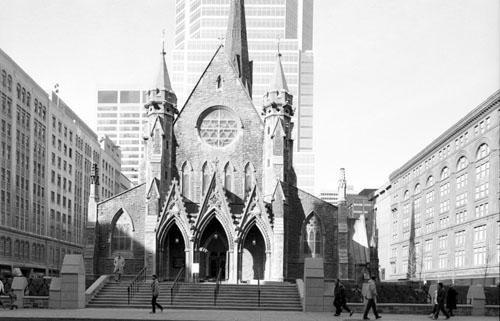
Christ Church Cathedral National Historic Site of Canada
Montréal, Québec
Christ Church Cathedral National Historic Site of Canada is a
picturesque Gothic Revival building prominently located in the busy
commercial district of Montréal, Quebec. With its cruciform plan, the
building is composed of simple geometric volumes set beneath a steep
gable roof with central tower and tall elegant spire. The west façade is
distinguished by a rose window above a projecting triple portal
entrance. An underground shopping centre is now situated below the
property.
This Anglican cathedral, built between 1857 and 1860, is inspired by
English architecture of the 14th century, and combines a highly rational
and geometric composition with a picturesque handling of silhouette and
massing. The original steeple, too heavy for the structure, was replaced
by a lighter steel-frame, aluminium-clad version in 1940. Problems with
the Caen stone facing also required adaptation from the original design.
Badly deteriorated due to the severe climatic conditions, large portions
of the exterior facing stone, particularly on the west end, were
replaced with Indiana limestone in the 1920s. By the 1980s this too was
failing and was restored using an artificial stone.
Christ Church Cathedral's architects were Frank Wills, whose mature
skills are evident in the picturesque massing and the harmonious
interior space but who died before construction began, and Thomas S.
Scott who was then commissioned to carry out Wills' design. The interior
has evolved over time to accommodate changes in use and liturgy: a large
east window was added in the late 19th century and other stained glass
has been donated over the years; the timber roof was decorated in 1906,
along with the installation of a marble floor and, in the 1920s, a new
altar and marble reredos were added, commemorating the congregation's
war dead. In 1938, the north porch was converted to a children's chapel
and in 1940, the south transept was changed into a memorial chapel. The
north transept was redecorated as a baptismal chapel in 1985. Recently a
choir loft has been constructed against the west wall.
The relatively elaborate design and decoration of the cathedral is, in
part, a reflection of its congregation, who, in the past, were often
high profile members of the Montréal's anglophone business
establishment. They included investor George Moffat, David Kinnear
senior partner and editor of the (Montreal) Herald, and Thomas Brown
Anderson, who became president of the Bank of Montréal.
|

©Historic Services Branch / Direction des services historiques, 2003 |
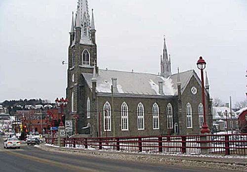
Church of Notre-Dame-de-la-Présentation National Historic Site of Canada
Shawinigan, Québec
The Church of Notre-Dame-de-la-Defence National Historic Site of Canada
is located in "Little Italy" in the northwest of Montreal where it is
associated with the development of the Italian community. Constructed of
stone on a Greek cross plan, the Romanesque Revival style church is
finished in the Italian manner with an exterior featuring decorative
brickwork and interior fresco decoration.
The Church of Notre-Dame-de-la-Defence was designated a national
historic site of Canada in 2002 because since its construction in
1918-1919, this church has been closely associated with Canada's oldest
Italian community, established in Montreal in the 1860s.
The building and its interior decorative program, executed in stages, is
by artist Guido Nincheri who specifically designed the structure for an
Italian Canadian parish. Recalling the Renaissance in Italy, walls and
vaults are painted in true fresco. The vault of the apse, executed in
1927- 1933, displays bright colours and a rich iconography with numerous
figures, many of which are portraits of contemporary Canadians and
Italians. These features make the church a rare and eloquent expression
of Canada's Italian community.
|

©Parks Canada Agency / Agence Parcs Canada, Rhona Goodspeed, 1996 |
Church of Saint-Léon-de-Westmount National Historic Site of Canada
Montréal, Québec
The Church of Saint-Léon-de-Westmount National Historic Site of Canada
is located in Westmount on the island of Montréal. The church possesses
a remarkable decorative program including frescoes, stained glass
windows, stonework, woodcarving and bronzework, all conceived by the
artist Guido Nincheri. Based on a Latin cross plan, this Romanesque
Revival church features an Italianate façade with bell tower.
The Church of Saint-Léon-de-Westmount features a splendid interior
designed by the prolific and talented Canadian artist Guido Nincheri
(1885-1973). His wall paintings are an outstanding example of mural
decoration. Beginning in 1928, he executed these works in the
wet-plaster "buon" fresco technique, a method of painting directly onto
the fresh plaster rarely used in Canada, but mastered by Nincheri in
Italy where he was born and trained. In this church, Nincheri combined
architecture, stained glass, painting and sculpture to create one of his
most remarkable masterpieces.
|
©Parks Canada Agency / Agence Parcs Canada, J. Dufresne, 2004
©Parks Canada Agency / Agence Parcs Canada, J. Dufresne, 2004 |
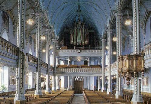
Church of Sainte-Marie National Historic Site of Canada
Sainte-Marie, Québec
The Church of Sainte-Marie National Historic Site of Canada is located
at the heart of Sainte-Marie, Québec. The church, the main façade of
which overlooks Marguerite-Bourgeois Avenue, is bordered by Notre Dame
Street on the west side, a parking lot on the east and the rectory on
the south. The Church of Sainte-Marie is a romantic Gothic Revival style
building, built in the 19th century in the shape of a Latin cross with a
semi-circular chevet connected to an irregularly shaped sacristy.
The heritage value of the Church of Sainte-Marie lies in the fact that
it is a fine example of a romantic Gothic Revival church, a concept
expressed in its relatively simple exterior arrangement as well as its
gothic components, which are simply applied to the surface of the
building rather than being incorporated into the architecture. In
contrast to the sober exterior of the church, the interior has an
impressive décor, created by Charles Baillairgé and François-Édouard
Meloche.
Inspired by the style of 14th-century English Gothic churches, the
church opens to a grand, blue-and-gold interior, with boldly sculpted
quatrefoils, rib arches and clustered columns. The modern-day interior
is almost identical to that which Baillairgé created in his time, except
for the painted décor that replaced the original white and gold. This
décor, created by François-Édouard Meloche of Montréal, is the most
striking aspect when one enters the church. Meloche excelled in
trompe-l'oeil painting: he created the illusion of three-dimensional
ornamentation on a two-dimensional surface. Meloche also painted the
beautiful little grisaille paintings of the patriarchs of the Old
Testament that hang over the gallery windows, as well as the four colour
paintings in the choir depicting the life of the Virgin Mary.
|
©Parks Canada Agency / Agence Parcs Canada |
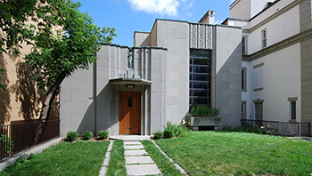
Cormier House National Historic Site of Canada
Montréal, Québec
Located at 1418 Pine Avenue West in Montréal, Cormier House is a spectacular
example of an Art Deco residence. Distinguished by the composition of its
main façade and the quality and opulence of its interior design, materials,
and furnishings, it is a truly unique architectural ensemble in Canada. It
reflects the aesthetic ideas of the 1930s and the design values of architect
and engineer Ernest Cormier, who designed it for himself in 1930-31 and lived
there until 1975. The house is also closely associated with former Prime
Minister of Canada, the Right Honourable Pierre Elliott Trudeau, who
purchased it in 1979 and, after leaving politics, made it his personal
residence from 1984 to 2000.
The property is located in the Golden Square Mile, a residential
neighbourhood in the western section of downtown Montréal. In the 1930s, the
neighbourhood was losing its once prominent place in the city. A lack
available space for development, the development of other parts of the city,
and the economic crisis all affected the neighbourhood greatly. Within this
social and economic context, Ernest Cormier undertook the construction of his
residence in 1930-31.
The long, narrow lot beside the mountain inspired a non-traditional layout.
The private quarters are located below ground instead of on the upper floors.
The main façade facing Pine Avenue has all the characteristics of the Art
Deco style with its two well-defined rectangular volumes of different
proportions with flat roofs, with its vertical lines and with its stylized
ornamentation. The home's décor is also distinguished by the use of expensive
and refined materials. Here you can find a mix of grand, modern, and
traditional materials, for example, the home features marble, terrazzo, and
cork floors.
The location chosen by Cormier was half-way between his office and the
University of Montréal. Throughout his long career, he designed public
buildings, mostly in Quebec and Ontario, his residence being the only known
exception. For its design, he was inspired by largely European contemporary
aesthetic ideas, but he gave the house a personal, original character in its
layout, furnishings, and artwork. Some of the furnishings of the
studio/living room came from his former studio on Saint Urbain Street; others
were bought by Cormier in Montréal and Paris. He received a gold medal from
the Royal Architectural Institute of Canada for this building.
In 1979, the Right Honourable Pierre Elliott Trudeau acquired Cormier House.
He renovated it in 1981, added an indoor swimming pool at the end of the lot
in 1983, then in 1984 he moved in after leaving active political life. Here,
he focused on his law career and his family, living in the house until his
death in 2000. The house is therefore closely connected to a more personal
and private stage of the former Prime Minister's life.
|

©Parks Canada Agency / Agence Parcs Canada |
Corossol National Historic Site of Canada
Sept-Îles, Québec
Corossol National Historic Site of Canada is an underwater site situated
south of Île Manowin, near Corossol Island near the entrance of Baie des
Sept Îles, Quebec. Its name refers to the ship belonging to the King of
France, which sank in a storm in 1693 while en route to France. The site
is comprised of a number of cannon, as well as several associated
artifacts.
The scientific value of the wreck of the Corossol is based on its rarity
and its antiquity. Its remains are the only ones in Canada that have
been confirmed to date as being from the wreck of a 17th-century French
vessel. It also serves as a significant contribution to the
commemoration of Canada's little-known national maritime heritage.
The historical value of Corossol derives from its potential as a source
of information on the material culture of New France in the 17th
century. Documentary evidence indicates that the French King's vessel
arrived in the colony in August 1693, and departed in October of the
same year with fur pelts and passengers for France. A few days later it
struck a shoal and sank, and its cargo was scattered along the coast. A
salvage expedition in May 1694 was partly successful. Even though the
old witness reports from survivors did not enable the wreck to be
accurately located, the site was identified in 1990 from period
documents, records of the salvage expedition, and from the discovery of
such significant items as a 1691 French coin and various military
artifacts attesting to the military role of the ship. Local place names
also contributed to the identification of the wreck, as the remains were
located between Île du Corossol and Île Manowin, previously known
respectively as "Carroussel du Large" or "Petit Carroussel" and
"Carroussel de terre" or "Grand Carroussel".
|
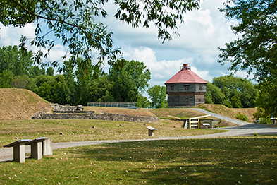
©Parks Canada Agency / Agence Parcs Canada
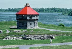
©Parks Canada Agency / Agence Parcs Canada, F. Cattroll, 1982 |
Coteau-du-Lac National Historic Site of Canada
Coteau-du-Lac, Québec
18th-century transportation and defence structures.
The Coteau-du-Lac National Historic Site is located 40 km southwest of
Montréal on the shores of the St. Lawrence River, and offers a window on
a particularly rich history going back several millennia in time.
Owing to its strategic position on the River, the main route into inland
North America, this site has played a major role in the development of
river transportation in Canada. At first a portage for nomadic
Aboriginal peoples, Coteau-du-Lac later became a genuine bypass for
travellers from Great Britain and France.
By the late 18th century, a lock canal is constructed on this location.
It was the first work of its kind in North America and was to serve as a
forerunner of the modern-day St. Lawrence Seaway.
Situated in the municipality of Coteau-du-Lac, Québec, on the shores of
the St. Lawrence River, approximately 40 km southwest of Montreal, the
Coteau-du-Lac National Historic Site of Canada comprises the remains of
the canal, the fortifications, numerous archaeological vestiges, a
replica of the 1813 bunker, and many installations for interpretation
purposes.
Coteau-du-Lac's heritage value resides in the fact that it is the first
lock canal in North America. Built between 1779 and 1781, the width of
the canal was doubled between 1814 and 1817 to facilitate the passage of
Durham ships. Two other locks that were better adapted to the needs of
the canal then replaced the three original locks. Today, major
modifications to the surrounding landscape have caused the water level
to fall approximately 2.5 meters, which resulted from the construction,
during the 1940s, of a dike and a dam upstream from the site.
Coteau-du-Lac was, from 1778 until the mid-19th century, the
illustration of an important British military post whose function was to
ensure the protection of the navigable corridor and ease the transport
of merchandise. During that period, the site was equipped with new
buildings such as fortifications, an octagonal bunker, an explosive
magazine, a guardhouse, and various other buildings that reinforced its
military role.
Coteau-du-Lac's heritage value also resides in the strategic roles it
played in the American Revolution and in the War of 1812. Due to
isolation and the difficulties in supplying the British military posts
in the Great Lakes region, Coteau-du-Lac was built as a strategic
defence point for the navigable corridor, thus easing the transportation
of supplies as well as troops on the St. Lawrence River towards Upper
Canada.
Finally, the strategic position of this canal made it a port of entry
for imports to Upper Canada. Indeed, from 1797 and up to 1840, a customs
office was in operation in Coteau-du-Lac. Fees were collected on wine,
spirits and other imported goods into Upper Canada. The aim was to
account for these goods in order to evaluate what part of the fees paid
at the port of Québec were due to Upper Canada. The opening of such an
office made Coteau-du-Lac the principal port of entry into Upper
Canada.
|

©Parks Canada Agency / Agence Parcs Canada, HRS 0838 |
Davie Shipyard National Historic Site of Canada
Lévis, Québec
Davie Shipyard National Historic Site of Canada is located on the St.
Lawrence River waterfront close to the Québec-Lévis ferry terminal. The
shipyard is bi-sected by rue Commerciale running parallel to the St.
Lawrence River. A marine railway and floating dock are located on the
river side, and three buildings are situated across the road. Together
they constitute the rare cultural landscape of a shipyard of the wooden
sailing ship era.
Davie Shipyard was the oldest shipyard in Canada in operational
condition when it was commemorated in 1991. Established by former sea
captain Allison Davie in 1829, upon his death it was managed by his
wife, Elizabeth Davie, operating continuously as a shipyard until 1998.
During that time, Davie Shipyard was responsible for several innovations
important to sailing ship construction. The site today consists of a
two-and-a-half-storey residence and office (1832), a single-storey brick
stable (1872) and two-storey brick warehouse (1892) on the landward side
of rue Commerciale, and on the river side, a patent slip (or marine
railway), a floating dock, and possible underwater archaeological
remnants.
The heritage value of Chantier Davie lies in its unique surviving
representation of a shipyard of the wooden sailing ship era. Its value
resides in the integrity of its components, together with their setting
and, spatial disposition.
|

©Parks Canada Agency / Agence Parcs Canada, 2002 |
de Salaberry House National Historic Site of Canada
Chambly, Québec
The de Salaberry House National Historic Site of Canada is located in
front of the Chambly Rapids in Chambly, Québec. The site consists of a
large, three-storey stone house representative of vernacular Montréal
villas built in the early 19th century. The house includes a low
hipped-roof featuring two gable dormers, two side chimneys and an
imposing columned portico. It was constructed under the orders of
Lieutenant-Colonel Charles-Michel d'Irumberry de Salaberry from 1814 to
1815. De Salaberry lived in the house until his death in 1829.
The de Salaberry House was constructed under the orders of
Lieutenant-Colonel Charles-Michel d'Irumberry de Salaberry between 1814
and 1815. De Salaberry was known as "the hero of Châteauguay" for his
role in rebuffing American troops under Major-General Wade Hampton's
command at the Battle of Châteauguay on the 26th October, 1813. He lived
in this house with his wife until his death in 1829.
The de Salaberry house is representative of vernacular Montréal villas
built in the early 19th century. It is a large, three-storey stone
house, which features two large parapeted chimneys and numerous casement
windows. It is a rectangular, harmoniously proportioned building that
makes use of cut stone building materials and exhibits common features
of houses from the early 19th century, including the casement windows
with plain trim and dormer window surrounds. It also features a
classically detailed pediment and columns.
|

©Parks Canada Agency / Agence Parcs Canada, Michel Gagné, 2006 |
Droulers-Tsiionhiakwatha National Historic Site of Canada
Saint-Anicet, Québec
Droulers-Tsiionhiakwatha National Historic Site of Canada represents an
Iroquoian village complex, which, at the height of Iroquoian
civilization in the St. Lawrence Valley, was the central place in a
region that has yielded an impressive number of archaeological sites.
Situated in south-western Québec, some eight kilometres from the St.
Lawrence River, its geographical location makes it one of the most
remote of the Iroquoian villages in Québec. This major archaeological
site, discovered in 1994, was the subject of a campaign of six intensive
digs, which produced over 150 000 archaeological remains, making it
possible to deduce the presence of a series of longhouses.
Droulers-Tsiionhiakwatha is the largest paleohistorical village
discovered to date throughout Québec. This site was occupied around the
mid-15th century by a group now identified as the St. Lawrence
Iroquoians. Particularly good soil conditions have allowed for the
preservation of the village structures, including fireplaces, pits and
trenches, which indicate the positions of some fifteen dwellings that
date from the last three centuries before the arrival of the Europeans.
In terms of scientific data, Droulers-Tsiionhiakwatha ranks among the
major sites documenting Iroquoian village life. Its unique situation
makes it possible to properly document the use of plant species in the
daily diet, since an appreciable quantity of bone objects and bone
remains associated with cooking activities have been found in a
remarkable state of preservation. Droulers-Tsiionhiakwatha has one of
the most significant collections of domesticated and wild plants
gathered on one site in eastern Canada. These remains indicate that when
the site was occupied, the population used several ecosystems present on
its territory. The remains demonstrate the strong dependence of this
population on cultivated plant species, in addition to attesting to
other activities such as farming, fishing and gathering small wild
fruits.
|
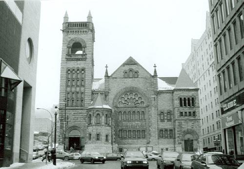
©Parks Canada Agency / Agence Parcs Canada, R. Goodspeed, 1997 |
Erskine and American United Church National Historic Site of Canada
Montréal, Québec
The Erskine and American United Church National Historic Site of Canada
is located in the Golden Square Mile of Montréal. Built in 1893-94, this
Romanesque Revival style church contains stained glass windows by Louis
Comfort Tiffany. The façade, crowned by a gable, includes a large
demi-rose window above smaller windows framed by a massive central arch.
Smaller towers balance the tall tower dominating the composition. The
stonework is heavily rusticated.
Constructed in 1893-1894 to the designs of Montreal architect Alexander
Cowper Hutchinson as the Erskine Presbyterian Church the richly textured
exterior is a splendid example of the Romanesque Revival style
influenced by Richardson. The interior is a finely executed example of a
19th-century amphitheatre plan altered in 1938-39 by architect Percy
Nobbs to reflect the new values of the United Church. The Tiffany
windows in the sanctuary and chapel date from 1903, and were installed
in 1938-39 to form the most extensive group of Tiffany religious stained
glass identified in Canada to date.
|

©Parks Canada Agency / Agence Parcs Canada, 1989 |
Étienne-Paschal Taché House National Historic Site of Canada
Montmagny, Québec
The Étienne-Paschal Taché House National Historic Site of Canada is
located in the town of Montmagny, Quebec. This attractive
one-and-a-half-storey wooden house was for many years home to E. P.
Taché, remembered as one of the fathers of Confederation. Displaying
elements of traditional Quebec architecture, the distinctive twin towers
give the house a substantial appearance. This distinctive house stands
in a residential area surrounded by more recent structures. The house
also has been classified historic site by the Quebec ministère de la
Culture, des Communications et de la Condition féminine.
The house was constructed for Étienne-Paschal Taché, a doctor who
practiced medicine, before becoming a major figure in Canadian political
history from the mid-1830s until his death in 1865. As Prime Minister of
United Canada, Taché presided over the 1864 Quebec Conference and,
although he died before Confederation had been achieved, he is
remembered as one of the fathers of Confederation. Taché lived in the
house for 35 years, raising 15 children.
The house exhibits elements typical of the Quebec "maison
traditionnelle", including the rectangular plan, the medium-pitched,
front-sloping roof, high basement, and heavy timber construction. Built
in the late 1820s and enlarged in 1855 with an extension to the east and
a north-east tower, the house was completed with a second tower in the
1880s. Interior detailing exhibits influences of British classicism.
Many modifications were made to the house over the years, and it was
partially restored in the late twentieth century.
|

©Natural Resources Canada / Ressources naturelles Canada |
First Geodetic Survey Station National Historic Site of Canada
Chelsea, Québec
First Geodetic Survey Station National Historic Site of Canada is
located on the south slope of King Mountain in Gatineau Park, Quebec. It
was the first geodetic station established in Canada and consisted of a
point, referred to as an "eccentric station," represented by a copper
survey bolt, bearing lettering on its top surface, driven into the
ground and secured with cement. The site is 2.3 square metres in area,
approximately the same size as the former tower.
Geodesy is the scientific discipline that deals with the measurement and
representation of the dimensions and shape of the Earth. When a network
of geodetic points is established by "triangulation," it is possible to
define the geometric structure of the Earth by measuring triangular
elements. These geodetic points are copper bolts, often located on
mountaintops to ensure intervisibility over distances of up to several
tens of kilometres.
In 1888, the Association of Dominion Land Surveyors increased activities
aimed at setting up a geodetic service in Canada. After years of
research by Director William Frederick King and others, the first
geodetic surveys were carried out in Canada, beginning in June 1905 at
Kingsmere, in the National Capital Region. The first geodetic point (or
geodetic station), named King MTN, was installed approximately 14
kilometres from Ottawa. The point was selected because it is the most
visible from the federal observatory at the Central Experimental Farm.
This geodetic point would not be long used because its visibility is
unsatisfactory. A second point, called an "eccentric station" was
selected in September 1909. This second point is located at an elevation
64 metres (211 feet) lower than the original station, and it became the
point of reference. It is located at 45º 29' 20.56787" N, 75º 51'
45.26354" W.
|
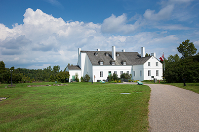
©Parks Canada Agency / Agence Parcs Canada |
Forges du Saint-Maurice National Historic Site of Canada
Trois-Rivières, Québec
Remains of Canada's first industrial village.
Not only Canada's first iron industry, but also its first industrial
village, that is the Forges du Saint-Maurice National Historic Site's
very essence.
On the shore of the Saint-Maurice River and bordered by a brook, the
Forges combines cultural and natural treasures. In the Grande Maison it
is possible to enter the universe of this original industrial community.
The blast furnace reveals the mystery of iron-making. The archaeological
remains are witnesses of this era where life of the whole community
centered on the intense iron production.
Forges du Saint-Maurice National Historic Site of Canada is located
fifteen kilometres north of the centre of Trois-Rivières, Quebec, on the
banks of a stream that flows into the Saint-Maurice River. It is a
cultural landscape that contains remnants of Canada's earliest
industrial community. The site has been redeveloped for historical
interpretation by Parks Canada Agency.
The heritage value of Forges du Saint-Maurice resides in the evidence of
early colonial industrial activity, methods, and lifestyles reflected in
its cultural landscape. Sieur François Poulin de Francheville, seigneur
of Saint-Maurice established Forges du Saint-Maurice in 1730. The 252
remains on the site reveal traces of iron ore exploitation and an
occupation which extends over 150 years (1732-1883), during which time
Forges du Saint-Maurice was a major supplier of material goods necessary
for the development of the colony and for its defence. The remnants of
the Forges du Saint-Maurice provide the oldest and most complete example
of a site with European ironworking technology typical of the end of the
15th century. From 1973, the site has been the subject of an extensive
research and interpretation program conducted by Parks Canada
Agency.
|
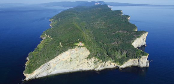
©Parks Canada Agency / Agence Parcs Canada |
Forillon National Park of Canada
Headquarters: Gaspé, Québec
The "Jewel of the Gaspé" where land meets sea.
Located on the tip of the Gaspé Peninsula, Forillon Park is a
mountainous area that borders on the Gulf of St. Lawrence and the Bay of
Gaspé.
|
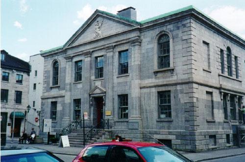
©Parks Canada Agency / Agence Parcs Canada, N. Clerk, 1997 |
Former Montréal Custom House National Historic Site of Canada
Montréal, Québec
The Former Montréal Custom House is an elegant, early
nineteenth-century, two-storey, Palladian-style building, built of
stone. It is located in the harbour area of Old Montréal, facing the St.
Lawrence River, and surrounded by an area of offices, boutiques and
restaurants. Since 1992, the Custom House has formed part of
Pointe-à-Callière, the Montréal Museum of Archaeology and History, and
is connected by underground passageway to other buildings in the museum
complex.
The Former Custom House is a striking, Palladian-style building,
distinguished by its elegant façades, compact proportions and
architectural detailing. It was one of the last Canadian public
buildings to use the Palladian style, a style derived from English
domestic architecture which achieved the height of its popularity in
Canada between 1800 and 1820. Despite an extension in 1881-2 in which
the south façade was reconstructed and windows and doors were added to
the side elevations, the Custom House retains the effect of its original
exterior appearance.
The Former Montréal Custom House was the first Montréal building
designed by John Ostell, a British-trained architect who was, in that
era, Montréal's most important architect. Beginning with the Custom
House, Ostell designed 25 of the city's major buildings in as many
years, using a variety of styles. The 1881-2 extension was designed by
Alphonse Raza.
The construction of the Former Custom House in 1836-8 marks an important
moment in the history of the port of Montréal, when it acquired its own
customs service. Until 1828, customs duties were collected at the city
of Québec, as the principal port of entry to Upper and Lower Canada.
During the early 19th century, the construction of the Lachine canal,
improvements to marine transportation between Québec and Montréal,
greater diversification in Montréal's economy, and increasing commercial
traffic with Europe led to the rapid development of Montréal's port
area. The significant increase in port traffic justified the collection
of customs duties at Montréal beginning in 1828. The customs house was
built soon afterwards, reflecting the new importance of the port of
Montréal. It soon became the major Canadian port for the transshipment
of goods to and from the Great Lakes and the exportation of primary
products to Europe, a role it would retain until the opening of the St.
Lawrence Seaway in 1959. It served as Montréal's customs house from 1838
until 1871.
|

©Parks Canada Agency / Agence Parcs Canada, Jacques Pleau & Michel Pelletier, 2001 |
Former Shawinigan Aluminum Smelting Complex National Historic Site of Canada
Shawinigan, Québec
The Former Shawinigan Aluminum Smelting Complex National Historic Site
of Canada is an early aluminum smelter and hydroelectric plants that
supplied it with power. It is located at Shawinigan Falls on the
Saint-Maurice River, at the southern end of the City of Shawinigan. The
complex consists of 12 brick buildings on a high point of land
overlooking the river, a hydroelectric power plant on the riverbank
below, and the remnants of the foundations of a second power plant, also
adjacent to the river. The buildings were erected between 1899 and 1927,
and are in many cases adjoined or linked by passageways. Some buildings
have been rehabilitated to serve as galleries and events venues, and are
now open to the public.
The heritage value of this site resides in its historical associations
as illustrated by the design of the complex, which integrated the
manufacturing process with its source of energy and established a
Canadian precedent for manufacturing complexes based on hydroelectric
energy, and by its extant buildings, erected between 1899 and 1927,
which date to a period when the complex was the only one of its type in
the country. The complex was the site of several Canadian precedents in
aluminum smelting. The first aluminum ingot cast in Canada was produced
in Building 7 in 1901. The first aluminum cables in Canada were produced
in Building 3 in 1902. The first aluminum conductor cables with steel
centres (ACSR-type) in Canada were produced in Building 3 in 1910. The
smelter operated until 1945.
The Shawinigan complex was the first aluminum smelter built in Canada.
It is connected with the beginning of both the aluminum industry and the
manufacture of aluminum products in Canada, as well as the early use of
hydroelectric energy to support heavy industry. Aluminum production
requires huge amounts of electric power to convert vats of powdery
alumina to molten metal. The late 19th-century discovery of this
metallurgical technology by the American inventor, Charles Martin Hall,
coincided with the newfound ability to produce hydroelectric power from
moving water.
At the invitation of the Shawinigan Water and Power Company, Hall and
his company, the Pittsburgh Reduction Company (PRC), built the first
Canadian aluminum production plant on the Saint-Maurice River, along
with a power plant, and therefore successfully married the two
technologies. The complex was operated by a subsidiary of PRC, the
Northern Aluminum Company Limited, which later became the Aluminum
Company of Canada Limited (commonly known as Alcan).
|

©Parks Canada Agency / Agence Parcs Canada

©Parks Canada Agency / Agence Parcs Canada |
Fort Chambly National Historic Site of Canada
Chambly, Québec
Restored and stabilized 1709 stone fort.
Fort Chambly is located at the edge of the Richelieu River, at the foot
of the Chambly rapids. Built in 1711, this imposing stone fortification
protected New France from a potential British invasion.
During the War of 1812, the British Army built an important military
complex on the site. The fort has resisted the upheavals of history and
remains a valued reminder of the French presence in North America.
Restored by Parks Canada, Fort Chambly now houses exhibitions showcasing
key moments in the history of New France.
Fort Chambly National Historic Site of Canada is a square-shaped stone
fortress strategically placed on the Richelieu River at Chambly, Quebec.
The present structure is the fourth fort to have been constructed on the
same site. Four prominent corner bastions and high curtain walls protect
accommodation and storage facilities arranged around a central
courtyard. Strongly built of stone the fort also features bartizans,
embrasures and muskets loopholes. The fort stands within a large
waterside park.
In 1665, French army officer Captain Jacques de Chambly directed the
construction of the first wooden fort in Canada to control the invasion
route and to support French troops against the Iroquois. The present
stone fort, built between 1709-1711 to protect New France from British
invasion, draws inspiration from European classical fortifications
adapted to the particular geographical context of North America. Ceded
to the British in 1760, the fort was temporarily occupied during the
American invasion of 1775 before being recaptured by the British. It
also played an important role during the war of 1812 and the rebellions
of 1837-1838. The fort subsequently fell into disrepair and was
abandoned in the mid-19th century. The intervention of Chambly
inhabitant Joseph-Octave Dion played an important role in safeguarding
the fort between 1875 and 1916. Designated a national historic site of
Canada in 1920, Fort Chambly was restored by Parks Canada in 1983 and
now houses a small museum and interpretation centre.
|

©Parks Canada Agency / Agence Parcs Canada |
Fort Charlesbourg Royal National Historic Site of Canada
Cap-Rouge, Québec
Fort Charlesbourg Royal National Historic Site of Canada is located in
Cap-Rouge, a residential suburb in the city of Québec. The site consists
of the uncovered vestiges of two sixteenth-century forts: an upper fort
on the treed promontory at the junction of Rivière du Cap-Rouge and the
St. Lawrence River; and a lower fort situated approximately 500 metres
to the northwest, on the banks of Rivière du Cap Rouge. Established in
1541 by Jacques Cartier, the forts served as the basis for the first
French colony in North America, until they were abandoned in 1543.
Established in 1541 by Jacques Cartier on his third and final voyage to
the French territory along the St. Lawrence River, Fort Charlesbourg
Royal consisted of an upper fort and lower fort located near the mouth
of Rivière du Cap-Rouge. The upper fort, constructed at an elevation of
40 metres, offered a strategic defensive position, while the lower fort
provided a potential anchorage for ships, as it was sheltered from the
strong winds coming off the river. The two forts possessed a total of
three towers, and the upper fort was constructed of square logs.
Charlesbourg Royal was named after Charles, Duke of Orleans, the third
son of King Francis I of France, and was the home of Cartier and a group
of some 400 colonists during the winter of 1541-1542. This period of
occupation saw difficult relations with the local Aboriginal population,
and many of the colonists suffered from scurvy.
In June 1542 Jean-François de la Rocque de Roberval, who had been
appointed «Lieutenant-général au pays de Canada» in the previous year,
arrived at the fort. That same month, Cartier decided to return to
France, and Roberval took possession of the fort, changing its name to
France-Roi. Archaeological evidence shows that Roberval modified some
aspects of the fort to better suit the newer weaponry at his disposal.
Roberval and a group of 200 colonists spent the winter in Canada,
suffering from cold, famine, and disease. Although a ship was sent back
to France to request assistance from the king, by summer 1543 the fort
was abandoned. More than 60 years passed before another attempt was made
to colonize the St. Lawrence region.
|
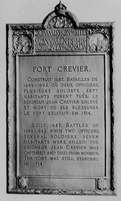
©Parks Canada Agency / Agence Parcs Canada, 1924 |
Fort Crevier National Historic Site of Canada
Pierreville, Québec
A fort was built near here in 1687 for the defence of the French
inhabitants of the area against Iroquois attacks which had been
encouraged by the English. Originally named Fort Saint-François, it came
to be known by the name of its builder, Jean Crevier in whose
seigneurie, Saint-François-du-Lac, this wooden fort stood. Skirmishes
between the Iroquois and French were fought near here on many occasions
between 1689 and 1693. With the signing of peace treaties with the
English in 1697, and with the Iroquois in 1700 and 1701, the French
allowed the fort to fall into ruins.
|
©Google, 2010 |
Fort Laprairie National Historic Site of Canada
La Prairie, Québec
Fort Laprairie National Historic Site of Canada is located on the
western bank of the St. Lawrence River in La Prairie, Quebec. The site
consists of a 17th-century French Regime fort, of which there are no
visible remains. Constructed in 1687, Fort Laprairie and its palisade,
which enclosed some of the village buildings, served as a defensive
outpost and as a refuge for settlers until 1713. The trapezoid shape of
the fort influenced the formation and layout of lots and roads in what
is now a residential area.
Fort Laprairie was designed in 1687 by Robert de Villeneuve and built
the same year by Gédéon de Catalogne, both official engineers of the
French colonial troops. The fort served as a defensive outpost for
Montréal during the War of the Grand Alliance and the War of the Spanish
Succession. From 1687 until the Peace of Utrecht in 1713, the fort was
continuously garrisoned settlers took refuge inside the palisade on
several occasions. For example, in August 1691, during the First Battle
of Laprairie, the French defended the fort from an attack by New England
Militia troops. The fort is reputed to have saved the lives of its
occupants during this encounter. After withstanding numerous attacks by
the English militia and the Iroquois, Fort Laprairie was largely
destroyed when the Americans retreated following the Invasion of Canada
in 1775.
|
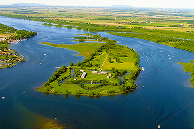
©Parks Canada Agency / Agence Parcs Canada

©Parks Canada Agency / Agence Parcs Canada |
Fort Lennox National Historic Site of Canada
Saint-Paul-de-l'Île-aux-Noix, Québec
Outstanding example of early 19th-century fortifications.
This old British fort is located on Île aux Noix, in the middle of the
Richelieu River. No bridge connects this island, with its fabulous
destiny. There isn't any choice: you have to leave your vehicle behind.
The boat is how you get there! The children will love it. The crossing
takes five minutes. Just long enough to cross the time barrier and tread
the ground of an outstanding site.
Located a few kilometres from the Canada-U.S. border, the fort was built
from 1819 to 1829. It consists of defensive works and of several masonry
buildings of outstanding beauty. The site as a whole had the aim of
protecting the colony from an eventual American invasion along the
Richelieu River.
Fort Lennox National Historic Site of Canada is a highly evocative
military fortification and landscape covering the full extent of Île aux
Noix in the Richelieu River near the city of
Saint-Paul-de-l'Île-aux-Noix, Québec. Over a critical period from the
end of the French Regime to the 1870s, French, American and British
forces exploited the strategic value of the site. The fortifications
themselves are framed by a water-filled moat that surrounds the
ramparts. Inside is a collection of handsome, classically designed
buildings beautifully executed in stone.
Fort Lennox played an important role in the military history of Canada
due to its strategic location along the Hudson-Champlain-Richelieu
navigation route. The island's geography, with narrow channels and an
elevated southern point, provided a natural defence system that was
supplemented by military defensive works. The French first fortified the
island in 1759 as a barrier to British invasion along the Richelieu
River. In 1760, the British captured the island, just prior to the fall
of New France. In 1775, American revolutionary forces used the island as
a base for an attack on Canada. After their retreat in 1776, the British
began fortifying the island to guard against further invasions. During
the War of 1812 the fort was used to secure the border with the United
States and to protect the Royal Navy base at Saint-Jean. The present
Fort Lennox, the third set of fortifications on the island, was built
from 1819 to 1828. It replaced the earlier fort and was garrisoned until
1870. Île aux Noix was also used, but not modified, by British forces
during the uprising of the Patriots, the Fenian Raids, and the American
Civil War. After the departure of the British garrison in 1870, the
Canadian militia used the site for summer training until 1921. From 1940
to 1943 a refugee camp for European Jews was located on the island.
The historic place includes archaeological and built resources
associated with each of the following periods of military occupation:
the French fortifications (1759-1760); the period of American occupation
(1775-1776); the first British occupation and installations (before
1778); the first British fortifications (1778-1812); the redevelopment
of the British fortifications (1812-1819); the naval establishment
(1812-1834); and the establishment and operation of Fort Lennox (1819 to
present times).
|
©Parks Canada Agency / Agence Parcs Canada, 2005 |
Fort Longueuil National Historic Site of Canada
Longueuil, Québec
Fort Longueuil National Historic Site of Canada is an archaeological
site located in urban Longueuil, Québec. The fort was demolished in
1810, and a church was built on its site. The site extends beneath
present-day Saint-Antoine-de-Padoue Cathedral, constructed in 1887, as
well as under Saint-Charles Street, Chambly Road, and adjacent
buildings. Saint-Antoine-de-Padoue Cathedral contains stone building
materials and elements salvaged from the original fort, and from the
church that succeeded it.
Fort Longueuil was constructed between 1685 and 1690 as a fortified
residence for Baron Charles le Moyne II, the only Canadian-born person
to be raised to the rank of Baron by a French monarch. The home featured
a vast yard, which was fortified with an enceinte and corner towers,
designed to protect against any attack from Iroquois, with whom the
French suffered a deteriorating relationship during the late 17th
century.
Fort Longueuil was one of many fortified residences, known as
châteaux-forts, belonging to local seigneurs that protected the French
settlements around the Montréal area in the late 17th and early 18th
centuries. Though Fort Longueuil was the only stone château-fort on the
mainland, it was designed to be defensible in tandem with those located
on Montréal Island. Fort Longueuil was also the oldest stone
château-fort on the south bank of the St. Lawrence River in the Montréal
area.
It is believed that the fort was later occupied by American troops in
1775 and subsequently by the British. It was demolished in 1810 due to
its poor state of repair. Its stones were re-used in a church that was
built at the site between 1811 and 1814. This church was itself
demolished in 1884 and, again re-using building material whenever
possible, the present Saint-Antoine-de-Padoue Cathedral was completed in
1887.
|

©Parks Canada Agency / Agence Parcs Canada, Catherine Cournoyer, 2009 |
Fort Richelieu National Historic Site of Canada
Sorel-Tracy, Québec
Fort Richelieu National Historic Site of Canada is located within the
limits of the city of Sorel-Tracy 91 kilometres northeast of the city of
Montreal, Quebec. Situated on the eastern shore of the Richelieu River
near where it meets the St. Lawrence River, the site marks the location
of two forts of which there are no extant remains. The first, known as
Fort Richelieu, was constructed in 1642 by the French as a strategic
position and symbol of strength to the Iroquois with whom they were
again at war. A second fort, Fort Sorel, was built on the site in 1665
by Captain Pierre de Saurel. An HSMBC plaque was erected in 1980 to mark
the site.
Fort Richelieu was one of the earliest forts constructed in New France,
established in 1642, at the mouth of the Richelieu River, by the
Governor of New France, Monseigneur de Montmagny. The fort was
established as a strategic position from which the French could counter
Iroquois raiding parties who were using the Richelieu River as a route
to put New France under severe military pressure and the fort was
intended to block this approach. From its construction in 1642 until its
abandonment four years later Fort Richelieu was also used a base for
missionary efforts amongst the local population. The fort was abandoned
in 1646 and the Iroquois burnt it down in the winter of 1647. A second
fort was built on the site in 1665 by Captain Pierre de Saurel which was
later named Fort Sorel.
|

©Library and Archives Canada / Bibliothèque et Archives Canada, C-001507, 1779 |
Fort Saint-Jean National Historic Site of Canada
Saint-Jean-sur-Richelieu, Québec
Fort Saint-Jean National Historic Site of Canada is located on the
Richelieu River, about 40 kilometres southeast of Montréal, in
Saint-Jean-sur-Richelieu, Québec. Built in the 18th century, remains of
the early fort ramparts include the masonry foundations, piling
impressions, and stockade trenches. Remains of the 1776 fort can also be
seen on the site today, particularly the two bastions.
Between 1665 and 1666, the French erected five forts along the Richelieu
River to counter Iroquois attacks. The location of the first Fort
Saint-Jean, built in 1666 and abandoned in 1672, is unknown to this day.
The French used the fort again after the War of the Austrian Succession
in 1748, when a new fort was built in Saint-Jean by engineer
Gaspard-Joseph Chaussegros de Léry Jr.. The fort comprised a stockade
built on piles, 3.5 to 4 metres tall (12 to 13 feet), flanked by
bastions at each corner with firing slits for cannons. With the
exception of its masonry foundation, all components of the fort were
made of wood.
In 1760, the French abandoned and burned the fort, but the surrounding
area remained sought after for its strategic location on route to
Montreal. In the summer of 1775, during the American Revolution, the
fort was once again rebuilt, this time to protect against the cannon
fire of the American invasion. Styled after the model by Sébastien Le
Prestre, Marquis de Vauban, the new fort withstood a 45-day siege led by
the American General Richard Montgomery. Following the 1837 uprising,
new fortifications were built on the site, which, since 1952, have
formed the core of the Royal Military College Saint-Jean.
|

©Parks Canada Agency / Agence Parcs Canada, 1969 |
Fort St-Louis National Historic Site of Canada
Kahnawake, Québec
Fort St-Louis National Historic Site of Canada is located on River Front
Road in Kahnawake, Québec, within the Kahnawake Mohawk Territory. The
site is delineated by three bare sections of wall from the original
fortification, which dates from the early 18th century, that are
approximately three metres high, and adorned with two bastions pointing
northwest and southwest. The original eastern wall of the fortification
cannot be seen today. The Caughnawaga Mission / Mission of St. Francis
Xavier National Historic Site of Canada and the Caughnawaga Presbytery
National Historic Site are located in the northeast section of the fort.
Jesuit missionaries founded the Mission of Caughnawaga at the French
colony of La Prairie in 1667 for Iroquois Christians; however, it was
displaced several times before coming to rest in Kahnawake. The
different migrations of the mission were the result of economic
influences; the agricultural methods of the Iroquois caused the
depletion of nutrients in the soil, which required them to move their
village every 10 to 15 years.
The presence of an Iroquois village contributed to the importance of
building a fortification in Kahnawake. While there had been proposals
for a fort to be built at that location since 1720, it was not until
1725 that a wooden palissade was constructed to serve as a defence for
the village and the mission. In 1747, with the threat of war, the wooden
palisade was partially replaced with a fortification made of
stone.
|
©Parks Canada Agency / Agence Parcs Canada |
Fort Ste. Thérèse National Historic Site of Canada
Chambly, Québec
Site of French fort for defence against Iroquois, 1665.
Built in 1665, on the point south east beyond the canal, by M. de
Salieres. One of the forts constructed on the Richelieu by the Carignan
Regiment for defence against the Iroquois, starting point of the
expedition of 1666. In June, 1760, Major Robert Rogers burned the
fortified post.
|

©Parks Canada Agency / Agence Parcs Canada, 2009 |
Fort Trois-Rivières National Historic Site of Canada
Trois-Rivières, Québec
Fort Trois-Rivières National Historic Site of Canada is located on rue
des Casernes in the town of Trois-Rivières in southern Québec near the
three mouths of the Saint Maurice River. There are no visible remains of
this 17th-century French Regime fort which was constructed in 1634
overlooking the St Lawrence River. This wooden fort became a centre for
fur trade with the local First Nations and eventually developed into the
settlement of Trois-Rivières. The site is now an open public space
marked by an HSMBC cairn with grass and trees bounded by a road, a
parking lot and a former post office.
Fort Trois-Rivières, a fort constructed by the French regime at
Trois-Rivières, Quebec on the north side of the St Lawrence River, was
established by the Sieur of Laviolette on behalf of Samuel de Champlain
in 1634. The site was chosen for the strategic advantage it would offer
both military and economic endeavours. The site was further down the St
Lawrence than earlier forts and the fort itself was elevated from the
river which offered natural protection as well as strategic control of
the waterway. The original fort consisted of two buildings surrounded by
a palisade. The original fort burnt down in December 1635 and was
rebuilt on a larger scale and included a drawbridge to increase access.
In 1653 the fort was proclaimed to be in ruins by Governor Lauzon and it
was burnt to the ground. The site was also home to a Jesuit mission and
other early buildings of the town of Trois-Rivières.
|

©Parks Canada Agency / Agence Parcs Canada, R. Lavoie, 1999

©Parks Canada Agency / Agence Parcs Canada, P. St. Jacques, 1984
©Parks Canada Agency / Agence Parcs Canada, J.P. Jérôme, 1995 |
Fortifications of Québec National Historic Site of Canada
Québec, Québec
4.6-km network of walls, gates and squares.
Fortifications of Québec National Historic Site commemorates the defence
system developed between 1608 and 1871 in Québec, Canada's main
stronghold during the colonial period.
The Fortifications of Québec National Historic Site of Canada comprises
a number of sites associated with the city of Québec's historic defence
systems. Its components are located in the city's Upper Town and Lower
Town, along the north shore of the St. Lawrence River to the Montmorency
River in Beauport and on the south shore of Lévis. The site includes the
actual fortifications and certain components, such as doors, guard
posts, powder magazines, storehouses, barracks, and military facilities,
all built between 1608 and 1871, which contribute to the city's defence
system.
Located on a plateau overlooking the convergence of the St. Lawrence and
the St. Charles Rivers, the fortifications for the city of Québec began
with the city's founding in 1608 by Samuel de Champlain. The original
fortifications were makeshift works, built to meet the colony's most
pressing needs. Resembling a medieval castle, Champlain's first fort, or
Habitation, included a residence, merchandise and supply store, and a
redoubt with elevated walls. Throughout the 17th century, this first
habitation was replaced by a succession of rudimentary military works,
including Fort St. Louis and Champlain's second Habitation. In 1690, the
fall of Port Royal in Acadia led the French to properly fortify the city
with its first enceinte, consisting of 11 redoubts joined by palisades.
Although the Upper Town's steep cliffs acted as natural defences for two
of its three sides, its vulnerable west side, which faced the open
countryside of the Plains of Abraham, was made the top priority of
Québec's fortification program. The initial enceinte was followed by a
succession of modifications and additions until 1745 when, after the
fall of Louisbourg to the British triggered a state of panic among
Québec's inhabitants, a new enceinte laden with masonry was built,
permanently enclosing the Upper Town's western boundary.
Shortly after the conquest of Canada in 1759, the British victors were
faced with new defense requirements. Though the British feared an
attempt by the French to recapture Québec, as well as an uprising from
the Francophone population, they could not raise the funds to strengthen
the city's defences right away. However, the Revolutionary War in
America eventually spurred the construction of new fortifications. The
British undertook a plan to strengthen and extend the 1745 enceinte
around the entire city, build outworks in front of the enceinte to
hamper the enemy's approach, build defense works on the Plains of
Abraham, and erect a masonry citadel on Cap Diamant. This last phase was
completed between 1819 and 1832. Incorporating existing 18th-century
defence systems in its design, the Citadel's only real new fronts were
those that faced the city, indicating that it was built, in part, to
function as a British refuge in the event of a Francophone uprising. The
completion of the Citadel marked the height of the city of Québec's role
as a fortress.
The construction of detached forts on the south shore in Lévis in 1865
was followed by the departure of the British garrison in 1871. Although
several structures of the fortifications have deteriorated or were
demolished since then, the primary defences of the city have been
preserved due to the late 19th-century intervention of Governor General
of Canada Lord Dufferin (1872-1878). Today, the city of Québec is the
sole surviving example of a fortified city in North America.
|
©Parks Canada Agency / Agence Parcs Canada, HRS 0521 |
George Stephen House National Historic Site of Canada
Montréal, Québec
The George Stephen House is a large, stone Victorian mansion occupying
the majority of its urban lot in downtown Montreal. It is presently
operated as the Mount Stephen Club.
The George Stephen House was designated because it the best example of a
Renaissance Revival house in Canada and because it was the home of
George Stephen, president of the Bank of Montreal and of the Canadian
Pacific Railway in the late nineteenth century.
The Renaissance Revival style design, opulent materials, and fine
craftsmanship of this grand residential building reflect the economic
and social position of George Stephen, a prominent businessman in late
nineteenth century Canada.
|

©Parks Canada Agency / Agence Parcs Canada, 1973 |
Governors' Cottage National Historic Site of Canada
Sorel-Tracy, Québec
The Governors' Cottage National Historic Site of Canada is located on
the banks of the Richelieu River in Sorel, Quebec. Originally occupied
as a summer residence by the early British governors and military
commanders of Quebec, the one-and-a-half-storey house has a traditional
Quebec-style rectangular core flanked by wings, all under steep,
front-sloping gable roofs. To the rear, an open verandah looks out over
gardens that were once part of a larger seigneury.
The Governor Sir Frederick Haldimand acquired the seigneury of Sorel for
the Crown in 1781 for defensive reasons, as a result of the American
invasion of 1775, and as an area where soldiers, Loyalists and their
families could be settled. The same year, he had a house built for
General Riedesel, the core of the present cottage, to which wings were
added at a later date. In 1787, Prince William Henry, later King William
IV of the United Kingdom (r. 1830-1837), spent time in the house during
a visit to the colony. Until 1860, it was used as a summer residence by
Governors General Dorchester, Prescott, Dalhousie, and Aylmer, and by
Commanders-in-Chief St. Leger, Brock, Colborne, Jackson, D'Urban and
Eyre. After a succession of owners, the town of Sorel acquired the house
in 1921. In April 1990 the Governor's Cottage Exhibition Centre was
inaugurated as a centre for artists.
|

©Parks Canada Agency / Agence Parcs Canada, N. Clerk, November 1995 |
Granada Theatre National Historic Site of Canada
Sherbrooke, Québec
Granada Theatre National Historic Site of Canada is three storey
building built up to the sidewalk facing Wellington Street in downtown
Sherbrooke, Quebec. The Spanish Revival theme of the facade continues
inside with splendid interior decoration evocative of a Spanish
courtyard at night.
Granada Theatre was designated a National Historic Site of Canada in
1996 because it is a magnificent example of an atmospheric theatre in
Canada.
The heritage value of the Granada Theatre resides primarily in the
fabric, quality and richness of an interior decor that has remained
virtually unchanged since the theatre was built.
Atmospheric cinemas typically employed painted decor, and this is a
particularly spectacular one created by interior decorator Emmanuel
Briffa. The Granada Theatre itself was designed by architect D.J.
Crighton and built by the United Amusement Corporation in 1928-29. It
served as a venue for cinema and live performance continuously to 1980,
then was renovated as a multi-functional auditorium by the City of
Sherbrooke in 1988.
|

©Parks Canada Agency / Agence Parcs Canada, 2004 |
Grey Nuns' Hospital National Historic Site of Canada
Montréal, Québec
The Grey Nuns' Hospital National Historic Site of Canada is situated in
Old Montréal. Built in 1765, the three-and-a-half storey main building
is an example of early French Canadian architecture and is the one
surviving building of the Grey Nuns' Hospital complex. An attractive
building constructed of solid masonry, it is austere in appearance and
features an end gable roof, tall casement windows, a full basement,
lateral additions and a centred rear wing. The interior stands empty
with little remaining trim. To the rear are the remains of the walls of
the original Chapel.
The main building was erected in 1765 on the site of the earlier
hospital of the Frères hospitaliers. In 1747 the existing hospital had
been entrusted to the care of Sainte-Marie-Marguerite d'Youville and the
order of Grey Nuns in order to continue care for the sick. Gutted by
fire in 1765 the building was rebuilt while two wings were added in the
19th century to meet demands for more space. In 1871 the Grey Nuns
relocated to a different residence and in 1900 the north section of the
complex and half of the chapel were demolished to permit the extension
of Rue St. Pierre. From 1900 until 1973 the empty building was used
intermittently for warehouse storage.
|
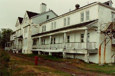
©Parks Canada Agency / Agence Parcs Canada |
Grosse Île and the Irish Memorial National Historic Site of Canada
Grosse-Île, Québec
Quarantine station for immigrants from 1832-1937.
Located in the middle of the St. Lawrence River, Grosse Île was a
quarantine station for the Port of Québec from 1832 to 1937. At the
time, the island was the main point of entry for immigrants coming to
Canada.
Grosse Île National Historic Site is located on an island of the same
name in the St. Lawrence River. It is the site of a 19th and early 20th
century quarantine station. Today it contains built, archaeological and
cultural landscape resources that survive from this 1832-1937 period of
use as well as a Celtic Cross erected in 1909 to commemorate the Irish
immigrants who died there.
The heritage value of the site resides in the cultural landscape and its
component parts that illustrate the process of immigration and
quarantine of 19th century immigrants to Canada through the port of
Quebec, particularly the Irish during the mid-19th century.
Among its residents was Dr. Frederick Montizambert, medical
superintendent of the island during the last 30 years of the 19th
century. His belief in the new science of preventative medicine
(microbiology, epidemiology, disinfection, vaccinations) caused him to
develop a new generation of Canadian quarantine stations which protected
Canadians from the deadly epidemics that ravaged many parts of the world
at the time.
|
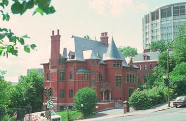
©Parks Canada Agency / Agence Parcs Canada |
H. Vincent Meredith Residence National Historic Site of Canada
Montréal, Québec
The H. Vincent Meredith Residence National Historic Site of Canada is
located in Montréal, Quebec. Built in 1896 of red brick with stone trim,
this fine two-and-a-half-storey Queen Anne Revival-style mansion has an
asymmetrical composition. Plain wall surfaces contrast with a band of
decorative brickwork at eave level. A prominent tower with a conical
roof provides focus and contrasts with the mass of the steep hipped roof
with its dormers and very tall chimneys. Steps lead up to the main
entrance set under an open porch.
H. Vincent Meredith Residence was designated a national historic site of
Canada in 1990 because it is a particularly noteworthy example of the
use of the Queen Anne Revival style in domestic architecture.
The house, with its elegant styling and spacious grounds, was typical of
the many mansions built by Montréal's financial elite in the late 19th
century in the area called the "Golden Square Mile". In this case the
house, with its warm red brick, eclectic stylistic references, and
whimsical composition with turrets, towers and lively roofline, is an
outstanding example of the then-fashionable Queen Anne Revival style.
The house was built in 1897 for Andrew Allen, a partner in the Allen
Line Steamship Company by Montréal architects Edward and William
Maxwell. From 1906 to 1941, it was the home of Sir Vincent Meredith,
president of the Bank of Montréal, and his wife Isabella Allan. Sir H.
Vincent Meredith died in 1929 and in 1941 Lady Meredith willed the large
private house to the Royal Victoria Hospital for use as a nurses'
residence. It was later acquired by McGill College. In 1990 the
residence suffered a fire but was subsequently restored to its original
appearance. It is currently used as the McGill Centre for Medecine,
Ethics and Law.
|
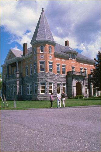
©Parks Canada Agency / Agence Parcs Canada, 05440 |
Haskell Free Library and Opera House National Historic Site of Canada
Stanstead, Québec
Haskell Free Library and Opera House is not only located on Church St.,
Rock Island Québec, it is also situated on Derby Line, Rock Island,
Vermont because this building straddles the border. It is an ornate
stone two-storey Queen Anne Revival-style building with a three-storey
tower that houses both a library and an opera house.
Haskell Free Library and Opera House was designated a National Historic
Site of Canada in 1985 because the building straddles the
Canadian-American border and accommodates at one time a library and an
opera house.
Haskell Free Library and Opera House was donated for the use of the
residents of both countries in memory of American sawmill owner Carlos
Haskell and his Canadian wife Martha Stewart Haskell by their family.
Designed by architect James Ball and Gilbert H. Smith, and built
1901-1904, it testifies to the late Victorian belief in the intellectual
and moral benefits of education and the arts. Its Queen Anne Revival
style is typical of public libraries of the time. The second storey
opera house has an ornate interior that seats 500 people and follows the
accepted principles of 19th century theatre design. The building
continues to serve its original functions.
The heritage value of Haskell Free Library and Opera House National
Historic Site of Canada resides in its unusual location, its dual
function and the long-term sense of community and goodwill they
symbolize. The values are expressed by the impressive aesthetic design
of the building, its details, composition and materials, as well as in
the functional design of the interior, its detail composition and
materials. The building's site and setting are critical to its
value.
|

©Parks Canada Agency / Agence Parcs Canada |
Havelock Township Hall National Historic Site of Canada
Havelock, Québec
Havelock Township Hall National Historic Site of Canada is a simple,
stone township hall, built in 1868, with a two-storey open hall plan. It
sits on an isolated lot on a rural road in the township of Havelock,
Québec.
The residents of Havelock were among the first in the St. Lawrence
Valley to avail themselves of rural municipal status following the
passage of enabling legislation in 1855. In 1868 Sanders and Kirkland
erected this hall based on a design of Charles Gordon to accommodate
council meetings and various social gatherings. Although its two-storey
open-hall plan is typical of many rural town halls built in l9th century
Canada, the carefully detailed stone construction and classically
inspired proportions are exceptional and reflect the pride and community
spirit of the municipality it was built to serve.
|

©Parks Canada Agency / Agence Parcs Canada, C. Desmeules |
Henry-Stuart House National Historic Site of Canada
Québec, Québec
Henry-Stuart House is a small, romantic 19th-century brick cottage set
in a picturesque garden at 82 de la Grande Allée West, Quebec City. The
irregular, 1,528.3 sq. m site survives as an oasis of the past in a
prestigious urban residential area.
The heritage value of Henry-Stuart House lies in its illustration of
19th and early 20th-century bourgeois aesthetics and lifestyle in urban
Quebec. In this case, the aesthetic reflects the picturesque
sensibilities favoured by British settlers. These values are carried by
specific elements of the grounds, house, and furnishings that have
survived from the 19th century. Henry-Stuart House was built by a Quebec
entrepreneur for his daughter, Mary (or Maria) Curry Henry in 1849. In
1918 it was purchased by the sisters Adèle-Maud and Mary-Lauretta Stuart
who continued to own the house until Adèle's death in 1987. In the
almost 70 years they owned the property, the Stuart sisters restored and
supported its 19th-century picturesque character. In 1997, the Conseil
des monuments et sites du Québec purchased the property in 1997 in order
to preserve it as a public resource.
|
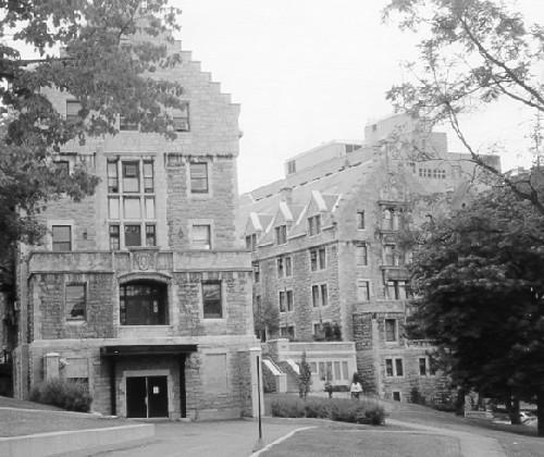
©Parks Canada Agency / Agence Parcs Canada |
Hersey Pavilion National Historic Site of Canada
Montréal, Québec
Located on the campus of the Royal Victoria Hospital in Montreal, the
Hersey Pavilion National Historic Site is a splendid surviving example
of the type of purpose-built nurses' residence dating from the late
nineteenth and early twentieth centuries. It is a large, institutional
design, designed in a Châteauesque manner, of Montreal limestone,
featuring the picturesque historicist details of the time, such as
grouped windows, steeply pitched room with dormers, and elaborate
mouldings.
The Hersey Pavilion of the Royal Victoria Hospital was one of the first
purpose-built nurses' residences in Canada. It provided facilities for
study and learning, and it provided residential accommodation in the
form of bedrooms, sitting rooms and a dining hall. This building, as
well as other nurses` residences erected in the country at this time,
reflected the growing professionalisation of nursing.
|
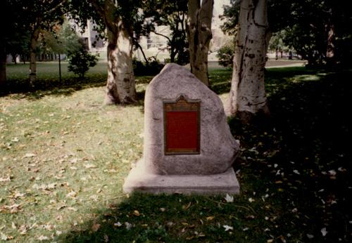
©Parks Canada Agency / Agence Parcs Canada, ca. 2005 |
Hochelaga National Historic Site of Canada
Montréal, Québec
Hochelaga National Historic Site of Canada is a cultural landscape
recalling a former Iroquois village, consisting of a grass-covered space
about 79 square metres in area. The site is located to the left of the
main entrance of McGill University on Sherbrooke Street, Montreal.
Hochelaga National Historic Site of Canada represents the old Iroquois
village of Hochelaga. The village is mentioned in the logbook kept by
Jacques Cartier on his second voyage to the region of the St. Lawrence
River in 1535. The village no longer exists, and its exact location is
unknown.
The historical value of Hochelaga National Historic Site of Canada
derives from its association with the Iroquois village of Hochelaga.
According to Cartier's log for October 1535, the palisaded village was
home to about 1500 Iroquois living in some 50 longhouses approximately 8
metres high and of varying lengths, with groups organized according to
maternal family ties. A subsequent French expedition in 1600 noted that
the village of Hochelaga was abandoned. This coincided with the
departure of all the Iroquois from the St. Lawrence Valley after they
were excluded from new trading alliances between the French and the
Montagnais, Algonquin and Huron nations. To consolidate their fur trade
relations, the French became hostile toward the Iroquois, resulting in
their departure.
|

©Parks Canada Agency / Agence Parcs Canada, 1980 |
Holy Trinity Anglican Cathedral National Historic Site of Canada
Québec, Québec
This relatively small and simple stone church occupies a central
location on the place d'Armes within the old city of Quebec. Sited
behind low stone walls within a treed green space, the cathedral is set
apart from the surrounding tightly built urban fabric. Its simplified
Palladian exterior and elegant interior speaks strongly to its British
roots.
Holy Trinity Anglican Cathedral was designated a national historic site
because it is a very fine, well-sited and largely unaltered example of
the auditory hall type of church and because its construction heralded
the introduction of the British classicism to Quebec City.
Built between 1800 and 1804 by two Royal Artillery engineers, Captain
William Hall and Major William Robe, the refined Palladian style design
was adapted from St. Martin-in-the-Fields in London and features a
rectangular plan, tripartite nave with lateral galleries and
Palladian-inspired decorative elements including a three-bay, pedimented
facade divided by arcading with Ionic pilasters. The cathedral has
suffered only minor changes, some of which include embellishment of the
facade by Quebec architect Francois Baillargé. Sited on former Récollet
property, the cathedral occupies a central location within the old city,
a designated World Heritage Site.
|

©Parks Canada Agency / Agence Parcs Canada, CIS-2003/EIC-2003 |
Hôpital-Général de Québec Cemetery National Historic Site of Canada
Québec, Québec
Hôpital-Général de Québec Cemetery National Historic Site of Canada is
located in the Saint-Roch and Saint-Sauveur quarters of Québec City's
Lower Town, on the grounds of l'Hôpital-Général de Québec. This cemetery
landscape was designated to commemorate soldiers who died as a result of
the battles of the Plains of Abraham and Sainte-Foy.
Hôpital-Général de Québec Cemetery National Historic Site of Canada
consists of the small central part of a much larger cemetery, which was
established in 1755-1760. This central section contains the earliest
graves, of which 277 are those of soldiers interred in the cemetery from
the Battles of the Plains of Abraham and Sainte-Foy. Some 277 are
identified by gravestones, the remaining 747 died of illnesses
contracted during the course of the Seven Years War after these battles.
The names, birthplaces, and sometimes the ages of these 1,058
Aboriginal, French-Canadian, French and British soldiers are recorded in
the first parish register of Notre-Dame-des-Anges. The cemetery was
named "the Cemetery of Heroes" by archivist Pierre-Georges Roy in
1940.
The heritage value of the site lies in its role as a memorial to the
French-English struggle for supremacy in North America in colonial
times. Its value is amplified by knowledge about the identity and
socio-cultural profiles of these soldiers, knowledge recorded in the
first parish register of Notre-Dame-des-Anges, itself a rare manuscript
record.
|
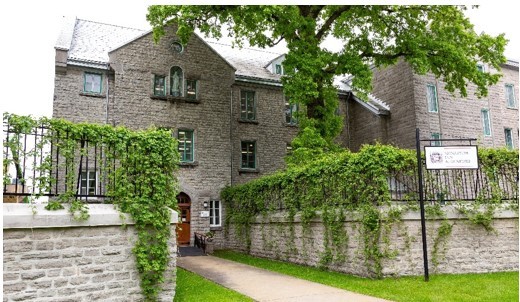
©Étienne Richard / Monastère de l'Hôpital général de Québec |
Hôpital-Général de Québec Monastery National Historic Site
Québec, Quebec
The Hôpital-Général de Québec monastery, located at the intersection of
the Saint-Roch and Saint-Sauveur neighbourhoods, is a large convent
complex dating back to the 17th century built on the former property of
the Récollets. Located on the traditional territories of several First
Nations, this convent complex was occupied continuously by the
Augustines since 1693 and is an excellent example of their hospital
work. The oldest convent in the country, it is of vital importance to
Canada's medical, religious and social history. Inspired by European
tradition, the Augustines' monastery buildings are a remarkable
illustration of the evolution of architecture and building techniques in
Canada since the second half of the 17th century. Having been spared the
bombardments of the Siege of Québec of 1759 and having never experienced
a major fire, the buildings are still in their original condition. The
ensemble of buildings is in a remarkable state of conservation,
constituting a site of architectural and artistic heritage preservation
of outstanding importance.
The Hôpital-Général de Québec monastery was built on the former domain
of the Récollets. After arriving in New France in 1615, the Récollets
established their convent on the bank of the Saint-Charles River in
1620. After an exile forced by the capture of Québec by the Kirke
brothers on behalf of England, the Récollets retook possession of their
property in 1670 and built a church (1671-1673) and a new stone
monastery (1680-1684). In 1692, Bishop Jean-Baptiste de La Croix de
Chevrières de Saint-Vallier (1653-1727) acquired the Récollets'
monastery and founded a general hospital, open to the poor, the sick,
the infirm, and the aged. In 1693, he entrusted management of this
hospital to the Augustines de la Miséricorde de Jésus, a community of
cloistered nursing sisters who were already responsible for the
Hôtel-Dieu de Québec. The Hôpital-Général de Québec monastery served as
a military hospital during the Seven Years' War, particularly during the
Siege of Québec (1759) and the Battle of Sainte-Foy (1760), treating all
injured soldiers, allies and enemies alike. In addition, the monastery
was occupied by New England revolutionaries in 1775 and became a place
of refuge for victims of large fires in the adjacent neighbourhoods of
Saint-Roch (1845) and Saint-Sauveur (1866).
The complex consists of the 11 wings of the convent built between 1671
and 2002 along with the gardener's house (1840) and its outbuilding. In
addition to these buildings, there are several large landscaped areas, a
garden, and three cemeteries. The irregularly-planned architectural
complex comprises several wings corresponding to the former
Hôpital-Général and the Augustines' monastery: only the part
corresponding to the monastery, still owned by the Augustines, has been
designated. Certain parts of the complex reflect the original convent
decor, including the Récollets' refectory building, with its pine
panelling, and the Notre-Dame-des-Anges chapel, with its wooden arched
ceiling, its retable (behind which are the remains of a half-timbered
wall, a very rare illustration of the layout of Récollet churches), and
its wooden panels decorated with painted landscapes and works of art.
In 1999, the nuns divested themselves of the section of the building
used as a general hospital. The location became a long-term care home
managed by the Government of Quebec.
|

©Parks Canada Agency / Agence Parcs Canada, Michel Pelletier, 2004 |
Hôtel-Dieu de Québec National Historic Site of Canada
Québec, Québec
Hôtel-Dieu de Québec National Historic Site of Canada is a large
religious complex and hospital located in the heart of Old Québec,
Québec. Founded in 1637, it is now one of the most important hospitals
in Quebec. The site includes interconnected structures that range in
date from 1695 to 2001. The vaulted cellars that support the
three-storey wings were built in 1695. Stone walls surround an adjoining
Augustine cemetery, monastery, garden and cloister. Opened in 1803, the
hospital chapel had its interior and façade remodelled in later years by
Thomas Baillairgé.
The Duchess D'Aiguillon founded the Hôtel-Dieu de Québec on August 16th
1637. The Augustines, Hotel-Dieu's religious community, came to the City
of Québec in 1639 to establish a hospital to provide physical and
spiritual comfort to those in need. In 1644 they moved to the Hôtel-Dieu
de Québec's present site. The Hôtel-Dieu de Québec quickly became the
main civil and military hospital of New France. The complex gradually
evolved incorporating new additions and in 1855 was designated a
university hospital. In 1995 the Hôtel-Dieu de Québec merged with two
other hospitals to become the Centre hospitalier universitaire de
Québec. The Augustine Nursing Sisters remain at the Hôtel-Dieu de Québec
monastery.
|

©Parks Canada Agency / Agence Parcs Canada, Daniel Laroche |
Île aux Basques National Historic Site of Canada
Trois-Pistoles, Québec
Île aux Basques National Historic Site of Canada is a long, narrow
island located five kilometres north of Trois Pistoles on the Saint
Lawrence River in Quebec. Two kilometres long by 400 metres wide, the
island supports a mixture of woods, prairie and marshland while the
surrounding shoreline features sheltered bays and sandy beaches.
Archaeological remains at four sites reveal evidence of Aboriginal
activity from both the pre-contact and post-contact periods. Three more
sites show evidence of occupation by French Basque fishermen between
1584 and 1637.
Occupied successively by Aboriginal groups, Basque sailors, Jesuit
missionaries, and homesteaders, Île aux Basques bears witness to many
centuries of human activity. Archaeological remains have been discovered
at seven sites in the southern part of the island. The Aboriginal
presence may have consisted of small groups visiting for short periods
on a seasonal basis while hunting, fishing and gathering. Harsh climatic
conditions may also have limited the French Basque occupation of the
island to sporadic, seasonal visits during the warmer months. The island
represents the eastern limit of the Iroquoian presence in the southern
Saint Lawrence area and also contains the largest concentration of
Basque sites in the St. Lawrence estuary. The island was occupied by
French Basques, in contrast to Red Bay National Historic Site of Canada,
which was occupied by Spanish Basques. The island is the only Basque
settlement in the estuary where contact between Europeans and
Aboriginals is supported by archaeological evidence. It is now a
protected area designated a sanctuary and refuge for migrating
birds.
|

©Parks Canada Agency / Agence Parcs Canada |
Île d'Orléans Seigneury National Historic Site of Canada
L'Île-d'Orléans Regional County Municipality, Québec
Île d'Orléans Seigneury National Historic Site of Canada occupies the
entire Île d'Orléans, and includes all surviving built, landscape and
archaeological resources from the seigneury that existed there during
the French Régime. Located just off the north shore of the St. Lawrence
River, near the city of Québec, Île d'Orléans was one of the earliest
settled areas of New France. The farmlands are laid out in long, narrow
strip plots that extend back from the water, while settlement are linked
by the chemin Royal that encircles the island. The surviving houses,
outbuildings, windmills, churches, and farmlands illustrate the
long-settled history of the island.
The Île d'Orléans Seigneury was created in 1636 and developed during the
17th century with the construction of a main road encircling the island
and the addition of several intersecting roads. The gently rolling land
with its many streams provided good farmland. Numerous seigneurs
governed the island over the years, with many tenant farmers working
under them, leaving a rich collection of managed farmlands, built and
archaeological resources. The farms are laid out with fields in long,
narrow strips, extending back from the water's edge and meeting at a
point in the centre of the island. Houses with their outbuildings were
usually built on the landside of the chemin Royal, looking toward the
river. The early division of the island into five parishes
(Saint-Pierre, Sainte-Famille, Saint-Francois, Saint-Jean, et
Saint-Laurent) reflected its varied geographic characteristics and
resulted in the construction of a church to serve each, with
processional chapels between.
|

©Parks Canada Agency / Agence Parcs Canada |
Île-Verte Lighthouse National Historic Site of Canada
Notre-Dame-des-Sept-Douleurs, Québec
Île-Verte Lighthouse National Historic Site of Canada is an attractive
12 metre high cylindrical stone lighthouse, with an octagonal painted
metal lamp, situated on an island in the St. Lawrence River opposite the
mouth of the Saguenay River. Its isolated setting contains not only the
tower, but a lightkeeper's residence, a fog horn building, an oil shed
and a small powder magazine.
The heritage value of Île-Verte Lighthouse lies in its age and its high
level of architectural conservation. Construction of Île-Verte
Lighthouse was approved in 1806 and completed in 1809. The tower was
designed and built by Edward Cannon, master mason of the city of Québec.
Its purpose was to guide ships in the dangerous waters and currents of
the St. Lawrence River at the mouth of the Saguenay River. For 137
years, from 1827 to 1964, this lighthouse was operated by four
generations of the Lindsay family. The only alterations to the building
have been the application of wood siding over the rubblestone walls
(initially in the form of clapboard in the 1850-1870 period, then later
as vertical siding), replacement of the original light with an automated
one in 1969, and replacement of original windows, inner ground floor
door, facing and metal hoops by the Canadian Coast Guard during
restoration in 1983.
|

©Parks Canada Agency / Agence Parcs Canada |
Jardins de Métis National Historic Site of Canada
Grand-Métis, Québec
The Jardins de Métis National Historic Site of Canada is an
English-inspired garden created by Elsie Reford from about 1926 to 1958.
The property, which covers approximately 18 hectares (45 acres) of land,
is located on the banks of the St. Lawrence and Métis Rivers between the
towns of Mont-Joli and Matane, near Sainte-Flavie, Quebec. The site
includes one villa and six distinct garden areas and more than 500
horticultural varieties.
Jardins de Métis is an excellent Canadian example of an early-20th
century English-inspired garden. The gardens were created by Elsie
Reford from about 1926 to 1958 on the grounds of a summer home given to
her by her uncle, George Stephen, founder of the Canadian Pacific
Railway and Canada's leading entrepreneur of the 19th century.
Originally a fishing lodge, Mrs. Reford created the gardens from a rough
landscape, taking full advantage of the site's favourable microclimate
and its sublime views. The site now includes specialized gardens,
winding paths, an allée royale and a variety of flower beds arranged in
an informal manner.
|

©Parks Canada Agency / Agence Parcs Canada, 2002 |
Joffre Roundhouse (Canadian National) National Historic Site of Canada
Charny, Québec
Joffre Roundhouse (Canadian National) National Historic Site of Canada
is a massive railway engine repair facility situated in the Canadian
National Railway Company yards in Charny, Quebec. Its hollow, circular
form is reflective of its function as a railcar roundhouse.
As part of the Intercolonial Railway (ICR), a railway designed to
connect the colonies of New Brunswick and Nova Scotia to the rest of
Canada, an essential provision for the maritime colonies' entrance into
Confederation, the Joffre Roundhouse (Canadian National) was the second
busiest divisional points on the system. It was originally constructed
as a 24-stall roundhouse to service ICR engines at the Charny depot in
1880. From 1920 to 1921, Canadian National Railway (CNR) added fifteen
stalls to the earlier structure thereby creating a full circle, apart
from one access opening. Its facilities also include a machine shop and
a still-functioning turntable, both added between 1920 and 1921. The
Joffre Roundhouse (Canadian National) continued to fulfill its original
function until 1981, when the CNR moved all diesel maintenance in the
province out of Charny.
|
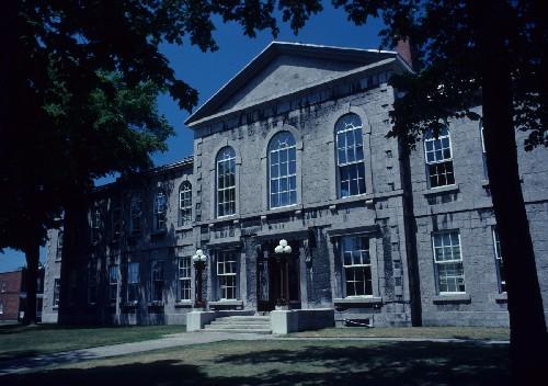
©Parks Canada Agency / Agence Parcs Canada, 1982 |
Joliette Court House National Historic Site of Canada
Joliette, Québec
Joliette Court House National Historic Site of Canada is a stately,
two-storey, stone building in the Neo-classical style. It was
constructed from 1860 to 1862 as a combined court house, registry office
and jail. The building is comprised of the original, symmetrical central
block with a jail wing to the rear, a sympathetic, two-storey addition
built in 1916, and two annexes added in 1960-1961.
The Joliette Court House is a particularly fine and well-preserved
example of a Neo-classical public building. It was constructed from 1860
to 1862 for what was then called "le village de l'Industrie" by the
government of united Canada, as one of about 28 court houses in Lower
Canada. The court house follows a standardized building plan created by
F. P. Rubidge, architect for the Department of Public Works of united
Canada, for 14 courthouses in Lower Canada built between 1859 and 1863.
It features a court room at the centre of the main floor flanked by a
jury room on one side and rooms for judges, lawyers and petit jury on
the other. The second storey of the main block was used for offices. A
rear wing, constructed as a prison, was divided into cells.
|
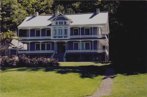
©Parks Canada Agency / Agence Parcs Canada, 2002 |
Joly de Lotbinière Estate National Historic Site of Canada
Sainte-Croix, Québec
The Joly de Lotbinière Estate National Historic Site of Canada occupies
Pointe Platon, a large peninsula on the south shore of the Saint
Lawrence River in Quebec. Founded in 1851 by Sir Henri-Gustave Joly de
Lotbtinière, an influential Canadian politician and Lieutenant Governor,
this 337-acre manorial-style summer estate consists of a large house
with landscaped park, specialist gardens and support structures.
Designed in the picturesque manner, the estate places an emphasis on the
informal and natural. Walkways lead through a succession of gardens
containing indigenous and exotic species complemented by lawns, pools
and carefully placed trees.
The Joly de Lotbinière family played an important role from the
seigneurial period onwards. Henri-Gustave Joly de Lotbinière, who
inherited the estate in 1860, became one of the outstanding politicians
of the 19th century, as well as being a remarkable botanist and
scientist of that period. The design of the grounds accommodated
extensive specimen planting and the establishment of exotic species.
Henri-Gustave was also a pioneer of forestry and established a tree
collection. The main residence exhibits characteristics of a summer
residence including large windows that maximize views of the natural
surroundings, and extensive galleries to provide an agreeable transition
to the exterior. His grandson inherited the estate and developed the
gardens after 1908. Their style is partly English and partly French. The
house and the garden have been in public ownership since 1984 and the
estate is now open to the public.
|
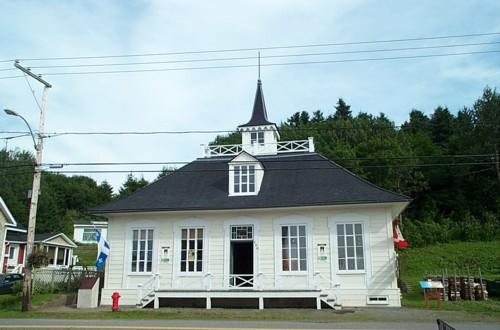
©Parks Canada Agency / Agence Parcs Canada, 2008. |
L'Isle-Verte Court House National Historic Site of Canada
L'Isle-Verte, Québec
The L'Isle-Verte Court House National Historic of Canada stands in the
small municipality of L'Isle-Verte, located on the south shore of the
Saint Lawrence River. This small yet elegant court house is located on
St-Jean-Baptiste Street, which extends the full length of the community
and connects the main institutions and residences. Built in the Regency
or English cottage style, it is a dignified one-and-a-half-storey
symmetrical, wood-frame building with evenly spaced openings and a
truncated pyramidal roof with belvedere.
Erected in 1859-1860, the L'Isle-Verte Court House is a rare example of
a purpose-built circuit court building. Prior to Confederation, the
province of Québec was divided into 21 judicial districts with high and
lower courts. The circuit courts travelled to the various localities on
a fixed schedule, providing small communities with access to the courts
system of the province.
The L'Isle-Verte Court House was designed in the Regency style, an
element of the Picturesque movement of the first half of the 19th
century. This style, favoured for Québec residences, was rarely used for
public buildings. Designed by Benjamin Dionne in the tradition of local
residential architecture, the modest courthouse in the village of
L'Isle-Verte contained offices for judges, legal counsel, and the clerk
of the court on the same floor. The lantern and rooftop terrace that
alludes to the domes erected on more imposing public edifices gives the
courthouse an official appearance. The building's simple yet elegant
design was perfectly suited to its original purpose, which was that of
both part-time courthouse and community hall. It is an excellent example
of vernacular architecture adapted to official use.
|

©Parks Canada Agency / Agence Parcs Canada, B. Violette, 2002 |
La Corne Nursing Station National Historic Site of Canada
La Corne, Québec
La Corne Nursing Station National Historic Site of Canada is located in
La Corne, in the Abitibi-Témiscamingue region of Québec. It was built in
1940 and comprises two wooden buildings painted in white, the
dispensary-residence, a two-storey building with a front veranda, and a
garage. A summer kitchen is located at the south-west corner of the
premises. The nursing station has a rear courtyard where the tree line
marks the western limit of the property. The nursing station has also
retained its furniture and houses an ethnological collection directly
associated with the site's history.
The La Corne Nursing Station is one of the best preserved of the network
of 174 nursing stations created in Québec between 1932 and 1975. For 50
years, from 1940 to 1990, the same nurse, Gertrude Duchemin, who retired
in 1976, lived at the La Corne Nursing Station. Her long residence in
the building helped to preserve the site's integrity and enabled the
conservation of the furniture as well as an ethnological collection
directly associated with the site's history. Because of its physical
integrity, the La Corne Nursing Station is an excellent example of a
nursing station residence built in Québec and implemented in newly
colonized regions by the Service médical aux colons (SMC) during the
Great Depression. Three models of nursing station residences were built.
The La Corne Nursing Station was built in the years 1930-1949 according
to the first model, which was also the most common, and is comprised of
a two-storey wooden building with an attached garage and an adjacent
summer kitchen.
The nursing station also symbolizes the contribution of the network
created by the SMC to the development of healthcare services in Québec's
remote areas. These nursing stations contributed to the genesis of the
socio-sanitary infrastructure of many rural regions in Québec and nurses
played a key role. The nursing station served both as the nurse's
workplace and residence consisting of a nurse's office, waiting room,
kitchen, living room, bathroom and bedrooms on the second floor, hence
the term "dispensary-residence." Nevertheless, nurses had to travel
great distances to serve the settlers. They took on many
responsibilities, including promoting public health, monitoring the
outbreak of contagious diseases, caring for the poor, delivering babies,
and extracting teeth.
The La Corne Nursing Station illustrates the fundamental role played by
these nursing stations in the development of communities and in the
colonization process of the Abitibi region. Nurses like Gertrude
Duchemin played an essential role in the development of Québec's
regions, particularly in Abitibi-Témiscamingue.
|
©Québec City / Ville du Québec, 1997 |
La Fabrique Historic District National Historic Site of Canada
Québec, Québec
La Fabrique National Historic Site of Canada is located in the
Saint-Roch district in Québec. Formerly an industrial building it now
houses the offices of Québec's land-use planning and economic
development services and the Université of Laval School. This striking
building fronts on Charest Boulevard East and is constructed of red
brick. It features ornamental white brick trim, medieval-inspired square
towers, and rich ornamentation.
La Fabrique is valued for its significant role in Canada's clothing
industry. It began as the Argenteuil Paper Manufactory, built in 1804 by
two American paper makers, Walter Ware and Benjamin Wales. By making
paper from cloth rags, the mill supplied wrapping paper and newsprint
largely to the Montréal market from 1805 to 1834. For much of this time
it was under the control of James Brown, Montreal stationer and founder
of the present "Montréal Gazette". The mill, in the municipality of
Saint-André-Est (now Saint-André-d'Argenteuil), Québec, was the first
and for many years the only paper mill in what is now Canada. The
origins of Canada's pulp and paper industry may be traced to its
establishment. Its time as the Dominion Corset has further cemented its
place in Canadian industrial history. In 1964, a modern addition was
constructed in the International style. Rehabilitated and partly
reconstructed in 1992-93, the building now includes an atrium and a
renovated and subdivided interior.
|
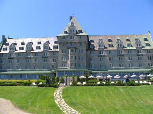
©Parks Canada Agency / Agence Parcs Canada, Geneviève Charrois, 2005 |
La Malbaie Historic District National Historic Site of Canada
La Malbaie, Québec
La Malbaie Historic District National Historic Site of Canada is nestled
in the mountainside of a narrow, eight-kilometre long strip of land
overlooking the St. Lawrence River, in Quebec's Charlevoix region. One
of the oldest villégiature areas in the country, this designated site
includes over 200 main and subordinate buildings dating primarily from
the Golden Age of villégiature, from 1880 to 1930, as well as more
recent components. Most of the main buildings are directly associated
with the villégiature because of their use as hotels/restaurants,
residences and recreation-related sites. La Malbaie Historic District is
also characterized by its numerous panoramic vistas of the river and its
winding roads, along which wooden cottages can be found.
The historic value of La Malbaie Historic District's historic value is
mainly based upon its function as a villégiature resort. Its use and
historical ties are associated with this social phenomenon, which
characterized Canada from the mid-1800s until about 1930. La Malbaie was
one of the first areas to host vacationers. With the growth of maritime
transportation, this phenomenon quickly took hold, transforming the
rural, isolated nature of the place. As a result, La Malbaie became a
very exclusive resort, offering all that was essential to its
reputation, including an incomparable setting and location, as well as
many resources made available to vacationers.
In its early days, the villégiature coincided with the appearance of a
bourgeoisie arising from the industrial revolution and the
socio-economic changes that ensued. At that time, sea bathing and fresh
country air became a solution to the unhealthiness of cities, as such
natural spaces were beyond rapid industrialization. Vacationers stayed
in lovely summer homes along des Falaises Road and regularly went to the
Manoir Richelieu for grand receptions. Still today, many resources bear
witness to the significance of La Malbaie during the entire Golden Age
of villégiature in Canada. With its man-built and landscaped heritage,
La Malbaie Historic District still represents a showplace for Canadian
villégiature.
|
©Parks Canada Agency / Agence Parcs Canada, J. Dufresne
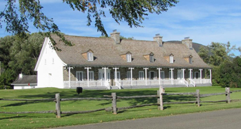
©Parks Canada Agency / Agence Parcs Canada, J. Dufresne |
La Petite-Ferme du cap Tourmente National Historic Site of Canada
Saint-Joachim, Québec
La Petite-Ferme is located in a landscape of remarkable beauty, where the St.
Lawrence River meets the great coastal marsh and the tidal plain. It was
because of these unique conditions that the site was recognized early on as
being particularly favourable for human settlement. With an Indigenous
presence in the area dating back more than 2,000 years, la Petite Ferme is
part of the vast network of known paleohistoric sites of the Cap Tourmente
plains. It was at this strategic location that Samuel de Champlain had a farm
built in 1626 to raise livestock, before it became a source of food for the
small community of the newly formed Québec City. The remnants found on the
site or still buried there are among the rare tangible traces of Champlain's
work in the St. Lawrence Valley. La Petite-Ferme was purchased by Monseigneur
François de Montmorency Laval in 1664, and it bears witness to the unique
evolution of the Séminaire de Québec, which operated the farm for 300
consecutive years and contributed to the farm's conservation through its
continuous presence. United by their history, functions, architecture, and
their relationship with the surrounding landscape, the group of farm
buildings reflect close to 400 years of agricultural use, making this a
highly symbolic place.
Champlain called the site "Cap de Tourmente" ("cape of storms") because the
waters of the river rise at the slightest gust of wind. The farm built by
Champlain was used as a food reserve for the first settlers to arrive at the
Habitation de Québec. It became the first livestock farm in the St. Lawrence
Valley and one of the first farms in New France.
La Petite-Ferme was at the heart of the Séminaire de Québec, contributing to
its educational work and, through revenues arising from its operations,
ensuring that the Séminaire could carry out its work for over 300 years. In
1664, Monseigneur de Laval purchased almost all the land on Côte de Beaupré
in order to guarantee the establishment and existence of his Séminaire de
Québec. He likely began building the house in that year, though its existence
is only confirmed three years later. In the 18th century, La Petite-Ferme
became one of the largest farms in New France. In 1759, its activities were
disrupted by the threat of a British invasion when eight English ships
dropped anchor at the entrance to the crossing known as "la traverse" at Cap
Tourmente. La Petite-Ferme was completely burned down, except for the
dwelling house, which resisted the fire and destruction. The Séminaire
continued to operate its farms up until the 20th century. Beginning in the
1920s, agriculture in Quebec began to decline due to industrialization, urban
development, and the advancement of farming technologies. During the second
half of the 20th century, the Séminaire began to sell some of its lands, and
beginning in 1969, the Government of Canada began to acquire various farms,
including La Petite-Ferme, and established the Cap Tourmente National
Wildlife Area.
The house is the only preserved building dating from the French Regime in Cap
Tourmente, and is also the oldest evidence of the presence of the Séminaire
de Québec. It is a handsome example of a French Regime residence, with
picturesque features added in the 19th century showing neo-classical
influence. The site includes remains from the Champlain's farm and from
buildings built in the early 20th century: the washhouse/blacksmith's shop,
the barn/cowshed, and the grain shed, as well as a workshop/bathroom built in
1964.
|
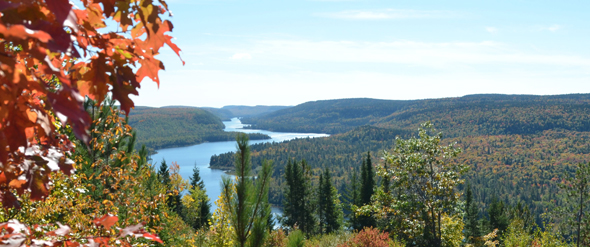
©Parks Canada Agency / Agence Parcs Canada |
La Mauricie National Park of Canada
Headquarters: Shawinigan, Québec
Lakes winding through forested hills for canoe and portage
activities.
Located in the Laurentian mountain range, La Mauricie National Park is a
536-km2 natural conservation area intended as a representative sample of
the southern part of the Canadian Shield.
|
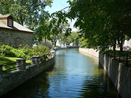
©Parks Canada Agency / Agence Parcs Canada, 2007 |
Lachine Canal National Historic Site of Canada
Montréal, Québec
Operational canal; five locks, railway / road bridges.
Lachine Canal National Historic Site of Canada is an early 19th-century
canal, 14 kilometres in length, built to circumvent five kilometres of
white water on the St. Lawrence River between Lachine and the old port
on Montréal Island, at the level of McGill street. It is now a
recreational waterway running through the south-central part of the city
of Montréal.
The heritage value of the Lachine Canal lies in the layout of the canal
and the illustration of its historic role in the development of the
country and of the city of Montréal. The Lachine Canal was built as a
commercial canal in 1825-26 and was operated and upgraded continually as
a commercial and industrial route until it was transferred to Parks
Canada in 1978 for tourism development.
|

©Parks Canada Agency / Agence Parcs Canada, Catherine Cournoyer, 2005 |
Last Post Fund National Field of Honour National Historic Site of Canada
Pointe-Claire, Québec
Last Post Fund National Field of Honour National Historic Site of Canada
is located in the west end of Montreal Island, in Pointe-Claire, Quebec.
Inaugurated in 1930, this military cemetery was created to provide a
burial service for veterans who died in a hospital or a public
establishment after their military service. Marked at the entrance by
the Remembrance Gate that houses a chapel, the cemetery was designed on
an axial plane with a Beaux-Arts inspired centre line, revolving around
roundabouts. It has approximately 9,500 pink granite gravestones
arranged flat on the ground, side-by-side in rows, and a number of
commemorative monuments that, in the sober landscape, accentuate the
solemn military character of the location.
Founded in 1909, the Last Post Fund was a charitable organization that
became a partner-agency to the Department of Veteran Affairs Canada,
handling the burial of Canadian veterans. It is a pillar of the veteran
community, administering a government program to which it contributes a
growing share through activism, as demonstrated by its actions to honour
with dignity the men and women who served Canada. The Last Post Fund
provided a honourable burial for over 100,000 veterans and their family
members throughout the country.
The cemetery is an obvious example of military tradition as demonstrated
by the choice of the Beaux Arts style layout characterized by symmetry,
simplicity and regularity. Burials, generally with two veterans per
grave with officers and soldiers resting side by side, are marked by
granite headstones engraved with standard inscriptions. Like the
landscaping, the commemorative monuments also help to establish the
solemn military character of the site, particularly by evoking the
symbols associated with the classical tradition of the Commonwealth War
Graves Commission (CWGC).
Designed as a monument to the memory of all the soldiers who honourably
served the nation, the National Field of Honour evolved over time.
Soldiers from practically all conflicts now rest there, beginning with
the soldiers of the British garrison posted in Montréal in the 19th
century. The place names accentuate the commemorative character of the
site, recalling important people, events and battlefields in Canadian
military history.
|

©Parks Canada Agency / Agence Parcs Canada, Jocelyne Cossette, 1997 |
Le Boutillier Manor National Historic Site of Canada
Gaspé, Québec
Le Boutillier Manor National Historic Site of Canada stands sentinel at
Anse-au-Griffon in the Gaspé region of Quebec. The Manor, characterized
by its appearance and style, as well as its construction and building
materials, is a fine example of 19th-century vernacular architecture in
Quebec. The house has a symmetrical façade, a gable roof and an
upturned, bell-cast eave that evokes an attractive and harmonious whole.
Built between 1850 and 1860, Le Boutillier Manor clearly stands out from
the simple fishermen's houses found along the Gaspé coast. It was the
second home of businessman, politician and magistrate John Le
Boutillier, as well as an office for the managers of his fishing outport
at Anse-au-Griffon. The house has a bell-cast eave and a neo-classically
inspired design, expressed in its elegant shapes, symmetrically
organized façade and uncluttered interior decor. The bell-cast eave of
this attractive and unusual manor makes it an example of a particular
style of Quebec vernacular architecture, of which very few examples have
survived.
|

©Parks Canada Agency / Agence Parcs Canada, 2001 |
LeBer-LeMoyne House National Historic Site of Canada
Lachine, Québec
LeBer-LeMoyne House National Historic Site of Canada is a 17th-century
former fur trading post located on a small headland beside the Lachine
Canal on the grounds of the Lachine Museum in Montreal. Both the main
and subsidiary buildings are modest fieldstone structures with steeply
pitched roofs.
LeBer-LeMoyne House National Historic Site of Canada was built for
Jacques LeBer and Charles LeMoyne as a fur trade post in 1669-1671. They
operated the post until 1685. In 1689 the house was damaged by fire, and
its trading location was abandoned in 1695. Between 1695 and 1946,
LeBer-LeMoyne House was subject to a series of renovations for use as a
residence. The City of Lachine acquired it in 1946 and renovated it as a
museum. Today the property consists of the house proper, its rear annex
and the dépendance outbuilding, a separate utility building constructed
at the same time as the house.
The heritage value of LeBer-LeMoyne House resides in the historical
period and activity to which it bears witness, and in the fact that it
is the only complete structure with Charles Le Moyne. The site played a
role in the fur trade during the French Régime, as illustrated by the
form, composition, site, and setting of both the house and the
outbuilding.
|

©Parks Canada Agency / Agence Parcs Canada, 1999 |
Légaré Mill National Historic Site of Canada
Saint-Eustache, Québec
Légaré Mill National Historic Site of Canada is a milling site situated
between the sloping north bank of the Rivière du Chêne and the main
street of the village of St. Eustache, Quebec. Located just opposite the
town hall, the site has functioned continuously since the French Régime.
Now part of a complex, the flour mill is surrounded by a saw mill, a
miller's house, a dam, and a mill pond, all of which are encompassed by
the designation.
The heritage value of Légaré Mill lies in the physical and functional
continuity of the cohesiveness of the complex, in the utilitarian forms
and diverse vernacular traditions of its buildings, and in the evidence
of continuous technological evolution it contains. Légaré Mill was
constructed in 1762-63 by François Maisonneuve on land granted to him by
the Seigneur of Mille Isles on condition that he build a mill complex.
Today that complex contains a flour mill (1762-63), a saw mill (1880), a
miller's house (1902-1903), a dam and a mill pond (1762-63). These
resources reflect different time periods of vernacular construction and
milling technology. The name of the site comes from the Légaré family
who owned the mill during the 20th century.
|

©Parks Canada Agency / Agence Parcs Canada, P. St. Jacques, 1984

©Parks Canada Agency / Agence Parcs Canada, J.P.Jérôme, 1985 |
Lévis Forts National Historic Site of Canada
Lévis, Québec
Part of Québec fortification system.
Built on the south shore of the Saint Lawrence River by the British
between 1865 and 1872, the Lévis Forts were designed to protect Québec
against American invasion following the Civil War.
Last in a series of three detached forts and beautifully restored by
Parks Canada, Fort No. 1 attests to technological innovations that were
remarkable for their time.
Lévis Forts National Historic Site of Canada consists of the above and
below-ground remains of three 19th-century stone defensive works located
on a height of land on the south bank of the St. Lawrence River at
Lévis, Québec. The three forts, arranged in a linear pattern, are each
approximately 1800 metres apart. The site includes the extant
fortification of Fort No. 1, the archaeological remains of Forts No. 2
and 3 as well as evidence of roads leading between the forts, and camps
used by construction teams.
The decision to build three forts at Lévis to complete Québec's system
of defence was made by the British during the American Civil War under
the threat of an invasion by Union soldiers. The Birtish sent William
Drummond Jervois to Québec to design improvements to the defensive
fortifications at Lévis in order to protect the soldiers stationed
there. The construction of the three forts began in 1865, under the
direction of the Royal Engineers, and Fort No. 1 was completed in 1872.
In addition to the forts, work included the building of a construction
camp of some 20 buildings, a dock and a communications network along the
St. Lawrence River. Innovative methods were tried and proven in the
design, surveying and construction of the Lévis Forts. Steam-powered
equipment was used to make concrete faced with stone and the escarpment
of Fort No. 1 was constructed of new types of concrete poured in stone
frames. No garrisons ever occupied the forts however, because the
signing of the Washington Treaty in 1871 eliminated the fear of further
clashes between the British and the Americans.
|

©Parks Canada Agency / Agence Parcs Canada, 1990 |
Lévis Railway Station (Intercolonial) National Historic Site of Canada
Lévis, Québec
Lévis Railway Station (Intercolonial) National Historic Site of Canada
is a two-storey, stone railway station building located on the east
(town) side of CN railway tracks that historically ran along the east
bank of the St. Lawrence River in the city of Lévis. It is situated at
the head of Côté du Passage street, near its junction with rue Saint
Laurent.
Lévis Railway Station (Intercolonial) was commemorated in 1976 as the
effective terminus of the Intercolonial Railway from Halifax.
The heritage value of this site resides in its association with the
historic Intercolonial Railway illustrated by its physical survival from
the nineteenth century.
The Intercolonial Railway, originally built between Halifax and
Rivière-du-Loup (1867), extended its main line to end at Lévis in 1879
by the purchase of the Charny/Rivière-du-Loup line constructed by the
Grand Trunk Railway between 1854 and 1860. In 1884 the Intercolonial
Railway extensively remodelled the Lauzon town hall/market (1864) in
Lévis to serve as its station. In the years that followed, the Grand
Trunk Railway and the Québec Central Railway also used terminal
facilities in the building. Both the Grand Trunk Railway and the
Intercolonial were folded into Canadian National Railways (CNR) after
1919, and the building became a CNR station. It was renovated and
modernized in 1986 for use as a VIA Rail passenger depot, but was closed
in 1993 when service stopped on the railway line on which it
stands.
|

©Parks Canada Agency / Agence Parcs Canada, 1999 |
Louis Bertrand House National Historic Site of Canada
L'Isle-Verte, Québec
The Louis Bertrand House National Historic Site of Canada is located in
the village of L'Isle-Verte in the Bas-Saint Laurent region of Quebec.
Constructed for Louis Bertrand, a successful merchant and active
politician, the house is rectangular in plan with two full storeys and a
two-level attic. The house was built in the traditional "maison
québecoise" manner, as seen in the high foundations, gallery, steep
roof, and details such as the multi-paned casement windows. To this are
added stylistic elements from Neoclassicism, including the overall
symmetry of plan and elevations, decorative details, and wood cladding
fashioned to imitate cut stone. The interior retains its original floor
plan, mouldings, and many of its original fittings and furnishings.
This house was constructed in 1853 for the merchant and notable Louis
Bertrand, who became the first mayor, founder of the Agricultural
Society and Deputy of the county of Rimouski. Measuring 15.85 metres by
10.66 metres, the house has a rectangular plan and medium-pitch roof
typical of Quebec architecture, while the detailing reflects a
Neoclassical influence. The interior retains fittings and furniture
typical of middle class residences of the period. Louis Bertrand's
descendants continued to live in the house for four generations. In 2005
the house and contents, a remarkable collection of family related
objects, were given to the Université du Quebec à Rimouski
(UQAR).
|
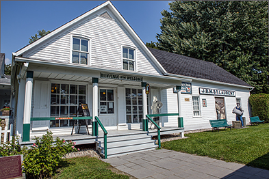
©Parks Canada Agency / Agence Parcs Canada
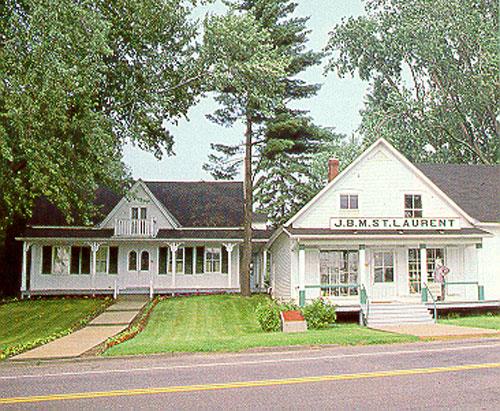
©Parks Canada Agency / Agence Parcs Canada |
Louis S. St. Laurent National Historic Site of Canada
Compton, Québec
Childhood home of Louis S. St. Laurent, Prime Minister of Canada,
1948-57.
The Louis S. St. Laurent National Historic Site of Canada, which is
located in Compton, in the Eastern Townships, some 20 km from
Sherbrooke, is a living reminder of the life and work of the former
Prime Minister of Canada.
The rural atmosphere of the village, the charming house in which Louis
St. Laurent was born, the once bustling general store: all take us back
to another epoch in which we can savour the enchantment of the lifestyle
of a different time, while learning about this great man, marked out by
destiny.
Located in the Québec Eastern Townships, in the heart of the village of
Compton, Louis S. St. Laurent National Historic Site of Canada consist
of a house, a general store and its warehouse, a small shed and a
shelter associated with Louis S. St. Laurent, former Prime Minister of
Canada, all within a landscape design that retains traces of its
evolution. More recently, two structures have been built, one recalling
a former stable in its location and massing.
The heritage value of Louis S. St. Laurent National Historic Site of
Canada resides in the features of its cultural landscape associated with
the life of Louis S. St. Laurent (1882-1973), and in the general manner
in which its cultural landscape depicts village life in the Eastern
Townships over one century.
Louis S. St. Laurent was born on this property; he inherited a share of
it in 1933, and retained ownership until 1971. The historic site
consists of three lots assembled by his parents in 1881 and 1908, and
contains four surviving structures from this period. Two buildings, a
house and a general store, were acquired from previous owners by the St.
Laurents in 1881, and eventually expanded. Two structures were added by
the family: a small shed (1885 - 1900) and a weigh scale shelter (1936).
In addition, there are archaeological remnants of buildings from the St.
Laurent period, and two buildings constructed at a later date. Parks
Canada assumed management in 1975.
|
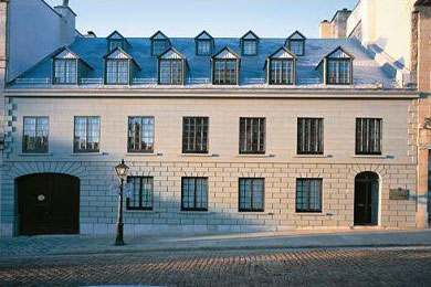
©Parks Canada Agency / Agence Parcs Canada |
Louis-Joseph Papineau National Historic Site of Canada
Montréal, Québec
Stone house built in 1785, associated with Louis-Joseph Papineau.
Located in Old Montreal on Bonsecours Street, the Louis-Joseph Papineau
National Historic Site of Canada is typical of the architectural style
seen in the Montreal area in the late 18th and early 19th centuries. It
was home to four generations of the Papineau family: Joseph Papineau,
his son Joseph Papineau, Louis-Joseph Papineau and his descendants. This
National Historic Site of Canada is closed to Visitors.
Louis-Joseph Papineau National Historic Site of Canada was the Papineau
family home in Montreal. Located on rue Bonsecours, the two-and-a-half
storey stone house with its steeply pitched roof sits flush to the
street. An arched passageway allows for vehicular access to the rear
courtyard.
Louis-Joseph Papineau National Historic Site of Canada is valued for its
connection to Papineau during the years he was most active politically.
His family's long period of previous ownership make the underlying
French Regime architecture of this house a reflection of Papineau's
roots. The changes he introduced in 1831-32 provide an indication of his
tastes as well as the new ideas he implemented to suit his contemporary
world.
This house was owned by the Papineau family from 1748 to 1779, and again
from 1809 to 1920 and was substantially renovated by Louis-Joseph
Papineau in 1831-1832. The changes he made included construction of
covered brick passage providing entrance to the rear courtyard, moving
the main door from a central location on the façade to one end and
creating a new interior vestibule and main staircase. This house was
sold to the Government of Canada in 1982. Under Parks Canada
administration, its roof and façade have been substantially
rebuilt.
|

©Parks Canada Agency / Agence Parcs Canadada, 1988 |
Loyola House / National School Building National Historic Site of Canada
Québec, Québec
Loyola House / National School Building National Site of Canada is an
imposing early Gothic Revival style public building located within the
walls of Old Québec City, Quebec. Set on a sloping street, this
classically organized two-and-a-half-storey stone building features
regular fenestration, a large gabled portico and a belvedere. Gothic
Revival detailing enhances the structure.
Constructed between 1822 and 1823 to plans by stone merchant Benjamin
Tremaine, the Loyola House / National School Building is one of the
earliest examples of Gothic Revival style architecture in Canada, and
also in the use of this style on a public building. Its pointed gothic
windows and distinctive drip label mouldings applied to a building of
classical proportions reflect the Romantic phase of the Gothic style. In
1842, architect Henry Musgrave Blaiklock added another storey and an
annex, taking care to use the same fenestration pattern in the
additions. Modifications have been made over the years to adapt to
changing functions. The building has served as a school, a home for
orphans and the poor, and as a social and cultural centre.
At the instigation of the Society for Promoting Christian Knowledge, an
Anglican institution, this National School insuring the education of
orphans was erected in behalf of the creation of the British National
Schools. The Building housed a number of other institutions of
religious, charitable, or educational vocations. Owned by the Jesuits
from 1904 to 1969, the building was renamed Loyola House and used as a
centre for social and cultural activities.
|

©Library and Archives Canada / Bibliothèque et Archives Canada, PA-056837, C. M. Johnson, 1934 |
Madeleine de Verchères National Historic Site of Canada
Verchères, Québec
Madeleine de Verchères National Historic Site of Canada is located in a
small landscaped park on the south shore of the St. Lawrence River in
Verchères, Quebec. The site consists of a 7.2-metre high bronze statue
of Madeleine de Verchères set atop a tapered conical tower with a square
stone base, which stands sentinel facing the St. Lawrence River. The
site also includes the manicured grass area and the fence surrounding
the monument.
In 1692, a group of Iroquois attacked Fort Verchères in what was then
New France. At the time of the attack, 14 year-old Madeleine de
Verchères (1678-1747), her two younger brothers, an elderly servant and
two soldiers held the fort. Young Madeleine led the defence, which after
eight days of resistance, ended in victory.
In the early 20th century, the Governor General of Canada, Lord Grey,
recommended a commemoration project to honour the role Madeleine de
Verchères played in defending Fort Verchères. After seeing the statuette
of Madeleine de Verchères created by Louis-Philippe Hébert in 1910, the
Governor General proposed reproducing the statuette on a larger scale
and placing it on the headland of Verchères, facing the St. Lawrence
River. The monument was erected in 1913, and in 1927, a plaque was added
by the Historic Sites and Monuments Board of Canada.
|
©National Library, NL 14659, 1955 |
Magog Textile Mill National Historic Site of Canada
Magog, Québec
Only 19th century mill where the entire process of spinning, weaving,
bleaching and printing was carried on at one site; built in 1883.
|
©Parks Canada Agency / Agence Parcs Canada, 2003 |
Maillou House National Historic Site of Canada
Québec, Québec
Fine example of 18th-century Québec town architecture, 1736.
Maillou House is a picturesque two-storey, stone house located in Quebec
City's historic district. Its simple vernacular form with steep, gabled
roof and high chimneys speaks to its French-Regime origins. Set flush to
the sidewalk with a courtyard and outbuildings hidden behind a stone
wall, it is a fine example of an urban house of the 18th century.
Built about 1737 as a one-storey structure by Jean-Baptiste Maillou, the
house was raised one storey in 1767, extended at ground level in 1799
which was raised one storey in 1805, and a rear annex added between 1828
and 1831, by which time it had achieved its present form. The Maillou
House is typical of the traditional domestic architecture of the French
regime, a style that continued into the early 19th century and it is a
good example of the urban residence of a well-to-do citizen of Lower
Canada. Two outbuildings were built by the Royal Engineers in 1830 to
serve as a stable and storage shed, together with the stone wall, during
the time the house was held by the British army. The arrangement of the
house and its outbuildings around the periphery of a closed court is one
of the few extant examples of a once-typical urban grouping in the first
decades of the 19th century.
Jean-Baptiste Maillou dit Desmoulins (1688-1753) built the house and
lived in it until his death. He was one of the most important private
landowners in Quebec during the French regime and one of the most
successful building contractors of the time. Louis Liénard de Beaujeu de
Villemonde, who owned the house from 1754 to 1766, was a military
officer who rented the premises to other officers. After the British
conquest, the military governor designated the house as the meeting
place for the military council that would govern Quebec until civil
government could be established. The council met there from 1760 to
1764. Antoine Juchereau Duchesnay (1740-1806), who lived in the house
from 1766 until 1785 and added the second storey, acquired the house
from his father-in-law Villemonde. Duchesnay was a wealthy and
influential politician and businessman, an army and militia officer, a
member of the Executive Council of Lower Canada, and seigneur of
Beauport, Fossambault, Gaudarville, and Saint-Roch-des-Aulnaies. John
Mervin Nooth, who lived in the house from 1785 until 1799, was
superintendent of military hospitals for British North America. John
Hale (1765-1838) who lived in the house from 1799 to 1815, was Deputy
Pay Master General for the British troops, Inspector-General of Public
Accounts, member of the legislative council of Quebec, militia
commander, justice of the peace for Quebec, Montreal and Trois-Rivières,
and seigneur of Saint-Anne-de-la-Pérade. He built a one-storey extension
to the house to serve as an office for the British army treasury.
The crown acquired the property in 1815 and the Commissariat, Pay and
Army Bill Offices charged with provisioning the troops were located
there from 1815 to 1871. It served as the office of the British army's
chief administrator as well as the military treasury. After 1843, it
also served as lodging for senior administrative officers. After British
troops left Canada in 1871, the house was used as headquarters for the
local militia for almost 60 years. Since then it has been used by local
reserve forces and as the offices of the Quebec Chamber of
Commerce.
|

©Parks Canada Agency / Agence Parcs Canada, 1982 |
Maison Cartier National Historic Site of Canada
Montréal, Québec
Maison Cartier National Historic Site of Canada is located on the east
side of Place Jacques Cartier in Old Montréal, in Quebec. Built between
1812 and 1813, this two-and-a-half storey building is made of cut stone,
with a gabled tinplate roof. The property also includes a rear yard and
a stone block addition. Associated with the lodging industry for most of
its existence, this house is one of the last small inns remaining in
Canada.
In 1808 a parcel of the property was transferred to the City of Montreal
to develop a public market, the "New Marketplace," known today as Place
Jacques-Cartier. In the midst of this flurry of growth, Augustin
Perrault and Louis Parthenay became involved in land speculation. The
two associates purchased land in the New Marketplace and then on March
10, 1812, made an agreement with Amable Amiot to build two to three
houses at the location. The first building completed was Maison Cartier.
As soon as it was finished, it was rented out. One of its first
occupants was Joseph Sicard Carufel, an innkeeper. Today, Maison Cartier
is a restaurant and one of the last small inns still standing in Canada.
Maison Cartier is an example of a building used as an inn in the early
19th century, a very popular type of building at a time where travellers
had to make frequent stops. Now covered with cut stone, it is endowed
with a new gallery at street level. The ground floor is characterized by
large windows and double doors on the left side. Six windows, arranged
in a row, adorn the second floor and three accentuate the gabled roof.
Covered in tinplate, the roof is closed in by firewalls that extend the
gabled walls.
|
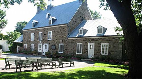
©Parks Canada Agency / Agence Parcs Canada, N. Clerk, 2005 |
Maison Saint-Gabriel National Historic Site of Canada
Montréal, Québec
Located in the southern part of Pointe-Saint-Charles in Montréal, at the
end of Dublin Place, Maison Saint-Gabriel National Historic Site of
Canada is situated at the centre of a property of irregular shape which
also contains a barn constructed of field stone, a well and a wooden
cross. Maison Saint-Gabriel is an example of French-Canadian
architecture dating from the days of the French regime. The lot is an
island of pastoral greenery in a large residential sector.
The heritage value of Maison Saint-Gabriel derives from the fact that it
is an exceptional example of the rural architecture of New France and it
is associated with the religious work of Marguerite Bourgeoys and of the
religious community Congrégation de Notre-Dame, which she founded.
Maison Saint-Gabriel is a remarkable building whose history and
architecture are evocative of 17th-century New France. Erected on a
rectangular plan, the impressive fieldstone house consists of a central
body flanked by two small wings and topped by a steep, gable roof whose
two slopes are pierced by small dormers, double chimneys and a belfry.
Owing to its exterior composition, interior layout and construction
techniques, it is an exceptional example of the rural architecture of
New France.
It is also an exceptional testament to the religious work of Marguerite
Bourgeoys and the Congrégation de Notre-Dame. Maison Saint-Gabriel was
home to a small group of filles du roi (king's daughters), served as a
primary school for young children and a homemaking school for young
girls, and also served as a residence for nuns employed on a sharecrop
farm.
|
©Parks Canada Agency / Agence Parcs Canada, 2004 |
Manoir Papineau National Historic Site of Canada
Montebello, Québec
19th-century manor, home of Patriot leader, Louis-Joseph
Papineau.
Located in Montebello, halfway between Hull/Ottawa and Montréal, the
Manoir Papineau National Historic Site represents one of the most
treasured heritage locations in the area surrounding La Petite-Nation
and in the greater Ottawa River region.
The Site has been designed primarily to commemorate Louis-Joseph
Papineau, the man who was to become a leading figure in Canadian
politics during the 19th century. The Site is also designed to showcase
the manor house and domain of "Monte-Bello," the impressive work of
architecture designed and given form by Louis-Joseph Papineau.
Manoir Papineau is a large elegant residence set on wooded grounds on a
high bluff above the north bank of the Ottawa River at Montebello,
Québec, half way between Ottawa and Montreal. It is located next to the
Château Montebello Hotel.
The heritage value of Manoir Papineau National Historic Site resides in
the manor as a reflection of the tastes and knowledge (including reading
habits, knowledge of agriculture, eclectic architectural taste and
interest in genealogy) of the lawyer and seigneur Louis-Joseph Papineau.
Louis-Joseph Papineau left Canadian politics in 1837 and decided to move
to this estate in 1846. Most of the buildings it contains were
constructed before his death in 1855. His family continued to occupy the
property until 1929 when it was sold to an investment corporation that
became the Seigniory Club in 1933. Canadian Pacific, in turn, purchased
the property in 1949. Parks Canada has since restored the estate and
opened it for public visitation.
|

©Parks Canada Agency / Agence Parcs Canada, 2006 |
Marie-Reine-du-Monde Cathedral National Historic Site of Canada
Montréal, Québec
The Marie-Reine-du-Monde Cathedral is an imposing building in the
Baroque Revival style of the second half of the 19th century. The
cathedral is in the shape of a Latin cross, covering nearly 4,700 square
meters. It is characterized by a prominent narthex built in coursed
ashlar, surmounted by 13 statues and a monumental dome. It is 77 meters
in height, and dominates the building where the transepts meet. The
other walls of the cathedral are made of limestone with embossed
surface. The nave has a two slope roof made of copper. Inside rises a
red copper canopy with gold leaves. The cathedral was built in the
"Golden Square Mile", a privileged neighbourhood where lived the
Montreal gentry that emerged during the mid-19th century. Nowadays, the
cathedral is surrounded by Place du Canada and Dorchester Square, two
green spaces, and is adjacent to renowned buildings such as the Sun Life
building, the Queen Elisabeth Hotel and Central Station.
The Marie-Reine-du-Monde Cathedral was built gradually, from 1870 to
1878 and from 1885 to 1894. The interior decoration was put in place
over the course of many years during which, among other things, marble
altars, the large organ, the canopy and a series of historical paintings
were added. The commemorative monument to Bishop Bourget was erected in
1903. The cathedral was built at a time when revolutionary liberal ideas
collided with the Church's conservatism. Bishop Bourget, second bishop
of the Montreal diocese and keen promoter of ultramontanism, initiated
the project which was aimed at promoting the predominance of the Church
over social and government spheres and the construction of the cathedral
evokes the materialization of this will. Built in a district in full
development, the cathedral demonstrates the will of the Church to impose
itself at the very core of an urban centre in full bloom.
Through its style, the Marie-Reine-du-Monde Cathedral illustrates the
will to copy the baroque model of St. Peter's Basilica in Rome, the
greatest symbol of the Catholic religion. It offers an interpretation,
although simplified and of more modest dimensions, of its roman model.
Architects Victor Bourgeau and Joseph Michaud were, in turn, sent to
Rome by Bishop Bourget in order to draw the plans of the cathedral. The
cathedral's Baroque style breaks with the neo gothic architecture in
both Protestant and Catholic churches in Montreal during this
period.
|
©Parks Canada Agency / Agence Parcs Canada, HRS 319, 1992 |
Marlborough Apartments National Historic Site of Canada
Montréal, Québec
Marlborough Apartments National Historic Site is a four-storey, red
brick, Queen Anne Revival-style apartment building located at 570 Milton
Street, Montréal.
Marlborough Apartments was designated a national historic site in 1991
as a fine example of the Queen Anne Revival style and
turn-of-the-century apartment design.
The heritage value of this site resides in its illustration of the Queen
Anne Revival style as used for apartment building design at the turn of
the twentieth century in Canada.
The Marlborough Apartments was designed by Taylor and Gordon,
architects, and built in 1900. Queen Anne Revival was a popular motif
for luxurious domestic architecture (both houses and apartments) across
Canada in the 1870-1914 period. The key to successful Queen Anne Revival
apartment design is conception of the building as a unified whole, much
like a large house. Marlborough Apartments is one of the few Queen Anne
apartment buildings that has survived in Canada.
|

©Parks Canada Agency / Agence Parcs Canada, A. Waldron, 2000. |
Masonic Memorial Temple National Historic Site of Canada
Montréal, Québec
The Masonic Memorial Temple National Historic Site of Canada is a
monumental, elegant neoclassical stone building built from 1929 to 1930.
Designed in the Beaux-Arts tradition, it resembles a Greek temple and
occupies a corner lot in Montréal's urban core. The imposing main façade
features a rusticated limestone base with four openings and a central
entrance flanked by two freestanding columns supporting terrestrial and
celestial spheres. The main double-door is made of bronze. The
decorative belt course that defines the upper part of the base features
ornamental carving and words in relief. The property slopes with the
elevation of downtown Montréal.
Built to honour the Freemasons who had served and fallen in the First
World War, today it is the meeting place and headquarters of the Grand
Lodge of Québec. Designed by prominent Montréal architect John Smith
Archibald in 1929-1930, the Masonic Memorial Temple uses a form of
classicism favoured by the Beaux-Arts school of design during the first
decades of the 20th century. With its prominent portico, temple-like
entrance and windowless expanses, the building evokes a traditional
Greek temple. The complex interior layout uses Beaux-Arts principles of
rational symmetrical planning to suggest the Biblical temple of Solomon.
Beaux-Arts classicism appropriately expressed the morality of the
Freemasons, a fraternal organization who looked to the past for their
identity and believed in the superiority of antiquity and of classical
architecture. Masonic rituals emphasized moral uprightness through the
language of science and mathematics, as well as through the mechanics of
building. The moral beliefs of Freemasonry are symbolized in the design
and detailing of the temple, expressed in classical language.
|

©Parks Canada Agency / Agence Parcs Canada |
Mauvide-Genest Manor National Historic Site of Canada
Saint-Jean-de-l'Île-d'Orléans, Québec
Mauvide-Genest Manor National Historic Site of Canada is located on the
south coast of l'Île d'Orléans at 1451 chemin Royal in the municipality
of Saint-Jean. Its site is sub-divided by the chemin Royal which
circumnavigates the island. This road separates the smaller southern
portion near the St. Lawrence River from the main northern portion
between the road and a small wooded hill, on which a substantial
18th-century stone manor house is located. There are several later
outbuildings on both segments of the property.
The heritage value of Mauvide-Genest Manor lies in the substantial
18th-century rural form, materials and setting of its residence, and in
its illustration of land subdivisions of the French Regime seigneurial
system. Although a later owner was likely responsible, both the land and
the manor house appear have been gentrified during the 18th century.
Through its size, proximity to the St. Lawrence River and a clear
running stream, as well as its access to an established woodlot, the
property displays all the characteristics of a rural seigneury along the
St. Lawrence.
Originally part of the seigneurie of l'Île d'Orléans, the Mauvide-Genest
Manor property was created from an estate owned by Charles Genest. His
grandson Jean Mauvide acquired part of the property in 1734, adding the
southwest portion of the present property in 1752. When the residence
was constructed, its façade was oriented towards the south where it
overlooked a garden and the river. The gentrification of the property
and the manor in the 18th-century, however, seems to have been completed
by a subsequent owner.
Although the manor complex lacks the substantial barn that typically
separated such houses from an established road, the Mauvide-Genest Manor
is a substantial residence that makes an important contribution to the
historic ambience of l'Île d'Orléans.
|
©Parks Canada Agency / Agence Parcs Canada |
Mingan Archipelago National Park Reserve of Canada
Headquarters: Havre-Saint-Pierre, Québec
A string of islands carved out by the sea.
Beyond the 50th parallel, along the North Shore of the Gulf of St.
Lawrence, lies a remarkably beautiful scattering of some thirty
limestone islands and more than 1000 granitic islets and reefs. The
territory, the "Mingan Archipelago", became a national park reserve in
1984.
This necklace of land carved out of the limestone bedrock is the site of
spectacular natural monuments which bear witness to the never-ending
wear of the sea and of the centuries. And there is an abundance of life
in this strange half-world: plants of variegated hues and shapes,
seabirds gathered in colonies, seals, dolphins and whales, swarming the
blue vastness in which the islands bathe.
|
©Parks Canada Agency / Agence Parcs Canada, 2007 |
Model City of Mount Royal National Historic Site of Canada
Montréal, Québec
The Model City of Mount Royal National Historic Site of Canada is a
large residential suburb located north-west of Mount Royal on in the
heart of Montreal Island, Quebec. The current site reflects the original
concept of the district plan designed prior to 1914 and built gradually
until the 1970s. It consists mainly of residential buildings, ranging
from small single-family houses to multi-dwelling complexes, while
businesses, schools and churches are situated along strategic arterials.
The historic district is equally characterized by its main streets and
parkways, its urban fabric and its numerous green spaces, both public
and private.
The Model City of Mount Royal was planned as a whole by landscape
architect Frederick Gage Todd in 1914, and built in three successive
phases, each lasting about 20 years, until the mid 1970s. The three
phases of construction are defined on the basis of geographic factors,
the construction of infrastructures and the number and type of erected
structures. The historic community is nonetheless remarkably
homogeneous, thanks to the long-term plan on which this independent
urban project was based, starting with the original plan and progressing
through the stages of execution and supervision by the city.
The Model City of Mount Royal was created as a response to
industrialization and big-city problems that plagued large metropolitan
centres during the late 19th and early 20th centuries, as part of the
urban renewal movement carried on in large Canadian cities by landscape
architects. The Model City of Mount Royal is the result of the
convergence, in a single project, of the different concepts of the Urban
Park, City Beautiful and Garden City movements reaching its point of
maturity, as expressed through the presence of a railway, main
arterials, winding parkways, and its zoning and layout.
The creation of the Model City is also associated with the speculative
and real estate activities carried out by railway companies. By hiring
Todd to draw the plans, the railway speculators aimed to turn a profit
from the railway and the tunnel under Mount Royal by the Canadian
Northern Railway. By creating an attractive suburb, they were making
sure they could sell their lots. This close link between the railroad
company, the speculators and the creation of the model city still
represents an important symbol of the city, as evidenced by the simple
grid-like street layout and the prime location of the train station and
tracks.
|
©Parks Canada Agency / Agence Parcs Canada, 1998 |
Monklands / Villa Maria Convent National Historic Site of Canada
Montréal, Québec
Monklands / Villa Maria National Historic Site of Canada is located on
Décarie Boulevard in Montréal, Quebec. Monklands is a two-storey stone
residence that is currently part of the Villa Maria Private School. The
centre section, the oldest part of the convent, was built in the
Neo-Palladian style and served as the official residence of governors
general of Canada from 1844 to 1849, when Montréal was the capital of
the United Province of Canada.
The Neo-Palladian residence that today constitutes the centre section
and oldest part of the private school was constructed in 1804 on an
estate owned by the Décarie family and later purchased by Chief Justice
Monk in 1794. In 1844, Monk's niece leased the property to the Crown,
which used it as the official residence of the Governor General of
Canada and modified it to suit that purpose. Three Governors General
occupied the Montréal residence between 1844 and 1849: Sir Charles
Metcalfe, Lord Cathcart and Lord Elgin. After 1849, the residence was
converted into a hotel by its new tenants. In 1854 it was purchased by
the Congregation of Notre-Dame to house a convent and boarding school
called Villa Maria.
The heritage value of Monklands / Villa Maria Convent is limited to the
oldest part of the building, which served as the residence of Governors
General of Canada from 1844 and 1849, and the architectural features,
materials, floor plan, craftsmanship, furnishings and facilities dating
from the period from 1844 to 1849. It is also related to its setting and
elements that recall its status.
|

©Parks Canada Agency / Agence Parcs Canada |
Montmorency Park National Historic Site of Canada
Québec, Québec
Site of bishop's palace; Parliament of Canada 1851-55.
Located in the historic core of the City of Québec, at the top of Côte
de la Montagne, Montmorency Park National Historic Site of Canada is an
urban park that forms part of the Fortifications of Québec National
Historic Site of Canada. No surface structure remains to illustrate its
role as the site of the Parliament of the Province of Canada; rather,
what remains are its associations with military history, including the
views towards the river, the battery, and the defensive wall. These
associations contribute to its past as part of the military
infrastructure of the city. Montmorency Park has several commemorative
monuments, and several mature trees.
In 1688, Monsignor de Saint-Vallier acquired this property to construct
his Episcopal palace, which was erected between 1693 and 1695 to designs
drawn up by Claude Baillif. The original structure was heavily damaged
during the bombardment of Quebec in 1759. After repairs were made, the
structure was used for various purposes until rented by the government
in 1777 to serve as the governor's offices. The legislative assembly of
Lower Canada met here beginning in 1792. Finally, in 1831 the building
was sold to the government, whereupon extensive alterations and
reconstructions were made. No sooner was the building finished than, in
1854, it was burned to the ground. A new building erected later on this
site briefly housed the Parliament of the United Canadas. After
Confederation, this building served briefly as the legislative assembly
of Quebec until the present building was constructed. The present
building was also destroyed by fire. In 1908, after years of neglect,
the area was cleared and Montmorency Park came into existence.
|

©Parks Canada Agency / Agence Parcs Canada, Nathalie Clerk, 2006 |
Montréal Botanical Garden National Historic Site of Canada
Montréal, Québec
Montréal Botanical Garden National Historic Site of Canada is a
botanical garden built in the 20th century, which now occupies a square
plot of land of 75 hectares in eastern Montréal, Quebec. It consists of
a cultural landscape of formal and picturesque character comprising some
thirty thematic gardens, about ten exhibition greenhouses, an arboretum
and an "H" shaped administrative pavilion conceived in the Beaux-Arts
and Art Deco styles.
The heritage value of the Montréal Botanical Garden lies in its close
association with Brother Marie-Victorin, designated a national historic
person, the man who instigated the project. The garden is one of his
numerous achievements, realized at a time when he was one of the
prominent figures in an emerging Canadian scientific movement, making a
name for himself through his innovative approach to botany. The Montréal
Botanical Garden was conceived in collaboration with Henry Teuscher, the
horticulturist, botanist and landscape architect who designed the
original garden plans. Many original features of the garden have been
preserved; it has evolved harmoniously over time, remaining a steadfast
representation of the primary intentions of the designer.
The main functions of the modern botanical gardens are research,
conservation, presentation and education, which the Montréal Botanical
Garden has adhered to since its conception in 1931 and opening to the
public in 1936. In 1938, Brother Marie-Victorian founded L'École
d'apprentissage horticole and reserved a part of the Montréal Botanical
Gardens for young scholars and researchers. In addition to its
sustainability, the scientific and aesthetic values of the venue lie in
its scope, comprehensiveness and complexity, and the quality of its
facilities. The rarity of the garden is also notable, since it is one of
the principal botanical gardens in the world. The aesthetic experience
is based amongst other things, on the beauty of the venue as a whole,
including the spectrum of colours of vegetation, the diversity of
arrangements and forms, and the contrasts as well as harmony existing
between each installation.
|
©Parks Canada Agency / Agence Parcs Canada, P St. Jacques, 1994 |
Montréal City Hall National Historic Site of Canada
Montréal, Québec
The Montréal City Hall National Historic Site of Canada is a majestic,
five-storey stone building built in the Second Empire style between 1872
and 1878. The grand scale of the exterior is repeated in the interior,
where over half of the original space was devoted to ceremonial
functions. After a devastating fire in 1922, the interior of the
building was largely rebuilt, a fifth storey was added, and the central
tower redesigned. In 1932, an addition was constructed at the rear of
the building. The building occupies a prominent site on a height of
land, completing Montréal's historic Place Jacques-Cartier on the north.
As the country's first large scale solely administrative city hall
building, the Montréal City Hall responded to increasing population
during the late 19th century and the increasing complexity of municipal
administration. Its location on Place Jacques-Cartier, in the heart of
the expanding financial district, reflects the city's changing economy
and the diminishing importance of the city's port area, where the first
city hall was located.
The large scale of the building and the choice of the Second Empire
style allowed the city to project its importance in North American trade
and commerce, to showcase local craftsmanship, and to celebrate its
French heritage. It was the first major public building to adopt the
style in Canada, and remains one of the finest examples of the style.
Renovations, including those conducted after a fire in 1922, have
respected the original architectural vocabulary of the design.
|

©Library and Archives Canada, PA129603, from the National Film Board, Phototèque Collection / Bibliothèque et Archives Canada, PA129603, Office national du film du Canada, Collection Phototèque, 1947

©Parks Canada Agency / Agence Parcs Canada, Dana Johnson, 1997 |
Montréal Forum National Historic Site of Canada
Montréal, Québec
The Montréal Forum is a large, indoor venue for professional ice hockey.
It is located at the corner of Sainte-Catherine and Atwater streets in
the city of Montréal.
The Montréal Forum was designated a national historic site of Canada in
1997 because it was arguably the country's most famous sporting venue.
Because of its intimate association with one of the most successful
sporting franchises in North America, the Montréal Canadiens, it also
serves as an icon for the role of hockey in Canada`s national culture.
Further, the Forum is the oldest of Canada`s large-scale arenas and has,
throughout its history, been the country`s leading site for major indoor
cultural, political and religious events.
The heritage value of this site resides in its association with
professional ice hockey, and specifically as the former home of the
Montréal Canadiens. Built in 1924 as a professional ice hockey venue,
the Montréal Forum served for 71 years as the home of the Montréal
Canadiens, one of the earliest professional teams and Canada's oldest
continuously operating franchise. Founded in 1909, the Canadiens set
records unsurpassed in all of professional sport in North America, for
the making the most appearances in playoffs and in Stanley Cup finals.
Because of its close identification with the Canadiens, the Forum is
regarded as ice hockey's "Holy Place".
The Forum is a rare early example of a large indoor venue suitable for
international and national events and has accommodated a broad range of
social, political and religious events. These include pop and rock
concerts, symphonic performances and opera; non-musical shows of all
kinds; sports events other than hockey, including boxing, wrestling,
tennis and the 1976 Olympic gymnastics competition; political and sacred
rallies, conventions, meetings and ceremonies.
The building was substantially reconstructed in 1968. In 1996 the Forum
was officially closed and converted for other uses.
|
©Pointe-à-Callière Archaeological Field School / École de fouilles de Pointe-à-Callière, Alain Vandal, 2007 |
Montréal's Birthplace National Historic Site of Canada
Montréal, Québec
Montréal's Birthplace National Historic Site of Canada is located
between de la Commune Street West and Place D'Youville in the Old Port
of Montréal, in Quebec. The site marks the location where Paul de
Chomedey de Maisonneuve laid the foundation of Montréal on May 18, 1642.
The site consists of the remains of Fort Ville-Marie, also known as Fort
Maisonneuve, which was built in 1645 at the request of Paul de Chomedey
de Maisonneuve. There are no visible remains of the site.
The heritage value of Montréal's Birthplace resides in its associations
with the founding of the City of Montréal, as it was here that its
founders landed on May 18, 1642. In command of the expedition, Paul de
Chomedey de Maisonneuve, designated a national historic person of
Canada, chose to land in what was soon to be called Ville-Marie with the
goal of founding a city. The site, which gave birth to Montréal, also
witnessed the city's transformation into one of Canada's largest
metropolitan centres.
The foundation of Montréal was marked by the construction of Fort
Ville-Marie. The site was judged to be an ideal place to erect a
defensive fort, at a time when tensions were high between the French
settlers and the Iroquois, who had used the location as a meeting place
for centuries. Built in 1645 by French settlers under the command of
Paul de Chomedey de Maisonneuve, the original stone fort occupied a
footprint of 97.5 square meters. Archaeological excavations have
uncovered remains of Fort Ville-Marie.
|

©Parks Canada Agency / Agence Parcs Canada, 1993 |
Monument National Historic Site of Canada
Montréal, Québec
Located on Saint-Laurent Boulevard in Montréal, Quebec, the Monument
National National Historic Site of Canada is an impressive, four-storey
theatre and cultural centre constructed in an eclectic Renaissance
style. Its ornate façade in grey cut ashlar stone features four distinct
levels, distinguished by varied fenestration, stringcourses and
cornices. The redbrick rear elevation is dominated by six semi-blind
arches, and features two two-storey oriole windows and two square
windows at the base.
In 1884, the association Saint-Jean-Baptiste de Montréal announced the
construction of a multi-faceted cultural centre on Saint-Laurent
Boulevard in Montréal called the Monument National, designed to house
the administration of the society and to promote French-Canadian
culture. Construction of the building began in 1891 and was completed in
1894, with the main theatre being inaugurated on June 25, 1893. The
Monument National was known as the "Heart of French America" and was a
symbol of Quebec nationalism. In 1921, the Société canadienne d'opérette
was founded by Honoré Vaillancourt at the Monument National. Among the
many stars to grace the stages of the Monument National were Emma
Albani, La Bolduc and Alys Robi.
The Monument National also served as a venue for political discussion in
Montréal, hosting the likes of Honoré Mercier, Wilfrid Laurier and Henri
Bourrassa. Important women's rights activists, including Idola
Saint-Jean and Marie Gérin-Lajoie, led the Quebec feminist movement from
the Monument National, demanding revisions to the Civil Code of Quebec,
the right to vote and the right to post-secondary education. Often
called a "people's university," the Monument National allowed space for
classrooms to provide equal access to education for men and women.
The Monument National also served the Jewish, Chinese and English
communities in Montréal. The building housed religious offices between
1903 and 1935, it hosted the first meeting of the Canadian Jewish
Congress in 1919, Yiddish productions were held there until the 1950s,
and Chinese and English performances were held in the building. It was
also one of the first venues in North America to feature cinematic
projection.
The Monument National was purchased by the National Theatre School of
Canada in 1978 and was renovated between 1991 and 1993.
|

©Parks Canada Agency / Agence Parcs Canada, Andrew Waldron, 2014 |
Morrin College Former Quebec Prison National Historic Site of Canada
Québec, Québec
Morrin College / Former Québec Prison National Historic Site of Canada
is an imposing early 19th-century institutional building, located in
Quebec City. This four-storey stone building, designed in the Palladian
style, was built in 1808-14 as a prison. It was converted for use as a
college in 1868, and has served since then as the library and archives
of the Literary and Historical Society of Quebec.
In keeping with Howard's principles, the interior plan of the prison
provided for the separation of inmates into cell blocks according to the
type and severity of their crimes. Within each cell block, communal
space was provided for rehabilitative work activities, and latrines
ensured basic hygiene. The prison was also one of the first to be built
separately from a courthouse.
Designed by Quebec architect François Baillairgé (1759-1830), the
building reflects the traditions of both English Palladian and French
architecture. Brought to Canada by British administrators and clergymen
after the conquest, the Palladian style became popular in Canada during
the early 19th century for domestic and religious architecture.
Baillairgé was one of the first Quebec architects to use the Palladian
style for an administrative building. Baillairgé gave the building a
distinctive appearance by incorporating unusual dimensions and
ornamentation, and by employing a 16th-century French architectural
device in which building components are arranged in accordance with a
mathematical ratio. Craftsmen who contributed to the building of the
prison include joiners Charles Marié et Pierre Fauché, carpenter
J.-Baptiste Bédard, masons Édouard Cannon et fils, glassmaker Pierre
Romain, and ironworker Pierre le François. The building was converted
for use as an anglophone college in 1868 by architect Joseph-Ferdinand
Peachy. Since then it has also been the home of the Literary and
Historical Society of Quebec, itself an institution designated of
national historic significance.
|

©CUM, reproduite de : Les Chemins de la mémoire,tome II, Québec, Les publications du Québec, 1991, p. 113 |
Mother House of the Grey Nuns of Montréal National Historic Site of Canada
Montréal, Québec
Mother House of the Grey Nuns National Historic Site of Canada is a
large, austere, stone building located in downtown Montréal, Quebec. The
rectangular, central portion of the building features a distinctive,
elegant chapel with octagonal tower and spire. Regularly placed windows
and dormers give an ordered appearance. The main portion stands four
stories tall except the west wing which has five stories. The building
stands on an H-shape footprint with entrances on Saint Matheiu and Guy
Street. The Guy Street entrance features a gatehouse. An ornamental
metal fence and a stone wall surround the grounds that contain treed
gardens, paths, seating and statues.
The Mother House of the Grey Nuns was begun in 1869 and was used for
over 130 years as the centre of the order's extensive charity work. The
building's heritage value lies in its role as the home of the order and
as the facilitator of their work over the years through functional
spaces like a hospital and an orphanage. Heritage value is also derived
from the building's architecture — a mix of the Neoclassical and
Romanesque Revival styles that combine to make it an excellent example
of 19th century convent architecture. These styles are represented
through design elements like the austere stone exterior and the elegant
chapel.
|

©Parks Canada Agency / Agence Parcs Canada, Rhona Goodspeed, 2005 |
Mount Hermon Cemetery National Historic Site of Canada
Québec, Québec
Mount Hermon Cemetery National Historic Site of Canada is a small,
attractive example of a rural or garden cemetery. The picturesque
cemetery features funerary monuments in a variety of styles as well as a
varied landscape with winding roads and a range of different types of
trees. It was established in 1848 as a burial site of the various
Protestant denominations of the City of Québec, in what is now the
Sainte-Foy-Sillery borough of the city.
The Mount Hermon Cemetery was established during the rural cemetery
movement in the early 19th-century, in accordance with its principles of
creating a naturalistic and pastoral setting. Its Picturesque aspects
include a blending of nature and art which can be found in the variety
of neoclassical monuments located at the cemetery, in the winding paths
and in the panoramic views of the St. Lawrence River. Mount Hermon was
the first rural cemetery established in the area around the City of
Québec as a result of the need for a new burial site due to overcrowding
at the Old Protestant Burying Ground, located within the city.
|

©Parks Canada Agency / Agence Parcs Canada, 2004 |
Mount Royal Cemetery National Historic Site of Canada
Montréal, Québec
The Mount Royal Cemetery National Historic Site of Canada is located on
the northern slope of Mount Royal in the Outremont borough of Montréal,
Québec. Opened in 1852, the 67-hectare cemetery was designed in a
Picturesque style reminiscent of early 19th-century rural cemeteries in
France and the United States. The terraced grounds of the cemetery are
landscaped with islets of flowers and mature trees and contain many
commemorative monuments and sculptural grave markers of varying styles
and sizes. The site also features several associated buildings including
the director's residence and crematorium.
The Mount Royal Cemetery was incorporated in 1847 and consacrated in
1852 as a Protestant cemetery and was designed by architect James C.
Sidney according to the Picturesque principles of the early 19th-century
rural cemetery movement. Its arrangement includes natural features,
winding paths, irregular islets of flower beds and mature trees that are
integrated with the funerary monuments to create a series of landscaped
vistas. The cemetery also features a wide range of funerary monuments,
including 12 mausoleums, one of which is associated with the Molson
family, and a wide-range of smaller funerary monuments, including that
of General Sir Arthur Currie. Its park-like design and panoramic views
emphasize the dominance of nature in the cemetery and would become a
model for subsequent rural cemeteries in Canada.
|
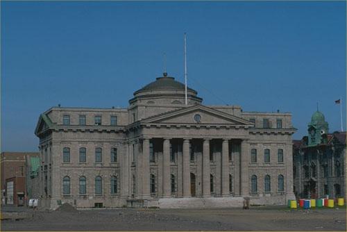
©Parks Canada Agency / Agence Parcs Canada, 1982 |
New Québec Custom House National Historic Site of Canada
Québec, Québec
The New Québec Custom House is a Neoclassical, stone building with a
pedimented portico and central dome. Its exterior detailing exhibits a
strong Italianate influence. The Custom House is located in the old port
area of the city of Québec. Now dominated by residential and
recreational uses, the port area sits on a flat shelf of land known as
Pointe-à-Carcy, below the old city of Québec, and is highly visible from
the river.
The New Québec Custom House was designated a national historic site
because, conceived in a rich Italianate style, it reflects Québec's
exceptional growth as the great centre of St. Lawrence Valley timber
trade and wooden ship construction.
The New Québec Custom House is a fine example of a Neoclassical public
building enhanced with a rich layer of Italianate detailing. One of many
public buildings designed by prominent Toronto architect William Thomas
during the mid 19th century, it features his signature decorative
touches: heavily vermiculated stonework, and sculptured, anthropomorphic
keystones. Although parts of the building's exterior were altered
following major fires in 1864 and 1909, and the interior was completely
redone in 1910, the Custom House retains its basic Neoclassical form and
features, along with the Italianate stylistic definition that typifies
its era and its architect. The early-20th-century, Beaux-Arts interior
is carefully integrated with the Neoclassical exterior.
The New Québec Customs House was built as part of the mid-19th-century
expansion of the customs system. It is the largest extant example of the
many new facilities built during the 1850s as part of the reorganization
of the customs function. Its scale and location reflect the continuing
importance of customs as the largest single source of government revenue
during the 19th century.
The construction of the New Québec Customs House reflects the prosperity
of Québec at mid-century, its position as one of two alternating
capitals of Canada, and its continuing importance as a major port on the
St. Lawrence River. Despite growing competition from Montreal, Québec
remained the major Canadian port for the timber trade in the 19th
century, and the ship-building industry continued to operate as a
mainstay of the Québec economy. The construction of a fine, new customs
house was justified by the large volume of port traffic at
Québec.
|

©Parks Canada Agency / Agence Parcs Canada, 2008 |
Notre-Dame-de-Lorette Church National Historic Site of Canada
Wendake, Québec
Notre-Dame-de-Lorette Church National Historic Site of Canada is a small
stone church set on a grassed lot in the centre of Old Wendake Historic
District, in Quebec. Constructed in 1865, the building features a
metal-clad gable roof surmounted by a bell tower on the ruins of an
early-18th century church. A lateral wood chapel and a sacristy date
from the early 20th century. Many interior furnishings and objects date
back to the 17th century.
Under the French Regime of the 17th century, the Huron First Nations
people became principal intermediaries in the fur trade and the closest
allies of the French. Due to the threat of disease and Iroquois
invasions, many Hurons fled to missions such as the one located at
Jeune-Lorette. The original stone chapel was constructed at the mission
in 1722, but was damaged by fire in 1862. The current church of
Notre-Dame-de-Lorette is the product of the 1865 reconstruction, using
the site and model of the previous church. The current church has
fieldstone walls half a metre thick. The simplicity of its layout, the
exterior ornamentation and its interior organization, recall the mission
churches, small chapels, and parish churches of the 18th and 19th
centuries. The layout of the church is rectangular, and ends with a flat
chevet.
The church's austere main façade features a circular window above the
arched main entrance. Rebuilt on the model of the preceding church,
which dated from the beginning of the 18th century, it is an exceptional
example of traditional religious architecture, in its simplest form. The
church interior remains simple following modifications to décor and
roofing at the end of the 19th century. The objects within the church
mark an era of transition in religious arts, as local artists and
artisans started to differentiate their work from European
styles.
|

©Parks Canada Agency / Agence Parcs Canada, 1997

©Parks Canada Agency / Agence Parcs Canada |
Notre-Dame-des-Neiges Cemetery National Historic Site of Canada
Montréal, Québec
Notre-Dame-des-Neiges Cemetery National Historic Site of Canada is
located in Mount Royal Park within Mount Royal Cemetery National
Historic Site of Canada, in Montréal. Founded in 1854, this attractive
park-like environment covers 113 hectares. Inspired by both formal
traditions and the picturesque style, the design of the cemetery
combines the site's remarkable natural topography, majestic trees,
lawns, and winding paths with more formal areas containing grave
markers, monuments, and commemorative elements of different styles and
sizes. Notre-Dame-des-Neiges Cemetery is an illustration of 19th century
rural cemeteries. Through the variety and historical significance of
many of the persons buried there, the Notre-Dame-des-Neiges Cemetery
commemorates many aspects of the history of Montréal, Quebec and Canada.
Located on Côte-des-Neiges Road, the main entrance to
Notre-Dame-des-Neiges Cemetery consists of two pavilions that remain
from the original portal. The site includes various buildings of
historical value including the administrative building, the chapel and
the first charnel house, now a mausoleum. The site also includes
greenhouses, various service buildings and eight mausoleums. Numerous
monuments and gravestones of great artistic, historic and symbolic
importance make this a significant site, conducive to contemplation and
evocative of the past. Northwest of the administrative building, the
cemetery offers panoramic views of the Université de Montréal,
Saint-Joseph Oratory and Westmount's summit.
Adapted to a diversified topography, Notre-Dame-des-Neiges Cemetery
offers sinuous, romantic roads on a checkerboard plan designed by
Henri-Maurice Perrault and his followers. The long avenues lined with
trees reflect French traditions while winding paths and wooded islets
recall rural American cemeteries of the 19th century. Uneven terrain at
the cemetery's northernmost section features winding pathways, while the
abundance of high quality funeral monuments within the more formal areas
the grounds create the impression of a garden of cut and sculpted
stones. Religious symbolism is omnipresent, as are the reminders of
mortality. The diversity of monuments and family vaults in this vast
"French garden" provides insight into the social, economic and political
history of the city of Montréal. The cemetery contains approximately 65
000 monuments, 71 family vaults and is the final resting place for more
than 900 000 individuals. Today, the Notre-Dame-des-Neiges Cemetery and
its 139 hectares and 55 kilometres of roads and pathways is one of the
largest cemeteries in Canada.
|

©Parks Canada Agency / Agence Parcs Canada, Architectural History Branch, 1988 |
Notre-Dame-des-Victoires Church National Historic Site of Canada
Québec, Québec
Notre-Dame-des-Victoires Church National Historic Site of Canada is
prominently located in Place Royale in Québec's lower town. Built on the
site of the first permanent French establishment in North America, the
site is associated with the growth of the city of Québec and its
inhabitants. The church was constructed of stone in the Québec's
vernacular style in 1688, and remains a symbol of the French presence in
North America. Constructed with both neoclassical and Palladian
influences, the building features a symmetrical façade, a wide pediment
and cut-stone pilasters.
Built as an annex for the Notre-Dame-de-Québec church, the
Notre-Dame-des-Victoires Church was constructed in 1688 on the site of
the first permanent French establishment in North America. It was the
same site of Champlain's Habitation constructed in 1608. The church was
named for the two French victories over British fleets in 1690 and 1711.
It has undergone many transformations beginning with the building of the
first walls in 1688 and the first permanent façade in 1723. The church
was destroyed during the siege of 1759 but, owing to popular interest in
this place of worship, it was rebuilt.
The church is a good illustration of the evolution of ecclesiastical
architecture in Québec. It retains its 17th-century plan and traditional
stone construction, which identify it with the church architecture of
New France and connect it to the works of some of the French Regime's
well-known architects such as, Claude Baillif, Jean-Baptiste Maillou and
Thomas Baillairgé. In addition, its façade represents an important
period in the architectural development of Québec churches when
Neoclassical forms began to take over traditional forms. It is also one
of the few surviving works by François Baillairgé.
|

©Parks Canada Agency / Agence Parcs Canada |
Notre-Dame Roman Catholic Cathedral National Historic Site of Canada
Québec, Québec
Notre-Dame Roman Catholic Cathedral National Historic Site of Canada
stands amongst other historic institutional buildings in the heart of
the historic district of Old Québec, Quebec. Overlooking the Place de
l'Hôtel de Ville this handsome stone building, set under a copper roof,
features a richly detailed Neoclassical facade flanked by two towers of
different age and design. Situated on the site of the Church of
Notre-Dame-de-la-Paix, built in 1647, the present cathedral is the
product of many reconstructions, the last in 1922, which restored it to
its mid-19th century appearance.
First built during the French Regime in 1647 as a stone church on behalf
of François de Montmorency Laval, Notre-Dame Roman Catholic Cathedral
became the first parish church of the colony of New France in 1664.
Notre-Dame has always been at the centre of Roman Catholic life in
Québec. The only parish church until 1829, it served all levels of
society. When Laval became the first Bishop of Quebec in 1674, the
building was "entrenched" as a cathedral and was then enlarged.
Destroyed during the Siège of Québec in 1759, the cathedral was
reconstructed from 1766 to 1771 according to plans by Gaspard-Joseph
Chaussegros de Léry from 1743. The exception was the bell-tower designed
by Jean Baillairgé who also supervised the works. In 1843-1844 architect
Thomas Baillairgé designed the remarkable neoclassical façade. The
innovative interior, which was to be influential in church architecture
within Québec, was designed by François Baillairgé. Ravaged by fire in
1922, the shell of the building was rebuilt to its mid-19th century
monumental appearance. Several well-known architects contributed to the
exterior and interior of Notre-Dame. Enlarged and altered at different
times during its history, the building was influential in Québec church
architecture and remains an important focus of Roman Catholic life in
the city.
|

©Parks Canada Agency / Agence Parcs Canada, 1994 |
Notre-Dame Roman Catholic Church / Basilica National Historic Site of Canada
Montréal, Québec
Notre-Dame Roman Catholic Church / Basilica National Historic Site of
Canada is an immense stone church built from 1824 to 1829 in the
Romantic Gothic Revival style. It features massive twin towers and a
Gothic-arched, recessed portico. The interior is decorated in a later
and more elaborate version of the Gothic Revival style. The church faces
onto Notre-Dame Street, directly across from Place d'Armes in the heart
of Old Montréal.
Built from 1824 to 1829, Notre-Dame Roman Catholic Church / Basilica was
the first significant example of the Gothic Revival style in Canada. In
the 1820s the parish of Notre-Dame was led by a group of prominent
Montréal merchants and by the Sulpicians, a powerful Roman Catholic
religious order that had historically controlled the island of Montréal
as its priests and seigneurs. The Sulpicians wanted to build a new
parish church that was more impressive than the recently built Roman
Catholic and Anglican churches in the city. The Sulpicians called on
James O'Donnell, an American Protestant architect to build a church in
the latest style, with enough space to accommodate a congregation of
more than 8000. The resulting Gothic Revival style church, named
Notre-Dame, served all of Montréal. For the next half century it was the
largest church in either Canada or the United States. Its early Gothic
Revival style, which was applied to a straightforward nave plan with
galleries and twin towers, marked the beginning of the style's
significance in Canadian church architecture. It represents a Romantic,
non-academic approach to the style, which contrasts with the formal
Ecclesiological Gothic Revival of many of Canada's large Anglican and
Roman Catholic cathedrals of the mid- to late-19th century.
The parish used many of Quebec's most celebrated architects and artisans
to help complete the decoration of the church in the 19th and 20th
centuries. Architect John Ostell finished the twin towers in 1843, after
O'Donnell's death but according to the original plan. Between 1872 and
1880, O'Donnell's interior was replaced by a more elaborate Gothic
Revival decoration, designed by well-known architect Victor Bourgeau.
Bourgeau commissioned French sculptor Henri Bouriché to produce the
statues and reliefs for the main altar and the massive reredos along the
east side of the chancel. Montréal sculptor Louis-Philippe Hébert added
a pulpit between 1883 and 1887 to plans by Bouriché. In 1926, Quebec
artist Ozias Leduc decorated vaults, walls, doorways and stained glass
windows.
|
©Parks Canada Agency / Agence Parcs Canada, 2009 |
Obadjiwan—Fort Témiscamingue National Historic Site of Canada
Ville-Marie, Québec
Remains of French fur trading post.
The first fort on this lake was bullt by the government of New France
about 1685 to compete with the English on Hudson Bay. Closed in the
1690s Fort Temiscamingue was re-established in 1720 and leased to
merchants until the fall of New France. After the Conquest various free
traders settled on the lake, but the North West Company had a virtual
monopoly by the 1790s, thanks to the astute management of Aeneas
Cameron. Control of the fort remained with the Cameron family for many
years after the union of the Hudson's Bay and North West Companies in
1821.
|
©La Pulperie de Chicoutimi - Musée régional | La Pulperie de Chicoutimi - Regional Museum, 2015. |
Old Chicoutimi Pulp Mill National Historic Site of Canada
Chicoutimi, Québec
Old Chicoutimi Pulp Mill National Historic Site of Canada is located in
a partially wooded valley on the Chicoutimi River in Quebec. It is a
typical early 20th century industrial complex, comprising five buildings
constructed between 1898 and 1923. The spacious buildings are of stone
masonry with a steel roof and are well lit by many windows.
ctrical
substation.
Old Chicoutimi Pulp Mill was established in 1896 by then mayor of
Chicoutimi, Joseph-Dominique Guay and some partners, including
Julien-Édouard-Alfred Dubuc, who became president of the Chicoutimi Pulp
Company. The mill produced pulp for newsprint at a time when newspapers
played a key role in the Canadian economy. Recognized for the quality of
its output, the mill was the Chicoutimi Pulp Company's main facility and
the biggest producer of mechanical pulp in Canada around 1910.
The Old Chicoutimi Pulp Mill is typical of the industrial complexes that
operated in Quebec from the 1880s until the turn of the century. Its
typical features include the stone masonry of the large buildings and
the many windows that light the space; all timber processing operations
were carried out under one roof, which was a common trait for pulp mills
in that period. Many of the buildings that were part of the pulp mill
are still standing, even though the mill closed in 1930, and are in
exceptionally good condition.
|
|
Old Chicoutimi Trading Post National Historic Site of Canada
Chicoutimi, Québec
A fur trade post was built here in 1676 by a firm owned by Jean Oudiette
and Charles Bazire. At the head of navigation of the Saguenay River, it
soon became the principal post of the region and the major centre of the
interior trade. As with the other depots of the King's Posts, it was
controlled by a succession of fermiers and companies wich included
François-Étienne Cugnet, the North West Company and, lastly, the
Hudson's Bay Company. The advent of agricultural settlement and
lumbering in the district in the 1840s caused a rapid decline in the fur
trade and the abandonment of this post in 1876.
|
©Parks Canada Agency / Agence Parcs Canada, 2003 |
Old Québec Custom House National Historic Site of Canada
Québec, Québec
The Old Québec Custom House National Historic Site of Canada is located
in the city of Québec's Lower Town. Situated along the St. Lawrence
River beside the Queen's Wharf, the two-storey building is distinguished
by its elegant, yet conservative, neoclassical design, and features a
granite façade, a low-pitched hipped roof, and two broad symmetrical
end-chimneys. The entrance is framed by four slightly protruding
two-storey Doric pilasters, and the windows are set at equal intervals
in the nine-bay façade, with blind arcading along the ground storey and
moulded cut-stone frames along the second.
Built between 1831 and 1832, the Old Customs House was designed by Henry
Musgrave Blaiklock, one of the first professional architects to practise
in Canada. Built along the St. Lawrence River, it is an excellent and
rare surviving example of a neoclassical federal building from the
1830s. Its neoclassical design is seen in the elegant exterior and
impressive interior woodwork and plaster decoration. The understated but
monumental building stands as a testament to the city of Québec's role
as a major port for both Upper and Lower Canada, from which the custom
duties collected became a significant source of revenue for the region.
Having fulfilled its original role as a customs house until 1841, the
building has since served various purposes, and now contains federal
offices.
|
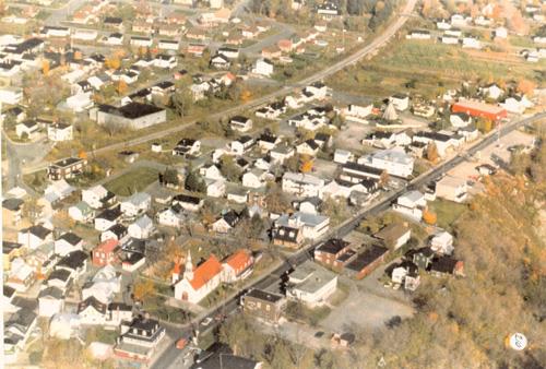
©Parks Canada Agency / Agence Parcs Canada, 2005 |
Old Wendake Historic District National Historic Site of Canada
Wendake, Québec
Old Wendake Historic District National Historic Site of Canada is
located 12 kilometres north-west of the City of Québec. Situated on the
southern bank of the Saint-Charles River, near the Kabir-Kouba Falls,
the site consists of mainly south-facing residential and commercial
buildings that reflect the plan of a traditional Huron village. Main
features of the site include a dense residential district of mainly
single- and multi-family houses, the Notre-Dame-de-Lorette Church
National Historic Site of Canada, two cemeteries, as well as multiple
commercial and administrative buildings.
The heritage value of this site resides in the topography and settlement
forms of the district, including land-usage patterns and architecture
that speak to the 300 years of settlement in this area. During the first
half of the 17th century, the Huron-Wendat, who lived and farmed in
Huronia just south of Georgian Bay in Ontario, became major fur trading
partners with the French. In 1650, devastated by famine, conflict, and
contagious diseases from Europe, the Huron-Wendat dispersed from their
lands, establishing themselves permanently at Jeune-Lorette. The
district was renamed Old Wendake in 1697.
Old Wendake Historic District presents an excellent example of
co-existing cultural influences. Rather than adhering to a geometric
plan, the district was constructed around natural elements. For example,
the primary entrances of its buildings generally face south-east,
regardless of which side of the lot faces the street. This layout is
similar to traditional Huron villages, although many of the buildings
were constructed in European-inspired styles after 1730. In addition,
the street blocks are densely formed to allow for pedestrian traffic
between houses, fostering a sense of community and public space while
facilitating an economic system structured on the basis of cottage
industries. The custom of naming streets after former chiefs of the
nation demonstrates the relationship that the Huron-Wendat have with
this site today, because it supports their collective memory, livelihood
and history.
|

©Parks Canada Agency / Agence Parcs Canada, Nathalie Clerk, 1993 |
Outremont Theatre National Historic Site of Canada
Montréal, Québec
The Outremont Theatre is a large, Art-Deco-style movie theatre located
at the corner of Bernard and Champagneur avenues in Outremont, an
early-20th-century suburban community on Montréal's west island. The
theatre is situated among residential buildings, in a mixed residential
and commercial neighbourhood.
The Outremont Theatre was designated a national historic site in 1993
because of its national historic and architectural significance. With
its early Art Deco exterior and its rich interior combining both
atmospheric and Art Deco elements, it is a very fine example of a deluxe
cinema in Canada dating from the late 1920s.
Designed by local architect René Charbonneau for Confederation
Amusements, Outremont Theatre is typical of the many deluxe cinemas
erected in new suburban neighbourhoods across Canada during the 1920s.
Deluxe cinemas were mid-size movie theatres designed to hold between
1000 and 2000 patrons. Purpose-built for cinematographic use, they were
intended to be attractive and comfortable, reflecting the fact that by
the late 1920s the cinema had become mainstream entertainment.
Fireproofing measures at Outremont reflect a heightened concern for the
safety of patrons after a deadly 1927 cinema fire in Montreal.
Outremont Theatre was one of the first expressions of the Art Deco style
in cinema architecture in Canada. It is typical of the early
manifestations of the style in its use of traditional classical forms,
presented in a stylized fashion. The exterior composition, in which two
distinct volumes differentiated by materials, colour and proportions
correspond to the principal functions of the building, reflects the
advent of the modern architectural aesthetic. The use of Art Deco motifs
continues throughout the building's interior.
The interior décor of the auditorium is an extravagant example of the
Art Deco style presented in combination with the atmospheric style of
cinema design. A short-lived phenomenon popular during the late 1920s,
the atmospheric style recreated exotic, pastoral scenes on the walls and
ceilings of cinema auditoriums. The Outremont auditorium combines the
stylized motifs of Art Deco with pastoral scenes painted on the upper
walls, and a luminous coffered ceiling intended to reproduce the
atmospheric quality of a sunny day.
Outremont Theatre's elaborate, dream-like interior décor, typical of
1920s cinema design, was created by Emmanuel Briffa. Briffa was a
well-known theatre artist who lived in Outremont and was responsible for
the interior decoration of more than 60 cinemas across Canada.
|

©Parks Canada Agency / Agence Parcs Canada, 1969 |
Pagé - Rinfret House / Beaudry House National Historic Site of Canada
Cap-Santé, Québec
Pagé - Rinfret House / Beaudry House National Historic Site of Canada,
situated on a slight rise overlooking the St. Lawrence River in the
village of Cap-Santé, Québec, is a one-and-a-half-storey, wood-frame
house, built during the 18th-century. It sits low to the ground, with a
very steep gable roof accentuated by multiple dormer windows and two
chimneys.
The Pagé — Rinfret House / Beaudry House is an attractive example of the
"French-inspired traditional house," an early 19th-century architectural
style that reflects the French roots of its Québecois builders. Having
evolved from earlier architectural styles of the French Regime, the Pagé
— Rinfret House / Beaudry House features a roof steeper and taller than
those of earlier traditional Québec houses, as well as a second storey,
illuminated by dormer windows, set within the high slope of the roof.
Its second chimney reflects the increasing size of the traditional
Québec house during the 18th century, and the use of tin to cover the
steep roof points to the relatively wide availability of this material
at the time. The house's deep curved eave and the raised gallery, two of
the most recognizable features of the "French-inspired traditional
house," began to appear around the beginning of the 19th century.
The construction technique used in the Pagé — Rinfret House / Beaudry
House reflects a building method adapted from Europe to Canadian
conditions, and used widely throughout Québec and across western Canada
during the 18th and 19th centuries. Known by various names depending on
the location and materials used, the technique begins with a frame of
heavy squared timber, which is then infilled with squared logs, stones
or thick planks. The Pagé - Rinfret House / Beaudry House employs plank
infill.
|
©Parks Canada Agency / Agence Parcs Canada, 1997 |
Pavillon Mailloux National Historic Site of Canada
Montréal, Québec
Pavillon Mailloux National Historic Site of Canada is a five-storey
brick nurses' residence on the campus of Montreal's Notre-Dame Hospital
at 1560 Sherbrooke Street East, now part of Centre hospitalier
universitaire de l'Université de Montréal. Very similar in exterior to
the rest of the hospital complex, it stands directly behind the east
pavilion of the main hospital building to which it is now joined. Like
the surrounding hospital buildings, it features a symmetrical,
rectangular massing, regularly arranged fenestration, and a flat roof.
The heritage value of Pavillon Mailloux lies in its role in the
development of the nursing profession, and in the witness it bears to
the health care practice, training, community, and lifestyles of
generations of professional nurses. This value is illustrated in the
site, setting, design, form and composition of the building,
particularly in the integrity of its interior functional layout which
reflects generations of nursing education.
Pavillon Mailloux was constructed in 1931 as a students' residence for
Notre-Dame Hospital's School of Nursing. The school itself had been
founded in 1897 by Mother Élodie Mailloux of the Grey Nuns and was one
of the first French language schools of nursing. Construction of this
residence was a confirmation of the major changes that occurred in
recognition of the roles of women, in particular in the nursing
profession. Although the school had run a nursing residence in a
converted private home since 1898, Pavillon Mailloux was purpose-built,
containing bedrooms and recreational space. Facilities were supplemented
by classroom and other educational facilities at the nearby Deschênes
Building.
|
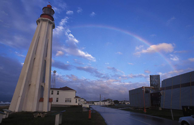 > >
©Parks Canada Agency / Agence Parcs Canada
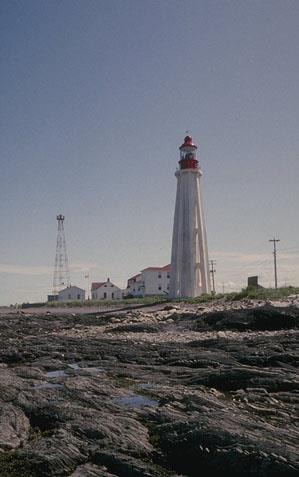
©Parks Canada Agency / Agence Parcs Canada, 1993 |
Pointe-au-Père Lighthouse National Historic Site of Canada
Pointe-au-Père, Québec
Early reinforced concrete lighttower at strategic location.
Both the Pointe-au-Père lighthouse and its important pilot station have
guided thousands of ships and played a crucial role in the history of
navigation on the St. Lawrence. Its signature tower, boasting an
architecture unlike practically any other in Canada, remains an
irreplaceable landmark and seamark. This national historic site is
protected and presented by Parks Canada in partnership with the « Site
historique maritime de la Pointe-au-Père ».
Pointe-au-Père Lighthouse National Historic Site of Canada is a
navigation aid centre located on a headland facing the St. Lawrence
River at the limit of coastal waters and the open sea. The station is
characterized by buildings with red roofs and white walls, dominated by
a 24 metre high concrete lighthouse.
Due to its strategic geographic situation, the Pointe-au-Père Lighthouse
became a privileged site for the St. Lawrence River pilots from the
early 19th century. Over a century of operations, the station has
constantly evolved beginning with the construction of the first
lighthouse in 1859, soon to be replaced after a fire. In 1909, the third
lighthouse was built in an effort of modernization before the department
of Transport initiated, in the 1960s, a lighthouse automation program,
which included the Pointe-au-Père Lighthouse. On the other hand, many
structures were added to meet new tasks delegated to the lighthouse
during the various phases of operations. From 1894 to 1985, it housed a
tides and currents surveying station and for fifty years, hosted the
piloting station. It also took charge of some of the quarantine
activities at the Grosse-Île quarantine station from 1923 to 1937.
The lighthouse station also tested many means of communication, which
benefited the aid to navigation. A few years after the development of
the international code of flag signals, it was implemented at the
Pointe-au-Père station; later on, a Marconi station was implemented. The
Pointe-au-Père station used simple cannon and explosive bomb signals,
and, in 1903, a foghorn signal building. Its implementation led to the
experimentation of two types of signals, i.e. the air fog signal and a
modified Canadian version, the diaphone. It also tested acetylene lamps.
After monitoring, their usage was recommended and in 1904, the diaphone
was the model adopted in most lighthouses in Canada. After 1972, an
electronic sound signal replaced the diaphone. In 1997, Fisheries and
Oceans Canada closed the aid to navigation station. Today, the station
is part of a heritage complex known as the "Pointe-au-Père Maritime
Historic Site".
|

©Government of Quebec / Gouvernement du Québec |
Pointe-du-Buisson National Historic Site of Canada
Beauharnois, Québec
Pointe-du-Buisson National Historic Site of Canada is made up of several
archaeological sites spread over a wooded plateau on a point of land
along the Saint Lawrence River in Melocheville, 30 kilometres south of
Montreal. The site is an average height of 34 metres above sea level,
and is cut into three unequal parts by two small steep-sloped ravines.
The space contains 15 separate archaeological sites, the remains of
which provide important information about Aboriginal life in the area
over the last five millenia.
Pointe-du-Buisson was an ancient location for portage camps and
settlement on the banks of a critical transportation route. The western
part of the site contains nine archaeological sites (Hector Trudel,
Station 2, Station 3 front, Station 3 rear, Plateau-des-portageurs,
Pascal Mercier, Camp McKenzie, Jane Ellice and Passerelle). It is a
large area that has been used continuously since 5000 BP. The central
part has three sites (Station 4, Trois Buttes and Pointe-à-Jonathan),
which were occupied primarily in the Late Middle Woodland period
(1500-1000 BP). The eastern part has two sites (Station 5 and André
Napoléon Montpetit) that provide exceptional documentation of an episode
of Early Woodland occupation (3000-2400 BP).
The heritage value of Pointe-du-Buisson National Historic Site resides
in the rare and excellent witness it bears to a long period of early
aboriginal history. Its value lies in its sites, their settings, and the
wealth of artifacts and knowledge they contain.
|
©Parks Canada Agency / Agence Parcs Canada |
Powerscourt Covered Bridge National Historic Site of Canada
Hinchinbrooke, Québec
Powerscourt Covered Bridge National Historic Site of Canada is a long
wooden covered bridge that still stands on its original stone
foundations in Elgin Township, Huntingdon County, Québec, where it
carries traffic on the First Concession Road over the Châteauguay River.
Featuring three freestanding regularly coursed masonry piers, an
irregular roofline and two functionally independent truss spans, it is
noted as the only remaining McCallum inflexible arched truss bridge in
the world.
The heritage value of Powerscourt Covered Bridge lies in its age and in
its use of the rigid (or inflexible) arch truss construction technology.
This technology, more commonly used for railway construction, was
invented by New York bridge builder Daniel McCallum in 1851. Also known
locally as Percy Bridge, it was built in 1861 to carry traffic on the
First Concession Road over the Châteauguay River.
|

©Parks Canada Agency / Agence Parcs Canada, S. Desjardins, 1998 |
Québec Bridge National Historic Site of Canada
Québec, Québec
The Québec Bridge National Historic Site of Canada is a steel cantilever
bridge which links the shores of Québec City and Lévis over the St.
Lawrence River, located a few kilometres upstream from Québec City.
Built in 1917 with a total length of 987 metres and a height of 95
metres, the bridge is comprised of north and south approach bays, anchor
piles and arms, two main pillars resting on the river bed, cantilever
arms, and a 500-metre suspended section between them.
The Québec Bridge, with its 500-metre free span between the two central
pillars, is the longest cantilever bridge of its kind in the world.
Built using the K truss system, in which two diagonal beams support one
vertical beam (forming a 'K' shape), the bridge is also remarkable for
the use of nickel steel in its construction. Although this stronger
alloy was more expensive than the more popular carbon steel, it allowed
engineers to attain the record-breaking length of the bridge's suspended
section.
The bridge was designed and constructed principally by Canadian
companies under head engineer H.E. Vautelet. Its construction was
facilitated by the K truss system, but also by the manner in which the
suspended section was installed. Constructed separately, this section
was floated on the river to the cantilever arms and raised, where it was
riveted in place. Because of its size and innovative design, the Québec
Bridge remains one of the most important bridges in the history of civil
engineering in Canada, as well as an important symbol of Québec
City.
|
©Parks Canada Agency / Agence Parcs Canada, P. St. Jacques, 1984 |
Québec Citadel National Historic Site of Canada
Côte de la Citadelle, Québec
The Québec Citadel National Historic Site of Canada is the 19th-century
fortress located on Cap Diamant in the centre of Québec City. This great
stone fortress sits with its back along the cliff above the St. Lawrence
River, facing the city. Today, the Citadel's functions are ceremonial,
symbolic and reflect the heritage of the site. The Citadel has served as
the home of the Royal 22nd Regiment since 1920 and as the secondary
residence of the Governor General of Canada since 1872.
The Québec Citadel National Historic Site of Canada includes all of the
south side of the fortifications from Dufferin Terrace on the southeast
extreme to the far edge of the Citadel itself. Most of it was built in
the years 1820-1832, although the bastions and cape polygon which were
integrated into the design, date from 1720 and 1745 respectively. It is
an imposing and complex military work following the Duke of Richmond's
strategy for colonial defence as it was defined following the War of
1812.
The heritage value of the Québec Citadel lies in the completeness of its
cultural landscape as a comprehensive defence work within the city's
larger fortification system. Value resides in the clarity with which the
principals of its strategic military design are both represented and
legible : those of a 19th-century British defensive bastion (flanking,
overcoming and commanding) as well as those of a mid 18th-century French
powder magazine.
|

©Parks Canada Agency / Agence Parcs Canada, 1991 |
Québec City Hall National Historic Site of Canada
Québec, Québec
The Québec City Hall is a majestic stone building built in 1895-6 in an
eclectic style typical of the late-Victorian era. The building occupies
a full block on a sloping site in Québec's upper town within the
boundaries of the UNESCO-designated World Heritage Site. The building
was enlarged with a two-storey addition in 1929.
The Québec City Hall was designated a national historic site of Canada
in 1984 because its monumental and elegant exterior and richly decorated
interior make it one of the most stately city halls in Canada.
The Québec City Hall reflects the eclectic opulence of the
late-Victorian period in its modified Second Empire style, while its
confident formality also demonstrates the competencies of local artisans
and builders. The basic form of the building is classical, rooted in a
French Beaux-Arts design philosophy, and its vocabulary draws from a
number of sources, including the Romanesque Revival and Châteauesque
styles. The lavishness of the exterior is continued in the splendid
interior decoration as evident in its sumptuous council chambers.
|

©Parks Canada Agency / Agence Parcs Canada, 1993 |
Québec Court House National Historic Site of Canada
Québec, Québec
Québec Court House National Historic Site of Canada is a massive, late
19th-century masonry public building in the Second Empire Style. It
occupies a prominent corner in the city's historic upper town, facing
the Place d'Armes, and is in close proximity to other major
administrative buildings of similar vintage and architecture. The
building is adapted to its sloping site, rising four storeys along
Saint-Louis Street and five storeys along du Trésor Street.
The heritage value of this site resides in its symbolism of the Québec
justice system and in its architectural design. The Québec Court House
was constructed in 1883-1887 to serve all levels of court in the local
judicial district of Québec. In its large scale, elaborate architectural
treatment, iconography and use of local materials, the court house
conveyed the province's commitment to justice, its self-confidence and
pride in its French Heritage. It served as a court house from 1887 to
1983.
The Québec Court House is a fine example of the French Second Empire
Style, and is distinguished by its rich stonework, mansard roof,
classical decoration and lively silhouette. The plans were prepared by
Eugène-Étienne Taché, a celebrated architect in the employment of the
provincial Department of Public Works. Its design was influenced by the
successes of the Québec parliament buildings (built 1877-1886), also
designed by Taché in the Second Empire Style.
|

©Parks Canada Agency / Agence Parcs Canada, 1993 |
Québec Garrison Club National Historic Site of Canada
Québec, Québec
Only private military club in Canada perpetuating the British colonial
tradition of assembling military officers in a social environment,
1879.
The Québec Garrison Club is defined by the long masonry two-storey
building which abuts the street, wrapping around the corner of
Saint-Louis Street and Côte de la Citadelle, in Old Québec. This
modified Château-style building shelters an expansive garden which, with
the building, services one of Québec city's oldest private clubs.
The heritage value of the Québec Garrison Club resides in its strong
military, architectural and social links with the fortified City of
Québec and its function as a club as illustrated by its site, setting,
club building with its modified Château-style design, associated
buildings, garden and wooded grove. The Québec Garrison Club was
established in 1879, when prominent Canadian militia officers acquired
permission to meet as a social club at 97 Saint-Louis Street. First
constructed as an office by the Royal Engineers (1816), this early
building was raised one floor in 1893, and extended in 1921, and in
1948, to meet the need for increased space. The Québec Garrison Club is
the centrepiece of a cultural landscape containing Messenger's Quarters
(1857), a well building (1867), storehouse (1871), garden and woods.
Fire destroyed the interior of the Québec Garrison Club building in
1954-55. It was restored by Parks Canada (1992-93), although a gas
explosion (1994) caused further damage. It continues to function as a
private club.
|

©Parks Canada Agency / Agence Parcs Canada, 2003 |
Québec Martello Towers National Historic Site of Canada
Québec, Québec
The Québec Martello Towers National Historic Site of Canada, form part
of the Fortifications of Québec National Historic Site of Canada, in
Québec City, Québec. It comprises three Martello towers at some distance
from one another -Tower No. 1 stands on the Plains of Abraham, Tower No.
2 at the corner of Laurier and Taché Streets, and Tower No. 4 on
Lavigueur Street. Built between 1808 and 1812, the three, freestanding
Martello Towers are two storeys high with flat roofs designed to serve
as a gun platform for one to four guns. They are sited to overlook the
St Lawrence and Charles River respectively.
The Québec Martello Towers were designated a national historic site of
Canada in 1990 because they form part of the fortifications of Québec.
The Québec Martello Towers illustrate the importance of Québec and its
fortifications in the various strategic plans for the defence of British
North America. The Citadel of Québec was key to the control of the
interior of the northern part of the continent under both France and
Britain. The Martello towers were constructed by the British to form a
first line of defence within the ensemble of Québec's fortifications by
preventing an attacker from drawing close enough to the walls to lay
siege. Functional, and massively strong for their time, these towers
were essentially elevated gun platforms. Towers No. 1 and No. 2 house
interpretive displays.
|

©L'abbé Roberge, 2005 |
Québec Seminary National Historic Site of Canada
Québec, Québec
The Québec Seminary National Historic Site of Canada, located in the
Historic District of Old Québec, is an educational institution
comprising two sections: the Old Seminary established in 1663, and the
19th and 20th century additions surrounding it. The Old Seminary
building has three wings which surround the Children's Courtyard. The
19th and 20th century buildings, which include the former Central
Pavilion, the Grand Seminary, and the Pavilion, exhibit a variety of
architectural styles, including the Greek Revival style. Despite
different construction dates the complex is visually unified due to its
configuration and the common stylistic features shared by many of the
buildings.
The Québec Seminary, a community of priests, was founded in Québec by
Monseigneur François de Montmorency-Laval, first bishop of New France.
In 1663, the Grand Seminary was created to establish a parish ministry,
mission work and a clergy. The 'Small Seminary' was founded, in 1668 to
instruct young Aboriginals in French culture and language. Beginning in
1674, the establishment only housed young Frenchmen who wished to become
priests. After the conquest there were further changes to the school's
direction and the 'Small Seminary' began to accept all young people who
wanted to study, not only those who wanted to become priests.
Dedicated to the cause of education, the Seminary founded the first
French Catholic University in the country in 1852 and named it
Université Laval in honor of Monseigneur de Laval. The university has
had a considerable influence on the arts, letters, and sciences in
Canada and moved to its current location in the district of
Sainte-Foy-Sillery in 1970-1971. Despite many fires throughout the
years, the Québec Seminary is still run as an educational institution by
the Société des prêtres diocésains which ensures pastoral and priestly
education at various levels. It is also home to the Centre de référence
de l'Amérique française within the Musée de la civilization, and to a
private high school, Le Petit Séminaire de Québec.
|

©Parks Canada Agency / Agence Parcs Canada, Nathalie Clerk, 1993 |
Rialto Theatre National Historic Site of Canada
Montréal, Québec
The Rialto Theatre National Historic Site of Canada, located on du Parc
Avenue in Montréal's Outremont neighbourhood, is an early 20th-century
movie theatre designed in the Beaux-Arts style. Distinguished by its
monumental columned façade, and inspired by the Paris Opéra, the
five-storey theatre also features a richly decorated neo-Baroque
interior, designed by the famed theatre designer, Emmanuel Briffa.
The Rialto Theatre is typical of Canadian public architecture of the
early 20th century and is a fine example of the Beaux-Arts principles of
symmetry, monumentality, smooth surfaces and rational, ordered planning.
The Rialto is distinguished from contemporary cinemas by its main
façade, imitating the decorative programme of the Beaux-Arts style Paris
Opéra, and its interior plan created for a variety of functions. It was
the first Montréal cinema to place the axis of the auditorium parallel
to the façade; and the first to provide rooms intended for other
functions (the dance hall, skittles and billiards rooms, and roof
garden). Features associated with traditional theatres from the turn of
the century include its rich interior décor, the steep pitch of its
balcony and the use of theatre boxes.
The Rialto Theatre was built for the United Amusements Corporation
Limited to plans by Raoul Gariépy, a prolific local architect
responsible for the design of five other Montréal cinemas. While the
engineering firm of Forgues and Guay designed the concrete structure,
the rich, Baroque-inspired interior décor was designed and executed by
Emmanuel Briffa, a Montréal artist responsible for over 200 cinema
interiors across North America. The interior is of exceptional quality
and preserves many original features, including paintings, mouldings,
plaster relief work, and artificially illuminated panels.
|
©Parks Canada Agency / Agence Parcs Canada |
Rivière-du-Loup Town Hall National Historic Site of Canada
Rivière-du-Loup, Québec
Rivière-du-Loup Town Hall National Historic Site of Canada, located on a
prominent site in downtown Rivière-du-Loup, Québec, is an eclectic,
two-storey red-brick city hall constructed in 1916. The building, was
renovated and enlarged between 1972 and 1973.
The decision by the town of Rivière-du-Loup to build a new municipal
building in the middle of the First World War symbolized the town's
determination to modernize its municipal services and to increase its
profile in the Lower St. Lawrence region of Québec. The eclectic styling
of the elegant building, including references to the Arts and Crafts
movement in its decoration, sets it apart from the surrounding
commercial buildings in the town.
|
©Parks Canada Agency / Agence Parcs Canada, 2009 |
Roberval Town Hall National Historic Site of Canada
Roberval, Québec
Roberval Town Hall National Historic Site of Canada is located near the
shore of Lac Saint-Jean in the centre of the present town of Roberval,
Quebec. The site consists of a large, three-storey brick building with
steeply pitched metal roofs in a late interpretation of the Second
Empire style. It was built in 1928-1929 to demonstrate the increasing
importance of the town as an administrative centre and regional capital
in the Lac Saint-Jean region.
The heritage value of this site resides in its historical associations
with the city of Roberval as illustrated by its monumental design, form
and materials. Constructed in 1928-1929 to a design by local architect
Charles Lafond, the Roberval Town Hall reflects the prosperity and
significance of the community. Conceived in the tradition of Second
Empire style of civic buildings so popular in Quebec, the town hall is
consistent in its design, form and construction with Beaux-Arts
principles. The building features pavilion-crowned towers, classical
ornamentation and a monumental staircase, to create an imposing civic
building which proclaimed the town's growing importance as an
administrative centre and regional capital in the Lac Saint-Jean region.
It originally served a multi-functional role, housing the fire
department, a theatre and a residential apartment, as well as serving
its primary role in providing space for civic administration.
|
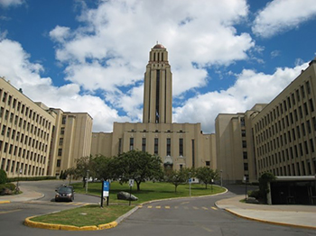
©Parks Canada Agency / Agence Parcs Canada |
Roger Gaudry Building, Université de Montréal National Historic Site of Canada
Montréal, Québec
Located at the heart of the Université de Montréal campus, the Roger Gaudry
Building is a prominent Montréal landmark. Built between 1928 and 1943, it
was designed by architect and engineer Ernest Cormier. Its grand scale and
functional layout, which was originally designed to include laboratories and
a teaching hospital, reflects French Canada's new appreciation of scientific
disciplines and research during the interwar period and it speaks to the
emergence of a dynamic Francophone academic and scientific elite committed to
higher education.
This large sprawling structure has an imposing 82 metre high central tower.
In its design, it combines the symmetrical and hierarchical layout of the
French Beaux-Arts tradition with features more typical of 20th century
architectural modernity, such as a concrete frame, sparse masonry facades,
and stylized geometrical motifs. The monumental scale, quality finishes, and
attention to colour, lighting, and texture of the principal ceremonial spaces
— specifically the Hall of Honour and the main amphitheatre — offer a rare
and remarkable sequence of Art Deco-inspired interiors.
The building was designed to encompass all the university's faculties and
schools, as well as a university hospital. It followed an innovative layout
for the time, referred to as a 'compact plan.' This complex layout was
designed according to a symmetrical and highly hierarchical concept,
reflecting a profound attachment to the Beaux-Arts tradition. The building
has a long main axis, dominated by the 22-storey tower, from which radiate in
mirror-image fashion horizontal wings and vertical outliers. The west end of
the building is dominated by a gable topped by a small bell tower, while the
east end has a small tiered tower, marking the location of superimposed
amphitheatres. The treatment of the central tower and exterior facades is
marked by strong vertical lines and the presence of jutting and set-back
elements and by a few stylized geometrical motifs, attesting to the influence
of aesthetic ideas associated with modernity, among them Art Deco.
The Roger Gaudry Building was the first building to be constructed by the
Université de Montréal after it gained its autonomy from Laval University in
1920. The new institution grew spectacularly during the 1920s with the
establishment of a science faculty and a school of social, economic, and
political sciences. Today, the Roger Gaudry Building is surrounded on all
sides by numerous university buildings erected over the years to meet the
demands of the institution's growth. This first building, however, put its
stamp on the campus around it, and remains the most imposing element therein.
Its commanding presence on the mountain speaks to Quebec's dynamic academic
life in the interwar years.
|

©Parks Canada Agency / Agence Parcs Canada, 2004 |
Round Stone Windmill and House National Historic Site of Canada
Notre-Dame-de-l'Île-Perrot, Québec
Round Stone Windmill and House National Historic Site of Canada, also
known as Parc Historique de la Pointe-du-Moulin, is located next to St.
Louis Lake, a flat open site on the eastern point of
Notre-Dame-de-l'île-Perrot, Quebec. The site consists of an extremely
rare, surviving stone windmill and its associated miller's house dating
from the 18th-century seigniorial regime. Both buildings are of
rubblestone solid wall construction with small windows and low doors.
The Round Stone Windmill and House has existed as an interdependent
building complex since at least the end of the 18th century. The
windmill was designed by Stephen Starenky for Joseph Trottier
Desruisseaux, who had the windmill constructed in 1712 to enable local
residents to grind wheat into flour. The miller's house dates from the
1712-1791 period, possibly originating at the same time as the mill.
Their heritage value resides in their in-situ survival as a building
complex and in the individual structures as examples of an early type of
construction.
|
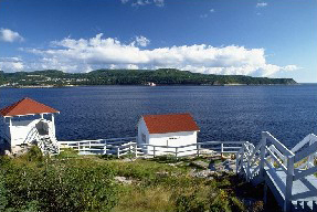
©Parks Canada Agency / Agence Parcs Canada |
Saguenay-St. Lawrence Marine Park
Headquarters: Tadoussac, Québec and Rivière-Éternité, Québec
A rich diversity of marine life: whales, seals, plants and birds of all
kinds.
An area to discover in depth! Since its creation in 1998, the marine
park has worked to protect and present the marine environment of a
section St. Lawrence Estuary and the Saguenay Fjord.
With a surface area of 1 245 km2, this large ecosystem is unique because
of its sea bottom topography and its fjord. The confluence of waters of
the St. Lawrence Estuary with those of the Saguenay Fjord creates
exceptional oceanographic phenomena promoting significant biological
diversity. Five cetacean species inhabit the waters of the marine park,
including the St. Lawrence beluga, a protected species. In all, more
than fifteen species of marine mammals have been reported, which bears
witness to the marine park's ecological significance.
As well, the area surrounding the Saguenay St. Lawrence Marine Park has
a long history of human inhabitation and is a place of importance in
North American history. On this land, Amerindian and European
civilizations came into contact, a contact that made a lasting
impact.
|

©Parks Canada Agency / Agence Parcs Canada, N. Clerk, 2002 |
Saint Joseph's Oratory of Mount Royal National Historic Site of Canada
Montréal, Québec
Saint Joseph's Oratory National Historic Site of Canada is a vast Roman
Catholic pilgrimage site located on the north slope of Mount Royal in
the city of Montréal, Québec. Dominated by a large domed basilica, the
site is a landmark visible for miles around. Pilgrims progress through
the gated entrance, along a sacred path and Way of the Cross, which
traverses a garden on the east boundary, towards a grouping of buildings
of which the basilica is the focus.
The heritage value of this site resides in its spiritual meaning and
associated history as illustrated by the evolved cultural landscape
comprised of gardens and buildings, with the Basilica as its focus.
Value also resides in the integration of its built features with their
setting within the natural landscape of Mount Royal.
Saint Joseph's Oratory originated with the construction of a small
chapel conceived by Brother André and built by Brother Abundius from
1904 to 1912. This modest beginning was expanded throughout the first
half of the 20th century with the assistance of many major architects
and artists including landscape gardener Frederick G. Todd (garden,
1943-1946), architects Lucien Parent with Dom Paul Bellot and Ernest
Cormier (basilica dome, 1937 and votive chapel 1946-1949 respectively),
Louis Parent and Ercolo Barbiere (Way of the Cross, 1943-1953 and
1952-1958 respectively). Today it is a complex landscape with many
parts, dominated by the Basilica (1924-1966), which was designed by
architects Dalbé Viau and Alphonse Venne and decorated by artists Gérard
Notebaert and Jean-Claude Leclerc.
|

©Parks Canada Agency / Agence Parcs Canada |
Saint-André-de-Kamouraska Church National Historic Site of Canada
Saint-André, Québec
Saint-André-de-Kamouraska Church National Historic Site of Canada is
located in Andréville, Quebec. Its simple rectangular plan with
semi-circular apse makes it a classic example of the small Quebec
churches built according to the "Récollet Plan". Its modest stone
exterior is enlivened by a two-tiered, spired belfry.
Built between 1805 and 1811, to replace a chapel dating from 1791, this
church was inspired by the parish churches built according to the
Récollet plan during the French Regime. This design influence is seen in
the simple plan with a nave and narrow semi-circular apse and in the
façade with its centre door and belfry. The church's elaborate interior
decoration executed between 1834 and 1836, provides one of the
best-preserved examples of the work of sculptor Louis-Xavier Leprohon.
The annex, constructed about 1822, was one of the first in rural Quebec
and served as a presbytery and sacristy.
|
|
Saint-Eustache Church National Historic Site of Canada
Saint-Eustache, Québec
Saint-Eustache Church is a Roman Catholic place of worship in the heart
of the town of Saint-Eustache, Quebec, located at the confluence of the
Mille Îles and Du Chêne rivers, northwest of the island of Montreal and
Île Jésus. It played a central role in the decisive Battle of
Saint-Eustache, which was fought on 14 December 1837 and marked the end
of the 1837 Lower Canada Rebellion. In this colonial conflict, the
rebels or patriotes rose up to challenge the powers of the British
governor and his advisors.
During the battle, which opened on the heels of an initial British
victory in Saint-Charles, British forces and government supporters led
by Sir John Colborne, confronted Patriote combatants. Artillery scars
left in the stonework of Saint-Eustache Church as a result of the
battle, the building silhouette, and the church's location are all
visual reminders of the fateful event.
The architecture of Saint-Eustache Church mirrors trends in vernacular
religious architecture in Quebec through the 18th, 19th and 20th
centuries. Its massive décor is a fine example of the influence of
neoclassicism in the early 19th century, with its twin spires on either
side, each topped with a belfry containing double lanterns. Behind this
décor rises a church much altered since it was originally
constructed.
It was built in 1780-83 on a Latin cross plan with a semicircular apse.
The building was extended forward 8.5 metres (28 feet) when the present
décor was added in 1831-33. After being heavily damaged by fire in 1837,
the envelope was rebuilt several times, most recently when major work
was undertaken in 1905-07. The aisles were extended, the sacristy was
rebuilt, and a chapel was built behind the church; the entire roof was
replaced at the same time. On the front, the bell towers were replaced,
and the peak of the new roof was hidden by adding a small triangular
pediment surmounted by a statue of Saint Eustace.
|

©Parks Canada Agency / Agence Parcs Canada, 1982 |
Saint-Hyacinthe Post Office National Historic Site of Canada
Saint-Hyacinthe, Québec
Saint-Hyacinthe Post Office National Historic Site of Canada is set on a
sloping site in the downtown commercial heart of the community of
Saint-Hyacinthe, Quebec. Completed in 1894, it is an attractive
two-and-a-half-storey building finished in rough-faced stone with a
symmetrical principal elevation and an imposing offset corner tower. Its
vigorous design incorporates Italianate detailing and is valued as a
good example of the work of federal architect Thomas Fuller.
The Saint-Hyacinthe Post Office, built between 1889 and 1894 to house
the post office, customs, and other government services, was designed to
serve as a prominent landmark and to identify the federal presence in
the town. The post office was part of a large-scale program of
government construction in small communities and towns across Canada.
Of solid appearance, it was constructed under the direction of Thomas
Fuller, who served as Chief Architect of the Department of Public Works
from 1881 to 1896. The design, consisting of a corner tower, double
entrance, ornamented gable, and the rugged texture of the limestone
walls were typical of Fuller-designed post offices and show the high
quality of design he brought to federal architecture.
|

©Parks Canada Agency / Agence Parcs Canada, 1992 |
Saint-Jean-d'Iberville Railway Station (Grand Trunk) National Historic Site of Canada
Saint-Jean-sur-Richelieu, Québec
Saint-Jean-d'Iberville Railway Station (Grand Trunk) National Historic
Site of Canada is a former passenger terminal located in the town of
Saint-Jean-d'Iberville, Quebec. Built in 1890, and of sturdy appearance,
it is a single storey, rectangular, brick building displaying elements
of the Chateau style. The overhanging eaves form a projecting canopy
that runs the length of the building on both the platform and
street-facing elevations.
Saint-Jean-d'Iberville Railway Station was designated a national
historic site of Canada in 1976 because it illustrates the expansion of
the Grand Trunk Railway.
The Saint-Jean-d'Iberville Station symbolizes the presence of the Grand
Trunk Railway in Quebec before its amalgamation in 1923 with the
Canadian National Railways. The Grand Trunk was incorporated in 1853 to
provide service through the Province of Canada to the east coast. It was
created by combining new construction with existing lines, and
eventually stretched from Sarnia, Ontario, to Portland, Maine. Typical
of small stations of the period, the single-storey design features a
waiting room, stationmaster's office, and baggage storage room all under
one roof. Details of note include the large brackets that support the
projecting canopy and the elegant doors and windows with their elongated
proportions. The heritage value of this site resides in its historical
associations as illustrated by its original design, materials and
decoration. It now functions as the town tourist office.
|

©Archithème, 1998 |
Saint-Joachim Church National Historic Site of Canada
Châteauguay, Québec
Saint-Joachim-de-Châteauguay Church National Historic Site of Canada is
located in Châteauguay, Quebec, near Montreal. Begun in 1775, this small
stone church presents a balanced composition with a simple rectangular
plan and a semi-circular apse. Its exterior features an attractive
neo-baroque façade flanked by two three-storey towers with spired
belfries. Set on a flat, triangular lot, the classically influenced
east-facing main entrance overlooks the Châteauguay River.
The heritage value of Saint-Joachim-de-Cháteauguay Church lies in its
physical fabric, for example its neo-baroque façade, and in its
historical associations. Works carried out through the years were
skillfully executed by master craftsmen sympathetic to the building's
original design. Saint-Joachim de Châteauguay, built between 1774 and
1797 to replace a church dating from 1735, is the dominating feature in
a rare, surviving landscape typical of French Regime towns, the traict
carré or town square. The square is of an exceptional and rare coherence
surrounded by the church presbytery, the convent and French regime
houses. The church is associated with a number of significant historic
events, including the Battle of Châteauguay. The church's interior
decoration, executed by various artists, also provides examples of the
work of sculptor Philippe Liébert.
|
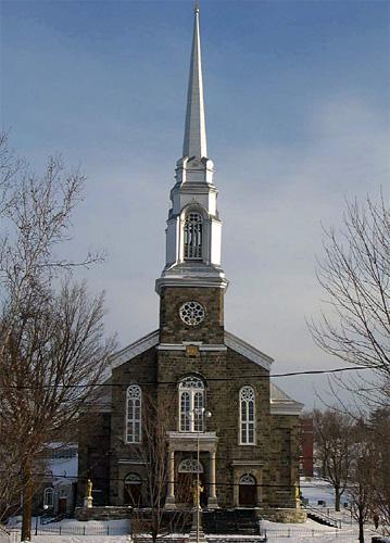
©Parks Canada Agency / Agence Parcs Canada, J. Dufresne, 2004
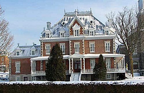
©Parks Canada Agency / Agence Parcs Canada, J. Dufresne, 2004
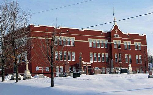
©Parks Canada Agency / Agence Parcs Canada, J. Dufresne, 2004 |
Saint-Joseph-de-Beauce Institutional Ensemble National Historic Site of Canada
Saint-Joseph-de-Beauce, Québec
The Saint-Joseph-de-Beauce Institutional Ensemble National Historic Site
of Canada is located in the centre of the town of Saint-Joseph-de-Beauce
in the Beauce region of Québec. This institutional complex of five
buildings built between 1865 and 1911, consists of a church surrounded
by a convent, a presbytery, an orphanage and Lambert School. A few
secondary buildings, the cemetery landscape features and part of the
avenue du Palais and Sainte-Christine and Martel streets are also
situated inside the ensemble.
Located in the town centre, the Saint-Joseph-de-Beauce Institutional
Ensemble is an example of the important role Roman-Catholic institutions
played in the development of small-town Canada in the 19th and early
20th centuries, through the social organization and improvement of these
communities. The ensemble, consisting of the church, the presbytery, the
convent, the orphanage, and the school, has helped to define the very
character of the town of Saint-Joseph-de-Beauce. A regional centre for
religious, community, and educational services, this group of buildings
forms a distinct precinct reflecting the desire of clergy, religious
communities, and laity alike to structure French Canadian village life
around Catholic institutions.
Inspired by architectural styles popular during the 19th and 20th
centuries and designed by notable Québec architects and artisans, these
buildings are balanced and harmonious in their scale, materials and
design. The Saint-Joseph church is executed in the Classical Revival
style, the convent and orphanage are in the Second Empire style, the
school is mainly Classical with an influence of Spanish Colonial Revival
while the rectory is in the eclectic style, a synthesis of three main
influences, Second Empire, the Château style and the traditional style
of Québec. Built between 1865 and 1911, these five well-preserved
buildings are also notable for their exceptional site overlooking the
Chaudière River, where they integrate well with the natural environment.
United by their history, function, and design, they constitute one of
the most striking religious institutional complexes in Quebec.
|
|
Saint-Joseph-de-la-Rive Shipyard National Historic Site of Canada
Les Éboulements, Québec
Saint-Joseph-de-la-Rive Shipyard National Historic Site of Canada
overlooks the St. Lawrence River in the village of
Saint-Joseph-de-la-Rive, Québec. Set parallel to the waters edge at the
foot of a steep hill, this small shipyard is dominated by a sawmill and
a workshop housing a windlass. The site, levelled and triangular, is
bounded by trees and the Boudreault River as it flows into the St.
Lawrence.
Established in 1946, the Saint-Joseph-de-la-Rive Shipyard, one of the
few surviving facilities of its period, continues to retain equipment
previously used in the repair and wintering activities associated with
small-scale coastal shipping along the St. Lawrence River.
Representative of the many shipyards that once flourished in Québec,
this was the primary location for the construction of schooners. First
rigged with sails and later motorized, these wooden crafts played a
crucial role in the coastal navigation of the St. Lawrence River and the
economic development of various communities located on its shores. With
only a population of 250 people in 1931, Saint-Joseph-de-la-Rive,
formerly known as the "Éboulement-en-bas," was a desirable site for a
shipyard due to its slight descent into the St. Lawrence and its heavily
forested borders, which protected the area from strong winds.
No longer operational, the Saint-Joseph-de-la-Rive Shipyard once
functioned year-round with the greater part of the repair and
maintenance activity taking place during the winter months. The shipyard
was the driving force of Saint-Joseph-de-la-Rive's economy, and as the
leading producer of schooners in Québec, it contributed greatly to the
economy of the province as a whole. The gradual disappearance of the
schooner, competition with other means of transportation, and the
prohibitive cost of building extra infrastructure to support larger
steel boats resulted in the decision to close the yard in 1972. The yard
and fittings have remained almost unchanged, and in 1986 the shipyard
became a regional museum and interpretation centre known as the
Charlevoix Maritime Museum.
|

©Parks Canada Agency / Agence Parcs Canada |
Saint-Louis Forts and Châteaux National Historic Site of Canada
Québec, Québec
Integral part of Québec's defence system; the seat of colonial executive
authority for over 200 years.
The Saint-Louis Forts and Châteaux National Historic Site of Canada is
located on an escarpment that overlooking the lower town of Old Québec.
The site includes the archaeological remnants of major building
campaigns between 1620 and 1838 including four Saint-Louis forts, two
châteaux Saint-Louis and Château Haldimand as well as secondary
buildings, landscapes and services such as courtyards, drains and
military works. The archaeological site, in an area delineated by
present Jardins des Gouverneurs, the Wolfe Battery, the present Château
Frontenac Hotel and the associated Dufferin Terrace, is also part of the
Fortifications of Québec National Historic Site of Canada.
The Saint-Louis Forts and Châteaux occupies a part of the most important
location in colonial Quebec. It is an archaeological site with remnants
of the buildings and structures that occupied it from 1620 to 1838: this
includes Saint-Louis forts (1620, 1626, 1636, 1692), Châteaux
Saint-Louis (1648, 1694) and Château Haldimand (1784). The heritage
value of this site resides primarily in its historical associations as
illustrated by its strategic location and the many layers of
archaeological remains the site holds, each layer witnesses a distinct
period of use, including that of both the French and English regimes.
The footprints, forms, materials, technology, functional and spatial
relationships of individual remnants provide essential evidence of
historic activity.
|
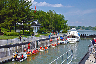
©Parks Canada Agency / Agence Parcs Canada |
Saint-Ours Canal National Historic Site of Canada
Saint-Ours, Québec
Operational canal; 1933 (and remains of 1849) lock.
Opened in 1849, the Saint-Ours Canal is a continuation of the Chambly
Canal, bypassing the final obstacle to navigation between the St.
Lawrence River and Lake Champlain.
Known as the tenth lock of the Richelieu, the Saint-Ours Canal is
situated between l'île Darvard and has been indispensable to
international trade for over a century.
Saint-Ours Canal National Historic Site of Canada is situated on the
east bank of the Richelieu River, 52 km from Chambly and 23 km from
Sorel Québec. It is located in a 5-hectare park and primarily consists
of one enclosed lock between the east bank of the Richelieu River and
Darvard Island, as well as a dam.
The heritage value of Saint-Ours Canal lies in the inter-relationships
of the components of its cultural landscape which have survived to this
day: the Richelieu River, Darvard Island, the canal route, the dam, the
buildings and archaeological remnants of canal activity. The Saint-Ours
Canal was constructed by the Board of Works of the United Canadas as a
commercial canal in 1844-1849, although the current lock dates from
renovations in 1930-1933. Additional alterations occurred in 1960-1969
and 1974.
|

©Parks Canada Agency / Agence Parcs Canada |
Saint-Sulpice Seminary and its Garden National Historic Site of Canada
Montréal, Québec
Saint-Sulpice Seminary and its Garden National Historic Site of Canada
is a religious seminary and adjoining garden located on rue Notre-Dame
Ouest in the heart of Old Montréal. The site consists of a large,
U-shaped stone seminary building of austere appearance, enclosing
formal, private gardens and a small courtyard. The stone building is an
impressive example of 17th-century classical architecture built during
the French Regime. Rectangular in plan, the convent gardens are
characterized by symmetry, geometrically arranged subdivisions and
intersecting cross-paths that lead to a central focal point. The complex
is shielded from rue Notre Dame by a stone wall pierced by the main
entrance.
The heritage value of Saint-Sulpice Seminary and its Garden resides in
its historical associations and in its architectural integrity as an
example of French Regime classicism. Since 1687, the seminary has served
as the residence and administrative centre of the Messieurs of
Saint-Sulpice who were the seigneurs of the Island of Montréal until the
end of the seigneurial regime. The building was inspired by 17th-century
classical French architecture, and its garden originally conformed
closely to the medieval monastic garden. With the colonization of New
France in the 17th century, this European garden tradition was carried
to North America by religious orders such as the Jesuits and Sulpicians.
The garden survives in its original location with its form virtually
intact. The garden's relationship to the walls of the surrounding
institution reflects the inward looking, self-reliant nature of these
protected communities and their calm, spiritual quality. The
ornamentation of the design and the interplay of geometry within this
small structured landscape are reflective of 17th-century tastes.
|

©Parks Canada Agency / Agence Parcs Canada |
Saint-Vincent-de-Paul Penitentiary National Historic Site of Canada
Laval, Québec
A monumental stone prison with a severe, forbidding presence,
Saint-Vincent-de-Paul Penitentiary National Historic Site of Canada is
located in Laval, Québec. Opened in 1873 in a facility previously
constructed as a reformatory, it was Canada's second federal
penitentiary, and served as the country's sole francophone correctional
facility from 1873 until it closed in 1989.
Originally built in 1873, most of the present institution was
constructed in the 1930s and 1940s. The architecture of the original
facility, which planned for only an administration building and
cellblock, was unimpressive, and the penitentiary has been altered so
significantly that it has lost its original Greek cross cell block
configuration.
The heritage value of Saint-Vincent-de-Paul Penitentiary National
Historic Site lies in its witness to over a century of criminal justice
in Canada in general and, particularly, Québec. Heritage value resides
in the recognizable public presence of the institution which includes
its exterior appearance, its site and its setting. It can also be found
in the stories and the relics of life within the institution's
walls.
|
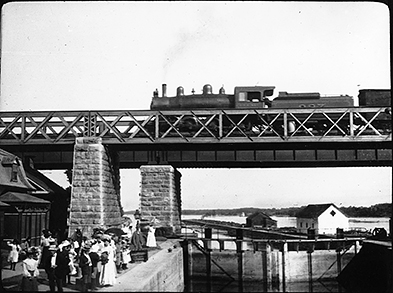
©Parks Canada Agency / Agence Parcs Canada
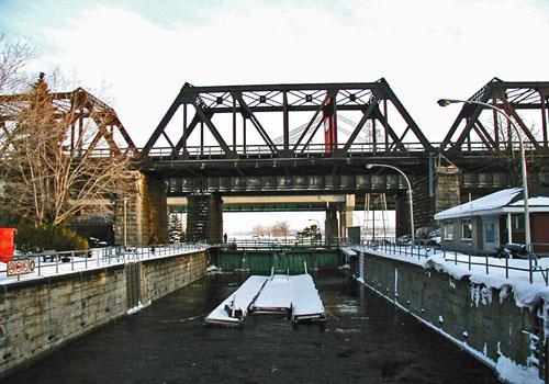
©Parks Canada Agency / Agence Parcs Canada, 2003 |
Sainte-Anne-de-Bellevue Canal National Historic Site of Canada
Sainte-Anne-de-Bellevue, Québec
Operational canal; site of earlier 1843 canal.
To travel the Sainte-Anne-de-Bellevue Canal is to take a trip through
over 150 years of history. Located west of Montreal, the canal links
Lake Saint-Louis and the Lake des Deux-Montagnes, at the mouth of the
Ottawa River.
Used for commercial purposes from its opening in 1843, the canal soon
became an integral part of the Montreal-Ottawa-Kingston inland shipping
route.
Sainte-Anne-de-Bellevue Canal on the Ottawa River consists of the canal
walls and fixed wharf of a man-made waterway constructed in the mid 19th
century to by-pass the Ste. Anne's Rapids in the east channel of the
Ottawa River opposite the village of Ste.-Anne-de-Bellevue on the tip of
Montreal Island.
Sainte-Anne-de-Bellevue Canal was designated a national historic site as
part of Canada's national canal system and because it commemorates the
role of the waterways during the 19th and 20th centuries as a part of
the canal network that linked Montréal to New York, via the
Saint-Lawrence, Rideau, Cataraqui and Ottawa rivers.
Its heritage value resides in the navigable route of the canal and in
those vestiges of the canal that witness the materials, forms, and
technology of its construction and operations as a commercial canal.
Sainte-Anne-de-Bellevue Canal was constructed by the Board of Works of
the United Canadas in 1840-1843, and altered in 1879-1883, then
repeatedly modernized throughout the 20th century. In 1963 its role
changed from a commercial to a recreational canal. After it was acquired
by Parks Canada in 1972, parts of the 1.6 hectare canal property not
essential to canal operations and historical interpretation were
subdivided and sold.
|

©Parks Canada Agency / Agence Parcs Canada 1999 |
Sainte-Anne Processional Chapel National Historic Site of Canada
Neuville, Québec
Sainte Anne Processional Chapel National Historic Site of Canada is
located just off the road in pastoral surroundings at 714, rue des
Érables, in Neuville, Québec. Featuring elements of vernacular and
neoclassical architecture, it is a small early 19th-century rubblestone
processional chapel with a gable roof, Roman-arched apertures, and a
high belltower.
The heritage value of this site resides in the remarkable integrity of
both the building and its site and in its design, composition, details
and materials, as well as in its special function.
The Sainte Anne Processional Chapel illustrates a building type strongly
associated with a medieval Christian tradition transplanted to New
France during the seigneurial system and maintained in Québec until the
mid-20th century. On the feast of Corpus Christi, and especially during
the novena to Sainte Anne, worshipers come here in procession from the
nearby parish church. This chapel, which displays elements of vernacular
and neoclassical architecture, was built around 1830 on the site of an
earlier one dating from 1697. With its original form, walls, window and
door openings, façade, and three-part belltower, the Sainte Anne
Processional Chapel is an eloquent reminder of this popular religious
tradition, which has continued uninterrupted to this day.
|
|
Second Battle of Laprairie National Historic Site of Canada
La Prairie, Québec
On August 11th, 1691, a few hours after the attack on Fort Laprairie,
Major Peter Schuyler and his indians suffered a severe defeat at the
hands of the French and their indian allies, under command of Captain de
Valrennes. The French lost the following officers: Lieutenants Le
Varlet, Le Ber, Duchesne, Denys de la Bruére and Depeiras.
|
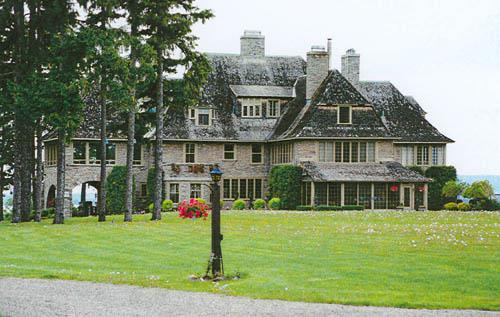
©Parks Canada Agency / Agence Parcs Canada, Michel Pelletier, 2001
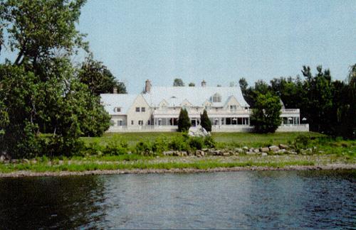
©Parks Canada Agency / Agence Parcs Canada, Michel Pelletier, 2001 |
Senneville Historic District National Historic Site of Canada
Senneville, Québec
Senneville Historic District National Historic Site of Canada evolved
from a late-19th-century resort village located on the shores of the Lac
des Deux-Montagnes, at the western tip of the Île de Montréal. The
district comprises more than 1400 acres and includes at least 82
buildings constructed between 1860 and 1930 as part of about a dozen
country estates. The main thoroughfare of the district is chemin
Senneville, a country road that runs parallel to the shoreline of the
lake. The buildings are set well back from the road within large, wooded
estates, many of which back onto the lake. The buildings include large
manor houses, as well as smaller secondary residences, agricultural
outbuildings and landscape elements. The district features a range of
picturesque landscapes and Arts & Crafts-inspired architecture. It
includes the ruins of Fort Senneville and the Senneville windmill, the
Morgan Arboretum, a nature park (l'Anse-à-l'Orme) and an agricultural
park (Bois-de-la-Roche) all of which are components of estate lands, as
well as Braeside, a late 19th-century golf course. These latter four
elements form an extensive greenbelt along the southern and eastern
edges of the district which separates it from adjacent residential and
industrial development.
The estate owners of Senneville were the founders, presidents or
directors of some of the largest commercial enterprises of the period,
including the Bank of Montreal and the Canadian Pacific Railway. They
included: Sir John Joseph Caldwell Abbott (1821-1893), Mayor of Montréal
and Canada's third Prime Minister; John Lancelot Todd, professor of
parasitology at McGill University; Louis-Joseph Forget (1853-1911), a
stock broker and Conservative senator; and Montréal bankers Sir Edward
Seaborne Clouston (1849-1912) and Richard Bladworth Angus (1831-1922).
The Senneville Historic District includes more than 30 major projects
designed by a small group of eminent Montréal architects, landscape
architects and urban planners, often working in collaboration with
American designers. This group included some of Canada's greatest
architects and designers of the period. They shared a picturesque
approach to landscape design, an eclectic approach to architecture and
an affinity for the Arts & Crafts Movement. At the heart of the Montréal
group were brothers Edward Maxwell (1867-1923) and William Sutherland
Maxwell (1874-1952), who designed dozens of Senneville buildings,
sometimes working in partnership with Montréal architect George Cutler
Shattuck (1864-1923). The 20 Maxwell buildings that survive constitute a
unique example in a single location of their work. Montréal architect
and professor Percy Erskine Nobbs (1875-1964), in partnership with
George Taylor Hyde (1879-1944), designed the buildings and grounds of
the J.L. Todd estate. Landscape architect and urban planner Frederick G.
Todd (1876-1948), working with American landscape designer Frederick Law
Olmsted, designed the grounds of the Abbott/Clouston estate. Olmsted
also designed the grounds of the Forget estate. Other eminent Montréal
architects responsible for the designs of Senneville buildings included:
James & H. Charles Nelson; Kenneth Rea (1878-1941); Harold Edgar Shorey
(1886-1971); Samuel Douglas Ritchie (1887-1959); J.R. Hind; Robert
Findlay (1859-1951); Frank R. Findlay; and David Shennan.
Built between 1860 and 1926, the Senneville estates and their buildings
illustrate the development of the Arts & Crafts movement and Picturesque
landscape design during this period in Canada. Because they were created
by a small number of owners using a limited group of architects and
designers over a relatively concentrated period of time, the buildings
and landscapes of Senneville have a strong formal and stylistic
coherence.
The Senneville Historic District includes several recognized
masterpieces of Canadian architecture and landscape design, including
"Bois-de-la-Roche", the Château-style residence built by Senator
Louis-Joseph Forget; and the J.L. Todd estate.
|

©Parks Canada Agency / Agence Parcs Canada, 1969 |
Sewell House National Historic Site of Canada
Québec, Québec
Sewell House National Historic Site of Canada stands on a large lot on
top of a slight knoll above the street facing Saint-Louis Street just
below the Quebec Citadel. This reserved example of early
nineteenth-century houses inspired by British classicism was the
residence of Chief Justice Jonathan Sewell. The two-and-a-half storey,
five-bay stone house forms part of the urban panorama of the
19th-century Upper Town of Québec.
Built in 1803-1804, Sewell House illustrates the early 19th-century
development in the Upper Town of Québec. The original owner, Jonathan
Sewell, may have been involved in the design, which placed the home
within extensive grounds he owned through inheritance from his
father-in-law, the former Chief Justice of Lower Canada William Smith.
Jonathan Sewell, a lawyer, was appointed Solicitor General and Attorney
General of Lower Canada before becoming a member of the Provincial
Legislature in 1796. In 1808 he became Chief Justice and Chairman of the
Executive Council. In 1854, his estate sold the house to the Crown. The
buildings were then inhabited by the officers of the Québec Garrison
Club, served as offices of the lieutenant governor and the Post Office
Department and also as a school.
Sewell House is an important component of the upper middle-class
settlement of Upper Town, typical of the early period of British
administration. The homes on Saint-Louis Street and neighbouring streets
constitute an urban panorama of small streets and similar houses of one,
two and three storeys, set close to the sidewalk. In the early decades
of the nineteenth century, the construction of dwellings for Anglophone
elites introduced a new architectural vocabulary that included
neoclassical elements such as symmetrical openings, low-pitched roofs,
and a restrained appearance. The architectural character of Sewell house
mirrors the penchant for British classical design so evident in nearby
military buildings, as does its well-crafted ashlar masonry
construction.
|

©Parks Canada Agency / Agence Parcs Canada, Christine Boucher, 2014 |
Sir John A. Macdonald's Summer Residence National Historic Site of Canada
Rivière-du-Loup, Québec
Sir John A. Macdonald's Summer Residence National Historic Site of
Canada stands on a rocky outcrop overlooking the St. Lawrence River on
the northern side of Fraser Street in Rivière-du-Loup, Québec. Standing
on a grassed lot dominated by conifers, the house is typical of summer
residences in the lower St. Lawrence River region. Canada's first Prime
Minister after Confederation, the Right Honourable Sir John A. Macdonald
(1815-1891) used this house as a summer residence between 1873 and 1890.
The house served as a place of relaxation and work from which he was
able to continue to govern the country.
The architecture results from the successful blending of two rectangular
structures from different periods and architectural styles. The core
structure of Sir John A. Macdonald's Summer Residence is an old
farmhouse dating from about 1850. An imposing Second Empire style wing
with mansard roof and dormers was added after the Macdonald's bought the
house in 1882. The central gable was also likely added soon after. The
house was not rebuilt or renovated after the Macdonalds sold it, and few
architectural changes have been made over the years, either inside or
out.
The heritage value of the house also resides in its association with
Canada's first Prime Minister, Sir John A. Macdonald, and in its
historical value. It was probably John A. Macdonald's arrival in the
area in the early 1870s that marked the high point of the popularity of
Saint-Patrice as a resort. The Macdonalds' presence attracted friends
and associates who settled nearby, many of them businessmen with
interests in railway companies, as well as politicians and high-ranking
officials. Following Macdonald's death, the house was sold in 1895 to
Lord Thomas Shaughnessy, chairman of the Canadian Pacific Railway
Company from 1899 to 1918. It later passed into the hands of Herbert
Symington, first chairman of Air Transat. He purchased the house in 1939
and it remained in the Symington family until 1981 when it was acquired
by Canadian Heritage of Quebec. In 2003, the house was inscribed within
the Vieux Saint-Patrice heritage site, a district on the western side of
Fraser Street containing forty farmhouses and summer residences
associated with the popular resort community from the end of the 19th
century.
|
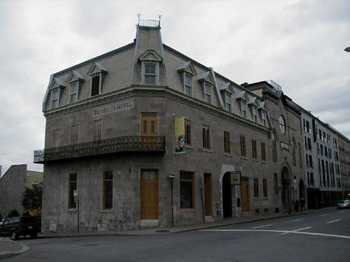
©Parks Canada Agency / Agence Parcs Canada, 2004. |
Sir George-Étienne Cartier National Historic Site of Canada
Montréal, Québec
Double house of prominent 19th-century politician, 1830s.
Located at the corner of Notre Dame and Berri streets, in downtown
Montreal, this masonry building occupies a little more than half of its
urban lot. The two semi-detached houses occupying this lot had been part
of a three house urban terrace on what had been the site of the Montreal
citadel. One part of the house presents the life and work of Father of
Confederation George-Étienne Cartier, upper-middle class Montrealer,
politician and Father of Confederation, and the other has been restored
to present the domestic setting of the Cartier family during the 1860s.
The heritage value of Sir George-Étienne Cartier National Historic Site
of Canada resides in its association with George-Étienne Cartier, whose
political career lasted from 1848 to 1873, and in its illustration of an
upper-middle class Montreal home in the middle of the 19th century,
showing both French and English architectural influences.
|
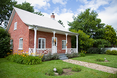
©Parks Canada Agency / Agence Parcs Canada |
Sir Wilfrid Laurier National Historic Site of Canada
Laurentides, Québec
House interprets life of Sir Wilfrid Laurier, Prime Minister of Canada
(1896-1911).
The Sir Wilfrid Laurier National Historic Site of Canada is located in
Saint-Lin-Laurentides, a town 50 km north of Montreal. The site
commemorates one of the most important figures in Canadian political
history, Sir Wilfrid Laurier, the man often referred to as the father of
modern Canada.
His long career straddles a period of major political and economic
changes. As Prime Minister of Canada from 1896 to 1911, Laurier was
instrumental in ushering Canada into the 20th century and in gaining
greater autonomy for his country vis-à-vis its international partners.
Sir Wilfrid Laurier National Historic Site of Canada commemorates the
birthplace of Sir Wilfrid Laurier, former Prime Minister of Canada.
Located on 12th Avenue, Saint-Lin-Laurentides, 60 km north of Montreal,
the site has been much changed since Laurier's childhood and now
contains a small brick house in the Quebec Vernacular style, set on a
landscaped lot.
The heritage value of Sir Wilfrid Laurier National Historic Site of
Canada resides in its sense of place as the setting of Sir Wilfrid
Laurier's childhood formation. Laurier was born in Saint-Lin-Laurentides
in 1841, where he maintained a residence until 1865. This property was
purchased by Laurier's grandfather at the beginning of the 19th century,
and sold out of the family in 1865. The residence it contains today was
constructed in 1870. The federal government acquired the two lots that
formerly comprised the Laurier property in 1937-38 and demolished all of
the buildings except the present house, then believed to be the former
Laurier residence. It was relocated centrally on the adjoining lots
which were landscaped by Frederick G. Todd, while ethnologist Marius
Barbeau furnished the house in a manner which he felt reflected the
handicraft tradition of rural Quebec. In its attempts to reflect the
humble, rural roots of Sir Wilfrid Laurier, Parks Canada created one of
its first non-military, interpreted sites and an example of early
twentieth-century historic site curatorship.
|
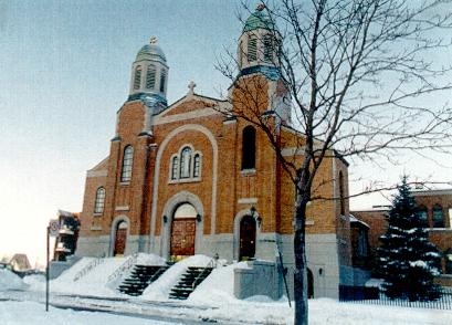
©Parks Canada Agency / Agence Parcs Canada |
St. George Antiochian Orthodox Church National Historic Site of Canada
Montréal, Québec
St. George Antiochian Orthodox Church National Historic Site of Canada,
located in the Villeray neighbourhood of Montréal, is a handsome brick
church designed in a predominantly Byzantine style. Capped with a
pediment and flanked by twin three-storey bell towers, the façade is
distinguished by a grouping of three round-arch windows above an arched
entranceway. The interior is a marriage of Byzantine and western
influences, in its broadly arched central nave, decorated with a
splendid program of murals and stained glass windows.
Serving the original and largest Syrian Orthodox community in Canada,
St. George Antiochian Orthodox Church is this cultural community's
earliest-known, purpose-built church that continues to fulfil its
original role. Designed by architect Raoul Gariepy, the church combines
Western and Byzantine styles. Through its remarkable architecture,
interior design by Emmanuel Briffa, and its role as the home of many
community organizations involved in humanitarian activities, this church
importantly illustrates the continuity of a cultural tradition within a
Canadian context. St. George Antiochian Orthodox Church, created by the
Syrian Orthodox community as the physical embodiment of that group's
ability to contribute to Canadian life through respect for and
adaptation of their cultural values and traditions, is a place of
special significance on the Canadian landscape.
|

©Parks Canada Agency / Agence Parcs Canada, P. St. Jacques, 1995 |
St. George's Anglican Church National Historic Site of Canada
Montréal, Québec
St. George's Anglican Church National Historic Site of Canada is a
stone, Gothic Revival style building located amongst office blocks in
the centre of Montréal, Quebec. Set under a steep gable roof, the church
is a picturesque arrangement of asymmetrical forms built to a cruciform
plan. Its open timber roof is a distinctive interior feature.
Constructed in 1869-1870 to plans by well-known architect William Tutin
Thomas, this Anglican church is a skillful arrangement of asymmetrical
forms, and displays a variety of picturesque visual effects. The
rusticated stone cladding, typical of the High Victorian phase of the
Gothic Revival style, adds to the richness to the exterior by providing
texture, as well as enhancing the various sculpted details, evidenced in
the complicated window mouldings. Interior features include the apsidal
chancel, the unusual polygonal transept with door, and the main entrance
situated on the west end, instead of through a north porch.
|
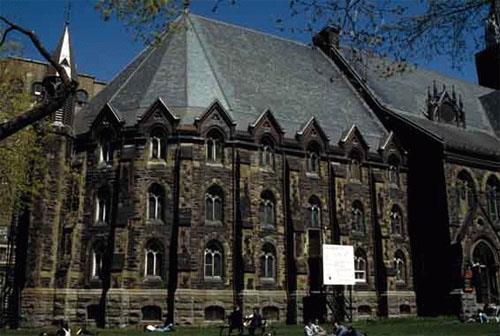
©Parks Canada Agency / Agence Parcs Canada, C. Turnel |
St. James United Church National Historic Site of Canada
Montréal, Québec
St. James United Church National Historic Site of Canada is located on
St. Catherine Street West within a commercial district of downtown
Montréal, Quebec. It is a large, late 19th-century stone church, built
in the High Victorian Gothic Revival style distinguished by two massive
towers on the primary façade that border a prominent rose window set
above a triple portal entrance.
Built between 1887 and 1888 as a Methodist church, St. James United
Church is representative of the late phase of Methodism, an evangelical
protestant movement founded in the mid-18th-century. By the late 19th
century, Methodist congregations included many prosperous and
well-placed members of society. Late-19th-century Methodism had matured
from an earlier focus on revival meetings and religious conversions
towards an emphasis on moderation, gradualism and the central place of
church institutions in the religious life of the individual. Central
among these institutions was the Sunday school, as seen clearly in St.
James United Church, which fostered the education and spiritual
development of all ages
St. James United Church illustrates Methodist church designs from the
late Victorian era in its large scale, central location, eclectic Gothic
Revival exterior, amphitheatre-based interior plan and the inclusion of
elaborate sunday school facilities. The large scale and elaborate design
of the church reflects the social, political and economic importance of
its members. The amphitheatre plan of the nave and transept maintained
the central role of the preacher in Methodism. The sunday school
facilities and their location in the chancel reflected the importance of
education and spiritual development within the church. Inspired by the
Akron plan, a mid-19th century innovation in sunday school design, the
room featured a semi-circular plan and a moveable wall system that
accommodated both small-group classroom study and large-scale
assemblies.
St. James United Church reflects the High Victorian phase of Gothic
Revival architecture, in its eclectic use of historical references and
its inspiration from both French and Italian Gothic architecture. On the
exterior, a high gable slate roof adorns the polychromatic façades. The
ornate plaster decoration of the interior, in the form of moulded and
carved arches and ribs, suspended from roof trusses and without
supporting pillars, has a High Victorian Gothic flourish. The interior
is illuminated with natural light through stained glass windows
decorated with wooden tracery and Gothic motifs, such as quatrefoils,
along the walls at the floor and gallery level.
|

©Parks Canada Agency / Agence Parcs Canada, P. St. Jacques, 1995 |
St. Patrick's Basilica National Historic Site of Canada
Montréal, Québec
St. Patrick's Basilica National Historic Site of Canada is a large stone
church built in 1843-47 in the French Gothic Revival style. It sits on a
large lot occupying one half of a city block near the southwest corner
of Réné-Lévesque Boulevard and Saint-Alexandre Street in a busy
commercial sector of downtown Montréal, Québec. The striking basilica
features various French Gothic Revival details such as a tall, central
tower and a prominent rose window.
St. Patrick's Basilica was constructed in 1843-47 as the parish church
of Montréal's growing Irish immigrant population. As soon as the church
was completed, its clergy helped care for Irish immigrants suffering
from a typhoid fever epidemic. Due to its continuing religious,
charitable and educational vocations, St. Patrick's became the heart of
the Irish community in Montréal. Its real and symbolic role was evident
in its choice as the location for the funeral of Thomas D'Arcy McGee in
1868.
St. Patrick's Basilica is a very early and fully expressed example of
the French Gothic Revival style in Canada. This revival style was based
on extensive studies into 13th-century French architecture carried out
by French scholars. They and their followers appreciated the period's
rational approach to the relationship between architectural and
structural elements. St. Patrick's illustrates this approach in the
clarity of its structural elements, in its symmetry and in its
verticality, and in the use of archaeologically correct decoration.
The designers of St. Patrick's Basilica, architect Pierre-Louis Morin
and the Jesuit priest Félix Martin, incorporated the use of French
Gothic Revival style in the building. Both men had sound knowledge of
and interest in French medieval architecture through practice and, in
the case of Martin, through close familial relationships with proponents
of the style. The interior of St. Patrick's Basilica features remarkably
complete examples of Québec ecclesiastical craftsmanship and artistry.
It was originally decorated in 1845-51 and additions were made twice
later in the century. The initial decoration was supervised by Victor
Bourgeau. Antoine Plamondon created the paintings of the Stations of the
Cross, and the main altar and two side altars were richly carved by
Perrault, Paré and Ouellet.
|
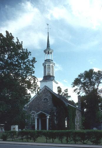
©Parks Canada Agency / Agence Parcs Canada, 1992. |
St. Stephen's Anglican Church National Historic Site of Canada
Chambly, Québec
St. Stephen's Anglican Church National Historic Site of Canada is a
small, stone church, combining Québec architectural traditions with the
strong influence of the Palladian style. Located in the town of Chambly,
southeast of Montréal in the Richelieu Valley, the church sits in a
picturesque location, set back from the street and surrounded by trees
and a very old cemetery. Fort Chambly National Historic Site of Canada
and the Richelieu River are located in close proximity to the church.
St. Stephen's Anglican Church was erected in 1820 to serve the garrison
at nearby Fort Chambly as well as a small civilian Anglican population.
Side galleries and box pews were added in the 1830s to increase the
amount of space available for the garrison. The design of the church is
a simple and harmonious combination of characteristics from two
architectural traditions. The materials, proportions and small scale of
the church are reminiscent of traditional Québec church architecture,
while the organization and ornamentation of the church exterior, and
features such as the tiered steeple, the porch, and the window openings
reflect the influence of the Palladian style brought to Québec by
English immigrants.
|


©Parks Canada Agency / Agence Parcs Canada |
Sulpician Towers / Fort de la Montagne National Historic Site of Canada
Montréal, Québec
Sulpician Towers / Fort de la Montagne National Historic Site of Canada
is located on Sherbrooke Street West, in downtown Montréal, Quebec. The
site is comprised of two two-storey 13-metre high stone towers, built in
1694, that were part of the original Fort de la Montagne. They each have
one entrance and a single door with square panes on the north side,
above which is a single multi-paned window. Both towers have eight-sided
conical roofs topped with a cross. In addition, the west tower is topped
by a weathervane.
Around 1676, the Sulpicians of Montréal Island founded a mission, known
as the Mission de la Montagne, intended for the instruction of local
aboriginals and their conversion to Catholicism. In 1681, M. François
Vachon de Belmont was named a superior of the mission which housed over
200 Iroquois, Hurons and Algonquins living in cabins within the fort.
In 1694, a stone fort composed of four towers connected by a stone
enclosure wall, was constructed to protect the new mission. The towers
were built with gun-ports for the defence of the fort; however, they
acted as a deterrent and were never used. In fact, the Sisters of the
Congregation of Notre-Dame used the southwest tower for a school and the
southeast tower as a residence for the nuns of the Congregation. With
the increasing departure of the aboriginals between 1692 and 1705, the
southeast tower was transformed into a chapel (1824) and the northwest
and northeast towers were demolished.
|

©Parks Canada Agency / Agence Parcs Canada, 1991 |
Symmes Hotel National Historic Site of Canada
Gatineau, Québec
Symmes Hotel National Historic Site of Canada is a two-and-a-half-storey
early 19th century stone inn located at the juncture of Aylmer's (now
Gatineau) main street in Québec, and the north shore of the Ottawa
River. This charming building has long galleries on each side, an
elegant bell-cast roof, and double chimneys. It now serves as a cultural
centre for the local community.
Symmes Hotel was designated a national historic site of Canada in 1976
because for many years, this hotel occupied a privileged location on the
route leading from Hull (now Gatineau) to Lake Temiscamingue.
Symmes Hotel was built in 1831 for Charles Symmes, founder of the town
of Aylmer. For many years travellers stopped at the inn, known then as
the Aylmer Hotel, before crossing to the head of Lake Deschenes by
steamboat in summer, or by sleigh in winter, and continuing on to the
trading posts of northwestern Québec. In 1973 the Western Québec
Development Society (Societé d'aménagement de l'Outaouais) salvaged the
building from ruin and restored it.
The heritage value of Symmes Hotel National Historic Site of Canada
resides in its historic associations with its role as an inn and
stopping place on a busy early transportation route. Value lies in its
form and special features, its materials and composition, its site and
setting.
|
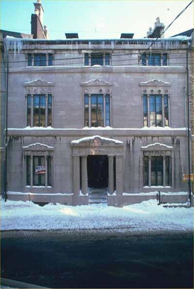
©Paolo Porzio |
Têtu House National Historic Site of Canada
Québec, Québec
The Têtu House is an elegant, three-storey, stone townhouse built in
1852-4 in the Neoclassical style and decorated inside and out with Greek
Revival motifs. The house sits on a narrow urban lot in the historic
upper town of the city of Quebec.
The Têtu House, designed by Charles Baillairgé in 1852, was designated a
national historic site in 1973 because it is one of the most remarkable
examples of the Neoclassical town houses built during the mid-19th
century.
Têtu House is a particularly elaborate example of the many large, urban
town houses built for prosperous Canadian merchants during the 1850s.
Designed by prominent Québec architect Charles Baillairgé for local
merchant Circe Têtu, the residence exemplifies Baillairgé's use of Greek
Revival motifs. In an approach typical of Baillairgé and other
mid-19th-century Canadian architects, the house retains its Neoclassical
form, composition, and treatment of materials, drawing on the Greek
Revival vocabulary only for its decorative detailing.
Charles Baillairgé was one of the principal architects in Québec during
the second half of the 19th century. He acted as City Engineer for 37
years and was responsible for the design of many private residences,
public buildings and religious structures in the city. A member of the
famous Baillairgé family of architects, he was trained by his uncle
Thomas Baillairgé and by Abbé Jérôme Demers. Baillairgé was assisted in
the construction of Têtu House by master joiner and general contractor
Isaac Dorion, master mason Pierre Chateauvert, master plasterers Thomas
Murphy and John O'Leary and master painters William and James
McKay.
|
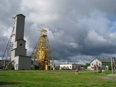
©Parks Canada Agency / Agence Parcs Canada, C. Cournoyer, 2009 |
The Former Lamaque Mine and the Bourlamaque Mining Village National Historic Site of Canada
Val-d'Or, Québec
The site is located in the city of Val-d'Or in the administrative region
of Abitibi-Témiscamingue in the province of Quebec. It lies in the
southeast part of the city where the residential and mining areas meet.
It comprises two adjacent and related sections: the old Lamaque mine,
and the mining town of Bourlamaque. Bourlamaque was planned and built by
the Teck-Hugues Company to serve the gold mine that went into production
in the mid 1930s.
Covering an area of 22 hectares, Bourlamaque Mining Village is an
example of a planned industrial town, and traces of its past as a
company town are still evident. Planned in 1935, the layout is efficient
and orderly, comprised of a grid two long avenues running east-west and
five perpendicular cross streets Laneways running between the avenues
and streets provide parking at the back of the houses Maple trees line
the streets and enhance the landscape.
The former Lamaque Mine and the Bourlamaque Mining Village in Val-d'Or,
Quebec is of historical significance because:
it comprises a significant number of in situ industrial and
residential resources, forming a well-preserved mining landscape
suggestive of the gold rush that took place in northwestern Quebec, an
important region in the history of Canadian mining;
it is a rare and well-preserved example of a mining company town, a
type of town that marked the development of many Canadian communities;
it is an example of a planned single-industry town from the interwar
years with features such as an orthogonal plan, residential land-use
segregation according to social hierarchy, and harmonious architecture
within each neighbourhood, which is highlighted by the contrast between
the well-to-do houses of the mine's management with the horizontal-log
dwellings of its workers;
it illustrates the community engagement that marked the Canadian
heritage conservation movement in the 1960s and 1970s.
|

©Parks Canada Agency / Agence Parcs Canada |
The Fur Trade at Lachine National Historic Site of Canada
Lachine, Québec
Stone warehouse used as depot, 1803; North West Company and Hudson's Bay
Company.
Located to the west of the Island of Montréal along Lake Saint-Louis,
The Fur Trade at Lachine National Historic Site testifies to the apogee
of the fur industry in the Montréal region in the 18th and early 19th
centuries. The old stone warehouse dates from 1803.
Alexander Gordon, ex-clerk and stockholder of the North West Company had
it built to store trading goods and furs. In 1833, the warehouse became
the property of the Hudson's Bay Company.
Lachine occupied a strategic position on the fur route as a departure
and arrival point for trading expeditions. It was also an important
centre for storing the Montréal merchants' furs and for trading goods.
Today, this unique warehouse houses an exhibition that enables visitors
to relive the Montréal fur epic.
Fur Trade at Lachine National Historic Site of Canada is a rectangular
single-storey, stone warehouse located in an attractive park-like
setting on the banks of the Lachine Canal on St. Joseph Boulevard
opposite the Convent of the Sisters of Sainte-Anne in Lachine on the
west end of Montréal Island.
The heritage value of Fur Trade at Lachine National Historic Site of
Canada resides in the surviving 18th-century form, and fabric of the
warehouse building as they illustrate the history of the fur trade in
Montréal.
Built in 1803 by Alexander Gordon of the Northwest Company, this
warehouse was acquired by the Hudson's Bay Company in 1833, then by the
Sisters of Sainte-Anne, who owned it from 1861-1977. When the building
was modernized early in the 20th century, most of its original openings
and surfaces disappeared. They were restored by Parks Canada (1978-1984)
after a fire demolished all but the stone walls and half of the roof
structure.
|
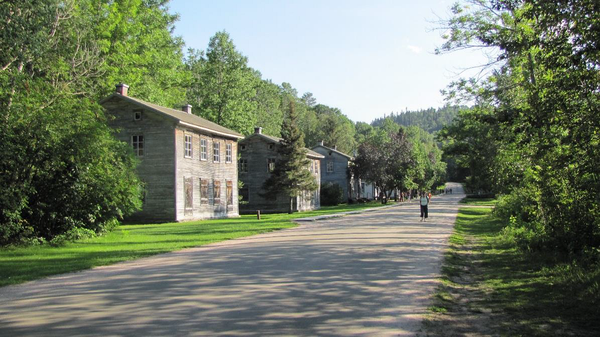
©Saint-Georges Street, Historic Village of Val-Jalbert, Chambord, Québec, Christine Boucher, Parks Canada Agency / Agence Parcs Canada, 2018.
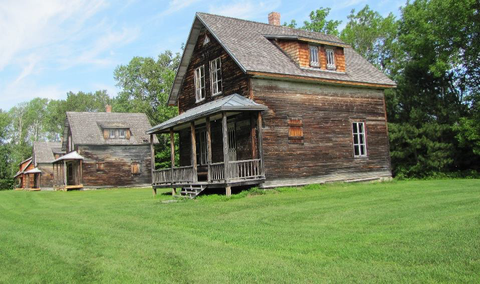
©Historic Village of Val-Jalbert, Chambord, Québec, Christine Boucher, Parks Canada Agency / Agence Parcs Canada, 2018.
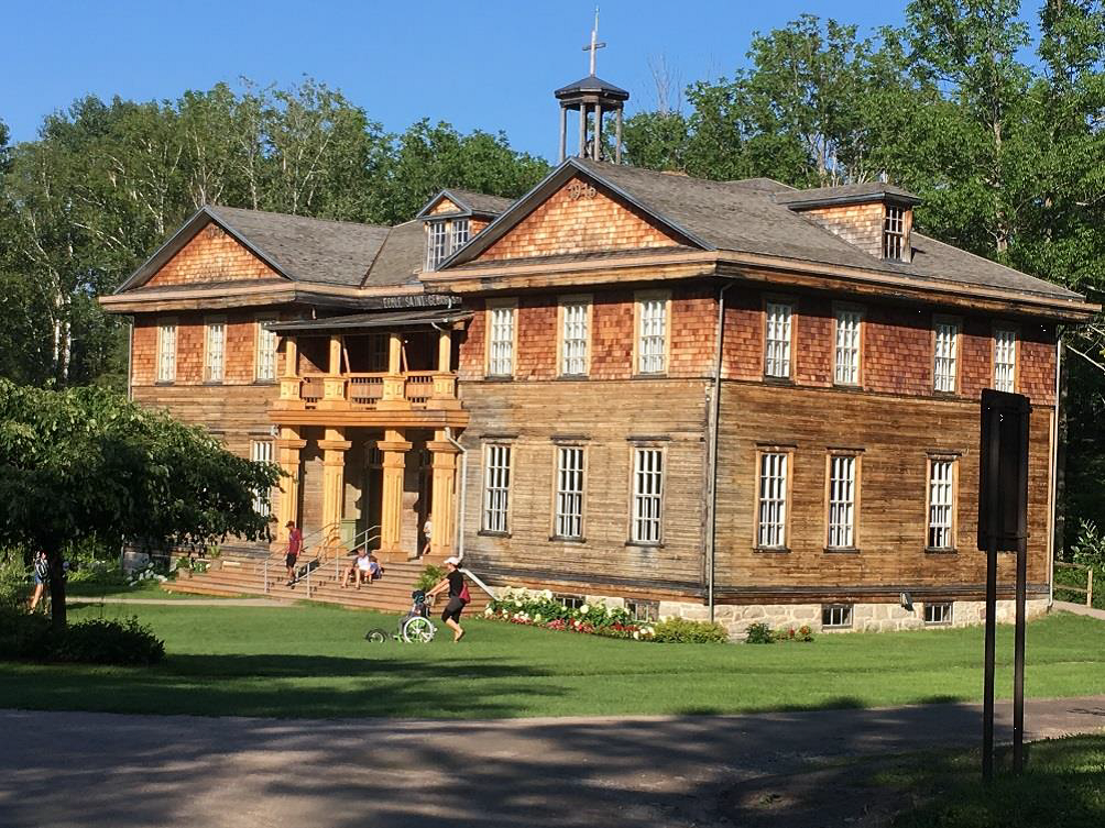
©Former Convent-School, Historic Village of Val-Jalbert, Chambord, Québec, Christine Boucher, Parks Canada Agency / Agence Parcs Canada, 2018.
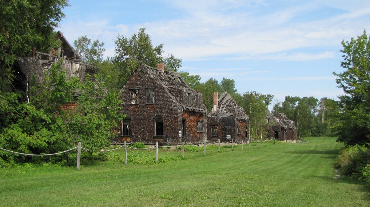
©Historic Village of Val-Jalbert, Chambord, Québec, Christine Boucher, Parks Canada Agency / Agence Parcs Canada, 2018. |
The Historic Village of Val-Jalbert National Historic Site of Canada
Chambord, Québec
Founded in 1901 around a pulp and paper mill, and deserted since 1927, the
village of Val-Jalbert is a prime example of an early 20th century pulp and
paper industry company town. It is remarkable for its authenticity and the
preservation of its built environment. Designed in successive phases according
to an urban plan that guided its growth, the village of Val-Jalbert features two
distinct districts, the upper town and the lower town, as well as a unique array
of industrial equipment, institutional and commercial buildings, and four
different types of workers' all-wood houses found along over a half-dozen
streets. In the early 1960s, this deserted "ghost town" was conserved and
developed into an open-air museum, typifying the growing interest in heritage
preservation that took place across the country during the second half of the
20th century.
Covering an area of approximately 1.7 square kilometres, the historic village of
Val-Jalbert is in the Regional County Municipality (RCM) of Domaine-du-Roy,
southwest of Lac Saint-Jean. Archaeological studies have shown that human
occupation of this region dates to at least 6,000 years ago. In the 1840s, when
colonization began in the region, this was Innu territory. The development of
the forest industry, through the granting of timber cutting territories and the
construction of pulp production plants, encroached on Innu territory and they
petitioned authorities for compensation and the protection of their lands. In
1856, the Mastheuiatsh (Pointe-Bleue) reserve was created. It is the only Innu
community in the Lac-Saint-Jean region.
In 1898, forestry entrepreneur Damase Jalbert began the development of a pulp
mill on the Ouiatchouan River. The construction of the mill, inaugurated in
1902, and the planning of the first residential area of the village took place
simultaneously. The site features numerous natural elements, including the
Ouiatchouan River and its waterfalls, the river canyon, forest, and the
topography of the site and its network of roads and trails. Over the years, four
different types of workers' housing were erected in the village's two primary
residential areas, known as the upper and lower town. In 1924, a crisis in the
pulp industry led to hard times and workers who lost their jobs sought
employment in nearby communities. The Val-Jalbert mill officially closed its
doors on 13 August 1927 due to financial difficulties.
In August 1949, the Quebec government acquired the Val-Jalbert facility, but it
wasn't until 1960 that the site opened to visitors. Largely unchanged, the site
has retained its spatial organization. Some 30 houses have been restored over
the years, as have other major buildings that today serve various functions for
visitors, including the plant, the general store, the old butcher shop, the
convent school, and a guest house. Another 10 houses have been intentionally
left in a state of ruin, and there are several overgrown foundations that evoke
the former era of this ghost town. Today, the Historic Village of Val-Jalbert
welcomes 60,000 visitors each year.
|
|
The Main National Historic Site of Canada
Montréal, Québec
The Main is a 6-kilometre long district along Boulevard Saint Laurent in
Montreal from la rue de la Commune in the south to la rue Jean-Talon in
the north where consecutive waves of immigrants settled, establishing
businesses and homes. The district is characterized by a mixture of
small factories, shops, theatres and restaurants established and
developed over time by numbers of peoples from a variety of ethnic
backgrounds.
The heritage value of the district resides in its association with
successive waves of immigrants and their efforts to establish lives in
Canada. The district is characterized by a variety of functional
building types, usually of a modest scale, and their successive
redevelopment by numbers of peoples from a variety of ethnic
backgrounds, imparting to the district a distinctly cosmopolitan
flavour.
|
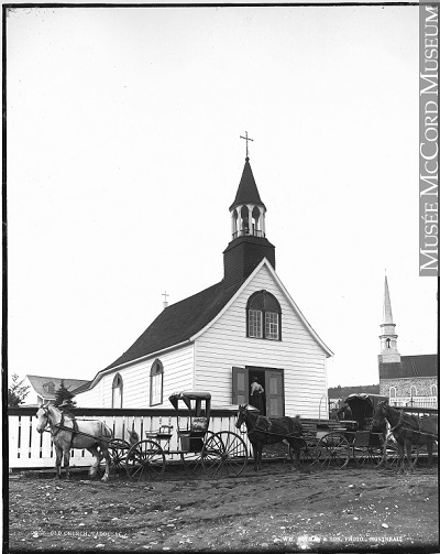
©Musée McCord Museum / Wm. Notman & Son / VIEW-2358 |
The Sainte-Croix-de-Tadoussac Mission Church National Historic Site of Canada
Tadoussac, Québec
The Sainte-Croix-de-Tadoussac mission church occupies a small portion of
the large cemetery of the Sainte-Croix parish council: the church is at
the corner, in the southwest portion of the cemetery, and the current
parish church is to the northeast. The church is painted in the same
colours as the Hotel Tadoussac, a renowned tourist destination. The
church faces Tadoussac Bay, and the south shore is visible beyond the
St. Lawrence. The overall view is spectacular.
The Sainte-Croix-de-Tadoussac mission church and its contents are of
historical significance because:
it is the only extant original place of worship bearing witness to
Jesuit missionary work in remote areas of New France and the conversion
of the Montagnais (Innu) to Christianity;
its features and construction methods make it an exceptional mission
church from the era of New France, as well as the oldest wooden church
in Quebec and in Canada;
constructed during the era when Tadoussac was an active centre of the
fur trade, it speaks to the relationship between the fur trade and the
missionization efforts of the Jesuits, both intimately linked with
Aboriginal peoples;
it is an excellent example of a mission post, where in the mid 19th
century the Oblate Missionaries of Mary Immaculate established
themselves, continuing to serve the religious needs of the indigenous
population.
|

©Parks Canada Agency / Agence Parcs Canada, 2001 |
Trafalgar Lodge National Historic Site of Canada
Montréal, Québec
Trafalgar Lodge National Historic Site of Canada is located on a treed
corner lot in the historic Westmount area of Montréal, Québec. Built in
the mid-19th century, Trafalgar Lodge is a picturesque one-and-a-half
storey brick villa built in the Gothic Revival style. The low-lying
house has a steeply pitched front-sloping gable roof with gables,
dormers and decorative chimney pots.
A rare example of a Gothic Revival villa in Québec, Trafalgar Lodge was
designed by Toronto architect John Howard as a country estate for a
prosperous businessman. The asymmetrical villa, with its red brick and
white trim, has a bold profile made up of prominent gables, dormers and
clustered chimneystacks. The house blends ecclesiastical and secular
Gothic elements to create a unique version of the Gothic Revival style —
the lancet window and rose window are ecclesiastical in design, while
the label mouldings are more appropriate to the secular nature of the
building. The strongly sculptural manner in which these details are
executed makes them quite distinct.
|
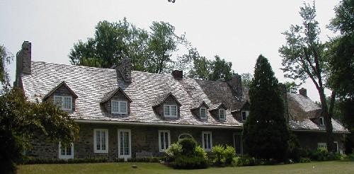
©Parks Canada Agency / Agence Parcs Canada |
Trestler House National Historic Site of Canada
Vaudreuil-Dorion, Québec
Trestler House National Historic Site of Canada is located on a point of
land jutting into a bend of the Ottawa River, in the centre of
Vaudreuil-Dorion, Québec, near the boundary line that once distinguished
these former communities. A fine example of traditional Québec
architecture, it is a one-and-a-half-storey, gable-roofed rubblestone
house that dates from the end of the 18th century.
The heritage value of Trestler House lies in its illustration of the
qualities of the traditional "Maison québécoise", or vernacular Quebec
domestic architecture, from the late 18th and early 19th centuries.
Trestler House was built by John Joseph Trestler in three stages: the
centre portion in 1798, the western wing in 1805, and the eastern wing
in 1806. An ambitious merchant determined to prosper from growing trade
through Montréal, Trestler built this prestigious house on the Ottawa
River, the major river highway to Upper Canada and the West. Trestler's
descendents continued to occupy this house with little change until
1927. In 1984 it became the property of the Trestler Foundation, a
private trust created to ensure its preservation and public
accessibility as a heritage building.
|

©Parks Canada Agency / Agence Parcs Canada

©Parks Canada Agency / Agence Parcs Canada

©Parks Canada Agency / Agence Parcs Canada |
Trois-Rivières Historical Complex National Historic Site of Canada
Trois-Rivières, Québec
Trois-Rivières Historical Complex National Historic Site of Canada is
located in the historic district of Trois-Rivières, in the Mauricie
region of Quebec. The site consists of five buildings: De Gannes House,
the Hertel de la Fresnière House, the Recollet Convent, the Recollet
Church, and the Ursuline Convent. Constructed in the French Regime
style, the one-and-a-half to two-and-a-half storey stone structures are
visually integrated through their steep gable roofs with overhanging
eaves, dormer windows, and multiple chimneys, as well as through their
regularly-spaced multi-light windows, and centred entrance doorways.
The heritage value of the Trois-Rivières Historical Complex resides in
its architecture and design, which represent a unique example of urban
construction in the French Regime style in Canada. Strategically
positioned at the confluence of the St. Maurice and St. Lawrence rivers,
the town of Trois-Rivières was developed under the French Regime as a
transportation hub, first for the fur trade in the 17th century, and
later for the colony's nearby iron works.
During this period of growth, a number of residences and religious
institutions were erected on the town's rue Notre-Dame, today known as
rue des Ursulines. The surviving buildings associated with this site
were all built between 1700 and 1829, in the French Regime style of the
time. The first of these buildings constructed was the Ursuline Convent,
which was constructed in 1700, and underwent various modifications and
additions between 1714 and 1960. The foundation wall is the only remnant
of the 1700 structure, due to fires in 1752 and 1806. The Recollet
Convent was built in 1742, followed by the church in 1754. The monastery
and the church were shared by the Recollets and the Anglicans between
1760 and 1777, and later, between 1779 and 1823, they served as a
hospital, shop, tribunal, prison, shelter and as administrative
buildings. The Anglicans restored the monastery and the church in 1823,
and, in 1830, the church was consecrated to Saint James. The house of
French naval officer Major Georges de Gannes was built in 1756, and he
resided there until 1760. The house's stone construction was later
roughcast. Lastly, Hertel de la Fresnière House was built between 1824
and 1829 by François Lafontaine, who named it after the French officer,
Joseph-François de la Fresnière, the property's original owner (in
1668). The Ursulines took possession of the property from 1899 to 1981
and today it serves as an interpretative centre. Having survived a
devastating fire in 1908 that destroyed much of Trois-Rivières' old
town, these five structures serve as a visual reminder of the urban
landscape of 18th-century French Canada.
|

©Ursulines Monastery, Giovanni Variottinelli, August, 2008. |
Ursuline Monastery National Historic Site of Canada
Québec, Québec
The Ursuline Monastery National Historic Site of Canada is an impressive
complex of 17th-, 18th-, and 19th-century stone buildings located at 18
Donnacona Street on the brow of the hill in Québec City's historic Upper
Town. Its chapel altar is a masterpiece of French Canadian wood
sculpture created in 1730.
The heritage value of the Ursuline Monastery National Historic Site of
Canada resides in the architecture of the complex, particularly those
17th-century vestiges which reflect its historic roots, its
architectural excellence as a pre-1880 building group, and the superb
craftsmanship of its chapel altar. An Ursuline Monastery was initially
constructed on this site in 1641-42 just two years after its Canadian
founder, Marie de l'Incarnation, and her companions arrived in Canada.
The original convent was destroyed by fire in 1650 as was its successor.
This second convent, destroyed in 1686, nevertheless established the
footprint of the present complex which now consists of 15 buildings
constructed in six successive stages between 1687 and 1850. Vestiges of
each of these stages survive. This complex contains high quality work by
several noted Quebec craftsmen including Charles Baillargé, Noel and
Pierre-Noel Levasseur.
|
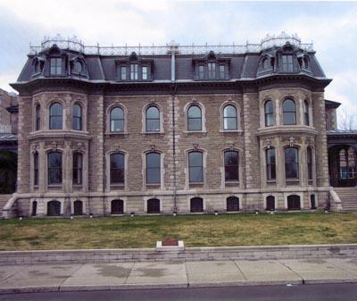
©Parks Canada Agency / Agence Parcs Canada, 2000 |
Van Horne / Shaughnessy House National Historic Site of Canada
Montréal, Québec
The Van Horne / Shaughnessy House National Historic Site of Canada is
located in downtown Montréal, Quebec. This symmetrical composition
consists of two semi-detached houses finished in the Second Empire
style, later merged into one large mansion. Featuring end pavilions,
bays and cast iron detailing cresting at the roofline, this elegant
building is now surrounded on three sides by buildings and gardens of
the Canadian Centre for Architecture.
Designed and built by William T. Thomas in 1874, Van Horne / Shaughnessy
House commemorates a time when Boulevard René-Lévesque (then Dorchester
Street) was lined with large opulent houses surrounded by landscaped
gardens. The mansard roof, two-storey bay windows, symmetrical façades
and stone textured walls speak to the architectural influences of the
time, the Second Empire style, and the Montreal greystone tradition. The
west house was originally built for Duncan McIntyre while the east house
was first occupied by William Van Horne and later T.G. Shaughnessy, all
of whom were associated with the construction and consolidation of the
Canadian Pacific Railway.
Over the years, several changes affecting the interiors have been made.
The historic building, once threatened with demolition in the 1980s, was
rehabilitated and integrated into the new building of the Canadian
Centre for Architecture following the drawings of architect Peter Rose.
The Van Horne / Shaughnessy House now serves as reception rooms and
offices for the Canadian Centre for Architecture museum.
|
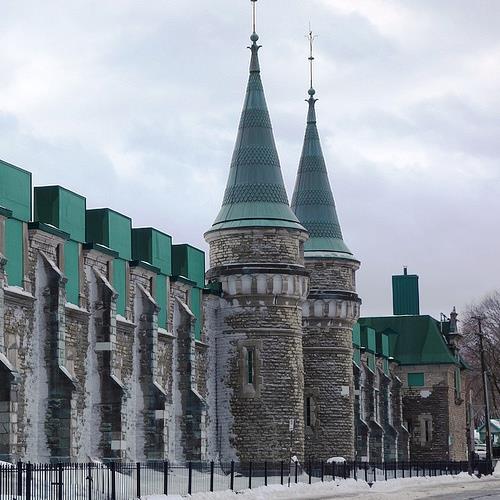
©Parks Canada Agency / Agence Parcs Canada, Andrew Waldron, 2014 |
Voltigeurs de Québec Drill Hall National Historic Site of Canada
Québec, Québec
Manège militaire Voltigeurs de Québec is a large Chateau-style armoury
located at 805 ave. Wilfrid-Laurier in Québec City. Situated just
outside the old city walls at the edge of the Plains of Abraham, the
drill hall overlooks its original parade square with which it is
inextricably linked. The building's fanciful design, with high pitched
roof, stone walls and pinnacled turrets has made it a Canadian
architectural icon.
Manège militaire Voltigeurs de Québec was designated a National Historic
Site in 1986 because it is the precursor of the Chateau Style in Canada.
The heritage value of Manège militaire Voltigeurs de Québec National
Historic Site of Canada resides in its physical manifestation of those
design elements that have come to be considered hallmarks of the
Canadian Chateau style of architecture. The Manège militaire Voltigeurs
de Québec was designed by Quebec architect Eugène-Étienne Taché for
Canada's Department of Public Works and was completed in 1887 in a style
intended to evoke the Renaissance-era chateaux of France. Unique among
Canadian drill halls, it emphasized the French roots of Quebec City. The
drill hall received an addition in 1913.
|

©Ministère des Loisirs
©Ministère du Développement durable, de l'Environnement et des Parcs du Québec, J. Gagnon, 2004 |
Waapushukamikw National Historic Site of Canada
Baie-James, Québec
Waapushukamikw National Historic Site of Canada, located in an area of
gentle countryside along the Témiscamie River in the Québec Mid-North,
is a white quartzite hill that stands out clearly in a relatively flat,
forested landscape. Also known as the Colline Blanche, the hill is
approximately 40 metres high with a width of 400 metres, extending 1200
metres along a northeast/southeast axis. Its three ridges, roughly 100
metres apart, are relatively bare, contributing to its clearly whitish
appeareance. Abutting the main peak is a quarry containing millions of
fragments of Mistassini quartzite, and along the foot of the hill are a
number of natural cavities, the largest of which is the smooth-marble
walled cave, the Antre de Marbre. This area has only been habitable
since 5050 B.C.E.
Located in an area that became inhabitable after the glacial melt, about
7000-6500 years before present, Waapushukamikw is a source of Mistassini
quartzite, a fine-grained and mainly white stone that generally presents
a waxy surface and is translucent in thin sections. In reference to its
white colour and waxy texture, the Cree call this stone Wiinwaapskw,
meaning "animal fat". Mistassini quartzite reacts predictably to blows
from artisans, making it a material of choice for tool makers. While
aboriginal craftsmen could produce most of the stone tools they needed
for their activities from Mistassini quartzite, the lack of animal
resources in the immediate vicinity of the hill did not lend the site to
prolonged occupancy. Therefore, after laying in supplies of quartzite,
archaeological evidence suggests that the craftsmen and their families
preferred to move on to more accomodating, temporary places where the
craftsmen would transform the stone into tools. This enabled families or
groups to make the journey back to their customary place of residence
without transporting large portions of stone.
It is believed that these early stonecutters did not need to dig the
hill to obtain the materials they required. Archaeological evidence has
shown that the stone needed could have been layed into by gathering the
blocks that detached naturally, particularly from the erosion talus of
the main peak, commonly known today as Rogers Quarry. It is possible
that they sometimes took things further, possibly leaving the site with
finished objects. Finished tools, such as scrapers and endscrapers,
found at the bottom of the hill suggest the preparation of handles or
shafts, customary casings for objects such as knives and points.
Interest in Mistassini quartzite manifested very early among various
Aboriginal peoples, and its use quickly spread throughout much of
northeastern North America.
Located at the base of the hill is the Antre de Marbre, the largest cave
at Waapushukamikw. Known as Tchichémanitououitchouapi, or house of the
Great Spirit, to the area's aboriginal peoples at the time of the
European re-discovery in the 18th century, this cave is a place of
spiritual significance and a respected place of memory for the Cree
community of Mistissini. The large, smooth-marble walled Antre de
Marbre, which served as a place for shamanistic rites and rituals, has
an aura that testifies to the religious beliefs of the northeastern
Algonquians in general and the Cree of Mistissini in particular.
|

©Parks Canada Agency / Agence Parcs Canada, Geneviève Charrois, 2008

©Parks Canada Agency / Agence Parcs Canada, Geneviève Charrois, 2008 |
Westmount District National Historic Site of Canada
Montréal, Québec
Westmount District National Historic Site of Canada is situated on the
southwest slope of Mount Royal, mostly northwest of Sherbrooke Street,
and forms part of the City of Westmount. The site is representative of a
prosperous Victorian and post-Victorian suburb in Canada, and is defined
by its architectural and landscape heritage reminiscent of the period
between 1890 and 1930. A local architectural and planning board
regulated development beginning in 1914. Defined by its high-quality
residential buildings, notable public buildings, schools, and places of
worship, the district also features grid-like streets and its network of
landscaped public and private green spaces.
The heritage value of Westmount District lies in its ties to the
development of the social and intellectual life of Montreal's
middle-class English community in the early 20th century. Examples
include the regulated construction of residential and public buildings
designed and built in a wide variety of architectural styles by
prominent Montreal architects and builders; and landscape features, such
as parks and gardens, the Belvedere and the stairs going up the
mountain. The district's visual coherence was retained through the
establishment of a local architectural and planning board which
regulated development in the area beginning in 1914. Overall, Westmount
displays a balanced setting for urban living with large green spaces and
aesthetically pleasing public buildings conducive to the harmonious
development of a sound community life.
|

©Parks Canada Agency / Agence Parcs Canada, N. Clerk, 1999 |
Wilfrid Laurier House National Historic Site of Canada
Victoriaville, Québec
Located in the old municipality of Arthabaska, (now amalgamated with
Victoriaville) Quebec, the Wilfrid Laurier House National Historic Site
of Canada is a two-storey building in the Italianate style. This elegant
red-brick residence, once Prime Minister Sir Wilfrid Laurier's home,
sits on a gracious lot behind a semi-circular driveway framed by mature
maple trees.
The Wilfrid Laurier House was designated a national historic site of
Canada in 1999 because it is directly associated with a national
historic figure, namely, one of the former prime ministers of Canada,
Sir Wilfrid Laurier.
Built between 1876 and 1877 to Laurier's specifications, the building
served as his principal residence for 20 years and illustrates his
success as a lawyer, in the Arthabaska region. This house was Laurier's
principal home until elected prime minister in 1896, after which he
visited regularly and used it as his summer home until his death in
1919. The house was eventually given to the Quebec government and used
as a museum dedicated to the memory of Sir Wilfrid Laurier. After the
building opened as a museum in 1929 some alterations were made to
accommodate the museological functions.
|
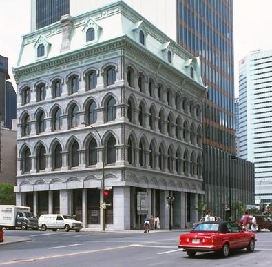
©Parks Canada Agency / Agence Parcs Canada |
Wilson Chambers National Historic Site of Canada
Montréal, Québec
Wilson Chambers National Historic Site of Canada, is located on a corner
lot in downtown Montréal, is a Gothic Revival style commercial building
with Italianate and Second Empire influences. It is distinguished by its
four-and-a-half-storey stone massing, its numerous pointed arch window
openings, smooth expanses of glass, and mansard roof.
Popular in the latter half of the nineteenth century, the High Victorian
phase of the Gothic Revival style arrived in Canada in the years just
prior to Confederation and coincided with a period during which many
prominent religious, civic, and scholastic institutions were
constructed. While numerous churches and institutional buildings were
erected in this style, Gothic Revival commercial buildings were a
rarity.
Designed by architect R.C. Windeyer and built in 1868, Wilson Chambers
is one of the few remaining examples of a commercial building designed
in the Gothic Revivial style. An example from the High Victorian phase
of the Gothic Revival style, its defining features include its strong
vertical lines and use of contrasting stone, as well as its numerous
pointed arch window openings. The building's eclectic design also
integrates features from other architectural styles, such as the
round-headed Italianate-style window openings, the Second Empire-style
mansard roof, and the classical entablature. Wilson Chambers was
extensively renovated in the latter half of the 1990s in a manner that
was sympathetic to its original design.
|

©Parks Canada Agency / Agence Parcs Canada, CIHB/IBHC, 1990 |
Windsor Station (Canadian Pacific) National Historic Site of Canada
Montréal, Québec
Windsor Station is a late 19th-century, stone railway terminal and
Canadian Pacific Railway (CPR) head office built in the Romanesque
Revival style. It is prominently located at the corner of Canada Place
in downtown Montréal.
Windsor Station was designated a national historic site in 1975 because
it is an excellent example of the Romanesque Revival style of
architecture.
Built for the CPR in 1888-89 to designs by American architect Bruce
Price, Windsor Station was one of the earliest major buildings in Canada
to use the Richardsonian Romanesque Revival style. The original portion
by Price set the style for the structure and for the principal additions
made in 1900-06, to designs by Edward Maxwell, and in 1909-14 to designs
by W.S. Painter. The additions are compatible with the original design,
reinforce its Romanesque Revival character and establish bridges between
the Romanesque Revival and the Château Style of later CPR
buildings.
|
©Parks Canada Agency / Agence Parcs Canada, Peter Waddell, 2000 |
Wreck of RMS Empress of Ireland National Historic Site of Canada
Saint Lawrence River, Québec
Wreck of RMS Empress of Ireland National Historic Site of Canada is
located on the floor of the St. Lawrence River near Rimouski, Quebec.
Situated 8.3 kilometres offshore at a depth of 45 metres, the once
opulent vessel rests on its starboard side at a 65-degree angle.
Operated by the Canadian Pacific Railway this large, elegant, steam
powered passenger ship sank in May 1914 with great loss of life.
The Wreck of RMS Empress of Ireland is a relatively intact and rare
example of an ocean liner from the "golden age" of passenger travel in
the North Atlantic, during the early years of the 20th century. In
service, this majestic ocean liner could accommodate 1,580 passengers in
three classes, along with its primary cargo the Royal mail, as it
traveled between Canada and the United Kingdom. Royal Mail Steamer (RMS)
Empress of Ireland and her sister ship the Empress of Britain were the
first passenger liners built specifically for the Canadian Pacific Line,
which provided international passenger transport to the growing flow of
emigrants from Europe to Canada. From May and June of 1906, the two
large Empress ships offered a fast, comfortable weekly service from
Liverpool and became popular ships on this route. Not built to be the
fastest or the largest liner on the North Atlantic, the RMS Empress of
Ireland was still competitive with cruise ships from other countries.
The first class facilities were just a notch below those provided by
ships such as Olympia and Titanic. The Empress's second- and third-class
accommodations suited the needs of the travelling public and combined
affordability, convenience, comfort and speed. The career of the RMS
Empress of Ireland ended in the early morning hours of May 29th 1914
when it collided with the Norwegian collier the SS Storstad. After being
struck on its starboard side by the former icebreaker, the vessel listed
on its side and sank below the surface fourteen minutes later. The
sinking of the RMS Empress of Ireland took the lives of 1,012 of the
1,477 passengers.
|

©Parks Canada Agency / Agence Parcs Canada, M.-A. Bernier, 1997 |
Wreck of the Elizabeth and Mary National Historic Site of Canada
Anse aux Bouleaux, Québec
Wreck of the Elizabeth and Mary National Historic Site of Canada is an
underwater archaeological site located on the seabed of Anse aux
Bouleaux, not far from Baie-Trinité, in the Côte-Nord region of Québec.
It is comprised of a section of the Elizabeth and Mary's hull above and
around which were found more than 4,000 artifacts that sank with the
ship in 1690. These artifacts, witnesses of Sir William Phips' tentative
invasion of Québec in 1690, were taken from the site and are now
preserved by the Centre de conservation du Québec.
The historic value of this site resides in the survival of the ship's
remains found in their initial location. The wreck of the Elizabeth and
Mary is an important discovery for the history of Canada because it is
one of the rare witnesses to the ill-fated expedition led by Sir William
Phips in Québec in 1690.
In 1689, during the war between France and England, New France had
proposed a plan to conquer New York in order to take control of the fur
trade and fishing territories in North America. The various raids
undertaken at the time caused panic among the population of these
colonies who decided to organize an expedition to seize New France. In
August 1690, a fleet of 32 ships left Nantasket, situated at the south
entrance of Boston Bay, to attack Québec. The expedition failed and the
fleet renounced its project of taking the City of Québec. During the
voyage back, the fleet was struck by smallpox and a series of storms.
Four ships and two companies were completely lost at sea.
|
|