|
Park Summaries
Ontario
All text and photos are copyrighted by Parks Canada or the Canadian Register of Historic Places
(except as noted) and were extracted from either the Parks
Canada or Canada's Historic Places
Websites. Parks with a grey background are managed by Parks Canada.

©Parks Canada Agency / Agence Parcs Canada, 1995 |
Aberdeen Pavilion National Historic Site of Canada
Ottawa, Ontario
Successfully combining the practical with the fanciful, the Aberdeen
Pavilion captures the spirit of the fairground. Its voluminous interior
space, well-lit by many windows, is an ideal venue for exhibitions of
all kinds, while its over-the-top exterior of sweeping roof, dome,
corner towers and classical detail embodies the holiday atmosphere of a
fair. The building is located in the midst of Lansdowne Park, Ottawa's
downtown fairgrounds.
Aberdeen Pavilion was designated a national historic site of Canada
because it is the only large-scale exhibition building in Canada
surviving from the 19th century.
This grand exhibition building was erected in 1898 by the Dominion
Bridge Company for the Central Canada Exhibition Association. Designed
by the Ottawa architect, Moses C. Edey, it was named to honour the
incumbent governor general, the Earl of Aberdeen, a staunch supporter of
the agricultural fair movement. Also known as the Cattle Castle, it is
the oldest surviving example of its type in the country, with its
elaborate pressed metal ornamentation, a whimsical mix of classical and
agricultural motifs, the structure evokes both the festive spirit and
serious purpose of the l9th-century fair.
|

©Maya Gavric & Century 21 Professional Group Inc., 2004 |
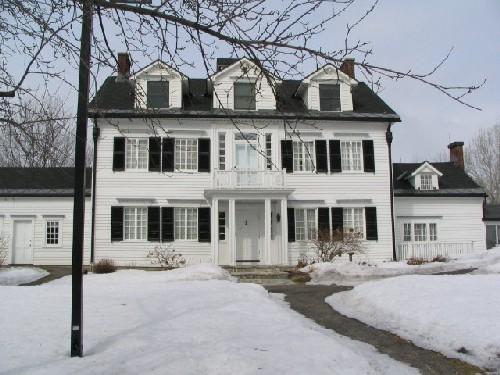
Adelaide Hunter Hoodless Homestead National Historic Site of Canada
Brant County, Ontario
Adelaide Hunter Hoodless Homestead is an early nineteenth-century
one-and-half storey wood-frame farmhouse located in a pastoral setting
in the rural community of St. George Ontario.
Adelaide Hunter Hoodless Homestead was designated a National Historic
Site in 1995 for its concrete linkages with the contributions of
Adelaide Hunter Hoodless, a champion of maternal feminism, who was
instrumental in the founding of the Women's Institute, the Young Women's
Christian Association, the National Council of Women, the Victorian
Order of Nurses, and three faculties of Household Science, and because
the rural situation and lack of amenities found in Hoodless' childhood
home speak eloquently to the hard labour and isolation experienced by
many rural women in the mid 19th century, a situation Hoodless spent her
entire life trying to alleviate.
The heritage value of Adelaide Hunter Hoodless Homestead National
Historic Site lies in its direct association with Adelaide Hunter
Hoodless, particularly in its role in defining and describing the reason
she became a figure of national importance. Its value is expressed by
the relatively isolated setting and in its illustration of a typical
farm house of mid-to-late nineteenth century Ontario. Adelaide Hunter
was born in this house, and lived here until 1881 when she married
successful Hamilton furniture manufacturer John Hoodless. Here, as the
youngest child in a large farming family raised by a widowed mother, she
experienced the hardship and isolation that attracted her to social
activism. That experience, together with the loss of her youngest child
1889, inspired her determination and defined the nature of the causes
she championed.
Adelaide Hunter Hoodless (1857-1910) herself was recognized by the
National Historic Sites and Monuments Board of Canada in 1959.
|

©Parks Canada Agency / Agence Parcs Canada, Smyth Photo, 1991 |
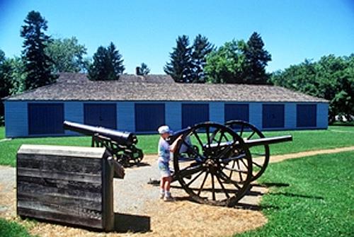
Algoma Central Engine House National Historic Site of Canada
Sault Ste. Marie, Ontario
The Algoma Central Engine House is a large, early-20th-century, brick
engine house with an internal turntable. It is located in the Steelton
Yard in Sault Ste. Marie.
The Algoma Central Engine House was designated a national historic site
in 1992 because it is a remarkably well-preserved example of its type.
Built by the Algoma Central Railway in 1912 to provide maintenance and
overhauls for steam locomotives, the Algoma Central Engine House was the
first of only two engine sheds built to this design in Canada. It
differed from other engine sheds in its massive scale and in its
incorporation of a full-sized turntable, instead of parallel
through-tracks.
The Engine House is almost completely intact, comprising an enclosed
turntable; numerous stalls with pits; and an attached machine shop.
Together with two flanking buildings of comparable size, construction,
age and integrity, it dominates the rail yard.
|

©Parks Canada Agency / Agence Parcs Canada, 1992 |
Algonquin Provincial Park National Historic Site of Canada
Nipissing, Ontario
Algonquin Provincial Park is a provincial park established in 1893. It
is located on the Canadian Shield, northeast of Toronto and northwest of
Ottawa. The terrain is hilly and heavily wooded, with five major rivers
and numerous small lakes within its perimeters.
Algonquin Provincial Park was designated a national historic site in
1992 because of its contributions to park management; its pioneering
development of park interpretation programs; and the role, as an
inspiration to artists such as the Group of Seven, it has played in
giving Canadians a sense of Canada.
The heritage value of this site resides in the cultural landscape,
comprised of a large natural area of forests and water populated with
indigenous flora and fauna, in occasional vacation structures and in its
illustration of park management.
Established in 1893, Algonquin Park was the first provincial park in
Canada. Originally proposed by Alexander Kirkwood of the Ontario
Department of Crown Lands to preserve important headwaters and protect
wildlife and forests, it achieved broader objectives.
Park management techniques developed at Algonquin were applied at
national and provincial parks across Canada. Algonquin acted as a
trying-ground for issues such as: wilderness protection versus
recreation promotion; and forest conservation versus logging activity.
The park reflects its three founding purposes: a forest reservation; a
fish and game preserve; and a health resort and pleasure ground for the
enjoyment of the people of Ontario. Forest management techniques have
included logging regulation; fire prevention and control; and assisted
reforestation. Wildlife management policies have banned, licensed or
otherwise restricted hunting and fishing in the park and have applied
various policies of intervention and conservation to the park's fish and
game. A variety of facilities have been constructed to accommodate human
enjoyment of the park.
Park interpretation was pioneered at Algonquin Park in the 1940s by
biologist Dr. J.R. Dymond of the Royal Ontario Museum, and later applied
at parks across Canada. A park museum, added in 1958, provided
facilities for displaying the flora and fauna of the park and giving
lectures by naturalists.
Algonquin's rugged lakeshores and wooded slopes have attracted
cottagers, tourists, artists and wilderness enthusiasts, fostering
intense affection for the park across the province and the nation.
Accessibility began with a rail line through the park in 1896 and the
consequent development and promotion of recreational facilities. Railway
companies and other private enterprises erected hotels and lodges,
individuals built summer cottages on leased land, and park management
marked, mapped and maintained interior water-routes, portages and
campsites for canoe-trippers and wilderness campers. When roads were
developed across the park, automobile camping and boating facilities
were added. The rugged beauty of Algonquin Park inspired many artists,
including members of the Group of Seven, whose paintings added to the
park's reputation.
|

©Parks Canada Agency / Agence Parcs Canada, J. Cousineau |
Amherstburg First Baptist Church National Historic Site of Canada
Amherstburg, Ontario
Amherstburg First Baptist Church National Historic Site of Canada is
located in a residential street in the town of Amherstburg, in
southwestern Ontario. Set on a small, flat lot this modestly sized
wooden church features a gable roof, pointed arch windows, a gabled
vestibule, and a rear addition. Built in 1848-49, it is typical of
auditory churches built by Black settlers in this period of settlement.
The modest scale is in keeping with surrounding housing stock.
The First Baptist Church was built in 1848-49. From its inception, the
First Baptist Church was associated with the flight from slavery and,
later, the Underground Railroad. It was also the Mother Church of the
Amherstburg Regular Missionary Baptist Association, one of the most
important Black organizations in Canada West, later Ontario. The First
Baptist Church was central to the establishment and development of the
Black Baptist church tradition in Ontario. As the material expression of
the practices and the beliefs of the early Black Baptists who settled in
the region, it made visible what some historians have called "the
invisible institution," in reference to the black church in North
America under slavery.
Amherstburg First Baptist Church was constructed mostly by its Baptist
congregants after a four year fund-raising period. The charismatic
Pastor/Elder Anthony Binga had recognized the need for a purpose built
structure to house his growing congregation. The neighbourhood,
developed in the 1830s and 40s at the same time as the church was
constructed, was a mixed neighbourhood with a significant population of
newly settled Black people. Many were refugees from American slavery
with later arrivals often travelling via the Underground Railway. Built
in what was then the back ranges of Amherstburg the neighbourhood was
further away from the Detroit River. This may have been influenced by
the fear of slave catchers from the United States. The simple massing
and modest scale is typical of the churches built by black settlers and
other Protestant groups. The church was designed so that the entire
congregation could see and hear the preacher. The simple, uncluttered
auditory-hall form of the interior is a feature of many of the churches
established by communities linked to the Underground Railroad in
Canada.
|

©Parks Canada Agency / Agence Parcs Canada |
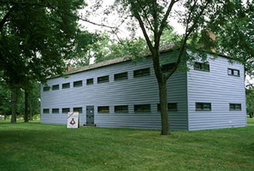
Amherstburg Navy Yard National Historic Site of Canada
Amherstburg, Ontario
Amherstburg Navy Yard National Historic Site of Canada is a long,
rectangular parcel of land overlooking the Detroit River in the town of
Amherstburg, Ontario. This former British navy yard evacuated by the
Royal Navy in 1813 contains no visible remains. Marked by a four-sided
monument featuring four brass Historic Sites and Monuments Board of
Canada plaques the site is now a 4.25 hectare (10.5 acre) municipal park
that features a municipal cenotaph, and several buildings that either
postdate the site or were moved to the site. The park features mature
trees, formal gardens, walkways and metal railings at the edge of the
river bank separating it from the river.
Amherstburg Navy Yard was constructed in 1796 after British forces
vacated Detroit and relocated downstream to the eastern side of the
Detroit River. The yard, used to construct and repair vessels, served as
the hub of the British Naval presence on the Upper Great Lakes. The
yard's facilities included a large storehouse, two blockhouses, a timber
yard with a saw pit, and a wharf. To the north of the naval yard, the
British built Fort Amherstburg, at what is now Fort Malden National
Historic Site of Canada, and to the south, a settlement, which became
known as Amherstburg, sprang up to supply the fort and naval yard. For
almost 20 years, the yard produced vessels ranging from small, open
bateaux, to full-sized, three-masted, ship-rigged men-of-war.
Amherstburg Navy Yard played a significant defensive role during the War
of 1812, as the ships it produced enabled the British to maintain
control of the area.
Following the British defeat at the Battle of Lake Erie in 1813,
Amherstburg was evacuated and both the fort and the navy yard were burnt
prior to the American capture. The Americans later built an installation
named Fort Malden on the ruins of Fort Amherstburg. Although Fort Malden
was returned to the British in July 1815, the area never regained its
pre-war importance as a fort and naval yard. The fort was used briefly
during the rebellions of 1837-38 before its closure in 1858.
|

©Parks Canada Agency / Agence Parcs Canada, HRS, 2000 |
Ann Baillie National Historic Site of Canada
Kingston, Ontario
The Ann Baillie Building is a two-storey, limestone institutional
building with a cruciform footprint and a monumental,
classically-inspired, portico. Built as a nurses' residence in 1903, it
is part of the Kingston General Hospital complex, located close to the
shoreline of Lake Ontario, in the city of Kingston.
The Ann Baillie Building was designated a national historic site in 1997
because it commemorates the contribution of nurses and nursing to
scientific medicine and to women's agency as health care professionals
and because it speaks to the training and professionalism of nurses, to
their social life, to the development of their unique culture, and to
the emergence of leaders in the field of nursing.
The heritage value of this site lies in its associations with the
professionalization of nursing as pursued by women in the early
20th-century and in the physical qualities of the building that
illustrate its use by student nurses. Built in 1903 as the nurses'
residence for the Kingston General Hospital School of Nursing, the Ann
Baillie Building was one of the first purpose-built nurses' residences
in Canada.
Hospital-based apprenticeship schools provided training to student
nurses, who in turn worked at the hospital. Nurses' residences were
required to house these student workers in a safe and chaperoned
environment. The Ann Baillie Building's classically-inspired
architecture is typical of early nurses' residences, whose impressive
architecture and secure living arrangements were intended to attract
respectable, middle-class girls to the profession. Although it no longer
serves as a residence, many vestiges of its use as a nurses' residence
remain. It now houses the Museum of Health Care. It is also designated
as part of the Kingston General Hospital National Historic Site.
|

©Parks Canada Agency / Agence Parcs Canada, 2005 |
Annandale House/Tillsonburg Museum National Historic Site of Canada
Tillsonburg, Ontario
The "pattern book" facade of this eclectic, late Victorian house belies
its quite extraordinary interior. Richly decorated with ceiling and wall
paintings, stained and painted glass windows, decorative metal work and
woodwork, this house is an ambitious essay in the tastes introduced by
the Aesthetic Movement in Canada.
Built in 1881-1882 for local entrepreneur E. D Tillson (considered the
father of Tillsonburg) in southwestern Ontario, the house was intended
as the manor on Tillson's model farm (now redeveloped for suburban
housing) which drew visitors from Canada and abroad. Like the farm, the
house incorporated the latest in technology and design. The Tillson's
support for the 1882 visit by renowned author and aesthete Oscar Wilde
to the Mechanics Institute in the nearby town of Woodstock, proved to be
a decisive influence on the interior decor of the mansion. Wilde
popularized the Aesthetic Movement which encouraged bringing 'art' into
middle-class homes through the use of a full range of media in interior
decor, ideally produced by local craftspeople. The Tillsons hired
Detroit decorator James Walthew, who worked on the house from 1883 to
1887. The exterior, already under construction at the time, closely
conforms to plans for "Brick villa No. 2" in Villas and Cottages: or
Homes for All by William M. Woollett of Albany, New York. A modern
two-storey museum wing was added to the rear of the house in 1985. The
building is now operated as a museum.
|
©Parks Canada Agency / Agence Parcs Canada, J Butterill, 1994 |
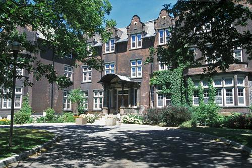
Annesley Hall National Historic Site of Canada
Toronto, Ontario
Annesley Hall is a handsome red-brick student residence on the campus of
the University of Toronto located in downtown Toronto, Ontario. The
building embodies the qualities of the Queen Anne Revival style as it
was expressed in institutional design, in which bold compositions of
steep roofs, prominent gables, richly coloured and textured materials,
and a wide variety of historicist details are used to lend charm and
domestic warmth to large, institutional structures.
Annesley Hall was designated a national historic site because it is a
particularly good example of the Queen Anne Revival style, as expressed
in institutional architecture.
Designed by architect G. M. Miller, and built in 1902-1903, Annesley
Hall was the first purpose-built womens' residence on a Canadian
university campus. The building continues in its original use, having
been renovated in 1988.
|

©Parks Canada Agency / Agence Parcs Canada, Ken Elder, 1998 |
Backhouse Grist Mill National Historic Site of Canada
Norfolk County, Ontario
Located within the Backus Heritage Village, the rural setting and
rushing stream beside the mill speaks to the industry and economic life
of Upper Canada's earliest pioneer communities. Its large, simple
volume, hand-hewn timber frame and surviving machinery are an enduring
reminder of the origins of Canada's agricultural sector.
This rare technological and architectural survivor of early grain
milling in Upper Canada was built by John Backhouse (or Backus) in the
1790s and remained operational until 1957. Typically found in frontier
agricultural communities of the early 19th century, such heavy
timber-framed structures used water power to mill grain. More
contemporary machinery, added in the later 19th and early 20th
centuries, was common in small-scale, commercial establishments in the
countryside. These mills marked the beginning of what became one of
Canada's major industries.
|

©Parks Canada Agency / Agence Parcs Canada, 1992 |
Balmoral Fire Hall National Historic Site of Canada
Toronto, Ontario
Located in downtown Toronto, Ontario, the Balmoral Fire Hall is a small
red brick Queen Anne Revival building.
The Balmoral Avenue Fire Hall was designated a national historic site of
Canada because it is a particularly good example of the Queen Anne
Revival Style, as expressed in institutional architecture.
The Balmoral Fire Hall is the quintessential Queen Anne Revival
institutional building: a clever use of eclectic historical revival
details to articulate a building with a modern function. Built in 1911,
the building designed by the architect Robert McCallum is an imaginative
evocation of early Renaissance Flemish urban design, featuring
polychromatic materials, a sculptural treatment of surfaces, which
enliven a small building with charm and economy.
|
©Parks Canada Agency / Agence Parcs Canada, 2003 |
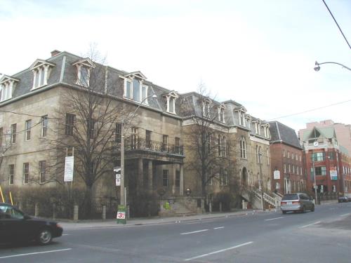
Bank of Upper Canada National Historic Site of Canada
Toronto, Ontario
The Bank of Upper Canada building is an early 19th-century,
two-and-a-half-storey, Neoclassical stone building. It is located on
Adelaide Street in downtown Toronto.
The Bank of Upper Canada Building was designated a national historic
site in 1977. The reasons for designation are: the role played by the
Bank of Upper Canada in the development of Upper Canada and in the rise
of Toronto as the commercial centre of the colony and the design of the
building, reflecting the image of conservative opulence favoured by
financial institutions of the time.
The heritage value of this place resides in its role in Canada's early
banking history as reflected in its restrained classicism and enduring
materials.
A portico designed by architect John G. Howard and added in 1844
contributes to the restrained classicism of the building.
|
©Parks Canada Agency / Agence Parcs Canada, 1981 |
Banting House National Historic Site of Canada
London, Ontario
Banting House is a two-and-a-half-storey, yellow-brick house associated
with Dr. Frederick Banting. Originally constructed in 1900, a modern
wing was added to the rear of the house in the late 20th century.
Banting House is located on a major downtown street in the city of
London. It is now operated as a museum presenting Banting's life and
achievements.
Banting House was designated a national historic site in 1997 because:
it is importantly associated with an event and a person recognized to be
of national significance; it is the only extant structure of its kind
that is associated with Dr. Frederick Banting between 1920 and 1922; and
Banting House is documented and recognized as the site of the defining
moment of the most consequential medical discovery in Canadian history.
The heritage value of this site resides in its association with Dr
Banting as illustrated by the house itself.
Banting purchased the house at 442 Adelaide Street for his home and
medical practice, and moved there in July 1920. Banting used the front
rooms on the main floor as his consulting office and slept in an
upstairs front bedroom, renting the rest of the house to the former
owners. It was here one night in October 1920, that, sleepless from
anxiety over his finances and his part-time lecturing responsibilities
at the university, he conceived the idea that taking an extract from a
dog=s pancreas might be useful in treating diabetes. With the help of
Professor J.J.R. Macleod, Banting eventually found lab facilities and an
assistant (Charles H. Best) at the University of Toronto. There, they
and James B. Collip pursued the research that led to the discovery of
insulin in January 1922. Banting sold the house at 442 Adelaide Street
at the end of 1921.
The house retains its architectural integrity, with the exception of the
modern addition on the east side. It is known internationally as AThe
Birthplace of Insulin@ and has a special significance to those who
suffer from diabetes or do research in the field. It is the only extant
historic structure connected with Banting and the discovery of insulin
during the 1920-22 period.
|
©Parks Canada Agency / Agence Parcs Canada, 1985 |
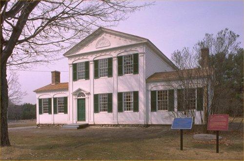
Barnum House National Historic Site of Canada
Grafton, Ontario
Based upon one of the great classical architectural traditions of
Europe, this building demonstrates the adaptability of classicism to a
small scale structure erected in frontier conditions. The symmetrical
composition and vocabulary of classical details, such as the pediment in
the gable end, and the graceful blind arcading that animates the
surface, combine to give this tiny gem of Neoclassical design its charm
and dignity. A modern addition has been appended at the rear.
Built ca. 1820 for Colonel Eliakim Barnum, an American emigrant, this
timber-framed home is recognized as an outstanding example of Neoclassic
domestic architecture as brought to Canada by settlers from New England
familiar with the Federal style of the American northeast. While
retaining a Palladian composition of centre block and wings, the house
expresses the Neoclassic mode in the temple facade of the principal
building, the dominant pediment and the smooth wall surfaces relieved by
blind arcading. The pedimented, pilastered door, the enriched cornices
and the tympanum fan are Neoclassic decorative motifs executed here with
a delicacy and linearity peculiar to wood.
|
©Parks Canada Agency / Agence Parcs Canada |
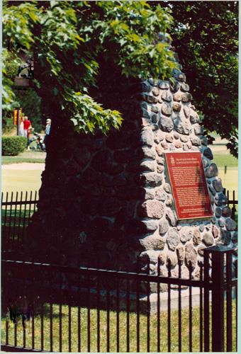
Battle Hill National Historic Site of Canada
Wardsville, Ontario
Site of Battle of the Longwoods, 1814; War of 1812.
Battle Hill National Historic Site of Canada is located on a rolling
landscape in the valley of Battle Hill near Highway 2 (also known as
Longwoods Road) west of Wardsville, Ontario. The site is associated with
the Battle of Longwoods, which occurred on March 4, 1814 on an open
landscape near what is now Battle Hill Creek. Following a short skirmish
between the British Regulars and American forces, the British were
forced to retreat back to Delaware, while the Americans abandoned their
advance and retreated to Detroit. There are no known extant remains of
the battle; however, the site is marked by a plaque and cairn positioned
on a small rise of land and surrounded by an iron fence.
Following the British defeat at Moraviantown on October 5, 1813, the
western section of Upper Canada lay open to American forces, who began a
series of small incursions into the territory. Although pitched battles
were rare, the British military authorities attempted to counteract
these American forays into their territory by establishing posts of
observation, and along with the local militia and their native allies,
they began moving throughout the countryside. In late February 1814, the
American commander at Detroit ordered a detachment to attack one such
British outpost, located at Delaware. The American force, under Captain
Andrew Holmes, encountered a Canadian Ranger Patrol on the way to
Delaware and retreated to a hill, later named Battle Hill, near Twenty
Mile Creek to await the arrival of the British. Once the British
Regulars under Captain James Badsen arrived at Battle Hill, they
immediately attacked the Americans but, due to heavy casualties, were
forced to retreat back to Delaware. The Americans retreated back to
Detroit, thus failing in their attempt to take Delaware.
|

©Parks Canada Agency / Agence Parcs Canada, 1989 |
Battle of Beaver Dams National Historic Site of Canada
Thorold, Ontario
The Battle of Beaver Dams National Historic Site of Canada is a large
open industrial landscape including part of the Welland Canal on the
east side of the City of Thorold, Ontario. Located south of the Niagara
escarpment, it was the site of a decisive British victory during the War
of 1812, between Iroquois and American forces. The site encompasses a
variety of properties including urban residential property in Thorold,
parts of the Welland Canal, a cemetery, and industrial land.
The Battle of Beaver Dams, which occurred on June 24 1813, was a crucial
battle during the War of 1812. Following their defeat at Stoney Creek,
the Americans sent a force under Lieutenant-Colonel Charles G. Boerstler
from Fort George to destroy a British advanced post at Beaver Dams. A
force of about 600 infantry and cavalry left Fort George for
American-controlled Queenston so as not to reveal the true destination
of their mission. At Queenston, Laura Secord, the wife of a wounded
Loyalist, overheard the American plans and journeyed, with an Iroquois
scout, to warn the British of the pending attack. Forewarned, a combined
force of Iroquois from Caughnawaga and the Grand River, led by Captains
Dominique Ducharme and William Kerr, ambushed the American force and
compelled them to surrender to British Lieutenant James Fitzgibbon of
the regular British Army. After their defeat, the Americans left the
British in control of the Niagara area for the remainder of 1813.
|
©Parks Canada Agency / Agence Parcs Canada, 2005 |
Battle of Chippawa National Historic Site of Canada
Niagara Falls, Ontario
The Battle of Chippawa National Historic Site of Canada is located south
of the town of Chippawa, Ontario, on the west side of the Niagara River
Parkway. It is the site of a battle that took place during the War of
1812 as a result of the last major American invasion of Canada in 1814.
There are no visible remains of this battle, and the site was recognized
with a Historic Sites and Monuments Board of Canada cairn and plaque in
1923. The site comprises a wooded northern section, an abandoned
agricultural field, and a southern portion of mixed fields and woods.
The Battle of Chippawa took place on July 5, 1814, as part of the last
major American invasion of Canada of the War of 1812. Under the command
of Jacob Brown, Brigadier-General Winfield Scott left Fort Erie on July
4 with a force of 1300 American troops. They set up camp several hundred
yards away from the Chippawa River, and waited for further
reinforcements. Brown arrived with 2000 more troops around midnight.
On the morning of July 5, Major-General Phineas Riall sent a small
contingent of troops to attack the Americans with sniper fire and to
gain information on their numbers. When the troops returned to General
Riall, they reported to him that the Americans appeared to be
militiamen, not the highly trained regular troops, as they were wearing
grey coats and not uniforms. Acting upon this false assumption, General
Riall attacked with his force of 1400 regulars, 70 cavalrymen, and 300
Aboriginal allies. When he sent his troops through the woods for cover,
he encountered 56 of Brown's regulars who had also been placed in the
woods. A battle ensued and the British were able to push the Americans
back towards their camp.
As both sides prepared for battle and marched on Street's Field, General
Riall realized that the Americans calmly marching towards him from their
own camp were not militiamen, as he had originally thought, but were in
fact highly trained regulars. Faced with skilled troops more numerous
than his own, General Riall was forced to retreat across the Chippawa
River.
|

©Parks Canada Agency / Agence Parcs Canada, 1989 |
Battle of Cook's Mills National Historic Site of Canada
Cook's Mills, Ontario
Site of British victory; War of 1812.
The Battle of Cook's Mills National Historic Site of Canada is a rolling
semi-rural landscape east of the Welland Canal bordering the north bank
of Lyon's Creek in the City of Welland, Ontario. It was the site of an
engagement between British and Canadian troops and American forces
during the War of 1812. There are no known extant remains of the battle;
however, a cairn and plaque erected by the Historic Sites and Monuments
Board of Canada in 1977 marks the south-west corner of the battle site.
The Battle of Cook's Mills was a heavy skirmish between British and
Canadian troops during the War of 1812. After his unsuccessful siege of
Fort Erie, Lieutenant-General Gordon Drummond withdrew north and
concentrated his army along the Chippawa River. In October 1814,
American forces under Major-General George Izard advanced northwards. On
18 October Izard ordered Brigadier General Bissell with a force of about
900 men to march to Cook's Mills, a British outpost, to seize provisions
in the form of wheat intended for British troops. On October 19, at
Cook's Mills, a heavy skirmish took place, involving men of the
Glengarry Light Infantry and the 82nd, 100th and 104th Regiments. Led by
Lieutenant-Colonel Christopher Myers the British and Canadian troops
succeeded in their objective of assessing the American forces so that
Drummond could take appropriate action. Having accomplished their
reconnaissance in force they withdrew in good order. Bissel also
accomplished his mission of destroying the wheat stored at the mills
after which he and his men withdrew to join the main American force.
Shortly afterwards the Americans destroyed Fort Erie and re-crossed the
Niagara River to go into winter quarters.
|
©Parks Canada Agency / Agence Parcs Canada, Dan Pagé, 2008 |
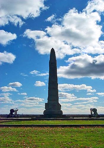
Battle of Crysler's Farm National Historic Site of Canada
Morrisburg, Ontario
Battle of Crysler's Farm National Historic Site of Canada is located in
Crysler's Farm Battlefield Park, near Upper Canada Village, east of
Morrisburg, Ontario. The battle, which took place on November 11, 1813
on farmland belonging to John Crysler, ended the American campaign for
Montréal. While the original battlefield is now underwater, a grassy
knoll made from earth removed from the original site and a commemorative
monument consisting of an obelisk surrounded by a rectangle of
flagstones and two flanking guns on garrison carriages together comprise
the historic site.
The heritage value of the Battle of Crysler's Farm resides in its
historical associations with the armed conflict related to the American
campaign for Montréal in 1813. On November 10, 1813, 8,000 American
troops under the leadership of Major-General James Wilkinson arrived in
the town of Williamsburg, Ontario. Simultaneously, 800 British troops
under Lieutenant-Colonel Joseph Morrison, took position on John
Crysler's farm behind two large ravines. The British had pursued the
Americans down the St. Lawrence River and were under orders to slow the
American advance and prevent a surprise attack. On November 11, the
Americans launched an attack with only half of their troops. Wilkinson
believed that the British were more inexperienced and underestimated
their size as half of the British troops were wearing grey winter coats
over the typical red coat. Without a tactical plan, the Americans
suffered heavy casualties and were driven back to Cornwall. The heavy
losses and quick retreat at the Battle of Crysler's Farm ended the
American campaign for Montréal.
In 1895, the Department of Militia and Defence erected a monument on the
battlefield of Crysler's Farm. Following the First World War in 1921,
the Historic Sites and Monuments Board of Canada (HSMBC) erected a
plaque on the existing monument. With the construction of the St.
Lawrence Seaway, the original location of the battle was flooded and the
monument was relocated to its current location in Crysler's Farm
Battlefield Park in 1955. The monument now rests on a stepped base
supported by a rectangle of flagstones, atop a mound of earth from the
original battlefield.
|

©Archives of Ontario / Archives publiques de l'Ontario, F 1075-13, H 1065, 1925 |
Battle of Lundy's Lane National Historic Site of Canada
Niagara Falls, Ontario
The Battle of Lundy's Lane National Historic Site of Canada is located
in Niagara Falls, Ontario. The battle occurred on July 25, 1814 on what
was a rise of clear farmland surrounded by an orchard and forest,
situated upon Lundy's Lane. The location of the site is now marked by a
plaque located within Drummond Hill Cemetery. Lundy's Lane was the site
of a major battle between the British and American forces in which the
Americans, who were advancing after the Battle of Chippewa, attacked the
British defensive position that they had taken up. Following a bitterly
contested engagement, the Americans withdrew. The six-hour long battle
was one of the bloodiest battles of the War of 1812 and marked the end
of American offensive action in Upper Canada.
In the summer of 1814, American forces crossed the Niagara River at Fort
Erie to invade Upper Canada. Advancing northward along the Niagara
River, they had initial success, defeating a British force at the Battle
of Chippawa. The British under Sir Gordon Drummond regrouped and on the
evening of 25 July, on Lundy's Lane almost within sight of Niagara
Falls, the British regulars and Canadian fencibles and militia were
attacked by the American forces. Throughout the evening the two armies
attacked each other and the battle surged back and forth, especially
around the field guns in what is now the Drummond Hill Cemetery. Both
sides suffered heavy casualties but by midnight the Americans retired
leaving the exhausted British and Canadians holding the field. The
Battle of Lundy's Lane was the bloodiest and bitterest contest of the
War of 1812 and it broke the American thrust in 1814 to take Upper
Canada.
|
©Parks Canada Agency / Agence Parcs Canada |
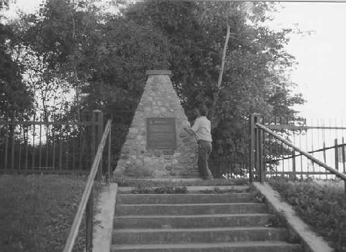
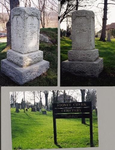
Battle of Stoney Creek National Historic Site of Canada
Hamilton, Ontario
Battle of Stoney Creek National Historic Site of Canada is a memorial
park built on the site of a battlefield from the War of 1812. It is
located at the edge of the Niagara escarpment on the east side of the
town of Stoney Creek, Ontario. The site includes the Gage House, the
Stoney Creek, Smith's Knoll and the Stoney Creek Cemetery Monument, the
Dunnington-Grubb and Stoney Creek Cemetery landscape; archaeological
resources; and objects held in repositories and on the site.
The heritage value of this site resides in its role as a critical battle
in Canadian history as illustrated by the memorial park, its battle
memorials and associated cemetery. The Battle of Stoney Creek, which
occurred on 6 June 1813, was a critical turning point in the War of
1812. During this battle, American forces under Generals Windler and
John Chandler were driven back by the British 8th and 49th Regiments led
by Lieutenant Colonel John Harvey and Major Plenderleath. This
battlefield marks the most advanced position achieved by American forces
on the Niagara frontier.
The importance of Stoney Creek Battlefield was first acknowledged when
the Women's Wentworth County Historical Society opened a commemorative
park on the battlefield site in 1899, and shortly thereafter acquired
the adjacent Gage property, which was also associated with the battle.
Between 1909 and 1913, the County of Wentworth Veteran's Association
erected a monument and in the 1920s, the firm of Dunnington and Grubb
formally landscaped the park's grounds. Management of the park was taken
over by the Niagara Parks Commission in 1963 and today is run by the
City of Hamilton.
|

©Parks Canada Agency / Agence Parcs Canada, André Guindon, 2009 |
Battle of the Windmill National Historic Site of Canada
Prescott, Ontario
American invasion mission foiled, 1838.
Battle of the Windmill National Historic Site of Canada is a fragment of
a battlefield located on Windmill Point overlooking the St. Lawrence
River at Newport, Ontario. The designated area for Battle of the
Windmill battlefield comprises a semi-circular arc with a 400-metre
radius that extends landwards from the windmill, and completed by
another semi-circular arc with a 400-metre radius that encompasses the
section of the river that borders the windmill.
The heritage value of Battle of the Windmill National Historic Site of
Canada resides in the legibility of natural and built features of the
cultural landscape associated with the Battle of the Windmill, and the
undisturbed battle remains it contains.
|
©Parks Canada Agency / Agence Parcs Canada, 1989 |
Battlefield of Fort George National Historic Site of Canada
Niagara-on-the-Lake, Ontario
War of 1812, capture of Fort George by Americans, 1813.
Battlefield of Fort George National Historic Site is located near Fort
George National Historic Site of Canada in Niagara-on-the-Lake, Ontario.
The rolling open landscape near the shore of Lake Ontario at Two Mile
Creek was the site of one of the fiercest and most important battles of
the War of 1812. There are no extant remains of the 1813 battle between
American invading forces and British regulars and Canadian militia;
however, a cairn and plaque erected by the Historic Sites and Monuments
Board of Canada (HSMBC) marks the northeast corner of the battle site.
The heritage value of the Battlefield of Fort George lies in the
landscape, which was witness to a significant battle fought on Canadian
soil. The Battle of Fort George, which took place from May 25 to 27,
1813, constituted some of the fiercest fighting during the War of 1812,
as British and Canadian forces attempted to prevent the American landing
at Two Mile Creek. Victory in the Battle of Fort George permitted the
Americans to gain a toehold on the Niagara Peninsula forcing the British
and Canadian forces to temporarily abandon the peninsula. Despite their
victory, the Americans were checked at the Battle of Stoney Creek, and
were ultimately overcome in Niagara (now Niagara-on-the-Lake), which
they abandoned and burned in December 1813.
|
|
Bead Hill National Historic Site of Canada
Toronto, Ontario
Bead Hill National Historic Site of Canada is located within the
boundaries of Rouge Valley Park in the lower Rouge River Valley in
Scarborough, Ontario. Set on the west side of the Rouge River at its
confluence with Little Rouge Creek, the site sits on a high point of
land just north of, and adjacent to, Highway 2. One of the few remaining
17th-century Seneca sites in Canada, it consists of the historic Seneca
village and an associated burial area, both dating from the late-17th
century, a tree covered midden on the hillside, an Archaic period
campsite dating from roughly 3000 BCE, as well as additional burials
located on the tip of the point of the tableland, east of the village.
The heritage value of Bead Hill lies in its association with the Seneca
and in its integrity as an intact archaeological site. The village and
the associated burial area have been dated to circa 1665-1687 CE, when
they were used by the Seneca, members of the Iroquois Confederacy. Bead
Hill is an example of the sedentary, semi-permanent villages
characteristic of the Seneca, which were generally pallisaded and
located in high, defensible locations some distance from major
waterways.
Bead Hill was first discovered in the late-19th century when a
pallisaded village near the mouth of the Rouge River was reported.
Further archaeological surveys turned up numerous small artifacts such
as glass beads, ceramic smoking pipes and European gunflints. These
findings, along with the location of the village on a defensible
hillside, and the presence of a burial site, are typical of Seneca
villages from the 17th century. The only known surviving "Iroquois du
Nord" village, the site presents enormous potential for acquiring new
knowledge regarding Iroquois culture of the time period. Due to the fact
that Bead Hill has never undergone large-scale excavations, the site is
well preserved and relatively undisturbed.
|

©Parks Canada Agency / Agence Parcs Canada |
Beausoleil Island National Historic Site of Canada
Muskoka District, Ontario
Beausoleil Island National Historic Site of Canada is the largest island
in Georgian Bay Islands National Park of Canada, located at Severn
Sound, southern Ontario. Archaeological finds demonstrate human activity
and settlement on the island from the late Paleo-Indian period to the
present day. Used by the Anishinaabeg as a traditional stopping place,
seasonal campsite and a reserve in the mid-19th century, the island's
cultural landscape features speak to traditional Anishinaabe narratives,
to the Reserve period, and to the post-Reserve period. The island is
named after Louis Beausoleil, a Métis settler whose 1819 homestead stood
at the island's southern tip. The landscape consists of swamp and
Canadian Shield.
As a cultural landscape Beausoleil Island represents aspects of the
relationship that evolved over the centuries between the Anishinaabeg of
the southern Georgian Bay area and their ancestral territories. It is
the setting of many Anishinaabe oral traditions and serves as a physical
link to the resources, routines and ceremonies that reflect their
traditional way of life and anchor their collective memory and culture.
Known to the Anishinaabeg as a "rocky place floating about the mouth of
a river", Beausoleil Island (1089 hectares) has been inhabited by humans
on an irregular basis since the late Paleo-Indian period ca. 10400-9500
BP. Representative of the Anishinaabe presence in southern Ontario it is
among the earliest sites of human occupation in the province. The island
was well-known to Aboriginal peoples as a bad weather refuge and
stopping place and supported two villages during the Reserve period
(1838-1856). Chief John Assance led his people to Beausoleil Island
after having ceded their lands at Coldwater. Assance's band settled on
the island`s leeward side at Cedar Spring. By 1844, there were 14
houses, a barn, one hundred cultivated acres and a cemetery. Assance had
a small Roman Catholic Church constructed, and a schoolhouse was
completed in 1847. YMCA Camp Kitchewa, the second Reserve period village
to the north, comprised at least fifteen dwellings and perhaps a church.
Poor soil and a relatively large population made long term settlement
and attempts at agriculture in the European manner unsuccessful. Some
moved to settle nearby Christian Island as early as 1844. By 1852 most
of Assance's band had followed. The Anishinaabeg who remained on
Beausoleil Island established homesteads, mainly on the southeast of the
island, and lived traditionally by fishing, hunting and
gathering.
|
|
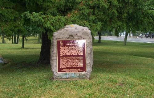
Beechcroft and Lakehurst Gardens National Historic Site of Canada
Roches Point, Ontario
Beechcroft and Lakehurst are two properties at Roches Point, situated on
the southern shore of Lake Simcoe. Large private land holdings, which
serve as a buffer to these properties, have enabled them to survive in
their 19th-century styles. One, Beechcroft, is laid out in the English
landscape style. According to strong local tradition its grounds were
designed by America's first landscape architect, Frederick Law Olmsted.
The garden is further believed to have been so created about 1870 during
the occupancy of A.G.P. Dodge of New York City. The adjoining property,
known as Lakehurst, shows the influence of Olmstedian patterns but is
much more in the horticultural and gardenesque tradition. (from
Journal of Garden History, Vol 1, No. 2)
|

©Parks Canada Agency / Agence Parcs Canada, R. Godspeed, 2000 |
Beechwood Cemetery National Historic Site of Canada
Ottawa, Ontario
Beechwood Cemetery is a large, 19th-century cemetery located in Ottawa.
Established in 1873, the cemetery is comprised of landscaped grounds
with roads, paths, buildings and monuments. It is located on rolling
terrain, bordered by a forest.
Beechwood Cemetery was designated a national historic site in 2000
because it is an exceptional example of 19th-century rural cemetery
design, characterized by a naturalistic, pastoral and picturesque
landscape of many perspectives. Beechwood Cemetery was also designated a
national historic site because: it contains two very good examples of
landscape expressing distinctive cultural traditions - the Chinese
Cemetery designed according to Chinese religious principles, and a
highly visible military cemetery; and it contains a concentration of
mausolea, monuments, and markers of architectural and of historical
interest that illustrate many aspects of the history of Canada, the
Province of Ontario and Ottawa.
Beechwood Cemetery illustrates the type of rural or garden cemetery that
emerged in the United States and Canada in the mid-19th century. It
typifies the rural cemetery in its use of a naturalistic setting to
attract and comfort the living; its creation of a secure space for the
dead; its use of funerary monuments to perpetuate the memory of
individuals of historic importance; and its layout as a park-like space
for public use.
It retains much of its original character in its layout of interlacing,
winding roads and islets of irregular shapes and varying sizes, and
funerary monuments of differing styles and materials, set within a
rolling landscape of trees, shrubs and plants with many picturesque
views.
The cemetery plan was designed and supervised by city engineer Robert
Surtees and laid out by government landscape gardener Alpine Grant. The
cemetery includes 19th-century buildings and structures designed by
Ottawa architect James Mather in consultation with Surtees; a stone
residence constructed in the 1880s using limestone quarried from the
cemetery; a double residence for gardeners and foremen; a former stable
building; and stone entrance gates. Both Surtees and Mather held
executive positions with the cemetery and are buried there.
The Chinese Cemetery consists of graves dating to the 1920s, and a
memorial garden designed and constructed in 1996 by the Chinese
community in keeping with traditional Chinese architectural and
religious traditions. The garden includes a pagoda with a granite altar
and bronze incense burner, and is used by the community to pay respects
to their ancestors.
Beechwood Cemetery is the site of the National Military Cemetery of the
Canadian Forces, purchased by the Department of National Defence in 1944
for interment of veterans of the Canadian Forces (CF). The military
cemetery is prominently located at the centre of Beechwood and is
distinguished by its uniform grave markers and a central military
monument.
Beechwood Cemetery exhibits a range of headstones reflecting different
periods in the development of the cemetery in terms of styles, materials
and symbolism. The cemetery contains the gravesites of many individuals
noted for their contributions on a national, provincial or local level,
as well as interments from earlier cemeteries in the Ottawa area. The
cemetery also includes several stone mausolea, including a Gothic
Revival stone mausoleum designed by W. Ralston and notable for its
attractive proportions, design, stonework and detailing.
|

©Parks Canada Agency / Agence Parcs Canada, James De Jonge, 1997 |
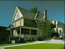
Bell Homestead National Historic Site of Canada
Brantford, Ontario
Bell Homestead National Historic Site of Canada is a suburban property
featuring a typical mid-19th-century rural Ontario house influenced by
the Picturesque aesthetic. One-and-a-half-storeys in height with a
low-pitched gable roof, it features a central door, gable end chimneys,
an attractive wooden front porch, a conservatory, and picturesque
landscaping. Also on the lot are a wooden carriage house and a grouping
of modest structures associated with the operation of the site as a
museum.
The heritage value of the site resides in its historical associations as
illustrated by the setting and the house in its surviving original
design and materials. Here at his parents' home in July 1874, Alexander
Graham Bell conceived the fundamental idea of the telephone and, in
August 1876, carried out the first successful long-distance trials. The
Bell Homestead evokes the formative influence of Bell's father, an
authority on the acoustics of speech, and of his mother who was deaf.
They stimulated their son's lifelong interest in teaching the deaf to
speak, a passion that proved crucial to the discovery of the telephone.
Since the early 20th century, the Bell Homestead has served as a symbol
of this inventor's remarkable achievement. In 1935, because of erosion
of the bluff to the rear, the house and carriage house were moved
forward on the lot and then placed on a new foundation, closer to the
main road. Despite the loss of property over the years, including most
outbuildings and an orchard, the site maintains its semi-rural setting
and quiet environment. The original Bell-era conservatory was
reconstructed in the 1970s, as were the house verandah and
chimneys.
|

©Parks Canada Agency / Agence Parcs Canada, 2009 |
Belle Vue National Historic Site of Canada
Amherstburg, Ontario
Belle Vue National Historic Site of Canada is a two-storey, white
painted, brick house constructed between 1816 and 1819 in the Palladian
style. The house consists of a central rectangular block that is flanked
by two wings, and features a small portico above the main entrance.
Built between 1816 and 1819 for Robert Reynolds, the Deputy Assistant
Commissary General of the garrison at Fort Malden, Belle Vue exhibits
the use of Palladian design in a residential building. The house
consists of a central two-storey rectangular block that features five
bays and a small portico surmounting the main entrance that is supported
by pilasters. Two wings flank the central block creating strong
horizontality and symmetry that is in keeping with the Palladian style.
A long corridor that passes through the interior of the residence joins
both components.
|
©Parks Canada Agency / Agence Parcs Canada, 1990 |
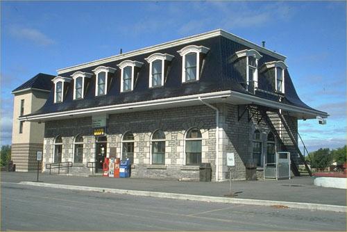
Belleville Railway Station (Grand Trunk) National Historic Site of Canada
Belleville, Ontario
The Belleville Railway Station is a one-and-a-half-storey, stone railway
station, built in the mid-19th century. It is located in the city of
Belleville.
The Belleville Railway Station was designated a national historic site
because it is representative of the larger stations for the Grand Trunk
Railway (GTR) and because it is an enduring monument to early Canadian
railway enterprise.
The Belleville Railway Station is a good example of the larger stations
erected for the newly-formed GTR along the key Toronto to Montreal line
during the mid-19th century. Built in 1855-56 by the noted English
engineering firm of Peto, Brassey, Jackson and Betts, it is a variation
on the standard GTR Second Class Wayside Station design developed by GTR
Chief Architect Francis Thompson. The original one-storey,
Italianate-style structure was altered in the late 19th-century by the
addition of a mansard roof in the Second Empire style.
As a major divisional point on the GTR line between Montreal and
Toronto, the Belleville station was a prominent part of a system which
radically improved overland transportation and had a profound effect on
the economics of the province. The railway was instrumental in the
19th-century growth of the town of Belleville.
|

©Parks Canada Agency / Agence Parcs Canada, B Morin, 1985
©Parks Canada Agency / Agence Parcs Canada, John McQuarrie, 2007 |
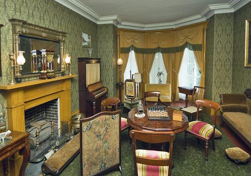
Bellevue House National Historic Site of Canada
Kingston, Ontario, John McQuarrie, 2007
Important Italianate villa 1840's; home of Sir John A. Macdonald, Prime
Minister of Canada (1867-73, 1878-91).
Bellevue House was the home of Canada's first Prime Minister, Sir John
A. Macdonald. It is an Italianate villa situated in its own landscaped
grounds in an early suburb of Kingston, Ontario.
The heritage value of Bellevue House is reflected in the Picturesque
qualities of its design and siting, and the Italianate expression of
this aesthetic, particularly during the 1848-1849 period in which it was
the residence of Sir John A. Macdonald.
|

©Parks Canada Agency / Agence Parcs Canada, B. Morin, 1995 |
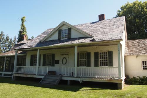
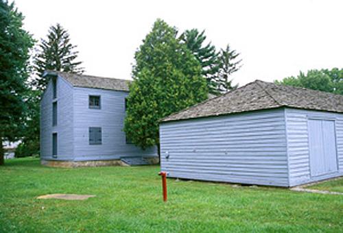
Bethune Memorial House National Historic Site of Canada
Gravenhurst, Ontario
Birthplace of Dr. Norman Bethune, a national hero to the Chinese and
possibly Canada's most prominent international humanitarian.
Bethune Memorial House National Historic Site, the original manse of
Knox Presbyterian Church, is located in the older residential district
of Gravenhurst, Ontario.
The heritage value of this site resides in its associations with Dr.
Norman Bethune and its illustration of his childhood environment. The
Bethune family only lived in this house a short time (1890-1893) before
moving on to a new parish in another small Ontario town. Dr. Norman
Bethune is revered by the Chinese for the time he spent in China serving
on battlefields, training medical personnel, and setting up medical
programs and hospitals. He is considered a role model by Chinese
society.
|
©ERA Architects / Courtesy of Emma Greer |
Bethune-Thompson House / White House National Historic Site of Canada
Williamstown, Ontario
Highly evocative of time and place, the Bethune-Thompson / White House
features the poteaux-sur-sol construction and verandah typical of Quebec
architecture, combined with the symmetry and classical details typical
of late 18th and early 19th century British architectural influences.
Both exterior and interior are in a remarkable state of preservation and
are included in the designation.
Historic construction techniques and classical design are combined in
this early Ontario home. The vertical log south wing may date from the
1780s when Loyalist Peter Ferguson settled on the site. The central part
was built ca. 1805 as a manse for Rev. John Bethune, the first
Presbyterian Minister of Upper Canada and was later the residence of
explorer David Thompson. Beneath the stucco of the main block, the
timber frame has three walls infilled with rubble stone and a fourth
with 'stick and mud'. The five-bay facade, formerly flanked by similar
wings, expresses the British classical tradition.
|
©Parks Canada Agency / Agence Parcs Canada, M. Schwartz, 2006 |
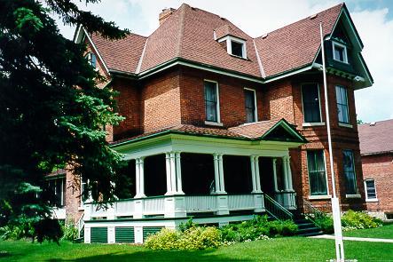
Billings House National Historic Site of Canada
Ottawa, Ontario
The Billings House National Historic Site of Canada, a fine five-bay
two-and-a-half storey wooden house, is one of the earliest in the city
of Ottawa. Its classically inspired design marked Billings House as a
home of some distinction when it served as the nucleus for the Village
of Billings Bridge. Once home of the Billings family, it is now operated
as a house museum.
Billings House, one of Ottawa's oldest homes, was built by Braddish
Billings. Born in Massachusetts in 1783, he was the first settler of
Gloucester Township in 1812, where his homestead formed the nucleus of
Billings Bridge. Billings House draws on the Georgian architecture of
New England and is distinguished by its fine classical detail. The
original house was built between 1828 and 1829 but the east wing, moved
intact from an earlier Billings home, was added in 1831. Subsequently, a
two-storey verandah was removed and the dormers and west wing added,
resulting in a central pavilion with wings.
|
©Parks Canada Agency / Agence Parcs Canada, 1993 |
Billy Bishop Boyhood Home National Historic Site of Canada
Owen Sound, Ontario
Billy Bishop Boyhood Home National Historic Site is a substantial
two-and-half storey brick house located in a residential neighbourhood
of Owen Sound, Ontario. Typical of many middle-class Canadian homes in
late 19th century towns, it is a solid brick home with minimal stylistic
pretensions.
The heritage value of Billy Bishop Boyhood Home National Historic Site
lies in its association with the famous pilot as illustrated by the
house itself and particularly the 1894-1911 period when he lived there.
The value is carried by its modest design, materials, craftsmanship,
layout and site, so typical of small town homes in late 19th century
Canada.
Canada's World War I flying ace Billy Bishop lived in this house from
the time of his birth in 1894 until 1911. The house had been built in
1884 and continued to be occupied by Bishop's extended family until
1987. Since then it has been open to the public as the Billy Bishop
Heritage Museum.
|

©Parks Canada Agency / Agence Parcs Canada, B Morin, 1993. |
Birkbeck Building National Historic Site of Canada
Toronto, Ontario
The Birkbeck Building is a four-storey office building located in
downtown Toronto, Ontario. Distinguished by its classically inspired
architecture, grand design, rich building materials and eclectic
sculptural decoration, this building was intended to create an air of
ordered permanence and prosperity. Its steel frame and fireproof
finishing materials placed it in the vanguard of building technology in
its time.
The Birkbeck Building was designated a national historic site of Canada
because it is a good representative example of a transitional building
which combined historical style with modern technology.
With its rich Edwardian Baroque details, classical composition, steel
frame and fireproofed surfaces, the Birkbeck Building represents a
transitional period of urban commercial design which combined historical
style with modern technology. Built in 1908 for The Canadian Birkbeck
Investment and Savings Company, this four-storey office building is
typical of many small financial instutions prevalent in central business
districts of Canadian cities before World War I. Designed by George W.
Gouinlock, the Birkbeck Building was restored by the Ontario Heritage
Foundation in 1987 for use as its offices.
|

©Parks Canada Agency / Agence Parcs Canada, 2005

©Parks Canada Agency / Agence Parcs Canada |
Bois Blanc Island Lighthouse and Blockhouse National Historic Site of Canada
Bois Blanc Island, Ontario
Wooden blockhouse part of the defences of Fort Malden, 1839; point of
attack by Canadian rebels and their American sympathizers; January
1838.
Bois Blanc Island Lighthouse and Blockhouse National Historic Site of
Canada is located on Bois Blanc Island in the Detroit River, near
Amherstburg, Ontario. The site consists of a single square blockhouse of
wooden construction and a limestone imperial-style light tower, dating
from the 1830s. Both buildings are located at the southern end of Bois
Blanc Island.
Bois Blanc Island was first recommended as a strategic defensive point
by Lieutenant Colonel Gother Mann while the British were preparing
replacement posts for those lost to the Americans during the American
Revolution. In 1837, the Government of Upper Canada authorized the
construction of a lighthouse on the southern tip of the island to
facilitate maritime navigation in the Detroit River. After the outbreak
of the Rebellions of 1837, militia volunteers occupied Bois Blanc Island
to defend it from Canadian rebels and their American sympathizers. On
January 8, 1838, Canadian rebels and their American allies seized the
schooner Anne and sailed down the Detroit River to Bois Blanc Island.
Fearing that movement toward Bois Blanc was a diversion for an assault
on Amherstburg, the militia hastily withdrew from the island. The rebel
force landed on the southern end of the island and set up camp near the
lighthouse. On January 9, they sailed the Anne past Amherstburg, but ran
aground south of the town and the militia captured the party on board.
The rebels that remained behind quickly retreated from the island.
Following the raid, the British rebuilt Fort Malden, now a National
Historic Site of Canada and Lieutenant Colonel Richard Airey suggested
the creation of further defensive positions on Bois Blanc Island, for
fear of rebel resurgences. Three blockhouses were built in 1839, and
were occupied by British troops until 1858, after which the land was
rented out to private citizens.
|
©Parks Canada Agency / Agence Parcs Canada |
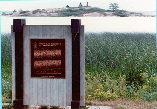
Bridge Island / Chimney Island National Historic Site of Canada
Front of Yonge, Ontario
Bridge Island / Chimney Island National Historic Site of Canada is
located on Chimney Island in the St. Lawrence River, about 20 kilometres
upriver from Brockville, Ontario. This island was the site of a
fortified British garrison during the War of 1812, which protected the
supply line to Lower Canada and provided a meeting point for British
ships. In 1980, the Historic Sites and Monuments Board of Canada erected
a plaque on the island to commemorate the site.
During the War of 1812, the St. Lawrence River was the lifeline of Upper
Canada along which virtually all military and civilian supplies were
transported from Montreal to Kingston. Fear that the Americans might
attempt to block the passage of material prompted the fortification of
Bridge Island / Chimney Island as a shelter for the "supply bateaux" and
a base for British gunboats. A blockhouse was completed early in 1814
and a circular battery with an 18-pounder constructed. These defence
works were maintained by a detachment of the 57th Regiment and
artillerymen during 1814, but fell into disrepair soon after the
war.
|

©Parks Canada Agency / Agence Parcs Canada |
Bruce Peninsula National Park of Canada
Headquarters: Tobermory, Ontario
Landscapes including the northern end of Niagara Escarpment.
In the heart of a World Biosphere Reserve, the 'Bruce' is place of
global significance. Thousands of visitors come each year to experience
the massive, rugged cliffs of the park, inhabited by thousand year old
cedar trees, overhanging the crystal clear waters of Georgian Bay. The
park is comprised of an incredible array of habitats from rare limestone
barrens (i.e. Alvars) to dense forests and clean lakes.
|

©Parks Canada Agency / Agence Parcs Canada, 2005 |
Burlington Heights National Historic Site of Canada
Hamilton, Ontario
Burlington Heights National Historic Site of Canada is located on an
isthmus, 2.5 kilometres long and rising some 30 metres above lake level,
separating Cootes Paradise from the harbour in Hamilton, Ontario.
Crossed by railway lines, major highways and a canal, the site currently
features a number of parks, a cemetery and botanical gardens.
Forced out of Fort George after the American forces landed at the mouth
of the Niagara River, the British, under General John Vincent, retreated
to Burlington Heights. Rising 30 metres above the lake and straddling
roads from Niagara, Amherstburg, and those leading to York, the Heights
were a natural strongpoint for the British to regroup. It was from here
that General Vincent organized the successful night attack on June 5-6
1813, led by Lieutenant-Colonel John Harvey, on the pursuing American
forces encamped at Stoney Creek. Following the American retreat back to
Fort George, General Vincent fortified the Heights with two lines of
earthworks across the peninsula, gun batteries, blockhouses, barracks
and storehouses. A strongpoint on the road to the east, Burlington
Heights became a major supply depot for the forces in the Niagara
peninsula; and at times, ensured safe anchorage for the Lake Ontario
fleet. In December 1813, the Heights were once again used as the
assembly point for another campaign against the Americans, in which the
British recaptured Fort George and captured Fort Niagara. Although the
military continued to view the site as defensible following the end of
the War of 1812, the buildings were allowed to deteriorate, and today
the site is occupied by various attractions, including the Dundurn
Castle National Historic Site of Canada and part of the Royal Botanical
Gardens National Historic Site of Canada.
|
©Parks Canada Agency / Agence Parcs Canada, B. Morin, 1993
©Parks Canada Agency / Agence Parcs Canada, B. Morin, 1993
©Parks Canada Agency / Agence Parcs Canada, B. Morin, 1993 |
Butler's Barracks National Historic Site of Canada
Niagara-on-the-Lake, Ontario
Complex represents 150 years of military history.
Butler's Barracks is a historic military complex comprised of five
wooden buildings located at the edge of the Commons behind the Fort
George National Historic Site of Canada in Niagara-on-the-Lake.
The heritage value of Butler's Barracks lies in the form, fabric and
physical inter-relationships of the buildings, structures and remains
associated with 19th and 20th-century military barracking and troop
training. Built by the British after the War of 1812, it was occupied as
a military camp until the 1960s.
|

©Heritage Conservation Program / Programme de Conservation du Patrimoniaux, J. Latremouille, 2002 |
Buxton Settlement National Historic Site of Canada
Chatham-Kent, Ontario
The Buxton Settlement National Historic Site of Canada is a cultural
landscape of some 4,680 hectares. It is a primarily agricultural
landscape, comprised of flat, worked fields defined by deep drainage
ditches and a grid of intersecting roads. Homesteads are scattered
throughout the settlement area including its two hamlets, South and
North Buxton, which also contain important religious, educational and
cultural institutions associated with the settlement's founding by
Underground Railroad refugees.
The heritage value of this site resides in the site's illustration of a
successful Underground Railroad refugee block settlement through the
survival of land-use patterns and associated built resources.
Established as the Elgin Settlement at Buxton, Ontario, the Buxton
Settlement survives today as a distinct cultural landscape, one that
continues to function as a community while preserving tangible survivals
from its historic past. It was founded in 1849 by Irish Presbyterian
Minister, Reverend William King and 15 former American slaves who, with
other Underground Railroad (UGRR) refugees and abolitionists, purchased
a 4,680 hectare tract of land as a joint stock company. Settlers cleared
the land and established farms on 50-acre (202,342 square metre) plots
which they purchased over time. By 1859, the settlement reached its peak
population of over 1,000 residents served by three integrated schools,
two temperance hotels, a general store, a post office, a sawmill, a
brickyard, a grist mill and a pearlash factory. In 1873, its objectives
achieved, the company was disbanded but the community survived.
|

©Parks Canada Agency / Agence Parcs Canada, D. Dodd, 2008 |
Canadian Car & Foundry National Historic Site of Canada
Thunder Bay, Ontario
Canadian Car & Foundry National Historic Site of Canada is located in
the southwestern part of the city of Thunder Bay, Ontario. Set within
the Bombardier Transportation facility, the site is bordered by Montreal
Street to the south; Mountdale Avenue to the east; Neebing Avenue to the
west; and the CN railway tracks to the north. The site consists of the
existing elements from the Second World War period, including a low-rise
two-storey steel-frame metal-clad structure that is divided into
Building 1, comprised of Production Bays A, B, and C; Buildings 2, 6 and
8; Building 7 to the south and Building 3 to the north.
The Canadian Car & Foundry was created in 1909 following the merger of
the Rhodes Curry Company of Amherst, the Canadian Car Company of Turcot
and the Dominion Car and Foundry of Montréal. With a qualified and
enthusiastic production team, the foundry quickly established an
exceptional track record. In 1938, the company was hired to supply the
British Royal Air Force and the Royal Canadian Air Force with Hawker
Hurricanes, which played a pivotal role in winning the Battle of
Britain. The company became the largest aircraft manufacturer during the
Second World War, producing more than 2,300 fighters. In 1942, it was
contracted to produce SB2C Curtiss Helldivers, which were used by the
United States Navy during the War in the Pacific.
As male enlistment increased during the war, the Canadian Car & Foundry
hired and trained a greater number of female employees. Representing the
wartime contributions of women who left traditional 'female' occupations
to work in the public sphere, the female workers in the factory took on
welding, precision drilling, riveting, sub-assembly of instruments and
inspection. These technical contributions and changes in labour trends
were guided in part by the aeronautical engineer Elizabeth Muriel
Gregory 'Elsie' MacGill, a person of national historic significance, who
oversaw the company's first original design for the Hawker Hurricane.
The period saw women gain valuable skills and confidence, earn financial
independence, and helped to demonstrate that women could do
non-traditional jobs.
After the war, the demand for aircraft dropped exponentially. The
Canadian Car & Foundry eventually found a niche in the manufacturing of
large transportation equipment, including logging equipment, buses and
highway trailers. In 1955, it began producing subway cars for customers
around the world, which it continues to do under the current ownership
of Bombardier Transportation of Montréal.
|
©Parks Canada Agency / Agence Parcs Canada, 2005 |
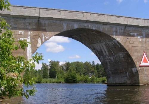
Canal Lake Concrete Arch Bridge National Historic Site of Canada
Bolsover, Ontario
The Canal Lake Concrete Arch Bridge National Historic Site of Canada
which spans the Trent-Severn Waterway near the settlement of Bolsover,
Ontario, is a sturdy concrete bridge comprised of a single arch braced
by abutments on either shore. The appearance of the arch, which forms an
almost complete semi-circle over the waterway, was enhanced by markings
on the concrete surface, which simulate the voussoir stones of masonry
arches and the coursed stonework of stone masonry bridge abutments. It
is one of several remarkable engineering works associated with this
navigational waterway.
The heritage value of this site resides in its design and early use of
reinforced concrete as illustrated by the surviving original structure.
Designed as a plain concrete structure, several significant
modifications made to the bridge's plan shortly before construction
drove the canal engineers to add reinforcing to the concrete structure.
However, the engineers failed to take full advantage of the design
properties of a reinforced concrete arch and as a result, the arch ring
and abutments remained much heavier than necessary. Although the bridge
was the first to use reinforced concrete in Canada, in its configuration
and mass, its design closely resembles earlier arch bridges in plain
concrete, and consequently, approximate the appearance of the
traditional stone masonry arch bridge. After its use on the Canal Lake
Concrete Arch Bridge, reinforced concrete became the primary building
material of other major canal structures along the Trent-Severn Waterway
National Historic Site of Canada, including the Rosedale Lock (1908) and
the Bobcaygeon Dam (1909). Thereafter, reinforced concrete totally
superseded the earlier employment of plain concrete.
|
©Parks Canada Agency / Agence Parcs Canada, 2005 |
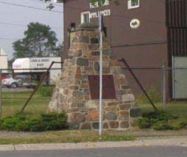
Carrying Place of the Bay of Quinte National Historic Site of Canada
Carrying Place, Ontario
Site of 1787 treaty between British and Mississauga.
Carrying Place of the Bay of Quinte National Historic Site of Canada is
located on the isthmus at the west end of the Bay of Quinte on Lake
Ontario. The site, at the intersection of the Trenton and Carrying Place
roads, marks the location where Sir John Johnson and the Chiefs of the
Mississauga negotiated a treaty in 1787. The site is comprised of a
small plot of land owned by Parks Canada Agency containing a solitary
Historic Sites and Monuments Board of Canada cairn and plaque.
In the 1780s, Loyalist settlements along the St. Lawrence River and in
the Niagara region were separated by Mississauga lands. While the
British Crown possessed much of the lands from Toronto to Lake Simcoe,
they wished to join the St. Lawrence and Niagara settlements. As a
result, the Governor General, Lord Dorchester, sent the Superintendent
of Indian Affairs, Sir John Johnson, to negotiate a treaty with the
Chiefs of the Mississauga at Carrying Place, an isthmus separating the
Bay of Quinte from Lake Ontario. The treaty was signed in 1787 and
purchase of the land was completed in 1788.
|
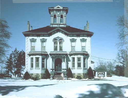
©Wilmot Township, 1985 |
Castle Kilbride National Historic Site of Canada
Baden, Ontario
Castle Kilbride is a two-storey, Italianate villa set on a knoll at the
edge of the town of Baden in southwest Ontario. Built in 1877-8, the
house is noted for its elaborate mural paintings executed in the
Renaissance Revival style of the late 19th century. The villa is set on
a 1.2-hectare lot which features a Victorian-style garden, a circular
drive and a row of mature trees around its perimeter. A rear extension
was added in the mid-1990s and houses municipal offices.
Castle Kilbride is an excellent example of a late 19th-century Victorian
house in the Italianate style, set in a Picturesque landscape. Built in
1877-78 by successful linseed oil businessman James Livingston, it
features elaborate wall murals created with linseed oil based paint
decorating all the principal rooms of the house. The paintings are
outstanding examples of late 19th-century, domestic, painted mural
decoration because of their high level of execution, their fine
decorative quality, their cohesive integration with the architecture of
the house, and their generally good condition. The classical style of
the painting illustrates the mid-19th-century attempt to re-establish
the lost art of mural painting in the Renaissance tradition. The house
shows evidence of skilled craftsmanship in every aspect of design and
construction.
|
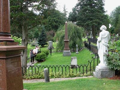
©Parks Canada Agency / Agence Parcs Canada, Rhona Goodspeed, 2009 |
Cataraqui Cemetery National Historic Site of Canada
Kingston, Ontario
The Cataraqui Cemetery National Historic Site of Canada is located in
the greater area of Kingston, Ontario. Designed by Frederick Cornell and
established as a non-denominational cemetery in 1850, the park-like
Cataraqui Cemetery now covers approximately 40 hectares and is a
medium-sized rural garden cemetery laid out according to Picturesque
design principles. It features a naturalistic, treed landscape, winding
paths and many funerary monuments of varying types, styles set within a
rolling topography.
The heritage value of the Cataraqui Cemetery lies in its design and
physical features. Cataraqui Cemetery belongs within the tradition of
rural cemeteries that developed during the 19th century and found
expression in many parts of Canada from the late 1840s to the 1870s.
Cataraqui is an early and very good expression of the rural cemetery in
its use of a naturalistic setting to attract and comfort the living, its
creation of a secure space for the dead, its use of funerary monuments
to perpetuate the memory of the deceased, and its layout as a park-like
space for public use with a variety of species of trees and shrubs.
Cataraqui Cemetery has retained nearly all of its characteristic
features as they were originally set out, including its many Picturesque
views within the grounds. It is also noteworthy for its attractive
examples of late 19th century decorative statuary placed throughout the
grounds. Established three miles out of Kingston, the cemetery is now
located within the boundaries of Kingston.
|
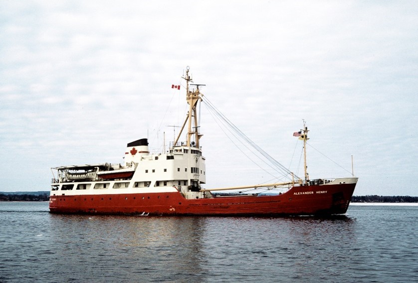
©Parks Canada Agency / Agence Parcs Canada, Roger LeLièvre |
CCGS Alexander Henry Historic District National Historic Site of Canada
Thunder Bay, Ontario
The former Canadian Coast Guard Ship (CCGS) Alexander Henry is a retired
light icebreaker, buoy tender, and navigational aid ship that served on
the Great Lakes from 1959 to 1985. As the main Canadian icebreaker
committed to Lake Superior, and the first government-owned icebreaker
there, Alexander Henry provided exemplary service to marine navigation,
breaking ice to extend the shipping season at the Lakehead. The ship's
critical duties included supplying lighthouses and escorting lighthouse
keepers, maintaining buoys, and performing life-saving search and rescue
and other important missions. The vessel represents the commitment of
the Government of Canada to marine navigation in a period of expanding
shipping and trade.
Designed by the Montréal naval architectural firm German & Milne, and
built by the Port Arthur Shipbuilding Company, the ship was launched on
18 July 1958. The vessel was one of more than ten icebreakers ordered as
part of a government shipbuilding program prompted by a post-war
expansion of shipping and trade alongside concerns for a Canadian
presence in the Arctic. Originally constructed for the Department of
Transport's Marine Services fleet, the ship was one of 49 large vessels
incorporated into the Canadian Coast Guard upon that agency's inception
in 1962 and repainted the service's iconic red and white. Bronze
commemorative plaque with golden text Historic Sites and Monuments Board
of Canada commemorative plaque for CCGS Alexander Henry National
Historic Site
Alexander Henry is part of a long history of government support for
marine navigation and is an excellent representative of this activity on
the Great Lakes. The Coast Guard was organized to address the increasing
complexities of tasks associated with safe navigation. The ship was
responsible for the safe passage of huge volumes of shipping enabled by
the construction of canals and locks. Infrastructure development
culminated in the St. Lawrence Seaway in 1959, which allowed full-sized
ocean bulk carriers to travel the Upper St. Lawrence River and beyond,
to all five of the Great Lakes. One of the vessel's roles was to extend
the shipping season as long as possible, breaking channels in the ice
during the freeze-up in early winter and around break-up in the spring.
Major bulk cargoes shipped on Lake Superior included grain, coal, iron
ore, and pulpwood. The region became a major component of the Canadian
economy. The ship also maintained navigational aids, bringing lighthouse
keepers and supplies to the various light stations, and maintaining
buoys during the shipping season. The vessel could be called to perform
search and rescue missions whenever marine disaster struck. It also
performed missions to support environmental response, scientific
research, and hydrography. While the vast majority of Alexander Henry's
work was on Lake Superior, in the 1980s the ship sailed to the
Newfoundland Region, where it helped tend navigational aids.
The vessel was retired in July 1985, after which the former CCGS
Alexander Henry became a museum ship. It was first exhibited at the
Marine Museum of the Great Lakes at Kingston, where it was well
maintained for more than three decades. The ship was purchased by the
Lakehead Transportation Museum Society in 2017 and now hosts summer
visitors at the Transportation Museum of Thunder Bay. The vessel is one
of the best surviving examples of the government's icebreaker
construction program of the late 1950s, designed to meet Canada's
responsibilities off its coasts and on inland waters.
|

©Parks Canada Agency / Agence Parcs Canada, M. Trepanier, 2002 |
Central Chambers National Historic Site of Canada
Ottawa, Ontario
Central Chambers National Historic Site of Canada is a splendid, 6
storey building, designed for commercial premises on the ground floor,
and combined commercial and office premises above. The first two storeys
form an arcuated base for three storeys of bay windows, culminating in a
storey of Palladian windows set within decorative pediments. The
building is faced with red brick, decorative tile, and metal framing for
the many window openings.
Central Chambers was designated a national historic site of Canada
because it is a particularly good example of the Queen Anne Revival
Style, as expressed in commercial architecture.
The heritage value of the site resides in its splendid architectural
design, in which the principles of the Queen Anne Revival style have
been applied to commercial purposes and in the physical properties of
the structure that illustrate that design. The building was constructed
in 1890-93 to the designs of Ottawa architect J.J. Browne. It has always
enjoyed a high profile location and is an important contributing element
in the Confederation Square National Historic Site of Canada.
|

©Parks Canada Agency / Agence Parcs Canada, 1995

©Parks Canada Agency / Agence Parcs Canada, 1995

©Parks Canada Agency / Agence Parcs Canada |
Central Experimental Farm National Historic Site of Canada
Ottawa, Ontario
The Central Experimental Farm National Historic Site of Canada, located
in urban Ottawa, Ontario, is comprised of various structures and
buildings embedded within a large rural landscape. Flanked by broad
expanses of farmland, its central area consists of the administrative
core, housed in a variety of eclectic and picturesque structures, and
encompasses an arboretum, specimen plantings, and intricate ornamental
gardens.
Eager to introduce profitable new agricultural methods and products, the
federal government created the Central Experimental Farm in 1886. The
Department of Agriculture selected a rectangular parcel of land, over
400 hectares in area, approximately 3 kilometres from Parliament Hill.
Located on a desirable site, due to its variety of soil types and access
to land, water, and rail transport, the farm would serve both Ontario
and Québec. As the city of Ottawa grew, the Farm was gradually absorbed
into the urban environment and is now situated well within the city
limits.
The plan of the Farm is based on three clearly defined zones: a central
core of administrative, scientific, and functional farm buildings and
spaces; the experimental fields, plots, and shelterbelts; and the
arboretum, ornamental gardens and experimental hedges. The Farm's
Picturesque landscape is the result of a movement promulgated by a
18th-century English aesthetic theorists and practitioners who sought to
bring landscape design closer to an idealized nature. One convention of
this movement was the adoption of certain standard features of the
British country estate, including large stretches of lawn and fields,
use of water, masses of trees and shrubbery, and winding pathways. These
features, designed to enhance nature's inherent beauty by emphasizing
its irregularity, variety, and intricacy in form, colour, and texture,
integrate harmoniously with the administrative, scientific, and
functional farm buildings. The Picturesque qualities of the Farm are a
significant aspect of the 19th-century philosophy of agriculture.
This philosophy also recommended the use of chemistry and genetics to
make farm life more productive and appealing. Its proponents sought to
develop better farming methods by applying a new scientific methodology
to farming. Since its establishment, the Central Experimental Farm has
contributed substantially to the development of Canadian agriculture
through scientific research, experimentation, and practical
verification. The Farm has addressed issues such as human and animal
health, the importation of plants and livestock, the identification and
control of imported insect pests, and soil fertility. It also
contributed to the expansion of agriculture in western Canada through
the development of hardy strains of wheat, and in eastern Canada through
research on forages and grasses. The Farm soon became the headquarters
of a national system of experimental farms, as its central location and
administration served to address a range of national agricultural
issues.
|
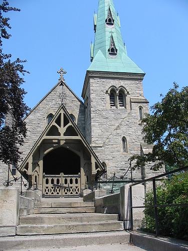
©Chapel of St. James-the-Less, Alan Brown, July 2006 |
Chapel of St. James-the-Less National Historic Site of Canada
Toronto, Ontario
The Chapel of St. James-the-Less is a mid-19th-century funeral chapel
built of stone in the High Victorian Gothic Revival style. The chapel is
picturesquely set atop a small landscaped knoll, just inside the main
gates of St. James Cemetery in downtown Toronto.
The Chapel of St. James-the-Less was designated a national historic site
in 1990 because this small funeral chapel is a splendid example of High
Victorian Gothic design.
Designed by prominent Toronto architects Cumberland and Storm, St.
James-the-Less exemplifies the small chapels built in the High Victorian
Gothic Revival style. It maintains the liturgically correct interior,
steep roof and prominent tower of earlier Gothic Revival designs, but
presents its component parts in a manner that is both dramatic and
harmonious. The chapel is enhanced by its elevated site and the
picturesque setting of St. James Cemetery, laid out by John G. Howard in
1842.
|

©Parks Canada Agency / Agence Parcs Canada |
Château Laurier National Historic Site of Canada
Ottawa, Ontario
The Château Laurier National Historic Site of Canada is an
early-20th-century hotel located across from the Former Union Railway
station in downtown Ottawa, Ontario. It sits atop the banks of the
Ottawa River, overlooking both the river and the Rideau Canal. This
picturesque hotel, constructed in the Château style is a commanding
presence in Confederation Square, a national historic site of Canada
encompassing some of the most recognizable historic buildings in the
downtown core of the capital.
The Château Laurier, built between 1908 and 1912, was the first in a
series of hotels constructed by the Grand Trunk Pacific Railway Company
(GTPR) to encourage tourists to travel its transcontinental routes. From
Québec to Victoria, these Château-style hotels can be found near the
railway stations in their urban environment, often in a dramatic
location. The Château-style vocabulary used by the railway hotels
evolved as a distinctly Canadian architectural type, and came to
symbolize fine hotel accommodation. When the Château style began to
evolve into a distinctly 'national' style of architecture, the physical
proximity of the Château Laurier to the seat of the federal government
led the hotel to serve as a model for the style. The constant
reinforcement of this architectural image across the country provided a
powerful visual expression of the bond that links these cities and
regions of diverse cultural and geographic characters into a national
unity.
The Montréal architectural firm Ross and MacFarlane designed the Château
Laurier, and based their plans on designs created by New York's Bradford
Lee Gilbert. The pale Indiana limestone walls of the Château Laurier
harmonized with the nearby Grand Trunk railway station, and the steep
roof, turrets, and gothic details of the structure ideally suited the
character and climate of Canada. From 1916 to as late as the 1950s, the
federal government insisted that all federal architecture in Ottawa
conform in some way to this style. This is demonstrated in buildings
such as the Confederation Building and the roof structure of the Supreme
Court Building.
|

©Parks Canada Agency / Agence Parcs Canada, 2003 |
Chiefswood National Historic Site of Canada
Six Nations of the Grand River First Nation, Ontario
Chiefswood is a small gem of an Italianate villa set in a picturesque
treed landscape on the banks of the Grand River in the heart of the Six
Nations Grand River Territory, in Ontario. Its location is key to its
historic meaning as the home of the Johnson family, especially poet E.
Pauline Johnson.
Chiefswood National Historic Site of Canada was designated because it
speaks to the Johnson family's role as intermediaries between Aboriginal
and non-Aboriginal cultures.
Built between 1853 and 1856 for Six Nations Chief George H.M. Johnson
(1816 - 1884), Chiefswood was the birthplace of poet Emily Pauline
Johnson and the Johnson family home until George Johnson's death in
1884. Johnson was prominent socially and politically, serving as
official government interpreter, thus bridging both the British colonial
and First Nations worlds. He built his home on farmland he purchased
along the Grand River, close to the Anglican mission church near
Tuscarora (Middleport). While not the only mansion built by First
Nations families during the nineteenth century, Chiefswood is the only
one of such a grand scale and architectural sophistication known to have
survived.
|

©Parks Canada Agency / Agence Parcs Canada, 1995 |
Christ Church, Her Majesty's Chapel Royal of the Mohawk National Historic Site of Canada
Deseronto, Ontario
Christ Church, Her Majesty's Chapel Royal of the Mohawk National
Historic Site of Canada is centrally located on a rise of land
overlooking the Bay of Quinte, in Tyendinaga, Ontario. Surrounded by a
cemetery and trees, this handsome small-scale Gothic Revival style
building, features stained-glass windows and a short spire. A low gable
roof and a square bell tower sit atop exterior walls made of local
limestone. The windows are made of wood panels or stained glass with
pointed neo-gothic arches.
The heritage value of this site resides in its historical associations
as illustrated by physical properties of the church and particular
historical artifacts it houses. The American Revolution, in which
certain Mohawk groups had fought on the British side, left the Mohawk
people dispossessed of their lands, in what is now New York State.
Mohawks loyal to the British Crown had come to Tyendinaga in the Bay of
Quinte to settle land promised to them by the British for their loyalty
and allegiance.
The church, replacing an earlier log structure, was designed by John
Howard, and was funded by the Mohawk people. The church's prominent
location on a rise of land overlooking the Bay of Quinte, chosen by the
community itself, symbolizes its power for the Mohawk. It was designated
a Royal Chapel in 1906, meaning it is set aside for the use of the
reigning monarch. Although the spire and most of the interior were
destroyed in a 1906 fire, the stone walls survived, and the remainder of
the church was faithfully reconstructed by the Mohawk. It continues to
house artefacts which symbolize both Mohawk history and the alliance
between the Mohawk peoples and the British Crown.
|

©Parks Canada Agency / Agence Parcs Canada, 1978 |
Claverleigh National Historic Site of Canada
Creemore, Ontario
Claverleigh is a Gothic Revival-style villa set in extensive park-like
grounds in an isolated rural setting 3.2 kilometres (2 miles) west of
the Village of Creemore, Ontario.
Claverleigh was designated a national historic site in 1990 as a very
fine representative example of a Gothic Revival-style villa.
The heritage value of this site resides in its physical expression of
the Gothic Revival-style villa in Canada.
The house was built in 1871 by William Forster as a parish rectory, to
plans by his brother, British architect Richard Forster. The Gothic
Revival style was considered suitably ecclesiastical in character for
the style of a small rectory.
|
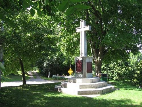
©Parks Canada Agency / Agence Parcs Canada, 2005 |
Cliff Site National Historic Site of Canada
Port Dover, Ontario
Cliff Site National Historic Site of Canada, located on Brant Hill in
Port Dover, Ontario, overlooks Highway 6, along the north shore of Lake
Erie. The site is marked by a large memorial cross. A cross on a
pedestal resting on octogonal steps, this monument bears a Historic
Sites and Monuments Board of Canada plaque, as well as a secondary
plaque, commemorating a 1670 cross raising of which there are no extant
remains.
On 6 July 1669, French missionaries François Dollier de Casson and René
Bréhent de Galinée departed from Montréal as part of an expedition into
the interior led by Robert Cavalier de La Salle. Part of an original
party of twenty-two Europeans and Algonkian interpreters, Dollier and
Galinée split from the party shortly after travelling through
present-day Hamilton. Dollier and Galinée were accompanied by seven men
and three canoes and, in late October 1669, they set up a winter camp at
the present day community of Port Dover. Having chosen the site for its
aesthetic appeal and abundant food sources, Dollier and Galinée declared
this area territory of France in the name of King Louis XIV. On 23 March
1670, three days prior to the group's departure, a large cross was
erected with the arms of France, thereby marking an important episode in
the development of the Canadian nation.
|

©Parks Canada Agency / Agence Parcs Canada, 2001 |
Cobalt Mining District National Historic Site of Canada
Cobalt, Ontario
The Cobalt Mining District National Historic Site of Canada consists of
portions of the Town of Cobalt and a part of the Township of Coleman in
the District of Timiskaming, which contain landscape features, mines and
buildings associated with early 20th-century silver mining and urban
settlement.
|

©Parks Canada Agency / Agence Parcs Canada, Meryl Oliver, 2005

©Parks Canada Agency / Agence Parcs Canada, Ian Doull, 1987 |
Confederation Square District National Historic Site of Canada
Ottawa, Ontario
Located in the heart of the nation's capital, Confederation Square
National Historic Site of Canada is best known to Canadians as the site
of the National War Memorial with the Tomb of the Unknown Soldier. The
square opens at the northern terminus of Elgin Street, immediately
southeast of Parliament Hill, and is a planned urban space where
commercial, ceremonial, and institutional spheres of the city converge.
Developed during the early twentieth century from an existing commercial
district, the square is built around a permanent bridge over the Rideau
Canal, and is framed by a group of buildings including the Central
Chambers, the Scottish-Ontario Chambers, the Central Post Office, the
Langevin Block, the East Block of the Parliament Buildings, the Château
Laurier, the Union Station (Grand Trunk), and the National Arts Centre.
The heritage value of this place resides in its role as a national
ceremonial site and in its physical manifestation of a City
Beautiful-inspired public space as illustrated by its location in the
heart of Ottawa. It also resides in its eclectic grouping of buildings
of various ages, functions and styles. This grouping includes a number
of individually designated national historic sites of Canada, including
the National Arts Centre (1964-1969), the Château Laurier (1909-1912),
the Langevin Block (1883-1912), the Central Chambers (1890), and the
East Block portion of the Parliament Buildings (1859-1865).
Additionally, the square is built over a portion of another national
historic site, the Rideau Canal. Since 1939, when the present National
War Memorial was unveiled, the square has become a focus of annual
Remembrance Day commemorations, as the nation honours its war
dead.
|
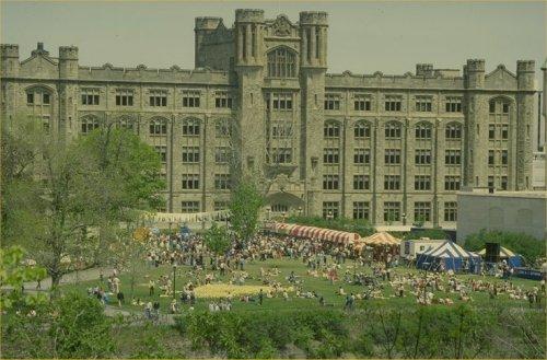
©Parks Canada Agency / Agence Parcs Canada, 1993 |
Connaught Building National Historic Site of Canada
Ottawa, Ontario
The Connaught Building is a large, multi-storey Tudor Gothic-style
departmental building located in central Ottawa facing Major's Hill
Park, Parliament Hill and the Chateau Laurier Hotel.
The Connaught Building was designated a national historic site in 1990
because it is a tangible expression of Sir Wilfrid Laurier's commitment
to the enhancement of architecture in the National Capital.
The heritage value of this site resides in its architectural style,
design, materials and location. As Prime Minister, Sir Wilfrid Laurier
aimed to transform Ottawa into a more handsome national capital and
supported a federal building program led by David Ewart, Chief Architect
of the Department of Public Works (1897-1914). Under Ewart's direction,
a modified Tudor Gothic style, compatible with the buildings on
Parliament Hill and thought appropriate for a capital associated with
the British Empire, was used to build a federal identity in Canada's
capital. The Connaught Building is among Ewart's finest achievements in
uniting Tudor Gothic styling with Beaux-Arts principles. It is also the
last of a group of major federal buildings designed by Ewart for the
capital before World War One. It originally served as the new Ottawa
Customs Examining Warehouse and offices for the Department of Customs
and Internal Revenue. It was named in honour of HRH The Duke of
Connaught, who served as Canada's Governor General between 1911 and
1916.
|
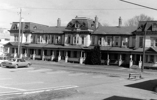
©Peterborough Architectural Conservation Advisory Committee, 1989 |
Cox Terrace National Historic Site of Canada
Peterborough, Ontario
Cox Terrace is a late 19th-century, brick terrace built in the Second
Empire style. Located in downtown Peterborough, it consists of seven,
two and three-storey residential units. The building is currently a
commercial property.
Cox Terrace was designated a national historic site because it is a fine
example of a residential terrace built in the Second Empire style.
Cox Terrace represents a unique adaptation of the Second Empire style to
the residential terrace. Its elaborate design, rarely seen in row
housing, imitated the pavilion massing of larger public and
institutional buildings.
Cox Terrace was built for George A. Cox, a wealthy and influential
businessman and Canadian senator. Cox has been designated by the
Historic Sites and Monuments Board of Canada (HSMBC) as a person of
national significance.
|
|
Cummins Pre-contact Site National Historic Site of Canada
Thunder Bay, Ontario
Cummins Pre-contact Site National Historic Site of Canada is located on
the outskirts of Thunder Bay, Ontario, north of Lake Superior. Set on a
treed landscape, the fenced-in site includes Cummins Pond and Minong
beach ridge, which was once the shoreline of glacial Lake Minong. The
site is part of a complex regional pattern of Paleo-Indian sites,
collectively known as the Lakehead Complex, that is associated with
taconic lithic assemblages, Gunflint formation outcrops, and proglacial
lake strandlines. Tactonite debitage and stone tools lie scattered along
the strandline and the surrounding area.
Cummins Pre-contact Site, as part of the Lakehead Complex, is one of the
most significant and representative examples of Plano cultural
occupations, which existed during the late stages of the Paleo-Indian
period (7000 B.C.E. — 3000 B.C.E). The Lakehead Complex developed
according to the availability of raw lithic materials in the area,
specifically from the Gunflint Formation that was rich in taconite, a
flint-like pre-cambrian rock rich in iron and silica that was used by
the Plano to make tools. Like most sites in the Lakehead Complex,
Cummins Pre-Contact Site was developed because it was located near water
supplies, it was along caribou migration routes and it provided access
to fish, small game, and waterfowl. The site is at the core area of
archaeological intensity, directly on the taconite, and served as a
major quarry, workshop and habitation area in the Lakehead Complex.
While surrounding portions of the site suffer ongoing disturbances as a
result of gravel extraction, urban expansion, recreational vehicle
traffic and road construction, the 7.3 hectares owned by the Province of
Ontario remain intact.
|

©Parks Canada Agency / Agence Parcs Canada |
Darlingside National Historic Site of Canada
Leeds and the Thousand Islands, Ontario
Darlingside is a mid-19th century, wood depot located on the banks of
the St. Lawrence River just east of the Ivy Lea Bridge, midway between
Kingston and Brockville. Darlingside consists of a 2.8-hectare riverside
lot with a small, one-and-a-half storey store, a frame house, a barn,
and a boathouse. The buildings are located on a small, narrow ledge
alongside the riverbank, in an otherwise steeply sloping and wooded
terrain.
Darlingside was designated a national historic site in 1992 because it
is a rare, relatively intact, surviving example of a wood depot on the
upper St. Lawrence River.
The heritage value of the place lies in the collection of modest,
vernacular, purpose-built structures strategically sited on a riverside
lot on the St. Lawrence River.
|
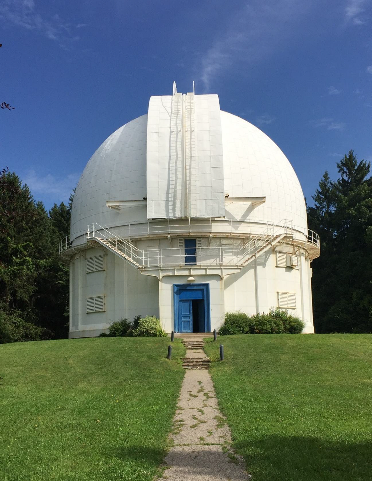
©Parks Canada Agency / Agence Parcs Canada, Jennifer Cousineau, 2018 |
David Dunlap Observatory National Historic Site of Canada
Richmond Hill, Ontario
When it opened in 1935 in what was then an isolated setting 20 kilometres north
of Toronto in Richmond Hill, Ontario, the David Dunlap Observatory (DDO)
featured the world's second-largest telescope and was central to establishing
academic astronomy in Canada. The long-term project of C.A. Chant, "the father
of Canadian astronomy," the Observatory was home to generations of astronomers
at the University of Toronto, combining a mandate of teaching, research, and
public accessibility. Through his research at the DDO, astronomer Thomas Bolton
achieved a major astronomical breakthrough when his research confirmed the
existence of black holes in 1971. The DDO was financed by Jessie Donalda Dunlap,
who named it in memory of her late husband. It comprises two principal
buildings: the Great Telescope Dome, a fine and well-preserved example of early
to mid-20th century observatory design in Canada which successfully combines
Modern and Neo-Classical elements, and the elegant Beaux-Arts Administration
Building, designed by the architecture firm of Mathers & Haldenby, and in
keeping with other designs for buildings for the University of Toronto.
As an educational centre, the DDO immediately strengthened the discipline of
astronomy in Canada. While the federal government had funded two observatories —
the Dominion Observatory in Ottawa and the Dominion Astrophysical Observatory in
Victoria — the lack of university facilities meant that there were still no
opportunities for Canadian students to receive practical astronomical training
during their education. As a result, the University of Toronto was the first
Canadian school to offer graduate degrees in astronomy, with the first doctorate
awarded in 1953.
The research conducted at the DDO has informed hundreds of publications, but one
stands out as the most significant of these. In the summer of 1971, postdoctoral
researcher Thomas Bolton found evidence of a black hole in the middle of the
Milky Way. This was a major astronomical development as a black hole had never
been identified and his original article confirming its existence is an
important contribution to astronomy.
The DDO's most striking visual feature is the Great Telescope Dome, often simply
called "the observatory." It is a massive domed structure, the primary function
of which is to form a protective envelope for the 74 inch reflecting telescope
it houses. It is painted white and comprises a set of raised, retractable
shutters for astronomical viewing, characteristic of astronomical architecture
throughout the 20th century. Located northeast of the observatory and reached
via a paved processional pathway is the Administration Building. This stately
structure is a restrained Beaux-Arts composition. Echoing the architecture of
the Dome, the Administration Building features three symmetrically-disposed
domed turrets, each of which once housed a functioning telescope (one of which
still does). These smaller domes made the Administration Building a second
location at the site for astronomical research and a place where students could
be trained without having to compete with research astronomers for time in the
larger dome.
|

©Parks Canada Agency / Agence Parcs Canada, 2000 |
Diefenbunker / Central Emergency Government Headquarters National Historic Site of Canada
Ottawa, Ontario
Diefenbunker National Historic Site of Canada is a large, underground
bunker located at Carp, Ontario, just south of the nation's capital.
Located securely just below the peak of a natural ridge, only its metal
entrance way tunnel and butler hut, associated antenna farm and
perimeter fence are visible on the surface. The Diefenbunker itself is a
fortified concrete structure extending four storeys below ground: its
air intake and exhaust elements, escape hatches, deep wells and sewage
lagoons are disguised in the man-made contours of the surrounding
landscape. It is now open to the public as a Cold War museum.
The heritage value of the Diefenbunker National Historic Site of Canada
lies in the comprehensive physical evidence it presents confirming
Canada's determination to survive and function as a nation during a
nuclear attack as illustrated by its location, disguised setting,
defensible design, and the heavily fortified construction. The
Diefenbunker was Canada's Central Emergency Government Headquarters
during the Cold War. Designed 1957-59, it was built by the Government of
Canada in 1959-61 to shelter key political and military personnel in the
event of a nuclear attack. It functioned as the hub of a communications
network and civil defence system from 1961-1994. The facility originally
had two parts - a transmitter building located at Richardson, 45 km
south of Carp, and the main or receiver building situated at Carp. The
National Historic Site consists of only the Carp facility which is owned
today by the Municipality of West Carleton and managed as a tourism
site.
|
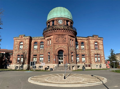
©Parks Canada Agency / Agence Parcs Canada, Mikaela Gallinger, 2022 |
Dominion Observatory Complex National Historic Site of Canada
Ottawa, Ontario
The Dominion Observatory Complex, constructed between 1902 and 1954, is
located within another national historic site, Ottawa's Central
Experimental Farm cultural landscape, on the traditional unceded
territory of the Algonquin Anishinaabe people. It is a complex of
distinctive buildings whose architecture conveys the federal
government's forward-looking vision, at the turn of the century, to
establish national scientific institutions in the capital. This
outstanding collection of surviving early 20th-century scientific
buildings and landscape elements supported research across the country.
Together, the functions, interrelationship, and placement of these
structures within the landscape were essential to the success of decades
of research at the site. From 1905 to 1970, the Dominion Observatory
Complex served as a major centre for Canadian scientific research in the
field of practical astronomy in the areas of surveying, time service,
and geophysics. The Prime Meridian for Canada, situated on the site, was
determined by astronomical research and supported national official time
and the survey program. Geophysical research contributed to
seismological and gravitational studies. Further, the Dominion
Observatory Complex was a site of scientific collaboration between
international researchers.
Canada's westward expansion in the late 19th century highlighted the
need for accurate surveying which was dependent on precise astronomical
measurements; an exercise generally undertaken without permission or
involvement of the Indigenous Peoples who have occupied those lands
since time immemorial. The federal government initially established a
national observatory in 1890 in a small building on the present-day site
of the Supreme Court. In 1901, a new observatory site was selected in
the northeastern section of the Central Experimental Farm. Far enough
from the city to avoid light pollution, on a height of land suitable for
astronomy, and close to a fault line for seismological research, the
site could accommodate future expansion. The original master clock
installed in the base of this new observatory would be close enough to
provide government buildings with accurate national timekeeping. Most of
the early buildings on the site were designed by the Chief Architect's
office of the Department of Public Works including the Dominion
Observatory (1905), Observatory House (1909), South Azimuth Building
(1912), and Photo Equatorial Building (1914). Other surviving buildings
such as the Geophysical Data Centre (1908), Seismology Building (1913),
Machine and Carpentry Shop (1917), Electrical Station (pre-1928), and
Geophysical Building (1954) were constructed to serve the evolving needs
of the scientific research conducted on site. Not visible are a series
of connecting tunnels and underground vaults constructed for
seismological research. Despite the loss of some structures, including
the North Azimuth Building, the complex has remained remarkably
intact.
In addition to its role as a research centre, the site served as a place
for outreach and education as researchers shared their passion for
astronomy with the public through meetings of the Royal Astronomical
Society, public lectures, guided tours, and Saturday evening stargazing
events. Throughout its history, the research and experiments undertaken
at the Dominion Observatory Complex were influential in the advancement
of Canadian scientific excellence.
|

©J.V. Wright and J.E. Anderson, "The Donaldson Site," National Museum of Canada Bulletin 184, 1963 |
Donaldson Site National Historic Site of Canada
Chippewa Hill, Ontario
Donaldson Site National Historic Site of Canada is located at the first
major rapids upstream from Lake Huron on the northern band of the
Saugeen River near Chippawa Hill, Ontario. Covering approximately 1.2
hectares, this archaeological site is comprised of three river terraces
that contain the remains of a macroband settlement occupied
intermittently for over 1,000 years by the Saugeen People. The site was
the subject of several archaeological investigations that revealed
numerous artefacts, including two house structures, various pits,
deposits, depressions and assorted cultural goods.
Donaldson Site is the largest and best-documented known site of the
Saugeen culture from the Middle Woodland Period (c. 200 BC - 900 AD).
Occupied by a small macroband during the spring and summer months, the
settlement served primarily as a harvesting station that exploited the
abundant fish resources of the Saugeen River. Numerous cultural
materials associated with these native inhabitants have been discovered
through various archaeological excavations, including the remains of two
residential structures, two separate burial grounds, and several hearths
that lie on the middle and upper terraces. Large midden deposits, pits
containing floral and faunal evidence and a large assemblage of
artefacts, including ceramics, stone, metal and bone implements, provide
rare insight into Saugeen Complex habitation and mortuary
practices.
|
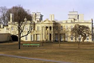
©Parks Canada Agency / Agence Parcs Canada, J. Butterill, 1995 |
Dundurn Castle National Historic Site of Canada
Hamilton, Ontario
Dundurn Castle National Historic Site of Canada is an early-19th-century
estate in Hamilton, Ontario. Located on Burlington Heights, between
Hamilton Harbour and the low-lying land known as Cootes Paradise,
Dundurn Castle's associated buildings and structures are set in a
picturesque, park-like estate of 13 hectares overlooking Burlington Bay.
The main residence, a large building in the Italianate style, is
surrounded by subsidiary buildings constructed during the 19th century.
These include a dovecot, a two-storey pavilion for cockfighting (the
Cockpit), a gardener's cottage, a gatehouse (Battery Lodge), and a
stable (MacInnes Stable). The site also features 19th-century entrance
gates (Rolph Gates) and a 20th-century pavilion (Park Pavilion).
In terms of exterior design, plan and landscape setting, Dundurn
represents the most comprehensive statement of the Picturesque values of
Canadian architecture. Its heritage value lies in the picturesque
qualities of the landscape and buildings and in their association with
Sir Alan Napier MacNab, prominent politician and businessman, for whom
it was built between 1834 and 1835. Developed over the course of the
19th century, Dundurn Castle remains a complete surviving example of a
19th-century picturesque estate in Canada. The estate integrates an
Italianate style main house, a series of Gothic Revival and classically
styled outbuildings, natural landscape features, remnants of 1812
military earthworks and 18th-century farm buildings, to create a
composition that embodies the principles of picturesque design.
The Dundurn estate, originally the property of Richard Beasley who
erected a two-storey brick residence on the site in 1800, was purchased
by John Solomon Cartwright of Kingston in 1832. The following year
Cartwright sold the property to MacNab, who began construction of his
'castle' in 1834. When completed in 1835 it surpassed in scale,
lavishness and sophistication of design anything previously known to the
young colony. Designed by Hamilton architect Robert Wetherell, the main
house is an eclectic blend of Classical and Italianate motifs, set in a
sweeping landscape with panoramic views of the adjacent bay. MacNab and
resident master gardener William Reid continued to develop the landscape
over their lifetimes, often enlisting the aid of professional landscape
and building architects. The classical portico was added in 1855 to
designs by Hamilton architect Frederick Rastrick. Subsequent owners
added other elements, such as the stone stable. The estate retains its
formal gardens, informal park-like areas, and natural undisturbed slopes
and ravines, evoking the desired picturesque effects of variety,
suspense, surprise, irregular outline and contrast.
|

©Parks Canada Agency / Agence Parcs Canada, 1993 |
Earnscliffe National Historic Site of Canada
Ottawa, Ontario
Earnscliffe National Historic Site of Canada is the former home of
Canada's first Prime Minister, Sir John A. Macdonald. Picturesquely
sited on a cliff at the edge of the Ottawa River, this 19th-century
villa, built of local stone, is set within landscaped grounds and faces
Sussex Drive on Ottawa's ceremonial route. The charming Gothic Revival
house is now the residence of the British High Commissioner in Canada.
The heritage value of this site resides in its historical associations
with Sir John A. Macdonald as illustrated by the physical elements of
the property surviving from the time of his occupancy. The house had
been built in 1855-57 by John MacKinnon and rented by Sir John A.
Macdonald in 1870-71 and in 1882, until he bought it in 1883. He lived
here until his death in 1891. For many of those years Macdonald was
Prime Minister of the Dominion of Canada. Earnscliffe was subsequently
occupied by a succession of private owners until it was acquired by the
government of the United Kingdom in 1930. Since that date, it has served
as the residence of its High Commissioner in Canada.
|

©Eaton's of Canada Ltd. / Eaton Canada ltée., c. 1930 |
Eaton's 7th Floor Auditorium and Round Room National Historic Site of Canada
Toronto, Ontario
Eaton's 7th Floor Auditorium and Round Room National Historic Site of
Canada comprises a former restaurant (Round Room), large foyer (crush
space) and auditorium recognized as a tour de force of Art Deco design.
These spaces are located in the former Eaton's College Street store in
downtown Toronto. Recently restored, these rooms are now a private
events venue within the rehabilitated College Street building. The
entire building, designed by Canadian architects Ross and Macdonald with
Sproatt and Rolph as associates, has been officially recognized by the
Municipality of Toronto under the Ontario Heritage Act.
The series of Art Deco-style rooms, designed by French architect Jacques
Carlu, muralist Natacha Carlu, and architect René Cera within the
Eaton's College Street department store, was built in 1930, opened in
1931 and sealed off by 1970 until they were restored in 2000 - 2003.
These rooms, which had hosted significant cultural events of the day and
were a favourite gathering place for Toronto's middle class, are now
available for private rentals.
|
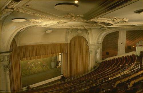
©Parks Canada Agency / Agence Parcs Canada |
Elgin and Winter Garden Theatres National Historic Site of Canada
Toronto, Ontario
The Elgin and Winter Garden Theatres National Historic Site of Canada is
a rare stacked theatre building in downtown Toronto. Built in the early
twentieth century for vaudeville performances, its relatively sober
exterior with its two-storey, masonry façade belies the sumptuous
interiors with the elegant Elgin Theatre at ground level and the magical
Winter Garden Theatre above.
The heritage value of the Elgin and Winter Garden Theatres National
Historic Site of Canada lies in its double-decker form, its illustration
of early movie palace architecture and its preservation of the designs
of New York "movie-palace" architect Thomas Lamb, who designed the
structure for the Loew Theatre circuit. The ground floor Elgin Theatre
opened in late 1913 with a Renaissance Revival decor, while the smaller
upper-storey Winter Garden Theatre opened in early 1914. Both offered
vaudeville and movie entertainment. The Winter Garden, with its
naturalistic "atmospheric" decor, closed in 1928 and remained virtually
untouched for over half a century. The Elgin remained open, being
frequently altered to adapt to changing times. Both theatres were
restored by the Ontario Heritage Foundation in the 1980s.
|

©Parks Canada Agency / Agence Parcs Canada, J. Mattie, 1992 |
Eglinton Theatre National Historic Site of Canada
Toronto, Ontario
The Eglinton Theatre National Historic Site of Canada is a landmark in
its setting on Eglinton Avenue West in the Forest Hill suburb of
Toronto, Ontario. Constructed in the 1930s, the cinema is an elaborate
and luxurious example of the Art Deco style in Canada. The front façade
features the extensive use of multiple lighting fixtures, and a
distinctively ornamented sign tower, with neon lettering and a
three-stage pylon topped with a flashing neon ball.
Designed by Toronto architects Kaplan & Sprachman, Eglinton Theatre
represents a departure from previous theatre design, in that the styling
and detailing are derived from the mainstream of architectural thought
and practice, rather than from the world of theatre. This focus on
architecture is illustrated by the Art Deco style of the building,
especially in its sleek, uncluttered lines, stepped and overlapping
forms, and emphasis on decorative detail.
In its location on Eglinton Avenue, within the 1920s Forest Hill suburb
of Toronto, the Eglinton Theatre illustrates Toronto's increasing
suburbanization, and the nation-wide trend towards building new cinemas
in suburban areas rather than in the central urban core of cities.
|

©Parks Canada Agency / Agence Parcs Canada |
Elizabeth Cottage National Historic Site of Canada
Kingston, Ontario
Elizabeth Cottage National Historic Site of Canada is a
mid-19th-century, Gothic Revival villa. Originally built in 1841-1843,
it received a large addition in the late 19th century. Elizabeth Cottage
is located on a residential street in what was once a suburb of
Kingston, Ontario. Unlike its neighbours, the house is set back from the
street on an unusually wide corner lot.
Originally designed and built by Kingston architect Edward Horsey in
1841-1843 to serve as his family residence, Elizabeth Cottage was
enlarged in the 1880s with a one-and-a-half-storey addition designed by
another Kingston architect, William Newlands. The house with its
addition is a charming example of a Gothic Revival villa constructed in
keeping with the picturesque aesthetic. Its lively silhouette, irregular
plan, Gothic decorative details, and the pleasing interrelationship
between the house and grounds, create a picturesque composition that
defines the mid-19th-century villa. The differences in detail between
the original section and the later addition show the evolution of the
style during the 19th century.
|
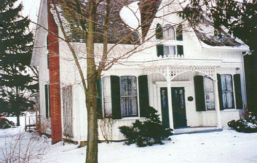
©Parks Canada Agency / Agence Parcs Canada, Dianne Dodd, 2002 |
Erland Lee (Museum) Home National Historic Site of Canada
Hamilton, Ontario
The Erland Lee (Museum) Home National Historic Site of Canada is set in
a rural landscape in the town of Stoney Creek, Ontario. It is an
ornamented Gothic Revival style farmhouse in which the constitution of
the highly successful Women's Institute was written.
One-and-a-half-storeys high, with board and batten siding and
distinctive gingerbread trim, the home is situated amongst lawns and
gardens.
The Erland Lee (Museum) Home, built as a log home in 1808, was altered
and enlarged in 1860 and 1873 by Abram Lee, the father of Erland Lee,
and today retains its appearance from the 1890s. It is associated with
the founding of the first Women's Institute as the home of Janet
Chisholme Lee and her husband Erland Lee, who together organized the
founding meeting, drafted the constitution, formalized provincial
government support, and set an excellent example in Stoney Creek.
The house has become a potent, widely recognized symbol of Women's
Institutes both in Canada and internationally. Home of the "Mother
Institute", it is the site most intimately associated with the
development of an important farm women's organization, with its focus on
family, and improvement of self and surroundings. The house itself is
typical of many so-called "Ontario cottages" with their
one-and-a-half-storey, rectangular massing, three-bay façade with centre
door, central gable breaking a front-sloping pitched roof, and
centre-stair interior plan. Its decorative elaboration speaks to the
"improving" objectives of the movement.
|

©Parks Canada Agency / Agence Parcs Canada, 1995 |
Ermatinger House National Historic Site of Canada
Sault Ste. Marie, Ontario
The Ermatinger House National Historic Site of Canada is located in
Sault Ste. Marie, Ontario. Built between 1814 and 1823 by Charles
Ermatinger of the North West Company, is believed to be the oldest
surviving house in northwestern Ontario. It is an classically inspired,
two-storey, five bay house with a hip roof, built of stout masonry and
heavy timber framing.
Constructed when Sault Ste. Marie was still a small fur trading post on
the Upper Lakes, this fine house soon became the centre of the districts
business and social life, and was noted by such visitors as Lord
Selkirk, Anna Jameson, Sir John Richardson, Paul Kane and George Catlin.
It was built between 1812 and 1823 by Charles Ermatinger, an independent
fur trader with business and family connection in Montreal. Ermatinger
in 1812 had led a party of volunteers under Captain Roberts in the
capture of Michilimackinac which secured the North Country for the
British and was a powerful factor in bringing about the surrender, by
Hull, of Detroit in August, 1812. The Ermatinger family left Sault Ste.
Marie in 1828.
The imposing house was large for its time (35 feet by 40 feet) and, with
its masonry construction and classically inspired design, was an
outstanding landmark in its day. A succession of occupants used the
house as a mission, hotel, tavern, courthouse, post office, dance hall,
tea room and apartment building. In 1965 the building was purchased by
the City of Sault Ste. Marie and restored to its original appearance. It
is now a House Museum.
|
|
Etharita Site National Historic Site of Canada
Clearview, Ontario
Main village of Wolf Tribe of Petun, 1647-49.
|

©Parks Canada Agency / Agence Parcs Canada, 1989 |
Fairfield on the Thames National Historic Site of Canada
Chatham-Kent, Ontario
Fairfield on the Thames National Historic Site of Canada is located on
the north bank of the Thames River in Zone Township between Thamesville
and Bothwell, Ontario. The village of Fairfield, of which there are no
extant remains, was originally located on the north bank of the river.
It was founded in 1792 as a community for Aboriginal refugees and
Moravian missionaries from Ohio. The site is comprised of a large plot
of land containing a cemetery, the Fairfield Museum and a plaque and
cairn erected by the Historic Sites and Monuments Board of Canada in
1948.
The village of Fairfield was founded in 1792 by Aboriginal refugees and
Moravian missionaries who came to Canada from Ohio. They were fleeing
persecution in the United States after refusing to take sides during the
American Revolution. The Moravian missionaries were a German-speaking
religious sect that originated in the early 1700s in Eastern Europe as
the Church of the Brethren. Their settlement in Upper Canada, called
Fairfield, was on the north bank of the Thames River and has been
described as the first Protestant mission in Ontario. The Delaware
represented the largest Aboriginal group in the community, yet other
nations were also present. The Hat Hill Cemetery associated with the
Fairfield Mission was established the same week as the village.
Fairfield on the Thames stood for 21 years, until the War of 1812. On 5
October 1813, British forces and their Native allies were defeated by
invading American forces during the nearby Battle of the Thames, also
called the Battle of Moravian Town. Following the battle, the Americans
accused the pacifist residents of Fairfield of hiding English officers.
Although the Americans found no evidence of this offense, the village
was plundered and burnt to the ground after residents were allowed to
escape. The village was subsequently rebuilt on the opposite bank of the
Thames River.
|

©Parks Canada Agency / Agence Parcs Canada |
Fathom Five National Marine Park of Canada
Headquarters: Tobermory, Ontario
The spectacular underwater of the Niagara escarpment in Georgian
Bay.
The deep and sparkling waters at the mouth of Georgian Bay are home to
Fathom Five - Canada's first National Marine Conservation Area. The park
preserves a rich cultural legacy that includes 22 shipwrecks and several
historic lightstations. Fathom Five's freshwater ecosystem contains some
of the most pristine waters of the Great Lakes. The rugged islands of
the park are a reminder of the impressive lakebed topography found
beneath the waves.
|

©Parks Canada Agency / Agence Parcs Canada, Michelle Cinann, 2008 |
Finnish Labour Temple National Historic Site of Canada
Thunder Bay, Ontario
Finnish Labour Temple National Historic Site of Canada is a two-storey,
rectangular, brick building located in the heart of the multicultural
Bay-Algoma neighbourhood in Thunder Bay, Ontario. The eclectic design
consists of two hipped-roof sections joined by a central, gabled-roofed
section. The symmetrical facade features a three-storey central
polygonal tower, square end bays, regularly arranged windows, and stairs
leading up to the porch-covered main entrance. The imposing size of the
building speaks to the importance of the area as a centre of Finnish
immigration, as it contains offices, meeting rooms, museums and features
an original restaurant and large auditorium. It served as a hall for two
Finnish organizations representing the active role Finnish Canadians
played in the labour movement in Canada.
The Finnish Labour Temple reflects a period of significant Finnish
immigration to Canada during the mid 1870s following the promise of work
and unsettled land. Thunder Bay, Ontario became an increasingly popular
settlement of Finnish Canadians, leading to the establishment of Finnish
culture within the area and the rise of collective organizations.
Constructed in 1909-1910, Finnish Labour Temple housed two large Finnish
organizations - the Socialist Local and the New Temperance Society, both
associated with socialist thought in Canada. The Finnish Labour Temple
represents the active role Finnish-Canadians played in the labour
movement in Canada and the community's commitment to political and
collective organization. It also acts as a venue for the preservation
and celebration of the Finnish community's unique culture and
traditions, reflecting the multiculturalism of the area. Additionally,
the Finnish Labour Temple houses the Hoito Restaurant, an
internationally acclaimed restaurant established in 1918 which continues
to serve traditional Finnish meals. Finnish Labour Temple is an
important symbol and landmark to the Finnish community as well as an
anchor of Thunder Bay's Bay-Algoma Street area.
|

©Parks Canada Agency / Agence Parcs Canada, A. Roos, 200 |
First Commercial Oil Field National Historic Site of Canada
Oil Springs, Ontario
Located near Oil Springs, Ontario, the First Commercial Oil Field
National Historic Site of Canada is an industrial landscape featuring
oil and gas extraction, transportation and refining equipment and
buildings. The land itself is level and open, like the surrounding
agricultural lands. The official recognition refers to the Fairbank and
Oil Museum lands, the in situ equipment and the buildings in their
existing spatial relationships.
The location of gumbeds in this area of Ontario had long been known to
local inhabitants. The first commercial exploitation of the gumbeds was
the extraction of bitumen for asphalt paving. Further study of the
qualities of the oil revealed its technical applicability to numerous
uses, while advances in drilling, refining and transportation techniques
made the exploitation of these oil fields economically viable. The work
undertaken here had significant impacts from both technological and
financial aspects, on the development of the oil refining industry both
in Canada and abroad.
|
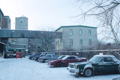
©Parks Canada Agency / Agence Parcs Canada, CIHB - (HRS 898) |
Forbes Textile Mill National Historic Site of Canada
Cambridge, Ontario
For a time in the early decades of the twentieth century, it was the
largest woollen and worsted mill in Canada; 1863.
|
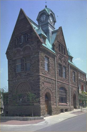
©Parks Canada Agency / Agence Parcs Canada, 1999 |
Former Almonte Post Office National Historic Site of Canada
Almonte, Ontario
The Former Almonte Post Office National Historic Site of Canada is a
striking building with a steep gabled roof with central clock tower and
an attractive stone exterior. It is prominently located on a triangular
piece of land at the corner of Little Bridge and Mill Streets in the
centre of the town of Almonte, Ontario. The late 19th-century,
two-and-a-half-storey, stone building is representative of the multi-use
post offices designed by Thomas Fuller.
The Former Almonte Post Office epitomizes the smallest of the multi-use
post offices erected by the Department of Public Works in small urban
centres during Thomas Fuller's term as Chief Architect (1881-1886). It
is representative of Fuller post offices in its two-and-a-half-storey
height, its use of high-quality materials, its Romanesque Revival
styling, its prominent sitting, and its interior layout. Having
undergone no major exterior alteration, the post office possesses
architectural merit.
|
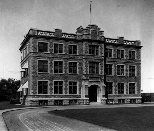
©National Archives of Canada / Archives nationales du Canada, PA-34242 |
Former Archives Building National Historic Site of Canada
Ottawa, Ontario
The Former Archives Building National Historic Site of Canada is a
substantial stone building, designed in the federal Tudor Gothic style.
The building is set back from Sussex Drive, a street that is also the
home of several other major federal institutions in Ottawa, including
its immediate neighbours, the Royal Canadian Mint National Historic Site
of Canada and the National Gallery of Canada. The building consists of
an original, seven-bay three-storey block with a central entrance built
from 1904 to 1906, and a larger three-storey addition at right angles to
it between 1924 and 1925.
The Former Archives Building served as the home of Canada's national
archives from 1906 until 1967. The construction of a secure permanent,
fire-proof, facility to collect, preserve and study the nation's records
reflected a growing sense of a distinct Canadian identity and an
increasing interest among Canadians in the country's history. Its
location on Sussex Drive helped fulfill former Prime Minister Sir
Wilfred Laurier's vision of transforming Ottawa from an industrious
lumber town into a prestigious capital city with requisite cultural and
civic amenities and institutions. Under Laurier's direction, David
Ewart, Chief Architect of the Department of Public Works (1897-1914),
supervised the design of four major federal buildings, including the
Former Archives Building, which helped create a federal identity in
Canada's capital. These buildings were designed in a Tudor Gothic style
that was compatible with the buildings on Parliament Hill, appropriate
for a capital associated with the British Empire, and easily adapted to
Beaux-Arts planning principles.
Sir Arthur Doughty, Dominion Archivist from 1904 to 1935 and a
designated person of national historic significance, is closely
associated with both the evolution of the physical structure of the
Former Archives Building and the development of the archives as a public
institution. Appointed in the same year as construction began on the
archives building, he served for over three decades, including the
period of expansion of the building between 1924 and 1925.
|

©Parks Canada Agency / Agence Parcs Canada, Jennifer Cousineau

©Parks Canada Agency / Agence Parcs Canada, Jennifer Cousineau |
Former Bowmanville Boys Training School/Camp 30 National Historic Site of Canada
Bowmanville, Ontario
The complex of buildings that began as the Bowmanville Boys Training
School is a rare and outstanding group of Prairie-Style buildings in
Canada. All six buildings are of masonry construction, finished on the
exterior in brick and stucco, with asbestos-shingle roofs. The four
earliest buildings, the Cafeteria, Jury House, Kiwanis House, and the
Gymnasium, bear the hallmarks of the Prairie Style most strongly. They
exhibit open plans, fragmented volumes, natural materials, a
horizontality that reflects the flatness of the prairie landscape,
geometric ornamentation, and flat roofs. These buildings are strikingly
modern in sensibility. Though technically institutional buildings, Jury
House, Kiwanis House, and the Cafeteria are relatively intimate in scale
and therefore bear greater resemblance than the other buildings to the
domestic architecture through which Frank Lloyd Wright first articulated
the Prairie Style at the turn of the 20th century. The Triple Dormitory
and the Infirmary/General's House present designs that are more
traditional in their aesthetic approach. They adopt elements of the
Prairie Style and the Arts and Crafts tradition, such as open interior
spaces and fragmented volumes, natural materials and geometric ornament,
but retain the pitched roofs and sash windows that were abandoned in
institutional architecture once the International Style took hold in
Canada (over the following decades).
Bowmanville Boys Training School/Camp 30 is of historical significance
because:
when it opened in the mid-1920s, the Bowmanville Boys School was widely
considered the most progressive institution of its kind in Canada. A
rare example of Prairie School architecture in Canada, Bowmanville's
modern architecture, campus style plan, professional staff, open,
semi-domestic environment, and broad educational programme for boys aged
8-14, placed it at the head of the youth reform movement;
during the Second World War, the school was adapted to serve as an
internment camp, known as Camp 30, for German prisoners of war captured
by the Allies. Its principal buildings, used from 1941 to 1945 for
internment, remain at the site although guard towers, fencing and
temporary barracks were dismantled after the war when the camp was
turned back into a school. Camp 30 was the site of a small but infamous
riot popularly known as the Battle of Bowmanville.
|

©Parks Canada Agency / Agence Parcs Canada, 1980 |
Former Brockville Post Office National Historic Site of Canada
Brockville, Ontario
The Former Brockville Post Office is a late-19th-century,
two-and-a-half-storey, stone building. It is prominently situated in the
core of Brockville within a group of 19th-century public buildings.
The Former Brockville Post Office was designated a national historic
site in 1983 because: it is representative of small urban post offices
designed by Thomas Fuller; it possesses architectural merit, this is to
say it has not undergone major exterior alteration; it possesses
integrity, that is to say that its siting is sympathetic.
The Brockville Post Office is a good example of the post offices erected
by the Department of Public Works in smaller urban centres during Thomas
Fuller's term as Chief Architect (1881-1886).
|

©Parks Canada Agency / Agence Parcs Canada, J. Butterill, 1995 |
Former Elora Drill Shed National Historic Site of Canada
Elora, Ontario
The Former Elora Drill Shed National Historic Site of Canada is a simple
single-storey mid 19th-century stone building under a pitched roof.
Located in the town of Elora, Ontario, it was built for both military
exercises and community use and it contains a large open hall.
The Former Elora Drill Shed is a particularly well-built example of the
type of drill shed constructed in Canada by rural militia units before
the Department of Defence introduced a standard design for such
buildings. Although built to a simple open-hall plan, its stone
construction and careful finishing raise it above the norm for its time.
Intended to serve as both a community hall and a drill hall, today, the
Drill Shed remains an integral part of the community in Elora, currently
housing the local franchise of the Liquor Control Board of Ontario
(LCBO).
|

©Parks Canada Agency / Agence Parcs Canada |
Former Galt Post Office National Historic Site of Canada
Cambridge, Ontario
The Former Galt Post Office National Historic Site of Canada is
prominently situated on a corner lot overlooking the Grand River in
downtown Cambridge, Ontario. Completed in 1887, this handsome
two-and-a-half storey stone building is finished in Guelph limestone and
features symmetrical twin façades. Its striking design includes an
eye-catching clocktower and blends elements of Romanesque, Gothic and
Second Empire styles to create a unique and eclectic building typical of
Chief federal architect Thomas Fuller.
Built between 1884 and 1887, the Former Galt Post Office served an
important function as the home of the post office, customs, and other
government services. This post office was one of the many buildings
erected during the course of a program of government construction in
small communities and towns across Canada under the direction of Thomas
Fuller, Chief Architect of the Department of Public Works from 1881 to
1896. The high standard of design imposed by Fuller is evident in the
former Galt Post Office. Typical of his designs, the building features
an round-arched entrance portico, symmetrical twin façades and a clock
tower, in this case uniquely adapted to be visible from both the street
and the Grand River. The steeply pitched mansard roof, as well as the
use of contrasting colours and textures and the accomplished stonework,
come together to create a striking blend of the Gothic, Second Empire
and Romanesque styles.
|

©Parks Canada Agency / Agence Parcs Canada, 1991 |
Former Geological Survey of Canada National Historic Site of Canada
Ottawa, Ontario
The Former Geological Survey of Canada Building is a relatively plain
three-storey, stone building located on a prominent corner in Ottawa's
Byward market area.
The Former Geological Survey of Canada Building was designated a
national historic site in 1955 because it is one of the oldest remaining
buildings erected in the capital and it was the home, at various times,
of public services and cultural institutions.
The heritage value of this site resides in its associations with
official Ottawa as illustrated by its location, form, materials and
massing. The former Geological Survey Building was created in the 1860s
from three attached structures have been used individually or as a group
as a hotel, army barracks, museum, government offices, commercial
offices and shops. The oldest part of the building was constructed in
1863 by a local businessman, James Skead, for the expansion of what was
then the British Hotel. Almost as soon as this expansion was completed
as the Clarendon Hotel, the owners tried to sell the property, leasing
it to the Crown as military barracks from 1864 to 1871. In 1874 it was
remodelled once again as a hotel. In 1879 the federal government
purchased the property.
As a Crown-owned building, 541 Sussex Drive was first used as the Ottawa
home of the Geological Survey of Canada, originally established in
Montréal in 1842 by the Province of the United Canadas. In 1877 a new
act concerning the Survey, made it a branch of the federal government
under the Minister of the Interior. In 1879 the simultaneous decisions
were made to purchase the Clarendon Hotel and retrofit it as the offices
and museum of the Geological and Natural History Survey of Canada. In
addition to the Survey's important work in supporting the discovery and
exploitation of Canada's vast mineral wealth, its museum collection
became the foundation of Canada's national museums.
Before the Survey moved into the former hotel, the building was used to
host the inaugural exhibit of the Canadian Academy of Arts. The works
from this exhibit formed the initial collection of the National Gallery
of Canada.
The Survey provided services for those interested in geology and natural
history for professional, scholarly and business reasons and for the
general public. As a consequence, its headquarters at 541 Sussex Street
included museum exhibits, a library, a mapping office and laboratories
for preparing natural history specimens, analyzing geological materials,
and drawing and copying maps. Its museum occupied all three floors of
the George Street wing of the building, which was renovated several
times, including with funds from the Survey's founder, William Logan.
The Sussex Drive section was rebuilt by a prominent local builder,
Thomas Askwith, on its original footprint in 1881 by the Department of
Public Works for Survey offices. The Survey, under the Direction of Dr.
Alfred Selwyn from 1869 to 1894, remained at 541 Sussex Drive until 1911
when it moved to its new home, the Victoria Memorial Museum.
After the museum and the survey offices moved, 541 Sussex Street was
renovated for the Department of Mines. In 1917 a laboratory was added on
the east side of the George Street wing.
|

©Parks Canada Agency / Agence Parcs Canada, HRS 0918, 1998 |
Former Hamilton Customs House National Historic Site of Canada
Hamilton, Ontario
The Former Hamilton Custom House National Historic Site of Canada is a
handsome two-storey Italianate-style building, located in downtown
Hamilton, Ontario. It is executed in beautifully tooled stonework, and
features a rich vocabulary of classical details, such as a columned
portico, prominent stringcourses and cornice, and elaborate interior
mouldings and plasterwork. It now houses the Workers Arts and Heritage
Centre.
The Former Hamilton Custom House was designated a national historic site
of Canada because it is an extremely attractive example of Italianate
architecture in Canada with stonework of exceptionally fine quality.
The Former Hamilton Custom House (1858-1860) is a fine example of the
Italianate style of architecture, which was popular in Canada from the
1840s through the 1870s. Inspired by Renaissance palazzi of Rome and
Florence, Italianate buildings were characterized by an elevated first
storey of rusticated stone, a smooth upper storey, abundant classical
detailing and a heavy cornice. The design of the Former Hamilton Custom
House is enhanced by the variety of finishes and the superior quality of
its stonework.
Built by the preconfederation Province of Ontario's Board of Works to
designs by F. P. Rubidge, its construction reflected the rise of
Hamilton as a major railway centre and Great Lakes port. This function
ceased in 1915 after which the building served a variety of uses, it
currently houses a cultural centre.
|
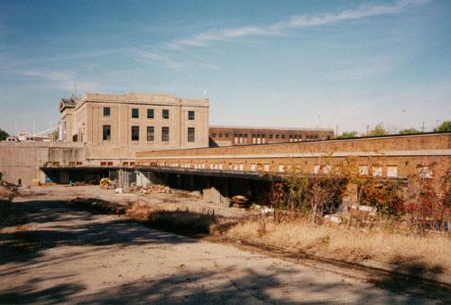
©Parks Canada Agency / Agence Parcs Canada, J. Hucker, 1999. |
Former Hamilton Railway Station (Canadian National) National Historic Site of Canada
Hamilton, Ontario
The Former Hamilton Railway Station is a complex of interconnected
railway buildings built in 1929-31. The main feature is a monumental,
two-storey, classically inspired, stone-fronted station building. In
front of the station building is a large, open plaza. Behind the station
building the ground drops away to the level of the former trackbed and
the station becomes a four-storey structure. A glass-walled concourse
extends from the rear of the station over the trackbed. A long, low
express building, built of brick, extends from one side of the main
station building, parallel to the former trackbed. The station is
located close to Hamilton's downtown area, in a mostly residential area
known as the North End.
Built in 1929-31 to designs by Canadian National Railways (CNR) chief
architect John Schofield, the Former Hamilton Railway Station is a rare
surviving example of a railway station complex. It followed a highly
rational approach to passenger and baggage circulation, in which
passenger and operational functions were neatly separated horizontally
and vertically. The configuration of elevated concourse over depressed
tracks, although common in the United States, was rare in Canada.
Although it is no longer used as a train station, the original
circulation patterns are still discernable in the arrangement of the
station building, the projecting concourse, the depressed trackbed, and
the express building.
The station's classically inspired façade, Beaux-Arts composition and
large, open plaza which fronts it are elements typical of the City
Beautiful movement. An urban reform movement that began in the late 19th
century, the City Beautiful movement sought to counter the negative
physical and moral effects of rapid industrialization through the
beautification of urban spaces. In Hamilton, the city finally embarked
on a rationalization and beautification plan in the 1920s. The plan
included a more centrally located railway station and improvements to
transportation and circulation problems, and to the urban landscape
through the elimination of level crossings and the introduction of
railway cuts and bridges. The Former Hamilton Railway Station was
constructed by the CNR as part of this scheme.
After the Second World War, the station operated as an important gateway
for immigrants to Canada. When the federal government loosened its
immigration policies in the postwar period, Hamilton experienced a
sudden influx of Italian and German immigrants. Many would have arrived
in Canada by boat, taken a train to Hamilton, and entered the city for
the first time through the Hamilton Railway Station. Immigrants from
Greece, Yugoslavia and Portugal followed the same route in the 1960s.
Rehabilitated in 2000 by the Labourers International Union of North
America (LIUNA) as a training and recreation centre, the complex has
remained intact on the exterior and in the major public spaces.
|

©Parks Canada Agency / Agence Parcs Canada, 1993 |
Former Ottawa Teachers' College National Historic Site of Canada
Ottawa, Ontario
The Former Ottawa Teacher's College National Historic Site of Canada is
located on Elgin Street in downtown Ottawa. A fine example of late-19th
century eclectic design, the building's two-and-a-half-storey front
block is a balanced composition exhibiting an eclectic interpretation of
the Gothic Revival Style. The roof, in the Second Empire style, with a
central spired belfry, features a gable and a lively series of turrets.
The building is now part of the Ottawa City Hall Complex.
The Former Ottawa Teacher's College was designated a national historic
site of Canada in 1974 because it is a nationally significant example of
the Gothic Revival Style in Canada whose use of disparate architectural
details reflects a spirit of eclecticism.
The Ottawa Teacher's College or Normal School, designed by the architect
W.R. Strickland and built in 1874-1875 by J. Forin under supervising
architect James Mather, was the second institution of its type to be
established in Ontario. The College continued to train teachers for
Ontario until 1974. Purchased by the regional government, an office
complex was constructed to the rear. After municipal amalgamation, the
building became part of Ottawa City Hall.
The rectangular massing with central pavilion of the main block follows
an accepted format for 19th century academic institutions, while the use
of disparate architectural details including a mix of pointed
Gothic-style, semi-circular and flat-headed windows, Romanesque columns,
and Second Empire-style roof, reflects a spirit of eclecticism.
|
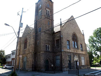
©County of Brant Public Library |
Former Paris Town Hall National Historic Site of Canada
Paris, Ontario
Built in 1854, according to the plans of architect John Maxwell, this former
town hall is a rare Canadian example of a civic building in the Gothic
Revival-style. It is distinguished by the presence of medieval architectural
details, including the magnificent wooden structure of the large hall on its
second floor. It served as a combined town hall and market, similar to other
buildings of this type built in Canada during the second half of the 19th
century, which were inspired by British examples from the late 18th and early
19th centuries. It remains a monument to civic pride, constructed during a
period of ambitious growth, when the small community of Paris emerged as an
industrial town.
Now known as the Bawcutt Centre, the former Paris Town Hall is located at 13
Burwell Street, in what was once considered the centre of the small town of
Paris, Ontario. This building's English Medieval Gothic Revival style, often
seen in churches, was an unusual choice for a civic building of this type in the
19th century, when classicism prevailed. This two-and-a-half-storey brick
building has a tower, which originally housed a bell, angled buttresses, which
once had small turrets, and a combination of Gothic Revival-style pointed
windows and Tudor-style rectangular windows.
Like its exterior, the building's interior has a number of original
characteristics. On the second floor there is a room with vaulted ceilings and
arched doorways, which is the building's centrepiece. The ceiling has exposed
wooden beams, and six very well preserved Gothic trusses. Previously, the ground
floor was home to a covered market at one end, and a council room, magistrate,
and treasurer offices at the other. The basement was used as a "lower market"
and had space for a small prison with two cells, which are still there.
For 50 years, the building was used as a town hall and market, with a meeting
room on the second floor, which was used for events, such as plays, opera,
concerts, conferences, and film projections. After the Paris municipal council
left the building in 1904, it was used for various other purposes, including as
a needle manufacturing plant, a private residence, retail headquarters for Mary
Maxim's craft supplies, and an auction house.
|
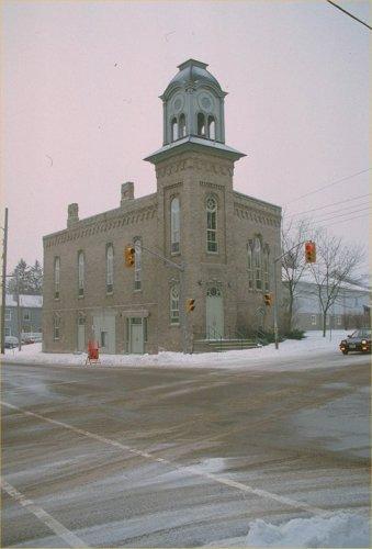
©Parks Canada Agency / Agence Parcs Canada, 1991 |
Former Port Perry Town Hall National Historic Site of Canada
Port Perry, Ontario
The Former Port Perry Town Hall is a three-storey brick building of
Italianate design, built in 1873. It is prominently located at the
corner of a major intersection in the town of Port Perry.
The Former Port Perry Town Hall was designated a national historic site
in 1984 because: it is a particularly fine example of the municipal
meeting hall which served as a community's political and social centre;
and it is noteworthy for its commanding site and the quality of its
design and interior finishes.
Constructed in 1873 following the incorporation of the Village of Port
Perry and the arrival of the railway, the Town Hall reflects the
community's optimistic view of its future prosperity. Like many small
Ontario communities, Port Perry built a multi-purpose building to serve
a variety of community purposes. The simply decorated lower hall was
used for village council meetings. The elaborate, balconied opera house
on the second storey became the community's social centre. Although the
building is no longer used for municipal offices, it continues to
function as a community centre and theatre.
The Town Hall is prominently sited at a major intersection, with its
corner tower serving as a landmark in the Port Perry commercial
district. Its Italianate design was a popular choice for civic buildings
built in Ontario during the mid-19th century.
|
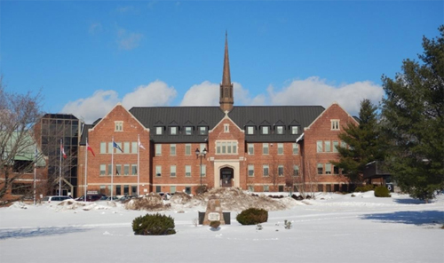
©Parks Canada Agency / Agence Parcs Canada, Nathalie Ouellette. |
Former Shingwauk Indian Residential School National Historic Site of Canada
Sault Ste. Marie, Ontario
Opened in 1875 by the Anglican Church, Shingwauk Indian Residential
School was part of the system of residential schools in Canada. This
system was imposed on Indigenous Peoples by the federal government and
certain churches or religious organizations, who worked together in a
deliberate effort to assimilate Indigenous children and convert them to
Christianity by separating them from their families, cultures,
languages, and traditions. From 1935 to its closure in 1970, the school
was administered and funded by the federal government. The Anglican
Church operated the school until 1969.
The school was named after prominent Anishinaabe Chief Shingwaukonse,
who advocated for the education of his people with a vision of teaching
Anishinaabe students to thrive in a rapidly changing society while
preserving their language and culture. Over the course of its 96 years
of existence, the residential school was a Shingwauk school in name only
as Chief Shingwaukonse's true vision was lost.
Shingwauk Hall, the school's primary structure, was built in 1934-35 to
replace the original school building which dated to the late 19th
century. It is one of the few remaining residential school buildings in
Canada. Other buildings and landscape elements related to the former
school include the Shingwauk Memorial Cemetery (1876), Bishop Fauquier
Memorial Chapel (1883), the former principal's residence (1935), the
former woodworking shop (1951), and Anna McCrea Public School (1956).
The Shingwauk Indian Residential School site is one of the few surviving
residential school sites where a number of preserved built and landscape
elements continue to testify to the long history of the residential
school system in Canada. The Shingwauk Cemetery contains 109 known
burials, including 72 students who died between 1875 and 1956.
More than a thousand Indigenous children from Ontario, Quebec, the
Prairies, and the Northwest Territories attended this school. Students
were subjected to a regimented daily routine that involved working to
maintain the school while facing severe discipline and abuse, harsh
labour, emotional neglect, inadequate nutrition, poor healthcare, and
poor living conditions. Siblings remained separated by gender and age,
and Indigenous languages were forbidden. Many students spent their
entire childhoods at the school and those who died while at the school
never returned home. The far-reaching effects of the residential school
experience continue to have significant impacts on former students,
their families, and communities today.
|
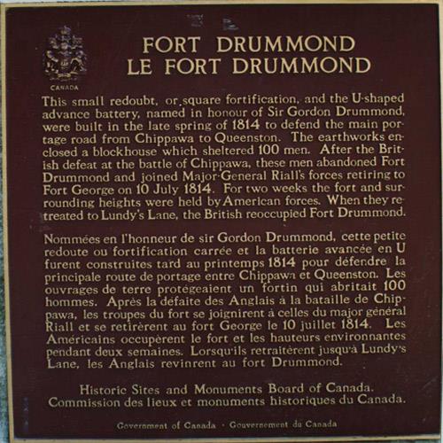
©Parks Canada Agency / Agence Parcs Canada, 1989. |
Fort Drummond National Historic Site of Canada
Kingston, Ontario
Fort Drummond National Historic Site of Canada is located in a park
setting not far from Brock's Monument in Queenston, Ontario. Built to
protect the portage route around Niagara Falls during the War of 1812,
the fort's two square redoubts fell into ruin following the hostilities,
and were incorporated into the park in 1926, now Queenston Heights
National Historic Site of Canada.
Fort Drummond was built in the spring of 1814 on Queenston Heights to
guard the portage route around Niagara Falls from Chippawa to Queenston.
It was composed of a square redoubt, enclosing a blockhouse for 100 men
and a U-shaped advanced battery. Following the end of the war, the post
was abandoned and sank into ruin. With the creation of the Niagara Parks
Commission, both redoubts were incorporated into the Queenston Heights
park. In 1926, a children's wading pool was built in the western redoubt
where the barracks once stood, and this use continues today.
|
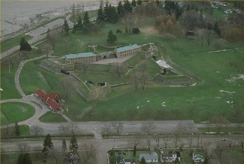
©Parks Canada Agency / Agence Parcs Canada, 1991 |
Fort Erie National Historic Site of Canada
Fort Erie, Ontario
Fort Erie National Historic Site of Canada is a pentagonal stone
fortification strategically located on the shore of Lake Erie at the
mouth of the Niagara River in Fort Erie, Ontario. Situated on a flat
landscape adjacent to the river, the present structure is the fourth
fort to be constructed under the name of Fort Erie on this site. The
fort includes various buildings such as a guardroom, barracks and powder
magazine, archaeological resources and reconstructed components.
The heritage value of Fort Erie lies in its historical associations and
in the archaeological remains of previous fortifications. Four different
forts under the name of Fort Erie have been constructed on this site.
The first (1764-1799) and the second (c. 1783-1803) were abandoned when
the fortifications were destroyed by high water and ice in the spring of
1779. The third Fort Erie, built by the British between 1805 and1808,
was rebuilt in January 1814, but was captured by an invading American
army in July of the same year. The Americans used the fort as a base of
operations and then retreated there after their defeat at Lundy's Lane.
After surviving a siege by the British under General Gordon Drummond the
Americans abandoned the fort and destroyed it on November 5, 1814. The
fort remained in this ruined state although the lands around it were
surveyed and settled by military pensioners and by other settlers. In
1901 the property was granted to the Niagara Parks Commission who
restored the fort to its 1814 state between 1937 and 1939. Fort Erie
continues to be operated by the Niagara Parks Commission.
|
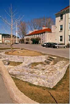
©Parks Canada Agency / Agence Parcs Canada, J. Butterill, 1995 |
Fort Frontenac National Historic Site of Canada
Kingston, Ontario
Fort Frontenac National Historic Site of Canada is an archaeological
site located beneath the intersection of Ontario Street and Place
D'Armes in Kingston, Ontario. The site extends under four stone
buildings, constructed during the 1820s as part of the former Tête du
Pont Barracks on the southern portion of ground previously occupied by
the original French fort. While these four buildings are part of a
complex currently referred to as Fort Frontenac, only a fragment of the
original fort can be seen today. Sections of the west and north
limestone curtain walls are exposed on a traffic island at the
intersection of Ontario Street and Place D'Armes.
Fort Frontenac, located at the confluence of the Cataraqui River and
Lake Ontario, was established in 1673 by the Governor of New France, the
Comte de Frontenac, in order to control access to the fur laden lands of
the Great Lakes Basin and the Canadian Shield. As the fur trade expanded
west along the Great Lakes and into the Mississippi and Ohio River
valleys, the explorer René-Robert Cavelier de La Salle rebuilt the
wooden fort into a stronger masonry building by reinforcing it with
limestone walls and square bastions. The fort became a strong French
outpost against the British and the Iroquois, as several smaller
buildings were built around it and a community of settlers established
themselves in the region. During one of La Salle's extended explorations
of the interior in 1682, the fort fell into the hands of creditors who
neglected its defences and, after an attack by the Iroquois, the French
ordered the fort's destruction in 1689. However, in 1695, the Comte de
Frontenac ordered the fort rebuilt, and it was occupied by a small
garrison until 1745. In 1758, the British under Colonel John Bradstreet
captured the fort and it remained in British possession until the end of
the War of 1812, when it was deemed obsolete and was gradually
demolished. Archaeological research in 1982 uncovered several sections
of antiquated limestone walls constructed by La Salle, including those
sections of the north and west curtain walls that remain visible today.
|
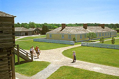
©Parks Canada Agency / Agence Parcs Canada, B. Morin, 1995

©CPS, ORO, 1989 |
Fort George National Historic Site of Canada
Niagara-on-the-Lake, Ontario
Reconstructed British fort from War of 1812.
Fort George National Historic Site of Canada is a largely recreated
18th-century military fort located on the west bank of the Niagara River
near the river's mouth. It is situated on the remains of the original
Fort George, largely destroyed during the War of 1812.
The heritage value of Fort George lies in the remnants of a late
18th-century British fortification embedded in its cultural landscape,
and the residues of the history to which they bear witness, particularly
those associated with the War of 1812, the Battle of Fort George,
British and American occupancy of the fortress, and its destruction in
May 1813. Fort George was the site of a historic reconstruction during
the 1930s, an activity which reconfigured most of its earthworks and
resulted in the construction of several buildings inside the footprint
of the original fort.
|
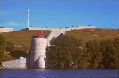
©Parks Canada Agency / Agence Parcs Canada
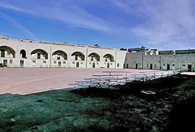
©Parks Canada Agency / Agence Parcs Canada, J. Butterill, 1995 |
Fort Henry National Historic Site of Canada
Kingston, Ontario
British fort completed 1836 to defend Rideau Canal.
Fort Henry National Historic Site of Canada is a 19th-century British
military fortress situated on Point Henry between the mouth of Kingston
harbour and a second natural harbour at the mouth of the Cataraqui
River. It sits high on a natural cliff facing the confluence of the
eastern end of Lake Ontario with the beginning of the St. Lawrence
River.
Construction of Fort Henry by the British military began in 1832, with
the addition of ditch towers and commissariat casemates in 1840 to
create its present configuration. The fort was garrisoned by units of
the British Army until 1870, and then by Canadian forces. Although Fort
Henry has never seen military action, it was used as a prison for
combatants captured during the 1837-38 Rebellions and again during the
first and Second World Wars. During the 20th century it was restored and
interpreted for public visitation. Originally designated a national
historic site of Canada in 1923, the fort also was designated part of
the broader Kingston Fortifications National Historic Site of Canada in
1989.
The heritage value of this site is most critically represented by the
surviving massing, form and fabric of the fort including the advanced
battery, the redoubt and the glacis, as well as by its sense of scale
and purpose.
|

©Parks Canada Agency / Agence Parcs Canada |
Fort Malden National Historic Site of Canada
Amherstburg, Ontario
19th-century border fortification; Fort Amherstburg; War of
1812.
The Fort Malden National Historic Site of Canada is an extensive,
park-like area defined by surviving earthworks, a brick barracks
building and a classically inspired structure of a domestic nature,
situated on the banks of the Detroit River opposite Bois Blanc Island in
Amherstburg, Ontario.
The heritage value of Fort Malden National Historic Site of Canada lies
in the association of surviving cultural resources with the military
role of the fort in the 18th and 19th centuries. The fort consisted of a
deep protective ditch lined with pickets and a raised earthen parapet
with bastions and mounted artillery which helped to define its interior
parade square. The fort's only surviving building is the Men's Brick
Barracks built in 1820. Fort Malden was established in 1796, and built
as Fort Amherstburg by the Second Battalion Royal Canadian Volunteers in
1797-1799. It was strengthened in 1812, but evacuated and burned by the
British in September 1813. The Americans partially rebuilt the fort in
1815. After the War of 1812, Fort Malden returned to the British and in
1837-38 was reconfigured in order to serve as a border post.
|
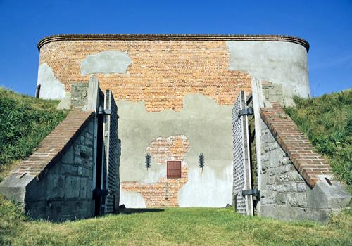
©Parks Canada Agency / Agence Parcs Canada |
Fort Mississauga National Historic Site of Canada
Niagara-on-the-Lake, Ontario
19th-century brick tower within star-shaped earthworks; War of
1812.
Fort Mississauga is a large, square, brick defensive tower set within
the remains of earthworks on the shoreline of the Niagara River. On the
landward side, it is surrounded by golfing greens located within the
town of Niagara-on-the-Lake.
The heritage value of Fort Mississauga lies in its illustration of a
rare type of military structure located in a strategic position.
|

©Parks Canada Agency / Agence Parcs Canada, 2005 |
Fort Norfolk National Historic Site of Canada
Norfolk County, Ontario
Fort Norfolk National Historic Site of Canada is located at the entrance
to Turkey Point Provincial Park golf course, bounded by the eastern edge
of Old Hill Road, near Lake Erie. The site consists of mixed landscape
features and foliage, and is surrounded by the vast lawns of the nearby
golf course. There are no known extant remains of Fort Norfolk; however,
since its designation the site has been the subject of several archival
research projects.
In 1795, Lieutenant-Governor John Graves Simcoe selected the Turkey
Point area for the construction of a fort and naval station. During the
War of 1812, the area became of strategic interest to the British, who
on the orders of General Henry Procter, built a blockhouse and a partial
palisade on the slope above Turkey Point. From 1814 until 1815, Fort
Norfolk served as a British military and naval post, but when
hostilities ceased, the project was abandoned. By 1826, the fort was in
such a state of decay that the naval and military developments were
relocated northeast to the Grand River.
|

©Parks Canada Agency / Agence Parcs Canada, 1989 |
Fort Sainte Marie II National Historic Site of Canada
Christian Island, Ontario
Fort Sainte Marie II National Historic Site of Canada is located within
the Beausoleil First Nation land reserve along the southern shore of
Christian Island, on Georgian Bay, in Ontario. The site consists of a
clearing bordered by trees, some modern homes, and the shoreline of
Georgian Bay. Low-lying cobble walls, probably created by 20th century
rock piling, delineate the footprint of the square fort as well as its
corner bastions. Also included on the site is a large, unused Huron
burial pit. Over time, natural factors have slightly altered the
original setting, such as the effects of shoreline erosion.
Fort Sainte Marie II was constructed in 1649 following the destruction
of the former Jesuit mission of Sainte-Marie Among the Hurons Mission
National Historic Sites of Canada on the Wye River. The new fort was
settled from June 1649 to June 1650 by Jesuit Missionaries, French
soldiers, and Huron-Wendat who had fled from the Wye River mission
station after confrontations with Five Nations bands and the Dutch who
together sought to break the Huron-Wendat control of northern fur
resources.
In their new location, the French built a small stronghold consisting of
a military-style four-metre-high stone outer wall, which was surrounded
by a moat. These fortifications enclosed a church, missionary living
quarters, and a well. The Huron-Wendat lived in a village adjacent to
the fort structure. The site was partially abandoned in June 1650 after
a winter of famine, disease, and new threats of encroaching Iroquois. At
that time, the Jesuits, led by Father Paul Ragueneau and approximately
300 Huron-Wendat, travelled as a group from Christian Island into Lake
Nipissing and the Ottawa River valley to Québec. They settled at what is
now Old Wendake National Historic Site of Canada north of Québec City
(Lorette, Quebec). The Huron-Wendat that remained at the site lived in
the fort and during the next spring, they made their last stand against
the Iroquois in Huronia. The survivors of this group then relocated to
Québec City to rejoin the Jesuits and other Huron-Wendat.
|
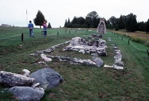
©Parks Canada Agency / Agence Parcs Canada, J.P. Jérôme, 1994 |
Fort St. Joseph National Historic Site of Canada
St. Joseph Island, Ontario
British military outpost on western frontier, 1796-1812; War of
1812.
Fort St. Joseph National Historic Site of Canada is composed of the
remnants of three archaeological sites: Old Fort St. Joseph Point, Rains
Point and LaPointe Point, all located on adjacent points of land
projecting into Lake Huron on St. Joseph Island at the narrow mouth
where it connects with Lake Superior.
The heritage value of Fort St. Joseph National Historic Site of Canada
resides in its location and remote setting and in the extensive
collection of archaeological remains from the 1796-1812 period. Old Fort
St. Joseph Point was a military and a British Indian Department post
established by the British in 1796-1799, and vacated in 1812. Rains
Point was the site of Milford Haven, a 19th-century tract settlement for
British settlers. LaPointe Point was the site of a private 20th-century
hunting camp. Efforts to construct a road to this camp in the 1940s
resulted in damage to the east half of Old Fort St. Joseph Point and
structures on Rains Point.
|

©Parks Canada Agency / Agence Parcs Canada, 2008 |
Fort St. Pierre National Historic Site of Canada
Fort Frances, Ontario
Fort St. Pierre National Historic Site of Canada is located in the town
of Fort Frances, 348 km west of Thunder Bay, Ontario. The site comprises
an open grassed area in Pither's Point a municipal park on a point of
land at the southwest end of Rainy Lake at the mouth of the Rainy River.
Constructed in 1731, there are no extant remains of the square fort,
which measured 50 feet on each side, and featured two gates surrounded
by a double row of thirteen feet high stakes. A seven feet wide road
surrounded the fort's two main buildings, each of which featured two
rooms with double chimneys. On either side of Fort St. Pierre were two
bastions one of which contained a storehouse and powder magazine.
In 1731, French explorer La Vérendrye left Montreal with 50 men,
including his eldest son and his nephew, Sieur de La Jemeraye, and
travelled west. While La Vérendrye wintered at Kaministiquia, Sieur de
La Jemeraye constructed Fort St. Pierre on the southwest end of Rainy
Lake. It was the second French fort to be constructed on Rainy Lake
having been preceded by Zacharie Robutel de La Noue's Fort Tekamanigan,
built in 1717 and vacated in 1721. Fort St. Pierre was built for the
purpose of participating in the western fur trade north of Lake Superior
and furthering La Verendrye's explorations in search of the hypothetical
"western sea" that was believed would provide a route to the Far East.
The French vacated Fort St. Pierre in 1758 during the Seven Year's
War.
|
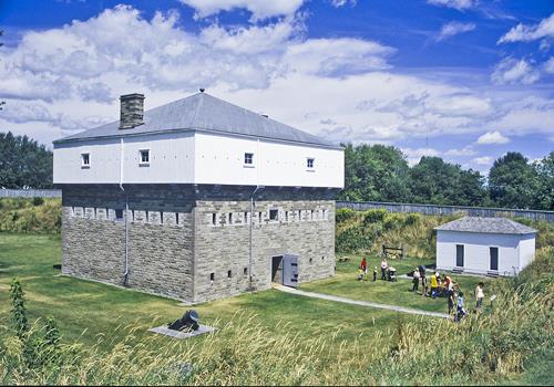
©Parks Canada Agency / Agence Parcs Canada, Brian Morin, 2006 |
Fort Wellington National Historic Site of Canada
Prescott, Ontario
Military remains of 1813-38 fortifications; War of 1812.
Fort Wellington National Historic Site of Canada is one of the best
preserved nineteenth-century fortifications in Canada. The current
structure dates from 1838 and is built on the site of an earlier fort on
the banks of the St. Lawrence River at Prescott, Ontario. Set on a rise,
a blockhouse and officers' quarters overlook the river.
The heritage value of Fort Wellington National Historic Site of Canada
lies in the legibility of its found cultural landscape as an early
19th-century fortress, and in the integrity of surviving 1813-1838
remnants of that landscape as illustrations of its historic role.
Lieutenant Colonels Thomas Pearson and George R.J. Macdonnell built Fort
Wellington in 1813-1814. This was an important fort during the War of
1812, and it was subsequently improved to play a more limited role in
later American raids, most notably those following the 1837 Rebellion.
Used up to the late 19th century as a militia base, it became a national
historic site in 1925 and has since been restored for visitation.
Extensive sections of the military lands associated with the fort have
been alienated for development. In the 1980s Parks Canada acquired lands
between the fort and the shore that had been extensively redeveloped for
railway use (1855-1980).
|
|
Fort William National Historic Site of Canada
Thunder Bay, Ontario
When the boundary settlement of 1783 placed its major inland depot,
Grand Portage, in U.S. territory, the North West Company was forced to
seek a new site on British soil. Following the reopening of the
Keministikwia route a new post, later named for William McGillivray, the
principal Montréal agent, was constructed here at the river's mouth.
Here each summer from 1803 to 1821 the Montréal and wintering partners
held council, while trade goods were readied for the Indian country and
furs brought down for shipment to Montréal. After 1821, changed supply
patters led to Fort William's gradual decline.
|

©Parks Canada Agency / Agence Parcs Canada, 1991

©Parks Canada Agency / Agence Parcs Canada, 1991

©Parks Canada Agency / Agence Parcs Canada, 1991 |
Fort York National Historic Site of Canada
Toronto, Ontario
Located in downtown Toronto, Ontario, near Lake Ontario, Fort York is a
green open space in the midst of high-rise urban development, containing
seven original War of 1812 buildings. The fort's grounds and
neighbouring environment encompass the birthplace of the city, remnants
of the late eighteenth-century landscape, part of a 1813 battlefield,
military cemeteries, and vast archaeological resources. Today the fort
serves as a museum of the largest collection of War of 1812 buildings in
Canada.
The heritage value of this site resides in directly related resources,
including War of 1812 seven buildings within the restored, bastioned
earthwork, the open mustering ground to the west, a military cemetery at
Strahan Avenue, and other related lands currently cut of the main area
by elevated roads.
Fort York, the birthplace of the modern city of Toronto, was established
in the late eighteenth century by the Lieutenant-Governor of Upper
Canada John Graves Simcoe to house a garrison of British soldiers,
creating a secure location which would attract permanent settlers.
During the War of 1812, the fort was burned by invading Americans and
subsequently rebuilt by the British who continued to garrison the fort.
In 1870, they were replaced by Canadian forces who used the fort until
the 1930s. Between 1932 and 1934, the City of Toronto restored the fort
as a historic site. Further work was carried out in 1949.
Now separated from the fort by roads and a railway corridor, the
military burial ground that forms part of Victoria Memorial Square was
opened in 1794 for the internment of soldiers and their families. It was
in use until 1863 by which time it had reached its capacity of 500
burials. Almost immediately the public moved to preserve it, both as a
cemetery, and as public park. In 1905, it was renamed Victoria Memorial
Square.
|

©Parks Canada Agency / Agence Parcs Canada, B. Morin, 1993 |
Fourth York Post Office National Historic Site of Canada
Toronto, Ontario
The Fourth York Post Office National Historic Site of Canada forms the
eastern unit of a complex located just east of Toronto's downtown core.
It is an early 19th-century three-and-a-half-storey building originally
erected as a detached structure. It was joined with the Bank of Upper
Canada Building National Historic Site of Canada in the 1870s with the
construction of an intervening building. Some of the original detailing
and openings of the post office building, altered during the late 19th
century, have since been restored.
The Fourth York Post Office is one of the earliest surviving examples in
Canada of a building designed specifically for use as a post office. It
is typical of small, early 19th-century public buildings, combining
public offices and a private residence within a domestic style building
featuring neoclassical details. It was built for postmaster James Scott
Howard, at a time when post offices in Upper Canada were owned by the
appointed postmaster.
The Fourth York Post Office forms the eastern part of a group of
buildings that includes the Bank of Upper Canada Building National
Historic Site of Canada. The buildings in this group have been connected
to one another since the 1870s when an intervening building was erected
by a religious order.
|

©City of Windsor, Nancy Morand |
François Bâby House National Historic Site of Canada
Windsor, Ontario
The François Bâby House National Historic Site of Canada is a
well-proportioned, two-storey, Georgian style, red brick house,
originally built in the early 19th century. It is situated on a tightly
bound lot on the southern bank of the Detroit River in downtown Windsor.
The house and its lot are surrounded by intensive urban development.
The heritage value of the François Bâby House derives from the important
role it played during the War of 1812. Its association with this
historic event is illustrated by the site, by the surviving original
material in the heavily rehabilitated house, and by the potential
archaeological remnants.
François Bâby, a prominent local political and administrative figure,
began construction of the house in the spring of 1812. In July 1812,
American forces, led by Brigadier-General William Hull, crossed the
Detroit River and used the unfinished, but strategically located Bâby
House as headquarters for the invasion. When Hull retreated in August
1812, the Bâby House was occupied by British forces under Major-General
Isaac Brock. Brock's forces built an artillery battery for four guns on
the property, and used the battery to open fire on Fort Detroit. On the
following August 16, the British crossed the river and Hull surrendered
Fort Detroit to Brock. In 1815, Bâby moved back into his house,
developing the property and changing the house over the years. After
years of neglect and a major fire, the Windsor Historic Sites
Association rehabiliated the structure in 1948. It now serves as a
community museum.
|
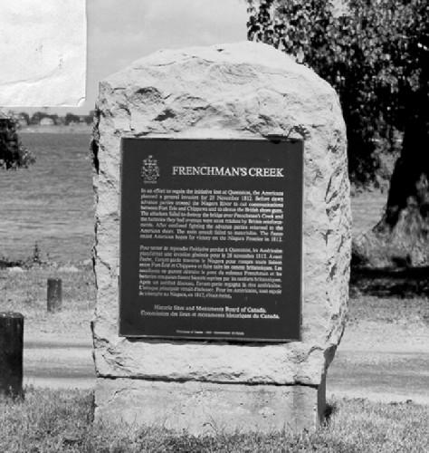
©Parks Canada Agency / Agence Parcs Canada, 1989 |
Frenchman's Creek National Historic Site of Canada
Fort Erie, Ontario
Frenchman's Creek National Historic Site of Canada is located on a point
in the centre of a bridge over Frenchman's Creek, a tributary of the
Niagara River, near Bridgeburg, Ontario. It is marked by a Historic
Sites and Monuments Board of Canada plaque, located within the
designated place, approximately 85 metres from the centre of the bridge.
There are no known extant resources associated with the War of 1812
battle that took place in this area.
The battle at Frenchman's Creek, a minor skirmish, occurred early on
November 28, 1812. It was part of a two-pronged American attack on
Frenchman's Creek and Fort Erie, in preparation for a general invasion
of the Niagara Frontier. American Lieutenant-Colonel Charles Boerstler
was directed to attack the guard at Frenchman's Creek and destroy the
bridge over the creek along the edge of the Niagara River. This was
intended to stop British reinforcements at Chippawa from interfering
with the main invasion at Fort Erie. Boerstler was ultimately repulsed
by Lieutenant Colonel Bisshopp's forces and was unsuccessful in his
attempts to destroy the bridge. The failures at Frenchman's Creek
contributed, in part, to the cancellation of the larger American
invasion planned for the Niagara Frontier at the end of 1812.
|

©Parks Canada Agency / Agence Parcs Canada, 2004 |
Frontenac County Court House National Historic Site of Canada
Kingston, Ontario
Frontenac County Court House National Historic Site of Canada is a
large, limestone court house, built in the mid-19th century in the
Neoclassical style. Its imposing columned portico and dome overlook a
wide expanse of park to the shoreline of Lake Ontario. It is located in
a downtown residential area of 19th-century homes, adjacent to Queen's
University, in the city of Kingston.
Frontenac County Court House is representative of the large-scale, court
houses erected in Ontario after 1850. The passage of the Municipal Act
gave increased power to county government, justifying the construction
of court houses on a monumental scale to accommodate multiple county
functions. The Frontenac County Court House is one of several surviving
court houses built during the boom in court house construction from 1852
to 1856. Designed by architect Edward Horsey, the building's elaborate
façade, comprised of a central portico, flanking wings and domed cupola,
and the elaborate mix of Italianate and classical detailing, are typical
of mid-19th century Ontario judicial buildings. The court house was
rebuilt by architect John Power and contractor George Newlands in 1874
following a fire. The only significant exterior change was the central
dome, which was given added height and emphasis.
|

©Parks Canada Agency / Agence Parcs Canada |
Fulford Place National Historic Site of Canada
Brockville, Ontario
Located along King Street East in Brockville, Ontario, overlooking the
Saint Lawrence River, Fulford Place National Historic Site of Canada was
the residence of businessman and entrepreneur Albert W. Fulford. The
house is a large stone structure, two-and-a-half storeys high, with a
gently pitched roof, an asymmetrical and picturesque elevation, and
richly finished interior. Together with its original furnishings, this
estate constitutes a remarkably intact example of the type of residence
erected by the wealthy in the late-19th and early-20th centuries. The
general spatial layout of the site retains the structural elements of
the landscape as it was originally laid out by the Olmsted Brothers, an
American landscape firm.
The heritage value of Fulford Place resides in the fact that it is a
particularly fine example of the type of mansion built for the wealthy
in the late 19th and early 20th centuries. Such residences typically
were quite large, designed in the stylistic eclecticism of the times; in
this case, the design is predominantly Beaux Arts in its general
symmetry and classical detailing, with Romanesque Revival elements in
the rusticated treatment of the masonry. The interior spaces feature the
suite of public and private rooms, as well as extensive service areas,
typical of mansions of the time where a great deal of entertaining was
undertaken, supported by a large household staff. The house is
remarkable in that most of the original furnishings — furniture, china,
pictures, and family mementos, etcetera — survive in situ. Such estates
typically also featured extensive landscaped grounds; remnants of the
landscape as originally laid out by the Olmsted Brothers firm still
survive.
|
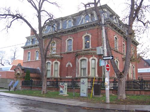
©Parks Canada Agency / Agence Parcs Canada, 2005 |
George Brown House National Historic Site of Canada
Toronto, Ontario
George Brown House National Historic Site of Canada is a three-storey
Victorian residence located at the corner of Beverley and Baldwin
streets in the heart of downtown Toronto. The proprety includes a red
brick mansard-roofed house with carved stone trim and a elegant cast
iron garden railings, built for George Brown, a Father of Confederation.
The house, where George Brown spent the end of is life, now houses a
museum, a meeting space and offices.
The heritage value of George Brown House National Historic Site of
Canada lies in its association with Geo rge Brown and through him with
the achievement of Canadian Confederation as well as with the
Abolitionist Movement and the Underground Railroad. The historical
associations are carried by the house itself in both its location and
physical properties.
This house was built for George Brown 1875-1877 and occupied by his
family from 1877-1886. Brown lived here in retirement until his death in
1881. At the time he lived here, Brown was owner and editor of The Globe
newspaper, a Senator and a Father of Confederation. Brown and his family
also had played a central role in the Abolitionist movement whose
Canadian activity centered in Toronto. Brown himself was personally
involved in the lives of many Underground Railroad refugees. The house
has been restored by the Ontario Heritage Foundation and is open for
public visitation.
|

©Parks Canada Agency / Agence Parcs Canada |
Georgian Bay Islands National Park of Canada
Headquarters: Midland, Ontario
Captivating islands representing Lake Huron's landscape.
Discover the iconic Canadian landscape of Georgian Bay Islands National
Park. Located in the world's largest freshwater archipelago, the 30,000
islands, it is at Georgian Bay Islands National Park that you will
discover spectacular landscapes, time-worn rock faces, diverse habitats,
the rugged beauty of the Canadian Shield and cultural history dating
back 5,000 years. These magnificent islands are accessible by boat only.
Hop on our shuttle, the DayTripper to explore the largest island,
Beausoleil, which offers tent camping, overnight and day docking,
geocaching, hiking and biking trails and interpretive activities.
|
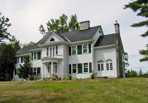
©Parks Canada Agency / Agence Parcs Canada |
Gillies Grove and House National Historic Site of Canada
Arnprior, Ontario
Gillies Grove and House National Historic Site of Canada is a
20th-century estate, located in a forested area at the edge of the
Ottawa River on the outskirts of Arnprior, Ontario. The major elements
consist of a stand of old growth forest encircling a cleared area with a
handsome, Colonial Revival house constructed from the white pine of the
forest itself.
The heritage value of this site resides in the integrity of the estate
comprised of a forest grove and clearing with house, subsidiary
buildings and landscaped areas. Gillies Grove is one of the few
remaining accessible Ottawa Valley woodlots with significant stands of
old growth white pine, long the mainstay of the region's lumber
industry. For more than 125 years the grove was owned and conserved by
two of the Valley's great lumbering families, the McLachlins and the
Gillies. In 1937, a fine Colonial Revival style house was built in a
clearing in the grove to showcase the white pine products grown,
harvested and milled by Gillies Brothers. The grove and house together
form a well-preserved example of a country estate from the interwar
period.
|

©Parks Canada Agency / Agence Parcs Canada, 2002 |
Glanmore / Phillips-Faulkner House National Historic Site of Canada
Belleville, Ontario
Glanmore / Phillips-Faulkner House National Historic Site of Canada is
an impressive, three-storey, 19th-century buff-brick house, built in the
Second Empire style. It is located on a generous corner lot in a
residential neighborhood in the city of Belleville.
Designed by architect Thomas Hanley for J.P.C Phillips, a wealthy
Belleville banker and financier, and his spouse, Glanmore /
Phillips-Faulkner House is a classic example of the Second Empire style
popular among the upper middle class in late-19th-century Canada. The
design elements of the Second Empire style most evident in the house are
the single-sloped mansard roof and the rich sculptural detailing along
the façade. The house has survived relatively intact, inside and out. It
is now operated as a house museum.
|
|
Glengarry Cairn National Historic Site of Canada
Cairn Island, Ontario
Conical stone monument, with stairway, to the Glengarry and Argyle
Regiment, erected in 1840.
Glengarry Cairn National Historic Site of Canada is located on The
Cairn, an island in Lake St. Francis, near the village of South
Lancaster, Glengarry County, Ontario. The site consists of an imposing
conical, masonry, fieldstone structure, 16 metres high and 16 metres in
diameter at its base. Steps spiral the structure that was constructed
between 1840 and 1842 to commemorate the services of Sir John Colborne.
The cairn remains an important and distinguished landmark that overlooks
the picturesque waters of the St. Lawrence River.
Glengarry Cairn was designated a national historic site of Canada in
1921 because: it is a monument erected by the Glengarry militia to
commemorate the services of Sir John Colborne, commander of the Imperial
Forces during the Rebellion of 1837.
Glengarry Cairn was erected between 1840 and 1842 under the direction of
Lieutenant-Colonel Lewis Carmichael, who commanded the Glengarry militia
during the Rebellion of 1837 and the border conflicts of 1838. The cairn
was erected to commemorate the services of Sir John Colborne, later Lord
Seaton, commander of the Imperial Forces during the rebellion. It was
also intended as a tribute to the services of the Glengarry Militia
regiments who fought from 1837 to 1838. A landmark for travelers on the
St. Lawrence, the deteriorating site was repaired in 1905 by the
citizens of Glengarry. A plaque was attached to the site at this time,
outlining its history.
|
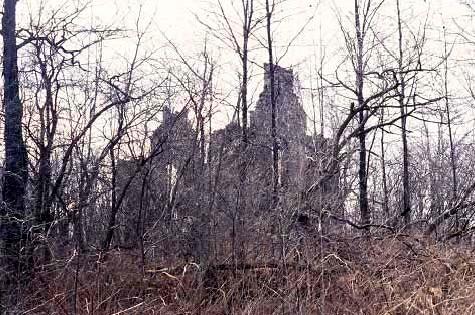
©Parks Canada Agency / Agence Parcs Canada, Dennis Carter-Edwards, 1996. |
Glengarry House National Historic Site of Canada
Cornwall, Ontario
Glengarry House National Historic Site of Canada is located on
Stonehouse Point, just east of Cornwall, Ontario. Now a ruin, the
fieldstone gable walls of the house are overgrown by thick brush. The
house was likely built in 1792 by Lieutenant Colonel John Macdonell, the
first Speaker of the Legislative Assembly of Upper Canada and a pioneer
in the settlement of Ontario.
John Macdonell received a land grant from the Crown at the conclusion of
the American Revolution in recognition of his military service. Although
he likely first constructed a log dwelling, it was recorded that he had
almost completed a large fieldstone house near the shore of the St.
Lawrence River in 1792. Macdonell called the house Glengarry House.
It is unclear what happened to the house after Macdonell's death. During
the War of 1812, it was converted into a barracks for the local militia
and was badly damaged by the soldiers. There is a local tradition that
the house burned in 1813, but this seems unlikely, since claims were
made in 1815 and 1825 to the British authorities for the cost of
repairs. By the 1890s, the building was in ruin with only the gable
walls standing. In 1921, the Historic Sites and Monuments Board of
Canada recommended that the house be recognized as a national historic
site of Canada.
|

©Parks Canada Agency / Agence Parcs Canada |
Glengarry Landing National Historic Site of Canada
Springwater, Ontario
Glengarry Landing National Historic Site of Canada is located on the
east bank of the Nottawasaga River, south of Edenvale in Simcoe County,
Ontario. The site consists of a semi-rural landscape that was occupied
during the War of 1812 by the Glengarry Light Infantry Fencibles who
constructed a flotilla of boats to relieve the British garrison at Fort
Michilimackinac. At the time of designation, the site encompassed
cleared fields and pasture, with no evidence of the 1814 military
expedition's activities. Today, the site has been divided into several
lots, with the addition of several different structures and access
roads.
In February 1814, during the War of 1812, the Glengarry Light Infantry
Fencibles was sent from Kingston under the leadership of
Lieutenant-Colonel Robert McDouall to reinforce the garrison at Fort
Michilimackinac. En route, the troops stopped at the junction of the
Nottawasaga River and Marl Creek, where they spent two months
constructing a flotilla of boats to move supplies and troops across Lake
Huron to the fort. On April 19, 1814, the flotilla left the landing for
Fort Michilimackinac. Subsequently, McDouall divided his forces and sent
a party to Wisconsin, under the command of Brevet Major William McKay,
to recapture Prairie du Chien on the Mississippi River. This mission was
successfully carried out in July 1814.
|
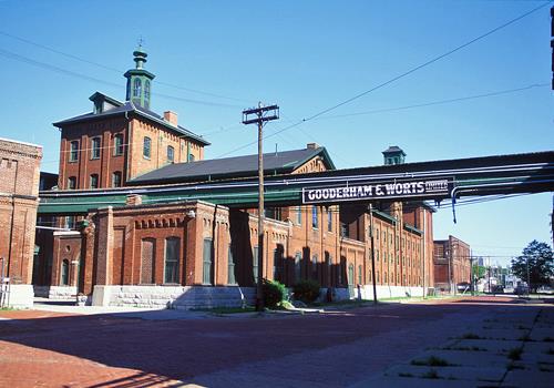
©Parks Canada Agency / Agence Parcs Canada |
Gooderham and Worts Distillery National Historic Site of Canada
Toronto, Ontario
The Gooderham and Worts Complex includes 30 brick and stone industrial
buildings, some of which are attached to one another, located on 13
acres of land at the intersection of Trinity and Mill streets on the
eastern edge of downtown Toronto. The buildings were constructed between
1859 and 1927 to produce, package, store, market and develop spirits for
the Gooderham and Worts firm.
The Gooderham and Worts Complex was designated as a site of national
historic and architectural importance because: it is an imposing
landmark, containing a number of buildings that collectively bear
witness to the evolution of the Canadian distilling industry.
The heritage value of the Gooderham and Worts Complex resides in the
unique sense of history and place created by: the completeness of the
complex in illustrating the entire distillery process, from the
processing of raw materials, to the storage of finished products for
export; the physical evidence that it provides about the history of
Canadian business, the distilling industry and 19th-century
manufacturing processes; the architectural cohesiveness of the site
characterized by a high degree of conformity in the design, construction
and craftsmanship of its constituent buildings; and the physical
relationships among the buildings and between the site and the railway
to the south.
|
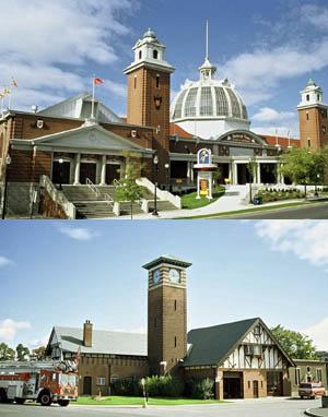
©Parks Canada Agency / Agence Parcs Canada, B. Morin, 1996 |
Gouinlock Buildings / Early Exhibition Buildings National Historic Site of Canada
Toronto, Ontario
The Gouinlock Buildings/Early Exhibition Buildings National Historic
Site of Canada is a group of five buildings built in the early 20th
century as part of Toronto's permanent exhibition grounds. They include
the Press Building (1904, formerly known as the Administrative
Building), the Music Building (1907, formerly known as the Railways
Building, the Hydro Building, and the Career Building), the Horticulture
Building (1907), the Government Building (1912, sometimes known as the
Arts Crafts & Hobbies Building) and the Fire Hall/Police Station (1912).
While the first four buildings were built in the Beaux-Arts Baroque
style, the Fire Hall/Police Station is more eclectic in design. The
buildings are clustered in a rough semi-circle at the western end of the
Canadian National Exhibition, grounds, close to Toronto's waterfront.
They are surrounded by more recent exhibition buildings of varying sizes
and styles.
The Gouinlock Buildings/Early Exhibition Buildings were designated a
national historic site of Canada in 1988 because these five buildings
are the largest and finest group of early 20th century exhibition
buildings in Canada.
The Gouinlock Buildings/Early Exhibition Buildings are the only
surviving examples of a group of fifteen exhibition buildings designed
by Toronto architect George W. Gouinlock as part of a comprehensive plan
for the Industrial Exhibition of Toronto. Erected between 1902 and 1912
in the Beaux-Arts Baroque style, the buildings are integrated within a
carefully planned and articulated site, that emphasizes the entrance to
each building as well as the physical relationships between them. These
characteristics were influenced by the 1893 World's Columbian Exposition
of Chicago. The Horticulture Building (1907), surrounded by attractively
landscaped open spaces at the front and rear of the building, formed the
focal point of Gouinlock's plan. The Government Building was built to
house federal government exhibits. The Press Building, originally known
as the Administrative Building, was built to emulate formal public
buildings of the time. The Music Building (1907), originally known as
the Railways Building, was built as an exhibition pavilion for the
Canadian Pacific and Grand Trunk railway companies.
Prompted by the federal government's plan to sponsor a major exhibition
at the site in 1903, and inspired by the Chicago exposition, the Toronto
City Council decided to rebuild the exhibition site. The building
campaign transformed the Industrial Exhibition of Toronto, as it was
then known, from a makeshift collection of temporary buildings into a
sophisticated complex of elaborately designed, permanent exhibition
pavilions set in an attractively landscaped site. The building project
reflected the development of the Toronto exhibition from a 19th-century
municipal fair into a nationally recognized exhibition of industrial,
manufacturing and agricultural development. At the conclusion of the
building campaign, the name was officially changed to the Canadian
National Exhibition.
|

©Parks Canada Agency / Agence Parcs Canada, M. D'Abramo, 2006 |
Griffin House National Historic Site of Canada
Hamilton, Ontario
Griffin House National Historic Site of Canada is a modest
one-and-one-half-storey house located atop a hill overlooking the Dundas
Valley in Ancaster Township, in what is now the City of Hamilton. Built
around 1827, the dwelling is of simple Georgian-inspired design typical
of a 19th-century Upper Canadian four-room house. It has a front-sloping
gable roof, and is clad in unfinished horizontal clapboards.
A major influx of Black immigrants made their way to pre-Confederation
Canada during the 19th century along the Underground Railroad to obtain
freedom from enslavement and the restrictive laws for the Black
population in the United States. Enerals Griffin was among the Black
settlers who chose to come to Canada, arriving at Niagara with his wife
in 1829. Griffin bought the former Lawrason house and fifty acres (202
342.8 metres squared) of land from George Hogeboom in 1834. Griffin
House is a typical, but now rare surviving example of a four-room house
found throughout Upper Canada in this period. It has undergone major
restorations between 1922 and 1994 to return the house to its 1830-1850
appearance.
In addition to its architectural value, Griffin House is historically
significant because it conveys the complexity of the Black experience in
British North America during the early years of the Underground
Railroad, in that it represents a more elaborate dwelling than was
common among Black refugees. The location of Griffin House in Ancaster
township (now the city of Hamilton) also contributes to the historical
value of the site. Immigrants in the 19th century were attracted to the
predominantly Euro-Canadian community for its labour market and
agricultural potential instead of the planned refugee settlements in
south-western Ontario. Griffin House represents the permanent, long-term
settlement of Black immigrants in what is now Canada, for the house
stayed in the family's possession through the generations until 1988,
when it was sold to the Hamilton Conservation Authority.
|

©Parks Canada Agency / Agence Parcs Canada, 1990 |
Guelph City Hall National Historic Site of Canada
Guelph, Ontario
Guelph City Hall is a two-storey, limestone building built in 1856-7 in
the Renaissance Revival style, and enlarged in 1875. It is prominently
located in the downtown area of the city of Guelph, across the street
from the train station.
Guelph City Hall was designated a national historic site in 1984 because
it is an example of a multi-functional city hall; it symbolized the
city's confidence in its future; and the smoothly dressed stonework and
delicate carving of the exterior design provide an elegant and refined
example of civic architecture in a classical style.
Guelph City Hall was erected, along with other prominent local
buildings, during the mid-19th-century period of pride and prosperity
that followed the arrival of the Grand Trunk Railway service to the
community. It is an excellent example of a mid-19th-century,
multi-functional civic building, combining the functions of a market,
fire hall, police office and jail, library, a reading room for the
Mechanics Institute, a large public hall along with town offices and a
council chamber in a single building. Designed by prominent Toronto
architect William Thomas and built by Morrison and Emslie with an 1875
addition by George Netting, Guelph City Hall is one of Ontario's finer
examples of the mid-19th-century Renaissance Revival style, a classical
style based on 16th-century Italian precedents. The carved detailing of
the façade were supervised by well-known artisan Matthew Bell.
|
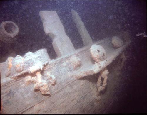
©National Geographic, 82-1874, 1982 |
Hamilton and Scourge National Historic Site of Canada
Lake Ontario, Ontario
Hamilton and Scourge National Historic Site of Canada is located at the
bottom of Lake Ontario 11 kilometres north of Port Dalhousie, near St.
Catharines. The site is comprised of the wrecks of two American
gunships, the Hamilton and the Scourge, which sank during the War of
1812. The ships are in a remarkably good condition, despite their
initial sinking and despite some decay brought about by the passage of
years at lake bottom. A sizeable debris field surrounds the two wrecks,
and it is thought that the site contains numerous artifacts.
The Hamilton and the Scourge were originally constructed as merchant
schooners, but both were pressed into service by the Americans and
modified for military purposes at the outbreak of the War of 1812. On
the night of August 7-8, 1813, a sudden squall came over the American
fleet stationed off Port Dalhousie, causing both ships to capsize and
sink. Less than a quarter of the over 70 crew members aboard both
vessels, survived. The loss of life was the greatest single loss of life
on the Great Lakes during the entire war. The wrecks were discovered in
their current location in 1979 and were purchased from the United States
Government by the City of Hamilton. They have been the subject of
several underwater archaeological investigations.
|
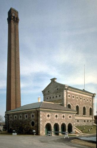
©Parks Canada Agency / Agence Parcs Canada, 1993 |
Hamilton Waterworks National Historic Site of Canada
Hamilton, Ontario
Hamilton Waterworks National Historic Site of Canada is a gracious
complex of mid 19th-century brick industrial buildings located just west
of the present City of Hamilton Waterworks on a narrow strip of land
between Woodward Avenue and the Queen Elizabeth Way. The complex can be
readily identified by its tall chimney and the distinctive Italianate
profile of the original waterworks pumphouse.
Hamilton Waterworks was designated a national historic site of Canada in
1997 because it is an early, rare surviving example of a Victorian
industrial building complex that is both architecturally and
functionally largely intact.
The heritage value of Hamilton Waterworks National Historic site of
Canada lies in its physical illustration of a Victorian industrial
complex, in this case a municipal waterworks which survives as a rare
representation of the Victorian use of industrial technology to improve
quality of life. Value resides in the overall site, setting, design,
materials and function of both the complex and its component parts, with
particular emphasis upon those original to the 1859 waterworks.
Hamilton Waterworks was designed by Thomas Coltrin Keefer and built by
the City of Hamilton in 1856-1859. Its purpose was to deliver large
quantities of clean water for safe drinking and fire control to the
rapidly expanding city. The facility was upgraded to address the needs
of the growing city in the years that followed: its original Gartshore
pumps were replaced in 1882; a second pumping station was built in 1887;
a third station with electric and steam turbine engines was installed in
1910-1913. When the complex itself was replaced by a new waterworks on
adjacent land in 1970, several buildings in the original group were
demolished. Today the early waterworks complex consists of the 1859
Pumphouse with its engines and equipment, an original Boilerhouse,
Chimney and Woodshed (all 1859), the Worthington Shed (1910) containing
a small steam pump, a second Pumphouse (1913), a Carpenter's Shed
(1915), and a large number of in-ground valves and valve chambers dating
mainly from the 20th century. The City of Hamilton has restored the
original waterworks, and today it is open for public visitation.
|
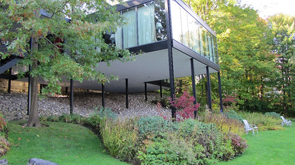
©Parks Canada Agency / Agence Parcs Canada |
Hart Massey House National Historic Site of Canada
Ottawa, Ontario
The heritage value of Hart Massey is based on its architectural and
environmental interests. The house was built in 1959, designed by the
architect Hart Massey, who lived there until the 1970s. It is an iconic
example of mid-20th century modernism in residential architecture in
Canada, and a Canadian example of International style because of its
sensitivity to its natural surroundings. Built on a rectilinear plan,
the minimalist structure is made up of a series of modular boxes
enclosed by alternating glass and opaque walls, which open the house to
its site creating a completely unique architectural ensemble. This
prestigious house reflects the personal tastes and the modernist ideals
of architect, Hart Massey, who designed it for himself and his family.
The design earned him the Silver Medal of the Massey Awards for
Architecture, the highest honour at the time. Elevated on thin steel
columns so that it appears to float above its sloped site on McKay Lake,
the house was designed to preserve the integrity of its natural
environment. Its architecture is an extension of the landscape, and its
dramatic expanses of glass erase the line between indoor and outdoor
space.
The Massey House is situated in the Ottawa residential community of
Rockcliffe Park, one of the few houses built directly on the shoreline
of McKay Lake. The house has two storeys. The common areas are on the
lower level, while the bedrooms are on the second floor. Massey wished
to preserve the natural environment of the site which he accomplished by
elevating the house above ground on thin pillars. There are mature trees
including a large willow to the north, shrubs, bushes, flowers,
perennial plants and grassy areas throughout the property, all of which
integrate nicely into the sloped site. The façades are smooth and
unadorned and the large glass surfaces expose a structural system based
on a steel frame or reinforced concrete. The east side of the house,
which faces the lake, features floor to ceiling windows that provide an
unobstructed view of the surrounding landscape. Inside, partition walls
on the ground floor are only three-quarters high contributing to an open
plan. A common colour scheme of beige and black extends throughout the
house.
The building has undergone changes over the years. The most important
was the enlargement of the house to the north in 1993 with the addition
of a modular box on each level. However, the integrity of its aesthetic
design as well as the treatment of materials has been maintained.
Subsequent owners have carefully restored and renovated the house while
meticulously respecting its original concept. Some changes have also
been made to the landscaping in keeping with the architecture of the
house. Gardens have been successfully integrated and new varieties of
plants and flowers continue to be introduced.
|

©Parks Canada Agency / Agence Parcs Canada, 2007 |
Heliconian Hall National Historic Site of Canada
Toronto, Ontario
Heliconian Hall National Historic Site of Canada, located in downtown
Toronto, is set in a neighbourhood dominated by Victorian and Edwardian
brick buildings interspersed with more recent infill buildings.
Constructed in 1876 as a church, Heliconian Hall is distinguished by the
use of the Carpenter's Gothic style and Gothic-style ornamentation that
contrasts with the simple board-and-batten exterior. It features a
square, flat-roofed tower to the right of the entrance, and a steeply
gabled central section flanked by two entrance porches.
By the early 20th century, Toronto's female artistic community had
reached a population capable of sustaining a multidisciplinary arts club
specifically for women. Founded in 1909, a year after the all-male Arts
and Letters Club, the Heliconian Club was a manifestation of the women's
club movement that swept North America during this period. Operating for
nearly 15 years without a clubhouse, the Heliconian Club purchased the
former Olivet Congregational Church in 1923, renovating and decorating
it to fit their needs. Invigorated by the acquisition of a permanent
clubhouse, the Heliconians met more frequently and organized more
numerous and elaborate events. As the club's first permanent location,
the aptly-named Heliconian Hall provided a place where women in the arts
could meet, socialize and network, as well as a creative space for
artistic activity, featuring regular performances, either to promote
talent within the Club, or to showcase guest performers.
A fairly-modest building, Heliconian Hall was purchased by the members
of the Heliconian Club themselves, and adapted and outfitted to reflect
the activities and goals of the club. With its excellent acoustics,
stage and exhibit space in the main hall, and equipment such as a stage
and gallery lighting, the hall is a valuable performance space,
providing ample room and facilties necessessary to fulfill the Club's
role as a gathering place for women in the arts.
|

©Parks Canada Agency / Agence Parcs Canada |
Her Majesty's / St. Paul's Chapel of the Mohawks National Historic Site of Canada
Brantford, Ontario
Her Majesty's / St. Paul's Chapel of the Mohawks National Historic Site
of Canada is a picturesque white-frame church located in a treed
churchyard on the banks of the Grand River. Recognized as the oldest
surviving church in Ontario, it serves the Mohawk community that
relocated to the area after loyally supporting the British during the
American Revolution.
The heritage value of Her Majesty's / St. Paul's Chapel of the Mohawks
resides in the witness it bears to the depth and strength of the
British-Mohawk alliance and to an early period of Canadian history. The
primary value of the church lies in its presence, its form and its
structural composition. Value also exists in its design, decor,
materials, function, site and setting.
The chapel was built by the British Crown in 1785 as a gift to the
Mohawk First Nation who, under Joseph Brant, supported the British
during the American Revolution. Her Majesty's / St. Paul's Chapel of the
Mohawks was built by Loyalists John Thomas and John Smith who also came
from New York. It has been in continuous use since its construction, and
as a result has experienced many improvements and alterations. Most
important among them was a ninety-degree re-orientation of the interior
axis to align with the gable in 1829, and an 1869 reworking of the
original Georgian design to reflect Victorian architectural values. Her
Majesty's / St. Paul's Chapel of the Mohawks was declared a Royal Chapel
in 1904.
|

©Parks Canada Agency / Agence Parcs Canada |
Hillary House National Historic Site of Canada
Aurora, Ontario
Hillary House National Historic Site of Canada is a brick,
one-and-a-half-storey, Gothic Revival style house, surrounded by
spacious lawns, trees, and plantings. It is located in the city of
Aurora, Ontario, just north of Toronto. The house and its grounds
provide a fine example of a mid 19th-century villa in the Picturesque
style of that era. It is now operated as the Koffler Museum of Medicine.
Built in 1861-1862 for the Geikie family, and altered by subsequent
owners in 1869 and 1888, Hillary House and its grounds form one of the
most complete examples of Picturesque Gothic in Ontario. The evolution
of the Gothic Revival is evident in the house's two successive
additions. The 1888 addition was designed by architect David
Dick.
|

©Parks Canada Agency / Agence Parcs Canada |
HMCS Haida National Historic Site of Canada
Hamilton, Ontario
Last of World War II tribal class destroyers.
HMCS Haida is a restored Tribal Class destroyer moored at Pier 9 in
Hamilton harbour. Retired from active service, it is now open to the
public.
The heritage value of the HMCS Haida lies in her legibility and
completeness as a Tribal Class destroyer whose design was "improved" for
use in Canadian waters, and in her impressive record of service. HMCS
Haida was built for the Royal Canadian Navy (RCN) at Newcastle, England
in 1942 following a design developed by the Royal Navy. She was launched
at Newcastle, England in 1942 and was commissioned into the Royal
Canadian Navy in 1943, after which she saw heavy action mainly with the
British navy during World War II in the Arctic, the English Channel, off
Normandy, and the Bay of Biscay. The Haida was converted to a
destroyer-escort in 1951-52 and then saw two tours of duty with the
United Nations in Korea. From 1954, she continued in the RCN,
participating in numerous NATO and UN activities during the Cold War
until she was decommissioned in 1963. Saved by private citizens, she was
brought to the Toronto waterfront and was acquired by the Province of
Ontario, becoming an attraction at Ontario Place. In 2002 she was
acquired and repaired by Parks Canada, refurbished and moved to Hamilton
harbour where she is open to the public. She has been called Canada's
most famous warship.
|

©Parks Canada Agency / Agence Parcs Canada, J. Butterill, 1995. |
Homer Watson House / Doon School of Fine Arts National Historic Site of Canada
Kitchener, Ontario
Homer Watson House / Doon School of Fine Arts National Historic Site of
Canada is located in the hamlet of Doon, which is now part of Kitchener,
Ontario. This modest, 19th-century, one-and-a-half-storey house that
sits within a generous property, was the home and studio of Canadian
landscape artist Homer Watson. The house was designated for its dramatic
gallery and studio addition that contains works of art and creative
spaces associated with Watson's career.
Canadian landscape painter Homer Watson (1856-1936), born in Doon, was
commemorated by the National Historic Sites and Monuments Board of
Canada as a person of national historic importance in 1939. He purchased
this house when he married in 1881, and lived in it until he died in
1936. Although the house is a typical 19th-century brick farmhouse built
in 1834, Watson personalized its facilities to pursue his art, and made
two additions: a studio addition on the rear of the house (1893) and a
gallery (1906). Particular value lies in those rooms and places
associated with his art, his studio and gallery spaces, viewscapes and
features of the surrounding site associated with his paintings, and
location of the residence within the historic community of Doon. Some of
Watson's most respected works are views of the surrounding countryside
from various vantage points of the property. The house later became the
Doon School of Fine Arts and a privately maintained memorial to Watson.
Since that time it has been operated by the City of Kitchener.
|
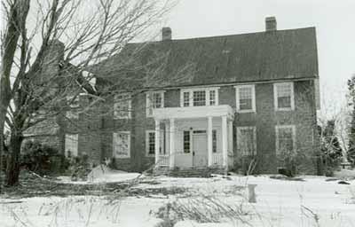
©Parks Canada Agency / Agence Parcs Canada |
Homewood National Historic Site of Canada
Augusta, Ontario
Homewood National Historic Site of Canada is a very early 19th-century
two-storey stone residence set just back from the St. Lawrence River a
few kilometres east of the hamlet of Maitland in eastern Ontario.
Homewood was built in 1800-1801 as the residence for Dr. Solomon Jones
(1756-1822), a prominent south-eastern Ontario Loyalist. It was
constructed of stone by Montreal mason Louis Brillière, and today
retains much of its original character. The building has had two major
additions - a rear addition constructed about 1830, and a west wing in
1945. The house remained in the Jones family until the 1960s when it was
purchased by the Dupont company. In 1974 it was acquired by the Ontario
Heritage Foundation for preservation as a museum.
|
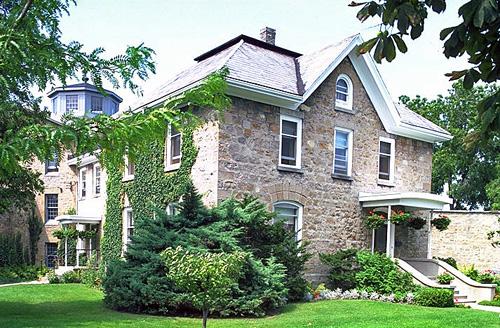
©Parks Canada Agency / Agence Parcs Canada, 1982 |
Huron County Gaol National Historic Site of Canada
Goderich, Ontario
Huron County Gaol National Historic Site of Canada is a walled prison
compound dating from the first half of the 19th century. It contains a
three-storey octagonal prison building with wings, a gaoler's residence,
and five enclosed exercise yards. Located at 181 Victoria Street North
in Goderich, Ontario, it now houses a prison museum.
The heritage value of Huron County Gaol National Historic Site of Canada
resides in those aspects of the complex that illustrate the panopticon
prison design. The Huron County Gaol was built between 1839 and 1841
when the town of Goderich was established as the county seat of the
Huron District. The prison's third storey initially accommodated a
courtroom. Designed by Thomas Young of Toronto, it follows a British
prison design created by Jeremy Bentham known as the panopticon plan.
This design is based on an octagonal central block with radiating wings
between which are wedge-shaped exercise yards. The complex, surrounded
by thick masonry walls, served as a jail for Huron County until
1972.
|
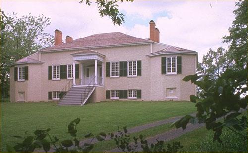
©Parks Canada Agency / Agence Parcs Canada, 1988 |
Inverarden House National Historic Site of Canada
Cornwall, Ontario
Important 1816 Regency cottage with fur trade associations.
Inverarden House National Historic Site of Canada is a gracious early
nineteenth century house set on a 1 hectare fragment of the original
estate of John McDonald of Garth on the north side of County Road 2
(formerly Highway 2) along the St. Lawrence River on the outskirts of
Cornwall.
The heritage value of this site resides in its physical illustration of
domestic Regency architecture and in its association with Northwest
Company fur trader John McDonald of Garth.
Inverarden House epitomizes the taste and social standing of retired
Northwest Company fur traders who settled in this part of Ontario in the
19th century. John McDonald of Garth built the central portion of
Inverarden House in 1816 and added its wings (1821-1823), completing a
substantial Regency residence.
|

©Parks Canada Agency / Agence Parcs Canada, 1982 |
John R. Booth Residence National Historic Site of Canada
Ottawa, Ontario
The John R. Booth Residence National Historic Site of Canada is located
in Ottawa, Ontario. This large house, built in 1909, is a sophisticated
composition in the Queen Anne Revival style. Its design features
multiple projections, elaborately shaped gables, ornate stone moulding
and a medieval style square corner tower. The house interior retains
many original features and finishes. The effect of these combined
elements is one of opulent grandeur.
This luxurious house was constructed in 1909 for prominent lumber baron
John R. Booth. A fine example of the Queen Anne Revival style, its
corner lot allows both principal façades to be appreciated
independently. When viewed from an angle, balance and harmony is
conveyed through the gables of similar design anchored by a tall chimney
at the point of intersection. John R. Booth died in 1925 and the house
remained in the Booth family until 1947 when it was sold to the
Laurentian Club of Ottawa. Trinity Western University acquired the site
in 2001 to establish a base for educational programs in Ottawa and
subsequently opened the Laurentian Leadership Centre in 2002.
|
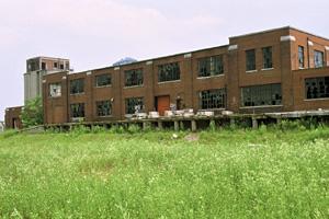
©Parks Canada Agency / Agence Parcs Canada, 1994 |
John Street Roundhouse (Canadian Pacific) National Historic Site of Canada
Toronto, Ontario
John Street Roundhouse (Canadian Pacific) National Historic Site of
Canada is a low semi-circular brick structure built to accommodate
railway engines on a massive turntable. Located a short distance from
Toronto's waterfront on former railway lands near the CN Tower, it is
being rehabilitated for alternate uses which will ensure public access.
The heritage value of the John Street Roundhouse lies in its location on
Toronto's formerly vast rail yards and in the design and surviving
physical fabric which illustrate its former role in the rail industry.
The John Street Roundhouse was designed by Chief Engineer J.M.R.
Fairbairn of Canadian Pacific Railway's Engineering Department and built
in 1929-1931 by Anglin-Norcross Ltd. of Montreal. Constructed as a
32-stall roundhouse to accommodate the inspection, servicing, cleaning
and repair of steam passenger locomotives, its use declined with the
introduction of diesel service. It continued to operate in a reduced
capacity for Canadian Pacific and later, for VIA Rail Canada Inc., who
utilized the roundhouse until 1986. Now owned by the City of Toronto,
the turntable was removed, the coaling and sanding tower relocated, and
bays 1-11 of the roundhouse disassembled and rebuilt in 1994 - 1997 to
allow rehabilitation of the site for alternate uses.
|

©Parks Canada Agency / Agence Parcs Canada |
John Weir Foote Armoury National Historic Site of Canada
Hamilton, Ontario
The John Weir Foote Armoury is situated in the downtown commercial area
of Hamilton, Ontario. It is a large building composed of two sections
constructed at different times. The North section facing James Street
was built in 1888 in the Italianate style. The second, larger south
section, which stands 24 metres (80 feet) south of the original
building, was completed in 1908. A two-storey extension facing James
Street joins the two buildings together and provides a continuous brick
façade. A 1936 addition at the back of the North Drill Hall joins to the
South Drill Hall, the whole now forming one large complex set around an
open courtyard. The buildings are united by the use of red brick with
white stone trim.
Designed by Department of Militia Chief Engineer Henry James in the
Italianate style and built in 1888, the first section of the armoury,
the North Drill Hall, is one of five remaining examples of the first
permanent drill halls from the second phase of drill hall construction
in Canada between 1872 and 1895. Characteristics of this second phase
include styles that vary from the Châteauesque to the Italianate but
have a common rational plan. Constructed in solid brick or stone, the
drill halls exhibit a conservative approach to the handling of wide
spans, as evidenced here in the reinforced timber queen post trusses of
the north section. These buildings were increasingly constructed to
function as both fully equipped training centres and as recreational
clubs. The 1888 armoury underscores the continuous importance of
Hamilton as a militia centre, and as a first line of defense.
In 1905 it was decided that Hamilton needed a second drill hall.
Exceptionally, the Department of Public Works awarded the contract to
the architectural firm of Stewart and Whitton. The second section, the
South Drill Hall (1905-1908) is larger than the North section and
belongs to the 1896-1918 phase of drill hall construction completed
under Frederick Borden as Minister of Militia (1896-1911). It is a
"class A" type of drill hall reserved for battalion headquarters and
important military centres. This design follows that of the 1880s and
1890s drill halls with all the auxiliary rooms arranged around two sides
of a two-storey hall. The halls in these "class A" buildings have a
standard width of between 22.8-24.4 metres and vary in length from 45.7
to 71.6 metres. Equipped with drill, classroom, recreational facilities,
and modern washrooms, these drill halls set a new standard in the
modernization of the militia. A continued conservative approach to the
handling of wide spans is evidenced in the reinforced timber queen post
roof. The picturesque high Victorian design expressed the role of the
building through its architectural vocabulary that includes military
references such as corner towers and troop doors. It also satisfied the
militia's sense of its social position and fitted well into Hamilton's
commercial district.
The armoury now serves as headquarters for the 11th Field Battery, Royal
Canadian Artillery; the Royal Hamilton Light Infantry; the Argyll and
Sutherland Highlanders of Canada (Princess Louise's); and the 705
Communications Squadron. Originally called the James Street Armoury, the
building was renamed the John W. Foote VC Armoury in memory of Honorary
Lieutenant-Colonel John Weir Foote VC, CD.
|
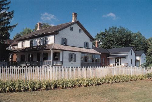
©Parks Canada Agency / Agence Parcs Canada, 1998 |
Joseph Schneider Haus National Historic Site of Canada
Kitchener, Ontario
Located on a major arterial road in the city of Kitchener, Joseph
Schneider Haus National Historic Site of Canada is a remnant of an early
19th-century Mennonite homestead. It survives as a house museum with a
two-storey frame house, reconstructed outbuildings including a bake
house and wash house, a period garden, an orchard, and a piece of
parkland near a former mill pond.
Joseph Schneider Haus was designated a national historic site of Canada
because of its association with the main migration of
Pennsylvania-German Mennonites from Lancaster County, Pennsylvania to
Waterloo County in the early 19th century and because it preserves the
vernacular house plan developed by the Mennonites in pre-American
Revolutionary Pennsylvania.
About 1816, a homestead was established by Joseph Schneider who led the
major migration of Pennsylvania-German Mennonites north from the United
States in 1807. The core of Schneider's property was converted into a
museum in 1979.
|
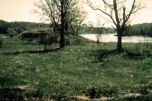
©Parks Canada Agency / Agence Parcs Canada |
Kay-Nah-Chi-Wah-Nung (Rainy River Mounds) National Historic Site of Canada
Morley, Ontario
Kay-Nah-Chi-Wah-Nung National Historic Site of Canada is part of a vast
network of ancient burial mounds extending from Quetico in the east
through Rainy River and Lake of the Woods into south-eastern Manitoba.
Constructed from approximately 3000 BCE to 1650 CE, the national
historic site of Canada consists of a 500 metre-wide strip of lowland
stretching 3 kilometres along the north bank of the Rainy River in the
isolated area mid way between Rainy Lake and Lake of the Woods. The site
contains 15 burial mounds and the archaeological remains of some 30
village sites.
Kay-Nah-Chi-Wah-Nung National Historic Site of Canada is one of the most
significant centres of early habitation and ceremonial burial in Canada.
It contains evidence of 5,000 years of human habitation including burial
mounds from the Laurel (300 BCE - 1100 CE) and the Blackduck (800-1650
CE) cultures. Home to the Ojibway people in past centuries, the site
area was homesteaded by the Rainy River First Nations from the time of
the signing of Treaty no. 3 in 1873 to 1916, and therefore also contains
evidence of cabins, farm buildings, and associated activities. This site
has deep cultural and spiritual significance to the Ojibway people as a
living link in the continuum of past, present and future. Its location
at the centre of a major network of North American waterways also means
it has significance to First Nations peoples on other parts of the
continent.
The heritage value of Kay-Nah-Chi-Wah-Nung National Historic Site of
Canada resides in its historical associations with past and present
cultures as symbolized by its strong sense of place, the location and
natural features of the site, the presence of its ancient burial mounds
and habitation sites, and the site's function as a living link between
those who visited, occupied or used it in the past and the lives of the
Ojibway people of today.
|

©Parks Canada Agency / Agence Parcs Canada, Michel Pelletier, 2004 |
Kensington Market National Historic Site of Canada
Toronto, Ontario
Kensington Market National Historic Site of Canada is a small
neighbourhood located west of Spadina Avenue in the heart of downtown
Toronto, Ontario. Similar to many urban ethno-cultural communities in
downtown Toronto, Kensington Market forms a part of this larger area of
residential, institutional and commercial buildings. Within the boundary
is a vibrant commercial and residential neighbourhood with distinctive
narrow streets of small stores with colourful awnings built onto former
homes selling food, spices and clothes from around the world. Behind and
beside the storefronts there are discreet back alleyways winding through
the neighbourhood where short rows of small late-19th century cottages
sit on narrow lots. Streets in the district are mostly made up of
mixed-use buildings, typically containing a ground-floor store,
extending out towards the street, with apartments on the second storey.
Most of the buildings date from the 1880s to the 1960s, and have heavily
modified fronts, either re-clad by owners or redesigned in a variety of
offbeat personal and cultural tastes, reflecting the eclectic milieu of
Kensington.
The area that is currently Kensington Market was first developed in 1815
by George Taylor Denison who constructed Bellevue Estate on a 40-
hectare (100-acre) parcel of land west of Spadina Avenue. In the 1850s
and 1860s, the Denison's gradually subdivided the land and sold it to
British and Irish immigrants. As the urban density increased, workers
built small cottages along the many laneways. In the early 20th century,
Kensington saw an influx of Jewish immigrants, mostly from Russia and
eastern and south-central Europe. Over the next thirty years, they
established its dynamic character as a market. In the 1920s and 1930s,
in response to growing competitiveness, the shops extended even farther
out onto the already narrow streets. Canopies and outdoor stalls reached
the street and additions were built onto many of the houses to provide
more shop space. Beginning in the 1950s, Kensington Market hosted an
increasingly diverse cultural mosaic of ethnic groups, races and
religions. This included post-war immigration from Eastern Europe,
Portugal and Italy. In the 1960s a considerable number of
Afro-Caribbean, Chinese and East Indian businesspeople moved into the
neighbourhood and opened up shops. The diverse character of Kensington
Market's history has created a continually evolving cultural and
architectural environment that remains evident in the market area
today.
|

©Parks Canada Agency / Agence Parcs Canada |
Kingston City Hall National Historic Site of Canada
Kingston, Ontario
Kingston City Hall is a monumental town hall, built of stone in the mid
19th century. Constructed in the Neoclassical style, it is prominently
located in the heart of Kingston's historic downtown, facing the
waterfront. The property takes up a full city block. To the rear is a
large, open area that accommodates the open-air stalls of a seasonal
farmer's market.
Kingston City Hall was designated a national historic site in 1961
because it is an outstanding example of the Neoclassical style in
Canada, and it is a representative example of a combined-function city
hall.
Designed by architect George Browne as his first major commission,
Kingston City Hall follows the precedent for public buildings of its
time in its composition and the emphasis on portico and dome. The Tuscan
portico, removed in 1958, was rebuilt in 1966 to replicate the original.
The design follows Neoclassical taste in its massive scale, the bold
projection of the end pavilions and portico, and the strong emphasis on
individual design elements.
Like many mid-19th-century town halls, Kingston City Hall was designed
to combine the functions of town hall and market place in one building.
Its impressive scale and design were in keeping with the anticipated
prosperity and stature of the city as the provincial capital. The city
hall provided two large meeting halls, offices and meeting space for
city officials, and quarters for the custom house, post office, police
station and jail. A rear section contained market space. This rear wing
that was rebuilt in 1865 and again in 1973 and the dome was rebuilt in
1910. The Tuscan portico that was reconstructed in 1966.
When Kingston's selection as provincial capital was revoked and the
city's fortunes changed, surplus space in the city hall was rented out
to a variety of private interests, including saloons, shops, churches,
private associations, a bank and a small theatre. Although the
allocation and use of space has changed over its more than 150 years of
civic use, the property's two main functions, as town hall and
marketplace, continue to the present day.
|

©Library and Archives Canada / Bibliothèque et Archives Canada, PA-57417, 1927 |
Kingston Customs House National Historic Site of Canada
Kingston, Ontario
The Kingston Customs House National Historic Site of Canada is a
handsome two-storey neoclassical building erected between 1856 and 1859
by the Province of Canada. It is constructed of limestone and is
situated in the centre of the city of Kingston on a block shared by the
former Kingston Post Office and a limestone stable associated with the
two public buildings. It is part of a cluster of 19th-century public and
commercial buildings, including the Kingston City Hall, in the immediate
vicinity.
The Kingston Customs House was designated a national historic site of
Canada in 1971 because it is a fine example of the architectural quality
of mid-19th-century administrative buildings designed in the British
classical tradition.
The Kingston Customs House was designed in 1856 in a British
neoclassical style for the Province of Canada by the Montréal
architectural firm of Hopkins, Lawford and Nelson to complement the
adjacent post office constructed at the same time. The Customs House
harmoniously blends neoclassical and Renaissance elements in local
Kingston limestone to convey the importance of its function and to
reflect Kingston's vital place in pre-Confederation Canada.
In its competent and striking use of neoclassical elements and its
careful placement in a government precinct, the Kingston Customs House
is also illustrative of major administrative buildings of the period
that were designed to instil pride in and respect for government in the
rapidly growing Province of Canada.
|

©Parks Canada Agency / Agence Parcs Canada, David Henderson, 2008 |
Kingston Dry Dock National Historic Site of Canada
Kingston, Ontario
Kingston Dry Dock National Historic Site of Canada is located on
Mississauga Point, part of the Kingston waterfront on the St. Lawrence
River. It now forms part of the Marine Museum complex. The Kingston Dry
Dock was an important repair facility for ships and provided dry working
access to the exterior of a vessel below the waterline. The long,
rectangular-shaped dock has stepped sides that rise 9.1 metres from its
bed. The original dry dock had an inner invert width of 16.8 metres and
a floor length of 85.3 metres. Both the walls and bed of the dock are
constructed of limestone. The dock was subsequently lengthened to 115.2
metres using concrete. The dock gate or floating caisson is seated in a
rectangular berth set at right angles to the dry dock entrance. The
caisson is built of steel in the shape of a rectangular box with
parallel sides and inclined ends. Along each side of the caisson berth
are heavy cast iron rollers placed at intervals, on which the caisson
rests and travels when being moved. Steps at either side of the entrance
provide access to the dock floor.
Mississauga Point was for over 150 years the site of major shipyards
when Kingston was one of the important ports and ship building centres
on the Great Lakes. The significance of the shipping industry led the
federal government to construct this dry dock in 1890. Initially
operated by the Department of Public Works as a repair facility for lake
vessels, it was enlarged and leased in 1910 to the Kingston Shipbuilding
Company; the first of a series of private companies, which operated the
shipyards until 1968. During the Second World War naval vessels, notably
corvettes, were built in this shipyard.
|

©Parks Canada Agency / Agence Parcs Canada, 2007 |
Kingston Fortifications National Historic Site of Canada
Kingston, Ontario
Protection for the Royal Naval Dockyard and the entrance to the Rideau
Canal; War of 1812.
Kingston Fortifications National Historic Site of Canada is located in
and around the harbour area of Kingston, Ontario. Situated at the mouth
of the Cataraqui River, and overlooking the confluence of Lake Ontario
and the St. Lawrence River, the fortifications consist of five separate
19th-century military installations, including Fort Henry National
Historic Site of Canada (NHSC), Fort Frederick, part of the Point
Frederick Buildings NHSC, the Murney Tower NHSC, Shoal Tower NHSC, and
Cathcart Martello Tower. An inter-related defense system, the
concentration and orientation of the limestone fortifications towards
the water convey their essential purpose as a defensible platform for
guns. Built between 1832 and 1840, the Kingston fortifications represent
the apogee of smooth bore technology.
A historically strategic site, the Kingston Harbour area is situated at
the mouth of the Cataraqui River, facing the confluence of the St.
Lawrence River and Lake Ontario. As the gateway to the Great Lakes, it
was a particularly significant site for shipping, especially before the
advent of railway transportation. The strategic importance of the site
was first recognized by the French, who constructed a military and
trading post there in 1673. Captured by British forces in 1758, the
Kingston Harbour area has had an uninterrupted military presence since
the establishment of a Kingston Garrison in 1783. Construction of the
fortifications began with the outbreak of the War of 1812, when a number
of simple defensive works were hurriedly built around the harbour,
including blockhouses at Point Henry, Point Frederick and Murney Point.
Following the war, Kingston evolved into a major commercial, political,
naval and military centre in the colony of Upper Canada. In 1832, the
Rideau Canal linking Kingston to Montreal was completed, thereby
increasing the town's role as a transportation hub. In order to protect
the southern terminus of the canal, the British began to fortify the
harbour with the construction of Fort Henry, situated atop Point Henry.
Designed by the British Royal Engineers, the new fort called for a
series of inter-connected supporting batteries and redoubts to augment
Fort Henry's defenses. The rehabilitation of Fort Frederick, and the
construction of the Shoal, Murney, and Cathcart Martello Towers was
conducted in the mid-1840s. These fortifications, along with the former
Market Battery, were designed to provide the town, the canal, and the
dockyards with a more comprehensive defensive system. Representing the
apogee of smooth bore technology, tactics and fortification design, the
Kingston fortifications are integrated through common limestone
materials, skillful construction, and orientation and placement as a
defensible platform.
In 1870, the British garrison left the town, and the fortifications
themselves were reduced to service as training and storage facilities
for the Canadian military. Although the fortifications were never tested
in war, the imposing system they compose points to the historic and
strategic importance of this place that called for such defenses.
|
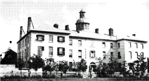
©Parks Canada Agency / Agence Parcs Canada |
Kingston General Hospital National Historic Site of Canada
Kingston, Ontario
Kingston General Hospital National Historic Site of Canada is a complex
of limestone hospital buildings of classically inspired design, built
between 1833 and 1924. The seven interconnected buildings that make up
the national historic site are set within a larger hospital campus of
post-1924 buildings, known as Kingston General Hospital. The hospital is
located in the city of Kingston, on the southern edge of Queen's
University Campus and adjacent to Lake Ontario. The original hospital
building (Main Building, 1833-5) and its two lateral wings (the Watkins
Wing, 1862; and the Nickle Wing, 1890-1) face northward onto Stuart
Street. A semi-circular building housing a 19th-century operating
amphitheatre (Fenwick Operating Theatre, 1895) is adjoined to the rear
of the Main Building. Behind these buildings are a late-19th-century
maternity hospital (Doran Building 1893-4), an early-20th-century
nurses' residence (the Ann Baillie Building National Historic Site of
Canada, 1903-4) and an early 20th-century wing of private and
semi-private rooms (the Empire Wing, 1914; 1923-4). Most of the
buildings are directly adjoined or connected by passageways. Some are
also adjoined or connected to other more recent hospital buildings. The
arrangement of buildings has created an informal courtyard at the rear
of the Main Building.
The seven buildings comprising the Kingston General Hospital National
Historic Site illustrate the evolution of hospitals in Canada from
19th-century charitable institutions, to 20th-century centres for
scientific medicine. The Main Building of Kingston General Hospital was
the third, purpose-built, public general hospital in Canada and is the
oldest one still operating as part of a modern hospital.
In the early 19th century, the sick usually were cared for at home.
Charitable institutions cared for the destitute sick. The Main Building
of Kingston General Hospital was built in 1833-5 to provide a permanent
charitable hospital. Its domestic scale and design reflected the
early-19th century preference for home-like settings. It also served as
Parliament for the United Canadas for several years, before opening as a
hospital in 1845. The Watkins Wing, added in 1862, provided additional
patient space and reflected advances in the care and treatment of the
sick and in public attitudes, providing isolation wards for smallpox
cases, wards for paying patients, and a surgery/lecture room for
instructing medical students.
The Nickle Wing, added in 1890-1, provided isolation units for patients
with infectious disease, and accommodation for nurses and students of
the nursing school established at the hospital in 1886. The Doran
Building, built in 1894, provided separate facilities for maternity
patients, gynaecology, and children. Its pavilion-style design and
interior finishes responded directly to the use of isolation, asepsis
and antisepsis to prevent infection. Its surgery reflected a renewed
emphasis on surgical procedure in obstetrics and gynaecology. The
Fenwick Operating Theatre, added in 1895, provided an operating
amphitheatre with seats for observers, reflecting the growing importance
of surgeons and medical training and the need for a sterile, well-lit
environment. It is the only extant pre-1920 operating amphitheatre in
Canada. The construction of the nurses' residence (Ann Baillie Building)
in 1904 to plans by William Newlands reflected the critical importance
of nurses at the hospital and the success of the nursing school. The
construction of the Empire Wing with private and semi-private rooms in
1912-14, and its subsequent expansion, reflected the increasing
proportion of paying patients and the acceptance of hospitals by the
well-to-do.
|

©Parks Canada Agency / Agence Parcs Canada, 2008 |
Kingston Navy Yard National Historic Site of Canada
Kingston, Ontario
The Kingston Navy Yard National Historic Site of Canada is located on
Point Frederick, Kingston, in Ontario. It is a 37-hectare point of land
at the confluence of the Cataraqui and St. Lawrence Rivers. The Navy
Yard, a former dockyard and naval station occupied most of the peninsula
that now contains the buildings of the Royal Military College of Canada
complex. Official recognition refers to the surviving structures
associated with the Navy Yard including the former naval surgeon's
quarters and dispensary now known as the Commandant's House (1813-14),
the stone wall that forms the western entrance to the inner enclosure or
core of the RMC campus dates from the immediate post-war period
(1816-19), and the three-storey Stone Frigate (1819). The former Guard
House and the larger Porter's Lodge (Gatehouse) were constructed circa
1838. A large open space, formerly used as a construction yard, is now
an open exercise area and parade square. In Navy Bay there are
underwater remains of the yard's wharves and launching slips as well as
associated shipwrecks and artefact concentrations.
An active military site from the 1790s to 1853, the Navy Yard was
established in 1789 as a trans-shipment point on the Great Lakes, and as
the Provincial Marine's Lake Ontario base. The Kingston Navy Yard served
as the main naval station in Upper Canada during the War of 1812. The
Rush-Bagot Treaty of 1817, which limited the number of British and
American warships on the Great Lakes, brought about a decline in
activity, and by mid-century the yard was closed. By 1876, the site was
being used by the Royal Military College of Canada. The earliest RMC
buildings include some of those erected in the old naval dockyard. These
include the present Commandant's House previously known as the naval
surgeon's quarters, the later large Stone Frigate, built to store naval
gear from warships laid up following the War of 1812 and has been
continuously used as a dormitory since the RMC was opened in 1876, and
the small Guard House and larger Porter's Lodge now used as an office.
The Kingston Navy Yard was originally protected by Fort Frederick, which
is also a component of Kingston Fortifications National Historic Site of
Canada, and later by Fort Henry atop Point Henry on the opposite shore
of Navy Bay.
|

©Parks Canada Agency / Agence Parcs Canada, J. Butterill, 1994 |
Kingston Penitentiary National Historic Site of Canada
Kingston, Ontario
Kingston Penitentiary National Historic Site of Canada is located in the
western suburbs of the City of Kingston, Ontario, on the east side of
Portsmouth Harbour. From the exterior, its massive stone wall and north
gate provide an intimidating and memorable landmark. A group of early
19th century classical stone buildings, including the original
cellblock, remain within the walls.
The heritage value of the Kingston Penitentiary resides in its
illustration of the early design and construction of prisons through the
legibility of its planned 19th-century cultural landscape, its scale,
its Auburn-style layout, its neoclassical inspired design, and its site
and setting. Value also lies in the architectural excellence of the
early penitentiary buildings, their aesthetic and functional design,
original materials, craftsmanship and composition.
Opened in 1835, the Kingston Penitentiary is Canada's oldest reformatory
prison. Its layout, with an imposing front gate leading to a
cross-shaped cellblock and three rear workshops, became the model for
other federal prisons for more than a century. William Powers, the
Deputy warden of Auburn Penitentiary in Pennsylvania, furnished designs
for the facilities inside the walls, an impressive architectural
grouping of 19th-century classically styled structures. These were built
in local stone, largely by the inmates, to working plans of local
architects and builders John Mills, William Coverdale, and Edward
Horsey. Original components of the prison include the south wing
(1834-35), the north wing (1836-40), the east wing (1836-57), the west
wing (1838-57), the kitchen and dining hall (1839-41), the hospital
(1847-49), and the rotunda (1859-61).
Kingston Penitentiary once occupied an 80-hectare (200-acre) site that
included a 4-hectare (10-acre) prison compound, a series of stone
quarries and a farm, which allows the prison to be self-sustaining.
Although some of the associated property has been alienated over the
years and the structures within the prison walls have been altered,
essential components of the penitentiary's original design remain
legible.
|

©Parks Canada Agency / Agence Parcs Canada |
Lake Superior National Marine Conservation Area of Canada
Headquarters: Nipigon, Ontario
Showcasing part of the largest freshwater lake in the world, including
fish, birds, shipwrecks, geology, plants, and human history.
Imagine a place where wind and waves caress the shores of tranquil
sheltered bays and endless rugged coastlines. A place where a myriad of
shipwrecks lay strewn on the lake floor silently giving testimony to the
power of the lake. Storms of Lake Superior are legendary and unforgiving
as the Anishinabek people have known for thousands of years as they
refer to this place as Gitchi Gumme or "The Big Lake". Lose and find
yourself in the Lake Superior National Marine Conservation Area, a site
so vast that once established it will be largest freshwater protected
area in the world.
|

©Parks Canada Agency / Agence Parcs Canada |
Langevin Block National Historic Site of Canada
Ottawa, Ontario
Langevin Block National Historic Site of Canada, stands within
Confederation Square National Historic Site of Canada, located on
Wellington Street in downtown Ottawa, Ontario. Prominently situated
opposite Parliament Buildings National Historic Site of Canada, it is
one of the finest federal examples of a Second Empire style office
building. Of robust appearance, this four-storey high building, features
a limestone exterior, pavilion massing, round arched windows and a
copper mansard roof; complimented by a rich decorative vocabulary. The
building is well-known due to its current use as the Prime Minister's
Office and the Privy Council Office.
Constructed between 1883 and 1889, the Langevin Block is one of the best
surviving examples of the work of Thomas Fuller, Chief Architect of the
Department of Public Works from 1881 to 1896. During his tenure as Chief
Architect, Fuller supervised the construction of over 140 buildings
across Canada and was responsible for designing buildings in smaller
urban centres that came to symbolize the federal government. Fuller's
attention to architectural details and his interest in creating a
distinguished collection of federal buildings through the use of
superior materials and craftsmanship is evident in the design and
construction of the Langevin Building.
The Langevin Block was the first purpose-built departmental building
erected by the federal government outside the boundaries of Parliament
Hill. The original Centre Block and two departmental buildings on
Parliament Hill were designed to house all of the legislative and civil
service functions of the United Province of Canada (present day Ontario
and Quebec). After Confederation in 1867, the number of Members of
Parliament, Senators and clerical staff increased substantially. In
addition, the 1870 transfer of the Northwest Territories to the newly
formed Dominion facilitated the rapid growth in the size and
responsibility of the Departments of the Interior and of Indian Affairs.
By 1880, the lack of office space on Parliament Hill became a major
problem for legislators and civil servants. In 1883, the decision was
made to construct a new building (the Langevin Block) on purchased land,
rather than to expand the West Block on Parliament Hill.
Upon its completion in 1889, the building was named for Sir Hector
Langevin, Father of Confederation and Minister of Public Works during
the buildings' construction. The building originally housed the
departments of Agriculture, Interior, Indian Affairs and the Post
Office. The Department of Indian Affairs continued to occupy the
Langevin Block until 1965. Between 1975 and 1977 the building was
renovated to house the Prime Minister's Office and the Privy Council
Office.
The Langevin Block is a late example of the use of the Second Empire
style in government buildings. The building features a mansard roof
punctuated by dormers, as well as numerous Romanesque Revival references
that steer its design away from French models towards North American
ones. The Langevin Block is one of the few surviving examples of a
building constructed in this style by the Department of Public
Works.
|
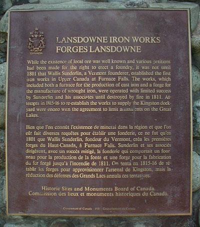
©Parks Canada Agency / Agence Parcs Canada, 2004 |
Lansdowne Iron Works National Historic Site of Canada
Leeds and the Thousand Islands, Ontario
Lansdowne Iron Works National Historic Site of Canada is a foundry
located on the eastern banks of the Gananoque River, just below the
falls, in the village of Lyndhurst, Ontario. The few visible remains of
the iron works include partial sections of its foundations and fragments
of scattered slag. It is an archaeological site that includes remains of
a furnace, a sawmill and associated works constructed by Wallis
Sunderlin in 1801. When established, Lansdowne Iron Works was the first
iron works in Upper Canada. The Historic Sites and Monuments Board of
Canada erected a plaque and cairn to mark the site.
The heritage value of Lansdowne Iron Works resides in its historical
associations with the iron manufacturing industry in Upper Canada. While
the existence of local ore was well-known and various petitions had been
made to the government for the right to erect a foundry, it was not
until 1801 that Wallis Sunderlin, a Vermont iron manufacturer,
established the first iron works in Upper Canada at Furnace Falls.
Sunderlin saw opportunity in the 7.3 metre natural waterfall, "Furnace
Falls," on the Ganonoque River and in the abundance of local iron ore.
The works included a sawmill, a furnace stack 7.62 metres (25 feet)
high, and a frame structure surrounding the furnace stack and a forge.
The works, with a furnace for the production of cast iron and a forge
for the manufacture of wrought iron goods was required by the area's
settlers. It was operated with limited success by Sunderlin and his
associates until it was destroyed by fire in 1811. Sunderlin died during
the War of 1812. Attempts in 1815-1816 to re-establish the works to
supply the Kingston dockyard were ended with the agreement to limit
armaments on the Great Lakes. The brick ruins visible on the site today
are from the later Harvey gristmill (1881).
|
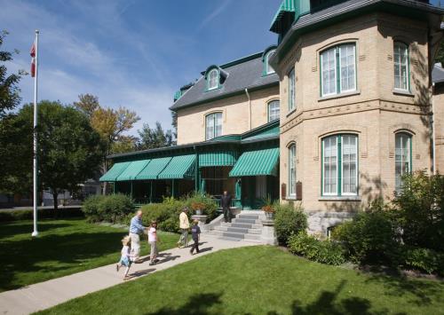
©Parks Canada Agency / Agence Parcs Canada |
Laurier House National Historic Site of Canada
Ottawa, Ontario
Second Empire home, built in 1878, of two prime ministers of Canada, Sir
Wilfrid Laurier and William Lyon Mackenzie King.
Laurier House National Historic Site of Canada is a large Second Empire
house on a residential lot situated on the northwest corner of Laurier
and Chapel Streets in Ottawa's Sandy Hill East Heritage District.
The heritage value of this site resides in its associations with Prime
Ministers Sir Wilfrid Laurier and William Lyon Mackenzie King and its
illustration of their tenures in the house.
This Second Empire house designed by James Mather, architect, was built
in 1879 for an Ottawa jeweller. It was purchased as a home for Sir
Wilfrid Laurier (1897-1919), then served as a home for Mackenzie King
(1923-1950) during the periods both men were leaders of the Liberal
Party. Canada did not have official residences for its political leaders
until 1950, and so Laurier and King served as both Prime Ministers
(1896-1911, 1921-25, 1926-30, 1935-48) and Leaders of the Official
Opposition while living in this residence. King transformed the third
floor of the house into his unofficial office, and from there conducted
much of the nation's business.
|

©Parks Canada Agency / Agence Parcs Canada, 2000 |
Leaskdale Manse National Historic Site of Canada
Leaskdale, Ontario
Leaskdale Manse National Historic Site of Canada is the former
Presbyterian manse where Lucy Maud Montgomery lived with her husband and
family from 1911-1926. It is a modest brick late 19th-century house set
on a residential lot just north of St. Paul's Presbyterian Church on
Durham Regional Rd. #1 in the hamlet of Leaskdale, Ontario, north of
Toronto.
The heritage value of Leaskdale Manse National Historic Site of Canada
lies in its association with the life and later published works of Lucy
Maud Montgomery. The value is illustrated in the form, materials, site
and setting surviving from the 1911-1926 period when Montgomery was in
residence. The house was constructed in 1886 as the manse for St. Paul's
Presbyterian Church where Lucy Maud Montgomery's husband, the Reverend
Ewan Macdonald, served as pastor from 1911-1926. It was here that
Montgomery lived during the first 15 years of her marriage, bore and
began to raise her family. It was purchased by the Township of Uxbridge
for restoration as an historic site in 1993.
|

©Parks Canada Agency / Agence Parcs Canada |
Leeds and Grenville County Court House National Historic Site of Canada
Brockville, Ontario
The Leeds and Grenville County Court House is a monumental building
prominently situated at the top of the historic town square in the city
of Brockville, Ontario. Set on a hill, the square is framed by churches
and formal civic architecture, and overlooks the historic downtown, and
the St. Lawrence River. The courthouse, designed in the British
classical tradition, is a symmetrical, stone building with a dignified
principal façade composed of a central block with portico flanked by two
identical wings.
The Leeds and Grenville County Court House was designated a national
historic site of Canada in 1966 because it is one of the most grandiose
district court houses of Upper Canada, and because the building easily
incorporates the diverse facilities of court room, offices and jail
while presenting an exterior of classical and monumental proportions.
The present Leeds and Grenville County Court House is an imposing
Neoclassical structure designed by the noted Toronto architect John
Howard and constructed in 1842-44 by Benjamin Chaffey, a local
contractor. Conceived as a multiple use structure, the building has been
enlarged and renovated but retains the original arrangement of prison
and court facilities. In combining the functions of a courthouse, office
and jail, the council was amalgamating funds from two separate programs
— those for civil and judicial administration. The result is a building
that is larger and more complex than if two separate buildings had been
constructed. The west wing was added in 1888, while the Gaoler's House
on the east side was built in 1898.
|
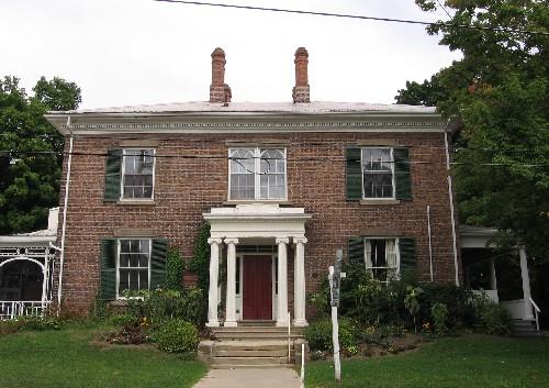
©Parks Canada Agency / Agence Parcs Canada 2005 |
Lynnwood / Campbell-Reid House National Historic Site of Canada
Simcoe, Ontario
Lynnwood/Campbell-Reid House National Historic Site of Canada is an
elegant modestly-sized brick house executed in the Neoclassical style
located on a slight rise overlooking the Lynn River in the town of
Simcoe. The red brick, rectangular, two-storey house features regular
openings, a hipped roof, a dentil course at the cornice, while the chief
feature is the Ionic portico projecting the main entrance. Above the
entrance paired arched windows with a pronounced mullion and
chimneystacks at the roofline continue the central emphasis.
Lynnwood/Campbell-Reid House was built circa 1850 for Duncan Campbell,
banker, land commissioner, and Simcoe's first postmaster. After
Campbell's retirement from public office around the time of completion,
the house and its surrounding grounds, which then consisted of four
hectares (10 acres) of landscaped grounds, acquired a reputation for
their elegance. The house is a refined example of a modestly sized
residence in the Neoclassical style. The fine grounds surrounding the
estate were broken up for development in 1911. Its restrained design
displays a balanced, judicious use of elements including symmetrical
window placement complemented by the classical portico, notable for its
detail and craftsmanship, and the tall, decorated chimneystacks above.
The sophisticated interior is what might be expected of an affluent
client and member of society.
|

©Parks Canada Agency / Agence Parcs Canada, Shannon Ricketts, 1996 |
Macdonell-Williamson House National Historic Site of Canada
East Hawkesbury, Ontario
Macdonell-Williamson House National Historic Site of Canada, also known
as Poplar Villa, is located on the banks of the Ottawa River in the town
of Pointe-Fortune, Ontario. It is an elegant stone residence built in a
local adaptation of the Palladian style. This two-storey house features
a five bay front, a hipped roof, and an attractive detailed interior.
The house sits on a grassed lot, a remnant of a former working estate,
reflecting the prominence of its original owner, John Macdonell, as a
major political and business figure in the early 19th century.
The heritage value of Macdonell House resides in its early origins and
compelling architectural presence as well as in its association with
John Macdonell and, through him, major commercial and settlement
phenomena. Value lies in the fine design, materials, and craftsmanship
of the residence, both interior and exterior, as well as its location.
Macdonell House was built in 1817-1819 for former North West Company
partner John Macdonell and his Métis wife, Magdeleine Poitras. Macdonell
was one of several former North West Company officials who built
retirement homes on the Ottawa River west of Montreal early in the 19th
century. Macdonell died in 1850. In 1882, the house was purchased by the
Williamson family who were residents until 1961, when it was
expropriated for the construction of the Quebec Hydro Dam at Carillon,
which then passed ownership to the Ontario Heritage Foundation in
1978.
|
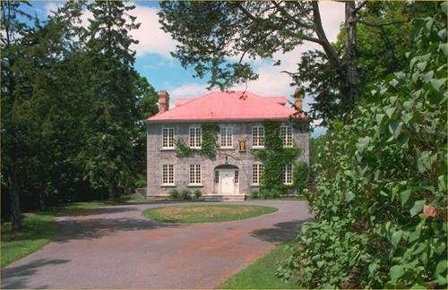
©Parks Canada Agency / Agence Parcs Canada, 2009 |
Maplelawn & Gardens National Historic Site of Canada
Ottawa, Ontario
Maplelawn & Gardens National Historic Site of Canada is located within a
mixed residential and commercial neighbourhood in Ottawa, Ontario. The
site comprises a dignified 19th century two-and-a-half-storey stone
house and a walled garden. Constructed for William Thomson in the
British classical tradition, the house features a five-bay symmetrical
façade and a hipped roof flanked by two end chimneys. Official
recognition refers to the property boundary of Maplelawn at the time of
designation in 1989.
Maplelawn & Gardens is a rare and well-preserved example of an early
19th-century country estate in Canada. Constructed in 1831 - 1834 for
William Thomson, the residence house is an excellent example of the
British classical tradition as exhibited in its rectangular plan,
symmetrical façades and its centrally-placed main entrance. The casement
windows, however, are not typical of this style and rather reflect
French-Canadian building influences on the domestic architecture of the
Ottawa Valley. The interior features a wide entrance hall with a
Neoclassical semi-elliptical arch at its midpoint. The elegantly curved
staircase, paneled doors and ceiling mouldings are typical of houses
constructed at this time.
Adjacent to the residence is a rare, one-acre walled garden type also
reminiscent of British tradition in Canada. The garden is symmetrical in
its layout, and features an oval central bed at the intersection of the
two gravel paths, which divide the garden into four lawns. The original
stone-crafted wall surrounds both the garden and the house, located in
the western section of the enclosure. In its early stages, the garden
was used by the Thomson family mainly as a kitchen garden that
transitioned into a lush, ornamental perennial garden in the
1940s.
|
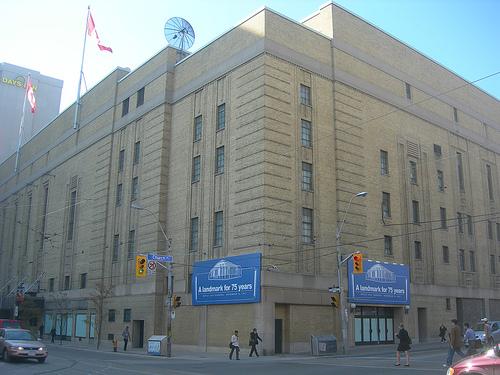
©Parks Canada Agency / Agence Parcs Canada, 1999
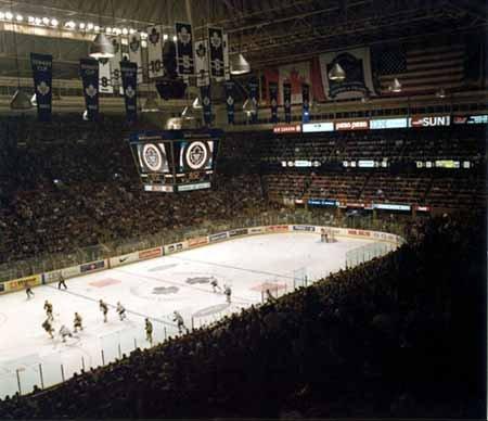
©Parks Canada Agency / Agence Parcs Canada, 1980 |
Maple Leaf Gardens National Historic Site of Canada
Toronto, Ontario
Maple Leaf Gardens National Historic Site of Canada, located at the
intersection of Carlton and Church streets in downtown Toronto, was
originally a state-of-the-art yellow-brick indoor arena built to house
the Toronto Maple Leafs hockey team. Constructed with a post-and-beam
rectangular concrete frame and slab floor, its simple aesthetic draws on
Art Deco and Art Moderne styles of streamlined form and decorative
geometrics. Its stone-faced brick façades rise 27 metres in height, with
its verticality emphasized by simple geometric shapes carved into the
stone. Its clear-span rectangular domed roof extends the building's
height an additional 19 metres above street level. Functional
requirements, rather than attention to architectural details, resulted
in a solidly built arena enjoyed by spectators for 68 years.
Maple Leaf Gardens, built in 1931 as a large-capacity arena for the
Toronto Maple Leafs hockey team, has maintained its iconic status as
Canada's 'cathedral of hockey,' despite the departure of the Maple Leafs
to a new arena. The Gardens was built by workers paid in company stock,
providing an incentive for a quick delivery. Breaking ground in April,
the arena was complete only eight months later. The inaugural game
between the Leafs and the Chicago Blackhawks played to a full house of
13, 233 spectators. With the Leafs capturing the Stanley Cup the
following year, they quickly became the league's foremost team during
the pre-expansion period. The Leafs won 6 Stanley Cups between 1941 and
1951, dominating the game. The team's association with the arena made it
a revered hockey shrine, both through domestic competition between its
home team and their arch rivals, the Montreal Canadiens, and also
internationally, through Team Canada's 1972 Summit Series victory over
the Soviet Union.
The arena was more than a shrine to hockey. It was Canada's largest
indoor venue for cultural, political and religious events for many
decades, drawing huge crowds to numerous and memorable moments in
Canada's cultural history. Besides hockey, both professional and
amateur, the Gardens also hosted many sporting events, including the
famous 1966 boxing match in which Canadian George Chuvalo lost a brutal
15 round decision to Muhammed Ali. While sporting events packed the
house throughout the 1930s, the arena soon began hosting other types of
events, such as speeches, including Sir Winston Churchill's 1932 speech
on the need to strengthen the British Empire, orchestras, concerts,
including two sold out Beatles shows at the height of Beatlemania in
1964, religious gatherings, and political gatherings and rallies,
including the country's largest communist rally, led by Tim Buck, who
had recently been released from the Kingston Penitentiary. These early
events at the Gardens reflect the social life of Canada and its cultural
diversity. More than a hockey arena, it was also a place for popular
culture in Canada to evolve.
|

©Massey Hall, Paul Henman, August 2009 |
Massey Hall National Historic Site of Canada
Toronto, Ontario
Massey Hall is a three-storey, red brick concert hall located in
downtown Toronto. Built in a late Palladian style at the end of the
nineteenth century, it was Toronto's major concert hall for much of the
twentieth century and is renowned for the warmth of its acoustics.
Massey Hall was designated a national historic site of Canada in 1981
because it has served as one of Canada's most important cultural
institutions and has earned widespread renown for its outstanding
acoustics.
The heritage value of Massey Hall lies in its historic role and a
cultural institution and in the functional design which resulted in
excellent acoustic conditions. These values are illustrated by the
physical and design properties of the building. Massey Hall was a gift
to the City of Toronto from wealthy industrialist Hart Massey
(1823-1896). He commissioned the design from Canadian-born Cleveland
architect S.R.Badgeley. Since it opened in 1894 Massey Hall has provided
Toronto with concert facilities which have encouraged the development of
the city's music community, in particular the Toronto Symphony Orchestra
and the Toronto Mendelssohn Choir. Interior modifications occurred in
1933 and 1948. The "warm" quality of its acoustics have attracted
audiences, orchestras, soloists and speakers from around the world for
over a century.
|

©Parks Canada Agency / Agence Parcs Canada, J. Butterill, 1995 |
Matheson House National Historic Site of Canada
Perth, Ontario
The Matheson House National Historic Site of Canada is located in the
heart of old Perth, in Ontario. Built in 1840 by Roderick Matheson, a
merchant of Scottish origin, the house is an elegant, Palladian-inspired
residence typical of houses of the affluent in pre-Confederation Canada.
A relatively late example of its type, the two-storey, five-bay
sandstone house is of classical design with a symmetrical principal
elevation with projecting frontispiece crowned by a pediment. The house
is unusual in that it was part of a group of family-owned buildings
including a store, two warehouses and a coach house, all of which have
survived as part of the streetscape on Gore and Foster Streets.
Roderick Matheson immigrated to Canada in 1805 from Scotland and pursued
a military career with the Glengarry Light Infantry Fencibles, becoming
Brigade Paymaster during the war of 1812. At the war's end he was placed
on half-pay and received a 230-acre land grant in the Perth military
settlement in 1816. Matheson became a prosperous merchant, a member of
the Legislative Council, and the Dominion Senate. The house remained in
the family until 1930. In 1966, it was purchased by the town of Perth
and rehabilitated to accommodate the Perth Museum.
The house represents early Scottish-Canadian architecture in its
classical inspiration, simple decoration and use of stone construction
materials. The streetscape, of which it is an important element,
continues this typology with its classically inspired structures
constructed in locally available stone and placed close to the
street.
|

©Parks Canada Agency / Agence Parcs Canada, Erica Lenton, 2008 |
Mazinaw Pictographs National Historic Site of Canada
Bon Echo Provincial Park, Ontario
Located at the confluence of Upper and Lower Mazinaw Lakes, within Bon
Echo Provincial Park, the Mazinaw Pictograph National Historic Site of
Canada is a large collection of pictographic symbols applied to a cliff
face that rises sheer out of the water.
Archaeological surveys of this site began as early as 1895, and
continued periodically through to the present times. For size and
complexity, this site has no rivals; no doubt the dramatic setting of a
great cliff rising sheer out of the water was a factor in the choice of
this location for pictographic arts.
|
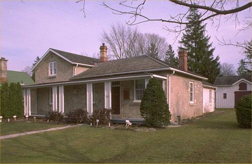
©Parks Canada Agency / Agence Parcs Canada, 1990 |
McCrae House National Historic Site of Canada
Guelph, Ontario
McCrae House National Historic Site of Canada is a
mid-nineteenth-century stone cottage situated at 108 Water St.
overlooking a park bordering the Speed River at the south end of Guelph,
Ontario. The house is noted as the birthplace of the author of "In
Flanders Fields", Canadian poet Col. John McCrae.
McCrae House was designated a national historic site of Canada in 1966
for its significance to the history of architecture; and because it is
the birthplace of John McCrae.
Canadian poet Col. John McCrae was born in McCrae House on 20 November
1872. McCrae himself was designated a figure of national historic
significance in 1946 for the creation of the poem, "In Flanders
Fields", written in 1915 on the battlefields of Ypres, Belgium. This
poem, published anonymously in the British magazine Punch, became one of
the most celebrated poems of the First World War, and has made the poppy
a lasting symbol of the soldiers who died during that war — a toll that
included McCrae himself. McCrae's family left this house a year after
his birth, although he continued to live in Guelph before qualifying as
a physician in Toronto then serving in the Canadian Army Medical Corps
in Europe. The house, built in the 1850-1860 period, has been somewhat
modified over the years.
The heritage value of McCrae House National Historic Site of Canada
resides primarily in its association with Col. John McCrae as
illustrated by its identity as a modest, middle-class nineteenth-century
Ontario residence, and in particular by retention of features associated
with the period of McCrae's occupation, 1872-1873.
|
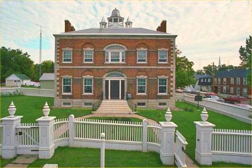
©Parks Canada Agency / Agence Parcs Canada, 1981 |
McMartin House National Historic Site of Canada
Perth, Ontario
McMartin House National Historic Site is a gracious two-storey red brick
residence located at 125 Gore St. in the centre of the town of Perth,
Ontario. Its classically inspired architecture is particularly elaborate
for the time and place and has been preserved as a museum.
McMartin House was designated a National Historic Site in 1972 because
this imposing house symbolizes the wealth and social aspirations of a
member of the Tory elite.
McMartin House National Historic Site was built in 1830 for Daniel
McMartin (1798-1869), one of the first lawyers in Perth, then capital of
Bathurst District. McMartin was a member of Upper Canada's Tory elite,
born at Williamsburg of Loyalist stock, educated at John Strachan's
Cornwall grammar school and Osgoode Hall in Toronto. The house he built
was a sophisticated and elaborate residence that reflects American
Federal style. Major renovations were carried out in 1883 and the
interior was altered in 1919 to accommodate use as St. John's Roman
Catholic Church hall. The house was acquired by the Ontario Heritage
Foundation in 1972 which has undertaken restoration over the years.
The heritage value of McMartin House National Historic Site resides in
its associations with the governing Tory elite as illustrated by its
high style, substantial scale, sophisticated composition and elaborate
details.
|
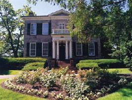
©Parks Canada Agency / Agence Parcs Canada |
McQuesten House / Whitehern National Historic Site of Canada
Hamilton, Ontario
McQuesten House / Whitehern National Historic Site of Canada is an
elegant mid-19th-century stone residence that sits in a walled garden at
41 Jackson Street West in Hamilton. This two-storey neoclassical house
was the home of a prominent family, the McQuestens, and retains many of
its original Victorian and Edwardian fittings and furnishings. It is now
used as a museum.
McQuesten House / Whitehern is a superior example of the residential
architecture of the mid-19th-century and is very much characteristic of
large Ontario houses built during this period. The house was built in
1848 for Richard O. Duggan as the centrepiece of a residential estate.
In 1852 it was purchased by Dr. Calvin McQuesten and remained in the
McQuesten family until they donated it to the City of Hamilton in 1959.
Under the Honorable T.B. McQuesten, a well-known Ontario cabinet
minister, some modifications were made to the house, the estate was
reduced in size, and the gardens were re-designed by the landscape firm
of Dunnington-Grub. The house was restored as a museum between 1968 and
1971.
|
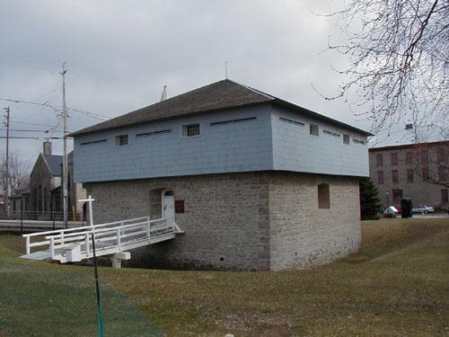
©Parks Canada Agency / Agence Parcs Canada, 2004 |
Merrickville Blockhouse National Historic Site of Canada
Merrickville, Ontario
Part of lock system of Rideau Canal, 1832-33.
Merrickville Blockhouse is a two-storey, masonry and timber defensive
structure located on the banks of the Rideau Canal in the town of
Merrickville Ontario.
Merrickville Blockhouse was designated a National Historic Site because
it was considered a fine example of the best type of blockhouses erected
for the defence of the Rideau Canal about 1832.
Its heritage value lies in its illustration of relatively large,
19th-century British designed blockhouse. Built in 1832-33, it is
associated with the construction of the Rideau Canal waterway and the
defence of Canada.
|
|
Middleport Site National Historic Site of Canada
Six Nations of the Grand River First Nation, Ontario
Archaeological site, Middle Ontario Iroquois.
|
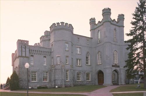
©Parks Canada Agency / Agence Parcs Canada |
Middlesex County Court House National Historic Site of Canada
London, Ontario
The Middlesex County Court House National Historic Site of Canada is an
imposing structure located on a 1.6-hectare parcel of land in London,
Ontario. Built in 1827, it is a very early example of the Gothic Revival
style, pre-dating the earliest important Gothic Revival public building
in England, the Houses of Parliament (1840-1865). Although significant
alterations were made in the 1880s, the building retains its original
Romantic Gothic Revival character. It features a central tower and
Gothic Revival elements such as corner octagons, crenellation,
pointed-arch openings and label mouldings.
In 1793, John Graves Simcoe, the first lieutenant-governor of Upper
Canada reserved an area at the forks of the Thames for the proposed
capital of the province. Although York (Toronto) was eventually chosen
as the capital, the government retained the site for public purposes.
The London district was created in the south-western part of Upper
Canada in 1800. A year later, Thomas Talbot, who had accompanied Simcoe
as his private secretary during his tour of inspection of the province
in 1793, immigrated to Upper Canada and received an extensive land grant
in the new district. Talbot spent the next 40 years promoting the
settlement of a huge area of present-day south-western Ontario along the
north shore of Lake Erie, known as the Talbot Settlement.
In 1826, Upper Canada's parliament situated the new District Seat at the
forks of the Thames and had a town plot surveyed for the town of London.
In 1827 the Court House Building Committee under Talbot's leadership
undertook to build a new courthouse and jail in the District Seat at
London. Designed by John Ewart of York, the impressive Gothic Revival
style structure was completed early in 1829. In 1846, a separate jail
building was attached to the west side. By 1878, an eastward extension
and a massive central tower were added. A law library was added to the
south side in 1911.
|

©Parks Canada Agency / Agence Parcs Canada, J. Molnar, 2004 |
Mission of St. Ignace II National Historic Site of Canada
Tay, Ontario
The Mission of St. Ignace II National Historic Site of Canada is located
near Georgian Bay in the Township of Tay, Ontario. The region was once
Huron-Wendat territory, and the Mission of St. Ignace II speaks to the
evacuation of Huronia in the second half of the 17th century. While the
specific location of Saint Ignace II remains unclear the designated area
consists of abandoned farmland covered by second growth forest
surrounding an open meadow. In the meadow, under an open sided shelter,
stands a large cobblestone cross erected by the Society of Jesus
commemorating the martyrdom of Fathers Breboeuf and Lalement.
St. Ignace II was one of several Jesuit mission sites in the territory
of the Huron-Wendat in the mid-1600s. On 16 March 1649, the Huron-Wendat
village and Jesuit mission of St. Ignace II was attacked by the Five
Nations Iroquois. Once St. Ignace II was captured, the Iroquois
continued west and that same morning attacked the village and mission of
St. Louis, capturing the Jesuit missionaries Brebeuf and Lalement. The
missionaries were brought back to St. Ignace II and killed there the
following day. The raids made clear to the Huron-Wendat that they were
not safe from destructive attacks in their homeland, and it initiated a
chain of events that led to the abandonment of Huronia in 1650.
|
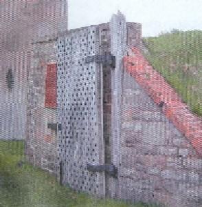
©Parks Canada Agency / Agence Parcs Canada, 2005 |
Mississauga Point Lighthouse National Historic Site of Canada
Niagara-on-the-Lake, Ontario
Site of first lighthouse on great lakes, 1804.
Located on the shoreline of the Niagara River in Niagara-on the-Lake,
Ontario, Mississauga Point Lighthouse National Historic Site of Canada
marks the site of the first lighthouse built on the Great Lakes in 1804.
While archaeological remains are believed to be situated below what is
now the eastern mortar bastion of Fort Mississauga National Historic
Site of Canada, no aboveground evidence survives.
The heritage value of Mississauga Point Lighthouse lies in its
historical associations as symbolized by the commemorative plaque
affixed to the west gate of Fort Mississauga.
Mississauga Point Lighthouse was constructed in 1804 by the military
masons of the 49th Regiment of Foot. Its hexagonal stone tower was
accompanied by a separate but adjacent lightkeeper's residence. The
lighthouse was damaged in the Battle of Fort George in 1813, and
demolished by the British in 1814 when they built Fort Mississauga on
the same site. According to local legend, the remains of the lighthouse
were incorporated into the tower of the fort.
|
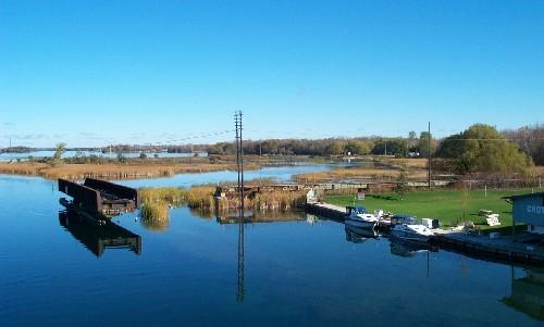
©Parks Canada Agency / Agence Parcs Canada, Jim Molnar, 2003 |
Mnjikaning Fish Weirs National Historic Site of Canada
Atherley, Ontario
Largest and best preserved wooden fish weirs known in eastern North
America, in use from about 3300 B.C..
Mnjikaning Fish Weirs National Historic Site of Canada is located on
portions of the bottom of the Narrows between Lakes Simcoe and
Couchiching, a part of the Trent-Severn Waterway. This includes the
navigable marked channel, the old channel that runs to the northeast and
marshland surrounding these channels. The constriction of the Narrows
allows fish to be caught as they move between the lakes, and the
shallowness of the channel permits wooden weirs to be built there. The
channel today is divided in two: the original channel curves to the
northeast, and the navigation channel runs straight to the north. The
navigation channel was first dredged in 1856-57, and dredging has also
taken place in the original channel south of the junction. A linear
island has been created along the eastern side of the navigation
channel. A causeway for an old Canadian Pacific Railway bed runs across
the north end of the narrows. Marshland lies in between these channels,
and also east of the old channel. A third channel seems to have existed
in the past, curving to the west of the navigation channel and it has
been largely filled in by modern development.
The oldest wooden stakes are clustered in the east channel, and samples
taken from the stakes have provided carbon dates in excess of 5000
calendar years old. This falls within a time period referred to by
archaeologists as the Late Archaic. Little is known about this area in
this period of time, and so archaeologists cannot describe the cultural
affiliations of the earliest people who used the weirs. Another cluster
of 12 radiocarbon dates falls within the time that the Huron-Wendat and
their immediate ancestors lived in the area around the Narrows.
|
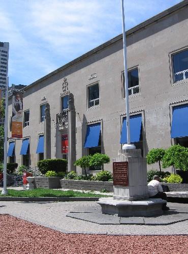
©Parks Canada Agency / Agence Parcs Canada, 2006 |
Montgomery's Tavern National Historic Site of Canada
Toronto, Ontario
Montgomery's Tavern National Historic Site of Canada is located in
Toronto at the intersection of Yonge Street and Montgomery Avenue. The
site, currently occupied by a post office, is marked by a Historic Sites
and Monuments Board of Canada plaque affixed to the base of a monument
and flagpole situated to the north of the building. There are no known
extant resources from the original tavern and its exact dimensions and
footprint in relation to the post office remain unknown.
In 1837, unable to establish fair government representation through
political means, William Lyon Mackenzie, a reformer, newspaper editor,
and the first mayor of Toronto (elected in 1834), assembled a group of
moderates and radicals in an attempt to overthrow the existing
government. Making Montgomery's Tavern, located north of Toronto's
current boundaries, his headquarters, Mackenzie began his rebellion on
December 5 when he and approximately 800 ill-equipped and untrained
rebels began a march southward. The local militia repelled them before
they could reach the city, and on December 7, Lieutenant Governor Sir
Francis Bond Head ordered 1,000 militia and volunteers under Colonel
James FitzGibbon to strike back. FitzGibbon's forces were routed
Mackenzie's near Montgomery's Tavern the same day, and the rebellion
collapsed. The tavern was burnt down the same day. Though the rebellion
was quelled, it was nevertheless instrumental in bringing about the
establishment of responsible government in Canada, as well as a
legislative union between Upper and Lower Canada, in 1841.
|

©Library and Archives Canada / Bibliothèque et Archives Canada, James L. Cotter, C-001719 |
Moose Factory Buildings National Historic Site of Canada
Moose Factory, Ontario
At the time of the Moose Factory Buildings designation in 1957, the
property consisted of several buildings, of which only the Staff House
is at its original location. Built in 1847-50, it is the last surviving
fur trade officer's dwelling in Canada and the oldest building in the
James Bay area. The Powder Magazine, built in 1865-66, is situated some
distance away on its original location, in what is now Centennial Park.
Established in 1673, this is the second Hudson's Bay Company post
erected in what is now Canada. It was captured by the French under
Pierre de Troyes in 1686 and renamed Fort St. Louis. After changing
hands several times, it was ceded to Britain by the Treaty of Utrecht in
1713 and then abandoned until 1730. By the 1770s it was supplying the
inland posts that had been built to compete with the North West Company.
After the two companies merged in 1821, Moose Factory became the supply
point for posts inland as far as Lake Timiskaming on the Ottawa River
watershed.
|

©Parks Canada Agency / Agence Parcs Canada |
Mount Pleasant Cemetery National Historic Site of Canada
Toronto, Ontario
Mount Pleasant Cemetery National Historic Site of Canada is located in
the middle of the city of Toronto, Ontario where it occupies some 83
hectares. Established in the late 19th century in an area which, at that
time, was on the northern edge of urban settlement, the cemetery was
designed as an informal, naturalistic environment where lawns, shrubs
and mature trees mingled with large commemorative monuments and grave
markers of varying styles and sizes. Many winding paths follow the
contours of the scenic, treed landscape. The park-like layout provides
picturesque views, which along with selective plantings, emphasize the
natural beauty of the environment.
The land now comprising Mount Pleasant Cemetery was purchased in 1873 as
ravine and plateau farmland in what was then the village of Deer Park.
Designed in 1874 by landscape gardener H. A. Englehardt, Mount Pleasant
Cemetery's arrangement is closely associated with the 19th-century
concept of rural cemeteries. Following three years of development the
cemetery opened in 1876. Such "rural" cemeteries were intended as places
not only of interment, but also of contemplation and recreation. The
cemetery is now distinguished by its picturesque walkways, rare trees
from around the world, co-existing native specimens, and a wealth of
historic funerary monuments that are well integrated into the original
design.
|

©Parks Canada Agency / Agence Parcs Canada, J. Butterill, 1994 |
Murney Tower National Historic Site of Canada
Kingston, Ontario
Mid 19th-century British imperial masonry fortification.
Murney Tower National Historic Site of Canada is a squat stone defensive
tower located on a point of raised ground known as Murray Point on the
west shore of Kingston Harbour. Murney Tower is also a component of
Kingston Fortifications National Historic Site of Canada.
The heritage value of Murney Tower National Historic Site resides in its
excellent portrayal of the martello tower, a type of military structure.
Value lies in its strategic design, its built and landscaped forms, its
materials, craftsmanship, construction technology, and function but also
in its strategic setting and defensive inter-relationship with other
parts of the Kingston Fortifications. Murney Tower (originally known as
Murray Tower) was constructed in 1846 as part of the new naval defences
authorized for Kingston Harbour by the Imperial government during the
Oregon Crisis of 1845-46. It was one of the last British works of
defence commenced in the Canadian interior. Although in regular use as a
barracks after 1849 it was not fully armed until 1862, when it had
already become obsolete because of rapid advances in offensive military
technology. Its guns were intended to cover the western approaches to
Kingston.
|

©Parks Canada Agency / Agence Parcs Canada, J. Molnar, 2005 |
Nanticoke National Historic Site of Canada
Nanticoke, Ontario
Nanticoke National Historic Site of Canada is located on the banks of
Lake Erie in Walpole Township, Ontario. It marks the location of a
skirmish that occurred in November 1813 between a volunteer militia of
local farmers and a group of American marauders who were pillaging
district farms. There are no extant remains of the battle at Nanticoke
on the site, which is currently occupied by the Nanticoke Generating
Station.
During the War of 1812, the British withdrew their regular troops from
southern Ontario to the Fort at Kingston after suffering several defeats
by American forces in the fall of 1813. This retreat and the reduced
military enforcement prompted a band of American marauders to pillage
district farms. As a result, a number of resident settlers formed a
volunteer militia, and on 13 November 1813 they attacked the Americans
on the farm of John Dunham, south of the present village of Nanticoke.
Three of the marauders were killed, several wounded, 18 captured, and
others escaped. This effectively ended plundering expeditions in the
area, and over 3,000 kilograms (7,000 pounds) of provisions were saved
for the British militia on the Niagara frontier, enabling them to
continue a winter campaign.
|

©Parks Canada Agency / Agence Parcs Canada, 1995 |
Napanee Town Hall National Historic Site of Canada
Greater Napanee, Ontario
Napanee Town Hall National Historic Site of Canada is a striking
mid-19th-century town hall, built in the Greek Revival style. It is
prominently located in the small town of Napanee Ontario. The imposing,
columned portico was added in 1928.
Erected in 1856, Napanee Town Hall is an early example of a combination
town hall and market, an arrangement popular in Ontario before 1870.
Designed by Kingston architect Edward Horsey with its simple yet stately
design and porticoed entry added in the twentieth century, the town hall
is a rare extant example of a town hall in the Greek Revival
style.
|
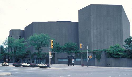
©Parks Canada Agency / Agence Parcs Canada, W. Duford |
National Arts Centre National Historic Site of Canada
Ottawa, Ontario
The National Arts Centre is a complex structure of irregular plan whose
design is based on the triangle and hexagon, from the overall
composition down to decorative details. The building houses several
performance spaces, rehearsal halls, dressing rooms, a workshop and prop
room, offices, restaurants, reception spaces and subterranean parking
garage. Designed in the Brutalist style, the National Arts Centre is
constructed of poured reinforced concrete and covered with precast
panels of exposed Laurentian-granite aggregate concrete with a variety
of textures. The visually dominant components of its irregular design
are the three main performing spaces that rise above a series of
terraces.
The National Arts Centre was both a major cultural as well as a major
architectural achievement for the country. The structure, built in
1965-69 to designs by the architectural firm of Affleck, Desbarats,
Dimakopoulos, Lebensold and Sise, reflects the rise of state support to
the arts in the second half of the 20th century. It was built as part of
the celebrations of for the one-hundredth anniversary of Confederation,
and it was intended to herald the cultural achievements of the nation in
the fields of the performing arts. The National Arts Centre is also a
component of the Confederation Square National Historic Site of
Canada.
|

©Parks Canada Agency / Agence Parcs Canada |
Navy Island National Historic Site of Canada
Niagara Falls, Ontario
Archaeological remains related to ship building.
Navy Island National Historic Site of Canada is a heavily wooded,
uninhabited island on the Canadian side of the Niagara River just above
Niagara Falls, Ontario. In the 1760s, Navy Island became the first
British shipyard to serve the Upper Great Lakes and, during the
Rebellions of 1837, was the seat of William Lyon Mackenzie's exiled
government. The island features many surviving archaeological resources.
In 1761, the British established a shipyard on Navy Island to build
ships required to transport troops and supplies to Lake Superior and
Lake Huron. During Pontiac's uprising in 1763-1764, three schooners
(Boston, Gladwin and Victory) and two sloops (Charlotte and Huron)
constructed at the shipyard were transported troops and supplies to the
siege of Fort Detroit. The dockyard was transferred to Detroit in the
mid 1760's, where the current was less swift and the chance of American
attack was diminished.
Navy Island also played a very significant role in the Rebellions of
1837 in Upper and Lower Canada. Following his failed attempt to seize
control of the government in December 1837, William Lyon Mackenzie,
leader of the Upper Canada Rebellion, fled to Buffalo. He established a
"government in exile" on Navy Island. The rebels were joined by American
sympathizers, and the island was soon ringed by crude fortifications
against an expected invasion by British troops and Canadian militia. The
swift reactions by local militia and British regulars prevented his
moving to the mainland, and on 14 January 1838, facing a hopeless
situation, he abandoned the island. The occupation of Navy Island lasted
little more than a month, but the impact of Mackenzie's rebellion, and a
similar uprising in Lower Canada, reverberated through the colonies. The
Rebellions of 1837-1838 were key events in the escalation of political
conflict in Upper Canada, and played a role in the reform of the
political system in both Upper and Lower Canada.
|

©Parks Canada Agency / Agence Parcs Canada, 1999 |
Nazrey African Methodist Episcopal Church National Historic Site of Canada
Amherstburg, Ontario
Nazrey African Methodist Episcopal Church is a simple fieldstone chapel,
now part of the North American Black Historical Museum complex in
Amherstburg, Ontario. Remarkable as an expression of the determination
of the Underground Railroad refugees who settled in this area, the
church has been restored for special religious ceremonies and as part of
the museum's mandate to present the history of the Black community.
In 1848 refugees from American slavery built this church by hand to
serve Amherstburg's growing Black community. Its simple auditory-hall
form is typical of many of the churches established by the UGRR
communities in Canada.
The church is named for Bishop Nazery, who led many congregations,
including this one, from the American-based AME Church conference into
the new Canadian-based British Methodist Episcopal Church. The
denomination flourished until the late 20th century when many dwindling
congregations consolidated and reunited with the AME Church. It is now
managed as part of the North American Black Historical Museum.
|

©Parks Canada Agency / Agence Parcs Canada, 1990 |
Niagara Apothecary National Historic Site of Canada
Niagara-on-the-Lake, Ontario
Niagara Apothecary National Historic Site of Canada is a fine example of
a late nineteenth-century commercial establishment and pharmacy. It is a
white, single-storey clapboard Georgian building situated on
Niagara-on-the-Lake's main commercial street, Queen Street Distinguished
by a central door with an arched transom flanked by two large arched
display windows, the building is readily identified by its prominent
sign and the three dimensional mortar and pestle proudly situated above
its door.
Niagara Apothecary was designated a national historic site of Canada in
1968, because it is one of the very few remaining examples of an old
apothecary shop.
The heritage value of the Niagara Apothecary National Historic Site of
Canada lies in its rich representation of a Confederation-era
pharmaceutical practice and business premises. Its value lies in its
exterior form, in its interior furnishing and features, in its original
late nineteenth-century materials, its functional design, its site and
setting. The Niagara Apothecary served as an apothecary / drug store
from at least 1866 to 1964. It is one of the oldest continuously
operated pharmaceutical practices in Canada. Built ca. 1820, both the
exterior and the interior of this building reflect its refurbishment as
a commercial apothecary in the late nineteenth century. In 1969 it was
acquired by the Ontario Heritage Foundation, restored, furnished and
interpreted for public visitation by the Ontario College of Pharmacy.
|
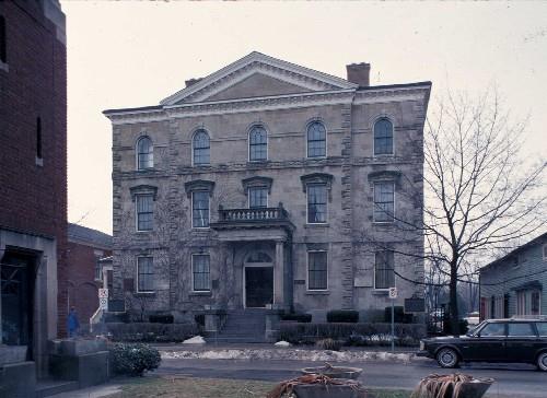
©Parks Canada Agency / Agence Parcs Canada, 1990 |
Niagara District Court House National Historic Site of Canada
Niagara-on-the-Lake, Ontario
Located on the main street of Niagara-on-the-Lake, the Niagara District
Court House National Historic Site of Canada is a handsome stone
building in a classical style. Its classicism is expressed through its
symmetry and classical details, such as the central pediment, porch with
columns, window surrounds, and stringcourses. The surviving interior
spaces reflect the multiple uses for which this building was designed.
The Niagara District Court House marks a step in the transition to large
and more sophisticated civic buildings after 1850. Its greater scale
resulted from the inclusion of a wide range of functions. In addition to
the courtroom, offices and jail, the Niagara District Court House also
included a town hall and market. The structure was designed by William
Thomas, an architect of national standing, adept at several classical
styles.
|

©Parks Canada Agency / Agence Parcs Canada, 2002

©Parks Canada Agency / Agence Parcs Canada, 2002

©Parks Canada Agency / Agence Parcs Canada, 2002 |
Niagara-on-the-Lake National Historic Site of Canada
Niagara-on-the-Lake, Ontario
Niagara-On-The-Lake National Historic Site of Canada is an early-19th
century Loyalist town located on the southern shore of Lake Ontario,
near the United States border. The historic district covers 25 city
blocks and includes more than 90 residential, commercial, ecclesiastical
and institutional buildings constructed between 1815 and 1859. The
majority of the buildings are constructed in the British Classical
Tradition, producing similarities in design, materials and scale. The
wide, tree-lined streets within the district follow a late-18th century
grid plan. The district also includes a city park and two
early-19th-century cemeteries. The landscape is gently rolling in
places, with a creek running through part of the district.
Niagara-on-the-Lake was established in 1779 as a supply depot for
British Loyalist forces. By the end of the 18th century it had developed
into a major military and cultural centre and served briefly as the
capital of Upper Canada. The town's grid plan, laid out in 1794, was
based on the Imperial model plan for new colonial towns.
Niagara-on-the-Lake was destroyed by fire in 1813, and then rebuilt by
Loyalist settlers. The streets retain their original arrangement,
proportions and edge treatments. Between 1831 and 1859, the town
prospered as a major shipping and shipbuilding port, and residents built
or enlarged their houses and commercial buildings.
The district is dominated by the classically-designed buildings erected
during the period from1815 to 1859. Most buildings retain their original
siting close to the road and are of similar design, materials and scale,
and the majority of buildings have been restored to resemble their
original appearance. The commercial section of Queen Street, largely
built between 1813 and 1840, illustrates the informal features of
commercial streets characteristic of that period. The historic district
is distinguished from later 19th-century streetscapes by the
individualized façades and the clear differentiation between buildings.
The residents of Niagara-on-the-Lake were among the earliest citizen's
groups in Canada to make a strong commitment to the restoration of their
built heritage. The Niagara Historical Society, established by residents
in 1896, collected artifacts and documents relating to local history and
published local histories. Beginning in the mid-1950s, individuals began
to restore private properties to their 19th-century appearance and to
promote conservation. In 1962 they formed the Niagara Foundation, a
local advocacy and fundraising group dedicated to preserving the town's
landmarks. The Niagara Foundation was instrumental in restoring several
major buildings in the town. Niagara-on-the-Lake was one of the first
Ontario municipalities to appoint a Local Architectural Conservation
Advisory Committee to advise on local heritage. The town was designated
as a provincial Heritage Conservation District in 1986.
|
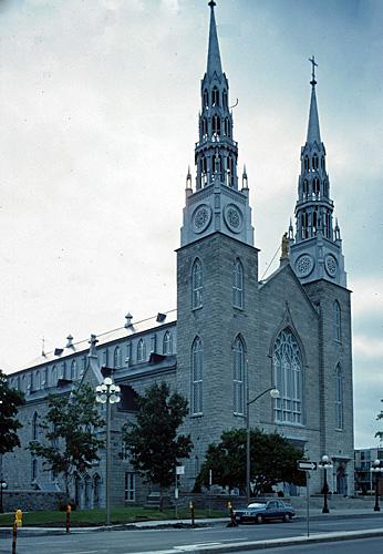
©Parks Canada Agency / Agence Parcs Canada, W. Duford, 1989 |
Notre-Dame Roman Catholic Basilica National Historic Site of Canada
Ottawa, Ontario
Notre Dame Roman Catholic Basilica National Historic Site of Canada is a
large Gothic Revival cathedral, built of ashlar limestone, whose twin
towers mark the entrance to Lowertown, one of Ottawa's earliest
neighbourhoods. It is prominently located on Sussex Drive, between St.
Patrick and Guigues streets, across from the National Gallery of Canada,
in Ottawa's Lowertown area. As the physical and spiritual centre of
Ottawa's Catholic community, the cathedral is flanked on its south side
by the Archbishop's Palace and on its north side by the former College
of Bytown and the Mother House of the Grey Nuns.
The basilica's heritage value is carried by its design, materials, and
interior decoration and craftsmanship. In its design and construction,
Notre-Dame Roman Catholic Basilica integrates classicism, Quebec church
architecture and the French Gothic Revival style. It is notable for the
continuity of design throughout the entire structure, despite its
numerous renovations and additions. It is also notable for its interior
finishes, decoration, artwork and embellishments. It is enhanced by its
ecclesiastic precinct as well as by its significant role as a landmark
in the nation's capital.
The original neoclassical design of the church was begun in 1842 under
parish priest Jean-François Cannon and altered in 1843 to plans prepared
by Jesuit priest Félix Martin. In 1844, the partially built structure
was transformed to the Gothic Revival style under Oblate priests Adrien
Telmon and Damase Dandurand. The steeples were added in 1858 to designs
by Dandurand. In 1862-3 an apse was built in the Gothic Revival style to
designs by Montréal priest-architect Victor Bourgeau. The interior
decoration was substantially completed in the late-19th century and
includes work by major artists, including 19th-century contributions by
Québec sculptor Philippe Hébert and stained-glass artist Harwood, and a
series of stained glass windows executed in the 1960s by Guido
Ninchieri. It also houses an organ made by Joseph Casavant.
|
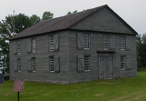
©Parks Canada Agency / Agence Parcs Canada, 2002 |
Old Hay Bay Church National Historic Site of Canada
Greater Napanee, Ontario
Old Hay Bay Church National Historic Site of Canada is a meeting house
dating from the early days of settlement in Upper Canada. Accessed by
country road, this rural two-acre property and adjacent graveyard
overlook Hay Bay, near Adolphustown, Ontario. The simple, box-like
building has a gable roof, heavy frame construction and clapboard
siding. Two-storeys high and three bays wide the gable-end building uses
a classically derived decorative vocabulary. The open interior features
a pulpit and an upper level gallery. The building is now operated as a
museum.
Old Hay Bay Church is of simple design, first built in 1792 as a meeting
house in the early days of Upper Canadian settlement when communities
were small and isolated, and waterways were the main form of
transportation. Its pioneer meeting house character is greatly
reinforced by its site and the unspoilt rural setting. The church was
conceived as a public space used for both secular and religious meetings
although its internal arrangements reflected its religious priorities.
Despite some changes, the church still retains the essential
characteristics of the pre-1840 evangelical meeting house, as it was
developed in Britain, New England and modified in Upper Canada. Enlarged
in 1835, Old Hay Bay Church closed as a regular place of worship in 1860
and becoming a farm storage area. In 1910 it was reacquired and restored
by the Methodist Church. It currently houses a museum and is still used
for annual services by the United Church of Canada.
|

©Parks Canada Agency / Agence Parcs Canada |
Old Kingston Post Office National Historic Site of Canada
Kingston, Ontario
The Old Kingston Post Office National Historic Site of Canada is a
handsome two-storey, limestone building built in the Neoclassical style.
It is situated in downtown Kingston, within an area of prominent,
mid-19th-century limestone buildings.
The Old Kingston Post Office illustrates the eclecticism of early
Victorian architecture in Canada, as architects gradually turned away
from the rigid and formal aspects of Neoclassicism towards the richness
and variety found in other architectural vocabularies. The Old Kingston
Post Office is typical of the continued popularity of the Neoclassical
style, and the increasing use of Renaissance elements in commercial and
public buildings. Its basic proportions and composition, as well as some
ornamental features, reflect the Neoclassical style. The influence of
the Italian Renaissance is evident in the richness of its masonry and in
the use of round-arched openings.
Local builders, Overend and Matthews, built the Old Kingston Post Office
from 1856-1859 to a square, five-bay plan of the Montreal architectural
firm Hopkins, Lawford and Nelson. The 1912 extension by three bays along
its length was designed by the Department of Public Works and built by
contractors McKelvey and Birch.
|

©Parks Canada Agency / Agence Parcs Canada, 2006 |
Old Stone Church National Historic Site of Canada
Beaverton, Ontario
Old Stone Church National Historic Site of Canada is a small rural
fieldstone church located on the outskirts of the town of Beaverton near
Lake Simcoe, Ontario. Presbyterian in denomination, this simple building
with gracious classical features stands on a wooded lot separated from a
regional road by a stone wall. The church's burial ground, which has
become the municipal cemetery for Beaverton, flanks it to the south and
west.
Old Stone Church was designated a national historic site in 1991 because
it is a particularly gracious example of the few early stone vernacular
churches surviving in Canada.
Old Stone Church was built on a 100-acre lot in Thorah Township granted
in 1835 to the Church of Scotland by the Legislature of Upper Canada. In
1840, the congregation contracted stonemason John Morrison to build a
replacement for the first log church. Construction was completed in
1853. The church, known as St. Andrew's, has changed little since its
construction. In 1991, the Beaverton Presbyterian Church undertook its
restoration and currently uses it for special services and during the
summer. The heritage value of Old Stone Church National Historic Site
resides in the rare combination of its high degree of integrity and
simple pioneer origins.
|

©Parks Canada Agency / Agence Parcs Canada, 2004 |
Old Stone Mill National Historic Site of Canada
Delta, Ontario
The Old Stone Mill National Historic Site of Canada is a three-storey
high stone, grist mill comprised of an 1810 mill and an attached turbine
shed, built in the 1860s. The Old Stone Mill is a water mill located on
Delta Creek in the small village of Delta, nestled between Upper and
Lower Beverly lakes, in the Rideau Lakes area north of Kingston.
Built in 1810 by William Jones, the Old Stone Mill in Delta is the
earliest surviving stone mill in Ontario. The mill features high-quality
stonework and was technologically advanced for its time. The building's
height, scale, and roof truss configuration were designed to accommodate
the Oliver Evans automatic milling system, a late-18th-century
innovation that improved the movement of grain through mill buildings.
Typical of early-19th-century mills in eastern Ontario, the Old Stone
Mill played an important role in the settlement and economic development
of Leeds County. The existence of the mill encouraged agricultural
settlement in the area and led to the development of the village of
Delta. The mill was in continuous use from 1810 to 1949. The replacement
of the original waterwheel with cast-iron turbines in 1860 (housed in a
new turbine shed), and the instalment of roller-milling machinery in
1893, showed the mill's attempts to remain commercially viable in the
late-19th century.
|
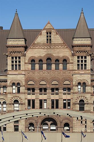
©Old Toronto City Hall and York County Court House, deymosD, June 2007
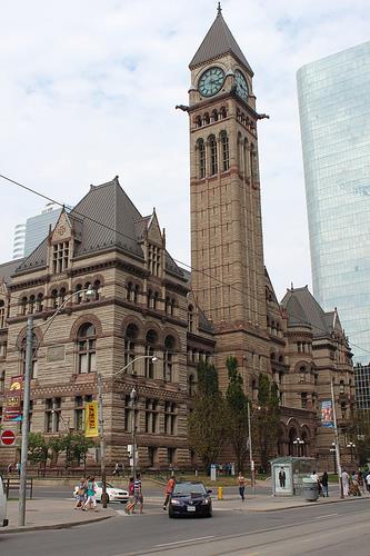
©Old Toronto City Hall and York County Court House, deymosD, June 2007 |
Old Toronto City Hall and York County Court House National Historic Site of Canada
Toronto, Ontario
The Old Toronto City Hall and York County Court House is a massive,
sandstone building in the Richardsonian Romanesque style. Built over an
11-year period from 1889 to 1899, it is located in the heart of the city
of Toronto, adjacent to the current City Hall which replaced it in 1965.
Old Toronto City Hall and York County Court House was designated a
national historic site in 1984 because this Richardsonian Romanesque
structure is among Canada's most important examples of monumentally
scaled city halls; and because its superb downtown site, richly carved
sandstone surfaces, and variety in colour and texture combine in a clear
expression of the region's late 19th century self-confidence.
The Old Toronto City Hall and York County Court House is one of Canada's
finest examples of Richardsonian Romanesque architecture. Its massive
scale and monumental design reflect its dual function as city hall and
court house, the increasing complexity of civic administration, and the
desire of city politicians to convey the prosperity and rapid
urbanization experienced by Toronto in the second half of the 19th
century. Designed by local architect E.J. Lennox between 1883 and 1886,
the City Hall and Court House took eleven years to construct, from 1889
to 1899. Its design used a variation of the Romanesque style developed
by American architect H.H. Richardson, which was popular for public
buildings during the 1880s. Numerous crafts- and trades-people were
involved in its construction, including Robert McCausland Limited
(stained glass) and George Agnew Reid (muralist). The Richardsonian
Romanesque style is evident here in the massive scale and proportions of
the building, the richly carved and coloured sandstone surfaces, and the
repeated use of towers, round-arched openings, and arch-and-spandrel
motifs. The building is dominated by a tall, off-centre clock tower that
corresponds with the axis of Bay Street, the heart of the city's
financial power.
|

©Parks Canada Agency / Agence Parcs Canada |
Old Toronto Post Office / Old Bank of Canada National Historic Site of Canada
Toronto, Ontario
The Old Toronto Post Office/Old Bank of Canada is a mid-19th-century,
three-storey, stone building constructed in the Greek Revival style. It
is located on the west side of Toronto Street between King and Adelaide
streets in downtown Toronto.
The Old Toronto Post Office/Old Bank of Canada was designated a national
historic site of Canada in 1958 because it is a fine example of Greek
Revival style architecture.
The building was designed by prominent Toronto architects Frederick
Cumberland and William Storm, who were responsible for the design of
several other mid-19th-century Toronto buildings in various revival
styles.
|

©Parks Canada Agency / Agence Parcs Canada, 1990 |
Old Woodstock Town Hall National Historic Site of Canada
Woodstock, Ontario
The Old Woodstock Town Hall is a two-storey, buff-brick, Italianate
Revival-style town hall building, built in 1853. The Old Town Hall is
prominently located at the head of a grassed square, in the heart of the
city of Woodstock.
The Old Woodstock Town Hall was designated a national historic site of
Canada in 1955 because it is a fine example of a colonial adaptation of
a British town hall, and because of its long association with the
political and social life of Oxford County.
The heritage value of this site resides in its form, materials and
functional design. It is an early, extant example of a mid-19th century
Ontario town hall. Originally built as a combined town hall and market
house, it was one of many combined-function mid-19th century municipal
buildings built in Upper Canada. Its tall, two-storey form, classically
inspired, multi-functional design, and roof-top cupola are typical of
mid-19th century town hall architecture. The Old Woodstock Town Hall's
classical proportions and Italianate Revival detailing reflect the
adaptation of British architectural trends to the needs and economic
limitations of Upper Canada. The building retains a significant amount
of its original interior layout and finishes and is likely the most
intact of this style of combined-function town halls in Ontario.
The Old Woodstock Town Hall's multiple use design reflects the changing
responsibilities of Ontario municipalities over the latter half of the
19th century. Originally designed to provide market space on the ground
floor and a meeting hall and mayor's office on the upper floor, it also
served at various times as a concert and lecture hall, dance hall, opera
house, fire station, police station, assize court, council hall, and
municipal offices. In 1865 a fire hall was added to the rear of the
building. In 1870, the market was moved elsewhere, a council chamber and
municipal offices were created on the main floor, and the upper floor
was extended to create a large assembly hall for social events and
public entertainments. A third extension was added in 1877, but later
demolished. The building was used for municipal and community purposes
for over a hundred years, before being converted to a museum in 1968. In
1994, the building was restored and a fourth extension was added on the
footprint of the third to accommodate elevators and washrooms.
|

©Parks Canada Agency / Agence Parcs Canada, Owen Thomas, 1999 |
Oro African Methodist Episcopal Church National Historic Site of Canada
Edgar, Ontario
Oro African Methodist Episcopal Church National Historic Site of Canada
is a simple log church with an unmarked cemetery that stands on the
south-east corner of the intersection of Line 3 of Oro-Medonte and Side
Road 10/11, commonly known as the Old Barrie Road, Simcoe County,
Ontario. It has been preserved as witness to an early African Canadian
settlement associated with Black militiamen from the War of 1812.
Oro African Methodist Episcopal Church was built by African Canadians.
The Oro Black settlement was a unique approach to integrating African
Canadians into a farming community. The idea for an African Canadian
community originated in 1783 with Sir Guy Carleton, Commander-in-Chief
of British forces in North America. During the American Revolution,
Carleton had promised that the slaves of non-Loyalists who joined the
British Army would have their freedom and protection from
re-enslavement. Black soldiers not only fought with the British during
the American Revolution, but also as the "Coloured Corps", a trusted
unit of the Upper Canadian militia during the War of 1812. Between 1819
and 1826, the British granted 25 plots of land in Oro County to Black
settlers, eleven of them former soldiers who received their grants in
acknowledgement of military service. Although the area had strategic
value, the land was both remote and agriculturally poor. Only nine of
the original grant recipients took up their plots, settling along an
area of the Penatanguishine Road known as Wilberforce Street. In
1829-1831, the settlement was augmented by thirty more families. They
built Oro Church in 1847, and it remained active until around 1900 when
the community itself faded away. The British Methodist Episcopal Church
declared the building abandonned in 1916. Local residents rallied to
preserve it in 1947, in 1956, and again after vandalism in 1981.
The heritage value of Oro African Methodist Episcopal Church National
Historic Site of Canada resides in its associated history as illustrated
by the form and composition of the building, the integrity of the
remnant cemetery, and in their site and setting.
|

©Parks Canada Agency / Agence Parcs Canada, J Butterill, 1993 |
Osgoode Hall National Historic Site of Canada
Toronto, Ontario
Osgoode Hall is a stately, Palladian-style building, erected in stages
throughout the mid-19th century. It is surrounded by grassed lawns, and
separated from the street by a stone and wrought-iron fence with
elaborate entrance gates. The building and its property occupy an entire
city block in the downtown business district of the city of Toronto.
Osgoode Hall was designated a national historic site in 1979 because it
represents the judicial institution in Ontario and the role of law in
protecting Underground Railroad refugees from extradition, and because
it ranks among Canada's architectural and historical treasures.
Since its construction in 1832, Osgoode Hall has served as the
headquarters for the Law Society of Upper Canada, the governing body of
the legal profession in Ontario. The building was named for William
Osgoode, the first Chief Justice of Upper Canada. As law society
headquarters, Osgoode Hall has provided a library, dining room and study
space for practising lawyers since 1832. During the 19th century it also
provided sleeping quarters for students-at-law. From 1889 to 1974 the
law society operated a law school at Osgoode Hall, until 1959, the only
one in the province. The law society continues to administer the bar
admission course for Ontario from Osgoode Hall. Since 1846 Osgoode Hall
has also served as a courthouse for senior provincial courts, and many
important cases have been heard here. The Province has owned part of the
building since 1874, with the Law Society retaining ownership of the
East Wing and Great Library. Growth of both the law society and the
court system prompted the numerous additions and alterations made to the
building over the course of the 19th and 20th centuries.
In 1861, the highly publicized case of John Anderson was heard in the
courtroom at Osgoode Hall. The Anderson case established a clear
precedent against allowing refugee extradition back to the United
States, thereby protecting Underground Railroad refugees from being
returned as fugitive slaves.
Architecturally, Osgoode Hall represents a blend of Palladianism and
Neoclassicism characteristic of mid-19th-century Canadian architecture.
The original building was erected in 1829-32 to designs by John Ewart,
assisted by Dr. W.W. Baldwin. The building's unusual plan and elevation
are a result of numerous successive additions by a series of different
architects. Centre and west wings were added in 1844-6 to designs by
Henry Bower Lane, establishing the basic composition of the present
building. Renovations by Cumberland and Storm in 1857 replaced the
centre wing and added other significant decorative and structural
components. In 1865, a law school was added to the rear of the East
Wing, to plans by William Storm. Additions and alterations to the
building continued throughout the 20th century.
In addition to its esteemed association with the legal profession and
the provincial court system, Osgoode Hall is well-known for its
commanding presence along Queen Street, and its elaborate interior
spaces. These include the Great Library, the Rotunda, and a
wood-panelled dining room for law society members. The distinctive
wrought-iron fence and gates which surround the property were built by
Hamilton and Son of the St. Lawrence Foundry, Toronto.
|

©Parks Canada Agency / Agence Parcs Canada |
Ossossané Sites National Historic Site of Canada
Ossossane Beach, Ontario
Ossossané National Historic Site of Canada is located on the shore of
Nottawasaga Bay, in the Georgian Bay on Lake Huron, Ontario. Composed of
two different sites 1.6 km apart, the former village covers an area of
approximately 2.5 hectares on a defensible peninsula of land. Protected
on three sides by steep topography this Ossossané village was the
principal village of the Attignaouantan or Bear Clan of the Hurons from
1632-1636 A.D. The site includes an ossuary, located a short distance
away covering less than 0.5 hectares, created when the clan abandoned
the village in 1636. Seven meters in circumference and 2 meters deep the
ossuary is situated on former agricultural land in a field amongst
scattered pine trees. The two sites are separated by fields, pasture and
a swamp.
The heritage value of the Ossossané sites derives from their historical
and physical significance. Both sites have been accurately dated, belong
to a known population, and contribute to the knowledge of daily life and
rituals of the historic Huron people. The designated site comprises two
distinct areas of archaeological interest, Ossossané Village and the
Ossossané ossuary. It was the main village of the Attignaouantan or Bear
Clan in the latter part of the Jesuit era and was on the southern edge
of the territory.Missionaries' records describe the Ossossané village
and its ossuary. The principal village of the Bear Clan of the Hurons
from A.D. 1632-1636, it was likely inhabited before 1632, and for
perhaps twelve years prior to the smallpox epidemic that swept Huronia
in A.D. 1639. Visiting French missionaries included Father Jean de
Brebeuf and Father Lalemant. It was also the location of the Recollect
Friar's mission of La Rochelle and of the Jesuit's mission of La
Conception. A large village, Ossosané comprised approximately 40
longhouses with a population of 1,500 people belonging to the
Attignaouantan or Bear Clan. The village lay on a main trail system, the
connecting point on the trail between Huronia and the Petun. Excavations
yielded pottery, pipes, beads, ironwork, arrowheads and fragments of
copper vessels. The Huron people would live in a village for ten or
twenty years then move on after exhausting local resources. The village
is located in a former agricultural field now in use as a horse pasture.
Before leaving the Ossossané village site in 1636 the Huron created an
ossuary 1.6 km away, a ritual witnessed by French missionary Father Jean
de Brebeuf. Marked only by a broad, saucer shaped depression in the
ground before excavation the ossuary was 7 meters in diameter and 2
meters deep. The only site of its kind described by eye-witness accounts
the ossuary was the first such location excavated by modern means in
1954. Excavations here yielded grave goods of both aboriginal and
European origin including: shell beads, projectile points, textiles,
pipes, bone pendants, red ochre, beaver skins, beech nuts, glass beads,
copper kettles, iron knives, iron scissors, iron awls, bracelets, a key,
and copper rings, copper beads and copper bangles. The Ossossané ossuary
is located on a sandy plain. When it was first excavated in the late
1940s, the area was in an open field but it has since grown up in
secondary forest. The ossuary component of the historic site is owned by
the Huron-Wendat of Wendake First Nation.
|
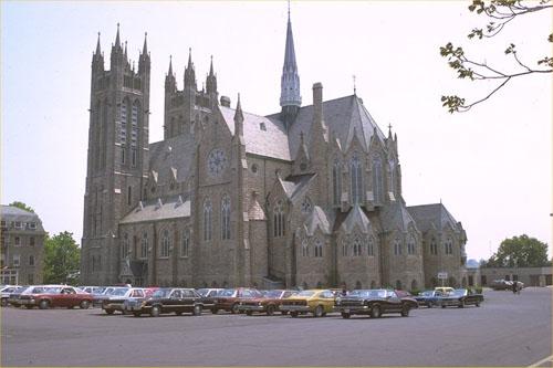
©Parks Canada Agency / Agence Parcs Canada, 1991 |
Our Lady of the Immaculate Conception National Historic Site of Canada
Guelph, Ontario
Inspired by the medieval cathedrals of France, the twin towers of this
large stone church rise above the city centre in Guelph, Ontario.
Constructed as the centrepiece of a complex of Roman Catholic religious
and educational buildings, the church is prominently situated on the
brow of a hill. It features elements inspired by the French Gothic
Revival, including, a twin-towered facade, a large rose window and a
polygonal apse with radiating chapels.
Unlike the earlier, Ecclesiological phase of Gothic Revival, during
which architects were restricted to certain correct precedents, the High
Victorian Gothic Revival gave architects freedom to draw inspiration
from a wide variety of periods and countries, while still following
certain established principles as to composition and structure. Like
many churches designed by English-speaking architects in the late19th
century, the design of Our Lady of Immaculate Conception shows the
strong influence of the French Gothic Revival. Designed by Joseph
Connolly, the principal architect for the Roman Catholic church in
Ontario, Our Lady of Immaculate Conception incorporates French Gothic
Revival features, such as a twin-towered façade, rose windows and a
polygonal apse with radiating chapels. Built in 1876-1888 with towers
completed in 1925-1926, the church is considered to be Connolly's best
work.
|
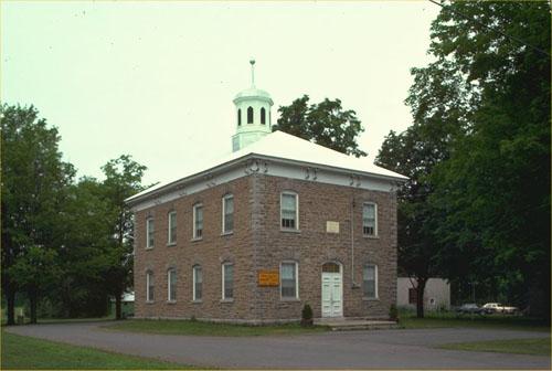
©Parks Canada Agency / Agence Parcs Canada, 1980 |
Oxford-on-Rideau Township Hall National Historic Site of Canada
Oxford Mills, Ontario
Oxford-on-Rideau Township Hall National Historic Site of Canada is a
handsome two-storey stone building topped by a cupola. Located in Oxford
Mills, Ontario, this former township hall now houses the local library.
The Oxford-on-Rideau Township Hall was designed by Brockville architect
John Steacy as a municipal government and community centre and was
constructed in 1875 by builder Ambrose Clothier using local stone. In
1967-1970, the building's original interior, which typically consisted
of two open halls one above the other, was renovated and partitioned to
provide office and vault space for municipal administration. It served
as the seat of local government until 1998, when Oxford-on-Rideau
Township was amalgamated into the Township of North Grenville and the
municipal offices were consolidated in Kemptville.
The heritage value of Oxford-on-Rideau Township Hall National Historic
Site of Canada resides in its identity as a public building,
representative of the importance of local government in small Ontario
communities during the late 19th century and in its scale, detailing,
proportions, fine craftsmanship, materials and assembly.
|
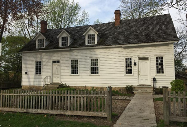
©J. A. Cousineau, Parks Canada Agency / Agence Parcs Canada, 2017 |
Park House National Historic Site of Canada
Amherstburg, Ontario
Park House, an 18th-century dwelling located on the commercial main
street of Amherstburg, Ontario, is considered one of the oldest houses
in the region. The precise date of its construction is unknown, but it
has long been contended that this combined dwelling and warehouse were
floated down the Detroit River to Upper Canada by its Loyalist owners
when Detroit was handed over to the Americans by the British in 1796.
Park House has a long association with fluctuations in the economic
history of the transborder region in Southern Ontario. Its early use by
transplanted Detroiters and transformation by the Park brothers in the
context of the local shipping industry attest to the history of
settlement around Windsor, where colonial power struggles were evident
not only in fluctuating borders but also in the architecture and
landscapes of the region. A rare example of a once-common colonial
building type found in settlements and fur-trading posts across colonial
North America, its asymmetrical design, center-passage plan, and
French-framed grooved post construction are rooted in a common
French-Canadian vernacular architectural language.
Located on a large lot bordering the Detroit River, Park House was owned
by groups or individuals involved in river-based trade between the 1790s
and the mid-19th century. It was used by relocated Detroit merchants
during the closing days of French-British fur trade, around the time the
international border with the United States was first demarcated. In
1823, it was purchased by the Park brothers, who transformed the house
for use in the local shipping industry. Between 1881 and 1936, the house
served as the home of local physician Theodore Park, who worked out of
the house and added a wing for his offices.
Park House features a variant on "pièce sur pièce" construction known as
"poteaux en coulisse" (grooved post). The pièce sur pièce method of
construction, in which squared horizontal members are closely placed one
above the other, was once an important feature of the landscape of New
France. The technique involves vertical corner and wall posts that are
mortised in order to receive the tenoned ends of horizontal fill logs,
which slide down one atop the other. "Pièce sur pièce" spread across the
country with the fur trade, through the work of skilled
artisans.
In the heart of the oldest region of permanent French settlement in
Ontario, Park House is evidence for the mobility of the French-descended
population as the French Regime drew to a close and Upper Canada
emerged. Through its architecture, Park House tells the story of the
traders and artisans who populated the Windsor region. In 1972, when the
building was moved to its current site, the interior wall structure of
the building was revealed. It has remained so since, evidence of how
French artisans brought an ingenuity in construction that allowed them
to adapt older techniques to the topography, materials, and climate of a
new land.
|
|
Parkhill National Historic Site of Canada
Parkhill, Ontario
Parkhill National Historic Site of Canada is located near Parkhill,
Ontario. This archaeological site was once a Paleo-Indian settlement on
an ancient lakeshore, which represents an early lake level above that of
modern Lake Huron. Now set on a flat, cultivated field, the site covers
approximately 0.5 hectares (1.2 acres) just north of Parkhill Creek. The
heavy clay soil contains archaeological remains that date to 8800- 7800
B.C., at which time the site formed the shoreline of ancient Glacial
Lake Algonquin. It is the earliest, firmly dated Paleo-Indian habitation
site in Ontario.
Parkhill National Historic Site of Canada is significant not only for
its relatively large size and its number of pointed flutes, but also
because it represents the only Paleo-Indian habitation site in the Great
lakes area. Measuring approximately 243 metres wide and 495 metres long
the site possesses one of the largest Clovis artefact inventories of any
known sites. No other Ontario site has produced as many fluted points as
Parkhill. The site is thought to have existed in a sheltered southern
exposure, near a tributary stream and in proximity to pine and spruce.
This location probably offered a rich environment between the edge of
the ancient lakebed and the fossil beach. The productivity of the site
make it noteworthy, as do the wide range of tool types recovered, which
includes points, bi-face performs, scrapers, knives, gravers, a fluted
drill and quantities of channel flakes and "débitage".
|
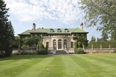
©Harold Clark Photography |
Parkwood National Historic Site of Canada
Oshawa, Ontario
Parkwood is a grand, residential estate developed between 1915 and 1940
by Canadian industrialist Colonel R.S. McLaughlin and his wife, Adelaide
Louise Mowbray McLaughlin. The estate comprises a two-and-a-half storey,
masonry Beaux-Arts style mansion, surrounded by 4.8 hectares of
elaborately designed grounds and ancillary buildings. The interior of
the residence is richly decorated in revival styles suited to the
function of each space and contains a large collection of period
furnishings, fine and decorative arts. Ancillary buildings at the estate
include a gatehouse, garages, a teahouse/gazebo, and extensive
greenhouses. Substantial hedges delineate the major areas of the
property (entrance court, pleasure grounds, service area and stable and
farm sectors) as well as individual garden areas. The extensive formal
gardens include a sunken garden with a Japanese pavilion, an enclosed
Italian garden with a lily pool, a sweeping front lawn with terrace and
walkway gardens leading to a summer house, a tennis court, a monotone
"white" garden, a rose garden, a cutting garden, an orchard, and an Art
Deco style water garden. The estate takes up an entire city block, and
is surrounded by a masonry wall along its front and wooden fencing along
the other three sides. It is centrally located in the city of Oshawa,
Ontario.
The national significance of Parkwood National Historic Site of Canada,
the estate of Colonel Sam McLaughlin, lies in the house, with its
collection of period furnishings and decorative art, and in the grounds,
with the formal gardens. Further significance lies in the succession of
prominent designers associated with the estate.
The Parkwood estate is among the finest and most intact surviving
examples of Canadian architectural and landscape design, period
furnishings and decorative art during the interwar period. The main
residence, designed by Canadian architects Frank Darling and John
Pearson, shows the influence of the American Beaux-Arts style. Its
gardens deftly blend English and North American traditions through the
use of spaces, plantings, vegetations, garden furnishings and visual
relationships.
Parkwood Estate exemplifies R. S. (Samuel) McLaughlin's leadership
position within Canada's business and social elites in the first half of
the 20th century. The changes directed by Colonel McLaughlin and his
wife, Adelaide Louise Mowbray McLaughlin, during 55 years of residence
at the estate contribute greatly to its richness and to its capacity to
express the life of a privileged and affluent Canadian family.
Parkwood's planning, design and construction represent the work of some
of the country's leading architects, landscape architects, artists and
artisans during the period 1915 to 1940. Darling and Pearson, Canada's
most prominent architectural firm of the period, designed the 55-room
main residence and coordinated the design of the entire estate with its
numerous outbuildings. Landscape architects William E. Harries and
Alfred V. Hall directed the first changes to the grounds following its
purchase by McLaughlin. The gardens were expanded in the 1920s by
Canada's leading horticulturalist and landscape architects Howard
Burlingham Dunnington-Grubb and Lorrie Alfreda Dunnington-Grubb and
include statuary by Toronto sculptors Frances Loring and Florence Wyle.
The superb Art Deco water garden, built in 1935-6, was designed by John
Lyle. The Japanese garden located in one of the estate's greenhouses was
designed by George Tanaka in 1963.
Numerous works of art, art objects and furnishings accumulated by the
McLaughlins remain in the main residence and in the gardens, adding to
the sumptuousness and completeness of the estate's design and
decoration. They include a bedroom suite and furnishings designed in the
Art Deco style by John Lyle.
|
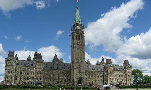
©Parks Canada Agency / Agence Parcs Canada, Catherine Beaulieu, 2010 |
Parliament Buildings National Historic Site of Canada
Ottawa, Ontario
Parliament Buildings National Historic Site of Canada is prominently
located on a hill above the Ottawa River on Wellington Street in
downtown Ottawa, Ontario. Four Gothic Revival style buildings grouped on
landscaped grounds, namely the West Block, the Centre Block, the East
Block, and the Library. Built 1859-1865 to serve the united provinces of
Upper and Lower Canada, the Parliament Buildings were occupied by the
House of Commons, Senate and departmental offices of the new Dominion of
Canada after Confederation in 1867. The Parliament Buildings have been
constantly occupied, and continue to be the real and symbolic centre of
Canadian government.
The Parliament Buildings were initially conceived to serve the needs of
the government of the united provinces of Upper and Lower Canada;
however, after Confederation in 1867, they were occupied by the House of
Commons, Senate, and departmental offices of the new Dominion of Canada.
Originally known as Barracks Hill, the site was chosen for its
commanding location, its fine uninterrupted views of the region, and for
its three decades of occupation by a military garrison and the Royal
Engineers, rendering it a central focus of town social life.
The building complex was dramatically sited on the hill and construction
began in 1859. The original buildings were examples of Ruskinian
picturesque High Victorian Gothic architecture, designed by two
architectural partnerships. Thomas Fuller and Chilion Jones designed the
original Centre Block and Library, and Thomas Stent and Augustus Laver
were responsible for the East and West Blocks. The buildings were
intended to house all government activities with the East and West
Blocks reserved for the entire civil service. The Centre Block was
sufficiently complete in 1865 to be occupied by government departments,
and it was officially opened on 6 June 1866. The Library was begun in
1859, redesigned in 1870, and finished in 1877. Fire destroyed the
Centre Block, with the exception of the Library, in 1916. When it was
rebuilt a few years later, the building was enlarged and the Peace Tower
was completed in 1928. The Gothic style was retained by the architects
Pearson & Marchand, although updated to a Beaux-Arts axial plan with
Gothic details
The Parliament Buildings play an important symbolic role as the physical
embodiment of the Canadian government. This symbolism is most visually
manifest in the exterior image of the Centre Block and its Peace Tower,
yet the whole grouping is clearly identified with the nation's capital,
particularly because it is not an architectural image developed
elsewhere in the country.
|
|
Penman Textile Mill National Historic Site of Canada
Paris, Ontario
Knitting mill complex, the first and most important plant of the Penman
Manufacturing Company, long the largest Canadian knitting firm,
1874.
|
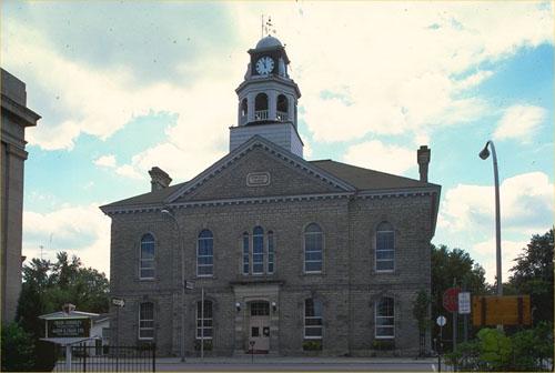
©Parks Canada Agency / Agence Parcs Canada, 1980, 1980 |
Perth Town Hall National Historic Site of Canada
Perth, Ontario
Perth Town Hall National Historic Site of Canada is an elegant
two-storey stone building topped by an ornate layered cupola containing
a town clock. It stands prominently at 80 Gore St. E. in Perth Ontario.
The Perth Town Hall was built in 1863-1864 to serve the growing Town of
Perth. It was designed by architect John Power, and built by Alexander
Kippen. As was typical of its place and time, it not only provided
offices and council chambers for municipal administration, but also
space for a market, a concert hall, a fire hall, a police station and a
post office. Over the years, its interior has been substantially altered
but the exterior is remarkably intact. Market facilities at the rear
have been converted to serve as a fire hall. This building has
continuously served as Perth's town hall since it was built.
|

©Parks Canada Agency / Agence Parcs Canada, 1980 |
Peterborough Drill Hall / Armoury National Historic Site of Canada
Peterborough, Ontario
Prominently located in downtown Peterborough across from Confederation
Park, the Peterborough Drill Hall/Armoury is constructed in a robust
Romanesque Revival style. The exterior's red brick contrasts with the
rough-faced stone foundation and stone accents. Its handsome
proportions, detailing and military motifs are evocative a medieval
fortress. The large, gable-roofed drill hall featuring a high, arched
window, balances the horizontal emphasis of the principal façade. The
main entrance has a monumental quality, its troop door being under a
heavy arch set with cannonball trophies.
Riding a wave of national pride and military enthusiasm following the
South African War (1899-1902), the Canadian government embarked on a
major reform of the nation's defence system. The new program included an
expanded and upgraded militia and the construction of new armouries
across the country.
Thomas Fuller, Chief Architect of the Federal Department of Public
Works, designed Peterborough Drill Hall/Armoury as one of the large,
Class B drill halls. It constitutes one of the largest and best-designed
examples from this period, measuring 24 metres by 51 metres and includes
spaces standard to drill halls by 1909, including armouries, stores,
administrative offices, and sanitary services.
The drill hall is home to the Hastings and Prince Edward Regiment,
originally two separate regiments formed in 1800 and 1804, which saw
action in numerous conflicts including the War of 1812, the 1837
Rebellion, and both World Wars. The regiment distinguished itself with
many battle honours during the Second World War.
|
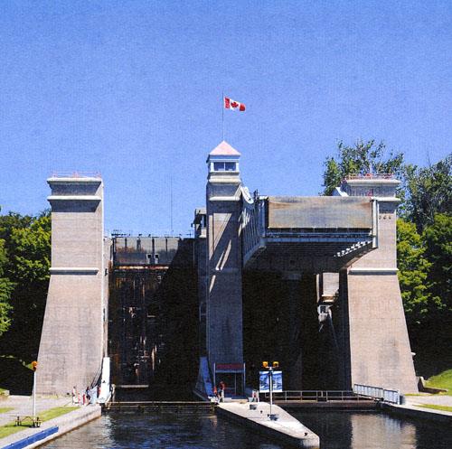
©Parks Canada Agency / Agence Parcs Canada |
Peterborough Lift Lock National Historic Site of Canada
Peterborough, Ontario
World's highest hydraulic lift lock, 1896-1904.
The Peterborough Lift Lock National Historic Site of Canada is located
on the Otonabee River section of the Trent Canal in the City of
Peterborough, Ontario. It is a large concrete structure along the
Trent-Severn Waterway designed to lift boats 19.8 metres. The lock
operates on a balance system, whereby water is let into the upper
chamber, a connecting valve is opened and the heavier chamber
automatically descends, forcing up the lower chamber to start a new
cycle. The lift lock continues to function as part of the Trent—Severn
Waterway National Historic Site of Canada under the management of Parks
Canada.
The heritage value of this site resides in its surviving physical
attributes, and the fact that it was, and remains, an engineering
achievement of national and international renown. When completed in
1904, it was the highest hydraulic lift lock ever built, with a vertical
lift of nearly 20 metres (65 feet) and was reputed to be the largest
unreinforced concrete structure in the world. Its engineering features
include the immediate upper and lower canal cuts and the embankments,
which are integral components of the lock design and operation.
|

©Parks Canada Agency / Agence Parcs Canada, B. Morin, 1993 |
Peterborough Petroglyphs National Historic Site of Canada
Otonabee-South Monaghan, Ontario
Located in Petroglyphs Provincial Park, Peterborough Petroglyphs
National Historic Site of Canada is a broad shelf of exposed marble
located in a woodland setting in Peterborough, Ontario. Inscribed across
the marble are hundreds of realistic human and animal forms, as well as
numerous abstract and symbolic images, which were carved between
900-1400 C.E.
Situated on an outcrop of white marble on the Canadian Shield, the
Peterborough Petroglyphs site is one of the largest known concentrations
of pre-contact rock carvings in Canada. Several hundred images
comprising a wide variety of realistic animal and human forms, as well
as abstract and symbolic representations, give evidence of the spiritual
and intellectual life of the Algonkian Indians who carved them between
900 - 1400 C.E. This site is a sacred place and a monument to their
artistic ability and sensitivity.
|

©Parks Canada Agency / Agence Parcs Canada |
Pic River Site National Historic Site of Canada
Pic River, Ontario
Pic River Site National Historic Site of Canada is located on the north
shore of Lake Superior, 14 kilometres south of Marathon, Ontario. Set on
broad sandy lowlands, the site is bounded by the lake to the west, a
rocky highland to the north, and the Pic River to the south and east.
The site is composed of four archaeological nodes: the Pic River site,
Fort Pic, the Heron Bay site, and the Duncan site, which together
represent numerous Aboriginal and European occupations dating from 12000
B.C.E. to the late 19th century.
The mouth of the Pic River has been the site of numerous Aboriginal
occupations, dating back thousands of years. In the 1780s, a fur trade
post was established at the site, to be taken over by the Northwest
Company in 1799 and subsequently by the Hudson's Bay Company in 1821.
The Ojibway who lived in the area eventually relocated upriver.
As a consequence of the changing shoreline of Lake Superior over time,
the sites generally exhibit evidence of more recent to more ancient
occupations as one travels inland or upstream. The Duncan site (DdIn-7),
the furthest excavated point upstream, represents a small late Archaic
or Early Woodland camp (400 B.C.E. — 300 C.E.). The Heron Bay site
(DdIn-1), located to the south near the mouth of the river, contains
midden deposits from Aboriginal occupations suggestive of Early and Late
Woodland Laurel peoples. The Pic River site (DdIn-2), located upon beach
terraces nearest the river mouth, is a midden deposit that runs along a
previous shoreline from the Late Woodland occupation (1300 C.E. — 1600
C.E.) to the early and late European contact periods. The Fort Pic site
is located between the Pic River site and the Huron Bay site, upon the
grounds of the former trading post.
|
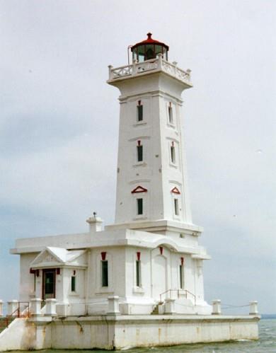
©Parks Canada Agency / Agence Parcs Canada, A. Powter, 1997 |
Point Abino Light Tower National Historic Site of Canada
Crystal Beach, Ontario
Point Abino Light Tower National Historic Site of Canada is an elegantly
proportioned, classically detailed concrete lighthouse situated at the
eastern end of Lake Erie near Crystal Beach and the town of Fort Erie,
Ontario. Designed in the late Classical Revival style, the lighthouse
consists of a square, slightly tapered volume rising from one end of a
rectangular, flat-roofed, single-storey base. It sits just offshore and
is joined to the nearby beach by a slightly elevated concrete walkway,
leading to the light keeper's residence onshore.
The heritage value of Point Albino Light Tower lies in the architectural
and functional qualities of the tower and in its setting with its former
lightkeeper's residence. Point Abino Light Tower was designed by William
P. Anderson and constructed by the Canadian Department of Marine and
Fisheries in 1917-18 to assist navigation at the eastern end of Lake
Erie. The late Classical Revival design, intended to complement the
American-owned summer homes nearby, was more elaborate than most
Canadian lighthouses. The former light keeper's residence is discretely
sited and sympathetically rendered as an Arts-and-Crafts-style cottage.
The light has operated continuously since it was built, although today
it is automated and accessible for public viewing.
|
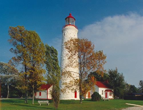
©Parks Canada Agency / Agence Parcs Canada |
Point Clark Lighthouse National Historic Site of Canada
Amberly, Point Clark, Ontario
Imperial tower and lightkeeper's house, 1859.
Point Clark Lighthouse National Historic Site is a 26.5 metres (87 foot)
high light tower, located on a round promontory that juts out from the
eastern shore of Lake Huron between Sarnia and Tobermory, Ontario. The
slightly tapered column is clad in rusticated whitewashed limestone and
is capped by a 12-sided cast iron lantern with a domed roof. The Point
Clark Lighthouse is surrounded by a wooden storage building and a former
lighthouse keeper's residence, which is currently run as museum.
The heritage value of Point Clark Lighthouse lies in the quality and
completeness of its physical form, its distinctive lantern, its siting
and its continuous operation since 1859. Known as an Imperial tower, it
was built between 1856 and 1859 by contractor John Brown for the
Department of Public Works. Marking the location of a dangerous shoal in
Lake Huron, it provided greater navigational safety for the increased
commercial and passenger traffic on the lake. The technology of its
lighting apparatus has changed over the years, and the revolving
mechanism of its light was replaced by an electric motor in 1953. This
site was occupied by a lighthouse keeper until the mid-1960s when the
light was automated. It was acquired by Parks Canada in 1967, but
continues to be operated by the Canadian Coast Guard as a navigational
aid.
|

©Parks Canada Agency / Agence Parcs Canada

©Department of National Defence / Ministère de la Défense nationale, 1993 |
Point Frederick Buildings National Historic Site of Canada
Kingston, Ontario
Located on a peninsula at the mouth of the Cataraqui River in Kingston,
Ontario, Point Frederick Buildings National Historic Site of Canada
consists of a group of five masonry structures, Fort Frederick and the
remnants of the navy yard's stone wall. Four of the buildings and the
fort were erected to support the activities of the Provincial Marine and
the Royal Navy. One of the buildings, the Mackenzie Building, was
purposely built for the Royal Military College. All of these structures
are still in use by the college. Although altered somewhat over the
years, these buildings are representative of the handsome but plain
design, sturdy construction and fine craftsmanship that characterised
the best of British military architecture.
This peninsula, headquarters of the Provincial Marine (c. 1790-1813),
and of the Royal Navy (1813-1853), was the major British naval base on
Lake Ontario during the War of 1812. Buildings surviving from this
period include the Naval Hospital, the Guard House complex, and the
Stone Frigate. On the southern part of the peninsula stands Fort
Frederick, erected in 1812-13 but completely rebuilt in 1846. In 1875
the Point was chosen as the site of the Royal Military College of Canada
which admitted its first class in June 1876.
|
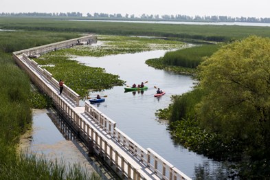
©Parks Canada Agency / Agence Parcs Canada |
Point Pelee National Park of Canada
Headquarters; Leamington, Ontario
Most southern point on Canadian mainland.
A lush Carolinian forest oasis at the southern tip of Canada, Point
Pelee National Park resounds with migrating song birds in the spring,
hums with cicadas in the summer, flutters with Monarch butterflies in
the fall and is a peaceful place of reflection in the winter.
|
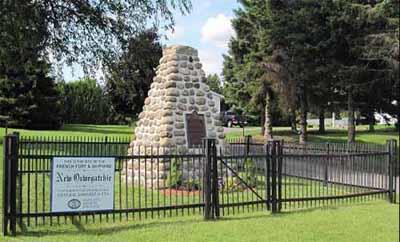
©Parks Canada Agency / Agence Parcs Canada, Historical Services Branch, Bryan Horton August 2009 |
Pointe au Baril National Historic Site of Canada
Maitland, Ontario
Pointe au Baril National Historic Site of Canada is located on the
northern shore of the St. Lawrence River, near the village of Maitland,
Ontario. This small 18th-century shipyard, of which there are no visible
remains, was the site of the construction and launching of the French
naval vessels, Iroquoise and Outaouaise, the last war-ships constructed
by the French on the Great Lakes. The shipyard was constructed alongside
a star-shaped fort that enclosed barracks, ships' stocks, and workshops.
Both the shipyard and the fort were abandoned and destroyed in 1760.
The Pointe au Baril shipyard was constructed by the French in the fall
of 1758, during the Seven Years War. Earlier that year, Fort Frontenac
and the entire French fleet on Lake Ontario had been destroyed by
Lieutenant-Colonel John Broadstreet's British forces, thus taking naval
control of the lake from the French. In an attempt to regain control of
Lake Ontario, the French constructed a fort and shipyard at Pointe au
Baril from which they could launch a new naval force. A large French
force arrived at the fort in 1759 and, under the command of Captain
Pierre Pouchot, completed and launched the barques Iroquoise and
Outaouaise. However, by the summer of that year, it had become evident
to the French that Pointe au Baril was indefensible and they
subsequently destroyed the installations and retreated to nearby Galop
Island and built Fort Lévis.
|

©Susan Schappert, 2007 |
Port Hope Capitol Theatre National Historic Site of Canada
Port Hope, Ontario
Port Stanley National Historic Site of Canada is located on a triangular
section of land east of Kettle Creek in the village of Port Stanley,
Ontario. The site is situated on a small traffic island at the
intersection of Bridge, Main, Joseph and Colborne streets in the centre
of the village. While there are no known resources associated with any
of the early episodes in Port Stanley's history, the village's
association with Adrien Jolliet, General Brock's expedition and
significant early explorers is commemorated by a Historic Sites and
Monuments Board of Canada (HSMBC) cairn, which is located on the
northeast corner of the site.
In the 17th century, Europeans began exploring and mapping the Great
Lakes. The landing point of Kettle Creek, which later became the village
of Port Stanley, was part of an important early route from Lake Erie to
other inland waterways. The mouth of Kettle Creek therefore became a
popular camping spot for a succession of explorers and travellers of the
17th and 18th centuries. For example, Adrien Jolliet, brother of
explorer and cartographer Louis Jolliet, first landed at the mouth of
Kettle Creek in 1669. It was from this point at present-day Port Stanley
that the first descent of the Great Lakes was made by Europeans.
In addition, François Dollier de Casson and René de Bréhant de Galinée
arrived at the mouth of Kettle Creek in 1670 using Jolliet's
information. They proceeded to depart north to present-day Sault Ste.
Marie. In 1749, almost a century later, French Captain Pierre Joseph
Celoron de Blainville, an officer in the colonial regular troops, passed
through the Port Stanley area on route to expand France's claim in the
Ohio Valley region. In 1761 Sir William Johnson, the British
superintendent of Northern Indians passed through this area on his way
to a grand council with the western tribes taking place in Detroit.
After the creation of Upper Canada in 1791, Colonel Thomas Talbot became
one of the original settlers of British descent in the area of Port
Stanley. During the War of 1812 General Isaac Brock also camped at Port
Stanley on his march to take Fort Detroit. Finally, Lord Edward Stanley,
Prime Minister of Great Britain for three terms between 1852 and 1868
visited nearby Talbot Settlement during a tour of Canada and the United
States. Port Stanley was named after Lord Stanley following his
visit.
|
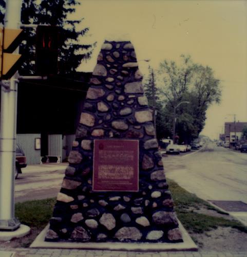
©Parks Canada Agency / Agence Parcs Canada, 1989 |
Port Stanley National Historic Site of Canada
Port Stanley, Ontario
Port Stanley National Historic Site of Canada is located on a triangular
section of land east of Kettle Creek in the village of Port Stanley,
Ontario. The site is situated on a small traffic island at the
intersection of Bridge, Main, Joseph and Colborne streets in the centre
of the village. While there are no known resources associated with any
of the early episodes in Port Stanley's history, the village's
association with Adrien Jolliet, General Brock's expedition and
significant early explorers is commemorated by a Historic Sites and
Monuments Board of Canada (HSMBC) cairn, which is located on the
northeast corner of the site.
In the 17th century, Europeans began exploring and mapping the Great
Lakes. The landing point of Kettle Creek, which later became the village
of Port Stanley, was part of an important early route from Lake Erie to
other inland waterways. The mouth of Kettle Creek therefore became a
popular camping spot for a succession of explorers and travellers of the
17th and 18th centuries. For example, Adrien Jolliet, brother of
explorer and cartographer Louis Jolliet, first landed at the mouth of
Kettle Creek in 1669. It was from this point at present-day Port Stanley
that the first descent of the Great Lakes was made by Europeans.
In addition, François Dollier de Casson and René de Bréhant de Galinée
arrived at the mouth of Kettle Creek in 1670 using Jolliet's
information. They proceeded to depart north to present-day Sault Ste.
Marie. In 1749, almost a century later, French Captain Pierre Joseph
Celoron de Blainville, an officer in the colonial regular troops, passed
through the Port Stanley area on route to expand France's claim in the
Ohio Valley region. In 1761 Sir William Johnson, the British
superintendent of Northern Indians passed through this area on his way
to a grand council with the western tribes taking place in Detroit.
After the creation of Upper Canada in 1791, Colonel Thomas Talbot became
one of the original settlers of British descent in the area of Port
Stanley. During the War of 1812 General Isaac Brock also camped at Port
Stanley on his march to take Fort Detroit. Finally, Lord Edward Stanley,
Prime Minister of Great Britain for three terms between 1852 and 1868
visited nearby Talbot Settlement during a tour of Canada and the United
States. Port Stanley was named after Lord Stanley following his
visit.
|
|
Port Talbot National Historic Site of Canada
Port Talbot, Ontario
Near the cliff was the log-hut residence for almost 50 years of the
Honourable Colonel Thomas Talbot, who on 21st May, 1803, began there the
Talbot settlement. From here in 1809-1811, Mahlon Burwell surveyed and
laid out Talbot Road east and west, for years the longest and best road
in the Province. In the War of 1812, Talbot was Colonel in command of
the London district. On 10th August, 1812, Brock's expedition encamped
on the Beach on its way to the capture of Detroit and Hull's army. Enemy
forces repeatedly raided the settlement and about 20th September, 1814,
burnt Talbot's mills and Burwell's buildings at Port Talbot.
|

©Parks Canada Agency / Agence Parcs Canada, 1990 |
Prescott Railway Station (Grand Trunk) National Historic Site of Canada
Prescott, Ontario
Prescott Railway Station (Grand Trunk) National Historic Site is a
small, stone station building situated beside CNR tracks at the base of
a small ridge at the end of St. Lawrence St. in Prescott.
The heritage value of this site resides in its physical illustration of
a 'First Class A Type' standard station design for the Grand Trunk
Railway on the Montreal-Brockville line in the mid 19th-century.
Prescott's Grand Trunk Railway (GTR) station was built in 1855 during
the first construction period of the GTR line between Montreal and
Brockville (1852-1855). It was a standard design for small stations
prepared for the new line by English architect Francis Thompson.
|

©Parks Canada Agency / Agence Parcs Canada, Catherine Beaulieu, 2010. |
Public Grounds of the Parliament Buildings National Historic Site of Canada
Ottawa, Ontario
Public Grounds of the Parliament Buildings National Historic Site of
Canada is prominently located on Wellington Street above the Ottawa
River in downtown Ottawa, Ontario. The site is comprised of the four
Parliament Buildings (Centre Block, East Block, West Block and the
Library) and the grounds surrounding them. The grounds are landscaped
with flower beds, mature trees, an upper terrace and roadways; and
contains commemorative monuments and statues of varying styles and
sizes. The site also features several associated buildings recently
built behind West Block.
Constructed between 1859 and 1865 in the Gothic-Revival style, the
Parliament Buildings were initially conceived to house the government of
the united provinces of Upper and Lower Canada. The government first
occupied the buildings in 1865, and after Confederation in 1867 the
buildings were occupied by the House of Commons, the Senate, and the
departmental offices of the new Dominion of Canada. With the change of
government, commissioning a landscape design for the grounds became an
important concern.
In 1873 the Department of Public Works contracted well-known New York
landscape architect Calvert Vaux to design a plan for the public grounds
on Parliament Hill. Superseding a design by English designer Marshall
Wood, Vaux's design was implemented during the second half of the 1870s.
Vaux's design accentuated the differences in elevation between Centre
Block and East and West Blocks with the construction of an upper terrace
and projecting bays and stairs. Three sets of stairs linked the two
levels, and at either side, curving ramps carried the road to the
primary entrance of Centre Block. His design also included various
roadways to integrate the dominating Parliament Buildings with the
departmental buildings. Small geometric flower beds, diagonal walks and
a circular plaza with a fountain ornamented the lawn.
While Calvert Vaux's design was being implemented, additional work was
undertaken to develop less formal gardens and the Lover's Walk to the
north of the buildings, in accordance with the ideas of Chief Architect
of the Department of Public Works, Thomas Scott. Although the outline of
Vaux's design is still evident, it has largely been superseded by other
designs. For example, the fountain and the diagonal walks have been
removed and the crisp outline of the terrace retaining wall has been
blurred by shrubbery. Fourteen statues have also been erected since the
implementation of Vaux's design. The first statue built behind the
buildings was that of Sir George-Etienne Cartier, unveiled in 1885.
Other statues followed including those of Sir John A. MacDonald in 1895,
Alexander Mackenzie in 1901 and Queen Victoria, also in 1901. Pathways,
flower beds and an ornamental summerhouse were added behind the
buildings in subsequent years, although the flower beds and summerhouse
are no longer present, as parking needs replaced much of the early
landscape design. The Public grounds of the Parliament Buildings is
often the focal for national celebrations and expressions of
democracy.
|

©Parks Canada Agency / Agence Parcs Canada |
Pukaskwa National Park of Canada
Headquarters; Heron Bay, Ontario
Canadian Shield's ancient landscape on Superior's North Shore.
Pukaskwa National Park's exceptional beauty is revealed in its vistas of
Lake Superior and in the rugged, ancient landscape of the Canadian
Shield and northern forest. The spirit of the wilderness envelopes those
who explore this special place. The only wilderness national park in
Ontario, Pukaskwa protects 1878 square km of an ecosystem that features
boreal forest and Lake Superior shoreline.
|

©Parks Canada Agency / Agence Parcs Canada, 1998 |
Queenston-Chippawa Hydro-Electric Development National Historic Site of Canada
Queenston, Ontario
Queenston-Chippawa Hydro-Electric Development National Historic Site of
Canada is located at Queenston, Ontario, at the Niagara Falls. Built
between 1917-1925, it was the first large hydro-electric project in the
world, and was created by Ontario's Hydro-Electric Power Commission
(HEPC). The HEPC created the project in response to increasing urban and
industrial demands for more electrical power in Toronto and southwestern
Ontario. The site consists of a very large crescent-shaped site
stretching approximately 22 kilometres from the mouth of the Welland
River where it meets the Niagara River, through the city of Niagara
Falls to the hydro-electric generating station situated on the Niagara
River between the Whirlpool and Queenston.
By 1913, there was an increasing industrial and urban demand for more
electrical power in Toronto and southwestern Ontario. As a result,
Ontario's Hydro Electric-Power Commission began to consider proposals
for a possible generating station at Niagara Falls. After consideration,
the HEPCO agreed to a proposal that utilized the watercourse of the
Welland River, the building of a power canal around the city of Niagara
Falls, and the building of a generating station on the Niagara River
between the Whirlpool and Queenston. The project began in 1917 with the
passing of "The Ontario Niagara Development Act" and the first unit of
the development went into service in 1922.
The design of the Queenston-Chippawa Hydro-Electric Development
presented many unique challenges. The size of the development required
construction equipment and power conversion units of a size not seen
prior to their use at Queenston-Chippawa. In addition, the 13.2
kilometre long power canal had to meet specific design characteristics
rarely found in ship canals. When the installation was completed in
1925, the Queenston-Chippawa Hydro-Electric Development was the largest
hydroelectric generation project in the world.
|

©Parks Canada Agency / Agence Parcs Canada

©Parks Canada Agency / Agence Parcs Canada |
Queenston Heights National Historic Site of Canada
Queenston, Ontario
Site of 1812 Battle of Queenston Heights; includes Brock Monument; War
of 1812.
Queenston Heights is an extensive hillside area on the Niagara
escarpment, centred on a heavily wooded, landscaped park which includes
an elegant 57.9 metres (190 foot), classical column containing Sir Isaac
Brock's grave. The park marks the site of the Battle of Queenston
Heights in the War of 1812.
The heritage value of Queenston Heights National Historic Site of Canada
resides in the completeness of the found forms and spatial
inter-relationships of the remaining cultural landscape of the large
area over which the battle was fought. This includes the landing place
in Queenston, the locations of the defending British batteries, the
portage road, the Redan battery, the cliffs, the slope upon which the
British charges were made and where Major/Gen. Brock and Lt/Col.
Macdonnell died, Sheaffe's march, and the Heights where the British
victory was secured. Fort Drummond, a feature of Queenston Heights, has
been separately recognized as a national historic site of Canada.
|

©Parks Canada Agency / Agence Parcs Canada |
R. Nathaniel Dett British Methodist Episcopal Church National Historic Site of Canada
Niagara Falls, Ontario
R. Nathaniel Dett British Methodist Episcopal Church National Historic
Site of Canada is a small wood-frame church located in a residential
community close to the business district in the city of Niagara Falls,
Ontario. This gable-roofed, three-bay, single-storey building features
regularly placed openings. Its gable end features a quatrefoil window
set above a modest entry porch flanked by lancet windows. Its open
speaking box design and intimate interior speak to the close involvement
of its African-Canadian congregation.
The heritage value of this site resides in the location, form and
materials of the building and in its continued use by the
African-Canadian community. An important symbol within the community,
this chapel was constructed in 1836 on Murray Street in the Fallsview
area and later rolled on logs, down the hill, to a less damp and windy
site in the present Drummondville area, and set up on a lot donated by
Oliver Parnall, a successful refugee from slavery. The congregation had
existed since the arrival of the Loyalists after the American Revolution
and continued to grow with the arrival of Black refugees fleeing
American slavery. In 1983, the church was renamed to commemorate
Nathaniel Dett (1882-1943), a parishioner who became an internationally
renowned musician and composer of North American sacred music. The
importance of music to the black community went far beyond that
community's boundaries because music was often one of the only ways in
which the black and white communities interacted. Music had a special
appeal that could temporarily break down racial divides, as is
illustrated by the careers of both R. Nathaniel Dett and Portia White.
The church currently houses the Norval Johnson Heritage Library, a
collection of material on the history of the local community.
|

©Parks Canada Agency / Agence Parcs Canada |
Rideau Canal National Historic Site of Canada
Ottawa / Kingston, Ontario
Operational canal; 202 km route, 47 locks.
Rideau Canal National Historic Site of Canada is a 200 km man-made
waterway running through a corridor of communities from Ottawa River to
Lake Ontario. It was built in the mid 19th century.
The heritage value of the Rideau Canal lies in the health and wholeness
of its cultural landscape, as a witness of the early 19th-century forms,
materials and technologies of the waterway, and as a dynamic reflection
of the longstanding human and ecological inter-relationships between the
canal and its corridor. The Rideau Canal was built for the British
government by Lieutenant-Colonel John By as a defensive work in
1826-1837. Canada assumed responsibility for its management in 1855, and
the waterway served as a commercial transportation route through most of
the 19th and 20th centuries. Parks Canada acquired the canal to sustain
its recreational operation in 1972.
|
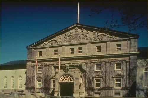
©Parks Canada Agency / Agence Parcs Canada |
Rideau Hall and Landscaped Grounds National Historic Site of Canada
Ottawa, Ontario
Rideau Hall and Landscaped Grounds is a large wooded estate located near
the Ottawa River in the nation's capital. Since 1864 it has served as
the residence of the Governor General of Canada.
The heritage value of this site lies in its associations with Canada's
Governor General and is carried by the landscape with its vice-regal
mansion and service buildings that together create this picturesque
estate. The property has evolved from the original 1838 home of local
industrialist Thomas McKay. From 1864, as the residence of Canada's
Governor General, it has been transformed by the federal government
along the lines of an English country estate. Additions have been made
to the house (two-storey wing in 1865, Tent Room in 1876-78, Minto Wing
in 1898-99, and pedimented northwest facade in 1914); some twenty
outbuildings have been constructed, many under the direction of the
Department of Public Works Chief Architect Frederick Preston Rubridge
(notably the Gate Lodge 1860s, the Stable Building, 1866-67, the Cricket
Pavilion, 1870s, the Gasometer, 1877-78, and the Dairy Building, 1895);
and the grounds have been developed, including the construction of main
gates (1867-68) and an elaborate fence (1920-1930s), to evoke a
picturesque British country estate.
|

©Parks Canada Agency / Agence Parcs Canada |
Ridgeway Battlefield National Historic Site of Canada
Ridgeway, Ontario
Site of battle against Fenian raiders, 1866.
Ridgeway Battlefield National Historic Site of Canada is located within
a four-hectare parcel of parkland in the small community of Ridgeway in
southwestern Ontario, approximately five kilometres west of the Town of
Fort Erie. The site consists of the 1866 battlefield, which now includes
privately owned rural agricultural properties. There are no known in
situ remains of the battle.
The Battle of Ridgeway was fought between the Canadian Volunteer Militia
and about 500 to 800 Fenian invaders on 2 June 1866, just north of what
was then the town of Ridgeway. Skirmishing began between the Militia and
the Fenians near the intersection of Ridge Road and Garrison Road, but
most of the fighting occurred on or near Lime Ridge, an elevated terrain
that ran almost parallel to Ridge Road. The Canadian Volunteer Militia,
led by Lieutenant Colonel Alfred Booker initially made a strong stance
against the Fenian invaders led by Colonel John O'Neil. Although the
Militia outnumbered the Fenians, they were unable to repel the invaders
due to lack of experience and training, and supply issues. After a
valiant stand, the Canadian Volunteer Militia was forced to retreat to
the nearby village of Stevensville. The Fenian raiders returned to the
United States the following day, fearful of Militia reinforcements being
sent from Chippawa, near Niagara Falls.
|


©Parks Canada Agency / Agence Parcs Canada |
Ridout Street Complex National Historic Site of Canada
London, Ontario
The Ridout Street Complex National Historic Site of Canada, is located
in downtown London, Ontario, at the confluence of the north and south
branches of the River Thames. The complex is comprised of a row of three
distinguished, mid-19th-century residential and commercial buildings,
the Anderson Residence, the Bank of Upper Canada building and the Gore
Bank of Canada building. Their forms, materials, and details provide
unity to the group, while their individual treatments and separate
structures provide a varied streetscape.
The heritage value of this site resides in the grouping of these
representative examples of mid-19th-century urban architecture in
southwestern Ontario. Ridout Street North was London's first financial
district, where leaders in the fields of law, medicine, and finance
established offices and homes. The street came to be known as 'Banker's
Row' after the establishment of the head offices of five banks, which
were later turned into residences or business premises. The conservative
classicized forms and the use of locally made buff-coloured brick are
typical of the buildings in this area during the late 19th
century.
|
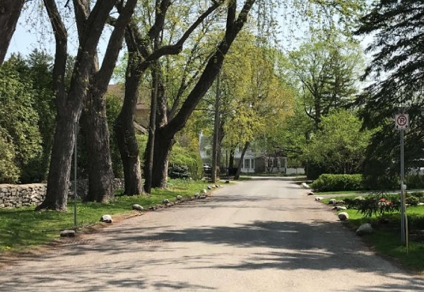
©Parks Canada Agency / Agence Parcs Canada, Christine Boucher, 2022 |
Rockcliffe Park Historic District National Historic Site of Canada
Ottawa, Ontario
The Rockcliffe Park Historic District is located on the traditional
unceded territory of the Algonquin Anishinaabe people. Located northeast
of downtown Ottawa, on the south shore of the Ottawa River, the district
covers an estimated area of 1.77 km2. It was designed and laid out in
1864 by Thomas Coltrin Keefer, as part of Thomas MacKay's large estate
purchased in the 1830s. It is characterized by narrow curving roads,
without curbs or sidewalks, large lots and gardens, and houses set
within a lush green landscape. Together, these features make it an
excellent example of the picturesque English and American suburban
planning traditions of the late 19th century. The varied, high-quality
architecture was the work of such renowned architects as Allan Keefer,
Werner Noffke, A. J. Hazelgrove, Hart Massey and A. J. Ames. They
promoted the use of a variety of styles such as Tudor, Georgian, and
Queen Anne. Homes in this district were built with durable, high-quality
natural materials, in a setting that respects the original rural
ambience of the Village of Rockcliffe Park.
Rockcliffe Park is also an important Indigenous historical site.
Artefacts found along the Ottawa River indicate that people from many
Indigenous nations passed through this crossroads, which was part of a
vast network of communication routes leading to many parts of North
America. More specifically, the Rockcliffe area was known as the hunting
ground of Chief Constant Pinesi (died 1834), Grand Chief of the
Algonquin Anishinaabe people, and was located on an ancient portage
route that provided a shortcut around Rideau Falls between the Rideau
and Ottawa rivers.
Since 1864, the Village of Rockcliffe Park has been and remains a
predominantly single-family residential community. It was planned as a
purely residential area to house future civil servants moving to Ottawa,
which became the capital of the new Dominion of Canada in 1867, and
continues to provide an inviting environment for most of Ottawa's
diplomatic missions. Other land uses, such as high-density housing as
well as commercial and industrial development, have always been excluded
from this community. The only institutional buildings in the Village are
three schools and a combined community centre and library. Of particular
note is Hart Massey House. Built in 1959 on Lansdowne Road North, it is
an iconic example of mid-20th-century modern residential architecture in
Canada. Private residences of national significance such as
Stornoway—the residence of the Leader of the Opposition—and a number of
embassies can be found in the neighbourhood. McKay Lake, formerly known
as Hemlock Lake, and an adjacent small pond ("the Pond") formed from a
quarry, are located in the eastern section of the Village. Rockcliffe
Park is known for its parks and green spaces, including the Jubilee
Gardens and the Village Green, and the Caldwell-Carver Conservation Area
bordering the lake. Amalgamated with the new City of Ottawa in 2001,
Rockcliffe Park retains a high degree of integrity and many of the key
elements associated with its original design.
|
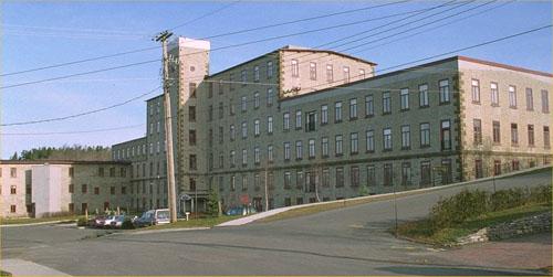
©Parks Canada Agency / Agence Parcs Canada, 1991 |
Rosamond Woollen Mill National Historic Site of Canada
Almonte, Ontario
The Rosamond Woollen Mill National Historic Site of Canada is located on
Coleman Island next to the lower falls on the Mississippi River in the
town of Almonte, Ontario. The mill's main structure is a large,
six-storey, flat-roofed, stone building that features a stair tower and
regularly placed windows. It stands adjacent to a two-storey
warehouse-and-office annex which survives from an original cluster of
ancillary structures. In 1987 the process of converting the mill into
residential condominiums was begun while the two-storey office and
warehouse building was opened as the Mississippi Valley Textile Museum
in 1991.
Rosamond Woollen Mill was built in 1866 to manufacture fine tweeds.
Milling emerged as a major manufacturing industry in Canada between 1840
and 1870. Mills were built in the Mississippi Valley, where waterpower,
labour and wool supplies were abundant. James Rosamond built mills at
Carleton Place and Almonte in the 1840s and 1850s. His sons, Bennett and
James, began the large Almonte mill in 1866, in partnership with George
Stephen of Montréal. Subsequent expansion of the mill continued until
the early 1900s. The textile mill was a functioning industrial complex
until 1986.
|

©Parks Canada Agency / Agence Parcs Canada, 1993 |
Roselawn National Historic Site of Canada
Kingston, Ontario
Roselawn National Historic Site of Canada is a two-storey Classical
Revival house located in Kingston, Ontario. Once the centre of a grand
estate, the house is situated within spacious landscaped grounds. This
elegant, hip-roofed, limestone residence has a projecting frontispiece
and a wide centrally placed gable over the main entrance. Classical
details of this balanced design include an open porch with columns,
dentillation at the eaves and symmetrically placed windows and chimneys.
Built by architect William Coverdale for David John Smith in 1841,
Roselawn stands as a reminder of the days when affluent Kingstonians
erected magnificent country homes just beyond the city. Its proportions,
roof pediments and arched openings reflect the then popular Classic
Revival style. Between 1851-1868 it was the home of Sir Henry Smith Jr.,
who served as Solicitor General for Upper Canada, then Speaker of the
House of the United Canadas. Later, from 1948 to1969, it became the
official residence of the Commandant of the National Defence College. In
1970 it was purchased by Queen's University, then substantially
renovated and expanded to open in 1974 as the University's Centre for
Continuing Education. In 1997 it was again renovated to serve as the
Donald Gordon Conference Centre.
|
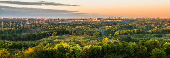
©Parks Canada Agency / Agence Parcs Canada |
Rouge National Urban Park
Headquarters: Toronto, Ontario
Once completed, Rouge National Urban Park will be one of the largest and best
protected urban parks of its kind in North America. A total of 79.5 km2 (7,956
hectares) of land have been committed to Rouge National Urban Park — making
it 19 times larger than Stanley Park in Vancouver, 22 times larger than Central
Park in New York, and close to 50 times larger than Toronto's High Park.
Rouge National Urban Park is located in the cities of Toronto, Markham and
Pickering and in the Township of Uxbridge. Situated in close proximity to 20 per
cent of Canada's population, Rouge National Urban Park will create unprecedented
opportunities for Canadians to connect with the country's vast network of
protected heritage areas. The Rouge National Urban Park Act was passed by the
House of Commons on January 26, 2015, and by the Senate on April 2, 2015; it
received Royal Assent from the Governor General on April 23, 2015. The Act came
into force — formally establishing Rouge National Urban Park — via
Order-in-Council on May 15, 2015. The Act is tailor-made to provide the Rouge
with its strongest ever protections. Rouge National Urban Park is home to a
unique combination of natural, cultural and agricultural features including:
1,700 species of plants, birds, fish, mammals, insects, reptiles and amphibians;
more than 10,000 years of human history; and large tracts of Class 1 farmland,
the rarest, most fertile and endangered in the country.
|
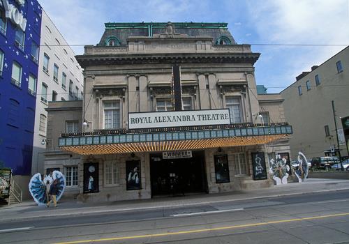
©Parks Canada Agency / Agence Parcs Canada, J Butterill, 1993 |
Royal Alexandra Theatre National Historic Site of Canada
Toronto, Ontario
The Royal Alexandra Theatre is an early-20th-century, Beaux-Arts-style
theatre. It is located in downtown Toronto.
The Royal Alexandra Theatre was designated a national historic site
because it is a nationally significant example of a theatre which was
built specifically for the presentation of live theatrical performances.
The Royal Alexandra is an intimate but lavish version of a traditional
19th-century theatre built exclusively for live theatrical performances.
Designed by noted Toronto architect John M. Lyle (1872-1945), who had
worked in theatre design in New York, the Royal Alexandra was a direct
importation of the small, lavish and more intimate type of theatre being
built in New York. Its design allowed a relatively large number of seats
in a deceptively small space. The Royal Alexandra was one of the last
theatres of its type built in Canada and likely the best surviving
example. Since its rescue and rejuvenation by Ed Mirvish in 1963, the
Royal Alexandra has played a central role in the social and cultural
life of Toronto. Its Beaux-Arts style continues to provide an elegant
setting for theatrical and musical events.
|
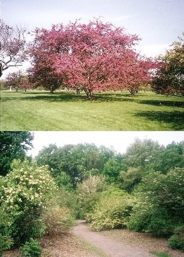
©Parks Canada Agency / Agence Parcs Canada, Jamie Dunn, 2002 |
Royal Botanical Gardens National Historic Site of Canada
Hamilton, Ontario
The Royal Botanical Gardens National Historic Site of Canada is an
extensive botanical garden that was developed over the course of the
20th century. Set at the western edge of the city of Hamilton, it
occupies almost 1100 hectares on several separate discrete parcels of
land clustered around Burlington Bay at the western end of Lake Ontario.
The site includes a series of themed gardens, an arboretum, a
conservation area and an interpretive centre.
The Royal Botanical Gardens was part of a late 1920s scheme to beautify
Hamilton by building a landscaped parkway into the city and creating a
campus for McMaster University. The plan to include a botanical garden
was developed by the Hamilton Board of Parks Management under its
chairman, Thomas Baker McQuesten. The Board's decision in 1932 to
combine separate parcels of land to create the Gardens was prompted by
an advisory committee including landscape architects Carl Borgstrom and
Howard Dunington-Grubb. The Gardens' unusual design, consisting of a
series of discrete gardens and conservation areas set within a sprawling
network of parkway, marked a radical departure from the 19th-century
conception of a botanical garden.
The landscape design of the Gardens was influenced by Carl Borgstrom,
who believed in a natural approach to landscape design and in creating a
botanical garden that would appeal to the general public. Borgstrom
designed a rock garden, in an abandoned gravel pit adjacent to the
parkway, transforming the pit into an intricate landscape of picturesque
winding paths, hidden flights of steps, ledges, crevices and pools. A
list of recommendations prepared by Borgstrom for the Gardens in 1942
was largely implemented over the next twenty years. It included
important components such as formal gardens, rose and climbing gardens,
an arboretum, and a lilac garden.
Plant curator K. Matthew Broman designed the Laking Garden in 1947. It
functions as a trial garden for hardy herbaceous plant collections and
includes a major iris collection.
Landscape architect J. Austin Floyd designed the formal garden in
Hendrie Park in 1962. Influenced by the International Style, Floyd
created a geometric framework for avenues and flower beds, organized
along a principal axis that is reminiscent of Renaissance garden design.
The Teaching Garden, first developed in 1947-1948 as an educational
project for children, includes a house, a greenhouse and six hectares of
gardens containing plants selected for their aesthetic appeal,
sturdiness and educational value.
The Arboretum, developed in the 1950s and 1960s, was designed to
facilitate automobile viewing, with trees planted on avenues radiating
from a central parking circle. The Katie Osborne Lilac Garden, begun in
1960-1961, is now the largest living collection of lilacs in the world.
The Conservation Area covers 800 hectares of marsh, shallow lake,
woodland, meadow, escarpment face, and agricultural land maintained in a
naturalized state. It includes the Cootes Paradise Sanctuary, a
carefully monitored wetland adjacent to Burlington Bay, and the Rock
Chapel Sanctuary.
An interpretive centre, designed in 1958, provides space for a library,
herbarium, lecture room, horticultural workshop and auditorium.
|
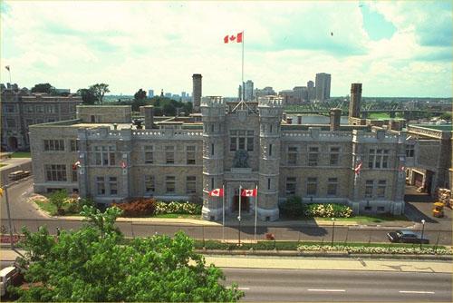
©Parks Canada Agency / Agence Parcs Canada, 1993 |
Royal Canadian Mint National Historic Site of Canada
Ottawa, Ontario
The Royal Canadian Mint is a two-storey, Tudor-Revival style limestone
building. The main part of the building was erected in 1905-1908, the
refinery was attached to the rear of the office building in 1909-11. The
Royal Canadian Mint is located on Sussex Drive, very close to other
government buildings of the period.
Royal Canadian Mint was designated a national historic site of Canada in
1979 because the building combines the function of a mint (producing
coins and medals) with that of a refinery for gold produced by Canadian
mines.
The heritage value of this site resides in its combined historic use, as
illustrated by its location, functional design, use of the Tudor-Revival
style, and surviving material from its original construction date.
Prior to the construction of the Royal Canadian Mint, most Canadian
coins were struck at the Royal Mint in London, England, using gold
shipped to England from Canada. In January 1908, the Ottawa Branch of
Britain's Royal Mint was officially opened with the striking of a
fifty-cent coin. In its early years, the Mint served two functions: it
minted coins and it refined gold produced by Canadian mines. The branch
mint increased Canada's ability to maintain some control over its
currency. As such, it housed offices and industrial operations. In 1931
the Mint came under the jurisdiction of the Government of Canada and was
renamed the Royal Canadian Mint.
The importance of the building to Canada was evident in the choice of
style and the choice of architect. In its styling and its stone
cladding, the Royal Canadian Mint was representative of the federal
government's approach to using the stylistic vocabulary of the Tudor
Gothic to create a distinctive identity in the Capital. The references
to English castles were also well-suited to the Royal Canadian Mint's
function and to its association with the British Royal Mint. The
architect, David Ewart, was the Chief Architect of the Department of
Public Works. He used the Tudor-Revival style for other prominent
federal buildings of the period, particularly the Victoria Memorial
Museum National Historic Site of Canada and the Connaught Building
National Historic Site of Canada.
The Mint facility consists of an office building oriented towards Sussex
Drive, and a refinery and workshop placed on an axis at the rear. Access
is controlled by a guardhouse admitting entry through a high stone and
metal fence. Although originally constructed in 1905-08, with additions
in 1909, 1916 and 1951, the Mint experienced its greatest change in
1985, when most of the original building was demolished, leaving only a
portion of the facade and tower entryway. The following year, the
building was reconstructed to appear identical from the exterior
although considerably altered on the interior. In 1987, modifications
were made to the south guardhouse to equip it as a visitor reception
area.
|

©Royal Conservatory of Music, Canuckistan, May 2011 |
Royal Conservatory of Music National Historic Site of Canada
Toronto, Ontario
The Royal Conservatory of Music National Historic Site of Canada faces a
busy street in downtown Toronto. Since 1963, this influential and
distinguished school of music has resided in a large, richly ornamented
four-storey building of eclectic late-Victorian design. This older
building forms the central element amongst a cluster of later, large
additions that now form a small complex. Its symmetrically disposed
façade features boldly handled detailing including rock-faced masonry,
decorative brickwork, projecting bays, stringcourses and a lively,
complex roofline that contrasts with the materials and treatment.
Founded in 1886, the Royal Conservatory of Music is a rare survivor of
the many conservatories founded in Canada in the 19th century. Its
longevity may be partly ascribed to the excellence of its instruction,
the caliber of its graduates, its adherence to high standards and its
sound administration. From its inception it was a large-scale
enterprise, with a large number of students and substantial funding.
Remarkable growth in the early years resulted in a purpose-built
structure with the later addition of further facilities and the opening
of branches in residential areas. The current building, McMaster Hall,
formerly the Toronto Baptist College, was purchased by the University of
Toronto from the government in 1936, and has served as the main teaching
and rehearsal facility for the Royal Conservatory of Music since 1963.
Affiliated with the University of Toronto until 1991, the Royal
Conservatory of Music is now an independent institution.
|
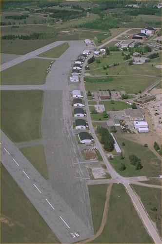
©Parks Canada Agency / Agence Parcs Canada, 1988 |
Royal Flying Corps Hangars National Historic Site of Canada
Essa, Ontario
The Royal Flying Corps Hangars at Canadian Forces Base Borden, near
Barrie, Ontario, face the runway in a ribbon-like line. Of the original
fifteen built on Canada's first military aerodrome during World War I,
eight survive. Some of these single-storey timber-framed buildings have
been rehabilitated for alternate uses, including a museum.
The Royal Flying Corps Hangars were built in 1917 as temporary quarters
for Canada's first military aerodrome. Witnessing the transition of the
Royal Flying Corps (1916-17) to the Canadian Air Force (1920) and then
to the Royal Canadian Air Force (1924), the hangars have since housed
air training schools and a variety of other uses, including a museum.
The heritage value of the Royal Flying Corps Hangars NHSC resides in
their associated history as illustrated by their functional design, form
and composition and their siting as an assembled grouping.
|
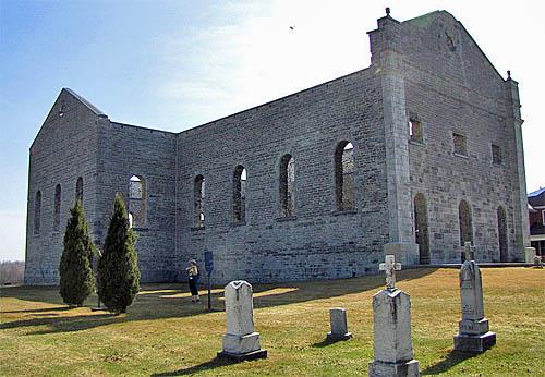
©D. Gordon E. Robertson, 2010 |
Ruin of St. Raphael's Roman Catholic Church National Historic Site of Canada
South Glengarry, Ontario
The Ruin of St. Raphael's Roman Catholic Church National Historic Site
of Canada is an evocative stone ruin set within a pastoral
ecclesiastical landscape in South Glengarry County, Ontario. In 1970,
St. Raphael's roof, its 1830s tower and all of its 1900 interior
decoration were destroyed by fire. The outer walls were spared and thus
its plan, impressive scale and fine masonry work were preserved. The
masonry shell of the formerly grand church is complemented by an old
burial ground, a small modern church, and other ecclesiastical buildings
that stand nearby.
The heritage value of this site resides in its historical associations
as illustrated by the well-preserved ruins of the former St. Raphael's
Roman Catholic Church set in an ecclesiastical precinct. The Ruin of St.
Raphael's Roman Catholic Church is also significant through its
association with the first Roman Catholic Bishop of Upper Canada,
Alexander Macdonell, who administered his see from this former church
during the 1820s. Until the 1840s, St. Raphael's parish was the largest
and most important ecclesiastical district for Anglophone Catholics in
Upper Canada. The ruin, set in an ecclesiastical precinct, is part of a
rich historic landscape that includes a burial ground, as well as
numerous historic and modern ecclesiastical buildings.
Bearing witness to the early history of Roman Catholicism in Upper
Canada, the Ruin of St. Raphael's Roman Catholic Church is evidence of a
formerly grand church, whose plan had been inspired by Québec churches
designed by Reverend Pierre Conefroy. Begun as early as 1815, St.
Raphael's was situated in the heart of an early Highland Scottish
settlement, and for the next half-decade, its parish would be the cradle
of Catholicism in Ontario. St. Raphael's suffered a devastating fire in
1970, leaving the current ruin, which has since been stabilized. Today,
this ruin serves as an evocative testament to Bishop Alexander
Macdonell's determined efforts to establish the Roman Catholic Church in
Upper Canada.
|
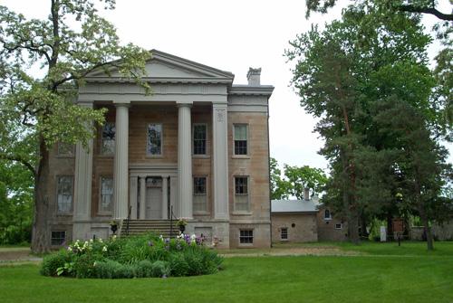
©Parks Canada Agency / Agence Parcs Canada, 2003 |
Ruthven Park National Historic Site of Canada
Cayuga, Ontario
Ruthven Park National Historic Site of Canada is a preserved
mid-19th-century, picturesque country estate with a Greek Revival villa,
associated outbuildings, and the archaeological remains of an
early-19th-century village. The estate and the remains of the village
are located on the east bank of the Grand River, just north of the
village of Cayuga, Ontario.
The focus of the estate is the temple-fronted, Greek Revival villa built
of ashlar limestone from 1845-1846, enlarged in the 1860s. To the rear
of the villa, a series of mid-19th century brick and rubble limestone
farm buildings, built between 1845 and 1867, are arranged around an
enclosed rectangular farmyard that now functions as a walled garden. The
villa and its outbuildings are set on a high point of land overlooking
the Grand River, accessed by a long winding driveway. The buildings are
set in a clearing, surrounded by open lawn and beyond that by woodland.
The estate also includes a brick gatehouse and a family cemetery. To the
north are the remains of the former village of Indiana, including a
mid-19th-century, frame house and the remnants of a lock and dam.
Official recognition refers to the 34.4 hectare cultural landscape with
its built and archaeological components.
During the 1830s, the Grand River Navigation Company transformed the
Grand River into a navigable waterway for commercial activity between
Brantford and Lake Erie. Under the leadership of David Thompson and
others, the company built a series of locks, dams and canals along the
river. Thompson also laid out the village of Indiana, one of the small
canal communities in the lower Grand River valley that prospered as a
result of the Company's activities. In 1845, using the British country
estate as a model, Thompson began to lay out an estate overlooking the
river that would reflect his elevated social and economic status.
Ruthven Park is a rare surviving example of the romantic fusion of
classical architecture and Picturesque landscape which characterized
country estates of the late 18th and early 19th centuries. The Greek
Revival villa, designed by American architect John Latshaw, follows the
form and plan of Neoclassical domestic architecture as it developed in
the 19th century. Bold, rich, Greek Revival ornamentation, including a
temple front in the American Greek Revival manner, decorates both the
exterior and the interior of the villa.
The estate is directly associated with the settlement of the middle and
lower Grand River Valley. This was a period of transition in Upper
Canada, as successful businessmen such as Thompson began to mould the
landscape in accordance with British precedents. Thompson's estate
epitomizes picturesque design principles. Buildings, open spaces, and
vegetation are carefully placed to create pleasing vistas and take
advantage of natural features. Roadways and pathways are positioned to
facilitate framed views of the estate and its components. Neoclassically
inspired structures, including the villa, the gatehouse and the family
cemetery, add sophistication and romance to the natural surroundings.
The arrangement of farm buildings to create a sheltered yard behind the
villa reflects the influence of the 19th-century agricultural reform
movement on rural forms.
|
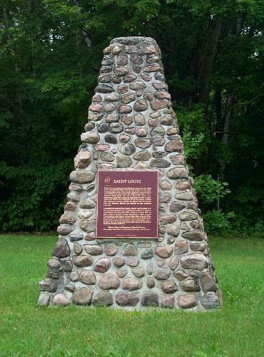
©Parks Canada Agency / Agence Parcs Canada, 2003 |
Saint-Louis Mission National Historic Site of Canada
Victoria Harbour, Ontario
Site of Huron village destroyed by Iroquois in 1649.
Saint-Louis Mission National Historic Site of Canada lies on a tableland
beside the Hogg River, 3 kilometres inland from Georgian Bay, near
Victoria Harbour, Ontario. This 2-hectare archaeological site was an
open field when it was investigated in the first half of the 20th
century. Since that time the field has been left fallow, while part of
the site area has grown into a mixed hardwood forest and the rest has
been planted with pine trees. There are mounds and surface depressions
indicative of past archaeological investigations.
In the 1640s, Saint-Louis was the name given by the Jesuits to the
stockaded village of the Ataronchronon tribe of the Huron-Wendat. On the
morning of 16 of March 1649, the Huron-Wendat village and Jesuit mission
of St. Ignace II was attacked by the Five Nations Iroquois. Once St.
Ignace II was captured, the Iroquois continued west and that same
morning attacked the village and mission of St. Louis, capturing the
Jesuit missionaries Jean de Brébeuf and Gabriel Lalement. The raids made
it clear to the Huron-Wendat that they were not safe from destructive
attacks in their homeland, and it began a chain of events that led to
the abandonment of Huronia in 1650.
|
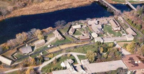
©Huronia Historical Park, Rosemary Vyvyan & William Brodeur, 2005 |
Sainte-Marie Among the Hurons Mission National Historic Site of Canada
Midland, Ontario
Sainte-Marie Among the Hurons Mission National Historic Site of Canada
is the former headquarters of the Jesuit Mission to the Huron-Wendat
from 1639-1649. It is located under the site of the reconstructed
17th-century Jesuit mission on the banks of the Wye River, which flows
into Georgian Bay near Midland, Ontario. The current site presents
reconstructed European-style mission buildings, including barracks and
workshops, and Iroquoian-type longhouses, all situated within a wooden
palisade fortification.
Sainte-Marie Among the Hurons Mission was designated a national historic
site of Canada in 1920 because it was headquarters of the Jesuit Mission
to the Hurons from 1639-1649.
Founded by the Jesuits in 1639, Sainte-Marie was the centre for the
mission to the Huron-Wendat peoples. The mission was built in the
territory known as Huronia, which was inhabited by the Huron-Wendat,
horticulturalists living in densely populated villages year-round.
Christian Hurons visited Sainte-Marie for worship, and for medical
treatment after the establishment of a hospital, but Sainte-Marie
remained essentially a European enclave, the headquarters from which
priests were sent out on missions to the individual villages. The
mission developed into a sizeable colony, with chapel, hospital,
residences, storehouses and workshops.
However, prolonged daily contact between native people and Europeans
profoundly affected both groups. The Huronia had suffered from fatal
outbreaks of smallpox and other European epidemic diseases. This
resulted in intensified Iroquois attacks, along with social divisions
and internal conflicts caused by conversions to Christianity. By the
winter of 1648-1649, Huronia was so ravaged by disease and conflict that
the Jesuits abandoned and burned Sainte-Marie and with some Wendat
followers moved to Christian Island (previously known as Gahoendoe or
Île-Saint-Joseph), establishing what is now known as Fort Sainte Marie
II National Historic Site of Canada. In 1650, the Jesuits and Hurons
withdrew to the location now called the Old Wendake Historic District
National Historic Site of Canada, just north of Québec City.
Initial archaeological work began on the site in the 1840s and 1850s and
then continued again during the 1940s and 1950s.This work informed the
1964 reconstruction of the buildings that once stood on the site.
|
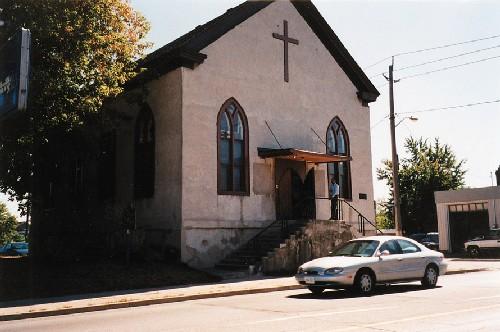
©Parks Canada Agency / Agence Parcs Canada, 1998 |
Salem Chapel, British Methodist Episcopal Church National Historic Site of Canada
St. Catharines, Ontario
Salem Chapel British Methodist Episcopal Church National Historic Site
of Canada is a gable-fronted church set on a high foundation. Located at
92 Geneva Street, in St. Catharines, Ontario, this stucco-clad building
is distinguished by its regularly arranged pointed-arch windows, modest
scale and overall simplicity.
Salem Chapel British Methodist Episcopal Church was an important centre
of 19th-century abolitionist and civil rights activity in Canada. Built
circa 1855, it replaced a smaller log church in order to accommodate St.
Catherines' growing community of refugees arriving via the underground
railroad. Among them was Harriet Tubman, the famous UGRR conductor, who
lived near Salem from 1852-1857 and personally led many refugees from
the southern United States to safety in Canada. The heritage value of
this church resides in its exceptional associations with the
anti-slavery movement and the early UGRR black community to which it
bears witness as illustrated by the church with its auditory-hall form,
typical of early African Canadian churches.
|
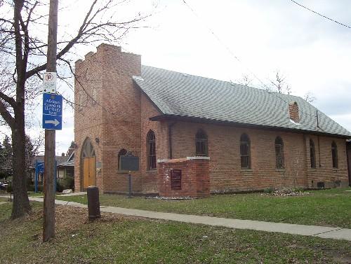
©Parks Canada Agency / Agence Parcs Canada |
Sandwich First Baptist Church National Historic Site of Canada
Windsor, Ontario
Sandwich First Baptist Church National Historic Site of Canada is a
picturesque brick church located in the former border town of Sandwich,
now part of the City of Windsor, Ontario. It is a small, brick,
gable-roofed church set close to the street, that exhibits the
vernacular qualities of simplicity, modest scale and limited decorative
embellishment typical of the many auditory hall-style churches built by
Underground Railroad refugee communities in mid-nineteenth century Upper
Canada.
Originally associated with the 19th-century establishment of an African
Canadian community of refugees from slavery arriving via the Underground
Railroad, Sandwich First Baptist Church is one of the oldest Baptist
churches surviving from this period in Ontario. Sandwich First Baptist
Church received, sheltered, and assisted new Canadians arriving on the
Underground Railroad. As a black community church next to the American
border, it was a focal point for many anti-slavery activities and is
directly related to the formation of the Amherstburg Regular Missionary
Baptist Association.
Built on land donated by the Crown in 1851, the church required that all
members aid in its construction by giving donations or making bricks
from local materials. Over the years the building was embellished, as
with the addition of its crenellated entry tower. The heritage value of
Sandwich First Baptist Church resides in its associated history as
illustrated by the location, composition, and materials of the building
itself.
|

©Parks Canada Agency / Agence Parcs Canada |
Sandyford Place National Historic Site of Canada
Hamilton, Ontario
Sandyford Place National Historic Site of Canada is a row of stone
terrace houses, built in the mid-19th century. It is located on Duke
Street in the Durand area, a primarily residential neighbourhood on the
southern periphery of downtown Hamilton.
Sandyford Place is a rare surviving example of the small number of row
houses built for affluent citizens in Canada during the mid-19th
century. Built during a period of rapid growth for Hamilton, it typifies
the construction style in the city at that time, when large numbers of
Scottish settlers sought to recreate the stone terraces and grid-plan
streets of Scottish towns and cities. The fine stonework is consistent
with the work of Scottish masons of the period throughout
Ontario.
|
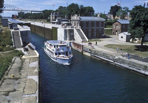
©Parks Canada Agency / Agence Parcs Canada
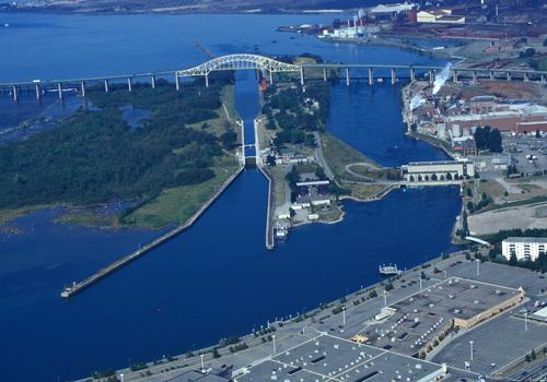
©Parks Canada Agency / Agence Parcs Canada |
Sault Ste. Marie Canal National Historic Site of Canada
Sault Ste. Marie, Ontario
First electrically-powered lock, 1888-94.
Sault Ste. Marie Canal National Historic Site of Canada is a man-made
waterway that passes between the city of Sault Ste. Marie and Whitefish
Island on the shipping channel joining Lake Huron and Lake Superior at
Sault Ste. Marie, Ontario. Of particular note are the canal's Powerhouse
built into the slope of the hill at the downstream end of the lock, and
the Emergency Swing Dam located west of the original lock near the
Superintendent's Residence. The canal is now operated as a recreational
facility.
The heritage value of the Sault Ste. Marie Canal lies in the legibility
and completeness of the man-made waterway including its engineering
works, associated buildings and designed landscape features. The Sault
Ste. Marie Canal was completed in 1895 as part of Canada's national
canal system. The Powerhouse for the canal was built in 1894 during the
initial phase of construction, and the canal's Emergency Swing Dam was
built by Dominion Bridge Co. in 1895. Administration of the Sault Ste.
Marie Canal was transferred to the St. Lawrence Seaway Authority
(1959-1979), then to Parks Canada to continue canal operation as a
recreational facility.
|

©Parks Canada Agency / Agence Parcs Canada, 2006 |
Serpent Mounds National Historic Site of Canada
Keene, Ontario
Serpent Mounds National Historic Site of Canada is located in an open
oak savannah setting on Roach's Point and East Sugar Island in Rice
Lake, Peterborough County, Ontario. A burial site dating from 50 BCE to
300 CE, it is a grouping of six separate burial locations forming a
serpentine shape that is approximately 60 metres long and almost 8
metres wide and 1.5 to 1.8 metres high. The site is presented to the
public within the grounds of Serpent Mounds Park on the banks of Rice
Lake.
Serpent Mounds incorporates a 4.4-hectare area on Roach's Point, as well
as a 49-hectare area on East Sugar Island. The designated site comprises
six distinct areas of archaeological interest, including the Serpent
Mounds site, the Alderville site, the Island Centre site, the East Sugar
Island site, the Corral site and an unnamed Site BbG m-22. The Serpent
Mounds National Historic Site of Canada is the most completely
investigated archaeological site in Canada associated with the Point
Peninsula culture and contains information on both the daily and the
ritual life of this culture, which dates from 50 BCE to 300 CE. The
complex also incorporates evidence of Pickering or Early Ontario
Iroquois, Late Iroquoian Huron and some Archaic cultures. These sites
have been systematically investigated in 1897, 1910, 1955, 1960 and
1968.
|
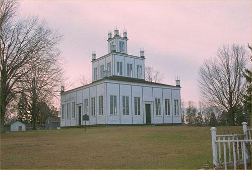
©Parks Canada Agency / Agence Parcs Canada, 1991 |
Sharon Temple National Historic Site of Canada
Sharon, Ontario
Sharon Temple National Historic Site of Canada is located north of
Toronto, in the village of Sharon. It is an elegant wooden building
comprised of three storeys of diminishing size. All four sides of the
building are filled with large windows that are candle-lit for special
celebrations. The Temple sits in the centre of a large, grassed area,
which also contains a collection of other buildings associated with the
religious community.
Its heritage value resides in the quality of its Neo-classical design
and pioneer craftsmanship and in its physical manifestation of the
beliefs of the Children of Peace who established a co-operative
community north of Toronto named Sharon, known at that time as Hope. The
temple was built by the members of the community between 1825 and 1831
to the designs of David Willson, the community leader, under the
direction of master carpenter Ebenezer Doan. The last service was held
in the Temple in 1889. In 1917, it was acquired by the York Pioneer and
Historical Society, which started restorations and developed it as an
historic site, moving additional buildings to the property over the
years.
|
|
Sheguiandah National Historic Site of Canada
Manitoulin District, Ontario
Sheguiandah National Historic Site of Canada is located on the
northwestern shore of Manitoulin Island near the present-day community
of Sheguiandah, Ontario. The main feature of the site is a quartzite
knoll containing artifacts spanning 9000 years of occupation, dating
from the Paleoindian Period to the Middle Woodland Period. The site
extends to the base of the knoll on all sides, including the modern
village of Sheguiandah.
The remains found in Sheguiandah represent a series of successive
cultural occupations of early inhabitants in what is now Ontario,
beginning with the Paleoindian Period circa 11,000 B.C.E. during the
recession of glacial Lake Algonquin. The site also contains artifacts
from the Archaic period (1000-500 B.C.E.) as well as Point Peninsula
culture stone tools associated with the Middle Woodland period (0 — 500
C.E.). The main features of the site are the local outcrops of
quartzite, from which early Aboriginal peoples could make tools and
weapons. Large stone hammers were used to strike off pieces of the
bedrock, and from the finer fragments the settlers chipped out great
numbers of knives, scrapers, and other tools for use in hunting,
fishing, and food-gathering.
|

©Parks Canada Agency / Agence Parcs Canada, F. Cattroll, 1982 |
Shoal Tower National Historic Site of Canada
Kingston, Ontario
Mid 19th-century British imperial masonry fortifications.
Shoal Tower National Historic Site of Canada is a circular stone
defensive tower located on a shoal in the harbour, directly offshore
from the site of the historic City Hall and the site of the former
Market Battery in Kingston Ontario. From this location, the Shoal Tower
had a commanding field of fire over Kingston's commercial harbour and
the entrance to the Rideau Canal.
The heritage value of this site lies in its relationship with the other
four components of the Kingston Fortifications National Historic Site of
Canada as illustrative of a system of defence. Shoal Tower was built by
the British government from 1846 to 1847 as one of four Martello towers
and the Market Battery, in order to reinforce Kingston's existing
defence system in response to the anticipated American threat during the
Oregon Crisis.
|

©Parks Canada Agency / Agence Parcs Canada, 1995 |
Sir John A. Macdonald Gravesite National Historic Site of Canada
Kingston, Ontario
The Sir John A. Macdonald Gravesite National Historic Site of Canada,
located in Kingston's Cataraqui Cemetery, is marked by a simple stone
cross with an inscription. The cross is set within a rectangular family
plot on a gentle slope surrounded by an ornate iron fence. Near the
centre of the enclosed area, amongst other stone markers, a tall granite
obelisk bears the names of Macdonald and Williamson, the two
inter-related families in the plot. Sir John A. Macdonald is also
memorialized by a small rectangular inscribed footstone, and a small
metal plaque with his name attached to the plot's iron gate.
The Sir John A. Macdonald Gravesite is associated with the man who
dominated the political life of Canada during its first quarter of a
century. Macdonald was a visionary statesman, a determined Conservative
partisan, and a well-respected leader. His policies of westward
expansion and of railways to the Atlantic and Pacific laid the basis of
a successful transcontinental nation. Macdonald died while still prime
minister in Ottawa on June 6th, 1891. Having spent most of his life in
Kingston, his body was transported back there to be buried in his family
plot in the Cataraqui cemetery. A simple stone cross marks his grave, as
he wished.
|

©Parks Canada Agency / Agence Parcs Canada, 2005 |
Sir John Johnson House National Historic Site of Canada
Williamstown, Ontario
House of famous Loyalist, 1780s.
Sir John Johnson House National Historic Site is a large, wooden house
of typical nineteenth-century Ontario vernacular design, set amidst
spacious grounds on the banks of the Raisin River in Williamstown,
Ontario. The evolved house is built around a late eighteenth-century
core. The designation refers to the house, as well as a shed, an
ice-house, the remains of the west wing and the burnt layer from initial
clearing of the land.
The heritage value of Sir John Johnson House lies in its illustration of
late eighteenth-century frontier building techniques and in its
association with Sir John Johnson. The original core of the house was
built 1784-1792 as part of a complex of buildings centered around a
mill. It was expanded around 1813-1830 (west addition), and in the early
1860s (east addition).
|
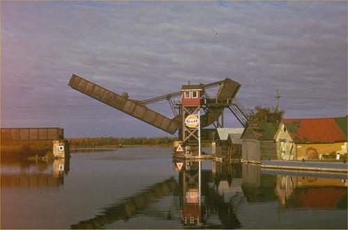
©Parks Canada Agency / Agence Parcs Canada, 1988 |
Smiths Falls Bascule Bridge National Historic Site of Canada
Smiths Falls, Ontario
Smiths Falls Bascule Bridge National Historic Site of Canada is an early
movable concrete bridge built in the early twentieth century to carry
rail traffic over the Rideau Canal. Located within the town of Smiths
Falls, today it stands with its roadbed span permanently raised, its
massive counterweight stretching almost perpendicular to the sky, and
its adjacent bridge tender's tower unmanned.
Smiths Falls Bascule Bridge was designated a national historic site in
1983 because this Scherzer Rolling Lift bascule bridge is an outstanding
early example of a novel concept in movable bridges.
The heritage value of Smiths Falls Bascule Bridge National Historic Site
of Canada resides in its manifestation of a technological achievement as
illustrated by its distinctive form, materials and design. The Smiths
Falls bascule bridge was built on the Toronto-Ottawa line of the
Canadian Northern Railway in 1912-1913. Very little power was required
to operate it owing to the unique rolling lift action which almost
eliminated friction, and the overhead concrete counterweight which
balanced the 21-metre plate-girder lift-span. Originally electrically
powered, the bridge was manually operated from 1915-1978. Scherzer
rolling lift bascule bridges were introduced to Canada ca. 1911, and
this is the oldest surviving structure of its type. Canadian National
Railways transferred ownership of the bridge to the City of Smiths Falls
for maintenance as a heritage resource in the mid 1980s.
|

©Parks Canada Agency / Agence Parcs Canada, 1988 |
Smiths Falls Railway Station (Canadian Northern) National Historic Site of Canada
Smiths Falls, Ontario
Smiths Falls Railway Station (Canadian Northern) National Historic Site
of Canada is located on the west edge of Smiths Falls off William West.
It is a custom-designed brick station with a Chateauesque flavor that
features a distinctive turret and polygonal waiting room. It operated as
a railway station from 1914 to 1979. In 1983, it became the Smiths Falls
Railway Museum.
Smiths Falls Railway Station (Canadian Northern) National Historic Site
was built on the Canadian Northern Railway's new Toronto-Ottawa line in
1912-1914. Its individualized design, likely created by the company's
architect, R.B. Pratt, is evidence of the Canadian Northern's
determination to compete for transcontinental business in the central
Canadian market.
The heritage value of Smiths Falls Railway Station (Canadian Northern)
National Historic Site resides in its presence as a symbol of the
Canadian Northern Railway's determination and practices in the highly
competitive railway environment of early 20th-century Ontario as
illustrated by the station's custom design and substantial form, its
composition, siting and most especially in the unique decorative turret
that renders it a local landmark.
|
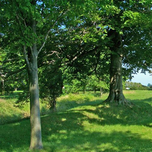
©Parks Canada Agency / Agence Parcs Canada, 2004. |
Southwold Earthworks National Historic Site of Canada
Iona, Ontario
Rare and well-preserved example of an Aboriginal fortified village
completely surrounded by earthworks; Attiwandaronk Indian village, circa
1500 AD.
Southwold Earthworks National Historic Site of Canada, located near
Iona, in Elgin County, is a piece of property containing the
archaeological remains of a village, originally inhabited by the
Attiwandaron, also known as the Neutral Iroquois. Conspicuous
earthworks, a rarity in southern Ontario, surround the village and are
well preserved. The interior of the village shows a typical Iroquoian
pattern of closely spaced longhouses, many of which are overlapping. The
overlapping houses indicate that many houses were reconstructed during
the life of the village, another typical Iroquoian pattern.
Attiwandaron is a name from the Huron-Wendat language that refers to the
confederacy of Iroquoian peoples living north of Lake Erie who were
neutral in the conflict between the Huron-Wendat and the League of Five
Nations Iroquois. The village was once home to several hundred people
who lived in longhouses, which were multi-unit dwellings that housed
entire extended families related by a common maternal ancestor. The
village was, and is, surrounded by conspicuous earthworks. The
17th-century French referred to the Attiwandaron as the "la nation
Neutre" or the Neutrals. There is no distinct descendant population of
the Attiwandaron today, as the entire confederacy was dispersed or
incorporated into the Five Nations Iroquois during the years 1647 to
1651. This is the only Iroquoian village administered by Parks Canada
that is commemorated as a village in itself.
|
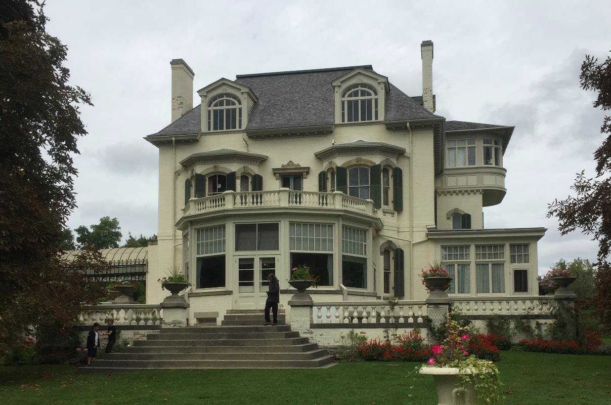
©Jennifer A. Cousineu, Parks Canada Agency / Agence Parcs Canada, 2018 |
Spadina National Historic Site of Canada
Toronto, Ontario
Begun in 1866 for Toronto entrepreneur James Austin and his wife Susan Bright
Austin, this Toronto landmark is a rare example of a country estate and villa
transformed into an opulent Edwardian residence. Between 1897 and 1913, Toronto
architect W.C. Vaux Chadwick, the American firm Carrère and Hastings with
Eustace G. Bird, and painter Gustav Hahn designed extensive changes for the
earlier Victorian country house, whose designer is unknown. Spadina was
inherited by James Austin's son Albert. Together with his wife, Mary, he
commissioned renovations that would impress upon neighbours and visitors alike
the family's prominent social position and their wealth. The mansion's
architecture, interior design and furnishings together with its surrounding
grounds, garden, and outbuildings illustrate the grandeur in which Canada's
wealthy elite lived during a period of rapid urban expansion at the beginning of
the 20th century. This is conveyed on the interior through the innovative
arrangements of public and private rooms for the family and a servants quarters.
On the exterior, it is expressed in the design and arrangement of gardens,
greenhouse, and a garage complete with chauffeur's quarters.
The current Spadina, a large, architecturally eclectic, 55-room mansion, was
preceded on the property by two other, smaller houses built in 1818 and 1836.
Both were destroyed by fire and both were also named Spadina. Considerably
altered in the last round of renovations in the early-20th century, the house
exhibits a predominantly Second Empire aesthetic, with earlier, mid-19th century
architectural elements visible on the exterior and interior. Clad in buff brick
with dark green trim and a grey mansard roof, the distinctive elements of
Spadina include its double-height bay windows, numerous dormers, the balustraded
south terrace, and the elaborate iron and glass porte-cochère on its west side.
The house is roughly symmetrical about its long, north-south central hallway,
but is irregular in the disposition of windows, doorways, and rooms within the
plan. Its lively exterior composition reveals a different elevation design on
each of the four sides of the house.
The interior of Spadina combines luxurious spaces for private family use and
public entertainment with utilitarian spaces once inhabited by staff that ran
the household. Many rooms, with their intact collections of original family
furniture and art objects, form the core of the house museum; other rooms serve
various museological functions including offices, a library, and storage rooms.
The basement currently houses a gift shop, meeting room, storage rooms, and
exhibition space that exposes the first (1818) Spadina foundations. The first
floor contains the historic kitchen, dining room, entry hall, reception room,
drawing room, and a conservatory known as the Palm Room. The second floor has
historic bedrooms, current staff offices, and sitting rooms. The third floor
contains servant spaces — bedrooms, bathroom, and sitting room — as well as
historic family bedrooms and sitting rooms.
Spadina sits on a 5.7-acre (2.31 hectare) plot of land on the brow of Davenport
Hill in the Casa Loma district of Toronto. The northern part of the property,
now separated from the southern part on the west side by a stone pergola dating
to 1909, contains the services buildings — stable (1850), garage/chauffeur's
residence (1909), and greenhouse (1913). An apple orchard also sits north of the
house. To the east is a formally-planned kitchen and flower garden in parterre
formation. South of the house, the terrace opens onto a large manicured lawn
that culminates in a tree screen at the lip of Davenport Hill.
|

©Ontario Ministry of Culture / Ministère de la Culture de l'Ontario |
St. Anne's Anglican Church National Historic Site of Canada
Toronto, Ontario
St. Anne's Anglican Church National Historic Site of Canada is located
in a central residential neighbourhood of Toronto, Ontario. Built in
1907-1908 in the Byzantine Revival style, St. Anne's Anglican Church
contains a remarkable cycle of paintings by ten prominent Canadian
artists. The elaborate interior mural decorations, designed by J.E.H.
MacDonald, cover the walls and ceiling of the apse, the main arches, the
pendentives and the central dome. The cycle combines narrative scenes,
written texts, as well as decorative plasterwork and detailing
accentuating the architectural lines of the building.
In 1923 J.E.H. MacDonald, having accepted a commission to paint and
decorate St. Anne's, brought in nine more artists including two other
members of the Group of Seven, Fred Varley and Frank Carmichael, along
with an architect, William Rae, who co-directed the decoration of the
interior. In keeping with the design of the building, MacDonald drew on
the motifs, colours and artistic conventions of Byzantine artistic
traditions, adapting their character to reflect a contemporary Canadian
setting.
Lawrence Skey, rector from 1902 to 1933, was the project's motivating
force and was directly involved with the original decision to build in a
Byzantine style. This reflected his support for an ecumenical movement
that advocated unification with other Protestant denominations.
Architect W. Ford Howland's design was intended to evoke the early
Byzantine period, before the Christian church had split into its
subsequent numerous denominations. Howland was an associate with Burke
and Horwood, a Toronto architectural firm known for their designs of
Protestant churches. The art and architecture of St. Anne's Anglican
Church illustrates a distinctive period in Anglican Church
history.
|
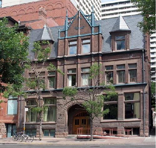
©Parks Canada Agency / Agence Parcs Canada, D. Hamelin, 2005 |
St. George's Hall (Arts and Letters Club) National Historic Site of Canada
Toronto, Ontario
St. George's Hall (Arts and Letters Club) National Historic Site of
Canada is a three-storey brick and stone building with a steep-pitched
roof. Located just west of Yonge St. in downtown Toronto the building,
which has been home to the Arts and Letters Club since 1920, exhibits an
eclectic blend of architectural styles that combine elements of
Romanesque, Flemish and medieval architecture. Its symmetrical front
façade is dominated by a prominent Romanesque Revival entranceway, while
a Great Hall dominates the rear of the building.
The heritage value of St. George's Hall (Arts and Letters Club) lies in
its layout and décor, its function as a gathering place for artists and
patrons of the arts, and its associations with the Arts and Letters
Club. Constructed in 1891 for the St. George's Society, the building was
renovated in 1920, when it became the headquarters for the Arts and
Letters Club. The Club brought together individuals from a variety of
disciplines — painters, writers, musicians, architects and actors, among
others — as well as patrons of the arts. For some eighty-five years, St.
George's Hall has been a gathering place for people working in the arts,
as well as an important venue for artistic activity. The well-preserved
building attests to the significance of the Club in Canada's cultural
history.
|

©Parks Canada Agency / Agence Parcs Canada |
St. Jude's Anglican Church National Historic Site of Canada
Brantford, Ontario
St. Jude's Anglican Church National Historic Site of Canada is a small
church built in 1871 in a modest rendition of the High Victorian Gothic
Revival style, located in the city of Brantford, Ontario at Alexandra
Park, just east of the downtown core. The church is distinguished by its
striking interior, painted in 1936, which features a series of painted
murals and decorative motifs influenced by the Arts-and-Crafts movement
and modelled on the work of the movement's founder, William Morris.
The painted interior of St. Jude's exemplifies Arts-and-Crafts
principles, including the integration of art with architecture to create
a harmonious and humanistic whole, the elevation of handwork over
machine work, and an interest in nature.
The decorative work at St. Jude's, consisting of flat-rendered,
naturalistic foliage intertwined with Gothic detailing, more closely
imitates Morris's work than any other known Canadian ecclesiastical
example. The painting style of the murals, inspired by the late
19th-century work of the Pre-Raphaelites associated with Morris,
reflects the biblical imagery popularized in the printed media during
the early 20th century. In keeping with the Arts-and-Crafts approach,
the murals feature landscape elements, soft painterly effects, and
gentle and romantic lighting. The murals and painted decorations enhance
and are in turn enhanced by the medieval-inspired architectural features
of the church's interior.
Three generations of the Browne family decorated more than 450 church
interiors in Ontario, including that of St. Jude's. Peter Charles
Browne, a decorative painter who trained in Scotland at the height of
the British-based Arts-and-Crafts movement, began the family firm in
1905 after immigrating to Ontario. The amount of work carried out by the
Browne family exceeds that of any other known firm or artist engaged in
similar work in Canada. The decorative program at St. Jude's was likely
executed by Peter Browne's son Thomas, under Peter's guidance.
|

©Parks Canada Agency / Agence Parcs Canada, 1996 |
St. Lawrence Hall National Historic Site of Canada
Toronto, Ontario
St. Lawrence Hall National Historic Site of Canada is an elegant
three-and-a-half storey mid 19th-century public building on the
southwest corner of King and Jarvis Streets in downtown Toronto. Its
classical proportions, fine stonework, ornate roof cresting and domed
cupola are outstanding features in the surrounding urban landscape.
St. Lawrence Hall was built by the City of Toronto in 1850. Designed by
architect William Thomas in the Italianate style, it provided an elegant
meeting place for Toronto's 19th-century elite. The ground floor was
designed as commercial space, the second as offices, and the third to
house a 1000-seat assembly room. The building was a major cultural venue
for lectures, concerts, balls and receptions attended by the city's most
notable citizens. These events included several important Abolition
meetings in the years when Canada was receiving thousands of Underground
Railroad refugees from American slavery. St. Lawrence Hall was restored
in 1967, and has once again become an active cultural centre.
|

©Parks Canada Agency / Agence Parcs Canada, 1993 |
St. Marys Junction Railway Station (Grand Trunk) National Historic Site of Canada
St. Marys Junction, Ontario
St. Marys Junction Railway Station (Grand Trunk) National Historic Site
of Canada is a mid 19th-century single-storey limestone building in the
Italianate design typical of the Grand Trunk Railway's original Ontario
stations. It stands in a field near a small enclave of buildings north
of the town of St. Marys beside the junction where Canadian National
Railways mainlines from Toronto diverge to cross the Canada / United
States border at Windsor or Sarnia.
St. Marys Junction Railway Station (Grand Trunk) National Historic Site
of Canada portrays the Italianate design for a First Class Way Side
Station created by British architect Francis Hopkins for stations of the
early Grand Trunk Railway line. This railway, which ran from Sarnia,
Ontario to Portland, Maine, was the first railway line of significant
length built in Canada. The line was constructed in segments. This
station is located on the western section of the main line between
Toronto and Sarnia begun by Gzowski and Co. in 1856 and completed in
1860. The station itself was constructed in 1858 using limestone from
the St. Marys area. As well as serving as a passenger and freight depot,
the station accommodated the manual switch that routed early trains at
the junction.
The heritage value of St. Marys Junction Railway Station (Grand Trunk)
National Historic Site of Canada resides in its rarity both as an
original small Grand Trunk Railway Station, and as one built of stone on
the western segment of Grand Trunk mainline. It also resides in the
clarity with which this station represents the Grand Trunk Railway's
early operations as seen through the design, scale, composition,
materials, assembly and siting of the station.
|

©Parks Canada Agency / Agence Parcs Canada, J. Butterill, 1994 |
St. Paul's Presbyterian Church / Former St. Andrew's Church National Historic Site of Canada
Hamilton, Ontario
St. Paul's Presbyterian Church / Former St. Andrew's Church National
Historic Site of Canada is an elegant stone church with a soaring stone
spire. Built during the mid-19th century in the Gothic Revival style, it
is located in the heart of downtown Hamilton.
Built in 1854-1857 for the Anglican congregation of St. Andrew's, St.
Paul's Presbyterian Church / Former St. Andrew's Church is an elegant
example of the Gothic Revival style in a small, urban parish church.
Designed by architect William Thomas, it reflects the influence of the
Ecclesiological Gothic Revival movement, which favoured historically
correct plans based on medieval English parish churches. St. Paul's
exemplifies many of the principles of the Ecclesiological Gothic Revival
movement in its scale, composition, and simple, historically accurate
detailing. The chancel was extended by architect Hugh Vallance near the
end of the nineteenth century.
|

©Parks Canada Agency / Agence Parcs Canada, 1991 |
St. Thomas City Hall National Historic Site of Canada
St. Thomas, Ontario
St. Thomas City Hall is an elaborate, two-and-a-half storey, stone
building with a commanding clock tower. It was built at the end of the
19th century in the Richardsonian Romanesque style. The hall is
prominently located on the main street of downtown St. Thomas on a
generous setback.
St. Thomas City Hall is a representative example of the large, strictly
administrative city halls which began to appear across Canada in the
1880s and 1890s. The construction of such a city hall reflected the
tremendous growth of the city in the last quarter of the 19th century, a
direct result of improved railway service. Designed primarily to house
the city's administrative services, this building's monumental scale and
prominent location reflected both the increased size of municipal
government, and the community's civic pride and ambition. The city's
expectation of continued progress was typical of communities whose
prosperity was fuelled by railway facilities.
The exterior form and interior arrangement of St. Thomas City Hall are
typical of large, administrative city halls built in medium-size cities
during the late 19th century. By the end of the century, urban town
halls had evolved from multipurpose buildings, to large-scale,
single-function, purpose-built buildings which accommodated only the
administrative and legislative functions of municipal government. The
construction of large-scale, single-purpose buildings reflected both the
growth of urban areas and the expansion of municipal responsibility for
local services.
The Richardsonian Romanesque style was used extensively for public
buildings in Canada during the late 1880s and 1890s. Designed by local
architect Neil Darrach, the St. Thomas City Hall is a restrained
representative of the style in its massive scale and quality, its
rusticated stonework, prominent clock tower, steep pavilion roofs, and
round-arched openings. The elaborate interior, with its vaulted,
two-storey council chamber, was in keeping with the style of the
exterior.
|
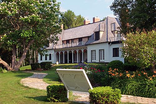
©Parks Canada Agency / Agence Parcs Canada, 2003 |
Stephen Leacock Museum / Old Brewery Bay National Historic Site of Canada
Orillia, Ontario
Stephen Leacock Museum / Old Brewery Bay National Historic Site of
Canada is located on the shores of Lake Couchiching within the city of
Orillia, in Ontario. Set on almost four hectares of land, the property
is oriented towards the water and is set in a flower-bordered lawn which
gives way to the shoreline along Brewery and Barnfield bays and to a
naturally wooded point of land, known as Leacock Point. The two-storey
house, once a summer home for humorist Stephen Leacock, features
whitewashes walls, and a pillared verandah from which the lake may be
viewed. The site includes reconstructed arbours, a boathouse, and a
visitor's centre.
The heritage value of the site resides in its associations with Stephen
Leacock as illustrated by those elements of the house and property that
reflect his occupancy during the first half of the 20th century. Leacock
(1869-1944) was a major literary figure, humorist, academic, lecturer,
radio personality and best-selling Canadian author. Between 1915 and
1925 he was the best-known humorist in the English-speaking world, and
his works inspired a generation of Canadian and American authors.
Leacock was the author of more than 60 books, including his masterpiece,
'Sunshine Sketches of a Little Town'. After his retirement in 1936,
Leacock spent most of each year at Old Brewery Bay, until his death in
1944.
Christened 'Old Brewery Bay' by Leacock after a former 19th-century
brewery nearby, the property served for 28 years as a summer retreat for
the Montréal resident, his family and his friends. It was at this
property that Leacock indulged in his passions for leisure activities,
creative design and building, and hosting family and friends. Over the
years, the property was the site of many structures and landscape
features built, designed or supervised by Leacock. The only extant
building, a large house, was built in 1928 to designs by the Toronto
architectural firm of Wright and Noxon. Leacock heavily influenced the
layout of the house to accommodate his houseguests, as well as his
writing schedule, and insisted that materials from the previous cottage
be reused. His personality is reflected in the present residence.
|
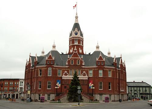
©Stratford City Hall, Perry Quan, 2011 |
Stratford City Hall National Historic Site of Canada
Stratford, Ontario
Stratford City Hall National Historic Site of Canada is prominently
located on a triangular-shaped civic 'square' that forms the centre of
the business district in Stratford, Ontario. Built at the end of the
19th century, it is a monumental town hall constructed of red brick with
a prominent clock tower. Its Picturesque design incorporates an eclectic
blend of late-Victorian features.
Stratford City Hall reflects the development of town halls during the
late-19th century, as the administrative functions of municipal
government increased and cities sought to express their civic pride and
ambition in impressive, large-scale buildings. Its Picturesque design,
incorporating details from a variety of styles, reflects the
architectural eclecticism of the late 1890s. Designed by Toronto
architect George W. King, with the assistance of local architect J.W.
Siddall, the building was intended to exploit its irregular site,
presenting interesting façades from all angles. Its monumental scale,
prominent tower and use of red brick distinguish it as a civic
building.
|

©Parks Canada Agency / Agence Parcs Canada |
The Grange National Historic Site of Canada
Toronto, Ontario
Now part of the Art Gallery of Ontario in the heart of Toronto, this
house was once the centrepiece of a fine estate in the suburbs of the
town of York. Sited at the end of a long park, the house, with its
original pedimented five-bay facade and brick construction, reflects the
conservative British classicism that typified other estates of its time
in eastern Canada.
The Grange was built about 1817 for D'Arcy Boulton Jr. in an area of the
town of York populated by residential estates belonging to prominent
citizens. Its symmetrical five-bay facade and central pediment reflect
the conservative influence of the British classical tradition of the
18th century. The west wing represents two later additions, one in the
1840s, and further changes in 1885 carried out by its new owner Dr.
Goldwin Smith. In 1911, the house became the property of the Art Gallery
of Ontario and has operated as a museum since that time.
|
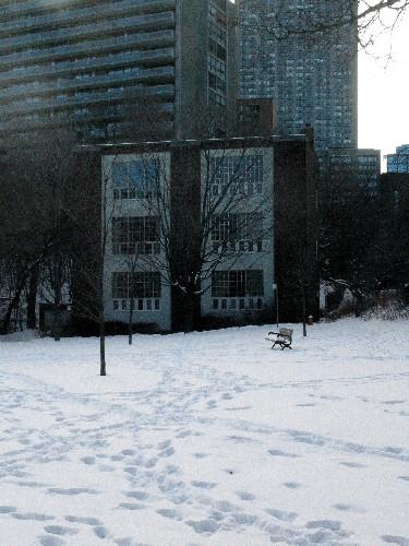
©Parks Canada Agency / Agence Parcs Canada, Andrew Waldron, 2004 |
The Studio National Historic Site of Canada
Toronto, Ontario
The Studio Building is a modernist three-storey brick building with an
industrial look which was constructed in 1914 as artists' studios.
Located at 25 Severn Street in downtown Toronto at the edge of the
Rosedale ravine, its studio spaces have been used by many Canadian
artists, among them members of the Group of Seven.
The Studio Building was designed by architect Eden Smith, FRAIC, in 1913
and built by R. Robertson and Sons in 1914 as an artists' studio for
painter Lawren Harris and Canadian art patron Dr. James MacCallum who
made it available to artists needing space to work and live. It contains
six purpose-built studio spaces that have provided excellent working
accommodations for Canadian artists for almost a century. At one time,
Tom Thomson, Arthur Lismer and Thoreau MacDonald lived and worked in a
shack in the yard (now demolished).
The heritage value of The Studio Building National Historic Site of
Canada resides in its associations with important Canadian artists
including the Group of Seven, and its physical illustration of an early
Canadian purpose-built artists' studio in the modernist idiom.
|

©Parks Canada Agency / Agence Parcs Canada, 1991 |
Thistle Ha' Farm National Historic Site of Canada
Claremont, Ontario
Thistle Ha' Farm National Historic Site of Canada is a working farm
comprised of 80 hectares of farmland with a farmstead including a stone
house, a large wooden barn and various outbuildings. It is located
within the municipality of Pickering, north of Lake Ontario and slightly
northeast of Toronto.
Thistle Ha' Farm was designated a national historic site of Canada
because of is historic associations with John Miller; a pioneer,
importer and breeder of pedigree livestock in Canada. Miller's example
played an important role in improving stock breeding throughout North
and South America in the 19th century.
The heritage value of this site resides in its identity as a farm
originating in the 19th century, illustrated by its agricultural fields,
and major buildings, including the stone house and large wooden barn.
Thistle Ha' Farm was established when Scottish immigrant John Miller
acquired it in 1848. In 1852, he began importing quality livestock,
notably Durham cattle, Shropshire sheep and Clydesdale horses from the
United Kingdom. His family have continued the farm as a breeding and
farming operation since that time.
|

©Parks Canada Agency / Agence Parcs Canada |
Thousand Islands National Park of Canada
Headquarters: Mallorytown, Ontario
Established in 1904 as St. Lawrence Islands National Park, the first Canadian
national park east of the Rockies.
The rocky islands, windswept pines, and cool waters of Thousand Islands
National Park have the flavour of the northern wilderness just a few
hours from Toronto, Montreal, and Ottawa.
In this traditional summer home of Haudenosaunee and Mississauga
Anishinaabe, nature and culture intermingle. Majestic castles and
historic summer homes stand in contrast to rugged islands of granite and
pine that are home to lumbering turtles, soaring eagles, and countless
other species.
|

©Parks Canada Agency / Agence Parcs Canada 1988 |
Thunder Bay Tourist Pagoda National Historic Site of Canada
Thunder Bay, Ontario
Thunder Bay Tourist Pagoda National Historic Site of Canada is an early
tourism bureau built in a novelty design inspired by a mixture of
classical and Asian architecture. An octagonal brick structure
surrounded by a verandah, it has a pagoda-shaped roof with cupola and a
columned entranceway surmounted by a carved beaver. It is located at the
foot of Red River Road and Water Streets, near the waterfront and
historic railway, in the downtown Port Arthur section of Thunder Bay.
The Thunder Bay Tourist Pagoda was designed by local architect H.
Russell Halton, and built by the Port Arthur Industrial Commission in
1909. It was an early tourism bureau designed to attract the attention
of train and ship passengers traveling through Port Arthur, in order to
promote the town's advantages as an industrial and tourism centre at a
time when it's rival, nearby Fort William, was becoming an increasingly
important transportation hub. The pagoda continued to be used as a
tourism bureau until declining rail traffic made its future uncertain.
By 1986 it had closed and its future remained in doubt until it
eventually was restored as a heritage facility.
|
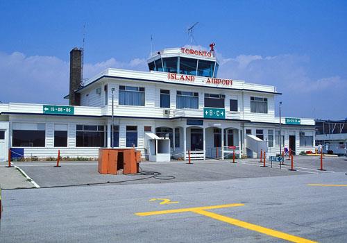
©Parks Canada Agency / Agence Parcs Canada |
Toronto Island Airport Terminal Building National Historic Site of Canada
Toronto, Ontario
The Toronto Island Airport Terminal Building National Historic Site of
Canada, built in 1938-9, is a two-storey, wooden aviation terminal with
a central control tower. It is located at the western end of the Toronto
Islands, across a narrow channel of water from downtown Toronto. The
building is part of an operating airport and is surrounded by runways,
hangars and other support buildings.
Designed and built by the Toronto Harbour Commission in 1938-9, the
Toronto Island Airport Terminal Building was part of the first group of
aviation terminals to be funded and approved by the newly formed
Department of Transport as part of the development of the federally
funded Trans-Canada Airway. It is one of very few early terminal
buildings to have survived and is likely the oldest, extant, operating
terminal of its kind in Canada.
The Toronto Island Airport Terminal Building is typical of early airport
facilities in its linear design, massing, orientation and the
combination of multiple functions within one structure. Its low,
rectangular massing, its fenestration and its minimal detailing reveal
the influence of the Modern movement. The Terminal Building provided
facilities for passenger and baggage handling (including airmail service
and customs and immigration processing), as well as for air traffic
control and airport administration. Its design and orientation provide
unimpeded views of the landing field for both passengers and airport
control staff. Its axial plan facilitates the movement of passengers and
baggage through the terminal and between air transportation and the
ferry slip.
|

©Parks Canada Agency / Agence Parcs Canada, 2005 |
Toronto Power Generating Station National Historic Site of Canada
Toronto, Ontario
The Toronto Power Generating Station National Historic Site of Canada is
located on the banks of the Niagara River just above Niagara Falls. The
Power House is a rectangular building measuring 132 metres by 30 metres
with an imposing classical façade. Its symmetrical plan consists of a
central block with a heavy Ionic portico flanked by two long Ionic
colonnades. The Power House contains the generators and stands above the
other principal engineering components of the installation that include
a submerged dam, penstocks, and the wheel pit housing the turbines, and
the tailrace tunnel.
The Toronto Power Generating Station, associated with development of
hydro-electric power in Canada, was a significant large-scale
engineering achievement in its time and was important in the development
of business, industry and technology in Ontario and Canada. The
Generating Station and Power House was built for the Electrical
Development Company of Ontario to supply hydro-electric power to
Toronto. The installation was begun in 1903 with the Power House
designed in the formal Beaux-Arts style by architect E.J. Lennox to
complement the majestic setting. The Toronto Power Generating Station
was opened in 1906, and was purchased by Ontario Hydro in 1922. It
operated until 1974.
|
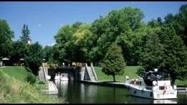
©Parks Canada Agency / Agence Parcs Canada, 2000
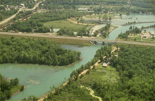
©Parks Canada Agency / Agence Parcs Canada, 1993 |
Trent-Severn Waterway National Historic Site of Canada
Trenton / Port Severn, Ontario
Operational canal; 386 km route, forty-four locks.
The Trent - Severn Waterway National Historic Site of Canada is a
natural and man-made waterway that meanders nearly 400 km across central
Ontario linking Georgian Bay to the Bay of Quinte. Of particular note,
are the hydraulic Lift Lock in Peterborough, Ontario, and the original
engineering structures in the Lake Simcoe-Balsam Lake section of the
waterway.
Trent-Severn Waterway was named a national historic site because it is
part of Canada's national canal system.
The heritage value of the Trent-Severn Waterway lies in its legibility
and completeness as a transportation route integrated and developed by
the Government of Canada early in the 20th century (1882-1920). This is
embodied in the many engineering structures, buildings, locks, dams and
bridges linked to the waterway, and in those cultural landscapes related
to the themes of water power, recreation, natural features and varied
uses associated with it.
Specific resources along the canal are of sufficient importance to be
designated separately, notably the Peterborough Lift Lock National
Historic Site of Canada, acknowledged because it was, and remains, an
engineering achievement of international renown because it was the
highest hydraulic lift lock ever built and was once reputed to be the
largest concrete structure in the world. The Lift Lock was designed by
engineers R.B. Rogers & Baird and built in 1904 by Corry and Laverdure
Construction (site preparation and concrete work), and Dominion Bridge
of Montreal (metal work).
The Lake Simcoe-Balsam Lake section of the Waterway is valued for the
high number of surviving unmodified structures dating from the
construction period 1900-1907 and because most lockstations in this
section retain their integrity from the early 20th-century
period.
|
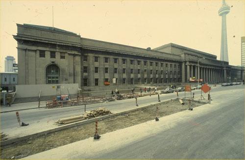
©Parks Canada Agency / Agence Parcs Canada, 1989 |
Union Station (Canadian Pacific and Grand Trunk) National Historic Site of Canada
Toronto, Ontario
Union Station is an early 20th-century, Beaux-Arts-style, stone railway
terminal. It is prominently located on the south side of Front Street in
downtown Toronto, taking up the entire block between Bay and York
Streets.
The successful use of monumental design, classical detailing and formal
setting makes Toronto's Union Station one of the most outstanding
examples of Beaux-Arts railway architecture in Canada. Built as a joint
venture between the Grand Trunk Railway and the Canadian Pacific
Railway, the station was designed by a prominent architectural team that
included Montreal architects Ross and Macdonald, CPR architect Hugh
Jones, and well-known Toronto architect John Lyle. Beaux-Arts principles
are evident in the monumentality of its massing; the legibility and
axiality of its plan, clearly and rationally expressed on the building's
exterior; the processional experience created by the transition through
grand interior spaces; the use of classical forms for both structural
and decorative elements on the exterior and interior of the building;
the use of durable, high-quality materials; and its formal, axial
setting.
The station illustrates the early-20th-century era of vigorous, planned,
urban growth, during which railways were expanding and the city of
Toronto was becoming a modern metropolis. It is the largest of the great
urban railway stations built in Canada during the early 20th century,
and belongs to a precinct of monumental structures that illustrates
Toronto's experiment with the "City Beautiful" movement. The station
retains many of the original functional features of an
early-20th-century railway terminal.
|

©Parks Canada Agency / Agence Parcs Canada |
University College National Historic Site of Canada
Toronto, Ontario
University College National Historic Site of Canada is a large,
mid-19th-century college building situated on the St. George campus of
the University of Toronto. Its prominent location at the top of the
central campus green illustrates its important role in the history and
life of the institution. An impressive Romanesque-revival styled pile,
it is a large structure with a towered south-facing façade, two wings
extending north and a medieval-inspired round building originally
intended as a chemistry theatre. Together the components enclose a
traditional campus quadrangle.
The University College National Historic Site of Canada, built between
1856 and 1859, is associated with both the development of the University
of Toronto, and with a national system of non-denominational
institutions of higher learning supported by government. The building
originally was designed by architect F.W. Cumberland, demonstrating his
skill in freely adapting the Romanesque-revival style to the purposes of
a North American educational institution. In 1890 a fire occurred,
largely destroying the eastern end of the building. The exterior walls
remained standing and reconstruction under architect David Dick was
completed in the style of the original building.
|

©Parks Canada Agency / Agence Parcs Canada, 1996 |
Victoria Hall National Historic Site of Canada
Hamilton, Ontario
Victoria Hall is a three-and-a-half-storey, commercial building built in
the late 19th century. It is prominently located in a row of commercial
buildings opposite Gore Park in the central commercial district of the
city of Hamilton.
Victoria Hall was designated a national historic site because it is of
national historic and architectural significance. It is a superior and
rare example of a commercial building with a decorative, architectonic,
sheet-metal façade, which is completely hand- rather than machine-made.
Its well-designed and well-crafted, three-storey, metal façade comprised
of high-relief architectural elements is largely intact. The building is
an irreplaceable element in King Street's continuum of commercial
architecture dating from the pre-confederation era to the present.
The conventional, late-19th-century commercial building is covered with
a hand-made, galvanized-sheet-metal façade on the front of its upper
three storeys. Designed by Hamilton architect William Stewart and
erected for Alexander Bruce, a prominent Hamilton lawyer, the façade
projects an image of prosperity by simulating the appearance of
exuberant stone masonry. It is a very rare Canadian example of an
in-situ, hand-made, sheet-metal façade and is one of the earliest and
most architecturally accomplished of the surviving sheet metal façades
in Canada. The façade is essentially intact.
Victoria Hall forms part of a continuous row of commercial buildings
overlooking Gore Park, an area that has traditionally functioned as the
city's commercial heart and the focal point of public events. Victoria
Hall is among the last of the robust High-Victorian commercial buildings
in the Gore area.
|

©Parks Canada Agency / Agence Parcs Canada, 1990 |
Victoria Hall / Cobourg Town Hall National Historic Site of Canada
Cobourg, Ontario
Victoria Hall / Cobourg Town Hall is a large, three-storey, stone public
building, constructed in the mid-19th century. It Neoclassical style
presents as well a variety of eclectic details. The building is topped
by a prominent clocktower. The plenty ornate building houses
well-preserved court rooms, meeting space, offices, and a concert hall.
Victoria Hall / Cobourg Town Hall is prominently sited on King St. in
front of the former fire hall and market square.
Victoria Hall / Cobourg Town Hall was designated a national historic
site in 1959 because it is a good example of a public edifice of
mid-19th-century Canada.
Victoria Hall / Cobourg Town Hall is one of a group of municipal
buildings built in Ontario after the passage of the Municipal Act in
1849, which altered and augmented the responsibilities of municipal
government. It is typical of these mid-19th-century municipal buildings
in its immense scale, elaborate detailing and the inclusion of multiple
functions under one roof. Victoria Hall / Cobourg Town Hall, however, is
one of the more extravagant examples in terms of scale and detailing.
Designed by Toronto architect Kivas Tully, its monumental scale and
Victorian Neoclassical design reflect the prosperity and tremendous
optimism of Cobourg during the 1850s. Victoria Hall / Cobourg Town Hall
retains much of its original layout, which included space for the county
courts, two levels of government (town and county), a concert hall, a
Masonic Hall, private offices, and commercial rental space.
|
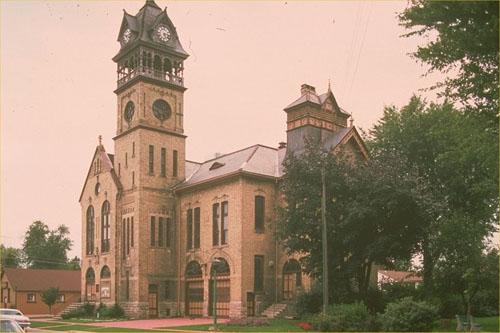
©Parks Canada Agency / Agence Parcs Canada, 1991 |
Victoria Hall / Petrolia Town Hall National Historic Site of Canada
Petrolia, Ontario
Victoria Hall / Petrolia Town Hall National Historic Site of Canada is a
fanciful, mid-sized town hall building with a prominent clock tower.
Built of buff brick in the late 19th century, its design follows the
tradition of late-Victorian eclecticism. Victoria Hall / Petrolia Town
Hall is located in Petrolia's historic downtown amongst other brick
buildings constructed in the late 19th century.
Victoria Hall / Petrolia Town Hall was designated a national historic
site of Canada in 1975 because, built in 1889 in the midst of an oil
boom, this opulent town hall reflects this stage in the town's growth.
Built in the late 1880s at the height of Petrolia's oil boom, Victoria
Hall reflects a time when Petrolia was among the wealthiest towns in
Canada. Oil was first discovered in the 1860s and the village became a
town in 1874. By the 1880s, permanent brick buildings had replaced the
small wooden structures of the early boom years. The construction of the
town hall was the highlight of this phase of permanent construction.
Victoria Hall / Petrolia Town Hall was built to house multiple civic
functions, including a jail in the basement; municipal offices, council
chamber, court room, fire department and armoury on the first floor, and
a 1000-seat opera house on the upper floor. The town's insistence that
an opera house be incorporated in the new town hall reflects Petrolia's
late-19th century affluence. The oil boom had created a class of wealthy
businessmen who demanded entertainment appropriate to their economic
status.
Designed by London, Ontario architect George Durand, Victoria Hall's
asymmetrical massing, varied roofline and lively detailing illustrates
the high Victorian taste for exuberant eclecticism. The building's
design also reflects the influence of American forms of the Queen Anne
Revival style. While a 1989 fire gutted the interior and destroyed much
of the original exterior wood trim and glazing, the original form and
masonry detailing of the building survive. In 1992, the building was
rehabilitated to accommodate a theatre for the performing arts.
|
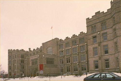
©Parks Canada Agency / Agence Parcs Canada, 1987 |
Victoria Memorial Museum National Historic Site of Canada
Ottawa, Ontario
Victoria Memorial Museum is a large Tudor Gothic-style Tyndall-stone
building located near downtown Ottawa. It sits alone, prominently sited
on a city block surrounded by green space and parking areas. The
building and its property terminate the south end of Metcalfe Street,
which runs north to south from Parliament Hill to the Museum.
Victoria Memorial Museum was designated a national historic site of
Canada in 1990, because of its prominent and early place in the
development of museology in Canada and because of its architecture.
The construction of the Victoria Memorial Museum in 1905-11 coincided
with the pre-World War I boom in the building of encyclopaedic museums
in most major cities in Europe and North America. As the first
purpose-built federal museum in Canada, its construction was the
culmination of decades of effort by Geological and Natural History
Survey of Canada staff and by Canadian scientists to house Canada's
natural history and human history collections in a suitable building.
When completed in 1911, the structure housed the National Gallery, the
Geological and Natural History of Canada Survey collections, and some of
the Survey's offices. From its earliest days, the museum was a leader in
new exhibit techniques, and it was the home-base for notable Canadian
museologists and anthropologists including Charles Sternberg, Diamond
Jenness, and Edward Sapir. The success of the building, its expanding
collections and the work of its scientists led to the creation in 1927
of the National Museum of Canada as a body apart from the Geological
Survey of Canada. The museum continued to occupy the building until
1950. The Canadian Museum of Man and Nature became the sole occupant in
1959. In 1988 the institution was divided into the Canadian Museum of
Civilization and the Canadian Museum of Nature, with the latter
institution remaining in the Victoria Memorial Museum.
Authorized in 1901, the Victoria Memorial Museum was the most ambitious
of five buildings designed for the capital in the Tudor Gothic style by
David Ewart, Chief Architect of the Department of Public Works. The
architectural quality, scale and location of the five buildings did much
to solidify the image of Ottawa as a capital city. The Victoria Memorial
Museum was built by local contractor George Goodwin to plans by Ewart.
The museum was built for the Geological Survey of Canada on a discrete,
landscaped parcel of land at the south end of Metcalfe Street. Its
location, visibility from Parliament Hill, grand scale, public function
and park-like setting were particularly appropriate responses to
Laurier's vision for the capital. The design of the building and its
orientation on the site were based on Beaux-Arts principles. The
detailing of the building, inside and out, was drawn from a Tudor-Gothic
vocabulary. Its towered entrance, in the centre of its highly
symmetrical main elevation, was a focal point of its design. Due to
unstable soil conditions, however, the tower was substantially reduced
in height five years after the building opened. In 2004-2005, the museum
underwent a large-scale rehabilitation which added a new glass tower to
its façade and undertook major interior modifications.
The Victoria Memorial Museum building also served as the home of the
Parliament of Canada from 1916 to 1920 after fire destroyed the Centre
Block of the Parliament Buildings.
|
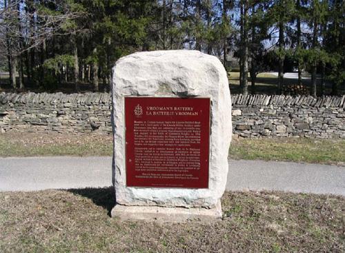
©Parks Canada Agency / Agence Parcs Canada |
Vrooman's Battery National Historic Site of Canada
Niagara-on-the-Lake, Ontario
Vrooman's Battery National Historic Site of Canada is located north of
the village of Queenston, Ontario on the western bank of the Niagara
River. Set on Vrooman's Point, now on private property, the site
overlooks the Niagara River from a strategic position. Vrooman's Battery
was an important site during the Battle of Queenston Heights in the War
of 1812, and now consists of a slight mound on the edge of the bank of
the river.
On 13 October 1812, American forces crossed the Niagara River at
Queenston and occupied the heights above the village. A subsequent
counter-attack, during which the commander of the British forces,
Major-General Sir Isaac Brock, was killed, failed to dislodge the
Americans. Soon after, British reinforcements climbed the escarpment to
the west, drove the Americans from their position, and defeated them.
The battery located on Soloman Vrooman's land on the Niagara River,
consisted of a 24-pounder gun battery mounted within a crescent-shaped
earthwork. Manned by Captain Samuel Hatt's 5th Lincoln (Militia)
Regiment and a small party of the Lincoln Militia Artillery under
Lieutenant John Ball during the battle, the battery maintained a
harassing fire on the American forces crossing the river.
|
|
War of 1812 Shipwrecks National Historic Site of Canada
Kingston, Ontario
HMS Prince Regent, Princess Charlotte and St. Lawrence
were the most powerful British warships built in Upper Canada during the
War of 1812. HMS St. Lawrence was the largest and most
heavily-armed warship ever to sail on fresh water. Their presence on the
waters of Lake Ontario gave the British control of the lake without
having to fire a shot in anger.
Shipbuilding started as soon as the British Royal Navy took over the
Kingston naval base in the winter of 1812-1813. Commodore James Lucas
Yeo took command in May 1813. The Navy mobilized supplies, skills and
labour from both British North America and Britain to build ships whose
design was suited to the conditions of the lake, the limits of the
material available and the need for quick construction. Between 1813 and
1817, at least ten ships were built in the Kingston dockyards, including
HMS Prince Regent, HMS Princess Charlotte and HMS St.
Lawrence, all launched in 1814.
Commodore Yeo's strategy depended on maintaining naval superiority in
numbers of ships and firepower. Master shipbuilders were recruited from
Quebec and hundreds of carpenters and labourers at Kingston worked
feverishly to counter the production by their counterparts across the
lake at Sackets Harbor. Oak and elm beams were purchased from the local
area, while cannon and other equipment were brought across the Atlantic
Ocean and then carried by packet boat and portage up the St. Lawrence
River. All three British ships were built with narrower V-shaped hulls
to increase their speed in the water, and their fire power was maximized
by fitting them with as many cannon as possible. HMS Princess
Charlotte and Prince Regent were launched in April 1814 with
40 and 58 guns respectively. In September that year, HMS St.
Lawrence was completed and launched. The largest warship on the
lake, armed with 102 guns, it tipped the advantage back to the
British.
Once the war was over, most vessels of the Lake Ontario squadron were no
longer needed following the terms of disarmament in the 1817 Rush-Bagot
Agreement, and these three vessels eventually sank. The wrecks of HMS
Prince Regent, Princess Charlotte and St. Lawrence and the
collection of objects from them attest to the presence of the British
fleet based in Kingston and continue to inform our understanding of this
arms race between the Americans and the British and its role in
determining the outcome of the war.
|
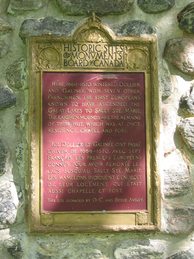
©Parks Canada Agency / Agence Parcs Canada, Jim Molnar, 2005 |
Wintering Site National Historic Site of Canada
Port Dover, Ontario
Here, 1669-1670, wintered Dollier and Galinée with seven other
frenchmen, the first Europeans known to have ascended the Great Lakes to
Sault Ste. Marie. The earthen mounds are the remains of their hut which
was at once residence, chapel and fort.
|
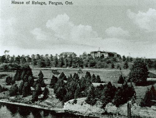
©Wellington County Archives/Archives de Wellington County, ca. 1910 |
Wellington County House of Industry and Refuge National Historic Site of Canada
Fergus, Ontario
Wellington County House of Industry and Refuge National Historic Site of
Canada is a former working farm dominated by a larger, two-storey
Italianate-style stone building standing high on a hill. It is located
beside the Grand River in the former hamlet of Aboyne between Elora and
Fergus in southwestern Ontario. For almost a century, this was the
county poorhouse: today it is the county museum and archives.
The heritage value of the Wellington County House of Industry and Refuge
resides in its representation of the state supported poorhouse as
illustrated by the cultural landscape of a working farm dominated by a
large residential building.
The Wellington County House of Industry and Refuge was built in
1876-1877 as the shelter of last resort for the homeless and destitute
in Wellington County. Its original inhabitants traded their domestic or
agricultural labour for spartan living accommodations. In later years it
became a home for the elderly and infirm. Designed by Guelph architect
Victor Stewart, the building was modified over the years, acquiring an
entry porch in 1907, and rear additions in 1892-93 and 1954-55.
Throughout its history, the Wellington County House of Industry and
Refuge operated as a working farm. Its grounds contain a barn, built by
Elora architect John Taylor in 1877, with a silo attached in 1914, an
1888 driveshed and shed, 1927 front gates, a 1947 boilerhouse, fields
and pastures, and a cemetery (1888-1946). The institution closed in 1971
and the main building was rehabilitated as the Wellington county
Archives and Museum in 1987-88. Part of the farm survives in
agricultural production.
|

©Parks Canada Agency / Agence Parcs Canada, G. Vandervlugt, H.06.644.09.01(10), 2001 |
Whitefish Island National Historic Site of Canada
Sault Ste. Marie, Ontario
Whitefish Island National Historic Site of Canada is located on the
Canadian side of St. Mary's River in Sault Ste. Marie, Ontario. Formed
more than 2000 years ago, Whitefish Island was an Aboriginal settlement,
trading post and fishing base. The island is a low-lying, tear-shaped
boulder field 1 kilometre long, and up to 500 metres wide that has
accumulated up to 50 centimetres of soil, primarily from centuries of
human occupation. The high organic content of the soil supports dense
brush that covers most of the landscape. The island is positioned on the
southern edge of the Sault Ste. Marie Canal National Historic Site of
Canada and is undeveloped and intact both as an archaeological site and
as a geographic feature.
Whitefish Island has been the site of native encampments since it was
formed over 2000 years ago by geological processes. From the time that
pottery was first used by native peoples around 300 B.C., eight
successive cultures have occupied the site, culminating in the
development of the Ojibwa nation in the Sault Ste. Marie area. The
island's unique location between Lakes Huron and Superior, and the rich
fisheries of the turbulent St. Mary's rapids, made it a focal point of
prehistoric and historic trade and settlement until early in the 20th
century. The island represents not only the evolution of Ojibwa culture
centred on the fishery, but also the influences of other Great Lake
cultures through trade and visits. Even though it was surrounded by
industrial and urban development, Whitefish Island remained
undisturbed.
|

©Jayne Elliott, 2002 |
Wilberforce Red Cross Outpost National Historic Site of Canada
Wilberforce, Ontario
Situated near the northeastern boundary of the village of Wilberforce,
Ontario, Wilberforce Red Cross Outpost National Historic Site of Canada
is a simple, rectangular, frame house with a truncated hipped roof, and
an open porch protecting the main entrance. The white-painted Red Cross
outpost stands on a quarter acre of land set back from the road and is
flanked by two private residences. The rear of the property backs onto
Dark Lake.
The heritage value of this site, as illustrated by the building on its
site, resides in its identity as the first outpost of the Ontario
Division of the Canadian Red Cross that served the village and
surrounding areas as a health centre and emergency hospital from 1922 to
1957. With limited funding at its disposal, the Red Cross rented an
existing house that could accommodate a nurse as well as room for
emergency cases and health education sessions. Over the years, the
building and its lot have been slightly altered. It now serves as a
museum of outpost nursing.
Here and elsewhere, dedicated women provided health education and badly
needed nursing care with minimal medical backup, facilities and
equipment, often travelling and working in difficult conditions. The Red
Cross outpost program served as a model for health programs outside
Canada, and aided the development of a government-supported health care
system at home.
|
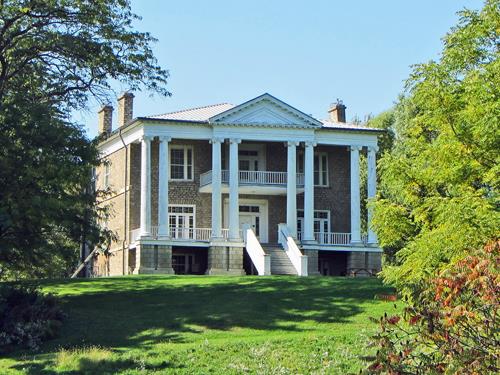
©Willowbank, Sean Marshall, October 2011 |
Willowbank National Historic Site of Canada
Niagara-on-the-Lake, Ontario
The Willowbank National Historic Site of Canada is a gracious treed
estate with a large three-and-a-half-storey temple-fronted mansion built
in the early 19th century. Sited on a height of land overlooking the
Niagara River and the Canada-United States border, the mansion is the
centrepiece of a wooded, five-hectare property at the north end of the
village of Queenston, within the municipality of Niagara-on-the-Lake.
Willowbank estate reflects the Romantic ideals associated with colonial
settlement in Upper Canada during the early 19th century. Elite members
of Upper Canadian society built large country estates in what was
regarded as wilderness, inspired in part by the Romantic sensibilities
of Classical Revivalism. Willowbank typifies the Romantic approach, in
which temple-like mansions were built on prominent sites within a
naturalistic, picturesque landscape. Willowbank is one of only a few
surviving examples of such mansions, once much more common in the Upper
Canadian landscape.
The house interior was renovated in 1912, again in the 1930s, and then
since the 1980s when it was acquired for the purpose of housing a school
of architectural restoration.
|

©Parks Canada Agency / Agence Parcs Canada |
Wintering Site National Historic Site of Canada
Port Dover, Ontario
Here, 1669-1670, wintered Dollier and Galinée with seven other
frenchmen, the first Europeans known to have ascended the Great Lakes to
Sault Ste. Marie. The earthen mounds are the remains of their hut which
was at once residence, chapel and fort.
|
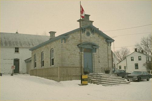
©Parks Canada Agency / Agence Parcs Canada, 1991 |
Wolfe Island Township Hall National Historic Site of Canada
Wolfe Island, Ontario
Wolfe Island Township Hall National Historic Site of Canada is an
elegant small stone building located on Wolfe Island, near Kingston,
Ontario. It is a simple structure built in the mid 19th century as a
meeting place for the community and the local municipal council.
Wolfe Island Township Hall National Historic Site of Canada is a
sophisticated public hall designed by Kingston architect Edward Horsey.
It was built in 1859 to provide a meeting place for the local council
after the 1849 Municipal Act enabled self-government in rural Ontario.
Its single large room also provided a convenient local assembly and
meeting hall. Since then, the interior has been sub-divided as a
municipal office and council chamber.
|

©Parks Canada Agency / Agence Parcs Canada |
Wolseley Barracks National Historic Site of Canada
London, Ontario
Wolseley Barracks National Historic Site of Canada is part of the
Canadian Forces Base located within the city of London, Ontario. Also
known as Wolseley Hall or 'A' Block, this large, U-shaped structure is
arranged around an interior courtyard. The buff-coloured brick building
is finished in a classical style with simplified Italianate detailing.
Features include a central tower with large arched main entryway for
troop access and regularly placed windows.
The first purpose-built infantry training school erected by the Dominion
Government, Wolseley Barracks was built in 1886-1888 to house Company
"D" of the Infantry School Corps of the Royal Canadian Regiment. The
establishment of a permanent Canadian military force began in 1871
following the withdrawal of regular British troops from Canada in 1871.
The standing Canadian forces of the time consisted of two small
artillery batteries and the volunteer militia, a poorly trained and
inadequately equipped force. In 1882, the government established
permanent military training schools in order to properly train and
educate officers. Infantry School Corps were located in Fredericton,
Saint-Jean and Toronto, where the three companies ("A", "B" and "C")
were housed in the old British barracks. In 1885, when a fourth school
was established in London, new barracks were required to house the 100
men who would make up "D" Company. This school, along with its fellow
infantry schools, artillery schools in Québec, Kingston and Victoria, a
cavalry school in Québec and a mounted infantry school in Winnipeg,
formed the foundation of Canada's permanent force.
True to its purpose as a facility for the training and housing of
officers, Wolseley Barracks contained a number of domestic spaces,
including a lecture hall and a reading room, as well as a parade ground
for drilling and manoeuvres. The eclectic design integrates elements of
both contemporary trends in architecture and traditional military
design.
|

©Women's College Hospital Archives / Archives du Women's College Hospital |
Women's College Hospital National Historic Site of Canada
Toronto, Ontario
Women's College Hospital National Historic Site of Canada faces
Grenville St. where a ten-storey buff brick Art Deco-style skyscraper
has, since 1935, established its presence in the centre of Toronto. The
hospital is a complex of buildings with a common purpose located
adjacent to one another on Grenville, Grafton and Bay Streets.
Thanks to the ground-breaking campaigning of Canada's first female
medical doctor, Dr. Emily Howard Jennings Stowe, a Women's Medical
College was opened in 1883 on Sumach Street in Toronto. In 1895, this
college amalgamated with its sister institution in Kingston (created by
Dr. Jennie Trout) to become the Ontario Medical College for Women,
continuing to offer medical instruction to women until 1898, when the
University of Toronto began to admit female medical students.
The college then became a free women's clinic, the Women's College
Hospital and Dispensary, with a growing clientele and a constant need
for larger premises, moving several times until 1935, when it raised
enough money to build the ten-storey core of the present Women's College
Hospital (WCH) complex. Affiliated with the University of Toronto in the
1950s, the WCH formally became a "university teaching hospital" in 1961,
at which time the by-laws were amended to allow the hiring of male as
well as female doctors as permanent staff. By this time a new School of
Nursing (east wing) and the Burton Hall Residence had been built (1956)
and in 1967 a new ten-storey east wing was added.
The heritage value of Women's College Hospital National Historic Site of
Canada resides in its association with the struggle and contribution of
Canadian women within the medical profession. This value is reflected in
the site's prominent location and landmark 1935 high-rise building, the
complex's phased construction and large scale, and its accommodation of
a wide range of research, teaching and treatment activities.
|

©Parks Canada Agency / Agence Parcs Canada, 2003 |
Woodside National Historic Site of Canada
Kitchener, Ontario
Boyhood home of William Lyon Mackenzie King, Prime Minister of Canada
(1921-26, 1926-30, 1936-48).
Woodside National Historic Site of Canada is a picturesque, wooded
estate, set in the midst of a modern suburb in the north-east part of
the city of Kitchener. It includes a one-and-a-half-storey house,
reconstructed in 1942 as a mid-19th-century house and furnished in the
style of the 1890s. The property also includes pathways and natural
landscape features. These serve to recreate the sense of place
experienced by William Lyon Mackenzie King when he lived here as an
adolescent with his family.
William Lyon Mackenzie King was Prime Minister of Canada from 1921 to
1930 and from 1935 to 1948. Woodside was rented by Mackenzie King's
father, and was occupied by the King family between 1886 and 1893.
Mackenzie King spent eight years of his adolescence here, and according
to King, Woodside was where the values and beliefs he held throughout
his life were formed. Whenever he spoke or wrote of the ideal family
life in later years, it was always Woodside to which he referred. When
the original 1853 house was dismantled and reconstructed in the 1940s,
Mackenzie King and his sister gave advice as to the appropriate design
and contents.
|
|