A Brief History of Canada's National Parks
Chapter 2
Expansion in the West (1900 to 1981)
Introduction
The early popularity of Rocky Mountains Park and its principal vacation centre, Banff, was due in a large measure to the enterprise of the Canadian Pacific Railway Company. For the first 25 years of its existence, the national park, later to become known as "Banff", was accessible only by railway. The company erected, with funds derived from sales of land, hotels at strategic points along its line through the Rocky and Selkirk Mountains. The company also carried on an advertising program that extolled not only the luxury of its hostelries, but also the magnificence of their surroundings. As visitor traffic increased, it was inevitable that Canadians would soon realize that a park area of 673 km2 would no longer serve the needs of a growing population. As events transpired, the demand for more and larger parks was met by the establishment of a chain of national areas that, midway into a new century, spanned the continent from the Atlantic almost to the Pacific Ocean.
As recorded in the first chapter of this history, park reserves or 'forest" parks had been established on the line of the Canadian Pacific Railway west of Banff at Lake Louise, Field and Glacier; at Waterton Lakes in the southwestern part of what is now Alberta; and at Jasper on the line of the projected Grand Trunk Pacific Railway. These reserves, together with Rocky Mountains Park, formed the nucleus of Canada's National Park system. By 1912, the motor vehicle, in various forms, was replacing the horse as a means of local transportation, and the pioneering instincts of early motorists exerted a profound influence on the expansion of the parks movement in Canada. In the following pages will be found details of the circumstances relating to the enlargement of the earlier park reserves, their confirmation as national parks, and the establishment of additional parks representative of the nation's outstanding scenic regions or its unique and varied wildlife.
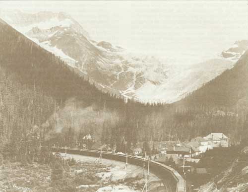
Glacier House Hotel and Station, Canadian Pacific Railways
Banff National Park
Before the close of the nineteenth century, the Government of Canada was urged to extend the boundaries of its national park. Early in January, 1899, A.E. Cross of Calgary, a member of the Legislative Assembly for the Northwest Territories, wrote the Honourable Clifford Sifton, Minister of the Interior, calling attention to the destruction of "big game" in the Territories. He suggested that Rocky Mountains Park be enlarged to incorporate lands between the Canadian Pacific Railway to the north and the Crows Nest Pass Railway to the south, extending easterly from the crest of the Rocky Mountains to the foothills. 1 Apparently Mr. Cross enlisted support for his proposal, for on February 25 Arthur L. Sifton of Calgary wrote to the Minister also recommending extension of the park boundaries. He enclosed a description of the lands he believed should form the extension, which lay south of Township 34 between the western boundary of Range 7 and the British Columbia boundary. 2
Howard Douglas, Superintendent of the park, had recommended an increase in the park area in his annual report for 1898. He now joined the advocates by forwarding a long letter to his Minister on March 23, 1899. Douglas compared the insignificant area of Rocky Mountains Park (673 km2) with that of Yellowstone National Park in the United States (7,770 km2) and the recently established Algonquin (1893) and Laurentides (1895) Provincial Parks in Ontario and Quebec, both of which exceeded 4,662 km2.3 He also drew attention to the attendance at Rocky Mountains Park for the years 1895 to 1898, which had greatly exceeded that at Yellowstone Park.
Another reason for suggesting an extension of boundaries was the possibility that, following the creation of provinces from the Northwest Territories, the assembly of land for park purposes might be more difficult. A final agreement advanced by Douglas was the need of ensuring that the park was large enough to accommodate visitors who might wish to ride out into wilderness areas and enjoy scenic and natural attractions not accessible by carriage roads.
The Park is Enlarged
Support from the press of western Canada also was evident, as editorials in the Winnipeg Free Press and the Vancouver World emphasized the need for immediate action. As the Free Press stated:
By all means let the National Park at Banff be enlarged, as the Superintendent urges in his annual report. Its area is about 260 square miles; about one-tenth the area of that of the United States National Park on the Yellowstone. There is lots of elbow room in the Northern Rockies as yet, and the time to take action is now — before vested interests shall have made it difficult to enlarge this, the most beautiful playground possessed by any people.4
Clifford Sifton approved the enlargement suggested by his brother Arthur and by Superintendent Douglas, and a bill to amend the Rocky Mountains Park Act was drawn and printed. The proposed legislation, however, was deferred until 1901, when the bill was resurrected and revised. The amendment was passed by Parliament during the 1902 session and received royal assent on May 15, 1902.5 The enlarged park now contained an area of 11,396 km2 including the spectacular Lake Louise area which had been originally reserved in 1892, together with the watersheds of the Bow, Red Deer, Kananaskis and Spray Rivers, and made available to park visitors the outstanding scenic areas surrounding the Bow, Spray and Kananaskis Lakes.
The area of Rocky Mountains Park later experienced further revisions. In 1908, the administration of the parks had been placed under the Superintendent of Forestry, and a forest and game protection service was organized. Howard Sibbald, who had been appointed chief game guardian of the park in 1909, recommended to Superintendent Douglas the deletion of a portion of the park comprising foothill country in which timber cutting and grazing privileges had been granted. Sibbald believed that boundaries where possible should be more definite than those described by township lines, many of which had not been surveyed. Douglas agreed that existing boundaries were impossible to locate on the ground and that the cost of a survey would be prohibitive. He also considered that any reductions should be compensated for by the addition of territory north of the park to the North Saskatchewan River. Superintendent Campbell of the Forestry Branch pointed out that the inclusion of the lands to the north would reduce the area outside the park open to public hunting and thus limit the area to which outfitters brought their hunting parties. Eventually, action was deferred on instructions from the Deputy Minister, who concluded that instead of dealing with Rocky Mountains Park in particular it would be better to consider the areas of all the parks along the eastern slope of the Rockies and adopt a consistent policy in each case.
A New Parks Act
On May 19, 1911, the Rocky Mountains Park Act was replaced by the Dominion Forest Reserves and Parks Act, which incorporated in Rocky Mountain Forest Reserve all lands formerly constituting Rocky Mountains Park.6 The new act authorized the establishment and proclamation by Order in Council of Dominion Parks from lands comprising forest reserves. On June 8, 1911, Rocky Mountains Park was re-established, but with an area of 4,662 km2, or less than half its previous dimensions.7 Available records contain little information on why a reduction of 6,734 km2 was made, but presumably the reason was to bring the park area within the administrative capabilities of the existing park staff. There is also reason to believe that neither the Minister, the Honourable Frank Oliver, nor Superintendent Campbell of the Forestry Branch were sympathetic to the cause of park extension. This assumption is supported by the explanation offered for a drastic reduction in the area of Waterton Lakes Park, reviewed later in this chapter.
Soon after the new Parks Act came into force, the administration of the national parks passed from the Forestry Branch of the Interior to the recently-established Dominion Parks Branch headed by J.B. Harkin as Commissioner. The new commissioner recognized the need for a more equitable distribution of public lands set aside for the purposes of forest reserves and national parks. Discussions between officers of the rival branches of the Department led, in 1917, to the re-inclusion in Rocky Mountains Park of the upper Red Deer and Panther River watersheds, together with part of the Kananaskis River Valley. This extension increased the area of the park from 4,662 to 7,125 km2.8
More Boundary Changes
Within the next few years, the boundaries of Rocky Mountains Park again were changed. By 1927, the Government of Canada was committed to proceed with Acts of Parliament by which the natural resources in the four western provinces would be vested in the provincial governments. As lands contiguous to park boundaries would no longer be vested in the same government that controlled the parks, it was essential that future park boundaries be decided well in advance.
Early in 1927 a study of the boundaries of Banff and Jasper National Parks was authorized by the Deputy Minister of the Interior. R.W. Cautley, D.L.S., a departmental officer with wide experience, was detailed to investigate and report on suitable permanent boundaries for the two parks, with the co-operation of the provincial government.
L.C. Charlesworth, Chairman of the Irrigation Council of Alberta, was appointed official representative of that province. Mr. Cautley travelled extensively during the summers of 1927 and 1928. His report recommended deletion of certain areas which had more value to the province by reason of their commercial possibilities, and the retention of areas which had outstanding park characteristics and potential. All recommendations had the unqualified approval of the provincial representative and, as a preliminary step, an area of 2,528 km2 south of Sunwapta Pass, which had formed part of Jasper National Park, was transferred to Rocky Mountains Park on February 6, 1929. At the same time an area of 267 km2 surrounding Mount Malloch was added to the park. These additions increased the area of the park to 9,920 km2.9
The withdrawal from Banff National Park of lands which failed to meet the new criteria was accomplished by the National Parks Act in 1930.10 Among the areas deleted were the Kananaskis River Valley which had been badly scarred by fire; a portion of the Spray Lakes watershed which had water-power potential; an area in the Ghost River watershed; much of the Red Deer River watershed; and an area of 976 km2 in the angle of the Cline and Siffleur Rivers which had been included in the transfer from Jasper to Banff Park in 1929. The 1930 Act established the name of the park as "Banff" and its area as 6,695 km2.
The name "Banff" came into use in 1888, when the railway station was moved from its original site at "Siding 29" to a permanent one adjoining the park townsite. In turn, the townsite took the name of the station. The name was suggested by Sir Donald Smith, later Lord Strathcona. A director of the Canadian Pacific Railway Company, Smith was born near Banff, a town in northeastern Scotland.
Latest Adjustment in Area
A minor adjustment to the eastern boundary in 1933 followed the transfer to Canada by Alberta of 84 ha to facilitate the construction of a new park entrance building on the Calgary-Banff Highway. The latest revision in the Park boundaries occurred in 1949 when adjustments were made in the vicinity of the Spray Lakes reservoir which had been developed by the Calgary Power Company.11 At the request of the Province of Alberta, 54 km2 in the vicinity of Goat Range were withdrawn by an amendment to the National Parks Act. This withdrawal facilitated the completion of a hydro-electric power development on provincial land, and left Banff National Park with an area of 6,641 km2.
The Automobile Arrives
The automobile was responsible, more than any other factor, for the expansion of visitor services in Banff and subsequent national parks. Although barred from park roads by regulation until 1910, the now ubiquitous "car" rapidly attained popularity and influenced the development of an extensive inter-park highway system. By 1911, Rocky Mountains Park was accessible from Calgary by road and the extension of a motor route westerly from Banff was undertaken that year. By 1920 a connection with Lake Louise was made, and access to Banff from southeastern British Columbia was made possible by the completion of the Banff-Windermere Road in 1923. An extension of the road from Lake Louise to Field in 1926 permitted motor travel to Yoho Park, and the following year the Kicking Horse Trail to Golden was opened.
The depression years of the "thirties" gave rise to a new motor road. Construction of the Banff-Jasper Highway was undertaken in 1932 as an unemployment relief project and was completed in 1939. Its opening, early in 1940, resulted in a direct motor route between Lake Louise and the Townsite of Jasper, traversing a magnificent scenic region replete with snow-crowned peaks, waterfalls, icefields and glaciers.
Successive improvements to the main highway through Banff and Yoho Parks were climaxed by the construction of the Trans-Canada Highway. The route, selected after intensive surveys, by-passed much of the original road construction. Completion of the highway through Banff Park in 1958 resulted in a greatly increased volume of visitor travel.
Original Upper Hot Springs, Banff, 1930
New Upper Hot Springs, Banff, 1932
Improvements at Banff
Increased public use of Rocky Mountains Park led to the expansion of the Townsite of Banff and the development of additional visitor accommodation and services. Horse-drawn vehicles, including the picturesque tally-ho, were discarded for buses and taxis. Several of the early hotels in Banff gave way to modern structures. Both the historic Banff Springs Hotel and the Chateau Lake Louise emerged in new form from the ashes of earlier construction devastated by fires.
The development of bungalow cabin camps in Banff National Park began in 1934, when sites for this form of visitor accommodation were advertised by the Park Superintendent. Located on the outskirts of Banff Townsite and along park highways, these innovations enjoyed a good patronage. In turn, the cabin developments later were supplanted by motels and motor hotels, constructed mainly in the Townsite of Banff. By the mid 1960's, motel accommodation had largely replaced other forms of public accommodation.
Development of the first visitor services centre outside a park townsite was undertaken at Lake Louise Station in 1964. This innovation, which concentrated in one area a public campground, trailer park, picnic area and modern motel accommodation, permitted the Department to ban future ribbon development of visitor services along park highways.
Hot Springs Development
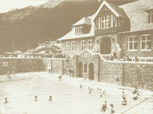
Banff's mineral hot springs continued to hold their attraction for visitors. The original bathing establishments at the Upper Hot Springs operated by private enterprise were supplemented in 1904 when a new outdoor pool and a bath-house were constructed by the park administration. The bath-house contained not only dressing-rooms for men and women but also hot plunge baths, steam rooms, hot and cold showers and modern lavatories. Its popularity soon necessitated extensions to provide essential dressing-room accommodation.
Eventually this public facility became outdated and below the standard befitting a national park. In October, 1931, the site of the former Grandview Villa hotel, which had been damaged by fire earlier that year, was acquired from the Brett family for $6,500. Here construction of a new stone bath-house and outdoor pool was undertaken. Completed and opened in June, 1932, the new building incorporated many desirable features including indoor plunges, steam rooms and commodious dressing rooms and was operated the year round. A program of modernization carried out in 1961 resulted in a new bathing pool, improved access to interior services, and provision for coffee shop and massage concessions.
Cave and Basin Springs
By the turn of the century, the Cave and Basin bathing pools were no longer capable of accommodating the number of patrons wishing to use them. Late in 1902, Park Superintendent Douglas commenced construction of a new pool, which was completed and opened for use in 1904. It measured 15 by 30 m, had a maximum depth of 2.7 m, and was complemented by additional dressing-rooms built that year and in 1905. Eventually, existing facilities became inadequate and, in 1912, excavation for a large new bathing establishment, designed by Walter Painter, a Calgary architect, was commenced. Difficulties in its construction delayed the opening of the new structure until 1914. Much of the superstructure was erected on piles driven into the porous underground tufa. Walls of the building and the pool were constructed of concrete, and exterior walls were faced with Rundle limestone. Two belvederes at the eastern end, capped with red tiles, formed a striking feature of the design. One gave access to the cave, and both provided vantage points from which spectators could view the swimming area. The roof over the dressing-rooms located along the south side of the pool also formed a promenade and viewpoint. With dimensions of 41 by 11 m, the new pool was believed to be the largest in Canada.
Later Reconstruction
Substantial renovation was undertaken at the Cave and Basin bath-house in 1935, during which the wooden dressing-rooms erected in 1887-1903 were demolished and replaced by a new structure faced with stone. The basin hot pool also was upgraded, a wading pool developed, and improved access to dressing-rooms was provided. Original construction of the dressing-rooms' roof had employed glass panel pavers, the joints of which leaked. Natural diffused light beneath was cut off when the roof had to be repaired by overall tarring. Hot spring waters heavily impregnated with minerals caused a severe plumbing problem, particularly after chlorine was introduced for sanitary reasons. Water in the large pool presented a heavy murkiness that resulted in a fatal accident when lifeguards were unable to observe a bather in distress. Consequently, in 1960 the natural spring water in the pool was replaced with chlorinated water from the townsite water system, artificially heated to maintain a comfortable temperature. In 1970, it was found necessary, for sanitary reasons, to close the Basin "hot" pool and the adjoining wading pool. In 1980, the indoor hot plunge baths also were closed.
Plans for Centennial
By the mid-1970's, planning for the celebration of the National Parks Centennial in 1985 had begun. The Cave and Basin springs, regarded as the "birthplace" of our national park system, obviously would occupy a very important place in objective planning. However, by 1976, a deteriorated building, serious maintenance problems, and costs of operation had prompted the closing of the Cave and Basin bath-house. Early planning proposals favored permanent closing of all bathing facilities and the use of the bath-house as an interpretation centre. Residents of Banff and vicinity, however, objected strongly to this proposal, and a local committee dedicated to the retention of the Cave and Basin bath-house as an active recreational centre was formed. It sponsored petitions that eventually collected several thousand signatures advocating the preservation of the Cave and Basin in its original state.
Reconstruction Decided On
Reconstruction of earlier proposals by Parks Canada, coupled with public consultation, resulted in the receipt of several concepts for future use of the historic establishment. Eventually, a proposal combining an outdoor swimming pool with an interpretation centre was chosen. The future Cave and Basin Centennial Centre as proposed would provide year round activity. During a summer season of some 80 days, swimmers clad in their own bathing attire, or alternatively in 1914 style rental suits, would be able to use the large open-air pool filled with chlorinated and filtered water from the thermal spring in the Cave. Provision of modern change-rooms on the ground floor of the 1914 "longhouse" would include facilities for the handicapped. Also, the end of the reconstructed pool would rise to zero depth, permitting its use by the very young and by persons in wheel chairs.
The restoration concept would present the Basin pool in its 19th-century appearance, with a replica of its 1887 bath-house on its margin. However, because of present-day sanitary and safety standards, the Basin spring would not be available for bathing. The Cave would be featured, and the second floor of the longhouse portion of the building would exhibit lively items commemorating the history of Canada's national parks. The bath-house also would incorporate a photo-gallery, an Edwardian lounge, and a small theatre providing multi-image audio-visual programs recalling outstanding events which occurred in Canada's national park system during the preceding 100 years.
Reconstruction of the Cave and Basin bathing establishment began in 1981 and was carried on to its completion early in 1985. In addition to restoration of the pool and other components of the building as outlined above, the tunnel leading to the Cave was made accessible to wheel chairs. Interpretation facilities at the Centennial Centre are open year round, a large parking lot was completed, and two interpretive walking trails constructed. The Discovery Trail highlights the history and geology of the hot springs, and the Marsh Trail focuses attention on the plant and animal life associated with warm sulphur water.
On June 15, 1985, the restored Cave and Basin Centennial Centre in Banff National Park was formally opened by the Minister of the Environment, Hon. Suzanne Blais-Grenier, in the presence of several hundred guests and other park-minded visitors assembled for this tribute to the completion of 100 years of national parks in Canada.
Campground Extension
The provision of campgrounds was a logical sequence to the development of motor travel. The first major campground in the park was laid out along the Bow River in 1916, below its confluence with the Spray. Later, when the site was required for an extension of the Banff Springs golf course, a new campground was developed on Tunnel Mountain in 1927. It was expanded gradually to accommodate both trailer and tent accommodation. A continuing demand for camp sites influenced the development in 1967 of a new campground east of the original one on Tunnel Mountain. By 1969 the expanded campground — the largest in the national park system — provided the ultimate in camping amenities including water, sewer and electric power services. Two additional serviced campgrounds, together with nine satellite areas, provided additional sites for camping parties.
Winter Sports Activity
The transformation of Banff National Park from a summer vacation area to a year-round resort followed the expansion of winter sport activities. An annual winter carnival was carried on at Banff for more than 50 years. Curling was organized in 1900 and a local club built its first closed rink in 1922. Its base of operations was relocated in 1962 following the completion of the Banff Recreational Centre.
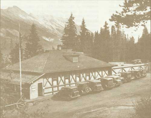
Skiing was introduced in 1900 and gradually through the years attained a fantastic popularity. Early ski developments were concentrated on the slopes of Mount Norquay overlooking the town of Banff, where a local club erected a club-house and the Park Superintendent co-operated in the development of a jumping hill and down-hill runs. The first chair lift, which doubled in summer as a sight-seeing conveyance, was installed in 1948. Development of a ski centre on Mount Whitehorn near Lake Louise was undertaken in 1959 when a gondola lift was constructed by private enterprise on the lower slopes of the mountain. This installation later was augmented by several lifts. New down-hill runs were developed and a large parking area was constructed. The nucleus of another popular ski centre northwest of Banff at Sunshine Valley was built in 1936. Early tows and lifts were improved in 1956, and in 1963 a major redevelopment of the area was undertaken by private enterprise. New installations including three chalets providing overnight accommodation, a day lodge, T-Bar tows and chair lifts all contributed to the development of Sunshine Village as a major ski resort.
Cultural amenities in Banff were broadened following the construction of the Banff School of Fine Arts between 1947 and 1968. This extensive complex, located on the slopes of Tunnel Mountain overlooking Banff, was sponsored and constructed as an extension to the University of Calgary. It offers a variety of courses in fine arts, music, languages, and business management. The erection of a modern building in 1968 within the town of Banff to house the Archives of the Canadian Rockies provided local citizens and visitors with a modern library, an art gallery, and a repository for papers, books, records and artifacts relating to the Canadian Rockies.
As the oldest, one of the largest, and the best known of Canada's National Parks, Banff has maintained its early popularity. Its magnificent scenery, excellent highways, unique natural attractions and its man-made amenities have attracted visitors in increasing thousands during its 85 years of existence. Each year since 1967, more than two million visitors have enjoyed unique and diversified attractions confirming the prediction of one of its original sponsors, Sir John A. Macdonald, that it would become "a great watering-place".12
Endnotes
1. National Parks Branch File B.2, vol. 1, 21 Jan. 1899.
2. Ibid., Feb. 25, 1899.
3. Ibid.
4. Ibid.
5. Statutes of Canada, 2 Edward VII, chap. 31.
6. Statutes of Canada, 1-2 George V, chap. 10.
7. Order in Council P.C. 1338, June 8, 1911.
8. Order in Council P.C. 2594, Sept. 18, 1917.
9. Order in Council P.C. 158, Feb. 6, 1929.
10. Statutes of Canada, 20-21 George V, chap. 33.
11. Statutes of Canada, George VI, chap. 5.
12. Canada, House of Commons, Debates, May 3, 1887.
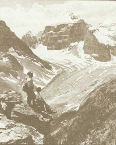
Mount Lefroy, Banff National Park
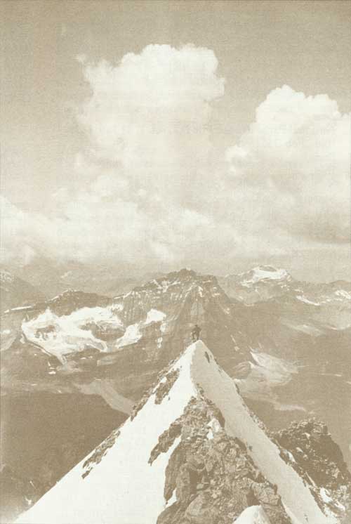
Guide Rudolph Aemmer on the summit of Mount Victoria, Banff National Park, 1933
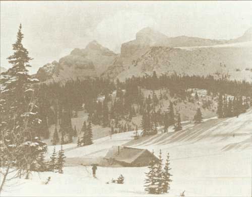
Sunshine Pass, Banff National Park
Yoho National Park
The national park movement gathered considerable momentum in December 1901, when the park reserve around Mt. Stephen in British Columbia was enlarged to incorporate an area of 2,144 km2.1 Described as the Yoho Park Reserve, it included the spectacular Yoho Valley, Emerald Lake, Lakes O'Hara and McArthur, and the major portion of the watersheds of the Beaverfoot, Ottertail, and Amiskwi Rivers. This timely park development stemmed from the explorations carried out in 1897 by Dr. Jean Habel of Berlin, Germany, whose ambition was to explore the area surrounding a high glacier-clad peak beyond the Yoho Valley which was visible from the line of the Canadian Pacific Railway.2 Habel termed it "Hidden Mountain". It was given the name of Mount Habel in 1898, but later was changed by the Geographic Board of Canada to "des Poilus" commemorating the French soldier in the First Great War.3 In his interesting book "The Trail to the Charmed Land", Ralph Edwards contended that Habel had as another objective the conquest of Mount Balfour. This peak dominated the Wapiti Mountains which flanked the Bow River Valley on its western side, northerly from Kicking Horse Pass.4
Yoho Valley Explored
A professor of mathematics, a scientist and mountain climber of considerable skill, Doctor Habel arrived at Field in June, 1897. Attempts to reach and climb Mt. Balfour had been made from the Bow River Valley on the eastern side. Habel was informed that the valley of the Yoho River, or north fork of the Wapta River as it was then known, was impenetrable — a tangled wilderness of canyon, rocks and trees.5 Undaunted, Habel decided to approach his objective by way of Emerald Lake, from which point he hoped to reach the reputedly inaccessible valley.
Outfitted by Tom Wilson, the well known guide and packer and discoverer of Emerald Lake, Habel left Field on July 15, 1897, accompanied by Ralph Edwards as guide, Fred Stephens as chief packer and Frank Wellman as cook.6 The outfit was carried by four horses but Habel chose to travel on foot. Emerald Lake was accessible by trail but from then on the route lay through primitive forests and across glaciated slopes. Making their way over Yoho Pass the party reached a point where the glacier-hung walls of the spectacular Yoho Valley and the glittering cascade of Takakkaw Falls met the eyes. As Habel described the scene:
The torrent from the hanging glaciers, which cover the eastern terraces of the valley, descended directly opposite to us in a very powerful waterfall. Rushing from under the ice at about the height of our standpoint, this fall plunges over a nearly perpendicular wall down to the very level of the valley bottom in beauty and grandeur hardly to be excelled by any other on our globe. An entire view of the falls can only be got from a point like that at which we stood, and not from the lower parts of the valley.7
Working their way down to the floor of the valley the party explored the upper Yoho or "Waterfall" valley, Twin Falls, Yoho Glacier and the Waputik Icefield. Habel was able to climb an outrider of Mount Balfour which he named "Trolltinder" but was obliged to cut short his exploration and any attempt to climb "Hidden" Mountain when supplies ran low. A return was made to the Kicking Horse valley and Field by travelling along the floor of the Yoho Valley to the canyon, which was avoided by a climb up the forested slopes around the northwestern side of Mount Field.
Park Reserve Established
A description of Habel's travels was read to members of the Appalachian Mountain Club at its annual meeting in 1898, but it was not until 1901 that the remarkable scenic attractions of the area were brought to the attention of the Department of the Interior at Ottawa. Ralph Edwards, Habel's guide, had described the Yoho Valley and its wonders to his employer, Tom Wilson. In turn Wilson was able to impress officers of the Canadian Pacific Railway Company with the possibilities of the region as a tourist attraction, provided it was opened up by construction of a road. Eventually, in February 1901, Charles Drinkwater, assistant to the president of the railway company, described Habel's discoveries to James A. Smart, Deputy Minister of the Interior, during a visit to Ottawa. Drinkwater followed up his interview with a letter to Smart and recommended that the Yoho Valley be set aside as a park reserve. Obviously impressed with the tourist possibilities of the recent discoveries, Drinkwater also made a formal application for a grant of an area of 9.3 ha near the railway station at Field, on which the railway company proposed to construct stables, a corral and other improvements that might be required to serve the visitors that would be attracted by the scenic wonders that had been disclosed.8
After considerable deliberation, during which the name "Wapta Falls" was considered and discarded, the "Yoho Park Reserve", containing 2,146 km2, was established on December 14, 1901, to preserve the "glaciers, large waterfalls and other wonderful and beautiful scenery within its boundaries". Attached to the enacting Order in Council was a plan which outlined in red the boundaries of the reserve. The name "Yoho" was suggested by the Surveyor General, Edward Deville, who, in a memorandum to the Deputy Minister, observed that the correct name of the principal waterfall was "Takakkaw" which had been selected by Sir William Van Horne, Chairman of the Canadian Pacific Railway Company. At the time, Mr. Deville observed that the name "Takakkaw" was the Cree Indian for "it is magnificent".9
Yoho Becomes a Park
In 1911, the Yoho Park Reserve was re-established under authority of the Dominion Forest Reserves and Parks Act as Yoho Dominion (National) Park.10 In common with several other park reserves established at the same time, it suffered a reduction in area to 1,450 km2. Eleven years later, a further reduction was made to eliminate several timber berths from the park. This withdrawal reduced the park area to 1,233 km2. Concurrently with the passing of the National Parks Act in 1930, the park boundaries again were adjusted to follow, as far as possible, heights of land, rather than township lines, and increased the park's area to l,313 km2.
Park Development Commenced
Development of the enlarged park reserve was undertaken by the Department of the Interior shortly after its establishment. From 1902 until 1908 its administration was supervised by Howard Douglas, Superintendent of Rocky Mountains Park, with the help of an assistant superintendent. After 1908, the local administration of the park was carried out by a resident superintendent. Douglas undertook construction of a network of roads including one to Emerald Lake which was completed in 1904. The task of opening up Yoho Valley was commenced in 1903 but limited funds, rugged terrain, and primitive equipment all combined to extend the construction period to seven years. By 1909, Takakkaw Falls were accessible by horse-drawn carriages and the following year the road was completed.11 Douglas also built a diversion in the Emerald Lake road to provide access to the natural bridge over the Kicking Horse River west of Field and converted an abandoned railway grade leading westerly from Field to Ottertail to a carriage road.
Following construction by the Canadian Pacific Railway Company in 1908-09 of the spiral tunnels in Mounts Ogden and Cathedral, which reduced the grade of the "big hill" east of Field, Superintendent Douglas utilized the abandoned railway right of way to construct a scenic drive easterly up Kicking Horse River Valley almost to Wapta Lake. Most of the roads previously used by horse-drawn vehicles were opened to motorists in 1919, and the Yoho Valley Road was made accessible to automobiles in 1920.12 Public demand for a motor route to Yoho Park from Lake Louise led the Department of the Interior in 1924 to commence construction of a road to Field, together with an extension from Field to the western boundary of the park. The section to Field was completed and opened to travel in July, 1926. By the end of that year construction had been carried to the park boundary, where it linked with a road constructed by the Province of British Columbia from Golden. The combined route, known as the Kicking Horse Trail, was formally opened to traffic in July, 1927. The main highway through the parks served as a link in a transcontinental motor route from the Prairies to British Columbia, until the Trans-Canada Highway project was instituted. Over the years, other roads in the park were improved. The Emerald Lake road was relocated in places in 1959 and paved in 1962. The Yoho Valley road also has been given a "face-lifting" by relocation. The spectacular. switch-backs lost most of their hazards to timid motorists when the grades were widened by the use of steel bin-wall in 1956.
Hotels and Lodges
The original hotel at Field, the Mount Stephen House, constructed by the Canadian Pacific Railway Company in 1886, served as the principal visitor accommodation for many years. Later it was turned over to the Y.M.C.A. as a rooming house and recreational centre for railway employees. It was finally demolished in 1963 after staff was accommodated in a modern bunk-house. Additional accommodation in the form of lodges and bungalow camps was constructed by the railway company at Emerald Lake in 1903 and at Yoho Valley, Wapta Lake, and Lake O'Hara in the "nineteen-twenties" but gradually these concessions were sold to individual operators. Cathedral Mountain Chalets were built in 1933 near the junction of the Yoho Valley Road and the Trans-Canada Highway. Wapta Lodge was gutted by fire in 1961 and was rebuilt in 1963 as a modern motor hotel by a Calgary group.
Park Administration
Although Yoho National Park was placed in charge of a resident superintendent in 1908, the duties of the latter were expanded some years later to take in the administration of the three other parks in British Columbia — Kootenay, Glacier and Mount Revelstoke. In 1957, Glacier and Mount Revelstoke parks were placed under separate administration, and an individual superintendent was assigned to Kootenay Park. The first park office was built in 1905 on railway land near the telegraph office at Field. In 1933, the superintendent and staff moved to a building on Stephen Avenue, formerly occupied by a bank. Later the lot and building were acquired by the Department, and in 1955 the premises were enlarged and modernized.
The Townsite of Field dates from 1884, when construction of the Canadian Pacific Railway reached its site. It was named after Cyrus W. Field, promoter of the first Atlantic cable, who was in the vicinity that year. 13 Early residents lived on both sides of the Kicking Horse River, but houses on the north side were almost totally destroyed or impaired by an avalanche which occurred in 1909 on the slopes of Mount Burgess. The present townsite was first surveyed in 1904, after which a number of additions were made. Field has the distinction of being the only townsite in a national park in which all lots are not leased to residents by the National Parks Administration. After the railway was completed, the Canadian Pacific Railway Company surveyed part of its station grounds as a subdivision, and a portion of the townsite north of Stephen Avenue still remains under railway control and ownership.
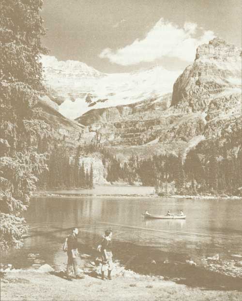
Lake O'Hara, Yoho National Park
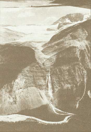
Daly Glacier and Takakkaw Falls, Yoho National Park
Highway Access Improved
Prior to 1926, access to the park from distant points was possible only by railway. Most of the early visitors disembarked from the trains at Field, where they were accommodated at the Mount Stephen House or driven by tally-ho to Emerald Lake or to other available accommodation. Early visitors to Wapta Lodge and Lake O'Hara Lodge had the option of leaving the train at Hector Station overlooking Wapta Lake. From this point they reached their destinations by boat to Wapta Lodge or by riding trail to Lake O'Hara.
The completion of the main park highway, the Kicking Horse Trail, from the eastern to the western boundaries of the park in 1927 opened a highly scenic route to motorists and in a few years the largest proportion of visitors to Yoho Park arrived by motor vehicle. In turn, this motor traffic stimulated a demand for campgrounds and picnic sites which were developed by the National Parks Service at strategic points along the principal avenues of travel. Construction of the Trans-Canada Highway through the park began in 1955 and was carried on for the next three years. By the end of 1958, the highway had been completed and hard-surfaced with the exception of a final lift of asphalt which was laid in 1963. The opening of the Trans-Canada Highway over Rogers Pass and through Glacier and Mount Revelstoke National Parks in 1962 helped swell the tide of visitors, which in Yoho Park now exceeds 900,000 each year.
Recreation
Outdoor recreation enjoyed by residents of and visitors to the park included riding, hiking and mountain climbing. Horse liveries were operated at Field and Emerald Lake in the early days of the park existence and at Yoho Valley and Wapta Lodge following their opening in the early 20's. The Alpine Club of Canada held its first camp in the park in 1906. For many years it held a lease covering the site of a summer camp on the south shore of Lake O'Hara. In 1931, the club was granted the occupancy of the two cabins left in the Alpine Meadow after the balance of the C.P.R. buildings comprising Lake O'Hara Lodge were moved to the lakeshore in 1925 and 1926. The club erected a lodge in the little Yoho Valley in 1941. The area between Yoho Valley and Emerald Lake has been a popular one for hiking and riding, and trails used extensively include those crossing Yoho Pass and along the upper slopes of the President Range overlooking Takakkaw Falls. A nine-hole golf course was built on the Kicking Horse flats in the mid 1930's, and was used by residents for some years. A ski hill was developed by the Field Recreation Commission on a slope cleared west of Field on the Trans-Canada Highway. A curling club, formed at Field in the early 1930's, has continued operation, and skating on an outdoor rink has been popular for years.
The Monarch Mine
Openings on the steep faces of Mount Stephen and Mount Field on opposite sides of the Kicking Horse River bear witness to a mining operation carried on east of Field for nearly sixty years.
The Monarch claim was located in 1884 on information supplied by Tom Wilson and was Crown granted in 1893. Hand-sorted shipments of lead ore were shipped intermittently to Vancouver until 1912, when a small gravity-type concentrator was erected by the Mount Stephen mining syndicate on railway land below the mine opening. Milling began that year and was continued off and on until 1924. In 1925, the Monarch mine, together with the adjoining St. Etienne and other claims on Mount Stephen as well as a group of claims across the valley known as the Kicking Horse Mine, were acquired by A.B. Trites, president of the Pacific Mining Development and Petroleum Company. Trites obtained a licence of occupation in 1926 for three parcels of land in Kicking Horse Valley from the Minister of the Interior for works and buildings. He also entered into an agreement which granted the Company certain privileges. In return, the agreement provided that at the end of the 21-year term, title to all Crown-granted and other mineral claims held by Trites and his company would revert to the Crown in right of Canada.
In 1929, Trites sold his interest in the two mines to Base Metals Mining Corporation. The Corporation built a new mill below the Monarch claim on railway land, installed an aerial tramway, erected accessory buildings and commenced operations in November, 1929. The Kicking Horse Mine, which included claims first located in 1910, was brought into production in 1941. The installation of an aerial tramway permitted the conveyance of ore from the mine portal to a bin on the valley floor, from which it was trucked a distance of three kilometres to the mill below Mount Stephen.
During the war years, production of lead, zinc and silver reached a high level and in 1947 the corporation requested and was granted an extension of two years in which to remove all remaining minerals. In 1948 the term of the licence was extended to 1957 but by November, 1952, the corporation had closed both mines. During the next two years it disposed of much of its mining equipment. With Departmental consent, the corporation sub leased a number of its buildings to contractors engaged on the Trans-Canada Highway and to the federal Department of Public Works. Early in 1958, the Company agreed to convey title to the Crown covering all claims which it then held. Acceptance of a surrender from the Company of its interests was delayed until the lands formerly occupied had been cleaned up and the portals to the mines had been sealed to the satisfaction of the park superintendent.
During the periods of operation a large heap of mine tailings had been dumped on the bank of the Kicking Horse River, creating an unsightly deposit and, in dry weather, clouds of dust in the vicinity. The unsightly piles of tailings were eliminated in July, 1960, during a period of high water, when they were bull-dozed by park forces into the Kicking Horse River. The former mining camp had been cleared by 1961 but compliance with the portal sealing requirement had not been obtained by the Department in 1968, in spite of correspondence and negotiations carried on for ten years. Finally, in May, 1968, the corporation completed a conveyance of title covering its land and mineral holdings to the Crown in right of Canada.
Endnotes
1. Order in Council P.C. 1901-2181, Dec. 14, 1901.
2. Jean Habel, The North Fork of the Wapta, Appalachia, vol. V III, 1898.
3. Geographic Board of Canada, "Eighteenth Report" (Ottawa: King's Printer, 1924).
4. Ralph Edwards, The Trail to the Charmed Land (Saskatoon: H.R. Larson Co., 1950).
5. Ibid.
6. Ibid.
7. Habel. See above, note 2.
8. National Parks Branch File Y.2, Feb. 18, 1901.
9. Ibid., Nov. 26, 1901.
10. Order in Council P.C. 1911-1338, June 8, 1911.
11. Department of the Interior, "Annual Report", 1911, part V, p. 37.
12. Department of the Interior, "Annual Report", 1921, p. 38.
13. Geographic Board of Canada. See above, note 3.
Glacier National Park
For more than fifteen years after its establishment in 1886, the mountain park reservation around Glacier Station in the Selkirk Mountains remained relatively undeveloped by the federal Government. Located in the heart of a rugged alpine wonderland, it was accessible only by the main line of the Canadian Pacific Railway. The route across the mountains lay over Rogers Pass, down the precipitous sides of which thundered avalanches carrying before them rocks, trees, ice and snow. Protection to railway cars and passengers was provided by lines of snow sheds and glances, built of heavy timber and capable of diverting or sustaining the great masses of snow and debris that rolled down during the winter months.
Glacier House and Station
Near the summit of the pass, the railway company had established at Rogers Pass Station a maintenance headquarters including a round-house where extra locomotives, snow plows and other equipment were stored. A small settlement developed along the right of way, which eventually was surveyed by N.C. Stewart, D.L.S., in 1912 as Rogers Pass Townsite. This small subdivision accommodated the dwellings of railway employees, a boarding house, store, a post office and a recreation hall. At Glacier Station, 4.8 km to the west, the Canadian Pacific Railway Company had constructed in 1886 a restaurant and small hotel known as Glacier House. This was one of four mountain hotels developed by the Canadian Pacific Railway to facilitate the hauling of trains up the heavy mountain grades. As explained by J.M. Gibbon in his history of the Canadian Pacific Railway:
There is no hotel so expensive to operate as a dining car on wheels, the labour on which doubles the primary cost of the meals, and as the train carried passengers of every class and purse, station restaurants had to be built as suitable places in the mountain districts, lessening the number of dining cars to be hauled and providing the initial cost of a tourist hotel.1
Alpine Centre
Similar developments had been installed at Field, Revelstoke and North Bend, all in British Columbia.
Glacier House opened for business on January 1, 1887, and very soon its unique location, magnificent setting, and its excellent service began to attract visitors, especially those with the resources and leisure to frequent alpine areas. One of the principal attractions of the area was the immense variety of mountains which offered unlimited scope to mountain climbers. Ascents in the vicinity of Rogers Pass had been made by its discoverer, Major A.B. Rogers, and his nephew in 1881, as well as by Professor John Macoun and his son James.2
In 1888, the Reverend W.S. Green of the British Alpine Club inaugurated what might be termed the "climbing era" in the Selkirks. Green undertook the task of mapping the peaks and glaciers surrounding Rogers Pass and in 1890 published an account of his climbs in his descriptive book, "Among the Selkirk Glaciers".3 That year, members of the English and Swiss Alpine Clubs visited the area and achieved a number of notable ascents, including that of Mount Sir Donald, formerly Syndicate Peak, which was accomplished by Emil Huber and Carl Sulzer. In 1897, a party of British climbers including Professor J.N. Collie, H.B. Dixon, and J.P. Baker brought out the first Swiss guide, Peter Sarbach.4 Two years later the Canadian Pacific Railway imported two accredited guides from Interlaken, Switzerland, Edouard Feuz and Christian Hasler, the first of a colony of guides who served an enthusiastic clientele over the years at Lake Louise, Field and Glacier. A steady increase in visitors necessitated two extensions to Glacier House Hotel, the second of which was made in 1906 and brought the accommodation up to 90 rooms.5
In its original form, the park reservation at Glacier comprised a rectangular area about 10.5 km long by 7 km wide. It enclosed Rogers Pass, the railway loop below Glacier Station, Mounts Macdonald and Avalanche, and the tongue of Illecillewaet Glacier. Oddly, it did not include Syndicate Peak, later named Mount Sir Donald, although the order in council which first authorized the reservation specifically mentioned it.6 Early improvements carried out in the vicinity of Glacier House consisted mainly of walking trails constructed by the Railway Company, which provided access to the Illecillewaet, or "Great" Glacier, Marion Lake on the slopes of Mount Abbott, and other nearby points. By 1903, Glacier House was a well established alpine centre and a great many of the mountains in the vicinity had been climbed. A table of first and second ascents of some of the higher peaks in the reserve, compiled by A.O. Wheeler, indicated that by the end of 1903 nearly 40 major mountains or crests had been climbed for the first time.7
Glacier Park Enlarged
On November 26, 1903, Glacier Park reserve was enlarged to include sixteen townships or 1,492 km2.8 The order in council did not elaborate the reason beyond stating "it is now desirable to enlarge its boundaries so as to include the best scenery in the neighbourhood". There seems little doubt, however, that the Minister of the Interior acceded to popular demand that a larger area of outstanding alpine scenery be set aside for public use. Following the enactment of the Dominion Forest Reserves and Parks Act in 1911, reductions were made in the areas of several national parks. Glacier Park was reduced by 280 km2 to 1,212 km2, in order to eliminate lands considered unsuitable for park purposes.9 In 1930, new boundaries following heights of land were established, and the resulting area of the park was 1,349 km2.10
Nakimu Caves Discovered
The discovery of the Nakimu Caves in 1904, by C.H. Deutschman of Revelstoke, attracted additional attention to Glacier Park and resulted in the first active development of the park by the Government. Although born in the United States, Deutschman was a naturalized Canadian citizen. He made his remarkable find while prospecting in the vicinity of Cougar Creek. Earlier in the year, Deutschman had visited the area on snow-shoes but was unable to make progress in the deep soft snow. In October, he returned and, while following the creek up the valley, suddenly realized that the creek bed had gone dry.
I could hear the water rushing ahead of me and when I investigated, I found that the stream disappeared into the ground through a large hole at the bottom of the big falls. Nearby, I found another large opening in the rock and went into it as far as daylight permitted. Through later explorations, I was to learn that I had that day, October 22, 1904, discovered the largest system of caves in Canada. I spent the next few days hunting for more entrances to the caverns and located a total of seven, some large and others just big enough for me to squeeze through.11
Deutschman consolidated his find by staking two mineral claims covering an area of 914 by 457 m, and recorded them at Revelstoke. In April, 1905, Deutschman escorted his first visitor, the editor of the Revelstoke Mail-Herald, A. Johnston, through the caves. In May, he returned with a party of twelve including Howard Douglas, Superintendent of Rocky Mountains Park, W.S. Ayres, a mining engineer, and R.B. Bennett of the Associated Press at Vancouver. Douglas later negotiated the purchase of the two claims by the Crown and Deutschman surrendered his titles in consideration of a payment of $5,000.12
Cave and Trail Development
When Deutschman agreed to sell his interest in the caves, apparently an understanding was reached with Howard Douglas that he would be employed in the development and operation of the caves.13 Whether or not Deutschman's statement in this respect was correct, Douglas recommended that he be hired as a caretaker, and Deutschman subsequently was engaged on a seasonal basis. Early in 1906, Douglas arranged for the construction of a trail from the railway water tank east of Ross Peak Station to the caves. Deutschman was given authority to construct log cabins for the use of visitors near the station and at the caves. The Canadian Pacific Railway Company opened and maintained a trail from Glacier House to the water tank that linked up with the trail made to the caves. Between 1911 and 1914, the trail from Glacier House to the caves, then used by saddle-horse riders, was developed by the Park Service to the status of a carriage road. In 1915, a tally-ho service was inaugurated from the hotel to the end of the road, which terminated about 1.6 km from the cave entrance. During the period of his employment each year, Deutschman continued his exploration of the caves, built a caretaker's quarters, and installed ladders, hand-rails and other aids for persons visiting the caves. A more accessible entrance to the lower caves was made in 1915 by tunnelling through rock, following a survey by O.S. Finnie, an engineer of the Department of the Interior.
The earliest reports on the unique character and features of the caves were written by W.S. Ayres and Arthur O. Wheeler and appeared in the annual report of the Surveyor General of Canada.14 Ayres had accompanied an inspection party to the caves on May 29, 1905, and, in company of Deutschman, had made further inspections on the last three days of the same month. Wheeler, a staff member of the Topographical Survey of Canada, also made a detailed inspection of the caves in August, 1905. Wheeler's report, accompanied by a plan showing the extent of the caves, contained a very detailed description of the various caverns and passages explored to date. A survey of the lower caves was undertaken in 1927 by another departmental engineer, C.M. Walker of Banff. During the depression years of the "thirties", park appropriations were drastically reduced, and caretaker services at the caves were terminated in 1932. Shortly after, the caves were closed to the public as a safety measure.15 Admission to the caves in later years was authorized by permit, mainly to individuals engaged in scientific observation. Studies carried on by a consultant from 1965 to 1969 increased knowledge of the caves, and disclosed additional passages and caverns previously unknown.
The Connaught Tunnel
The opening of the Connaught Tunnel through Mount Macdonald in December, 1916, by the Canadian Pacific Railway foreshadowed future events in Glacier Park. The heavy grades, the high cost of operating its line over Rogers Pass including the maintenance of kilometres of timber snow sheds, and occasional casualties from slides influenced the Company to commence construction of the tunnel in 1913. The most disastrous slide occurred in March, 1910, when a work crew engaged in extricating a stalled train was engulfed, with a loss of 62 men.
Construction camps were established at each end of the proposed tunnel — 8 km in length — and 1.6 km beneath the summit of Mount Macdonald. The drilling crews met on December 9, 1915, and the Governor General, H.R.H. the Duke of Connaught, officiated at an official opening on July 17, 1916. The new line went into service on December 9 of the same year.16 In addition to eliminating the need for snow sheds through Rogers Pass, the tunnel had the effect of lowering the grade over the summit by 164 m.
With the railway line relocated, the railway settlement and work camp at Rogers Pass Station was closed down and a new station constructed immediately west of the western end of the tunnel. All buildings were moved or demolished, and only the walls of the round house remained. Glacier House, which had been bypassed by the railway relocation, was connected with the new station by a road which utilized part of the abandoned grade. From 1917 on, Glacier House was open during the summer months only, but for several years it operated almost at capacity. In 1923, the C.P.R. built a tea-house with overnight accommodation at the Nakimu Caves, and operated it from 1924 to 1927. An era came to an end, however, when the Railway Company closed Glacier House forever on September 15, 1925.17 The building was allowed to stand for four years. After all furniture and fixtures were removed, it was dismantled under contract late in 1929, and the debris burned. The title to the land occupied by Glacier Station and Glacier House later was surrendered to the Crown.
Visitor Travel Declines
Following the closing and demolition of Glacier House, visitor travel to Glacier Park dwindled. The Swiss guides departed and the saddle horse concession and the tally-hos disappeared. The owner of the store at Rogers Pass Station had moved to a new site near the new Glacier Station. A few visitors were accommodated in the store building but others had to "camp out". Only when mountaineering clubs held an outing in the park was there any concentration of visitors. The Nakimu Caves, however, were open to visitors for several years. C.H. Deutschman accepted more renumerative employment in the United States in 1919, and his successor as caretaker, George Steventon, carried on for several years before the caves were closed. Deutschman died in Connecticut in 1967.
Avalanche Control
The selection of a route over Rogers Pass for the construction of the Trans-Canada Highway from Golden to Revelstoke brought new activity to Glacier National Park. Following surveys by the governments of Canada and British Columbia, clearing of the right-of-way was undertaken by park forces. Construction of the highway under contract was commenced in 1958 and completed, with an initial coat of asphalt, in 1962. Difficulties in maintaining the completed highway were accentuated by a need for the control of avalanches which was met in part by the construction of more than 823 m of concrete snow sheds at critical points. Additional control of avalanches between the eastern boundary of the park and Albert Canyon was developed by the construction of an avalanche observation station on Mount Fidelity. Here highly trained staff equate information obtained and transmitted by automatic equipment from two high-altitude observatories. These observations provide advance warning of avalanche conditions. Dangerous slopes are then stabilized by explosives detonated in the trigger zone of the avalanche by means of howitzers manned by a detachment of the Royal Canadian Artillery. The first observation station was erected on Mount Abbott in 1956 and an additional one at Balu Pass in 1958. The main control station on Mount Fidelity was completed in 1961.
Administration
From the date of its establishment until 1908, supervision of Glacier Park was carried on by the Superintendent of Banff Park. In 1909, a superintendent of Glacier and Yoho Parks, with headquarters at Field, was appointed. Later, when construction of the Trans-Canada Highway through Glacier and Mount Revelstoke Parks was decided on in 1957, a superintendent for the two parks was appointed, with headquarters at Revelstoke. The administrative offices are located in rented premises.
Park Buildings
The first warden cabin in Glacier Park was constructed in 1914 on the Nakimu Caves Road near Glacier Station. In 1916, three seasonal wardens were on duty and wardens' stations were established at Stoney Creek, at Flat Creek and at Glacier Station. In 1921, a bunkhouse, stable, and a new wardens' cabin were erected in the vicinity of Glacier House. In 1936 the Stoney Creek cabin, originally a C.P.R. building, was replaced with a new structure. The Flat Creek Station was rebuilt in 1947. Patrol cabins were built at Grizzly Creek in 1929, Beaver River in 1941, Mountain Creek in 1952 and Bald Mountain in 1953. The construction of the Trans-Canada Highway required relocation of the warden station at Glacier and a new building was built at Rogers Pass Summit in 1961. The Stoney Creek warden station was relocated in 1964 when a new cabin was built in the vicinity of the eastern gateway on the Trans-Canada Highway.
Between 1962 and 1965 an administrative headquarters for the park was developed in Rogers Pass, involving construction of vehicle maintenance and stores buildings and an administration building containing staff quarters and dining facilities. Additional accommodation for staff in the form of apartment blocks was added in 1968. Visitor traffic is controlled at a gateway building inside the eastern park boundary which was erected in 1962.
New Visitor Accommodation
The first visitor accommodation available in the Park since 1925 — Northlander Lodge — was constructed in 1964 by private enterprise. A large motor lodge situated at the summit of Rogers Pass provides modern amenities, including dining services, a heated swimming pool, and a small store and gasoline service station. The needs of campers are met by semi-serviced campgrounds completed in 1963 at Loop Creek and Illecillewaet Creek adjacent to the Trans-Canada Highway. Construction of an additional major campground at Mountain Creek 19 km east of Rogers Pass summit was commenced in 1964. Its completion in 1970 made available 260 tent and 46 trailer sites.
Recreation
Riding, hiking and climbing were or have been the most popular forms of recreation in Glacier Park. Glacier House Hotel formed the headquarters for the alpine fraternity for years and, after its demolition in 1929, mountaineers were obliged to establish tent camps. In 1945 the Alpine Club of Canada acquired a former C.P.R. section house for seasonal use. In 1947, the Club erected the A.O. Wheeler Hut almost opposite the site of the former Glacier House Hotel. The earliest hiking and riding trails in the park were established by the C.P.R. in the vicinity of Glacier House. These included trails to Glacier Crest overlooking Illecillewaet Glacier, to Marion Lake and to a lookout on Mount Abbott. Between 1909 and 1911, the Park Service built a trail from Rogers Pass up Bear Creek to Balu Pass and westerly to join the Nakimu Caves Trail. A fire trail was built from Glacier House to Rogers Pass over the abandoned railway grade between 1911 and 1914 and reconstructed to the status of a fire road between 1940 and 1950. Trails were also constructed from Stoney Creek south up Grizzly Creek to Bald Mountain Summit, and up Flat Creek from the wardens' cabin to the head of the stream. An access road to the Mount Fidelity snow research and avalanche forecasting station was completed in 1961.
Some skiing is carried on in Glacier National Park during the winter months. During the construction of the Trans-Canada Highway, a small rope tow was installed in Rogers Pass on the slopes of Mount Cheops, in the vicinity of the highway construction camp. Later, when Northlander Motor Hotel was opened, the operator extended the ski slope and installed two rope tows. The nature of the hill and the surroundings limit future expansion.
Glacier National Park incorporates many unique features of interest to visitors, including snow-fields, glaciers and deep forested valleys. Its peaks, many of them glaciated, still present a challenge to the ambitious climber, and the Nakimu Caves, when reopened to visitors, will provide a remarkable example of underground caverns formed mainly by water erosion. It has been said "no snows are so white as the Selkirk snows and no clouds so radiant, no forests so darkly, beautifully green". Since the park, after many years, was made easily accessible by a modern highway, its attractions have been enjoyed by a steadily increasing number of visitors.
Endnotes
1. J.M. Gibbon, Steel of Empire.
2. A.O. Wheeler, The Selkirk Mountains (Winnipeg: Stovel Company, 1912), p. 20.
3. Ibid., p. 23.
4. Ibid., p. 27.
5. F.V. Longstaff, "Historical Notes on Glacier House", Canadian Alpine Journal 1948, p. 195.
6. Order in Council P.C. 1886-1880, Oct. 10, 1886.
7. A.O. Wheeler, The Selkirk Range (Ottawa: Government Printing Bureau, 1905), p. 374.
8. Order in Council P.C. 1903-1950, Nov. 26, 1903.
9. Order in Council P.C. 1911-1138, Jan. 8, 1911.
10. Order in Council P.C. 1930-134, Feb. 11, 1930.
11. C.H. Deutschman, "Old Grizzly", unpub. manuscript, National Parks Branch File G.324, vol. 2.
12. Order in Council, Dec. 26, 1906.
13. Deutschman. See above, note 11.
14. Report of the Surveyor General, year ended June 30, 1906 (Ottawa: King's Printer, 1906).
15. National Parks Branch File G.2, May 7, 1935.
16. National Parks Branch File G.17 CP1, Dec. 15, 1916.
17. F.V. Longstaff, letter in Vancouver Star, Feb. 9, 1929, National Parks Branch File G.17 C.P.8.
Waterton Lakes National Park
Following the establishment of the Waterton or Kootenay Lakes Forest Park in 1895, it was used as a camping and picnic resort by residents of nearby settlements and communities including Pincher Creek, Cardston, Fort Macleod, and Lethbridge. Visitors to the park apparently were content to occupy the area in its primitive state, for nothing in the form of development or the provision of amenities had been undertaken by the Department of the Interior. Essentially, it was a forest reserve without special supervision or protection. Its timber was available to settlers under permit and prevailing regulations permitted prospecting for petroleum and the reservation of potential oil-producing lands. The early oil rush of 1890-91 had waned, but interest in the petroleum resources of the area had been rekindled in 1898, when the reservation of lands for prospecting of oil and their subsequent sale was authorized by order in council.1 John Lineham, of Okotoks, a former member of the Northwest Territories Legislative Assembly, had reserved lands for oil exploration one year earlier along Oil Creek, now known as Cameron Creek, and in 1901 had organized the Rocky Mountain Development Company. Linehain later purchased about 1,600 acres (647.5 ha) of potential oil-producing land at a cost of from $1 to $3 an acre. By November, 1901, Lineham had hauled a drilling rig up the narrow valley of the creek, established a drilling camp, and planned the townsite of "Oil City". Oil was encountered at 311 m in 1902. By the end of 1907, three additional holes had been drilled, but they failed to produce oil in a volume that would make the operation profitable.2
Efforts to locate oil in commercial quantity were carried on by the Western Oil and Coal Company which in 1906 had a hole down to 521 m on a site now situated within Waterton Park Townsite. A flow of one barrel a day had been obtained in October, 1905, but after walls of the well caved in only pockets of oil were found.3
Larger Park Recommended
By 1905 more than half of the sections of land comprising the forest park had been reserved for petroleum exploration, and the associated activities had generated some concern among the conservation-minded residents of the vicinity. On September 21, 1905, F.W. Godsal of Cowley wrote the Secretary of the Interior suggesting that the interest of the public be safeguarded and that consideration be given to an extension of the park reserve. Godsal had sparked the original reservation in 1895, and, as his letter indicated, those using the park were fully aware of its scenic and recreational attractions.
I have lately visited the vicinity again and I may inform you that the beauty and grandeur of the scenery there is unsurpassed, I do not think equalled by anything at Banff. Further, a very large number of people from Pincher Creek, MacLeod, Cardston and other towns resort there every year for camping, it being the only good place now left for the purpose. It is therefore very essential that the interest of the public should be properly safeguarded in this "beauty spot". Firstly, I doubt if the reserve is large enough for its purpose as the land around is very stoney and quite unfit for agriculture or settlement. It can be enlarged without hurting anyone. Further, if parties are allowed to bore for oil there, which personally I regret, but perhaps scenery must give way to money-making, very careful restrictions should be insisted on so that no unnecessary damage or ugliness be done as is insisted on I believe at Banff .... I hope that this letter may reach the eye of the Minister of the Interior himself as I am known to him and he has at heart every interest of the people of Alberta.4
Godsal's letter prompted instructions for an inspection of the area which was carried out by W.T. Margach, Chief Forest Ranger of the Department of the Interior at Calgary. Margach reported on May 4, 1906, to the Secretary of the Interior on the "oil fields of Alberta", including the activities of the Western Oil and Coal Company, the only operator carrying on oil exploration in the reserve at the time. Although it had failed to locate satisfactory oil deposits, the Company had used in its operations over a period of seventeen months more than 2,956 lineal metres of timber for construction purposes and 1,100 cords of wood in generating steam for its drilling rigs.5 More than 50 years later, the residue of the lands within the park which had been granted to John Lineham for oil production were acquired by the National Parks Branch from his heirs at a cost of more than $50,000.
Margach's report also reflected the views of most departmental field officers in respect of resource development. He observed that "owing to the development of the oil wells I think the area of the park quite large enough, as, in my opinion, playgrounds come second with development of the mineral wealth and industries of the country, and can see no area in close proximity to the present reserve that would add value to it as a game preserve or has any features that the present area has not".
Margach, however, did recommend that development should not be permitted to extend to the shore of Upper Waterton Lake and that surface rights should be confined to areas essential to the particular development concerned. A summary of Margach's report was referred by the Superintendent of Forestry to the Deputy Minister of the Interior with the recommendation that no action be taken pending the introduction in Parliament of a bill to establish forest reserves which would incorporate Kootenay Lakes or Waterton Forest Park.
Kootenay Lakes Forest Reserve
The Dominion Forest Reserves Act came into force on July 13, 1906.6 It established the forest park around Waterton Lakes as the Kootenay Lakes Forest Reserve and placed it, along with other reserves, under control and management of the Superintendent of Forestry at Ottawa. On May 27, 1907, Inspector Margach was asked by the Superintendent of Forestry for a report on the area "as it is the intention to make a provision for the proper administration of the reserve in question".7 Departmental records do not contain a copy of the requested report, but action toward setting up a local administration was taken by the Department of the Interior in April 1, 1908, when Rocky Mountains Park and other park reserves were placed under the administration of the Superintendent of Forestry at Ottawa. A move for the establishment of the Kootenay Lakes Forest Reserve as a National Park was supported by John Herron, M.P., and John George (Kootenai) Brown who, since 1892, had occupied the only freehold in the reserve. After consultation with Brown, Herron recommended to the Superintendent of Forestry that Brown be placed in charge of the park. A recommendation by the Superintendent of Forestry to the Deputy Minister was later approved and Brown was appointed Forest Ranger in charge of the park on April 1, 1910.8 Although Brown was then 70 years of age, his qualifications for the position were exceptional, as he had served as Fishery Officer for the Department of Marine and Fisheries in the district since January 1, 1901. This post he retained until March 31, 1912, and he continued as acting park superintendent until September 1, 1914.
Waterton Lakes Park Created
The future of the Kootenay Lakes or Waterton Reserve was affected profoundly by developments in 1911. The first was the enactment of the Dominion Forest Reserves and Parks Act9 which provided for the administration of both Forest Reserves and Dominion (National) Parks, and for the establishment as Dominion Parks of lands situated within forest reserves. The second development was the creation of a new branch of the Department of the Interior, the Dominion Parks Service, to administer under the direction of a commissioner both existing and new parks. Subsequently, out of an enlarged Rocky Mountain Forest Reserve, was established on June 8, 1911, Waterton Lakes Dominion Park with a reduced area of 35 km2.10 This reduction, which left the park with little more than the slopes of the mountains bordering the west sides of Upper and Middle Waterton Lakes, must have been a severe disappointment not only to the new park ranger but to those who had been recommending enlargement of the park. It seems clear that the new Commissioner of Parks at Ottawa, J.B. Harkin, had no part in the reduction of the areas of not only Waterton Lakes, but also Rocky Mountains and Jasper Parks. In fact, the new act elevated the status of the newly enlarged forest reserves at the expense of the older parks and park reserves. A partial explanation of the reasoning behind the action was provided by the Superintendent of Forestry, R.H. Campbell, in a letter addressed to F.K. Vreeland of New York City, an active member of the Campfire Club of America. This group had been advocating the enlargement of Waterton Lakes National Park as a natural continuation of the recently established Glacier National Park in Montana, with a view to protecting the native wildlife which was in danger of extinction. Mr. Vreeland had expressed his disappointment over the withdrawal of lands from Waterton Lakes Park when an enlargement had been expected. As Mr. Campbell explained the situation:
The policy of the former Minister (The government had been defeated in the September, 1911, election) of the Department in regard to Forest Reserves in Parks is apparently not very well understood. The position he took in regard to the matter was that forest reserves should be formed for the protection of the forest and also the fish and game where it was considered necessary. By the Dominion Forest Reserves and Parks Act which was passed by Parliament during the past summer, the whole eastern slope of the Rocky Mountains in Canada was made a Forest Reserve and that Act, a copy of which I enclose herewith, gives authority to make any necessary regulations for the protection not only of the forest but the fish and game also. ... His idea of parks was very different from the idea as accepted by many others. He considered a park as a place where people could be induced to come as much as possible to be given as much freedom to travel as could possibly be given. For this purpose he considered that the parks need not to be of large area but might be smaller even than those which had been previously established. You will see therefore that the reduction in the area of the park was not carried out with the intention of reducing the area in which the game would be protected but merely of reducing the area to which free access would be given and to which people would be invited, and that the protection of the game was to be provided under forest reserve regulations.11
Park Area Enlarged
Fortunately the area of Waterton Lakes Park was to be readjusted in less than three years. Recommendations by the new commissioner, J.B. Harkin, supported by public opinion, led to the extension in June, 1914, of the park boundaries to include an area of 1,096 km2.12 The enlarged park encompassed the colourful main range of the Rockies east of the continental divide, from the International Boundary north to North Kootenay Pass and the Carbondale River. The expanded park also included the portion of Upper Waterton Lake in Canada, together with the middle and lower lakes and a portion of the Belly River Valley. Inter-departmental rivalry for the control of game populations in the enlarged park led to enactment of an order in council which placed the park area containing the watersheds of Castle River and Scarpe Creek under the control of the Director of Forestry, exclusive of the game population, which continued to be the responsibility of the Commissioner of National Parks.13 This arrangement, however, proved to be unsatisfactory both to the Forestry Branch and the National Parks Service and, in 1921, the northwesterly portion of the park which had been under dual administration was withdrawn and later reincorporated in the Rocky Mountains Forest Reserve.14 The resulting park area of 570 km2 remained intact until 1947 when 41 km2 of burned-over timber land at the southeastern corner of the park were withdrawn. This action followed negotiations with the Province of Alberta about national park land requirements, which resulted in the acquisition of additional territory for the enlargement of Elk Island National Park. The latest reduction in the area of Waterton Lakes Park was made in 1955, when 305 ha in the vicinity of Belly River were withdrawn to facilitate access by the Blood Indian Band to its timber limit which was located in the southeastern portion of the park.
Townsite Surveyed
Over the years, Waterton Lakes Park developed gradually from a local resort to an international park of many attractions. The first section of the present park townsite was surveyed in 1910 and the first visitor accommodation was erected in 1911. Services provided by concessionnaires, including boat and saddle horse liveries, helped extend the field of natural attractions open to park visitors. As the use of motor vehicles developed, scenic roads were constructed up several of the park valleys and tourist traffic increased rapidly. The original park town site was extended, lots were made available for summer cottages and essential business enterprises, and the nucleus of a permanent year-round townsite was established. In 1932, by complementary legislation undertaken by the Parliament of Canada and United States Congress, Waterton Lakes National Park and Glacier National Park in Montana were proclaimed the Waterton-Glacier International Peace Park.15 Although the component units of the International Park retained their respective administrative rights, their proximity was heightened by the completion in 1935 of the Chief Mountain International Highway, which linked the two components and provided a direct route for visitors to Waterton Lakes Park from points south of the international boundary.
As visitor activities and services were extended and means of access to the park were improved, park attendance records soared. From a recorded visitor total of 2,000 persons in 1910, the figure had risen by 1921 to 20,000; by 1940 to 115,000; and by 1960 to 350,000. A new high attendance for the park was reached in 1968 when more than half a million visitors were recorded. Although Waterton Lakes remains one of the smallest of the mountain national parks, it offers a variety of scenic and natural attractions which can be expected to induce an ever-increasing public use.
Endnotes
1. Order in Council P.C. 1898-1822, Aug. 6, 1898.
2. W. Rodney, Kootenai Brown, p. 184.
3. National Parks Branch File W.2, vol. 1, May 4, 1906.
4. Department of the Interior File 559260.
5. National Parks Branch File W.2, vol. 1.
6. Statutes of Canada, 6 Edward VII, chap. 14.
7. National Parks Branch File W.2, vol. 1.
8. Rodney, p. 192. See above, note 2.
9. Statutes of Canada, 1-2 George V. chap. 10.
10. Order in Council P.C. 1911-1338, 1911.
11. National Parks Branch File W.2-1, vol. 1, Dec. 18, 1911.
12. Order in Council P.C. 1914-1165, June 24, 1914.
13. Order in Council P.C. 1917-2595, Sept. 18, 1917.
14. Order in Council P.C. 1921-2556, July 20, 1921.
15. Statutes of Canada, 22-23 George V, chap. 55.
Elk Island National Park
Public interest in the conservation of wildlife led, in the early part of the 20th century, to the establishment of Elk Island National Park, the first large federally controlled area to be enclosed as a big game sanctuary. On August 15, 1903, W.H. Cooper, the Territorial Game Warden for the Northwest Territories at Edmonton, called to the attention of his Member of Parliament, Frank Oliver, the need for preserving a small herd of elk known to exist in the Beaver Hills near Island Lake east of Edmonton. Cooper believed that these elk, numbering about 75, comprised the largest existing herd in Canada outside what he termed "the unexplored forests of the north". In his letter to Oliver, Warden Cooper suggested that the elk be given protection in a fenced preserve. In turn, Oliver forwarded Cooper's letter to Clifford Sifton, Minister of the Interior, for consideration.1
Reserve for Elk
The area inhabited by the elk lay immediately north of the Cooking Lake Timber Reserve which had been established by order of the Minister of the Interior on June 5, 1899.2 During the winter of 1903-04, at least 20 elk were killed by hunters in the Beaver Hills region because existing legislation provided no protection for the species. Large hunting parties were being organized for a "shoot" during the following winter, and the complete destruction of the elk appeared probable. In April, 1904, a petition signed by more than 70 residents of the Edmonton District was forwarded by Frank Oliver to Clifford Sifton.3 The petition requested protection of the elk in a fenced enclosure of about 41 km2 surrounding Island Lake, also known as Astotin Lake. Action to withdraw the lands described in the petition from settlement was instituted in the Department of the Interior on the instructions of Sifton's Deputy Minister, James A. Smart.4
The Minister also approved a suggestion made by the Commissioner of the Northwest Territories at Regina, W. Elliott, that legislation being prepared for the establishment of forest reserves should make provision for the protection of game in such areas.
In February, 1906, a group of residents of the district surrounding Fort Saskatchewan offered, under bond, to enclose at least 20 head of elk in the proposed reserve or park if the government would set aside the land for that purpose and fence it. A bond in the amount of $5,000, signed by F.A. Walker and W.A.D. Lees of Fort Saskatchewan, J. Carscadden and Ellsworth Simmons of Agricola, and W.H. Cooper of Edmonton, was executed on March 28, 1906, and was accepted by the federal Government.5 Erection of the fence around the land reserved was commenced in 1906 under contract, and completed in 1907. The land to be fenced, as described in the bond, included sections 13, 14, 15, 22, 23, 24, 25, 26, 27, 34, 35, and 36 in Township 54, Range 20, and sections 18, 19, 30, and 31 in Township 54, Range 19, all west of the Fourth Meridian, an area of 41 km2, in the newly created Province of Alberta.
Ellsworth Simmons, one of the signatories, was appointed caretaker of the reserve, and was permitted to engage two assistants, Joseph Haskins and Percy Ashby. A residence for Simmons was erected in 1907, and in 1908 the Deputy Minister approved expenditures recommended by Howard Douglas, Commissioner of Parks at Edmonton, required to erect cross fencing in the park and thereby create hay meadows where the animals could graze within sight of visitors.
Also in 1908, Douglas was able to report, on the strength of statutory declarations made by Haskins and Ashby, that at least 24 elk and 35 mule deer were by that time inside the fenced area. The conservation-minded parties to the bond were released from their obligations by the Deputy Minister of the Interior on August 4, 1909.6 Known originally as "Elk Park" and later as Elk Island Park, the enclosure was incorporated in the Cooking Lake Forest Reserve on its establishment in July, 1906, by the Dominion Forest Reserves Act, which made provision for the protection of wildlife.7 In 1911, this act was revoked and replaced by the Dominion Forest Reserves and Parks Act.8 The latest act authorized the establishment of Dominion or National Parks from lands within forest reserves, and on March 13, 1913, Elk Island was formally designated by order in council as a national park.9
Buffalo Herd Purchased
The primary function of the new preserve in providing a sanctuary for elk was radically altered in 1907, when the first shipments of plains buffalo purchased in Montana by the Government of Canada were received in Canada. These buffalo came from a herd developed by Charles Allard and Michel Pablo on the Flathead Indian Reservation from a nucleus of a few head purchased in 1884. In 1906, Pablo, then sole owner of the buffalo herd, was faced with the sale or destruction of his buffalo through the cancellation of his grazing privileges on range being thrown open to settlement. Alexander Ayotte, Assistant Emigration Agent at Great Falls, Montana, learned of Pablo's dilemma and on his insistence the Deputy Minister of the Interior was advised that the purchase of Pablo's buffalo was possible. The Deputy Minister, W.W. Cory, recommended acquisition of the buffalo to his Minister, Frank Oliver, who in turn secured the approval of the Prime Minister, Sir Wilfrid Laurier. The purchase of the herd, believed to number about 300 head, was negotiated by Ayotte and Howard Douglas, then Superintendent of Rocky Mountains Park, at a price of $245 per head, delivered at Edmonton.
A fenced reservation for the buffalo near Wainwright, Alberta, had been planned, but it was not ready for the reception of the animals purchased until 1909. Douglas arranged for the earlier deliveries of buffalo by rail from Pablo to be unloaded at Lamont, Alberta, and driven south to Elk Island Park. The fence around the latter area was completed hurriedly, and the first shipment of 199 head was received on June 1, 1907. On October 22, 211 more buffalo were delivered. In June, 1909, 325 buffalo were transported from Elk Island Park to the new Buffalo National Park at Wainwright.10 Later shipments from Montana also were directed there. By June, 1912, Pablo had scraped the bottom of the barrel when seven head of buffalo formed the final shipment of a total sale of 716 head.
Of the 410 head of buffalo received at Elk Island Park in 1907, 15 died from injuries during shipment, 12 were found drowned in the park sloughs and 10 were unaccounted for. After the transfer of buffalo from Elk Island to Wainwright was completed, it was believed that 48 head remained in Elk Island Park.
Increase in Buffalo
The growth of the buffalo herd at Elk Island Park from the mavericks left behind was steady if not spectacular. By 1915, the herd numbered 106, and at the close of 1920 it had more than doubled that figure. At the close of 1927, the animal population of Elk Island Park included 729 buffalo and an estimated 227 moose, 454 elk and 288 deer. This concentration of big game was considered to be greatly in excess of what the available grazing range could support. A small abattoir was erected in 1928 and 230 head of buffalo were slaughtered. By 1935, the buffalo herd was believed to number 2,000 and periodical slaughters were carried out during the next 37 years, accounting for approximately 7,000 animals. Meat and hides were disposed of mainly by public tender, following examination and certification of the meat products by qualified veterinarians.
Eradication of Disease
Examination of slaughtered animals and periodic tests had determined that the Elk Island Park buffalo were practically free of bovine tuberculosis, although other infections common to game animals were occasionally encountered. Many prime animals, after testing for disease, were donated to accredited animal parks and zoological gardens for display purposes. The sale of buffalo for breeding or commercial purposes, however, was not entertained for many years. Primarily this policy was influenced by a desire to maintain the national character of the buffalo herd, and later was dictated by the need to eradicate the incidence of brucellosis, a disease discovered in the herd in the mid-1950's. An intensive program to eliminate brucellosis, which induced premature abortion of calves by female buffalo, was undertaken by annual testing, vaccination, and slaughter.
By 1966, the infection was well under control, and the National Parks Service was in a position to meet requests for the purchase of buffalo for commercial breeding. In 1967, a selected group of 25 surplus buffalo was sold by tender to a game farm at Ormstown, Quebec. An additional group of 25 buffalo was donated to a Blackfoot Indian band at Gleichen, Alberta. The sale of buffalo for commercial purposes by tender was continued in 1968 and 1969, and bids from interested buyers were received from points as far apart as British Columbia and Nova Scotia. These sales, which accounted for about 500 buffalo, left the herd at Elk Island Park with about 500 head, a figure considered adequate for the limited area of grazing land available.
Wood Buffalo Introduced
In 1965, a new phase of buffalo or bison conservation was undertaken at Elk Island Park. Prior to 1959, an isolated group of wood bison was located in the northwest part of Wood Buffalo Park, Northwest Territories. A number of these bison were sent to an area near Fort Providence, N.W.T., and 24 head were shipped in 1965 to Elk Island National Park and segregated in what is known as the Isolation Area south of Highway No. 16. As the wood bison are on the list of endangered species in Canada, the segregation of specimens from Wood Buffalo Park was undertaken to ensure the development of a breeding population under extremely careful supervision. By selected culling after tests, wood bison having traces of tuberculosis or brucellosis were gradually removed, and the new herd is now disease free. The transfer of the wood bison from the north, although coincidental with an outbreak of anthrax in and outside Wood Buffalo Park between 1962 and 1964, had been planned for some time previous to the actual movement.
Park Area Increased
For a period of 15 years after the arrival of the buffalo from Montana, Elk Island Park remained a comparatively small preserve of 41 km2. The gradual but steady increase in the buffalo population, however, began to tax the park's grazing capacity and, in his annual report for 1920-21, the park superintendent recommended the extension of the park southerly for a distance of eight kilometres. In February, 1922, the park was enlarged by 91 km2.11 The addition, which comprised a portion of the Cooking Lake Forest Reserve then under federal Government jurisdiction, extended the park boundary southerly to the northern limit of Provincial Highway No. 16. The extension included two patented homesteads which were acquired by purchase. Title to more than a hundred hectares of Hudson's Bay Company land also was acquired in 1926 in exchange for lands outside the park.12 The land added to the park was enclosed by a 2.4-m fence and the buffalo were admitted to the new grazing area in December, 1922.
The need for additional grazing land in Elk Island Park, especially for the growing herd of moose and elk, had become apparent again in 1937, and negotiations with the Province of Alberta followed. About this time, the incidence of bovine tuberculosis in the buffalo herd at Buffalo National Park near Wainwright was causing concern to park authorities, and a policy decision respecting the future of the buffalo at both Buffalo and Elk Island National Parks became necessary. After intensive biological investigation, the buffalo herd at Wainwright was completely slaughtered in 1938 and 1939, together with a large number of elk, moose and deer. In March, 1940, under authority of the War Measures Act, Buffalo National Park was placed at the disposal of the Department of National Defence for army training purposes for the duration of World War II.
Elk Island National Park now formed the largest fenced buffalo preserve in Canada. The only logical area suitable for further extension lay to the south and formed part of the Cooking Lake Forest Reserve, now under provincial jurisdiction. Prior to the enactment of the Alberta Natural Resources Act in 1930, the forest reserve had been administered by the federal Government's Forestry Branch. Under an agreement made on January 9, 1926, between Canada and Alberta when the proposed transfer of resources to the province was being worked out, the forest reserve was to remain vested in the Government of Canada for forestry purposes and as a reserve for military purposes.13 However, this provision was not specifically incorporated in the Alberta Natural Resources Act. Following the transfer of resources in 1930, the province took the position that the reserve was under provincial jurisdiction and, in 1941, had established community pastures within its boundaries.
Latest Park Extension
After the war, negotiations leading to an extension of Elk Island Park were resumed. In 1947, agreement was reached between Canada and Alberta whereby the province would surrender to Canada title to an area of 62 km2 south of Provincial Highway No. 16 in the forest reserve. In exchange, Canada undertook to withdraw sixteen sections of land from Waterton Lakes National Park, and to abolish Buffalo and Nemiskam National Parks. Under the provisions of the Alberta Natural Resources Act, all lands withdrawn from national parks in Alberta or declared to be no longer required for park purposes would revert to the province. The legislation permitting the transfer of land to the province was passed by Parliament in July, 1947, and the conveyance by Alberta to Canada of the addition to Elk Island National Park was effected during the same year.14
Private Land Purchase
When the boundaries of Elk Island Park were extended southerly in 1922 to the northerly limit of Provincial Highway No. 16, several privately-owned properties were included in the description of the lands added to the park. Settlements were made for the Oster and Sanson farms in 1923 and 1926 respectively. Another area, comprising Section 13 in Township 53, Range 20, west of the 4th Meridian, although incorporated in the park description by statute following the acquisition of land south of Highway No. 16 from Alberta in 1947, remained as freehold outside the park boundary fence. In December, 1954, the Minister, Jean Lesage, was advised by the local member of Parliament that the freehold might be acquired for park purposes by purchase, but no action was taken on the suggestion for lack of available funds. Less than two years later, however, the purchase of this land became a matter of concern.
In February, 1956, the Park Superintendent, Dr. B.I. Love, reported that precipitation in the park and vicinity had increased greatly during the past two years and several wild hay meadows, on which the park administration depended for winter feed for the buffalo and other big game, were inundated by water. The privately-owned property within the park boundaries, owned by John Winarski, comprised more than 243 ha, of which 121 had been cultivated. Dr. Love reported that the land was capable of producing at least 600 tonnes of feed having a value in the open market of $24,000. As the existing park farm supplied less than half the supply of feed required annually, negotiations for the Winarski property were opened. Following an appraisal undertaken by an officer of the Department of Veterans' Affairs, authority for the purchase was obtained from Treasury Board in November, 1956.15 Title to the farm, including several buildings, was obtained in January, 1957, at a cost of approximately $20,500. This acquisition not only extended the amount of park land capable of cultivation but also extinguished the remaining private holding in the park.
Park Development
For many years after its establishment, the administration of Elk Island Park was carried on with a small staff and little expenditure. The superintendent's residence, built in 1907, was modified in 1920 to include an office. In 1937, the administrative staff was moved to a small building which had been erected a few years earlier to accommodate the park engineer. This building was enlarged in 1944, but remained inadequate for an increasing staff. Finally, in 1960, an appropriation was provided to erect a modern administration building which was completed that year. It is located a few hundred metres from the superintendent's residence in the park headquarters area, and provides accommodation and adequate space for the superintendent and the heads of various services involved in the operation of the park.
Elk Island Park also suffered from inadequate housing for staff. Park wardens were housed in inferior structures, and the operational staff lived either in the park bunkhouses or outside the park. A start in the provision of modern housing was made in 1945 by the construction of two single houses near park headquarters, followed by another in 1946. A new park wardens' house was built in 1952, and two duplex houses were built at park headquarters in 1956 and in 1959. Additional housing was provided in 1961-62 and in 1964. Quarters for staff at the western and northern gateways were built in 1956 and 1959 respectively. Accommodation for the warden service also was extended or improved, a modern cottage having been erected in the Isolation Area south of Highway No. 16 in 1956-57. The oldest building in the park, the superintendent's residence, has undergone a number of modern improvements and was still in use in 1975 after 67 years of service.
Works Compound
The original works or maintenance buildings were constructed not far from the park superintendent's combined office and residence between 1930 and 1935. A blacksmith shop and tool shed were added in 1938, and in 1947 an equipment and stores building was erected. Funds were provided in 1961-62 for the development of a new industrial area, which by 1964 included new equipment and stores buildings, and a modern maintenance garage. Water and sewer services also were installed in the headquarters area in 1960-61. The park abattoir, erected in 1928, was improved in 1938 by the addition of a storage room for hides and an extension to the "cooler". By 1946, the need for a modern abattoir was apparent, but it was not until 1951 that funds were provided for relocation and reconstruction of the original building at a cost of $48,000.
Work camps, used seasonally for farm operations and road improvement, were established in the northern part of the park in 1942 and in the southern area north of Highway 16 in 1945. Both these developments later were phased out of operation.
Road Construction
The first roads in the park were little more than trails. In 1923, Superintendent Coxford opened a road from park headquarters to Sandy Beach. In his annual report for 1924-25, he reported that a road from the north to the south boundary had been cleared and opened for public use. During the period 1931 to 1935, further improvements were made to existing roads in the park with funds provided for unemployment relief projects. During 1942 and 1943, the main road through the park was relocated and reconstructed. Similar improvement was made in 1963 to the road from the north gate to Sandy Beach and, between 1964 and 1967, the West Gate road was brought up to park standard.
Recreational Facilities Provided
Although created originally for the purposes of a game preserve, Elk Island Park was destined to become a recreational area of local renown. Unlike many of the prairie lakes and ponds to the south which have dried out or diminished in size, Astotin Lake has maintained a satisfactory water level. Its natural attractions, enhanced by a number of wooded islands and sloping beaches, were not lost on Archibald Coxford who, late in 1909, replaced Ellsworth Simmons as park superintendent. Coxford developed a small recreational area on a point extending into the lake near park headquarters and built a footbridge from the point to a small island on which a bath-house was erected to accommodate bathers. The most attractive bathing area across the lake, known as Sandy Beach, eventually was linked by road with park headquarters in 1923. The following year, two bath-houses containing dressing rooms were built there for the use of visitors.
In the years following, the area surrounding Sandy Beach was developed as a major recreational area. A public campground equipped with shelters, stoves and other amenities was developed between 1933 and 1935. Later, it was expanded and improved. The early bath-houses were replaced in 1965 by a single large building served by water and sewer systems. A nine-hole golf course was constructed in the mid-1930's complete with an attractive club-house. In anticipation of greatly increased park use following World War II, the National Parks Service leased sites to private interests for the construction of two bungalow cabin camps, as well as for a restaurant building, a dance hall, and a service station in the vicinity of Sandy Beach. Patronage enjoyed by these concessions later proved disappointing and was confined mainly to weekends. Finally, after years of unprofitable operations, all but two concessions within the park went out of business voluntarily or following cancellation of leases because of changes in the park policy. A tea-room concession is still operated under licence in the golf club house, and a refreshment booth functions at Sandy Beach during the summer season. An increasing day-use of the recreational area of Sandy Beach was encouraged by the expansion of picnic areas, improvement of parking facilities, and by extensive landscaping, all designed to provide the best use of a limited area suitable for development.
Since its inception, the park has been a favourite spot for community or group gatherings, holiday picnics and outings. A youth camp occupied a site on Elk Island for more than 35 years prior to the expiration of the lease in 1970. A hostel constructed on the south side of Astotin Lake in 1955 by a branch of the Canadian Youth Hostel Association has since served the needs of youth hostelers. A summer cottage subdivision, laid out in 1921 on Picnic Point in the vicinity of park headquarters, eventually contained seven cottages. By 1972, the number had been reduced to three by acquisition or cancellation of the relevant leases. That year, notice of non-renewal of lease privileges was given to the remaining lessees by the park superintendent, and by the end of 1973, the former cottage owners had been compensated in return for completed bills of sale to the Crown. The sites of the buildings were cleared in 1974.
Drive-in Buffalo Enclosure
Successive additions to the park area were followed by construction and improvement of roads within the park which provided access from the west, north and south boundaries. A drive through the park normally permitted observation of buffalo and occasionally of moose, elk and deer on their native range. Many of the buffalo, however, remained hidden from view by the extensive forest cover, and to overcome this situation a special drive-in paddock containing 38 ha was fenced in 1963. Located on the main park road almost midway between the southern gateway and Sandy Beach, the enclosure has since permitted park visitors to view the buffalo at close range while remaining in their vehicles.
Ukrainian Museum
A unique type of museum erected by the Department in 1951 in the vicinity of Sandy Beach commemorates the early settlement of the area surrounding the park by immigrants of Ukrainian origin. The building took the form of a typical Ukrainian home, finished on the exterior with whitewashed walls and a thatched roof. It contains hand-made wooden furniture and a hand-made stove and oven of a type once used for heating and cooking. The building was formally opened on August 5, 1951, by the Prime Minister of Canada, the Right Hon. Louis St. Laurent. Following its erection, many articles representing Ukrainian handicraft, including pictures, were donated for display in the museum by interested organizations and individuals. In 1963, the Ukrainian Pioneers Association of Alberta erected, near the museum, a cut-stone monument in honour of the region's pioneer settlers.
In years to come, Elk Island National Park can be expected to continue its dual function of providing a sanctuary for wildlife and an area for outdoor recreation. It preserves an interesting example of the Boreal Forest Region containing species common to both the aspen grove and the mixed-wood sections. Its forested glades and open meadows support superb examples of native wild game once prevalent in the area. Its recreational attractions, carefully developed to impair as little as possible the natural surroundings, provide increasing opportunities for healthful outdoor relaxation.
Endnotes
1. Parks Canada File E.2, vol. I, letter from Frank Oliver to Clifford Sifton, August 22, 1903.
2. Department of the Interior, "Annual Report", 1909, part V, page 25.
3. Parks Canada File E.2, vol. I, letter, April 20, 1904.
4. Ibid., memorandum, June 27, 1904.
5. Ibid., letter from F.A. Walker and W.A.D. Lees to the Minister of the Interior, February 12, 1906.
6. Ibid., letter from Secretary of the Interior to F.A. Walker, Aug. 19, 1909.
7. Statutes of Canada, 6 Edward VII, chapter 14.
8. Statutes of Canada, 1-2 George V, chapter 10.
9. Order in Council P.C. 1913-646, March 27, 1913.
10. Parks Canada File E.232, letter, Jan. 17, 1910.
11. Order in Council P.C. 1922-377, Feb. 20, 1922.
12. Order in Council P.C. 1926-376, March 13, 1926.
13. Department of the Interior, Forestry Branch File 456, April 23, 1930.
14. Statutes of Canada, 11 George VI, chapter 66.
15. Order in Council P.C. 1956-19/1606, Nov. 1, 1956.
Jasper National Park
Plans for the construction of a second transcontinental railway across the Canadian Rockies led to the establishment of Jasper National Park. The success of the Canadian Pacific had inspired the hopes of its older rival in eastern Canada, the Grand Trunk Railway, for a western extension. A proposal for the construction of a railway from Callendar, Ontario, to the head of the Portland Canal in British Columbia was made to the Prime Minister of Canada, Sir Wilfrid Laurier, in 1902 by C.M. Hays, president of the Grand Trunk.1 Before committing his government to support of the scheme, Sir Wilfrid tried to obtain participation by the Canadian Northern Railway, the owners of which also had plans for an extension to the Pacific. When this proved impossible, the Government sponsored and passed the National Transcontinental Railway Act, which became law in October 1902.2 It incorporated an agreement providing for the construction of a new railway linking New Brunswick with the Pacific Coast. The eastern division from Moncton to Winnipeg would be built by the Government and operated under lease by the newly incorporated Grand Trunk Pacific Railway Company. The construction and eventual operation of the western division from Winnipeg to what is now Prince Rupert would be the responsibility of the Company.
Forest Park Established
The route chosen for the crossing of the Rockies was that proposed originally for the Canadian Pacific Railway but later discarded. It followed the valleys of the Athabasca and Miette Rivers over Yellowhead pass. Construction of the western section was commenced in August, 1905, near Carberry, Manitoba, and by the following spring 5,000 men were at work on the prairies.3 On September 14, 1907, the Government of Canada set aside as the Jasper Forest Park of Canada an area of 12,950 km2 through which the line would run.4 The park incorporated the watershed of the Upper Athabasca River and its tributaries, an alpine wonderland first seen by pioneer fur-traders in the early years of the 19th century. This fortunate legislation appears to have been inspired by the Minister of the Interior, the Honourable Frank Oliver, for on his instructions a bill to establish the park was prepared by the Superintendent of Forestry. The proposed legislation was patterned after the Rocky Mountains Park Act but a review by the Department law officer revealed that some of its provisions would conflict with the laws of the recently created Province of Alberta. Consequently, the reservation was made by order in council under authority of the Dominion Lands Act. This act empowered the Governor in Council to set aside as a forest park, "lands for the preservation of forest trees on the crests and slopes of the Rocky Mountains and for the proper maintenance throughout the year of the volume of water in the rivers and streams that have their source in the mountains and traverse the Province of Alberta." Before the park was established, the name "Athabasca" was considered. It was discarded in favour of "Jasper", after Jasper House, an early trading post established about 1813 by the North West Company on Brul� Lake.5 The post, which is also referred to as Rocky Mountain House and Jasper's House in early journals, was in the charge of Jasper Hawes, a North West Company clerk, in 1817 and probably earlier.6
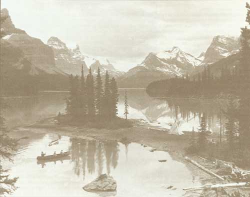
The Narrows, Maligne Lake, Jasper National Park, circa 1929
Early History of the Region
The park area has an interesting history, for the valleys of its rivers, the Athabasca, Whirlpool and Miette, formed the routes of the early explorers, furtraders and missionaries travelling over the Athabasca Trail between Fort Edmonton and the Pacific coast. One of the earliest to visit the area was David Thompson who, during the winter of 1810-11, crossed the Athabasca Pass at the head of the Whirlpool River. Following the amalgamation of the North West Company and the Hudson's Bay Company in 1821, Jasper House was relocated on the western shore of Jasper Lake, 22.5 km south of its original site.
Prior to its abandonment about 1884, it provided temporary shelter to many early but notable travellers including the survivors of John Jacob Astor's ill-fated trading post Astoria at the mouth of the Columbia River, after its take-over by the North West Company in 1814. Jasper House also was host to Sir George Simpson, Governor of the Hudson's Bay Company in 1824; David Douglas, the famous botanist, in 1827; Father Pierre de Smet in 1846; and Dr. James Hector of the Palliser Expedition in 1859. By 1872, when the site was reached by Sandford Fleming and the Reverend George Grant in the course of early railway surveys, the post had deteriorated in importance and was opened briefly twice a year for trade with the Indians.7
Railway Construction
Although established in 1907, Jasper Park had to await the coming of the railway for its early development. Contracts for the construction of the Grand Trunk Pacific line east and west of Snaring River were signed in 1909 and 1910.8 The contractors, Foley, Welch and Stewart, built a wagon road from Wolf Creek, Alberta, to T�te Jaune Cache in British Columbia, along which 50 construction camps were built. Steel was laid to Fitzhugh Station, selected as a divisional point, in August, 1911, and to Yellowhead Pass by the following November. The line into Jasper Park was opened for public traffic in April, 1912, and final connection with Prince Rupert, the terminal, was made in 1914. Following the survey of Jasper Townsite in 1913, the name Fitzhugh disappeared.
Construction of another railway through Yellowhead Pass from Edmonton to Port Mann, B.C., was commenced in 1911 by the Canadian Northern Railway Company. By December, 1913, most of the track had been laid to Lucerne, west of the pass.9 The British Columbia section was completed in June, 1915, but delay in the construction of a number of bridges and trestles east of the park boundary postponed the opening of the line through the park until October, 1915. The rights-of way of the two railways through the park ran for kilometres almost side by side, and in the narrow valley of the Miette River east of Yellowhead Pass were only metres apart. In 1916, a consolidation of the lines from Edmonton west was commenced and the rails from discarded sections were shipped to Europe in 1917 to meet war-time needs. In 1923, the two railways, which had been taken over by the federal Government, were merged as the Canadian National Railways, and the former Canadian Northern divisional point at Lucerne was moved to Jasper.
Townsite Surveyed
The administration of Jasper Park was commenced following an inspection made in 1909 by R.H. Campbell, Superintendent of Forestry at Ottawa, and Howard Douglas, the Commissioner of Parks at Edmonton. An acting superintendent, J.W. McLaggan, was appointed in December, and in 1910 two game guardians were engaged for fire and game patrols. McLaggan established his headquarters in a log building at Fitzhugh and authorized temporary developments for the convenience of the public including sleeping, restaurant and stable accommodation. In 1913 a survey of Jasper Townsite was made by H. Matheson, D.L.S., and the first permanent Park Superintendent, Colonel S.M. Rogers, was appointed. The present administration building and a number of maintenance buildings were built in 1913 and in 1914 applications for lots in the new townsite were accepted. Development outside the townsite was limited to trail and secondary road construction which provided access to Pyramid Lake and Maligne Canyon by carriage from Jasper and to Miette Hot Springs by saddle-horse from the railway at Pocahontas.
Park Boundaries Altered
Beyond the immediate vicinity of the railway line, development was inhibited by a drastic reduction in the area of the park in 1911. This action followed the repeal of former park legislation and the passing of the Dominion Forest Reserves and Parks Act. The new park boundaries, as defined by order in council under the act, located the park within two theoretical lines drawn parallel to and 16 km distant from each side of the Grand Trunk Pacific Railway, resulting in an area of approximately 2,590 km2.10 Withdrawn from the park were Medicine and Maligne Lakes, Mount Edith Cavell and the spectacular alpine region drained by the upper Athabasca and Sunwapta Rivers. Strong protests were made to the Government by senior officers of the Grand Trunk Pacific and Canadian Northern Railways, the president of the Alpine Club of Canada, and other organizations. As the new Commissioner, J.B. Harkin, observed in a memorandum to his Deputy Minister "the park is so narrow that it is only a joke so far as utility for game protection is concerned".11 By 1914, the Minister of the Interior had been convinced that the park area should be increased. Action was taken that year to extend its boundaries to include 11,396 km2, incorporating much of its original dimensions.12
Further adjustments in the park boundaries followed. In 1927, an area of 2,538 km2 south of Sunwapta Pass containing a portion of the Columbia Icefield and some of the highest mountains in the Canadian Rockies was incorporated in the park. This addition brought vigorous opposition from outfitters and packers in Banff who had guided parties there for many years. The Premier of Alberta also protested the addition in view of negotiations under way providing for the transfer to the province of its natural resources. A compromise eventually was reached, following the appointment of the Boundary Commission already mentioned and acceptance of its recommendations. In February, 1929, the disputed area was incorporated in Rocky Mountains Park. Concurrently, areas along its northern and eastern boundaries were added to Jasper Park.13 Final adjustments made in 1930 with the passing of the National Parks Act resulted in a park area of 10,878 km2.
Highway Development
In the early period of its development, Jasper Park was dependent entirely on its railway for transportation from outside points. The construction of motor roads in the parks was accelerated after the end of World War I and scenic roads to Maligne Canyon, Mount Edith Cavell and a few of the nearby lakes were in use by 1924. A road to the eastern boundary of the park, destined to form a link in the future Jasper-Edmonton Highway, was commenced in 1923. Built on sections of abandoned railway grade, it was completed in 1928, but motorists had to wait until 1931 for the province to complete its section before travel to Edmonton was possible. The opening of the Banff-Jasper Highway in 1940 brought the first wave of motorists from the south, although travel later was restricted by wartime gasoline rationing. Improvements to main park highways during the period between 1948 and 1954 were followed by extensive relocation and reconstruction inaugurated under a major trunk highway improvement program in 1955. By 1967, the highway east of Jasper leading to Edmonton had been reconstructed and hard-surfaced to the park boundary. The following year, the Jasper section of the Banff-Jasper Highway, including a major relocation south of Whistlers Creek, was rebuilt and paved. A new highway up the Miette River Valley to Yellowhead Pass and British Columbia was opened to motor travel in 1968, providing a direct connection with the Fraser River Valley and Vancouver. Maligne Lake was linked by road with the Townsite of Jasper in 1962, and much of the grade was paved by 1970.

Tonquin Valley, The Ramparts, Jasper National Park
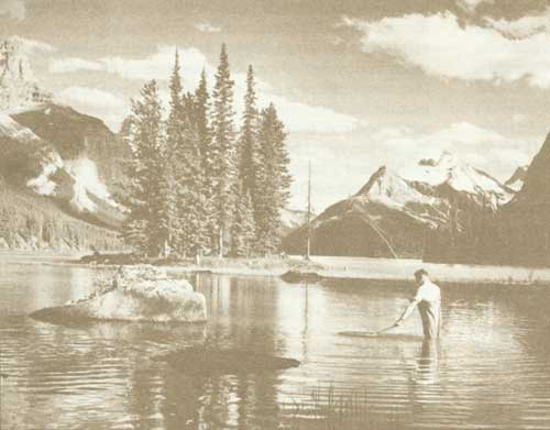
Maligne Lake, Jasper National Park

The making of a C.N.R. publicity film by W.J. Oliver. Maligne Lake, Jasper National Park, 1927
Visitor Accommodation
For years after its establishment, Jasper National Park had little visitor accommodation. During the railway construction era, the Grand Trunk Pacific Railway Company had grandiose plans for hotel development — one in the vicinity of Jasper Townsite and another at the mouth of Fiddle River, which would have had as a nearby attraction the Miette Hot Springs 13 km upstream. The company had applied in 1909 for the right to control and develop the springs, but this bid was firmly rejected. In 1911, the company selected and surveyed a 20-ha site at Fiddle River for its proposed Chateau Miette, plans of which depicted a luxurious and ornate edifice.14 The Commissioner of Parks indicated his interest in the proposed development by requesting his chief superintendent at Edmonton to investigate the possibility of having the springs connected by monorail with the railway line near the hotel site. Photographs and plans of a prototype in use near Calgary were obtained, but the project did not materialize. Financial difficulties experienced by the railway company prevented the release of funds for hotel construction, although a lease of the site had been prepared. The Fiddle River hotel project was finally written off when the company's railway line on the eastern side of the Athabasca River was abandoned in 1916.
The first "tourist" accommodation near Jasper Townsite was provided in 1915 by Robert Kenneth, president of the Edmonton Tent and Mattress Company, who leased a small area on Lac Beauvert for a tent camp. Aided by publicity from the Grand Trunk Railway, the "tent city" achieved instant success. In 1919, it was taken over by Jack Brewster. By 1922, the re-organized Canadian National Railway Company was in a position to undertake the development of a hotel in the park and that year it acquired Brewster's leasehold on Lac Beauvert.15 The railway company built a number of multiple suite cabins in 1922 which formed the nucleus of the present Jasper Park Lodge. In the year following, development was continued and, by 1929, the main lodge and satellite buildings had accommodation for more than 600 guests. The amenities included an 18-hole golf course which had acquired an international reputation. The original main building was destroyed by fire in 1952 but it was replaced the following year by a magnificent structure at a cost of two million dollars.
Early hotel development in Jasper Townsite began in 1921 and over the years resulted in the construction of a number of well-appointed hotels, motels and motor inns. Bungalow camp construction both in Jasper and along park highways later swelled the accommodation available to park visitors. Like other national parks in the Rockies, Jasper experienced an ever-increasing demand for public campgrounds. The first major campground was developed at Cottonwood Creek east of Jasper and opened in 1927. Additional campsites were made available at Patricia Lake in 1933 and at Miette Hot Springs in 1934. A phenomenal increase in motor travel in the 1950's led to the development of a chain of campgrounds along the main park highways which now serve thousands of visitors.
Recreational Features
For more than half a century Jasper National Park has offered visitors a wide choice of outdoor recreation. The operation of horse liveries was a major business in early years and saddle-ponies are still a familiar sight on park trails. Sport fishing in park waters has attracted thousands of anglers and the opening of the Medicine-Maligne Lakes system in 1932 attracted widespread interest. The waters of Miette Hot Springs, known to Indians, miners and others long before the creation of the park, were made more attractive to visitors in 1937 by the construction of a modern bathing establishment in the narrow valley of Sulphur Creek, a tributary of Fiddle River. A motor road from Jasper to the springs was built in 1933 and widened and improved in 1960.
Year-round public use of the park was encouraged by the development of winter sports. Early skating and curling activity was supplemented by skiing which began in the 1920's. Downhill runs were cleared on Whistlers Mountain south of Jasper Townsite in 1937. The initial development was undertaken by a local club which installed lifts and erected a club-house. In 1949, Marmot Basin, a few kilometres to the south, began to attract skiers who were transported to the ski slopes from the park highway by snowmobile. Active development of the area began in 1964. The area is now served by two modern chairlifts, a day lodge and a large parking area, all accessible by a motor road completed in 1970.
The Palisades Ranch
An interesting link in the park's early history is the Palisades Ranch, 9.6 km north of Jasper on the highway leading to Edmonton. When the park was established, several squatters occupied lands and all but one withdrew after receiving compensation. Lewis Swift, the park's first settler, who had occupied a quarter section of land since 1895, declined to vacate and in 1911 was granted title to his homestead. "Swift's place", before the coming of the railways, was a landmark for travellers who were always sure of hospitality, a helping hand or, in times of need, a share of its limited stores. Swift had cleared land for agricultural purposes, built a small grist-mill driven by water power, and carved his furniture from the surrounding forest. An offer of $6,000 from the Department for his title was declined in 1926, but eventually Swift found the operation of his homestead beyond his physical capacity and in 1935 indicated his willingness to accept the Department's offer. Unfortunately, the Minister of the Interior took the position that the purchase might be postponed and Swift promptly sold out to a new arrival from England, A.C. Wilby.
During the new few years Wilby spent over $100,000 in developing a "dude ranch" incorporating a number of attractive buildings. Operations were cut short in 1947 when Wilby died. The administrators of his estate offered the ranch to the Government for less than Wilby's investment, but funds were not available. Later the ranch was acquired by a Jasper contractor, G.F. Bried, who made heavy expenditures in converting most of the buildings to tourist accommodation. Bried also built a bungalow cabin development on the park highway. Land requirements for the reconstruction of the Jasper-Edmonton Highway and the threat of subdivision of the ranch by the owner led to an appraisal of the entire freehold.
Subsequent negotiations resulted in the purchase of the historic ranch for more than a quarter of a million dollars. The ranch is now used mainly as a training centre for park personnel. Although most of the original buildings have been replaced, evidences of earlier occupation remain in the form of Swift's water-wheel, some of his irrigation sluices, and Wilby's grave.
Within the vast expanse of 10,878 km2 which comprises Jasper National Park are areas which even today are relatively unexplored. Motor roads traverse or skirt many of the outstanding scenic attractions — ice-fields, glaciers, and clear, unpolluted lakes. Saddle-pony trails lead to the hinterland — the back country which few but the park wardens and the native wildlife have invaded. Park zoning will protect these wilderness areas from development in years to come and succeeding generations will be able to enjoy the primitive, beautiful mountain-land as the earliest explorer found it more than a century and a half ago.
Endnotes
1. G.R. Stevens, Canadian National Railways (Toronto: Clarke, Irwin and Co. Ltd., 1960), p. 120.
2. Statutes of Canada, 3 Edward VII, chap. 71 .
3. Stevens, pp. 176-178. See above, note 1.
4. Order in Council P.C. 1907-1323, Sept. 14, 1907.
5. F.W. Howay, New Westminster, B.C. (Historic Sites and Monuments Board of Canada), letter to Commissioner of National Parks, File H.S. 10-20, Aug. 16, 1926.
6. F.W. Howay, "Early Records of Travel in Jasper Park", unpublished manuscript, April 19, 1926, National Parks Branch File H.S. 10-20.
7. G.M. Grant, Ocean to Ocean (London: Sampson, Low, Marston and Searle, 1873).
8. Stevens, p. 191. See above, note 1.
9. Ibid., p. 95.
10. Order in Council P.C. 1911-1338, June 8, 1911.
11. National Parks Branch File J. 2-1, May 2, 1912.
12. Order in Council P.C. 1914-1165, June 14, 1914.
13. Orders in Council 1929-158 and -159, Feb. 2, 1929.
14. National Parks Branch File J. 17, G.T.P. 8.
15. National Parks Branch File J. 16-29.
Mount Revelstoke National Park
The establishment of Mount Revelstoke National Park in 1914 added an unusual unit to Canada's National Parks system. The reservation of this mountain-top area on the western slope of the Selkirk Mountains, much of it at an elevation of more than 1.6 km above sea level, made available for public use and enjoyment a rolling alpine plateau supporting scattered groves of balsam and spruce and carpeted in early summer by a vast profusion of mountain wild flowers. The park incorporated the Clachnacudainn Range and snow-field which form the source of several turbulent streams. From the summit of Mount Revelstoke — now accessible by motor road — are remarkable views of the valleys of the Illecillewaet and Columbia Rivers and the peaks of the adjoining mountain ranges to the north, east, south and west. As Arthur Wheeler observed in his description of the area, "Here Revelstoke found its park already laid out by nature without the intervention of any human landscape gardener".1
Early Park Visitors
Among the first to explore the mountain top area were C.R. MacDonald and J.J. Devine of Revelstoke who reached Balsam Lake in August, 1902.2 Four years later in August, 1906, Dan Mcintosh, William Mitchell and A.E. Miller climbed the slopes of the mountain through heavy timber and underbrush to the shore of Balsam Lake where a tent was pitched. During the next week the party explored the spectacular plateau, discovering the small alpine lakes that lie across a valley from the summit. Descriptions of the area, together with photographs taken by the group, led to the formation of a local mountaineering club in 1910. Members of this organization sponsored the erection of a small shelter at Balsam Lake which was built by voluntary labour. The club also induced the Corporation of the City of Revelstoke to construct a walking trail from the city limits to the summit of the mountain. This was completed in 1910 and given the name of the presiding mayor, C.F. Lindmark. Later the trail was extended to Eva and Miller Lakes, named after two members of the club, Eva Hobbs and A.E. Miller.3
Completion of the trail to the summit of the mountain — known locally as Victoria Park — attracted a large number of enthusiastic visitors. Representations made by citizens of Revelstoke to the Government of British Columbia through C.B. Hume, a prominent merchant, resulted in financial assistance towards the construction of a road up the mountain. The Minister of Public Works, the Honourable Thomas Taylor, arranged for a location survey and a grant of $10,000 towards the cost. By the end of 1912 a little more than six kilometres of "wagon road" had been completed.4
Park is Established
In August, 1912, J.H. Hamilton, president of the recently formed "Progress Club" in Revelstoke, solicited the assistance of the local Member of Parliament, R.F. Green, in having the area surrounding the top of the mountain established as a dominion park. In turn, Mr. Green referred the request to the Minister of the Interior, the Honourable Robert Rogers.5 A formal inspection of the area was undertaken in September, 1913, by the Chief Superintendent of Western Parks, P.C. Bernard-Harvey, who reported on the developments which had undertaken, and commented favourably on the natural attractions. A final push in the move for the establishment of a park was given by Mr. Green, Member for Kootenay, who, on September 25, 1913, advised the Honourable Dr. Roche, now Minister of the Interior, that the provincial Government would withhold further expenditures on the road up the mountain until the future status of the area had been dealt with by the federal Government.6 Favourable action was finally taken in April 28, 1914, when an area of 246 km2 was established as the Revelstoke National Park.7 The enacting order in council called attention to the natural beauty of the area which included "glaciers, mountain peaks and waterfalls which attract large numbers of tourists and make it adapted for the purposes of a scenic park". In 1915, the area was proclaimed the Mount Revelstoke National Park.
Road to Summit
Completion of the road to the summit of Mount Revelstoke was the first major project undertaken by the Parks Service. Work was commenced in July, 1914, but the intervention of World War I and limited park appropriations postponed its completion for some years. By 1922, construction had reached the 22.5-km post and the road to that point, which provided spectacular views along the route, was opened to the public. Finally, in June, 1927, construction had been completed over a distance of 29 km to Balsam Lake, and a formal opening ceremony was held on August 1, with H.R.H. the Prince of Wales as guest of honour.8 During 1928 and 1929 an extension of the road was made to the most accessible part of the summit where a turning circle was constructed. In the years following, improvements to the road were made and original crib work was replaced by stone walls at strategic points.
During the construction period, prominent visitors to Revelstoke were occasionally entertained by a drive up the mountain over completed sections of the road and some of these events were commemorated by the installation of special markers in the form of posts. The first of these was planted by His Excellency the Governor General, the Duke of Connaught, on July 28, 1916. In 1918, a post was erected by his son, Prince Arthur of Connaught, and in 1919 His Royal Highness the Prince of Wales dedicated a memorial erected at a switch-back overlooking the Illecillewaet River Valley. In 1930, the posts marking the sites of these ceremonies were replaced by permanent cut-stone markers bearing suitable inscriptions.
Boundaries are Extended
As originally constituted, the park contained 246 km2, but unfortunately the area did not include the first few kilometres of the park road on which construction had been commenced with provincial funds. In 1916, the Revelstoke Board of Trade informed the Agent of Dominion Lands that it favoured an addition to the park that would include land south of the park and also give the Park Service control over the entire length of the road. An extension of 13 km2 adjoining the southerly boundary was added to the park in 1920,9 and in 1927 an additional 97 ha enclosing portions of the eastern end of the park road were proclaimed as park lands.10
In 1948, four additional parcels, on which the road allowance encroached east of its junction with the provincial highway along the Columbia River, were purchased, thus placing the original road for the first time entirely within park boundaries.
Difficulties experienced in 1951 in obtaining a suitable site for a building which would combine the functions of a park entrance and a wardens' quarters led to a proposal that a new entrance to the park from the City of Revelstoke be explored. The matter was discussed by the Park Superintendent with the Mayor of Revelstoke, and the City Council not only gave enthusiastic support to the idea, but agreed to deed to the Crown lands adjoining the park that would be required for the right-of-way. Between 1952 and 1958, the Corporation of the City of Revelstoke donated to the Crown, for park purposes, about 81 ha of land including a portion of a surveyed extension to the city. These extensions increased the area of the park to approximately 260 km2. Work on the new approach road from the head of Pearson Avenue was commenced in 1954 and completed in 1956. The new road also permitted construction of a new access road to the foot of the ski hill and the development of a parking lot.
Trans-Canada Highway
Policy decisions which led to the construction of portions of the Trans-Canada Highway through Mount Revelstoke National Park influenced additional development of the park. In 1957, Revelstoke was selected as the headquarters for Glacier and Mount Revelstoke National Parks and a resident superintendent was appointed. The task of clearing the right-of-way for the highway within the park was completed in 1958, and in 1959 a concrete overpass was built across the section of the park highway from Revelstoke which had been completed in 1956. Construction of the Trans-Canada Highway through the park was carried on throughout 1959 and completed, with an asphalt surface, in 1960. A final asphalt lift was applied to the highway in 1969.
Mountain Road Rebuilt
In anticipation of a large increase in the number of visitors to Mount Revelstoke Park following completion of the Trans-Canada Highway, reconstruction of the road leading to the summit was commenced by park forces in 1960. Progress was limited by modest appropriations and the short season in which work could be carried on. By 1963, reconstruction of about 11 km had been accomplished and, in order to expedite the work, arrangements were made to have the balance of the road built by contract under supervision of the Department of Public Works. The inauguration of a crash program required closing of the road to the public during 1965 and 1966 and the temporary closing of normal visitor amenities. Complementing plans for completion of the road was the decision to develop a day-use area at the summit and concentrate camping activity at Balsam Lake about two kilometres below the end of the existing road.
Construction under contract was commenced in July, 1965, and continued during the portion of the year that work was practical, having regard for the exceptional snowfall experienced in winter. At the close of operations in November, 1965, rough grading had been completed to mile 12 (19.3 km). In December, 1966, grading had been carried to Balsam Lake and by July, 1967, an all-weather gravel road to that point was completed. In keeping with decisions reached after detailed studies had been made, the new highway terminated at Balsam Lake where modern parking facilities were installed in 1969. As funds are provided, paving of the 26-km route will be undertaken.
The reconstruction of the highway to the summit of Mount Revelstoke provided an opportunity for an improved approach from the City of Revelstoke. This was developed in 1963, from an interchange at the southwestern boundary. The new construction permitted the closing of the road from Pearson Avenue, and eliminated the use of a level crossing over the main line of the Canadian Pacific Railway.
Park Development
The earliest government building in the park was a warden patrol cabin at Balsam Lake erected in 1919.11 A lookout tower was built in 1927 above the end of the motor road by the Forestry Branch of the Department of the Interior. The Park Service took over the building and its operation in 1930. A patrol cabin was constructed at Eva Lake in 1928, a storage and equipment building at mile one (1.6 km) of the park highway in 1927, and a patrol cabin at Silver Creek in 1949. New staff quarters for the park superintendent and senior staff members were constructed in the park in 1961. A work compound, including equipment garage and maintenance buildings, was developed in 1962, and a new gateway building on the Trans-Canada Highway was completed during the same year. The superintendent and staff have occupied administrative headquarters in the City of Revelstoke since 1957.
The only visitor accommodation to be operated in the park was Heather Lodge, which was constructed by a resident of Revelstoke in 1940 at the summit of the mountain. Operation of the building, which offered overnight and dining accommodation, was taken over in 1949 by a former R.A.F. officer who purchased the leasehold in 1951. The distance of the lodge from the main avenues of travel and a very limited overnight business made profitable operation difficult.
In 1953, the National Parks Service constructed three alpine type chalets which were leased to the concessionnaire of the lodge, together with a service building constructed on the shore of a small nearby lake for the provision of power and water services. The decision in 1963 to close the road to the public for the following two years made operation of the lodge impractical, and after negotiation the owner accepted an offer from the Crown for his interest in the building and site. The main building was demolished and the cabins and service building were removed from the area in 1967. The decision to develop the summit of the mountain as a day-use area precluded the replacement of the accommodation formerly supplied by the lodge.
Visitor Accommodation
The opening of the Mount Revelstoke road in 1927 resulted in a demand for camping amenities. A small campground was developed on the shore of Balsam Lake in 1928 and a kitchen shelter erected.12 Improvements to the campground were made in 1948, when three new shelters were built. These additions were augmented by the erection of two kitchen shelters at the summit of the mountain, north of the lookout. Additional development was undertaken at Balsam Lake in 1961 when two new shelters were built to replace older structures being phased out. An additional shelter was added to the summit campground in 1961. The 1963 season, however, was to be the last one for overnight camping as reconstruction of the mountain highway necessitated its closing to visitors. On the reopening of the road in 1967, a plan for redevelopment of the former campgrounds at Balsam Lake and on the summit was initiated. On its completion, facilities for overnight camping will be missing, but picnic areas with suitable amenities, together with hiking and nature trails, will help visitors enjoy the many natural attractions and features of the park.
Winter Sports Development
For more than half a century Revelstoke has been famous as a ski centre. Skiing in the vicinity was enjoyed as early as 1891 but not until 1915 was the Revelstoke Ski Club organized. Club members constructed a jump on the lower slopes of Mount Revelstoke and annual tournaments attracted many competitors. The club's improvements had been made on leased land which was absorbed when the boundaries of Mount Revelstoke National Park were extended in 1920. From that year on, the club received assistance from the National Parks Service in improving the jump and landing hill. The performance of participants in the club's events later attracted wide attention. In February, 1921, the world's professional record was broken when Henry Hall of Detroit made a jump of 69.8 m on the Mount Revelstoke hill. During the same meet, Nels Nelson of Revelstoke set a new amateur record of 61.26 m.13 New amateur records by local competitors were made in 1931 and 1932 when jumps of 81.9 and 87.5 m were attained.
After World War II, renewed interest in skiing led to reorganization of the club in 1948, and the National Parks Service assisted in reconstructing the ski jump and landing hill that year to Olympic requirements. In 1950, the club organized its annual "Tournament of Champions". The slope of the mountain, below the ski jump, on which a rope tow was operated, was impaired by the construction of the Trans-Canada Highway through the area, and the Revelstoke Ski Club solicited the assistance and co-operation of the Park Service in the consolidation of all facilities in the vicinity of the senior ski jump, known as the Nels Nelson hill. An appraisal survey was carried out in October, 1958, by Franz Baier, a ski expert from the National Parks Engineering Division at Ottawa, and recommendations were made for the improvement of the club's ski jump and the clearing of down-hill runs. In 1961 the Park Service undertook the clearing of an area of 12 ha for ski runs and the right-of-way for a poma-lift installed by the Revelstoke Winter Sports Limited, an incorporated group of local skiers. During 1965 and 1966 the Park Service made further expenditures in improving skiing on the slopes of Mount Revelstoke. Work undertaken included the reconstruction of two ski jumps, construction of a modern ski patrol and toilet building, erection of a steel judges' stand adjoining the senior jump, and the construction of a new parking area near the foot of the ski slopes served by an access road built from the park highway. Late in 1969, the company operating the lifts merged its operations with those of a rival development outside the park. All rights in the vicinity of the park ski slopes were relinquished and the lift equipment was moved to the slopes of Mount Mackenzie to the south.
Endnotes
1. A.O. Wheeler, The Selkirk Mountains (Winnipeg: Stovel Company, 1912), p. 146.
2. Revelstoke Argus, descriptive article, May 24, 1913.
3. National Parks Branch File U.172-23A.
4. Vernon, B.C., News, Nov. 28, 1912, National Parks Branch File M.R. 2.
5. National Parks Branch File M.R. 2., September 10, 1912.
6. Ibid., Sept. 25, 1913.
7. Order in Council P.C. 1914-1125, April 28, 1914.
8. Department of the Interior, "Annual Report", 1928.
9. Order in Council P.C. 1920-985, May 5, 1920.
10. Order in Council P.C. 1927-1645, August 18, 1927.
11. Department of the Interior, "Annual Report", 1920, part II, p. 25.
12. Ibid., 1929, p. 118.
13. Ibid., 1921, part II, p. 41.
Kootenay National Park
The establishment of Kootenay National Park, British Columbia, in 1920, added a colourful and historic mountain region to the chain of national reservations set aside for the use and benefit of Canadians. It also climaxed the efforts of individuals and governments to complete the first motor road across the central Canadian Rockies, linking the Bow River Valley with that of the upper Columbia River. The route of this early parkway, known as the Banff-Windermere Road, had been pioneered years before by illustrious travellers. Sir George Simpson, Governor of the Hudson's Bay Company, had followed the valleys of the Simpson, Vermilion and Kootenay Rivers and Sinclair Creek to the Columbia in 1841 on his trip around the world. During the same year, James Sinclair led a group of 21 families from the Hudson's Bay Company's Red River colony across the Rockies to Fort Vancouver in the Oregon Territory.1 In 1858 Sir James Hector of the Palliser Expedition had crossed Vermilion Pass in the course of an exploratory journey from the Bow River Valley to the Kicking Horse River along the Vermilion, Kootenay and Beaverfoot Rivers. In summarizing his report of the expedition, Captain John Palliser had extolled the Vermilion Pass as "the most favourable and inexpensive to render available for wheeled conveyances".2
Mountain Highway Planned
The Banff-Windermere Road was conceived by Robert Randolph Bruce of Invermere, British Columbia, later Lieutenant-Governor of the Province. A Scottish engineer, Bruce, after coming to Canada, had worked for the Canadian Pacific Railway Company as a construction engineer, and had engaged in developing mines in western Canada. He believed that the construction of a motor road linking Banff in Alberta with the Windermere district in British Columbia would provide a valuable commercial link with the provinces east of the Rockies, and also would form a spectacular tourist route taking in the attractions of Banff, Lake Louise, and the Windermere area. Through his railway associations, Bruce in 1910 enlisted the support of Sir Thomas Shaughnessy, President of the Canadian Pacific Railway, and later interested the Premier of British Columbia, Sir Richard McBride, in his project.
Early Road Construction
Calgary had just been linked with Banff by a passable motor road and future communication lay to the west. Arrangements were subsequently worked out whereby the Canadian Pacific Railway Company and the British Columbia Government would share the cost of construction of that part of the route which lay in British Columbia from Windermere to Vermilion Pass. In turn, the Dominion Government through the federal Department of the Interior would build a section through Banff National Park necessary to provide a connection with the road to Calgary.3 The original estimate of completing the road was $150,000, but this figure soon proved to be unrealistic.4 Construction on the Windermere, or British Columbia, end of the road was commenced in 1911 following surveys carried out by H.J. Haffner and J.W. Wurtele. Following an expenditure of $277,000, of which the Canadian Pacific Railway contributed at least $75,000, work was suspended in 1913. Nineteen kilometres of difficult construction — 11 from the Columbia Valley easterly up Sinclair Creek, and 8 westerly from Vermilion Summit — had been completed when a shortage of funds developed. Meanwhile, the federal Government had proceeded with the construction of a 48-km stretch west of Banff and by November, 1914, a road to the Inter-provincial Boundary at the summit of Vermilion Pass had been completed.5
The outbreak of World War I and an unsatisfactory financial situation prevented serious consideration by British Columbia of completing its end of the road. By 1916, Mr. Bruce had conceived the idea of having the National Parks Branch of the Department of the Interior complete the British Columbia section, subject to the conveyance by the province to Canada of not only the highway right-of-way but of a strip of land bordering the road on either side for the purposes of a national park. Bruce visited Ottawa for interviews with the Minister of the Interior and the Commissioner of National Parks, and made the necessary approaches to the provincial authorities. In May, 1916, the Minister, the Hon. W.J. Roche, notified Premier Bowser of British Columbia that completion of the road would be undertaken by Canada if the proposition was endorsed by the provincial legislature in the form of a bill. Following lengthy negotiations and completion of the necessary legislation, the Banff Windermere Road Agreement was signed on behalf of British Columbia and the federal Government on March 12, 1919.6
Terms of the Agreement
The agreement contained features of great importance to the National Parks administration. It not only provided for the granting of a highway right-of-way and title to all unalienated lands within a belt 16 km wide along the highway, but also recognized the legislative jurisdiction of the federal Government over all national parks in British Columbia. The province agreed that its legislation and regulations applicable to national parks would conform to and correspond with federal Government legislation and regulations for the parks, and that it would not enact any legislation or regulations in conflict with those of "the Dominion". Title to the highway right-of-way and the lands within the encompassing belt was conveyed by British Columbia to Canada in July, 1919. The new park was proclaimed under the authority of an order in council approved on April 21, 1920.7 The choice of the name "Kootenay" for the park, which had been selected not only for the reasons of euphony but also as a tribute to the Kootenay Indians who in earlier days had inhabited the area, was not universally accepted. Randolph Bruce, who had seen his long cherished project completed, preferred the name "Columbia". In a letter to J.B. Harkin, Commissioner of Parks, Bruce set out his objections and incidentally provided a background for his endeavours.
One might say that the calling of this park 'Columbia' might be pandering to our cousins across the line. Well, we want to pander to them all we can. We want their cars and their money and their business, and that is a good deal why this road was started originally. I know it because it was me who started it. I got the C.P.R. interested and the provincial government, away back in 1910. The former put $75,000 into it and the latter about $200,000. Then came evil days in B.C. Our government had no more money. What had been built was falling into decay and I bethought myself of the Dominion Government and in conjunction with your good self, I suggested to Dr. Roche, the then Minister of the Interior, that he should take over the road as then constructed, as an outlet for the national park. At the time you will remember he said the Dominion Government will be willing to pay for necessary right-of way, which we then talked about as extending a mile on either side of the road. From Ottawa I went to Victoria, and asked the Government for five miles free right-of-way on either side of the road, and I got it for you. So I humbly think I am entitled to express my opinion as to what this area should be called.8
Park authorities, however, held to their original choice of name and "Kootenay National Park" it has since remained.
Completion of the Road
Under the agreement, the federal Government undertook to complete, within four years of "the conclusion of peace in the present war", the unfinished sections of the road. The stretch of road up the valley of Sinclair Creek built by the province had been largely washed out by floods in 1914. Reconstruction was commenced in 1920 and carried on through 1921 and 1922. The completed road, now designated the Banff-Windermere Highway, was officially opened at Kootenay Crossing on June 23, 1923.9 During the following tourist season, more than 4,500 automobiles travelled over the new all-weather route between the Columbia River Valley and Banff. In 1947, reconstruction of the highway to modern standards was undertaken and by 1952 the entire route had been rebuilt and paved. Further improvement of the road under the National Parks Trunk Highway Program was commenced in 1956 and was completed in 1967. The latest work, which involved major revisions in the vicinity of Radium Hot Springs, produced a modern hard-surfaced highway affording spectacular views of the mountains, rivers and valleys along its route.
Hot springs which issue from the base of Redstreak Mountain about 1.6 km from its western boundary have been one of the park's outstanding attractions since its establishment. Known as the Radium Hot Springs, they were frequented by Indians, miners and early settlers long before the beginning of the 20th century. Crude pools built of rock and chinked with moss permitted bathing in water having a temperature of up to 45° C. A grant of 65 ha surrounding the springs was obtained from the provincial government in 1890 by Roland Stuart and a partner, H.A. Pearse.10 An Englishman, Stuart, had come to the Windermere District of British Columbia in 1887 to study ranching. In 1893, Stuart bought out his partner after having moved to Victoria. He made no attempt to develop the springs until 1911, when construction of the highway which would eventually pass his property was undertaken by the provincial government. Stuart had analyses made of the spring waters in 1911, 1912 and 1913, which revealed a substantial emanation of radium. A syndicate to develop the springs was organized in England by Stuart, who obtained financial assistance from St. John Harmsworth, who had successfully developed the Perrier waters at Nimes, France. Harmsworth accompanied Stuart to the springs in 1914 and supplied the capital required to construct a concrete bathing pool, a log dressing-room, a small store and a caretaker's cottage. Although Harmsworth's contribution was about $20,000, only $7,000 actually went into development.11 Following the outbreak of World War I, Harmsworth returned to England and later withdrew from the syndicate. Before leaving Canada, Harmsworth had appointed an agent, and the bathing-pool was operated by caretakers from 1914 to 1921. Stuart also left Canada with Harmsworth in September, 1914.
Expropriation by the Crown
Following the establishment of the park in 1920, officers of the Department of the Interior at Ottawa tried to negotiate the purchase of Stuart's property which, in addition to Lot 149 surrounding the springs, included adjacent land containing 184 ha. Although he had offered to sell the springs property in 1909 to the Canadian Pacific Railway Company for $3,000, Stuart ignored cables from his agent in British Columbia which indicated the Department's desire to purchase. In fact, Stuart had been engaged in the promotion in England of a new company, "Kootenay Radium Natural Springs, Limited", from which he received substantial cash and stock benefits.12 In February, 1922, authority was obtained to expropriate the springs and adjoining lands and possession was secured by a court order. Settlement of Stuart's claim for compensation involved a reference to the Exchequer Court of Canada. Hearings were held at Banff, Vancouver and Victoria in 1924, and the judgment handed down in January, 1925, was appealed. In June, 1927, Stuart was awarded additional compensation which altogether amounted to approximately $40,000 together with interest.13
Development at the Springs
After the hot springs were taken over by the National Parks Service in 1922, the original bathing establishment was rehabilitated and operated for the next five years. In 1927, a two-storey bath-house was erected and the original concrete pool was improved and lengthened by nine metres. This building was destroyed by fire in 1948, and was replaced in 1950 by a large modern bathing establishment known as the Aquacourt, at a cost of nearly $1,000,000. The new structure incorporated the original pool, an additional large outdoor pool and commodious dressing-rooms, steam-rooms, management quarters and a refreshment counter. In 1966, the top floor of the building was renovated to accommodate a restaurant and outdoor dining terrace. Additional improvements were made in 1968 when the original or "hot" pool was demolished and replaced by a new pool of asymmetric design.
Permanent administrative quarters were developed in 1922 on a bench above the bathing pool where a small business and residential subdivision known as Radium Hot Springs Townsite was surveyed. Leases were granted to private enterprise for the construction of two small hotels, a garage and service station, and a bungalow camp erected by the Canadian Pacific Railway Company. Additional cabin developments later were erected along the completed highway. Patronage of the pools and plunges, fed by hot water almost free from the smell of hydrogen sulphide prevalent at Banff, induced the provision of additional accommodation at Radium Hot Springs. A steady increase in visitors also necessitated studies to relieve traffic and parking problems. Considerable improvement was effected between 1960 and 1967 when most of the business leaseholds in the vicinity of the Aquacourt were purchased and the buildings removed. The administrative headquarters were relocated on a bench overlooking the Columbia River Valley. The highway through the townsite area was relocated and a large parking area was created by filling in a bend of Sinclair Creek which was diverted through a tunnel.
The creation of Kootenay National Park, traversed throughout its length by a motor highway, influenced an exceptional demand for camping space. In 1923, development of a chain of campgrounds was commenced and, although primitive by today's standard, they provided convenient stopping places for motorists in an age when speed was not considered essential to a satisfactory vacation. Gradually, many of the early campgrounds were replaced by picnic areas, and remaining campgrounds were reconstructed and, in some cases, relocated. The largest of the new installations, the Redstreak Campground near Radium Hot Springs, was opened in 1962 on a bench overlooking the Columbia River Valley and provided a new standard for serviced campgrounds in Canada's national park system.
Kootenay National Park combines many attractions. Its mineral hot springs and well-maintained pools have been available to bathers for more than 50 years and have acquired a world-wide reputation. The Banff-Windermere Highway provides, throughout its length of 105 km, remarkable panoramas of alpine scenery. Its picturesque canyons, its "ochre" springs, and an interesting variety of game animals all have combined to attract visitors in steadily increasing thousands.
Endnotes
1. J.S. Galbraith, The Hudson's Bay Company as an Imperial Factor (Toronto: University of Toronto Press, 1957), p. 211.
2. Palliser Journals, p. 16.
3. Department of the Interior, "Annual Report", 1912, part V, p. 8.
4. B.G. Hamilton, "The Banff-Windermere Highway" Cranbrook Courier, March 14, 1924.
5. Department of the Interior, "Annual Report", 1912-13, part V, p. 12.
6. National Parks Branch File K.2 (Documents).
7. Order in Council P.C. 1920-827, 21 April, 1920.
8. National Parks Branch File K.2, vol. II, 22 June, 1922.
9. Department of the Interior, "Annual Report", 1924, p. 65.
10. British Columbia Land Grant 964/49, May 27, 1890.
11. Case on Appeal to Supreme Court of Canada, The King vs. Stuart et al (1926), 2 D.L.R., p. 260.
12. Ibid.
13. National Parks Branch File K.2, vol. 5.
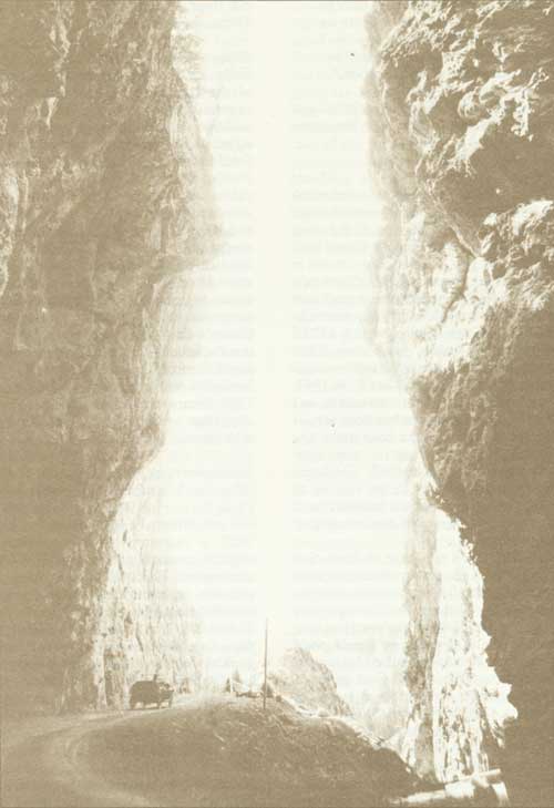
Sinclair Canyon, Kootenay National Park, circa 1923
Wood Buffalo National Park
The establishment in 1922 of Wood Buffalo National Park, located astride the boundary between Alberta and the Northwest Territories, was described as one of the most important and far-sighted conservation measures ever taken by the Government of Canada.1 Bison, or buffalo as they are generally called, had been known to exist in the vicinity of the lower Peace River and Slave River regions since the earliest days of exploration, and later were believed to be the only wild remnant of the millions of buffalo that once inhabited North America. Larger in size, heavier, and darker in colour than the typical plains buffalo, the northern bison were classified in 1897 as a distinctive subspecies, Bison bison athabascae, by S.N. Rhoads.
The earliest record of the existence of buffalo in the Lower Slave River area was left by Samuel Hearne, who crossed Great Slave Lake in the winter of 1771-72 and who found them "plentiful". In his description of the journey which took him to the mouth of the Mackenzie River in 1789, Alexander Mackenzie reported the existence of large herds of buffalo along Slave River. An outline of the range and number of the buffalo in the northern regions of Canada also was provided by observations of members of the Franklin expedition in 1820; by Daniel Harmon in 1808-10; by Sir John Richardson in 1845; and by John Macoun in 1875. Recorded observations after 1840 disclosed a growing scarcity of buffalo in northern Canada and, up to 1870, the disappearance of the species in the outlying districts of their habitat. Estimates of the numbers of buffalo made in 1888, during an investigation into the resources of the Mackenzie Basin instituted by a Senate committee, ranged from small bands to several hundred head.2
Early Protective Measures
The earliest move to extend legal protection to buffalo in northwestern Canada was taken in 1877 when an ordinance (No. 5) for their protection was approved by the Northwest Territories Council. The Northwest Territories at that time included lands now within Alberta, Saskatchewan and Yukon Territory. Unfortunately, the ordinance was repealed during the year following, but in 1890, the Territorial Game Ordinance of 1888 was amended to protect buffalo.3 This protection was confirmed by the Unorganized Territories Game Protection Act of 1894 and successive legislation. Following the creation of the Province of Alberta, the killing of buffalo was prohibited by the Alberta Game Act of 1907.
Although the law for the protection of buffalo was passed in 1890, little enforcement was in evidence for the next few years. In 1897, Inspector A.M. Jarvis of the North West Mounted Police made the first extensive patrol of the region between Edmonton and Fort Resolution on Great Slave Lake. On his return he reported that the inhabitants claimed complete ignorance of the law. In 1899, two hunters were convicted of killing buffalo in the vicinity of Fort Smith, and during the following 13 years the Mounted Police assumed an increasingly active role in their protection. In 1911, the police, known since 1904 as the Royal North West Mounted, were relieved of the special supervision of the buffalo, and their care was entrusted to the Superintendent of Forestry at Ottawa.4 Protective measures which followed included the appointment of resident game guardians or herders. On the enactment of the Northwest Territories Game Act of 1917, its administration, including supervision of the buffalo herds, became the responsibility of the Commissioner of National Parks, Department of the Interior, who had assistance from the Royal North West Mounted Police.
The Act confirmed the protection to which the northern buffalo were entitled, although provision was made for the taking of specimens for scientific and propagation purposes.5
Buffalo Range Investigated
The need for a measure that would ensure absolute sanctuary conditions for the wood bison was recognized years before the necessary action was actually taken. On his return from an inspection trip undertaken in 1907 to ascertain the number and condition of the buffalo, on which he was accompanied by Ernest Thompson Seton and E.A. Preble, Inspector A.M. Jarvis of the Mounted Police had stressed the need for resident guardians. He also pointed out that effective and easy protection of the herds would be possible if the area inhabited by buffalo was at once turned into a national park.6 In his annual report for 1913, the Commissioner of National Parks, J.B. Harkin, observed that a proposal to establish a protected area for the preservation of the herd of wild buffalo in the Fort Smith country was under consideration. On the basis of information supplied by Charles Camsell of the Geological Survey of Canada following an investigation of the wood buffalo range in 1916, Dr. C. Gordon Hewitt, consulting zoologist of the Department of Agriculture, made a strong plea for the creation of a national park, a step that he believed not only would save the wood buffalo from extermination but would also ensure repopulation of the species in adjacent territory.7
Developments which were to influence the economy of the Mackenzie District of the Northwest Territories were triggered by the discovery of oil in commercial quantities on the Mackenzie River about 80 km north of Fort Norman in August, 1920. Anticipating an oil stampede into the district on the opening of navigation in 1921, the Minister of the Interior established the Northwest Territories Branch at Ottawa for the purposes of administering the natural resources of and the transaction of Departmental business relating to the Territories.
Administrative headquarters was established at Fort Smith on July 1, 1921, and sub-offices were opened at Fort Resolution and Fort Norman. During the same year the administration of the Northwest Game Act was transferred to the new branch from the Commissioner of National Parks, together with the responsibility of administering the wood buffalo herds.8
By May, 1922, the Director of the new branch, O.S. Finnie, was able to forecast the creation of a national park which would encompass the ranges of both the northern and southern herds of wood buffalo known to exist. F.H. Kitto, of the National Resources Intelligence Service of the Department, had visited the southern range in 1920 and his report was to influence government action. "As a result of my recommendations, the Government decided to set aside a large tract of country including the whole of the range as a bison reserve. Further exploration was decided on to determine the extent of the boundaries".9
In May, 1922, F.V. Seibert, also of the National Resources Intelligence Service, was assigned to make a reconnaissance of the wood buffalo ranges. He was joined later by Maxwell Graham, officer in charge of wildlife administration for the Northwest Territories Branch. By late autumn, observations made by the two investigators had determined, within reasonable limits, the bison population and the approximate northern and southern ranges of the buffalo. Graham conservatively estimated that the southern range contained 1,000 wood buffalo and the northern range 500.10 Seibert described the limits of the northern range as lying between the Nyarling River on the north and the Little Buffalo River on the south. The southern range was believed to be within an area bounded by the Little Buffalo, Salt, Slave and Jackfish rivers.
Wood Buffalo Park Created
On December 22, 1922, Wood Buffalo National Park, containing an area of 27,195 km2 was created by order in council, under authority of the Dominion Forest Reserves and Parks Act.11 The order in council explained that the new park formed the original habitat of the wood buffalo in the vicinity of Fort Smith and that unless the area was reserved for the preservation of the species great danger existed that the only remaining herd in its native wild state would become extinct. The order in council also stipulated that, for purposes of administration, the new park was being placed under the jurisdiction of the Northwest Territories Branch of the Department of the Interior.
Following the establishment of the park in 1922, the District Agent for Mackenzie District, whose headquarters were at Fort Smith, was also appointed Park Superintendent. The herder or warden service which had existed for some years previously was reorganized and expanded by the appointment of a Chief Park Warden and a staff of five. A warden headquarters later was established at Hay Camp on Slave River about 72 km south of Fort Smith. Gradually, an effective game and forest protection service was developed, warden stations were connected to Fort Smith by telephone, fire detection towers were erected and development of a road system undertaken to link Pine Lake and Hay Camp stations with the Fitzgerald-Fort Smith Road.
In 1925, the transfer of surplus plains buffalo from Buffalo National Park at Wainwright, Alberta, to Wood Buffalo Park was commenced — a move which profoundly affected the character and health of the existing herds of wood buffalo. Between June 1925 and July 1928, a total of 6,673 plains buffalo were shipped north from Wainwright to Waterways by railway. From Waterways, the buffalo were transported by scows down the Athabasca and Slave Rivers to LaButte and adjacent areas on the west bank of the Slave River south and north of Hay Camp, where they were liberated. The plains buffalo rapidly adjusted to their new range, which embraced vast reaches of primordial forest interspersed with grassy plains and meadows. By 1926, some of the buffalo had crossed the Peace River to the south and in order to incorporate their new range Wood Buffalo Park was enlarged in April, 1926, to an area of 44,030 km2.12 The new boundary took in territory north and south of the Peace River east of the Fifth Meridian and north of the 27th Baseline, but excluded Buffalo Lake and a small area in the northwest corner of the original park. In September, 1926, Buffalo Lake and adjacent lands were reinstated in the park by order in council, thereby increasing its area to 44,807 km2.13
Buffalo Policy Criticized
The decision to transfer surplus plains buffalo from Buffalo National Park at Wainwright to Wood Buffalo Park was made at departmental level after lengthy deliberation. The Wainwright herd, developed mainly from buffalo purchased in Montana from 1907 to 1912, had, by March 1923, increased to more than 6,600 head. The condition of the range, which also supported elk, moose and deer numbering at least 1,200 head, had deteriorated to the stage where it could not sustain the increased animal population. Proposals for reduction of the buffalo by slaughter had brought letters of objection from the public and alternative proposals for shipment to northern areas. It was realized that an infusion of plains buffalo into the wood buffalo herds would result in hybridization, but the proposed action was forecast in a press article issued under the authority of the Director of the Northwest Territories and the Yukon Branch, O.S. Finnie.
In this article, published in The Canadian Field Naturalist, reference was made to the opinion expressed by Charles Camsell, following a brief investigation of the wood buffalo range in 1916, that there was no contact between the herds occupying the northern and southern ranges.14 Consequently, it was assumed that any integration would be confined to wood buffalo occupying the southern range and that the northern herd would "remain inviolate so far as admixture with the introduced bison is concerned".
Publication of the article resulted in letters from prominent zoologists and conservation societies protesting the introduction of the plains bison to the wood buffalo range, as it was believed the action would result in deterioration of the northern strain. Another objection raised was the danger that the wood buffalo would be subjected to the risk of tubercular infection. Park authorities had been aware of the existence of bovine tuberculosis in the Wainwright herd since 1919, when several buffalo had been autopsied after slaughter.15 At an early conference on the proposed shipments, tuberculin testing of the buffalo selected had been agreed on, but later it was decided to forego this precaution and the transplanted buffalo, confined mainly to one-year and two-year olds, were sent north without benefit of a tuberculin test. The primary purpose of the experiment was to save the calf crops, which by 1923 were exceeding 1,000 head a year.
The decision to waive the tuberculin test apparently was reached in the belief that only the older buffalo in the Wainwright herd were susceptible to disease and that if the young animals were segregated from the adults there would be little chance of their becoming tubercular. At least one departmental official disagreed with the decision.
In April, 1924, the Supervisor of Wildlife Protection, Hoyes Lloyd, advised the Commissioner of Parks by memorandum that "It is thought to be very bad epidemiology to ship buffalo from a herd known to be diseased and place them in contact with the buffalo at Wood Buffalo Park which are not known to be diseased, so far as I am aware".16
Infectious Diseases
Following the introduction of plains buffalo to the southern range of the wood bison, the combined buffalo populations of the park increased slowly. In 1929, the number was estimated to be 10,000. Scientific investigations of the buffalo range were undertaken from 1932 to 1934 by J. Dewey Soper, of the Department of the Interior at Ottawa, who estimated the buffalo population in 1934 to be 12,000. His studies in the park resulted in a remarkable description of the wood buffalo, its habits, its range in summer and in winter, and the physical characteristics of the park.17 Periodical reductions of the buffalo herd, now hybrid, usually not exceeding 100 a year, had been undertaken from 1930 to 1950. In 1947, W.A. Fuller, mammalogist on the staff of the Canadian Wildlife Service at Fort Smith, discovered tuberculosis in the wood buffalo herd following a slaughter of older animals.18 Observations continued in 1948 and 1949 confirmed earlier findings of the disease. Aerial surveys undertaken in 1949 and 1950 had indicated a buffalo population in the park of from 10,000 to 12,000. In 1950, studies were instituted with a view to establishing a herd management program in which buffalo would be tested for tuberculosis and reactors selectively slaughtered. Another disease, in the form of brucellosis, was discovered in the buffalo herd in 1956.19
The first of a series of management slaughters of buffalo was made in portable abattoirs at Prairie River north of Lake Claire in the winter of 1951-52, when 223 buffalo were killed. This slaughter confirmed a high incidence of tuberculosis. Late in 1952, the abattoir facilities were moved to Hay Camp where annual reductions by slaughter were continued over the following four years. A modern abattoir was built in the Sweetgrass area north of Lake Claire in 1957, and herd reductions were carried on there during the winters of 1957 to 1962. The Sweetgrass abattoir suffered heavy damage from flood conditions on the Peace River in 1958 and 1960, and in 1961 construction of another abattoir was undertaken at Hay Camp. This building was completed in 1962.
In 1962, the buffalo in Wood Buffalo Park were subjected to the threat of a dreaded infectious disease, when anthrax broke out among buffalo near Hook Lake in the Northwest Territories northeast of the park. This outbreak was discovered close to the site of a camp operated by an outfitter to accommodate hunters engaged in sport buffalo hunting which had been authorized in 1959. Additional outbreaks of the disease in 1963 and 1964 at points farther south infected animals within the park and vigorous steps to control and eliminate the disease were undertaken under the direction of officers of the Canadian Wildlife Service. A management program to control tuberculosis and other diseases by testing, innoculation or vaccination has since been carried on. In 1965, 24 head from the "northern" herd of Wood Buffalo Park were captured, tested for disease, and transferred to Elk Island National Park in Alberta where they were installed in an isolated area separate from the main herd of plains buffalo. This subsidiary herd of wood bison has had a satisfactory reproduction, and it is hoped the herd being built up will perpetuate the unique subspecies which, in its original habitat, had suffered from well-intended but disastrous game management policies undertaken earlier in the century.
Whooping Crane Located
A more encouraging event in the park's history was the discovery in 1954 of the nesting grounds of the whooping crane between the headwaters of the Nyarling, Sass and Klewi Rivers.
The tallest and one of the most imposing of all North American birds, the whooping crane had declined in number to less than 100 in the 1920's and by the early 1940's it appeared to be headed for extinction. The gradual disappearance of the whooping crane in central North America followed the destruction of its habitat, as farming, cattle grazing, settlement and hunting encroached on former nesting ranges. From 1922 until 1954 not a single active nest had been found in settled regions. In 1937, the United States Government established a national wildlife refuge at Aransas, Texas, to preserve a remnant of habitat suitable for whooping cranes. During forest fire suppression operations in 1954, the Superintendent of Forestry at Fort Smith, G.M. Wilson, observed from a helicopter two adult white birds and a young bird in an area south of Great Slave Lake. The birds were identified as whooping cranes the following day by Dr. W.A. Fuller. The nesting grounds were definitely established after very difficult ground search in 1955.20
In June, 1967, co-operative action was taken by scientists of the Canadian Wildlife Service and United States Fish and Wildlife Service to perpetuate the species. Eggs taken from a nest in Wood Buffalo Park were flown to a special reservation at Patuxent, Maryland, for artificial incubation. From six eggs hatched, four young birds survived. Additional eggs were flown from the park to the research station in Maryland in 1968-69 and twelve chicks survived the hatchings. In August, 1970, the whooping crane population in North America was estimated to be 76, of which 56 were observed during the northern migration period that year.
For more than 40 years following its establishment, the park had been administered as a buffalo range and as a hunting and trapping ground for Indians with hereditary rights. The inception of the Canol Project in the lower Mackenzie River Valley had an impact on Fort Smith, which developed into a zone headquarters for the transfer of supplies and personnel. In 1943, a winter road for military use was bulldozed across the northern section of Wood Buffalo Park to connect Fort Smith with the settlement of Hay River.
Resource Exploitation
Forestry inventory studies undertaken in western Canada by the federal Forestry Branch were extended in 1949 to Wood Buffalo Park and, by 1950, it had been established that exceptional stands of white spruce existed in the valleys of the lower Peace and the Athabasca Rivers. In 1951, the Northern Administration Branch, which then controlled the administration of the park, authorized the first major harvesting of mature and over-mature timber along the Peace River. The permit was issued to Eldorado Mining and Refining Limited to cut timber for operations outside the park. Prior to 1955, three large areas of timber-lands, designated the Peace Delta, Big Island, and Athabasca Blocks, had been selected for forest management — or in simple terms, logging. During 1955 and 1956, four timber berths in the Peace Delta and Big Island blocks were disposed of by public competition and, in 1962, a fifth berth on the Athabasca River was granted. Of the original operators of these berths only one, Swanson Lumber Company, managed to conduct a successful economic operation. This company gradually acquired all cutting rights and, by 1970, operated three mills on the Peace River. These included the Sweetgrass mill located about 16 km upstream from the Athabasca, one near Garden River 13 km east of the park's west boundary, and a third mill just west of the boundary. Company townsites were developed at these mill-sites, complete with schools and churches. At the Sweetgrass and Garden River mills, airstrips also were constructed. The mills provided employment for about 100 Indians or Metis. Special concessions made by the Department in the establishment of timber dues or stumpage rates on timber cut helped keep the mills in operation but, conversely, substantially reduced the revenue accruing to the Crown from the forest operations.
Indian Rights
Prior to the establishment of the park, the area for years had been a hunting ground for northern Indians, many of whom resided along Peace River or in the vicinity of Fort Chipewyan on Lake Athabasca and at Fort Smith. Consequently, in accordance with ancient treaty rights, Indians and half-breeds leading the life of an Indian and later their descendants were granted hunting and trapping rights within the park under permit, provided they had hunted and trapped there before the park was established. The hereditary rights of persons other than Indians and half-breeds who had hunted and trapped in the park south of Peace River prior to its establishment also were recognized within that area of the park. Originally, the National Parks Game Regulations, with amendments, were made applicable to the park, but in 1949 distinct game regulations for Wood Buffalo Park were established. The prevailing closed season for buffalo was continued, but provision was made for the issue of special permits authorizing the taking of specimens for scientific or propagation purposes. The principal fur crop taken by trappers in the park was muskrat, and assistance from the park superintendent in maintaining water levels in choice trapping areas was extended over a period of years by the construction and maintenance of dams on Dempsey and Murdock Creeks, north of the Peace River delta.
Road Development
Another development carried on in the park from 1954 to 1966 was a commercial fishery for goldeye on Lake Claire. The fishing industry provided summer employment for native residents of Fort Chipewyan and supplemented income normally derived from trapping.
A major road construction program supplementing earlier development in Wood Buffalo Park was commenced in 1957 and carried on for the next six years. On completion, the expanded road system provided connection between Fort Smith and Pine Lake, Peace Point, Carlson Landing, Rocky Point, Sweetgrass and Hay Camp. The program also included the clearing of the right-of-way of a proposed road from Peace Point to the western boundary of the park. The clearing was completed in 1959 and, although actual road construction was not undertaken, the right-of-way has since been maintained and used by the Swanson Company as a winter road connecting Peace Point with a provincial road leading east from High Level, Alberta, to a point 129 km west of the park boundary.
Mineral development at Pine Point on Great Slave Lake led to the construction in 1963 of a road linking Hay River on the Hay River Highway with Pine Point and Fort Smith. The work involved about 290 km of construction including a 22.5-km access road from the main route to Pine Point. The work was carried on over a period of three years and completed in 1966. The right-of-way traverses the northern portion of Wood Buffalo Park, incorporating part of the route of the military winter road constructed in 1942-43.
Major developments in the park exclusive of roads have been the buffalo management stations at Hay Camp and Sweetgrass, where abattoirs, staff dwellings, corrals, water systems and accessory buildings were constructed. Warden stations located at Hay Camp, Pine Lake, Peace Point, Carlson Landing, Little Buffalo River, Twenty-seventh Base Line, and Jackfish River incorporate dwellings and essential accessory buildings. Patrol cabins and forest fire detection towers also were established at strategic points in the park. In 1958 a summer cottage division was surveyed at Pine Lake and lots later were leased to residents of Fort Smith and other points in the Territories. A campground and recreational area also was developed at the Lake for the use of visitors.
Boundary Changes Proposed
By 1959, the development of natural resources in Wood Buffalo Park had attracted the attention of the Government of Alberta. In July, 1959, the provincial Minister of Lands and Forests wrote the Minister of Northern Affairs and Natural Resources questioning the consistency of a policy which encouraged industry in a national park originally established for the purpose of preserving its buffalo herds. The letter also suggested that if the area of the park within Alberta were returned to the province, steps would be taken to ensure the preservation of the buffalo. In reply, the provincial minister was advised that the harvesting of timber was restricted to mature and over-mature timber and the policy was, in a sense, comparable to sanitation cutting carried on by the staff of the Department in other national parks, although on a wider scale. Assurance also was given that the preservation of the buffalo and the nesting grounds of the whooping crane was an important function of the park. On April 5, 1962, the Legislative Assembly of Alberta passed a resolution calling for the return to the province of the ownership and control of that portion of Wood Buffalo Park lying within the provincial boundaries. Since then, negotiations have been carried on relating to the possibility of altering the park boundaries to delete areas having possibilities for resource development while at the same time assuring the retention of lands sufficient for the adequate protection of the wildlife of the park. The federal Government also has taken the position that if lands within the park were released to the province, alternative areas within the province suitable for national park purposes should be provided in exchange. Although a number of proposals have been advanced and considered, a satisfactory basis of settlement has not yet been reached.
Changes in Park Administration
From 1922 till 1954, the duties of the Park Superintendent were carried on by the District Agent, later termed the Administrator of the Mackenzie District of the Northwest Territories. In 1954, the Chief Park Warden, Evan Essex, was appointed as the first superintendent having exclusive supervision of the park. He was succeeded in 1957 by R.E. Olson, who retired in 1968. Many of the administrative responsibilities of the park superintendent were unavoidably integrated with the administration of the Mackenzie District, and forest protection, engineering stores and accounting services were extended to meet park requirements. By 1964, it became apparent that developments which had occurred within the park including the exploitation of timber resources, the extension of the park road system and expansion of buffalo management facilities, together with negotiations with the Province of Alberta concerning alterations in boundaries, had created problems which could best be resolved by a transfer of the administration of the park to the National Parks Branch. Subsequently, on June 1, 1964, the Minister of Northern Affairs and National Resources, the Honourable Arthur Laing, announced the change in park administration which was made effective on October 1, 1964. The transfer of some essential services, including those relating to forest protection and engineering, was phased over an extended period, but by April 1, 1969, all administrative functions had been assumed by the National Parks Branch.
Although by accepted standards Wood Buffalo remains an anachronism in Canada's system of national parks, steps are being taken to bring its management into conformity with accepted national park policy. The future of the buffalo herds is under study, negotiations are under way with the holders of timber-cutting rights with the objective of transferring operations from the core area of the park, and attention is being given to meeting the recreational needs of park visitors.
The possibility of reaching agreement with the Province of Alberta on park boundaries which will diminish or eliminate natural resource development and assure perpetuation of outstanding wildlife species is also envisioned. Meanwhile, a large wilderness area is being maintained in its original state, except for comparatively small areas of development. If present boundaries are maintained, the park will offer to adventurous visitors unique experiences in the enjoyment of its flora, fauna, geology, and other physical attractions.
Endnotes
1. Francis Harper, letter to the editor, Canadian Field Naturalist, Ottawa, Feb., 1925.
2. "The Great Mackenzie Basin", Reports of the Select Committees of the Senate (Canada) 1887-1888 (Ottawa: King's Printer, 1910).
3. Northwest Territories Game Ordinance (no. 11), 29 Nov., 1890.
4. Department of the Interior, "Annual Report", 1912.
5. Northwest Game Act, 1917, chapter 36, 7-8 George V.
6. North West Mounted Police, "Annual Report", 1907.
7. C. Gordon Hewitt, The Conservation of the Wild Life of Canada (New York: Scribners, 1921).
8. Department of the Interior, "Annual Report", 1922.
9. F.H. Kitto, "Athabasca to the Arctic", Geographical Review vol. 63, 1924.
10. Maxwell Graham, Canada's Wild Buffalo (Ottawa: King's Printer, 1923).
11. Order in Council P.C. 1922-2498, 18 Dec., 1922.
12. Order in Council P.C. 1926-634, 30 April, 1926.
13. Order in Council P.C. 1926-1444, 24 Sept., 1926.
14. Maxwell Graham, "Finding Range for Canada's Buffalo", Canadian Field Naturalist, Dec., 1924.
15. National Parks Branch File Bu. 210-1, March 15, 1940.
16. National Parks Branch File Bu. 232-1, vol. 1, April 22, 1924.
17. J. Dewey Soper, "History, Range and Home Life of the Northern Bison" Ecological Monographs 11; 347-412, Oct. 1941.
18. W.A. Fuller, The Biology and Management of the Bison and Wood Buffalo National Park, 1957.
19. Ibid.
20. Canadian Wildlife Service, "The Whooping Crane" (Ottawa: Queen's Printer, 1969).
Prince Albert National Park
On May 9, 1927, the Honourable Charles Stewart, Minister of the Interior, announced the establishment of Prince Albert National Park. Containing an area of 3,566 km2, it was created "for the purpose of preserving in perpetuity a portion of the primitive forest and lake country of Northern Saskatchewan and to provide for the people of Saskatchewan as well as other parts of the Dominion, a "great recreational area".1 This impressive addition to Canada's National Park system, situated at the gateway to the vast unsettled North, was welcomed by Canadians. To the citizens of the City of Prince Albert the evolution of the park was particularly gratifying, for it was there that its creation had been conceived and promoted.
Animal Park Proposed
In June, 1921, the secretary of the Prince Albert Board of Trade had written the Commissioner of National Parks at Ottawa requesting assistance in the establishment of a buffalo park in a portion of the Pine Forest Reserve, situated southeast of Prince Albert between the north and south branches of the Saskatchewan River.2 At that time, the increase of bison in Buffalo National Park at Wainwright, Alberta, had led the National Parks Service to consider a reduction of the herd. The Commissioner instituted an investigation to determine the suitability of the forest reserve as a buffalo park and, on the basis of reports obtained from several government departments relating to precipitation, pasturage, shelter and other conditions, the proposal was turned down. The request was renewed in February, 1926, by the Saskatoon Board of Trade which stressed the value of a buffalo park as a tourist attraction.3
After further study, in which the existence of three separate government buffalo herds in western Canada was considered, the Saskatoon Board was advised that the Department could not assume any additional expense in the establishment of new buffalo parks.
A more rewarding approach towards the establishment of a national park was made late in April, 1926, when Commissioner Harkin was interviewed in Ottawa by the Honourable T.C. Davis, Minister of Labour and Industry for Saskatchewan, accompanied by his Deputy, T.M. Malloy.4 They proposed the creation of a large scenic and recreational park north of the City of Prince Albert, incorporating the Sturgeon Forest Reserve and surrounding territory. Mr. Davis strengthened his case by interviews with the Minister of the Interior, the Honourable Charles Stewart, and with Prime Minister Mackenzie King, who had recently been elected Member of Parliament for Prince Albert.
National Park Established
Although anxious to extend the national parks system to every province, Commissioner Harkin considered that an assessment of the proposed area should first be made to ensure that any new park would meet national park standards. Financial restrictions precluded an inspection of the proposed area that year, and the Department proposed to withhold action until 1927. Mr. Davis, a former Mayor of Prince Albert, maintained pressure on the Minister of the Interior, with the assistance of a local national park committee headed by H.J. Fraser, Mr. Davis' former law partner and President of the Prince Albert Liberal Association. Mr. Davis reminded the Minister that Prime Minister King had provided encouragement by advising residents of the constituency of the Government's intention to create a national park north of Prince Albert.5 Another factor compelling an urgent decision was proposed federal legislation which would require the establishment of national parks by act of Parliament instead of by order in council. Finally, on the basis of information made available to the Department by several of its branches, the Minister of the Interior recommended the establishment of a park, having an interim area of 3,566 km2. The enacting order in council, which was approved on March 14, 1927, also reserved from disposal a large area of federal public land east of the new park, pending an investigation to determine what portion, if any, was suitable as an extension to the new park.6
As originally established, Prince Albert National Park included all lands within the former Sturgeon Forest Reserve. It also included eight additional townships to the north containing Crean and Kingsmere Lakes and the western half of Waskesiu Lake, together with an extensive area situated east of the Third Meridian and south and west of Montreal Lake. Located north of the limits of settlement, the park embodied a region of rocks, woods and waters, which appeared to have been formed by nature as a special playground for lovers of the great outdoors. As described by M.B. Williams in an early park booklet, "Here thousands of crystal lakes — from tiny rock basins only a few hundred yards across to great bodies of fresh water over 50 miles long — reflect in summer the intense blue of the Canadian sky. Between, tying one to another like crystal threads, run innumerable little rivers and streams, weaving the whole region together into a jewelled network of waters intricate as some pattern of the silversmith's art, and providing continuous waterways for hundreds of miles".7
Early Exploration
Prince Albert National Park lies between the Churchill and Saskatchewan Rivers, historic water highways of the early explorers and traders. The amazing network of lakes and streams must have provided an almost continuous waterway from the North Saskatchewan to the Athabasca country, through Lake Ile-a-la-Crosse, Lac Loche and historic Methye Portage, first crossed by Peter Pond in 1778. At the mouth of the Sturgeon River, which has its source in the park, once stood Sturgeon Fort, believed to have been founded by Pond in 1776. Situated on the North Saskatchewan about six kilometres above the site of Prince Albert, it was abandoned in 1779.
Alexander Henry noted in his journal the ruins of several old trading establishments near the mouth of the Sturgeon River in 1808. The Hudson's Bay Company maintained a trading port on Red Deer (new Waskesiu) Lake from 1886 to 1892. This post, with Charles Garson in charge, was established as an outpost of Montreal Lake to compete with a free trader named Stevenson whose headquarters were located on the south shore of the lake in 1887.8 By 1888, the Company's Red Deer Lake post was considered to be an outpost of Prince Albert, and although it was not a financial success its operation was considered desirable to keep Indian furs from going farther south to Prince Albert where they might be obtained by private traders. On the opening of the West to settlement the disappearance of those early posts was inevitable, and evidence of their former existence has been obliterated by time.
Park Development
Following the establishment of the park in 1927, little time was lost in making its attractions accessible to visitors. An experienced park officer, J.A. Wood of Banff, was appointed superintendent and a park warden service was established. An examination of the park was made personally by the Commissioner of Parks in company of the superintendent. The existing road which had served the forest reserve was little better than a logging trail, and a location survey for an all-weather highway to link the southern boundary with Waskesiu Lake was carried out late in 1927. A site was cleared for a campground, existing trails were improved, and temporary administrative headquarters established. A small subdivision had been surveyed at Waskesiu Beach in 1925 by the federal Forestry Branch, and a few lots had been made available for business and residential purposes under permit. To meet the expected demand for sites for commercial enterprise and for summer cottages the survey of a new townsite was undertaken early in 1928. A location survey for a scenic road along the south shore of Waskesiu Lake to Waskesiu Narrows was made, a residence was erected for the superintendent, and several administrative buildings constructed. Local interest in the park was maintained through the efforts of the Prince Albert National Park Committee. Although development of the new access road was still under way and the townsite had not yet been developed, an official opening of the park was held on August 10 and 11, 1928. The guest of honour was the Prime Minister of Canada, the Honourable W.L. Mackenzie King, who was presented with a summer cottage by his constituents. A program of boating, fishing, and aquatic sports rounded out a two-day celebration and, although prospective visitors had been warned in advance that overnight accommodation was limited to space in the public campground, an attendance of more than 2,500 made the opening an outstanding success.9
By the end of 1928 the new access road through the park had been completed, and lots in the business residential subdivision had been opened for lease. Orderly development of the park and the Townsite of Waskesiu was well under way in 1929 and was continued in the years following. The park superintendent and staff moved from a log cabin to a new administration building in 1920. The following year an electrical generating plant serving government and private buildings was built and in 1932 a summer water system was installed. Projects undertaken between 1932 and 1935 to relieve prevailing unemployment conditions resulted in the completion of numerous works and buildings. Campgrounds were extended, a park museum and a community building were built, a golf course and well-appointed club-house constructed, and a park work camp accommodating 100 men completed. Developments undertaken by private enterprise included construction of stores, summer hotels and bungalow camps, restaurants and a roller-skating rink.
Early recognition was given by the park administration to the unique opportunities available for outdoor recreation. In 1930, a large breakwater was constructed at Waskesiu Beach to provide shelter for swimmers, boat owners and the operators of boat liveries. Later a shore wharf was installed and individual boat stalls provided for rental by the public. The use of park waterways was facilitated by the construction of light railways at portages linking Waskesiu Lake with Kingsmere Lake and the Hanging Heart Lakes. Satellite campgrounds established at suitable locations on several of the large lakes encouraged overnight excursions by water. For the less adventurous, trips up Waskesiu Lake by licensed passenger boats were available.
Park Boundaries Extended
Meanwhile, the future dimensions of the park had been receiving departmental attention. By mid-summer of 1928, the Minister of the Interior had ascertained that the large reservation of some 4,662 km2 set aside for consideration as an extension to the park was more suitable for settlement. Consequently, the reservation was withdrawn by order in council on October 18, 1928.10 Investigation and appraisal of lands within and adjoining the park undertaken by the superintendent resulted in his recommendation that the park be extended to the north and northwest to incorporate a number of large lakes. Of these, Lavallee Lake supported one of the largest colonies of cormorants and white pelicans in northwestern Canada, and Wasaw, Wassegam and Tibiska Lakes contained several varieties of game fish. The addition was authorized by order in council of February 6, 1929, and increased the park's area to 4,841 km2.11
Eight years prior to the establishment of the park, much of its southwestern portion had been devastated by a forest fire. Although regeneration had been satisfactory, park authorities considered that some of this area could be dispensed with. Another section of the park having doubtful potential for future development and use was that located east of the Third Meridian, which surrounded the Montreal Lake Indian Reserve and south end of Montreal Lake. Superintendent Wood's appraisal of the park lands had led him to recommend the withdrawal of the entire area east of the Third Meridian, as much of it had little attraction for the visitor. The Indian Reserve included the shore line of Montreal Lake, the interior of the area was low-lying with extensive muskeg areas, and the expenditure required for game and fire protection services was not offset by any scenic or recreation values. Following consultations with the Indian Affairs Branch and the Province of Saskatchewan, the Minister, the Honourable T.A. Crerar, introduced legislation to amend the park boundaries during the 1941 session of Parliament. The bill, which provided for the withdrawal of lands surrounding the Indian Reserve as well as two small areas along the southern park boundary, met unexpected opposition. Members of the opposition party, led by R.B. Hanson, opposed the deletion of timbered lands. The Member for Lake Centre, John G. Diefenbaker, expressed the opinion that the stand of timber in the eastern part of the park was being sought by certain interests in northern Saskatchewan.12
The Minister assured members that the purpose of the legislation was to eliminate land not suitable for park purposes. Actually, the area in question had never been a part of the former forest reserve. One-third of it had been burned over and the remainder was low-lying muskeg and swamp. After opposition to the bill continued, it was withdrawn from the legislative program.
No further action to withdraw lands from the park was attempted during the war years. After a reconnaissance survey of the disputed area had been undertaken by a departmental forest engineer, the proposed reduction in the park area was accomplished by an amendment to the National Parks Act. It was piloted through the House of Commons in 1947 by the Honourable C.D. Howe after mild opposition from some of the members.13 This action left the park with an area of 3,875 km2.
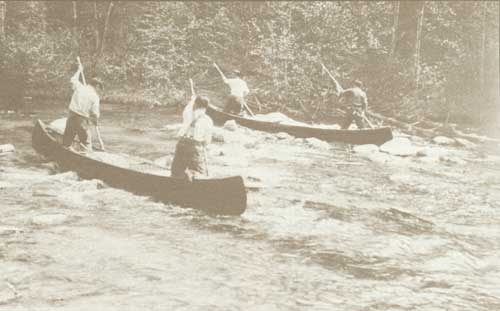
Kingsmere River, Prince Albert National Park
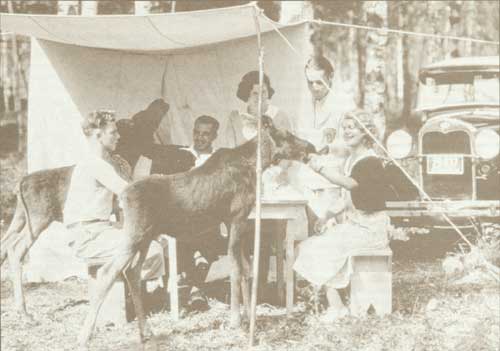
Visitors visited, Prince Albert National Park, circa 1929
Boundary Change Proposed
When the north and west boundaries of the park were reestablished by a legal survey in 1963, the Province of Saskatchewan requested that road allowances along the west boundary of the park be excluded. Such action would have relieved the park administration of building roads to serve provincial lands adjoining the park. Although legislation to effect the proposed withdrawal was prepared in 1970, it was later withdrawn and the surveyed boundary has been retained.
Residential Subdivisions
From the date of its formal opening, Prince Albert National Park received an ever-increasing patronage by the residents of Saskatchewan. They made full use of the campgrounds, waterways and recreational amenities; built summer homes on the sites made available for the purpose; and leased lots in the townsite for the erection of business premises required to provide essential visitor services. The residential area on Prospect Point was augmented in 1938 by the survey of the Lakeview Subdivision in which the construction of low-cost cottages was permitted. This subdivision was extended in 1946 and 1951. The business section of Waskesiu Townsite was expanded by survey in 1933 and 1950. The first bungalow cabin developments in the park were completed in 1932 and 1933 and were supplemented by lodge and hotel accommodation. A park museum constructed in 1933 and a block of tennis courts provided additional attractions for visitors.
Highway Improvement
Access to outstanding points of interest was facilitated by the construction of scenic drives. A road along the south shore of Waskesiu Lake to the first narrows was completed in 1931, and a companion drive along the north shore of the lake to Hanging Heart Lakes was opened in 1937. In 1961, work was initiated on an extension to the Hanging Heart Lakes Road, planned as a link in the Waskesiu Scenic Way, which when completed would encircle Waskesiu Lake. By 1963, 19 km of the new drive had been completed to Kingsmere River before construction was temporarily discontinued. The main park highway, completed in 1928, was improved in subsequent years. The right-of-way, noted for its curves, was substantially relocated prior to its reconstruction during the period 1948 to 1952. The project included the hard surfacing of the entire route.
A new access to park headquarters at Lake Waskesiu was completed in 1968 and hard-surfaced in 1969, with the co-operation of the highways department of the Province of Saskatchewan. For years, the park highway, which formed a link in Provincial Highway No. 2, carried a heavy traffic to points northeast of the park where fishing, lumbering, and mining were carried on.
In 1965, the Government of Saskatchewan announced its intention of building a new highway to serve mineralized areas in the vicinity of Lac la Ronge, which would by-pass the park. Following negotiations between the Director of National Parks and the Deputy Minister of Highways for Saskatchewan, the provincial authorities agreed to relocate the new route closer to the park in order to facilitate access to Waskesiu Townsite. The province also entered into an agreement with the Government of Canada to construct an access road about 11 km in length from the new highway to Waskesiu Townsite, with the federal Government paying all relevant costs. On completion in 1968, the new route shortened the distance from Prince Albert to the park by nine kilometres, diverted heavy traffic from park roads, and substantially reduced the cost of maintaining the original park highway.
Year-Round Administration
For more than thirty years after its establishment, the park was administered from Waskesiu Townsite during the summer months. During the winter, the park superintendent and his staff, exclusive of the warden service, occupied quarters in the City of Prince Albert, where a central garage and a work shop were maintained. Increasing winter use of the park highway and the supervision of winter work programs confirmed the needs for a centralized headquarters. The park engineer was stationed in the park during the winter of 1957-58 and, following the construction of a new central garage and additional staff quarters in 1959, maintenance operations were centralized in the park. The superintendent and his administrative staff continued the semi-annual moves until 1967, when a new administration building was built at Waskesiu. The final change in the park operation was facilitated by the provision, during the preceding years, of adequate staff accommodation.
Over the years, amenities for visitor use were improved. The popularity of boating was recognized by the repair and reconstruction of a large breakwater at Waskesiu Beach which provided shelter for boat liveries and docking facilities. Eventually, the ever-increasing use of watercraft resulted in congestion, which accentuated the need for adequate launching, berthing and control equipment. Following a study undertaken by consultants, the construction of a marina five kilometres northeast of Waskesiu Beach was commenced in winter 1961-1962 and completed in 1964. The marina, sheltered by a large breakwater, incorporated five docking piers, a berthing dock, and loading ramps, together with office and living accommodation for the concessionnaire by whom the marina is operated. Washroom facilities and adequate parking for patrons and visitors are also provided.
Campground Extension
The park's first campground at Waskesiu enjoyed a popularity which necessitated almost continuous expansion. The original site was extended in 1930 by an addition of ten hectares, and during the next four years kitchen shelters, toilet buildings and other amenities were added. Satellite campgrounds developed at Waskesiu Narrows, Sandy Lake and on the shores of some of the larger lakes also were well patronized. Waskesiu Campground witnessed the development of the tent house — better known as the shack tent — a collapsible structure which the owner was required to dismantle and store during the non-camping season. Requests of campers for permission to leave their shack tents on the campground the year round resulted in the allocation in 1951 of a section of the campground for the erection of small cabins mounted on skids, known later as "portable cabins". An increasing use of automobile trailers influenced the development of a large trailer park between 1959 and 1964.
The unrelenting demand for more camping space was met in 1962 by the development of a new campground, the Beaver Glen, on the Heart Lakes road north of Waskesiu Campground. The first section was opened in 1965, and additions have provided space for more than 200 tents, together with service buildings and an outdoor amphitheatre. The area occupied by shack tents originally comprised choicer sections of Waskesiu Campground adjoining the beach. In earlier days when park attendance was lower, the presence of these structures did not seriously affect day-use of the areas adjacent to the lake by casual visitors. However, changing patterns of visitor use and the introduction of more sophisticated types of camping equipment such as the tent trailer brought about over-crowding in tent and trailer camping areas.
This transition in visitor camping practice, together with a plan for the redevelopment of Waskesiu Townsite and vicinity, led to the announcement of a new departmental policy in 1967. Under proposed arrangements, it is hoped to phase out from use the semi-permanent tent-houses, and vacated sections of the campground will be redeveloped for occupation by a more mobile type of equipment. Owners of cabin tents, however, will retain camping privileges so long as their camping permits are renewed annually on a personal basis.
Grey Owl's Activities
Recollections of the history of Prince Albert Park would be incomplete without a reference to Archibald Belaney, known to thousands the world over as "Grey Owl". A native of Hastings in Sussex County, England, Belaney came to Canada in 1905 as a youth, lived the life of an Indian in the Temagami and Biscotasing areas of Ontario, served overseas in World War I, and later trapped for a living in the vicinity of Temiscouata, Quebec. A convert to wildlife preservation about 1929, Belaney wrote numerous articles under his adopted name of Grey Owl about the antics and habits of a pair of wild beaver which he had tamed. Publication of these articles in England and Canada aroused attention and, in 1931, he was induced to enter the employ of the National Parks Service of Canada to promote a wider public interest in conservation practices. He was first located with his beaver on a small lake in Riding Mountain Park where some remarkable motion pictures of his charges were filmed. When it was ascertained, late in the autumn, that the lake would freeze too deeply during the coming winter, the Commissioner of National Parks transferred Grey Owl and his beaver to Ajawaan Lake in Prince Albert Park.
Here he continued his writing, assisted in the production of additional wildlife films, and obtained leave to undertake lecture tours which took him to England and the United States. Following his return in the spring of 1938 from his latest tour, he contracted pneumonia and died in a Prince Albert hospital. He was buried on the shore of his beloved Ajawaan Lake, where his memory is perpetuated by the preservation of one of the cabins in which he lived during his seven-year sojourn in the park, and by the maintenance of his grave which continues to be an object of interest to many park visitors. His pet beavers, Jelly and Rawhide, were released to the wilderness and later investigation disclosed the existence of a substantial beaver population in the area surrounding Ajawaan Lake.
Endnotes
1. Canadian Press release, Toronto Globe, May 9, 1927.
2. National Parks Branch File P.A. 2, June 29, 1921.
3. Ibid., February 10, 1926.
4. Ibid., memorandum, May 1, 1926.
5. Ibid., letter, Nov. 10, 1926.
6. Order in Council P.C. 1927-524, March 24, 1927.
7. M.B. Williams, Prince Albert National Park (Ottawa: King's Printer, 1928).
8. National Parks Branch, Historical notes compiled by Hudson's Bay Company for information of the Superintendent, Prince Albert National Park, March 24, 1969.
9. Department of the Interior, "Annual Report", 1929.
10. Order in Council P.C. 1928-1846, Oct. 28, 1928.
11. Order in Council P.C. 1929-162, Feb. 6, 1929.
12. Canada, House of Commons, Debates, March 31, 1941.
13. Statutes of Canada, II George VI, chap. 66.
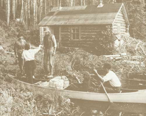
Grey Owl welcoming visitors at his home, Ajawaan Lake, Prince Albert National Park, circa 1929
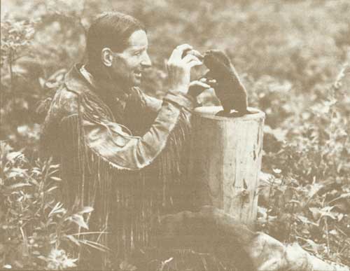
Grey Owl nursing a baby beaver, Riding Mountain National Park, circa 1929
Riding Mountain National Park
The establishment in 1929 of Riding Mountain National Park was a significant event, for it was the last park to be created from unalienated public lands administered by the Government of Canada. The new park also perpetuated public use of a popular recreational area located in a unique part of Manitoba, and its selection as a link in Canada's chain of national parks reflected the expressed wishes of a great many residents of the province.
First Park Proposals
A proposal that a national park be established in eastern Manitoba, south of the Winnipeg River and west of the Ontario boundary, was under consideration as early as 1919.1 The area, drained by the Whiteshell River, constituted a veritable lakeland relatively primitive in character, through which the construction of the Trans-Canada Highway was planned. The proposal, however, lay dormant for several years until a new interest was stimulated in 1927 by Dr. E.D.R. Bissett, Member of Parliament for Springfield. Dr. Bissett solicited support from Premier John Bracken of Manitoba, the Honourable Charles Stewart, Minister of the Interior at Ottawa, and J.B. Harkin, Commissioner of National Parks at Ottawa. By April, 1927, Dr. Bissett had written assurance that the National Parks Service, with departmental approval, was prepared to recommend creation of a park in eastern Manitoba subject to certain conditions.2 These conditions provided for the perpetuation of existing park policy in matters of resource conservation; that the area would be served by the interprovincial highway then under construction; and that the section of the highway in the proposed park would be built by the Province of Manitoba. The proposal later was endorsed by all 19 members of the House of Commons representing Manitoba, and in May, 1927, a decision was made to withdraw from settlement or disposal all vacant lands within the proposed area, containing 2,201 km2. Later, Premier Bracken notified Mr. Stewart that the proposal was acceptable to the provincial government provided mineralized areas having development potential were excluded from the park area. Formal reservation of the land from disposal was made by order in council on April 19, 1928.3
The prospect of a national park in a wilderness area of eastern Manitoba, however, was not universally favoured. By June, 1927, the Honourable Charles Stewart was receiving numerous resolutions from city and town councils and secretaries of rural municipalities in central and western Manitoba, urging the establishment of a national park in Riding Mountain Forest Reserve. Members of Parliament who had endorsed the Whiteshell River site now supported that at Riding Mountain. Among these were J. Allison Glen, member for Russell, and J.T. Thorson, member for Winnipeg, South Centre. In August, 1927, Mr. Thorson advised the minister that he had changed his mind after receiving objections from a number of constituents. Arguments against the Whiteshell area stressed its inaccessibility, lack of central location, and a general absence of big game. Mr. Thorson, later to become President of the Exchequer Court of Canada, also enclosed a communication from a leading citizen of Dauphin, J.A. McFadden, advocating the Riding Mountain Forest Reserve as the most desirable site for Manitoba's national park.4
The forest reserve, established in 1906, previously had been one of the first federal timber reserves set aside in Manitoba.5 It occupied a commanding location in the west-central part of the province, as its eastern escarpment rose sharply above the surrounding plains to a height of 305 m. The reserve contained a number of attractive lakes and supported one of the largest herds of wild elk in Canada.
On the shores of Clear Lake, there already existed a thriving summer community known as Clear Lake Resort in which lots surveyed by the Forestry Branch of the Department of the Interior had been made available by lease. Consequently, the attractions of the Riding Mountain Reserve, in contrast to those of the Whiteshell area, were known to hundreds of summer visitors.
Mr. McFadden, a member of a legal firm in Dauphin, in collaboration with the Mayor, D.D. McDonald, organized a Riding Mountain Park Committee representing many of the municipalities in the province. The committee published a pamphlet describing the attractions of the Riding Mountain area, and through its members mounted an aggressive campaign in support of its cause.
Riding Mountain Favoured
By November, 1927, the volume of correspondence received in the Department of the Interior favouring the western site prompted the Deputy Minister, W.W. Cory, to inform the Commissioner of National Parks that "I am inclined to think that the weight of public opinion in Manitoba supports the creation of a park in the Riding Mountain Forest Reserve rather than in Eastern Manitoba".6 The Winnipeg Tribune on January 20, 1928, favoured the eastern site and recommended its development as a national park. The Tribune suggested that the Riding Mountain Reserve could be kept in mind for a provincial park when the province obtained control of its natural resources. On February 7, 1928, the legislative assembly of Manitoba passed a resolution by a vote of 23 to 10, favouring the western area:
In the opinion of this House, the National Park for Manitoba should be established by the Dominion Government in the vicinity of Riding Mountain, as well as in the eastern part of Manitoba.7
The Honourable Charles Stewart had advised members of Parliament from Manitoba that as far as he could see, there would be only one national park in Manitoba and it was up to the members to place their preference on record. During the course of a tour of western Canada, Mr. Stewart attended a picnic at Clear Lake in Riding Mountain Forest Reserve on August 11, 1928, where, in a public address, he forecast the reservation of land within the reserve for a "Federal National Playground".
I am not going to say that we will call this a National Park, but I do say this — you will have all the facilities of a National Park. We will develop a small golf course for you; we will provide facilities for cottages here and give you sufficient ground for a playground and camping ground, and then your committee will have to get to work again to get a road which will provide facilities for people coming in here every day.8
Whiteshell Area Examined
Meanwhile, an examination of the alternative national park sites by an experienced investigator, R.W. Cautley, D.L.S., had been arranged by the Commissioner of National Parks. Mr. Cautley, who had carried on extensive boundary surveys in the Rocky Mountain parks, visited the Whiteshell area in July, 1928.
From Minaki, Ontario, Cautley travelled with guides by canoe down the Winnipeg River and up the Whiteshell River, passing through the extensive interconnected lake system of the region. The journey involved more than 322 km of travel, and 33 portages, permitting critical assessment of a wilderness area. Later he reported that he did not consider the eastern Manitoba area of sufficiently high standard to be created a national park, as it was "not truly representative of the best river, lake and rock island type of country to be found in Canada". On the basis of this report, the national park reservation made in 1928 later was cancelled.
In reporting on the Riding Mountain site, Mr. Cautley disclosed that he was favourably impressed with Clear Lake and the abundance of big game but considered the balance of the area to be more valuable as a forest reserve. Consequently, he recommended the creation of a summer recreation centre, taking in an area of 282 km2 surrounding Clear Lake.
Copies of Mr. Cautley's reports were made available to Dr. Bissett and to Mr. McFadden, spokesmen for the groups sponsoring alternative park areas. Again the Department was flooded with resolutions from towns and municipalities, rejecting the recreational park proposal and recommending instead the conversion of the entire Riding Mountain Forest Reserve to the status of a national park. On behalf of the Riding Mountain Park Committee, Mr. McFadden wrote the Minister expressing the opinion that the forest reserve in its entirety should be retained, administered and developed as a park by the federal Government, or alternatively it should be transferred to the province, under the impending transfer of natural resources.
A final decision on the establishment of a park was deferred until December, 1929, when Premier Bracken visited Ottawa in the company of two members of his Cabinet, to negotiate the terms of a formal agreement for the transfer to Manitoba of its natural resources. On his return to Winnipeg the Premier announced that the Riding Mountain Forest Reserve was being set aside as a national park. Formal authority for its creation was provided by order in council on December 28, 1929,9 and the new national park achieved ultimate status on its proclamation in The Canada Gazette on February 8, 1930, for the fourth time.
The escarpment of Riding Mountain is believed to be the result of pre-glacial erosion which occurred prior to the Ice Age, when much of the land now forming Canada lay under a vast sheet of ice. As the ice receded, large lakes fed by waters from the melting ice remained, and their shrunken remains exist in Lakes Winnipeg, Winnipegosis, Manitoba and Dauphin. During the post glacial period, Riding Mountain probably stood like an island surrounded by lakes and rivers.
Early Exploration
Although lying between the travelled routes of the early explorers along the Churchill River to the north and the Red Assiniboine Rivers to the south, the Riding Mountain area for years was relatively untouched by civilization. The great central plain to the southeast was the former territory of Assiniboine and Cree Indians, who were on friendly terms with the powerful Blackfoot of the west. Following the acquisition of fire-arms by western Indians, bitter hostilities broke out and Cree and Assiniboines joined in raids against the Blackfoot and Sarcee. As the buffalo, staple of the western tribes, began to disappear, the Assiniboines moved westward and the Crees remained in the Riding Mountain region.
One of the first white men to explore the region was Henry Youle Hind, a professor of geology and chemistry at Trinity College in Toronto. During 1857 and 1858, Hind headed an expedition sponsored by the Canadian Government which explored the country between the Assiniboine and the South Saskatchewan Rivers from the Red River west to the vicinity of present-day Saskatoon. Hind left a remarkable record of his travels and observations in his report "Assiniboine and Saskatchewan Exploring Expedition".10 In October, 1858, Hind reached the shores of Lake Dauphin and from there proceeded to Riding Mountain, which he climbed. Hind commented on the view from the summit from which he observed the pattern of lakes, rivers and swamps left by the retreating waters and the beach lines of the ancient post-glacial sea. While at Lake Dauphin, Hind met an old Indian named Ta-Wa-Pit who lived with two sons and their families on the western shore. Hind was presented by the old man with a pipe carved from soft shales found on the slopes of Riding Mountain and in exchange Ta-Wa-Pit received about one kilogram of buckshot. Ta-Wa-Pit also described the appearance and virtues of some gigantic bones exposed in the bank of the Valley River near where it cut through the old lake ridge. "Ta-Wa-Pit", Hind wrote, "calls these bones a great medicine and he now and then takes small fragments, bruises them to powder, and uses them as a medicinal preparation. From his description, I infer that the bones are those of a mammoth; his rough drawing in the sand, of the ribs and teeth correspond, in point of dimensions, with those of that gigantic animal".11 Hind found that the Indians he employed were reluctant to ascend the Riding Mountain as it was "full of devils". However, Indian occupation of lands now within the park followed later, and a small Indian reserve at the northwest end of Clear Lake was in existence when the park was established. This reservation, set apart to facilitate fishing in the lake by the native population, later was cancelled.
Park Development Initiated
Plans for the development of the new park were initiated early in 1930, although administration of the former forest reserve was carried on for a few months by officers of the Forestry Branch. Clear Lake, the largest and most attractive in the park, had been the focal point of visitors for some years and it was selected as the local seat of administration. James Smart, an experienced officer of the Forestry Branch at Prince Albert, was appointed acting superintendent and he assumed his duties in June, 1930.
The Superintendent established temporary administrative quarters at Dauphin, and later at Neepawa. He recruited the nucleus of an administrative and protective staff from former Forestry Branch personnel and instituted major development proposals. These included improvement of roads within the park, the development of an adequate campground at Clear Lake, the construction of a new road from Clear Lake to the eastern boundary of the park, and development of a golf course. The improvement of the existing route to the north boundary was commenced in 1930. It incorporated a road around the north shore of Clear Lake to Lake Audy and a section of the "Strathclair" road between Lake Audy and the boundary. By the end of 1931, the 40-km stretch to Lake Audy had been improved and the balance of the route was brought to satisfactory standard in 1932. The new Norgate road from park headquarters to the eastern boundary was completed in 1932. The development of a modern highway from Clear Lake to the north boundary which would provide a shorter route to Dauphin also was undertaken and clearing of the right-of-way was completed in 1931. Construction was carried on through the following four years and the road, known as No. 10 Highway, was completed in 1935.
The re-survey and expansion of the Clark Beach subdivision on the south shore of Clear Lake had priority in development plans. The original plan of survey made in 1916 and extended later to incorporate additional lots did not comply with park regulations, which required the lots to be setback at least 30 m from the lakeshore. The new survey, carried out in the winter of 1931-32, revised the boundaries of several existing blocks, expanded the subdivision to include a business section, and made adequate provision of a large new campground and a picnic ground.
An area on the lakeshore was developed as a public park and selected sites in the townsite were designated for the erection of park administration and maintenance buildings. Cottage owners who had previously held lots under permit were granted the privilege of applying for leases following compliance with park building regulations. The new townsite was renamed Wasagaming, Cree for "clear water", following a competition held in May, 1932, among pupils of Manitoba schools.
A cottage subdivision on the north shore of Clear Lake had been surveyed and opened to the public when it formed part of the forest reserve. Following the creation of Riding Mountain Park, the disposal of lots in this subdivision was suspended until 1948, when applications for leases were accepted. The privilege of leasing lots in this subdivision was terminated in 1957, and in 1958 similar action was taken in respect of residential lots in Wasagaming Townsite.
Riding Mountain National Park was established on the eve of the "Great Depression" and much of its early development was undertaken with funds provided for unemployment relief. Four work camps were established in the park in 1930 and throughout the next five years several hundred men were employed on a variety of projects including road, bridge, campground and building construction. A park administration building, museum, golf club-house, and superintendent's residence, all built of logs and stone from native materials, exemplified the craftsmanship of men from Scandinavian settlements south of the park. During the winter months the relief camps accommodated as many as 1,200 men. Artistic landscaping undertaken around public buildings in the townsite later drew much favourable comment from visitors.
Visitor Amenities Provided
In 1933, year round administration of the park from Wasagaming was commenced, and development of visitor services in the townsite by private enterprise was encouraged. By 1934, modern summer hotel and bungalow camp accommodation, together with several restaurants, stores and shops, were in operation. The earliest accommodation had been provided by a small building combining the functions of a store and a hotel, which was erected in 1925 facing Clear Lake. By arrangement with the owner, this building was moved across the road in 1933 and on its former site a modern summer hotel, the Chalet, was built. It continued in operation until 1959 when it was destroyed by fire. The original bungalow camp, the Idylwyld, was opened in 1931, and later was expanded to incorporate additional units. As park attendance increased, additional visitor accommodation was developed in the form of rooming-houses, bungalow camps and motels. The park was formally opened on July 26, 1933, by the Lieutenant Governor of Manitoba, the Honourable J.D. McGregor, assisted by the Minister of the Interior, the Honourable Thomas G. Murphy.
Natural attractions of the park were augmented by a number of recreational features including a group of hard-surfaced tennis courts, a bowling green, and a children's playground. The original pier or dock on the waterfront at Wasagaming was replaced in 1934 by a breakwater which extended in to the lake for a distance of nearly 213 m.
The breakwater was designed to provide berthing space for sightseeing and privately owned water craft. The park golf course, originally planned to include nine holes, was extended in 1934 to 18 holes and has attained a remarkable patronage by Manitoba golfers.
Campgrounds Popular
The popularity of the park was reflected by the intensive use of the original Clear Lake campground. From the date of its opening in 1931, it was subjected to heavy use which reached the saturation point in 1959. Much of the space was occupied by seasonal campers in tents, trailers and tent-houses. To reduce the camping pressure, the clearing of a new campground within the limits of the surveyed townsite of Wasagaming was commenced in 1959. Construction was continued to completion in 1965. By July, 1962, it was possible to open some completed sections of the new campground, which accommodated nearly 450 tents and 100 trailers. Its amenities included modern kitchen shelters, outdoor stoves, and sanitary service buildings. Patrons of trailer lots enjoyed water, sewer and electrical connections. In the early years of development, small road-side camp-sites with modest facilities were developed at Audy Lake, Moon Lake and Lake Katherine. In 1963 the Lake Katherine campground was enlarged and improved, and an adjoining area developed for day-use and picnics.
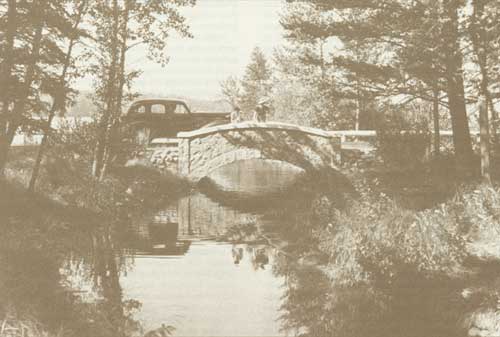
Bridge over Bogey Creek, Riding Mountain National Park
Winter Recreation
Although Riding Mountain is considered a "summer" park and the use of commercial and residential properties in townsites and subdivisions is restricted to the period from May to October inclusive, winter recreation in the form of skiing is available to visitors. A lack of suitable ski terrain in the vicinity of Winnipeg and other large centres of population in Manitoba led, in the early 1950's, to representations from ski associations and individual skiers that the federal Government develop a ski hill in the park. In 1953 and 1957, reconnaissance surveys were carried out by qualified personnel in the National Parks Service and an area drained by MacKinnon Creek on the eastern slope of Riding Mountain was selected. Clearing for an access road from Provincial Highway No. 5 was commenced in 1958 and clearing of ski slopes was undertaken as a winter project in 1959-60. By 1961 the ski slopes, which had been graded and seeded, were in use.
In 1962, a concession was awarded by tender to a Winnipeg company for the operation of lifts and complementary services. The company later installed a T-bar lift, two rope tows and a chalet. The park administration completed the access road in 1963, and in 1965 erected a combination ski patrol and toilet building. Flood control of MacKinnon Creek, which crosses the lower slopes, was accomplished by the installation of steel culverts.
Resource Development
Regulations governing the administration of federal forest reserves had permitted the harvesting of timber under permit for a variety of purposes and the sale of large stands of timber in areas known as berths. Farmers and ranchers living in the vicinity could obtain permits for the purposes of grazing livestock on reserves and removing wild hay for forage. When Riding Mountain Forest Reserve became a national park, its forests had been a source of lumber and other wood products for settlers in the vicinity, and several portable saw-mills were operating within the boundaries. The prevailing arrangements by which non-residents obtained timber were honoured until 1937, when the last mill was removed from the park and a forest management plan was inaugurated. Under the plan, which was administered by a resident forester, selected areas were designated for management and cutting rights were allocated in a manner intended to ensure a perpetual supply of timber. The remaining two timber berths were surrendered in 1947. The privileges of grazing cattle and the cutting of hay under permit on parklands also were extended for many years.
Perpetuation of these concessions brought to those responsible for the administration of the park the realization not only that these practices were in contravention with national park concepts but that the preservation as a natural heritage of unique examples of native flora was being jeopardized. The continued harvesting of timber for a period of more than 50 years in the forest reserve and in the park not only had impaired aesthetic values of the park landscape but also had debilitated greatly the quantity and quality of mature timber in the more accessible areas. In addition, numerous fires, believed to be of an incendiary character, depleted forested areas. Following the adoption of a national park policy in 1964, which ruled out grazing and the harvesting of land resources as detrimental to park land values, restrictions on the issue of permits were introduced. Later, in 1966, the Honourable Arthur Laing, Minister of Indian Affairs and Northern Development, announced that grazing and hay cutting in the park would be phased out by the end of 1970. All permittees were notified in order that alternative arrangements could be made in areas outside the park.
Applicants for timber cutting privileges apparently were aware of the situation, for permits declined drastically in the 1960's. By 1969 it was evident that future plans for park zoning and the establishment of representative wilderness areas in the park were not compatible with continued impairment of the forest, and that the park could no longer provide lumber to farmers in acceptable quantity and quality. Consequently, a decision was reached at ministerial level in June of that year whereby no timber permits would be issued following the close of the logging season of 1971-72.
Later Improvements
Over the years, many improvements were made in the park which resulted in greater convenience to park visitors. The main north-south highway through the park, No. 10, was hard-surfaced during 1952 and 1953 and satellite roads providing access to places of interest were renovated or improved. A small herd of buffalo installed in a fenced area of 133.5 ha near Lake Audy in 1931 became an outstanding visitor attraction. Additional bungalow cabin and motel accommodation developed by private enterprise has helped meet the demand of an increasing number of visitors. On the administration level, the need for improved office accommodation led to the construction in 1956-57 of a new park administrative building at Wasagaming. Relocation of the park work compound from the townsite was commenced in 1957, and resulted in the construction of a group of modern maintenance buildings. On the vacated area, a commodious new assembly hall was erected in 1969 and brought into use in 1970. The inauguration in 1965 of a park interpretation service, supervised by a park naturalist, has been instrumental in acquainting visitors with a wider knowledge of the natural attractions, characteristics and wildlife of the park.
Land Acquisition
When originally set aside in 1906, Riding Mountain Forest Reserve included little of the southern shore of Clear Lake that now forms part of the townsite of Wasagaming. An amendment to the Dominion Forest Reserves and Parks Act in 1923 added a marginal strip to the reserve along the shore line. This action, however, left the southern boundary in several places only a few metres from the lake.12 After Riding Mountain Park was established, the Commissioner of Parks instituted action to protect the townsite area from undesirable fringe development. This was partially accomplished by the acquisition of two quarter-sections of land comprising 129.5 ha which flanked the highway at the southern entrance. This acquisition extended the boundary 800 m southerly from the townsite, and assured future visitors of an approach to the park uncluttered by unsightly commercial developments. The buffer zone between the park and settled lands to the south was expanded by land purchases carried out between 1936 and 1955, and resulted in a straight line boundary east of the No. 10 highway for nearly ten kilometres. Immediately west of the townsite, only a narrow strip of land separated Clear Lake from privately owned property. Opportunities to deepen the buffer zone by land acquisition were exercised between 1965 and 1969, when nearly 526 ha were purchased for park purposes. A substantial portion of the properties acquired adjoined the shore line of South Lake, which is nearly a two kilometres in length, and is separated from Clear Lake by a narrow bar. By 1973, only one parcel of 24 ha fronting on South Lake remained in private ownership.
Riding Mountain Park has long fulfilled its original destiny as a summer playground for Canadians. Its man-made attractions have been expanded to provide outdoor sport in winter. The park continues to function as a vast wildlife preserve, containing a very large herd of elk, the largest member of the deer family in Canada. Now that the end of resource exploitation is in sight, future planning, involving a wider use of outlying areas will be facilitated, and examples of unique native flora can safely be perpetuated in an authentic wilderness setting.
Endnotes
1. National Parks Branch File U. 2-16-3, vol. 1.
2. Ibid., letter, April 7, 1927.
3. Order in Council P.C. 1928-612, April 19, 1928.
4. National Parks Branch File U. 2-16-3, April 25, 1927.
5. Department of the Interior, "Annual Report", 1899, p. ix.
6. National Parks Branch File U. 2-16-3, Nov. 18, 1927.
7. National Parks Branch File R.M. 2, vol. 1, Feb. 29, 1928.
8. Dauphin Herald, Aug. 23, 1928.
9. Order in Council P.C. 1929-2510, Dec. 28, 1929.
10. Henry Youle Hind, A Preliminary and General Report of the Assiniboine and Saskatchewan Exploring Expedition (Toronto: John Lovell, 1859).
11. Ibid., p. 98.
12. Statutes of Canada, 13-14 George V, chapter 13, June 13, 1923.
Pacific Rim National Park
On April 23, 1970, the Government of Canada and the Government of British Columbia signed an agreement for the establishment of a national park on the west coast of Vancouver Island. Eventually, this park would be known as Pacific Rim.
Three Components
The new park would consist of three parts — the area known as Long Beach, a 26-km stretch of surf and sand between Tofino and Ucluelet, as well as frontage on Kennedy Lake; a group of islands in Barkley Sound called the Broken Group and including Effingham Island; and the historic Lifesaving Trail, a 64-km stretch of wilderness between Bamfield and Port Renfrew.
The two governments agreed to share the cost of acquiring the lands, which would be transferred to the federal government. Final transfer of title to the Long Beach and islands portions was scheduled for 1972 and to the trail part for 1975.
Rich Indian History
The area contains a number of Indian reserves and has a rich Indian history. The federal government agreed to conduct separate talks with the Indians regarding their lands.
The three portions of the park represent the principal and most striking features of Vancouver Island's west coast — one of the most spectacular beaches in the world, backed by a giant forest and strewn with huge logs; off-shore islands that are one of the last remaining habitats of the bald eagle in Canada; and virtually undisturbed wilderness along the old Lifesaving Trail, once of vital importance to sealers and whalers.
Grasslands National Park
On June 19, 1981, the governments of Canada and Saskatchewan signed an agreement to establish Grasslands National Park in the Val Marie-Killdeer area of southwest Saskatchewan. They also agreed that Saskatchewan would carry out, within seven years, an oil and gas exploration program in the national park area. The final boundaries of the park will be established jointly by the federal and provincial governments after the potential oil and gas resources have been determined.
Prairie Landscape
The Grasslands agreement preserves a relatively unspoiled prairie landscape of grandeur, beauty, and solitude, including the Killdeer Badlands.
The Province of Saskatchewan agreed to identify 259 km2 of land to form the park. The federal government will purchase, not expropriate, neighbouring parcels of land as they become available, until the area of the park reaches 906.5 km2.