Volume IV
by W.F. Lothian
Chapter 10
Minerals and Timber
Introduction
When the Canadian West was opened to settlement by the construction of the Canadian Pacific Railway, the vast region between Ontario and the Pacific Ocean attracted not only prospective settlers, but also many other people with the necessary capital who were anxious or willing to participate in its development. Concerned with the promotion of both settlement and private enterprise on what were known as Dominion Lands, the Government of Canada created agencies for the disposal of homesteads and the harvesting of minerals and timber. These lands, then under federal control, were situated in Manitoba, the future provinces of Saskatchewan and Alberta, and the Railway Belt of British Columbia. Years later in 1930, natural resources not disposed of were returned by Canada to the provinces.

The Bankhead coal mine operated near Banff, Alberta, in the early 1920's. Coal was mined from tunnels in Cascade Mountain at right.
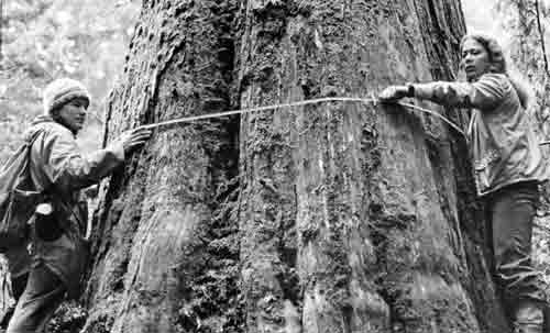
Visitors measure a huge western red cedar tree in Mount Revelstoke National Park, British Columbia, near the Giant Cedars nature trail.
Mineral Development
Many newcomers to western Canada were seeking opportunities to harvest the virgin stands of timber found in the valleys of the Canadian Rockies and the Selkirk Mountains, but probably more were interested in minerals. During and after the construction of the Canadian Pacific Railway, prospectors and miners arrived in a veritable stream. Some were interested in gold, silver or base metals, while others preferred coal-bearing land as a source of investment. In Volume III of this history, descriptions of several park townsites and subdivisions called attention to their origin as mining communities. In fact, Canmore, Anthracite, Bankhead and Pocahontas all owed their existence to the discovery and development of coal deposits.
Of the millions of visitors who now enter Banff National Park from the east over the Trans-Canada Highway, few are aware that in the course of their passage from Canmore to Banff they are traveling over one of the major deposits of high-grade coal in western Canada. The Cascade coal basin was estimated in 1914 by the Commission of Conservation to contain 400 million tons of anthracite and 1,200 million tons of softer grades of coal.1 Between 1886 and 1906, the Cascade Coal District, within the boundaries of the park, gave birth to two major mining communities, Anthracite and Bankhead. Both these settlements have long since disappeared. Farther east, the mining of coal provided a means of employment for many residents of Canmore until 1979, when operations were closed down. Canmore was excluded from Banff National Park in 1930, when the park boundaries were changed.
Early Coal Discoveries
Coal was discovered in the vicinity of Canmore, 14 miles east of Banff, before the coming of the railway. A small amount of surface mining occurred in 1879. In 1883, seams of anthracite coal were found in the valley of the Cascade River east and northeast of Banff Station. These discoveries were confirmed by Dr. George M. Dawson of the Geological Survey of Canada who, in 1881, had commenced a geological survey of the Rocky Mountains from the International Boundary northerly to the upper waters of the Red Deer River. Dr. Dawson spent the seasons of 1883 and 1884 in what he called the Cascade coal basin. His report, published in 1886, contained a vast store of information on the geology, topography and mineral resources of this spectacular alpine region, much of which is now contained within the boundaries of Banff National Park.2
Disposal of Coal Lands
Regulations for the disposal of coal lands by way of leases were established by order in council at the request of the Minister of the Interior on December 17, 1881. They authorized the issue of a lease to any one person for a term of 21 years, covering not more than 320 acres at an annual rental of 25 cents an acre.3 Lessees also were required to pay a royalty of 10 cents a ton on coal mined. In 1882 the department established as coal districts several areas known to contain coal which were withdrawn from ordinary sale and settlement. Within these districts leases could be issued. Included were the Souris district, west of the Manitoba boundary, and the Bow River, Belly River, and Saskatchewan River districts, all in the Northwest Territories.4
A change in policy also occurred in December 1882, when the Coal Mining Regulations were amended. The leasing of coal lands was discontinued and instead, provision was made for the sale of coal lands by tender at upset prices per acre established by the minister. Lessees in good standing had the privilege of converting their leased land into freehold, by payment in cash of the established upset price. In March 1884 the Cascade Coal District, containing 23,040 acres, was created.5 The new district included land now occupied by the townsite of Banff, the Anthracite and Bankhead coal fields, the southern slopes of Cascade Mountain and the northern slopes of Sulphur Mountain. Two months later, an upset (minimum) price of $10 per acre was established by order in council for land containing bituminous coal, while that for anthracite coal was set at $20 per acre.6 Complaints made about the higher cost of mining anthracite coal persuaded the department to reduce the price of land for this type of coal to $12.50 per acre in April, 1885. However, improved facilities for the shipment of coal by the Canadian Pacific Railway led to the restoration of the $20 per acre rate in 1888.
By 1892, the department was making available to some individuals, coal lands through the medium of licences authorized by order in council. That year, the Dominion Lands Act was amended to permit again the disposal of coal land by lease. Under regulations established on October 12, 1892, a coal operator could lease not more than 320 acres at a rental of $1.20 per acre per year, and pay a royalty of 10 cents for each ton of coal mined. Leases were disposed of by public competition, and drawn for terms of 20 years, with the right of renewal for further terms of 20 years but in all not exceeding 60 years.7 A further change affecting leases of coal lands in Rocky Mountains (Banff) Park was made on June 12, 1902, when the rental was reduced to 30 cents per acre per year.8 The new regulations restricted to 640 acres the area leased to any one person, but apparently, companies could increase their holdings by assignment of leases with the consent of the Minister of the Interior.
Mining at Anthracite
By the time the Rocky Mountains Park had been established in June 1887, a large coal mining operation within the Cascade Coal District was under way at Anthracite. McLeod Stewart, an Ottawa lawyer, together with his brother and other associates, had acquired between 1885 and 1887 title to about 1,600 acres of land in the heart of the anthracite coal area east of Banff. Their holdings were incorporated as the Canadian Anthracite Coal Company Limited. The mine was located north of the Cascade River and the Canadian Pacific railway line. Immediately south of the tracks, the company laid out the townsite of Anthracite. It was surveyed according to two separate plans, one prepared in 1887 by P.R.A. Belanger, D.L.S. (Plan 573A), and the other in 1888 by J.W. Vaughan, D.L.S. (Plan 761B). The townsite in all comprised 14 blocks containing a total of 337 lots.
During the peak years of its existence, Anthracite undoubtedly was a lively community. It contained three hotels, several stores, a small church, a company boarding-house capable of accommodating 200 miners, and a large number of houses. According to a news story which appeared in the Calgary Herald in 1926, the population at its peak was 1,500.9 Same aspects of community life at Anthracite were recorded for posterity by Rev. C.W. Gordon, better known as Ralph Connor, in his novel Black Rock. In 1887 the company was authorized by order in council to extend its mining operations for half a mile in all directions beyond the vertical boundaries of its holdings into adjoining park land, in which no further sales were being made.10 By 1897 the developed coal seams were fairly well worked out, and a great many miners moved eastwards to Canmore. Later, an almost total exodus of the inhabitants occurred in 1904, when a new coal mining community a few miles to the northwest offered better incentives. More about this new coalfield will be related in following paragraphs.
The Bankhead Mine
Exploration of the coal seams discovered on the west bank of Cascade River in 1883 was undertaken by the Canadian Pacific Railway Company early in the 20th century, and a vast deposit of coal was found. Leases covering nearly 5,000 acres were obtained by a Canadian Pacific subsidiary, Pacific Coal Mines Limited, in 1903 and 1904 from the Department of the Interior. The railway company built a spur line from its main line for a distance of two miles to the mine head, and erected a small station at the junction which it named Bankhead. In turn, the Pacific Coal Company laid out a company townsite on its leased land, which rivalled that its older neighbor, Banff, in amenities provided. The residents, mostly miners and administrative staff, were accommodated in company houses, and enjoyed features such as electric lighting, a modern water system and a sewer system. In fact, Banff's first electrical power supply came from the Bankhead power plant over an extension of the company's distribution system.
As mining and associated development was authorized by the Rocky Mountains Park Act, development of natural resources within the park boundaries was accepted as a desirable enterprise. In his annual report for 1903-04, Park Superintendent Howard Douglas presented a glowing account of the improvements which had been carried out by Pacific Coal Company Limited:
The new village of Bankhead, instead of being a detriment to the beauty of the park will, on the contrary, add another to the many and varied attractions of the neighbourhood. Situated almost directly on the road to Lake Minnewanka, one of the most popular drives in the vicinity of Banff and a little more than halfway to the lake, nestling under the shade of Cascade (Mountain) with its beautiful homes and its teeming industrial life, it has already become a popular stopping place for tourists.11
...Every possible provision has been made for the comfort of the men engaged in and about the mine. Already a large area has been cleared of timber, streets have been graded, and a modern water works system has been provided. Handsome and commodious offices have been erected, which are now being used to house a large clerical staff. Rows of comfortable cottages have been built for the use of the miners and their families, and palatial boarding houses, providing with all modern conveniences, are in the course of erection.12
Mining was well under way in 1904 on two seams of coal, which dipped westward at an angle of 45 degrees. The coal, classed as semi-anthracite, had a fixed carbon content of 83.3 percent. In 1907, a briquetting plant was brought into operation, and the product was used extensively by railway locomotives on the Pacific Division. In 1908, the company's name was changed to Bankhead Mines Limited. A report issued by the Commission on Conservation of Canada, published in 1914, reported that the working staff comprised 430 persons. Of these, 275 were engaged in underground operations, and 155, of whom 40 were Chinese, worked above ground.13 In April, 1911, Park Superintendent MacDonald reported that the combined output of the Bankhead Mine, and that of the McNeill mine at Canmore, which was then within the national park, exceeded 555,000 tons of coal.
Townsite Image Impaired
The flattering word-picture of Bankhead painted by Howard Douglas in his annual report for 1904 became tarnished over the years. Most mining camps of that era experienced outbreaks of rowdiness, usually brought about through excessive consumption of liquor by the inhabitants. Bankead apparently was no exception. In March, 1915, the General Superintendent of Bankhead Mines sought the assistance of the park superintendent in controlling the unlawful sale of liquor in Bankhead. A local hotel in the townsite was licensed in order to stop the miners of Bankhead from going to Banff and "making themselves obnoxious to the citizens and tourists at Banff".14 The mining company executive charged that a wholesale liquor house at Banff was peddling liquor at Bankhead, and as a result, drunkenness among the miners was becoming noticeable. The legal adviser of the Department of the Interior was consulted, but he offered the opinion that this was a matter for the mining company and provincial authorities to solve.
Many of the miners at Bankhead were of foreign birth, and a group of Chinese, presumably to save more of their wages, had established a squalid "Chinatown" at the base of a large waste pile of coal in the vicinity of the mine. Following an inspection of Bankhead in the company of the local medical health officer, Chief Superintendent P.C. Barnard-Hervey wrote Commissioner of Parks Harkin at Ottawa on March 20, 1917, complaining about conditions. He stated that Dr. Pointz considered the collection of shacks comprising Chinatown to be a "disgrace to civilization". The building which served as a kitchen and bath-house was termed most unsanitary, and "a razorback — a pig — with two young porkers, were grubbing around the building looking for what they could eat."15
Late in June, 1917, Park Superintendent Clarke reported that in company with Mine Superintendent Wilson, he had again inspected the townsite of Bankhead and found conditions considerably improved. Evidently half a dozen shacks had been burned, and 12 more were destined for destruction. A sewage connection had been installed from the Chinese camp kitchen, a general cleanup effected, and a quantity of cinders spread around the area to provide a firmer footing.
Mine is Closed
In spite of the enormous reserves of coal available under the company's leases, the operation of the Bankhead mine presented difficulties. The coal seams within Cascade Mountain were faulted and twisted, and coal was extracted from seven separate seams at different levels on a complicated pattern. On extraction, the coal was brittle, and after exposure to the outside air, it lost moisture and crumbled. Consequently, a large proportion of the mined coal deteriorated into dust. To salvage this product, the company erected briquetting plants, in which the coal dust was mixed with pitch obtained in Pennsylvania, to form briquettes. Although providing an excellent fuel for domestic use, the briquettes had to be mixed with softer grades of coal obtained elsewhere in Alberta for satisfactory use in locomotives.
The mine also was seriously affected by labour trouble which culminated in strikes which extended over several months in 1909, 1911 and 1919. The final strike in 1922, combined with poor market conditions for coal and difficulties associated with mining operations, led Bankhead Mines Limited to close down mining in June that year. All tunnels were sealed off, the miners and operating staff moved out, and for the next three years, the townsite was deserted. Many of the miners moved to Blairmore in the Crowsnest Pass area, and others went to Canmore and Banff. At the request of the Commissioner of National Parks, the operation of the company's electrical generating plant was continued to serve the residents of Banff. Construction of a new hydro-electric plant generating station was commenced by the national park administration in the gorge of the Cascade River below Lake Minnewanka, and brought into operation in 1924.
Disposal of Buildings
Although the Bankhead mine was closed in 1922, Bankhead Mines Limited renewed a number of its leases which expired in 1923 and 1924. Only after the purchasing agent of the Canadian Pacific Railway company at Calgary began selling vacant dwellings and other buildings in Bankhead late in 1925, was it realized that the mine would not be reopened. In December, 1925, Park Superintendent Stronach forwarded to Ottawa for approval, plans of alterations and improvements to a number of buildings which purchasers proposed to move to Banff. Apparently, the superintendent had failed to advise the Commissioner of Parks at Ottawa of the sale and proposed relocation of dwellings from Bankhead, and the reaction was one of surprise. A member of the commissioner's staff at Ottawa, J.E. Spero, commented in a memorandum that "It was only when Mr. Stronach was here and I was taking up with him the terrible plans received, when he ventured the information that these were the cottages at Bankhead." In his memorandum, Spero conceded that although a few of the Bankhead houses no doubt could be accepted for relocation in Banff, to permit the removal of the entire village would be a great mistake. Consequently, a stop order on the removal of any buildings from Bankhead to Banff was sent to the park superintendent by telegram.16
Chief Engineer J.M. Wardle of the Parks Branch, who maintained a district office at Banff, commented that the railway planned to dispose of from 20 to 30 of the small four-room houses at $200 each, and that many of them were objectionable from a sanitary standpoint. Some of the purchasers hoped to relocate their buildings on Banff Avenue, a proposal to which Mr. Wardle took strong objection. Commissioner Harkin brought to the attention of Deputy Minister Cory details of the house-moving proposal, and obtained approval of a recommendation that the acceptance of the larger and better types of buildings be permitted.17 The deputy minister also concurred in a recommendation that a few of the small four-roomed "shacks" might be relocated in Banff, provided they were placed in outlying parts of the townsite.
Decision Appealed
The departmental ruling was not well received by the purchasers of the Bankhead buildings. They appealed to their member of Parliament, R.B. Bennett of Calgary, who wrote the minister, Charles Stewart. Bennett pointed out that one purchaser already had excavated a basement on his lot, only to be advised by the park superintendent that he would not be permitted to place the house on the new site. The dilemma was solved by sending the architect of the Parks Branch, W.D. Cromarty, to Banff with full authority to decide on the ground what buildings would be acceptable. Most of the 35 relocations were made in 1926 and 1927. The Bankhead railway station, purchased by W.A. "Bill" Brewster, was moved to lot 24, Block 21, Banff in April, 1926. Unwin's Bankhead store was relocated on Lot 11, Block 6, facing Banff Avenue. The last Bankhead building destined for Banff was moved early in 1930.
Townsite Cleanup
Although Bankhead Mines Limited surrendered their leases in December, 1926, little was done in the way of cleaning up the former townsite and the mine workings for several years. Most of the buildings used in the mining and briquetting of coal were demolished and the equipment removed in 1928 and 1929. The general office building and a number of the larger houses in what was termed the "upper town" remained. In 1931, P.J. Jennings replaced R.S. Stronach as park superintendent, and in 1932 he began what proved to be a long-term task in having the remaining buildings removed, and the area cleaned up commensurate with funds made available.
The provisions of the special form of lease held by Bankhead Mines Limited lacked any covenant on the part of the lessees to restore the landscape to the form in which it existed prior to the advent of the mine. As early as 1915, Commissioner Harkin had consulted the controller of the Mining Lands and Yukon Branch of the Department of the Interior about the matter of surface rights of lessees. H.H. Rowatt concurred in Harkin's opinion that the leases not only granted to the lessee the exclusive rights to the coal, but also such surface rights as might be required for the efficient working of the mine. Rowatt also confirmed that Bankhead Mines Limited had obtained a total of 17 leases on the special form, comprising an area of 7-1/2 square miles or 4,800 acres.18 Specifically, the lease provided that within six months of the termination of the leases, the lessee might remove from the said lands tools and machinery, buildings and erections placed thereon... and in default of removal within such period of six months all such tools and machinery, buildings and erections would be absolutely forfeited, and become the property of His Majesty, his successors and and assigns.19
By September, 1932, only a few of larger buildings erected in Bankhead remained on their original sites. In December of that year, the park superintendent was requested by the Commissioner of National Parks to notify those responsible for the removal of structures to have the sites cleared by March 31 in the year following. An inspection of the abandoned townsite undertaken by a park officer in July, 1933, revealed that the former company office building and about five large houses remained on the site. In January, 1935, a solicitor of the railway company advised Park Superintendent Jennings that his company was under no obligation to demolish or remove any remaining buildings, or to clean up the property.20 Eventually, the remaining buildings were moved or dismantled, but numerous concrete walls and foundations remain to mark the site of the once highly productive coal mining community.
An unusual use was made of a portion of the townsite in 1953, when a large stockade resembling a frontier type of fort was erected with the permission of the department by a motion picture film company to facilitate the filming of scenes in the production Saskatchewan. This movie featured in leading roles Alan Ladd and Shelley Winters. Later the "fort" became a nuisance, and was demolished by national parks personnel. The last public use of the site was in 1974 and 1975, when a portion of the lower townsite was utilized for a transient youth camp. At the time of writing, the interpretation service of Banff National Park was developing plans to utilize the abandoned site of Bankhead in an exhibit illustrating certain features relating to the development of an industry no longer permitted within park boundaries — the mining of coal.
More About Anthracite
Although coal mining in the vicinity of Anthracite had been discontinued in 1904, many of the old buildings and a few residents remained on the site for years. By 1910, a "coaching" road had been completed from Calgary to Banff, and visitors approaching Banff townsite from the east either by railway or the new road had to pass by the dilapidated remnants of the former mining community. Plans for a cleanup took form that year when officers of the Department of the Interior at Ottawa instituted inquiries about the ownership of buildings still standing. Correspondence between the minister, Frank Oliver and Archibald Stewart, the secretary of Canadian Anthracite Coal Company Limited, revealed that only two of several structures remaining were owned by that company, and they were under lease to the McNeill Coal Company of Canmore.
Attempts to have the townsite cleared were continued in 1913 by P.C. Barnard-Hervey, Chief Superintendent of Dominion Parks at Edmonton. In November that year, he was able to inform the Commissioner of Parks at Ottawa that the former office building of the coal company was in a stage of demolition. Buildings on townsite lots which had been sold by the company to former miners and others presented problems, which were accentuated by the presence of several squatters. In June, 1914, Barnard-Hervey confirmed the demolition and removal of the former church, the school-house, and the company boarding-house. A final report made by Park Superintendent Clarke to Commissioner Harkin in 1915 disclosed that the former coal tipple structure — an outdated eyesore — had been removed, and that only a log store and two dwellings remained.21
Townsite Lots Acquired
Presumably the former townsite of Anthracite created little concern for park administrators during the next decade, as the relevant file contained no correspondence. In 1929, the park superintendent obtained from the Registrar of Land Titles for Southern Alberta a memorandum of search covering all lots contained within the two subdivisions that constituted the townsite. This document disclosed that title to 16 lots in the eastern portion covered by Plan 573A stood in the names of residents of Anthracite, Banff and Calgary, while the remaining lots, including those shown on Plan 761B, were owned by Canadian Anthracite Coal Company Limited.
An opportunity to reclaim, as public land, part of the freehold property originally owned by Canadian Anthracite Coal Company Limited occurred in 1937, when the Department of Mines and Resources obtained approval for a new crossing of the Calgary-Banff highway over the main line of the Canadian Pacific Railway Company at Anthracite. The original crossing involved two very sharp turns, and a new alignment proposed by park engineers would not only provide a gradual curve, but would also encroach on a surveyed portion of the townsite.
Canmore Mines Limited, which on March 21, 1938 had taken over the assets of the original owners, agreed to sell five blocks in the western section of Anthracite to the department at a nominal price of $20 per acre. The company also offered to transfer to the department at no cost, some additional land between the two original subdivisions, together with any lots required in Block 1, Plan 573A. Eventually, the department purchased Blocks A, B, D, E and G, together with a parcel located north of the railway right of way and east of the crossing. In order to acquire an undisputed title, the department in 1939 expropriated 4.33 acres of land donated by the company, together with 18 lots in Block 1.22 Altogether, some 27 acres of the former mining community were obtained at a cost of less than $500.
Coal Mining Resumed
Years after the community of Anthracite had reverted to the status of a ghost town, coal mining in the vicinity was revived. After its mine had been abandoned, Canadian Anthracite Coal Company Limited transferred its operations to Canmore. The mine tunnel and drifts at Anthracite gradually became flooded through seepage, but periodically ambitious prospectors tried to find a new coal seam in the vicinity. In the mid-1920s, Frank Wheatley, a former resident of Bankhead who had moved to Blairmore in the Crows Nest Pass region, returned to Banff and began a search for coal at Anthracite. With his sons and James Reid, Wheatley in August, 1928 located an excellent seam of coal on property owned by Canada Cement Company.23 Working under a lease, the Wheatleys drove a tunnel into the cliff north of the railway line at a point north of the Anthracite section-house, and east of a market garden operated in the vicinity. The first delivery of coal from the new mine was made in Banff on August 17, 1928, and operation of the mine was continued until 1944. During the winter of 1944-45, the mine was flooded and the site had to be abandoned.
In 1945, Frank Wheatley and Sons negotiated an agreement with Canmore Mines Limited permitting them to prospect and mine coal on lands formerly owned by the former Canadian Anthracite Coal Company Limited. A seam of good coal was located, and after a tunnel had been driven from a point about a mile west of the flooded workings, mining was resumed in 1946. In December, 1947, the Wheatleys completed the purchase of approximately 331 acres of coal-bearing land. During the following eight years, the mine produced 10,540 tons of semi-anthracite coal, which was marketed in Banff and vicinity. In 1951 Banff was provided with a natural gas service, and undoubtedly the sale of this form of fuel seriously affected the sale of coal, for the Wheatley collierly was closed, but not abandoned, on October 1, 1953.
Right-of-Way Required
In June, 1953, officers of the National Parks Branch learned that two parcels of land within the Wheatley freehold would be required as right of way for the reconstruction of the Trans-Canada Highway through Banff National Park. Negotiations were then opened with the owners for the purchase of land required for highway construction, or alternatively, the entire land holdings of the Wheatley family at Anthracite. A legal survey had disclosed that 11.65 acres would be required for the highway, and the value placed on the two parcels by the owners was considered by the department to be exorbitant. Consequently, to permit construction of the highway to proceed, the necessary right of way was acquired by expropriation on May 4, 1955.24 With a view to evaluating both the surface and mineral rights held by the Wheatley family, the director of the National Parks Branch arranged for an examination of the coal mine by a geologist of the Department of Mines and Geology, B.A. Latour. Latour's report was completed in October 1953. It included a plan of survey of the mine workings, and estimated the volume of coal recoverable from two seams to be 3,434,755 tons. The report also disclosed that about 75 percent of the coal recovered to date had been taken from Crown land which lay between opposite ends of the mine tunnel.25
Negotiations between the federal Department of Northern Affairs and National Resources, responsible for national park administration, and the Wheatleys were carried on for more than three years. Eventually a settlement in the amount of $70,000 was agreed on as compensation for title to all land and minerals held by the Wheatley family at Anthracite, including that acquired by expropriation. Authority for the purchase was obtained from Treasury Board and the Governor in Council in January 1957. The transaction, involving 331.5 acres, included 57 lots in the former townsite of Anthracite. A portion of the purchase price was withheld, by mutual agreement, until the former mine workings had been cleared and all provisions of the Mining Act of Alberta relating to abandoned mines had been met. This condition of the purchase agreement was complied with by October 31, 1957, and the property acquisition by the Crown reduced substantially the acreage of privately-owned land within Banff National Park.
More Property Acquired
Long before the Wheatley coal mine lands and the balance of the lots in western portion of Anthracite townsite were purchased by the Crown for parks purposes, Canmore Mines Limited had started to dispose of its holdings. In 1946, two parcels of land, comprising nearly 116 acres, were acquired by Conrad O'Brien ffrench of Vancouver Island. This land was situated north of the Calgary-Banff highway, and lay between the penstock of Calgary Power Limited on the west and the new road from Lake Minnewanka to Anthracite. Later, ffrench began the development of his property as a site for visitor accommodation.
In January, 1949, Park Superintendent Hutchison called to the attention of Controller James Smart at Ottawa that additional sales of property at Anthracite were being made to residents of Banff. One person, D.M. Soole, was buying lots in numbers and reselling them at a profit. The National Parks Branch included in its estimates for 1949-50, a substantial sum for the acquistion of privately-owned lands in the parks, but the item was deleted from the branch appropriation. During an inspection of the western parks in July 1949, Controller Smart discussed with officials of Canmore Mines Limited at Calgary the possibility of purchasing, on behalf of the department, title to any land at Anthracite still held by the company. Agreement was reached that further sales to the public would be withheld until the Department of Mines and Resources reached a decision concerning acquisition of some 700 acres remaining in possession of the company.
Further negotiation between Controller Smart and Canmore Mines Limited in September, 1949, resulted in an offer by the company to sell to the Crown the residue of its freehold land at Anthracite for $25,000. Following a search of titles in the provincial land titles office made by the park superintendent to verify the company's land holdings, a submission was made by the Minister of Mines and Resources to the Governor in Council in February 1950, seeking authority to purchase the lands described in the schedule to the submission for the sum of $25,000.26 Approval was obtained on March 14, 1950, and by July 18, title had been vested in the name of His Majesty the King in right of Canada. The certificates of title obtained included those for the remaining 50 lots in the former townsite of Anthracite which had not been sold. Title to six more lots within Blocks 1, 3, and 5, was obtained through the services of an agent of the Minister of Justice at a tax sale held by the provincial government at Cochrane, Alberta, on August 17, 1951, for the sum of $124, excluding legal fees.27
More Expropriations
Two years before the acquisition of the Wheatley property had been completed, the National Parks Branch was informed by the Department of Public Works that additional property at Anthracite would be required for the realignment and construction of the Trans-Canada Highway in the vicinity of Anthracite townsite. The right of way as proposed involved the relocation of a section of the Canadian Pacific railway line near the generating plant of Calgary Power Limited, and consequently an encroachment on lots in Block 2 would be necessary. In order to facilitate early construction, the National Parks Branch obtained the permission of the deputy minister to expropriate 25 of the 26 lots in Block 2. The remaining lot (4), already was owned by the department. The expropriation documents were registered by an agent of the Minister of Justice in the Alberta land titles office at Calgary on May 13, 1955.28
Meanwhile, a Calgary land valuator, E.B. Nowers, was engaged by the department to evaluate the lots and recommend the amount of compensation to be paid to the owners. Nowers employed a peculiar formula to evaluate the lots. Those facing the railway line, which were 25 feet wide, were considered to be worth, at most, $100, while lots with a frontage of 40 feet facing the Cascade river were valued at $50 each. In addition, improvements in the form of a dwelling and outbuildings on three separate sites were valued at $1,250.
Park Superintendent Strong tried to negotiate settlements with former lot owners on the basis of the Nowers valuations, but met with little success. Most of them had paid the former owner, D.M. Soole, double the amounts recommended by the valuator. Eventually, all parties concerned were advised that if the department's offer was not acceptable, compensation would have to be determined through the Exchequer Court. Three owners later agreed to accept settlement on the basis offered. The department subsequently instituted an action in the Exchequer Court against D.M. Soole, who had resold most of the lots in Block 2, but had retained two of them.
The solicitors for the department engaged the services of a second appraiser, I.C. Robison of Calgary, who recommended settlement with former lot owners on a basis commensurate with the amounts they had expended on their equity. Before the expropriation actually came to court, the department agreed to a settlement with Soole recommended by its solicitors, at twice the figure previously offered. The action in the Exchequer Court was then discontinued. Settlements with some owners, based on the new scale of compensation, were then continued until August 1958, when the Deputy Minister of Northern Affairs was advised by his counterpart in the Department of Justice that the expropriations made in 1955 were considered a nullity.
It was explained that the 1955 expropirations of lots in Block 2 had been made under the provisions of the Expropriation Act, whereas they should have been made under Section 6 of the National Parks Act, which required the prior permission of the Governor in Council for expropriation of land for park purposes. Action then was taken to obtain such authority and have the expropriation re-registered.29 The registrar of land titles at Calgary, however, refused to accept the new expropriation documents, claiming that titles were already vested in the Crown, Canada. Eventually, following a submission to the Supreme Court of Alberta, a court order was obtained on February 14, 1961, directing the registrar to accept for registration the new expropriation documents.
New Basis for Compensation
As the Exchequer Court Act provided that compensation paid for expropriated land should be based on its actual value at the time of expropriation, the acceptance of a second expropriation by the Registrar of Land Titles on May 17, 1961, necessitated a review of all amounts paid or payable as compensation to former property owners. A new appraisal of lots in Block 2 was undertaken by the Real Estate Branch of the Department of Transport, Ottawa, in March 1971. The report established a market value of lots having a frontage of 25 feet at $425, and for those having a frontage of 40 feet, $600. After titles were restored in the names of those who had accepted compensation, new settlements were reached during 1961 with all persons affected by expropriations in Block 2. Those who had already accepted settlement at the original scale of compensation received additional payments based on the values established by the Department of Transport report. Others were paid amounts of $425 or $600 per lot in return for a release of all claims. The total outlay by the department, exclusive of legal fees, was approximately $13,000.
Anthracite Titles Extinguished
Through the purchase of the Wheatley holdings in 1957, and other acquisitions, the Department of Northern Affairs and National Resources now held title for park purposes to all lots in Blocks 1, 2, 3 and 4, Plan 573A. There remained as privately-owned land some 38 lots in Blocks 5, 6 and 7, occupied by resident owners. Over the next 10 years the remaining components of the former townsite of Anthracite were purchased by negotiation for $123,000. Summarized by year, these acquisitions were:
1961 — Three lots and a portion of a fourth in Block 5, with improvements, from R.M. and Elsie Burnham for $10,000; nine lots including improvements in Block 6 from C.H. Peyto for $30,000.
1965 — Five lots and improvements in Block 5 from Annie L. Kovacs for $25,000.
1967 — Ten lots and improvements in Block 5 from Hugo and Gay Langas for $25,000.
1970 — Ten lots, a portion of another, and improvements thereon in Block 7 from W.H. and Christina Robertson for $33,000. In 1960 the Department had previously acquired from the Robertsons title to five lots and part of another for purposes of a scenic road. Compensation was accepted in the form of an asphalt roadway constructed by the department from the park road to the Robertson dwelling.30
Underlying the desire of the department to extinguish all private ownership of lands within national parks was the threat that development by owners might involve undesirable types of enterprise, or induce the creation of a satellite community in which park authorities might eventually have to provide municipal services. In fact, applications were received by the park superintendent from lot owners for permission to develop and operate an outdoor motion picture theater, to subdivide existing lots to provide a housing development, and to construct and operate a motel. All requests of this nature were refused. One owner of a group of lots, however, disposed of portions of his freehold, which later were included in the properties bought by the department.
The Fairholme Ranch
Before the unsold lands of Canmore Mines Limited at Anthracite were purchased in May 1950, the National Parks administration at Ottawa knew that several other large freeholds existed in the vicinity. These included the Wheatley mine holdings and the privately-owned portions of Anthracite Townsite, already described; a partly developed resort property containing 116 acres which had been purchased by Conrad O'Brien ffrench from Canmore Lands Limited in 1946; and an additional 350 acres which had been in possession of Canada Cement Company of Canada since 1911. The acquisition of the two last-named properties will be reviewed in subsequent paragraphs.
Captain ffrench's land acquisition, for which he paid $2,895, apparently came as a surprise to the park authorities both at Banff and at Ottawa. That sale, together with the disposal of the lots in Block 2 of Anthracite townsite, eventually led to the purchase by the department of the balance of the Canmore Mines holdings. An artist and sportsman, ffrench had in mind the development of a small resort where guests would be accommodated in superior style, at a cost comparable to that payable by guests at the Banff Springs Hotel. After submitting plans for approval he was granted permits in 1946, 1947 and 1948 for the construction of a log cabin, a log stable and a large house or lodge, all built principally of logs obtained in Kootenay National Park under permit.31
The lodge was exceptionally well constructed. On the main floor were a large living room with open Rundle stone fireplace, dining-room, study, bedroom, bathroom, kitchen and cook's bedroom. The second floor contained three bedrooms, two bathrooms, linen and broom closets. The basement incorporated in addition to a bedroom and bathroom, a fuel room, heating equipment and two-car garage. A considerable portion of the furniture was hand-crafted, some of it decorated with western or Indian designs. Although a per diem rate for accommodation was approved by the department in 1948, the lodge later was rented in its entirety by the owner at a monthly rate for several years. Captain ffrench lived in the cabin nearby. The lodge was rented by the federal Department of Public Works for the accommodation of Princess Margaret during her three-day visit to Banff National Park in the summer of 1958.
In May, 1950, Park Superintendent Hutchison advised the controller of the National Parks Service at Ottawa that he had received information that ffrench was disposing of portions of his property, now known as Fairholme Ranch, to others for building sites. While unconfirmed, the rumor brought into focus the possibility of the acquisition of the Fairholme Ranch for park purposes. Two years later, the superintendent reported that he had been informed by Captain ffrench that the sale of the ranch to a group of United States citizens had been under consideration, and that an option to purchase had expired. In the circumstances, ffrench offered to sell his property to the department for the sum of $150,000. The offer, however, was not accepted.
Rumors of a sale of the property to a group of Calgary investors again came to the attention of the park superintendent in June 1958. Although this development proved abortive, Assistant Superintendent H.T. Cooper was interviewed at length in July that year by the representative of a group in Edmonton, which contemplated an extensive development. J. Welykochy expressed interest in the jurisdiction of the department over the development of privately-owned land within the park. This was fully explained, and the sale failed to materialize.
During September 1958 the minister, Alvin Hamilton, accompanied by his executive assistant, the deputy minister and the local member of Parliament, Eldon Woolliams, visited Fairholme Ranch. After receiving advice from Captain ffrench that the latest option granted by him had lapsed, and that an offer from the department would be entertained, the minister made a formal offer of $100,000 for the property. The owner countered by offering to sell his entire interest for $125,000.32
A strongly-worded submission made by the minister to the Governor in Council in November, 1958, recommended acceptance of Captain ffrench's offer. It stressed the undesirable effects of a sale to private interests, including possible subdivision of the land and the development of various types of enterprise not in keeping with National Park concepts. Attention also was drawn to the fact that construction of the Trans-Canada Highway just south of the ranch boundary had enhanced its value. An appraisal of the land and buildings undertaken in December, 1958, on behalf of the department by an independent valuator, I.C. Robison of Calgary, valued the property at $125,000. After lengthy consideration, Treasury Board recommended acceptance of Hamilton's submission, which received approval on May 5, 1959.33 Acquisition of the ranch, comprising 115.83 acres, was completed later that month. The buildings on the land were used to accommodate Banff Park staff until 1973, when they were removed.
Canada Cement Property
The interest of Canada Cement Company Limited in privately-owned land at Anthracite dated from 1911, when the assets of Western Canada Cement and Coal Company Limited were acquired at a sheriff's sale. The latter company's holdings consisted of three separate parcels, titles for which were first granted by the Minister of the Interior in 1886 as coal land sales. The original owners were W.H. Merritt, who held title to 280 acres; Hugh Fleming, 40 acres; and F. Fleming, 35 acres. In 1904 J.S. Irvin, managing director of International Portland Cement Company Limited of Hull, Quebec, acquired title to these properties, and on November 29, 1905, sold them to Western Canada Cement and Coal Company Limited for $25,000.34 This company had been formed earlier in 1905 to produce portland cement from an immense deposit of high-calcium limestone located 25 miles east of Banff at Lac des Arcs. Here, on land leased from the Department of the Interior, the new company erected a cement plant and laid out a company townsite named Exshaw. The production of cement began in 1906, and was carried on by the company until 1911, when its plant and other assets were purchased by Canada Cement Company Limited.
A search of titles in the Alberta Land Titles Office at Calgary by officers of Banff National Park in May, 1957, disclosed that Western Canada Cement and Coal Company Limited had been financed by Royal Trust Company. Title to company lands at Anthracite and Exshaw were transferred to the trust company as collateral for the loan. By the close of 1910, Western Canada Cement and Coal Limited was in financial difficulty, and Royal Trust took legal action against their debtor in the Supreme Court of Alberta. A court order dated February 2, 1911, authorized the disposition of land and assets of Western Canadian Cement and Coal Company at a sheriff's sale. Real property, buildings and equipment at Anthracite and Exshaw were purchased by Canada Cement Company Limited, which had been incorporated in 1909. Production of cement at Exshaw has been continued since 1911 by the new owners, now known as Canada Cement Lafarge Limited.
Available records indicate that neither Western Canada Cement and Coal Limited nor Canada Cement Company Limited mined coal at Anthracite, but mining operations were carried on by Frank Wheatley and Sons under a lease from Canada Cement from 1927 to 1944. After Wheatley transferred his operation to a site purchased from Canmore Mines Limited, the Canada Cement holdings presumably were held as an undeveloped asset. In 1940, the Department of Mines and Resources acquired title to two small parcels required for the relocation of Calgary Banff highway by an exchange of land. In 1956, additional Canada Cement Company land was used in the construction of the Trans-Canada Highway, but payment of compensation for the 20 acres involved was deferred.
Interest in Jasper Park Land
In 1956 Canada Cement Company Limited sought permission from the Department of Northern Affairs and National Resources to extend quarrying operations from adjoining provincial land held under lease into Jasper National Park just inside the northeastern boundary. As the proposed operation would have involved withdrawal of the lands concerned by act of Parliament, and resource development within the park was undesirable, the application was not entertained. The company, however, renewed its interest in a quarrying operation in Jasper Park in December 1960, when it submitted an exhaustive brief explaining the company's market requirements in the Edmonton and other northern areas of Alberta.35 In the course of discussions between Vice-President V.C. Hamilton and the minister, Walter Dinsdale, Hamilton offered to exchange his company's property at Anthracite for the area desired in Jasper National Park. After careful consideration, the minister informed Hamilton that the proposed exchange would entail the alienation of land placed by Parliament under the National Parks act for "safekeeping", and that it was believed that Parliament would not consider an exchange of land a sufficient reason for withdrawing an area from the national park.36
Later Negotiations
The need for a portion of the Canada Cement property at Anthracite to undertake a recreational development at Johnston Lake in Banff National Park prompted the department to reopen negotiations with the company with the object of purchasing a portion or all of the Canada Cement Company land at Anthracite, believed to comprise 347 acres. In the course of a meeting held in Ottawa June 23, 1964, Deputy Minister E.A. C�t� explained to Vice-President Kennedy of Canada Cement the desirability of clearing the existing encroachment by the Trans-Canada Highway, and stated that additional land might be required, should the highway be widened to accommodate four lanes. Mr. Kennedy again expressed interest in obtaining quarrying rights in Jasper National Park, but was advised that the department's position on the exploitation of natural resources within the national parks remained unchanged. It was agreed, however, that a valuation of the Anthracite property should be made for the department.37
An appraisal completed by the Real Estate Branch of the department of Transport in January, 1965, placed the value of the surface rights Canada Cement's holdings at $56,000. The value of minerals underlying the company lands was determined by the Resources Management Division of the department to be $12,095. Subsequently, the deputy minister made a formal offer to purchase the Canada Cement Company property for $60,000. At a meeting between Deputy Minister C�t� and senior officers of the company on July 14, 1966, it was established that the company did not wish to sell its property, but was prepared to negotiate a trade for quarrying rights in Jasper National Park.
Further negotiation between Canada Cement Company Limited and the Department was suspended for more than two years. On December 30, 1968, Deputy Minister J.A. MacDonald reopened the subject by letter to President Taylor Kennedy and in February, 1969, he met with Vice-President Howe in Ottawa. At the meeting, it was agreed that the possibility of reaching agreement with the company would be reexamined, and that the appraisal of the company's land undertaken earlier would be reviewed. Eventually, the department took the position that the release of land from Jasper National Park for commercial exploitation would not be in the public interest. On September 30, 1969, Senior Assistant Deputy Minister Gordon informed Howe that it would not be possible to accede to his request for an exchange of land and that, following a review of the appraisal, the previous offer of $60,000 could not be increased. On December 17, 1969, Vice-President Howe advised Gordon that the Canada Cement Company Limited would accept the offer.38 Authority to complete the purchase was obtained from the Governor in Council on June 2, 1970, and the transaction was completed on behalf of the department by the Department of Justice on October 28, 1970. A certificate of title to the company's land holdings at Anthracite was issued in the name of Her Majesty the Queen in right of Canada.
Final Anthracite Acquisition
The last of the lands originally granted to Canadian Anthracite Coal Company Limited in the 1880s was repossessed by the Department of Indian Affairs and Northern Development for park purposes on June 18, 1971. On that date, the department obtained from Mrs. Winnie Gee a surrender and quit claim of all interest in an area of 10.4 acres on which she and her precedessors had operated a market garden since 1927. Known for years as the Sun Greenhouse, the garden area was one of two occupied by Chinese families under lease from Canmore Mines Limited when the residue of its lands were purchased by the Department in 1950. After administration of the land was assumed by the National Parks Branch in 1951, both leases — one held by Gee Moy and the other by Gee Wah, were replaced by licences of occupation. After Gee Moy's death in April, 1953, his widow and administratix of his estate, Winnie Gee, continued the operation of the greenhouse under authority of a licence of occupation. The operation of Gee Wah's garden, in the vicinity of Bankhead, was closed out after his licence expired in 1955.
Over the years the establishment deteriorated in appearance. Situated adjoining an ancient slack coal dump, it contained, in addition to primary buildings, a collection of abandoned equipment, decayed lumber and junk. Following an inspection of the property in April, 1960, the licensee agreed to replace the main residence and undertake repairs to other buildings. A new house was erected in 1962, and occupation of the site was continued as a overholding tenant. By 1964, termination of the concessionaire's rights of occupancy was being considered by the national park administration. An inspection of the property disclosed that many of the buildings were below standard, some buildings were occupied by persons having no connection with the garden, and others were not in use. The possibility that part of the garden site might be required for the future widening of the Trans-Canada Highway also was established.
In October, 1968, Park Superintendent Kun recommended to the western regional director, that action be taken to terminate the greenhouse operation, which was considered to be a nonconforming and objectionable use of park land. Mrs. Gee was subsequently offered a final licence of occupation for a term of three years from January 1, 1969. This offer was rejected, as it contained no provision for compensation for loss of improvements and a means of livelihood. Eventually, the department negotiated a surrender of all rights formerly held under licence of occupation, including improvements on the land, in return for a cash payment of $25,000. The settlement, authorized by the Governor in Council, represented the sum of $18,600 for the residence, and an ex gratia payment of $6,400 for loss of services, buildings and business dislocation.39 Mrs. Gee was granted a reasonable period in which to wind up her business and vacate the property. Following an extension of the period of occupancy, the former garden site was taken over by the department on June 1, 1973.
Other Coal Lands
Although Parks Canada was successful in recovering title to areas in Banff National Park that once comprised active coal mines, there remained in private ownership a large area of coal-bearing land. In later pages of this chapter, mention will be made of an area of 10 square miles granted to the Canadian Pacific Railway Company in the early 1900s as part of its main line subsidy. Located within the valley of the Cascade River, these lands contain, in addition to timber, coal deposits estimated by the company to aggregate 20 million tons. While these coal deposits to date have remained undeveloped, their continued existence under private ownership constitutes a threat to the preservation of the park environment.
Base Metals Production
Although mining activity within the national parks in western Canada produced more coal than any other mineral, public interest in the discovery of both precious and base metals also was evident in the earlier days of park administration. Volume I of this history refers to the mining boom that occurred at Silver City in 1883 before the first park reservation was made at Banff two years later. Undoubtedly, some silver and copper was mined, but the deposits lacked volume, and the pioneer mining camp was practically abandoned before the settlement was surveyed as the townsite of Silverton in 1884 and 1885. Elsewhere, claims believed to contain precious metals were staked and later filed, but none proved worthy of actual development.
On the other hand, the Monarch and Kicking Horse mines in Yoho National Park near Field were kept in operation — albeit spasmodically in their earlier years — from 1884 to 1952. The minerals obtained were lead and zinc, although silver was recovered as a by-product in the course of refining the ore. The Monarch mine, in towering Mount Stephen, and the Kicking Horse mine on the face of Mount Field across the Kicking Horse River, were spectacular operations. The rock was mined at levels high above the valley floor, and was transported by cableways or conveyors to storage areas from which it reached the mill. There it was reduced to concentrated ore for shipment to smelters. The operation of these mines, also described in Volume I, was terminated in 1952.
Carleton Claim Acquired
In July, 1976, Parks Canada purchased the title to the Carleton mining claim which adjoined the former Monarch claim on Mount Stephen near the townsite of Field. This claim, which was Crown-granted in 1891 to the Golden Mining and Smelting Company of Canada, included surface rights to about 20 acres, together with all minerals except gold and silver. Title to the property had changed hands several times over the years, and no record of its development existed in departmental records. The latest owner received $1,100 as compensation for its surrender.
Quartz Mining Regulations
Like the coal operations in Banff Park, the mining of base metals was sanctioned by early national park legislation, and was carried on until 1916 under authority of regulations for the disposal of quartz mining claims on Dominion lands in the Northwest Territories, Yukon Territory, and in the western provinces. Following establishment of the Dominion Forest Reserves and Parks Act in May, 1911, the regulations governing quartz mining claims were made applicable to the forest reserves and parks established under authority of that act. Eventually, Parks Commissioner J.B. Harkin was able to persuade the Minister of the Interior to have the right of filing mineral claims revoked. On August 15, 1916, the Governor in Council approved an order rescinding the authority to dispose of quartz mining claims in the Dominion Parks.48 The order in council read in part as follows:
Whereas, owing to the small area within the parks in comparison with the whole area of Canada, upon which prospecting and quartz mining is at present permitted and as few, if any, large deposits of minerals have been found within the parks, it is considered that it would be advisable to withdraw the parks from the operations of the Quartz Mining Regulations.
The rights of owners of existing claims for which grants had been made, or which were maintained in good standing by annual representation work, were recognized. Most of the claims registered before 1916 have been cancelled or alternatively, the titles extinguished by purchase or expropriation. In the cases of the Monarch and Kicking Horse mines, the rights held were surrendered by the owners after recoverable mineral deposits were exhausted.
Kootenay Park Mining Claims
Before its establishment on April 20, 1920, Kootenay National Park had attracted many prospectors and miners. Some sought lead and zinc, while others were interested in talc, a hydrous silicate of magnesium. Many claims had been staked under the mining laws of British Columbia, and national park adminstrators were obliged to condone operations until the rights of the owners lapsed through failure to comply with provincial regulations, or were cancelled for other reasons. Under the Banff-Windermere Highway Agreement of 1919, which preceded the establishment of Kootenay National Park, the Minister of the Interior had the authority to reject the recording of quartz and placer claims if the operation of the claim interfered with the scenic beauty of the park or other feature in the area. In addition, all lands within the park boundaries on which mineral rights were extinguished, automatically became vested in the Dominion Government.41 Later, when the National Parks Act was passed in May 1930, it made no provision for prospecting and the filing of claims to minerals of any description. Brief histories of some of the mining properties in Kootenay Park may be of interest.
Albion Group of Claims
In the autumn of 1929, a casual employee of the National Park Service, who had been a member of a crew engaged in improving a trail along Hawk Creek in Kootenay Park, discovered outcroppings of lead-zinc ore during off-duty ramblings. Without the knowledge of Park Superintendent Sibbald, Frank Jowett staked between October 31, 1929, and June, 1930, a group of six claims which were accepted for registration by the provincial mining recorder at Wilmer, British Columbia.42 Although advised by the superintendent that development of mineral claims in the park staked after the date of the Banff-Windermere Highway agreement, March 12, 1919, was not permitted, Jowett managed to undertake some representation work. He was, however, refused permission to bring explosives into the park to facilitate exploration of the mineral deposit.
Following a written inquiry, Superintendent Sibbald was informed by the mining recorder that the certificates issued by him bore an endorsement that "the record is issued subject to the provisions of the Dominion Forest Reserves and Parks Act." Commissioner Harkin at Ottawa protested the recording of the claims in a letter to Robert Dunn, Deputy Minister of Mines for British Columbia. Harkin received an acknowledgment of his letter and later was forwarded a copy of a memorandum signed by a legal officer of the provincial attorney general's department acknowledging that the recording of mineral claims within the lands granted to the federal government for the purposes of the Banff-Windermere Highway was illegal, and also that a record made in contravention of the provisions of the agreement was a nullity. Dunn added the information that mining recorders for areas adjoining the boundaries of Kootenay National Park were being notified accordingly.43
The Albion group of claims on Hawk Creek constituted a promising mining property. The annual report of the Minister of Mines for British Columbia covering the year ended December 31, 1930, contained a brief report on the Jowett find. As reported, the claims were located on the hillside above Hawk Creek about two miles by trail from the Banff-Windermere Highway. An examination of the property in August 1930 had revealed that surface trenching and two open cuts had been made, and that lead-zinc mineralization in limestone indicated good zinc ore having a width from 20 to 25 feet. Samples of ore analyzed later showed traces of gold and silver, together with a lead content up to 4.3 percent and zinc to 30.6 percent.
The original claimant, Jowett, had enlisted the assistance of a partner, J.E. Barbour of Wilmer, British Columbia, in obtaining permission of the Minister of the Interior to have their claims restored to good standing. In May 1933 Barbour appealed to Prime Minister R.B. Bennett in an effort to obtain permission to continue assessment work. The correspondence was referred to the Deputy Minister of Justice for an opinion. His reply confirmed that the staking of the Albion claims and the recording of entries by the provincial mining recorder must be considered a nullity. He also advised the Deputy Minister of the Interior that neither that department nor the Governor in Council had any authority to authorize the entries or permit development of the mineralized areas. Although this information was forwarded to Barbour, he maintained his lobby by correspondence, which was climaxed in 1937 by an appeal to Prime Minister Mackenzie King. This communication was referred to the Minister of Mines and Resources, T.A. Crerar. A reply signed by his private secretary, Ford Pratt, advised Barbour that neither the department or the Governor in Council had the authority to permit the development of areas in the park containing minerals, and that for legal reasons it was impossible to review the decision already conveyed to him.
Wartime Development
During World War II, representations were made by Base Metals Mining Corporation of Toronto, that its lead-zinc deposits in the Monarch and Kicking Horse Mines at Field in Yoho National Park were being worked out, and that permission to work the Albion claims in Kootenay park would assist the war effort. It was ascertained that an employee of Base Metals Mining Corporation had staked eight mineral claims along Hawk Creek in May 1941, and had been successful in having them recorded in June by the provincial mining recorder at Windermere, British Columbia. The president of the Corporation, J.H.C. Waite was informed that authority to work the claims could be granted only by Parliament.
The corporation then enlisted the support of the metals controller of the Department of Munitions and Supply in its effort to obtain mining privileges in Kootenay Park. After considerable deliberation, the Minister of Mines and Resources agreed to have an investigation of the mineral potential of the Albion claims investigated, and this was authorized by an Order-in-Council approved on May 8, 1942, under provisions of the War Measures Act.44 The investigation, which entailed a drilling program, was entrusted to Base Metals Mining Corporation in accordance with the terms of an agreement completed between the Crown, represented by the Minister of Mines and Resources, and Base Metals Mining Corporation Limited on May 15, 1942. A geologist of the Geological Survey of Canada, Dr. H.M.A. Rice, was appointed to supervise a diamond drilling program. The terms of the agreement stipulated that the cost of the investigation should not exceed $20,000. The drilling was begun early in July, 1942, and concluded on August 10. During this period 17 holes with a combined depth of 1,650 feet were completed to outline the extent of the mineral deposit. On the conclusion of the work, separate reports were submitted by Dr. Rice and by Dr. W.L. Brown of Base Metals Mining Corporation.45 Dr. Rice reported that the recoverable zinc in shipping ore was estimated to be 1,922,000 pounds or 961 tons. If development of the claims was decided upon, it was estimated that the outlay for mining equipment would be $17,050, less salvage value of $3,050. The cost of extracting the ore and having it transported to Field was estimated to be $45,833, and the value of zinc blocked out for selective mining was believed to be $52,000. Dr. Rice expressed the opinion that it was improbable that sufficient ore existed for the development of a mine.
Dr. Brown's report estimated the ore body contained 7,864 tons of milling grade and 3,677 tons of shipping grade. From the 3,677 tons of higher grade shipping ore, it was considered that about 2,030,000 pounds of zinc could be extracted, assuming a recovery of 85 percent was possible. Dr. Brown also considered that the total zinc recoverable was insufficient to justify the expenditure involved. The conclusions of the geologists that a practical mining operation was improbable were accepted by Base Metals Mining Corporation. The project was terminated later in August 1942, and all equipment withdrawn. No further attempt to exploit the lead-zinc deposit on Hawk Creek has since been made.
Zenith Mines Group
The largest group of base-metal mining claims in Kootenay National Park was held in the name of Zenith Mines Limited for nearly 29 years before the mining rights were cancelled by the British Columbia Department of Mines in 1943. These claims were located on Tokumm Creek about two miles above Marble Canyon, which is accessible from the Banff-Windermere Highway by a bridge over Vermilion River. The claims were recorded in two groups on November 5, 1914, by H.P. Saunders of Calgary. One group included the Phoebe, Olive, Royal, Yale, Moose, Kent, York and Eagle claims. The other group consisted of the Duke, Edith, Bear, Alma, Logan and Alice claims.46 Both groups of claims were maintained in good standing by assessment work until 1942, and over the years several small buildings and a mine tipple were constructed to facilitate operations.
The mine workings included two adit tunnels or drifts driven into the mountainside about 600 feet above the floor of the valley. One of these extended for about 20 feet and the other for 40 feet. The longest drift ended in a room from which short tunnels were driven for about 10 feet. In 1940 Saunders applied to the park superintendent for permission to transport explosives into the park to assist in minerals exploration. This request prompted an inquiry from the director of the Lands, Parks and Forests Branch at Ottawa about the status of the claims. Arrangements later were made for an inspection of the Zenith group of claims by Dr. H.M.A. Rice of the Geological Survey of Canada, Department of Mines and Resources, Ottawa. His report received in 1942 revealed that no assessment work on the claims had been undertaken for at least 10 years. On July 2, 1942, the Deputy Minister of Mines at Victoria was requested by his conterpart at Ottawa to have a formal inspection made of the Zenith Mines claims. This action was necessary in order to confirm assessment work which Saunders claimed to have made in 1940 to the value of $2,000. It was believed by the park administrators at Ottawa that a thorough inspection would help clear up title to the existing claims, all of which had been recorded before the completion of the Banff-Windermere Highway Agreement in 1919, which placed restrictions on the granting mineral claims within Kootenay National Park.
Later, on November 4, 1942, Saunders obtained from the provincial mining recorder, certificates of work purporting to have incurred an expenditure of $2,941 on representation work since November 5, 1941. If valid, these certificates would have maintained all claims in good standing until November 5, 1944. On December 23, 1942, Saunders was informed by letter from the Deputy Minister of Mines and Resources at Ottawa that a formal protest was being entered with the Deputy Minister of Mines at Victoria, on the ground that the value of the work shown on the certificates did not agree with the work actually carried out on the ground.47
Eventually, on June 2, 1943, the Deputy Minister of Mines for British Columbia informed the deputy minister at Ottawa that the certificates of work obtained by Saunders on November 4, 1942 were improperly obtained, and that his department had canceled the certificates of work for all 14 claims. Later, on September 30, 1943, the Director of Lands, Parks and Forests at Ottawa was informed by the Deputy Minister of Mines at Victoria that the period of appeal from the action of the provincial authorities had expired, and that the 14 claims of Zenith Mines Limited no longer existed in the records of the province.48
Mine Entrances Sealed
A check of all abandoned mines and mining claims in the mountain national parks of western Canada was instituted by chief of the National Parks Service in June, 1962, in order to ensure that any shafts or tunnels that might constitute a public hazard were properly closed or sealed. A report received from the superintendent of Kootenay National Park revealed that a few mine openings, including those at the Zenith Mines claims, still existed. Although none of the openings constituted an extreme hazard, the superintendent recommended that they be sealed by blasting the entrances. Formal permission for such action was granted.49
The Talc Mines
Among the minerals prospected for in the vicinity of what later became Kootenay National Park was talc, also known as soapstone. H.S. Spence of the Mines and Geology Branch, Department of Mines and Resources, Ottawa, described the mineral talc as a hydrous silicate of magnesium, containing 63.5 percent silica, 31.7 percent magnesia, and 4.8 percent water. In the narrower sense, the term "steatite" is generally applied to massive compact cryptocrystalline talc, without visible grain, and usually of a pale yellow or cream color. Steatite may be ground like ordinary talc for the production of powdered talc, but also is used for the production of "lava" articles, including insulators used in electrical and radio industries.50
Several occurrences of steatite talc were known to occur along the Alberta-British Columbia boundary in the vicinity of Mount Whymper in Kootenay National Park, and at the head of Redearth Creek in Banff Park. The deposits in these areas range in color from pale yellowish green to mottled black and white. In the Red Mountain claim south of Redearth Pass, the talc occurs as a bedded deposit consisting of several talc members from one to five feet thick, and in one location, a talc bed 10 feet thick was observed by Spence in 1931.
Red Mountain — Gold Dollar Claims
The claims in the vicinity of Redearth Pass in the northeastern part of Kootenay Park were located by E.W. (Bill) Peyto in 1917, before the national park was established.51 The Red Mountain claim was recorded on July 27, 1917, and Peyto later was granted a certificate of work to mine steatite talc. An adjoining claim called the Black Diamond also was staked and recorded in the name of Walter Peyto. The right to this claim lapsed for lack of representation work, but it was restaked as the Gold Dollar in 1927 in the name of Ethel W. Peyto, and erroneously recorded by the mining recorder for the Windermere district. Overlooked was the fact that the privilege of locating claims in the national park ended in March, 1919, on the completion of the Banff-Windermere Highway agreement between Canada and British Columbia.
Comparatively little work was undertaken on either claim until 1927, when National Talc Limited was formed in Toronto to undertake development of the talc deposits. The new company, headed by Sir Henry Pellatt as president and W.H. Matthews as vice-president and managing director, issued a prospectus offering for sale preferred shares in the company, carrying a bonus of common shares.52 Permission was obtained by the company from the Commissioner of Parks to construct a wagon road from Massive on the Canadian Pacific Railway line up Redearth and Pharaoh Creeks and over Redearth Pass to the claims. The company's interest in the talc deposits was obtained through an option agreement dated February 9, 1927, with E.W. Peyto and Ethel Peyto. The Department of the Interior agreed to recognize the Red Mountain as a valid claim, but refused to sanction work on the Gold Dollar claim because, when it was restaked in 1927, the privilege of recording mining claims in the park had lapsed.
In July, 1930, the Minister of the Interior, Charles Stewart, was informed by the solicitors for National Talc Limited that although it had spent $18,000 on the construction of a bridge over Bow River, a rough road to the mine, and two buildings, William Peyto had cancelled the option to purchase.53 Apparently, financial difficulties had limited the amount of work carried out, and thus affected the terms of the agreement. Advice also was received that Peyto had entered into a new agreement with Carl Voelker and E.A. Lange of Calgary, operating as Western Talc Holdings. In 1931, H.S. Spence of the Department of Mines at Ottawa visited the claims and later reported that the Calgary operators had put down five drill-holes on the Red Mountain claim in 1930. Records of what was found were not available.
Operations by National Talc Limited on Red Mountain apparently were concluded in 1929. On October, 1931, its secretary, E.T. Bartlett, advised Commissioner Harkin that "National Talcum is out of business".54 The operations of Voelker and Lange apparently were restricted to the drilling carried out in 1930. In 1935 the two buildings erected by National Talc were reported by the park superintendent to be in poor condition. The last certificate of work was issued by the mining recorder at Golden, British Columbia, in 1938, and rights to the claim probably lapsed in 1939. The park superintendent was informed in 1943 by the mining recorder that neither the Red Mountain nor Gold Dollar claim was in good standing.
Wartime Operations
Interest in the talc deposits south of Redearth Pass was revived in 1943, when a shortage of lava talc for wartime use was brought to the attention of the director, Lands, Parks and Forests Branch of the Department of Mines and Resources, by the metals controller, Department of Munitions and Supply. Permission was requested by the metals controller, G.C. Bateman, to mine talc from the Red Mountain and Gold Dollar claims in order to assist the war effort. Authority was granted by the Governor in Council under the War Measures Act on October 22, 1943.55 The development was undertaken by Wartime Metals Corporation and a special permit was issued by the Minister of Mines and Resources to the corporation, which set out the conditions under which the operations might be carried on.
The corporation erected a base camp at mile 8.3 on the Pharaoh Creek trail in Banff Park and a mine camp consisting of two buildings on the shore of a small unnamed lake south of Redearth Pass at mile 16.3. The park trail up Redearth and Pharaoh Creeks was improved to the status of a tractor road by work crews of Banff National Park on a repayment basis. Mining of talc was carried on from December 1943 to March, 1944, when the camp was closed down. Reports subsequently obtained revealed that about 7-1/2 tons of talc were mined and shipped during the period the camp was in operation. Neither mining claim has been worked since, and no legal authority exists for future development of these talc deposits.
Silver Moon Claim
Another interesting deposit of steatite talc held under Crown grant from the Government of British Columbia is contained in the Silver Moon mining claim on the southeastern slopes of Mount Whymper in Kootenay National Park. This claim, situated less than a mile from the Banff-Windermere Highway on the slope of the mountain, contains an undetermined quantity of talc, which, through unusual circumstances, cannot be worked by the owner, Mountain Minerals Limited, of Lethbridge. The grant to the claim confers title to gold and silver only, and the development of minerals for which title had not been issued is no longer permissible in national parks.
The Silver Moon claim, also known as Lot 11708, Kootenay District, was recorded on February 16, 1915, by Jack Ballard, when the site lay within the boundaries of the federally-controlled Yoho Forest Reserve. Ballard later assigned his interest in the claim to Burton F. Fox of Banff, one of a group having an interest in the Banff Talc Company. Sufficient representation work, including the excavation of a 30-foot tunnel, was carried out by Fox and associates to qualify for a mineral grant. In December, 1920, the Superintendent of Lands for British Columbia requested the agent of Dominion Lands at Revelstoke to transfer the underground rights and base minerals in the claim to the province in order to permit the issue of a certificate of title. The correspondence was referred to the Commissioner of National Parks at Ottawa, who explained to H. Cathcart, provincial superintendent of lands, that it was not the practice to grant underground surface rights and base metals when such claims were situated within the national parks. By that time, the base metals in this claim had been vested in the federal government with the establishment of the national park, and as talc is a base mineral, the claimant had no rights to the deposit. As a consequence, Mr. Cathcart confirmed that the province would be in a position to issue title to gold and silver only, and that Fox would be advised accordingly.56 On July 8, 1921, Burton Fox received a grant under the provincial Mineral Act for Lot 11708, known as the Silver Moon mineral claim, for all gold and silver found beneath the surface.
In September, 1926, Fox entered into an agreement for sale and option with W.H. Matthews, an officer of National Talc Limited of Toronto to dispose of his rights for $5,000. Fox also assigned to Matthews, his interest in a licence of occupation issued by the commissioner of parks on September 1, 1927 covering an area of 10 acres required to work the claim and remove minerals to which he had held title. On May 13, 1931, E.T. Bartlett, secretary of National Talc Limited, informed Commissioner Harkin that the company was practically out of existence, and that he no longer planned to pay the annual rental due on the licence of occupation.57 The licence later was formally cancelled by the Deputy Minister of the Interior on July 6, 1932, for non-payment of rental.
Presumably, the rights to the Silver Moon claim reverted to B.F. Fox, and in November 1947, it was acquired by a group including R.A. Thrall of Lethbridge, incorporated as Mountain Minerals Limited. Representations made by and on behalf of the company that it be permitted to remove talc from the Silver Moon claim have been consistently turned down, with the explanation that the development of this natural resource is not permissible under the provisions of the National Parks Act.
Ochre Springs or Paint Pots
An unusual kind of mineral occurring in Kootenay National Park is yellow ochre or iron oxide which, after roasting, produces a red oxide formerly used by North American Indians to decorate their bodies. Known as the Ochre Beds or Paint Pots, the Kootenay deposits are situated about two miles southwest of Marble Canyon, and six miles southwest of Vermilion Pass. Access is readily available by walking trail from a parking lot adjacent to the Banff-Windermere Highway (No. 93), a distance of half a mile. A longer trail following the north side of Vermilion River from Marble Canyon also is available.
The first white man to record the existence of the Paint Pots probably was Dr. James Hector, geologist of the Palliser expedition. In his journal for August 21, 1858, Dr. Hector referred to this unusual mineral occurrence:
...A mile further on we arrived at a sudden bend which the river (Vermilion) makes to the southeast, changing its course at right angles. Here in a corner of the valley on the right side is the Vermilion Plain, which is about a mile in extent, with a small stream flowing through it. Its surface is entirely covered with yellow ochre, washed down from the ferruginous shales in the mountains. The Kootenai Indians come to this place sometimes, and we found the remains of a camp and of a large fire which they had used to convert the ochre into the red oxide which they take away to trade with the Indians of the low country, and also to the Blackfeet as a pigment, calling it vermilion. We found loose horse tracks here, but evidently of a band that had been here the previous summer.58
During spring and early summer, when there is an abundance of ground water, the ochre beds assume the form of oozing yellow bogs. Several springs are distributed individually or in groups in the vicinity, and one group of cold mineral springs known as the Paint Pots is located in three pools about 550 yards from the bridge over Vermilion River. These pools form the principal attraction for the casual visitor. Deposits of iron oxide build a rim around the spring outlets, and as the height of the rim increases, the rate of discharge tends to decrease. Eventually, back pressure will force the imprisoned water to seek an alternative outlet which offers less resistance. The discharge of the pools is carried away by several small streams which find their way to Vermilion River, and in places, the gravels of the river channel are heavily stained with rust.
Mineral Claims Staked
The ochre beds or paint pots were staked as mineral claims by R.W. McDonald of Calgary, and recorded on his behalf by J.W. Fawcett at Wilmer, British Columbia, on December 8, 1917.59 According to a sketch plan submitted by McDonald to Acting Superintendent Stronach of Kootenay National Park in January, 1922, several claims had been staked and named Lillian, Magnet, Vermilion, Mount View, Yellow Creek and Margaret. Of these, the Margaret claim was recorded in the name of R.W. McDonald, the Mount View in the name of Murdoch J. McDonald, and the Vermilion claim in the name of Margaret McDonald. All three claims were recorded on the same day.
On September 15, 1921, R.W. McDonald wrote acting park superintendent R.S. Stronach at Banff, and applied for permission to roast iron oxide on the Margaret claim.60 Stronach evidently had misgivings that such an operation might ignite the surrounding forest, and referred the request to the Commissioner of Parks at Ottawa. The commissioner requested Stronach to obtain from McDonald a plan of the claim and evidence of mineral rights. This information eventually was supplied by McDonald in the form of a sketch indicating the location of the group of claims, accompanied by a certificate of record from the provincial mining recorder at Wilmer for the Margaret claim. The commissioner also appeared skeptical about the results of the proposed operation, for the acting superintendent of the park was requested to obtain particulars of the treatment of iron oxide, plans of the proposed plant, and information concerning gases that might be released in the treatment of the mineral. McDonald complied with this request in a letter dated March 16, 1922, stating that the erection of a building sufficiently large to store a couple of cars of oxide was contemplated. As proposed the building would contain a grinding plant, furnace and other facilities that would permit washing, drying, grinding and roasting the oxide. McDonald also stated that no gas detrimental to the forest cover would result from the operation, which would be carried out on open ground.
About two months later, on May 9, 1922, Superintendent Stronach of Banff Park sent the commissioner a blueprint plan of a building in which the iron oxide would be treated by the Vermilion Oxide and Chemical Company. Also included was a plan outlining the posted boundaries of the Margaret claim, and the boundaries in outline of the adjoining Yellow Creek, Vermilion and Magnet claims. This information, however, did not satisfy the parks authorities at Ottawa. The superintendent was advised that before any action would be taken in connection with the application for permission to roast oxide, additional information must be supplied. These requirements included a plan of the actual area required for the operation of the mine, a detailed explanation of the development with full particulars of the process, and further information on the treatment of the ore.
Subsequent correspondence on head office files at Ottawa is limited, including a report from the acting superintendent in November, 1922, stating that only a few wagon loads of oxide had been removed from the area during each of the past three years. It is doubtful that the mining plant proposed by McDonald in April, 1922, incorporating a 40-foot concrete chimney lined with fireclay pipe, was ever erected. A report on the Paint Pots of Kootenay National Park prepared under contract for the National Parks Service in 1971 by Robert C. Scace of Calgary, Alberta, included information that some oxide had been harvested.61 Scace observed mining debris on the site, including evidence of ore cars or trolleys and a winch which, by using a ramp, would have assisted in loading wagons. Rows of low mounds on the ochre beds also provided evidence of the last collection of ore assembled but not shipped.
When interviewed by national park officers at Calgary in 1957, McDonald, then 89 years of age, recalled that the ochre beds were worked when orders were received for the oxide in the form of clay. It was dug with the aid of hand tools, sacked and hauled, two tons at a time, to the Canadian Pacific Railway station at Castle Mountain. From there, it was shipped by freight to Calgary where it was used in the manufacture of paint. In September, 1943, the park superintendent was requested by the controller of the National Parks Bureau to furnish a report on existing mining claims in Kootenay Park. His report of September 28 included information that the Margaret and Vermilion claims in the vicinity of Marble Canyon were the only ones in good standing. In November, 1955, the chief of the National Parks Bureau authorized the legal survey of the Margaret and Vermilion claims by a British Columbia land surveyor, B.C. Affieck, on behalf of R.W. McDonald. The report of Robert Scace contains evidence that the Vermilion claim was surveyed on August 9, 1956, but no subsequent development appeared to have been undertaken. By 1947, the rights to the Margaret claim had reverted to the Crown (Canada), and ownership of the Vermilion claim also passed to Canada after it was canceled in the records of the mining recorder for the Windermere Division as of February 11, 1958.
Glacier Park Claims
Before the withdrawal in August, 1916, of national park lands from operations authorized by the Dominion Lands Quartz Mining and Placer Mining Regulations, Glacier National Park had attracted the attention of many prospectors and miners. Parks Canada records have disclosed that, before 1916, 30 mining claims had been recorded in the offices of the provincial mining recorders at Golden and Revelstoke.62 In addition, several Crown grants covering mining properties had been issued by the province.
Many of these claims were situated in the vicinity of the park's western boundary, north of the Illecillewaet River. In the years following, most of the claims had lapsed, presumably for failure on the part of the holders to perform the requisite representation work, or alternatively to pay the fees required in lieu of work performed. By August, 1959, only three claims, all held under Crown grant from the province, remained in good standing in Glacier National Park.63 These were the Round Hill, on Mount Fidelity; the Elizabeth, on the Fish or Incomappleux River south of Flat Creek Pass; and the Florian fraction, which straddled the park boundary and the Illecillewaet River about two miles west of Flat Creek Station.
Round Hill and Donald Claims
The most interesting of the surviving mineral claims was the Donald-Round Hill development on Mount Fidelity in the angle formed by Bostock Creek and the Illecillewaet River. Some 5,500 feet above sea level, the Donald was one of several claims held by the Woolsey family early in the 20th century. It had been relocated on July 1, 1915, recorded on July 7, 1915, and again relocated on May 5, 1926 by Otto A. Woolsey, for many years a resident of Albert Canyon, British Columbia.64 Over a period of years, Woolsey had carried out considerable representation work on this claim. In a letter to Senator F.R. Green in November 1926 about the status of his property, Woolsey claimed that expenditures made on the Donald claim before restaking in 1915 had amounted to several thousand dollars. The letter, which was forwarded to J.B. Harkin, Commissioner of Dominion Parks, also included the information that a mine tunnel 950 feet in length had been completed on the claim.
About 1925, Woolsey had purchased the Round Hill claim, which previously had been Crown-granted and recorded in the provincial land registry office as Lot 201. The Round Hill grant adjoined the Donald claim along the latter's northern boundary, and in March, 1928, Woolsey applied to the superintendent of Glacier Park for surface rights on the Donald claim in order to extend development on the two properties. Later, on October 1, 1928, the Commissioner of Parks granted Woolsey a licence of occupation covering two parcels for a term of 21 years. One of five acres was intended as a site for a tunnel entrance and ore dump, and the other, comprising 2.5 acres comprised a site for a bunkhouse, a cookhouse and two small storage buildings.65
During the next two years, Woolsey continued work on the Donald claim and also undertook active exploration of the Round Hill grant. On the latter property three shafts were sunk, a new tunnel driven for 300 feet, and some open-cut exploration carried out. Woolsey also engaged the services of a consulting engineer, H.L. Batten of Vancouver, whose report dated April 15, 1929, recommended additional underground work entailing the driving of tunnels for 750 feet, and raises totalling 300 feet, at a cost of $35,000.66 In 1931, concurrent with depressed economic conditions, the market for base metals collapsed, and Woolsey discontinued work on his mining properties.
Mine Is Inspected
In September 1949 the licence of occupation issued to Woolsey in 1928 expired, and he requested a renewal. Before meeting this request, the director of the Lands, Parks and Forests Branch, R.A. Gibson, arranged for an inspection of the mine by K.J. Christie, chief mining inspector of the Northwest Territories administration. Accompanied by park superintendent R.J.J. Steeves, Christie ascended the mountain side by a winding trail from Flat Creek Station, which provided access to the mine portal. Here Christie inspected accessible shafts and drifts, and collected samples of ore. As detailed in his report of September 27, 1950, Christie found that the mine had not been worked since 1929. He had planned to examine underground workings but found them all caved. Consequently he had to be satisfied with grab samples of promising ore taken from six separate locations. Assays of these samples later were made at the Bureau of Mines in Ottawa, and disclosed well-mineralized ore. One sample taken from the ore dump at Shaft No. 2 indicated occurences of 11.56 ounces of silver, 32.38 ounces of lead and a trace of zinc per ton. Another sample from an open cut disclosed a content of 10 ounces of silver, 23 ounces of lead and a trace of zinc per ton.67
Christie also reported that three major and several minor quartz veins had been exposed on the property, the most important being located at No. 2 shaft, which unfortunately was caved. Consequently, he found that, lacking information on the underground system, it was impossible to determine the mine's potential. Christie reported that a logical step for the owner to take was to prospect thoroughly and map the surface occurrences of minerals, and then diamond-drill the large veins to determine the depth of mineralization. He recommended that an extension of the licence of occupation for a term of 10 years be considered, provided the licensee was required to carry on mine operations for a term of two consecutive years. He also suggested the relocation of the larger work site held under licence to provide sufficient ground for future milling operations. On the basis of this recommendation, Woolsey's licence of occupation was renewed for two years from April 1, 1951.
Donald Claim Lapses
In 1928, O.A. Woolsey had engaged a British Columbia land surveyor, R.L. Horie, to survey the Donald claim in the expectation that he would subsequently apply for a Crown grant. Representation work on this claim was continued annually until 1931, when the claim was allowed to lapse. Under the provisions of the Railway Belt and Peace River Block Act, 1930, Canada obtained the ownership of unvested lands, mines and minerals in the national parks in British Columbia. In February 1952 Woolsey wrote the Deputy Minister of Resources and Development at Ottawa inquiring if it would be possible to have the Donald claim reinstated in good standing. He was informed that the National Parks Act made no provision for restaking claims or granting title to mineralized lands. In December 1956 Woolsey again requested that consideration be given to having his interest renewed in the Donald claim, which he stated had been allowed to lapse through an oversight. In reply, he was informed that it was no longer possible to permit the issue of a Crown grant for his former holding.
In April, 1957, Woolsey informed the chief of the National Park Service at Ottawa that he was considering the transfer of his Round Hill property to the department for park purposes, provided he could have the right to reclaim it. This offer was refused, with the explanation that it would be impossible to permit future development of the claim. Meanwhile, the renewed licence of occupation had expired, and no further correspondence was received from Woolsey until April, 1961, when he inquired if the department would be interested in purchasing his Round Hill property. Woolsey volunteered the information that expenditures made to date on the claim amounted to $60,000. Following receipt of a report on the property from the Park Superintendent, including a plan showing its proximity to the department's new snow research centre, consideration was given to Woolsey's offer to sell. Lacking firm information on the value of the minerals contained in the Round Hill mine, the department's valuation was based on property acquisitions elsewhere in the mountain parks. Departmental approval was obtained for the purchase of Woolsey's title for the sum of $1,500. Later, in the course of a discussion with Woolsey, the park superintendent learned that Woolsey was not prepared to dispose of his property for less than $12,000, which he stated was 20 percent of the outlay made on the claim.
The assistance of Dr. David Baird, Chairman, Department of Geology, University of Ottawa, was solicited in an attempt to reach a reasonable evaluation of the Round Hill mine. Dr. Baird inspected the property in August, 1962, but later stated that it was not possible to estimate the value of the minerals. Later in 1964, available reports and correspondence were assessed by the Mines Branch of the Department of Mines and Technical Surveys. The director, Dr. John Convey, advised the director of the National Parks Branch that the present-day value of the underground development work undertaken on the Donald and Round Hill claims, together with the value of buildings and works constructed, appeared to be $199,600. Converted to the 1929 value of the Canadian dollar, the value as of that date would be approximately $60,000.
On February 11, 1964, the Deputy Minister of Northern Affairs and National Resources approved a recommendation by the director of the National Parks Branch that an attempt be made to purchase title of the Round Hill claim for $12,000. A written acceptance of this offer was subsequently obtained from Woolsey. However, when the necessary submission to the Governor in Council was forwarded to the minister, Arthur Laing, he refused to sign it. Laing believed that insufficient justification for the expenditure required to extinguish the mineral claim had been presented. An appraisal of the proposed expenditure by the department's economist, H.W. Pfeffer, resulted in an opinion that at least 75 percent of Woolsey's expenditures had been made on the lapsed Donald claim, and that the owner, Woolsey, should not be compensated for the loss of a mineable ore body when no proof existed that such an ore body existed.
Agreement to Purchase
Failure on the part of the department to proceed with the acquisition of his property resulted in an inquiry from Woolsey, who appeared baffled by the turn of events. He was advised by the park superintendent, on instructions from Ottawa, that it had been decided not to proceed with the transaction at the present time. During the next three years Woolsey kept the matter alive by irregular correspondence, which consisted in part of efforts to have his lapsed Donald claim reinstated.
Eventually, in August 1968, Woolsey informed the department that he had received an offer from a mining organization to purchase his property, the development of which would be coordinated with that of a group of claims known as the Lanark, which were outside and west of the park boundary. Investigation by officers of the Western Region, National Parks Branch, revealed that the site of the Round Hill mine was visible intermittently from points along the Trans-Canada Highway through Glacier Park. It was realized that any significant development of the claim would create a noticeable scar on the mountain side. A further consideration was the desirability of preventing any mining development in the vicinity of the national park snow research centre on Mount Fidelity, and the use of the park road providing access to it from the Trans-Canada Highway. In effect, while the Round Hill mineral claim had possible value as a future mine, it also possessed a high nuisance value.
Rather than risk a recurrence of mining in the vicinity, and in keeping with the current policy of extinguishing private ownership of property in national parks having undesirable characteristics, the director of the National Parks Branch made a strong recommendation to the deputy minister that action be instituted to purchase all rights and title to the Round Hill mine for not more than $12,000.68 Following approval of this recommendation, the director of the Western Region, National Parks Branch, made successive offers of $6,000 and $9,000 to Woolsey, which were refused. Eventually, a firm offer of $12,000 was accepted by Woolsey on February 13, 1969. Authority for completion of the purchase was obtained from Treasury Board and the Governor in Council on April 22, 1969.69 Later, on August 4, 1969, title to the Round Hill mineral grant, including surface rights, was vested in the Crown (Canada) by an agent of the Minister of Justice.
Elizabeth Mining Claim
The Elizabeth was one of a group of seven claims in the valley of the Fish River — now called the Incomappleux River — which were located and recorded about 1892. These claims originally lay south of the first park reserves established in the Selkirk Mountains in 1886. In 1903 the surrounding area was included within an enlarged Glacier Park Reserve which, in 1911, was proclaimed Glacier Dominion Park. A revision of the national park boundary made in 1930 excluded four of the claims, the Annie, Agnes, Heronback and Salmon. Left inside the park were the Edinburgh, Elizabeth and Scotia claims. These three claims were legally surveyed in 1897 by E.B. Hermon, D.L.S., for the Fish River Silver and Copper Mining Company.70 A Crown grant was issued for the Elizabeth claim in 1898, but by 1959 mineral rights to all other six claims had lapsed.
Title to the Elizabeth claim or crown grant eventually came into the possession of R.C. McCorkell of Vancouver. On October 6, 1958, McCorkell advised the Superintendent of Glacier National Park that he planned to carry out some drilling on his property. He requested a map showing the location of existing trails in the area, and a copy of any regulations governing their use. The map was supplied, together with information that park trails were closed to public travel by vehicles. In July, 1959, another inquiry received from McCorkell asked if underground tunnels constructed in mining operations on the Elizabeth claim could be extended beyond the surface boundaries of the claim, presumably because the privilege of acquiring adjoining mining property no longer was available. McCorkell later was informed that any mining operation undertaken must be confined to areas within the boundaries of the grant. He also was advised that in cases where title had been granted for the claim, the department would consider the issue of a licence of occupation for such surface rights that might be required for the development of the claim. As a prospective licensee, however, he would be required to furnish a certificate from the mining recorder for the appropriate district indicating that the claim was in good standing, together with a plan and description of the land required for surface development activities. Apparently McCorkell's plans for development were dropped because no further correspondence about the Elizabeth claim was received by the National Parks Branch for several years.
Proposal for Development
On July 11, 1963, R.W. Hiebert of Toronto, a Canadian geologist of wide experience, called on E.A. C�t�, Deputy Minister of Northern Affairs and National Resources at Ottawa, to discuss the proposed development of the Elizabeth claim. The deputy minister referred Hiebert to the director of the National Parks Branch, J.R.B. Coleman. The writer was invited to participate in a discussion of Hiebert's proposals. Hiebert said he had visited the mining claim in 1940, and had taken samples of ore from the adit of a tunnel 160 feet long, which had been driven in 1896 by the Fish River Silver and Copper Company.71 According to Hiebert, the samples, after assay, had indicated a silver content of 43 ounces per ton across a mineralized fracture zone 11 feet wide. From the information disclosed, it appeared that Mr. Hiebert was acting on behalf of a syndicate which had under consideration, the purchase of the claim from R.C. McCorkell.
Hiebert's plan of development included a preliminary drilling program with a portable drilling outfit, to be transported to the claim from Flat Creek Station over the Flat Creek trail and Flat Creek Pass to the Incomappleux River Valley. The work would require the employment of two men and several horses for about two weeks. Mr. Hiebert evidently hoped to acquire additional mining rights to make the operation viable, either as mining claims or by an exchange with the federal government of property outside but near the park boundary. In the course of the discussion with Mr. Hiebert, it was made quite clear by national park officers that any investigation would have to be confined to land held under mineral grant. Moreover, written authority from the owner of the claim permitting the proposed drilling would have to be furnished in advance.
Hiebert left with the director a report on the Elizabeth and adjoining claims which he had prepared. It contained a brief history of mining operations in that portion of British Columbia now contained in Glacier National Park, described the production of silver from several of the lapsed claims, and outlined in some detail his proposals for development of the Elizabeth grant. The report emphasized the need for acquiring additional property for a successful operation. Although the filing of claims outside the park boundary seemed feasible to national park officers, the possibility of obtaining mining rights to lapsed claims within the park appeared to be remote.
A summary of Hiebert's proposals was submitted to the deputy minister with a recommendation that, provided Hiebert could supply written permission from the owner, an investigation of the claim and use of the Flat Creek trail for transportation of equipment would be permitted.72 The recommendation was approved subject to the condition that drilling would be confined to the Elizabeth claim, and that in line with accepted policy, no disposition or exchange of park lands for mineral development could be made. A letter addressed to Hiebert requesting written authority from the owner for the proposed examination, and more details of the proposed operation, elicited additional information. The requested letter of authority from the owner, however, was not included. Apparently Hiebert was unable to obtain McCorkell's approval for the investigation, or alternatively could not obtain the financial assistance required, because no further communications were received from him.
Later Development Proposals
Nearly two years later, in March, 1965, the owner of the Elizabeth grant, R.C. McCorkell, reopened correspondence with the park superintendent advising that he proposed a diamond-drilling program on his claim. As first planned, access to the property would be made by helicopter from the south. Later, after reconsideration, McCorkell advised the superintendent that he considered access over the Flat Creek trail would be preferable. He inquired if the department would share the cost of improving the trail in order to permit its use by a four-wheel drive truck. This proposal was rejected, and McCorkell was informed that the department had no plans to improve the trail to the status of a secondary road. If access was required by McCorkell, it would have to be undertaken over the existing trail or by an alternative route outside the park. McCorkell was also notified that no objection would be raised to the use of a helicopter for transporting supplies to his mineral grant. An offer by McCorkell to enter into negotiations with the department for the purchase of his mineral grant was not considered desirable. Its remote location, its undetermined mineral content and the unliklihood of its development no doubt influenced this decision. McCorkell's proposed drilling program did not materialize, and correspondence relating to the property terminated in September, 1965.
The remaining Crown-granted mineral claim in Glacier National Park, the Florian fraction, has attracted no attention for years. Rights held by the owner are confined to those below the surface, and unless mining operations are proposed in future, it seems unlikely that its status will change.
Wood Buffalo National Park
Wood Buffalo National Park is known mainly for its herds of bison, an intermingling of two subspecies, wood and plains bison. It also contains a valuable mineral resource in the form of very large deposits of gypsum. These deposits are exposed along the banks of the Peace River, almost 64 miles due south of Fort Smith, the park headquarters. The exposed gypsum deposits take the form of sheer bluffs along both sides of the river, extending on the north side for a distance of eight miles from Boyer Rapids downstream to Peace Point. A hydrous calcium sulphate, gypsum is one of the more important non-metallic minerals, mainly because of its wide use in the manufacture of plaster and plaster products for the building construction industry.
An evaluation of the gypsum deposits at Peace Point was undertaken in 1964 by two geologists of the Resources Division, Department of Northern Affairs and National Resources, S.A. Kanik and A.T. Jordan. From personal observation, and using all known geological literature and reports on the area, Kanik and Jordan estimated the tonnage of gypsum that might be obtained by quarrying to be 315 million tons.73 Examination of a report prepared by T.E. Rowebottom, geologist for Domtar Construction Materials Limited in 1955, revealed that the deposits extended back from the river for a distance of 5,000 feet, and had an average thickness of nearly 33 feet. Much of the deposit is covered by overburden. Samples of ore taken from the river banks were estimated to be from 95 to 98 percent pure gypsum, and compared most favourably with other gypsum deposits in Canada. At the time, Rowebottom estimated the total tonnage of the deposits to be 500 million tons — one of the largest in Canada.
Indian Land Claims
The future status of the Peace Point gypsum deposits and the feasibility of their economic development appear to hinge on the settlement of land claims by the native peoples of the region, as no provision is made for resource development by the National Parks Act. Under the terms of Indian Treaty No. 8 of 1899, the Cree band of Indians at Fort Chipewyan, Northwest Territories, is entitled to have land set aside as reserves for the use and benefit of the band. Negotiations for a reserve in the Peace Point area of Wood Buffalo National Park began in 1963. The right of the Indians to select land in the national park was confirmed by Jean Chr�tien, Minister of Indian Affairs and Northern Development, in 1973.
A basis of settlement reached that year provided that the total land entitlement based on the band population as of December 31, 1972 would be 97,280 acres (152 square miles), of which 42,000 acres would be in the park and the remainder, 55,280 acres outside the park. Under the provisions of the Alberta Natural Resources Act, 1930, title to any land withdrawn from a national park would forthwith be vested in right of the province. A retransfer of the land to the Crown (Canada) would be required before it could be established as an Indian reserve. The province has taken the position that any land settlement should be based on the population of the Cree-Chipewyan band as of 1899, which would entitle the Indians to a grant of only 24,000 acres. Moreover, although the province is prepared to permit occupation of park land in the vicinity of Peace Point, it has objected to the inclusion of subsurface minerals including gypsum, in any land grant.74
In 1978, the Cree-Chipewyan band entered into occupation of some 19,000 acres of land at or near Peace Point within the park. While no formal agreement had been entered into between the Indians and the Government of Canada concerning this land occupancy, the continued presence of the Indians is subject to certain terms and conditions which will permit the maintenance of land integrity until such time as reserve status can be attained. At the time of writing in January, 1980, no formal settlement of land claims had yet been made.
Commercial Timber Operations
The repossession of timbered lands held under license by private enterprise in the national parks of western Canada forms an interesting segment of national park history. With the opening of vacant Dominion lands to settlement and development concurrent with the completion of the nation's first transcontinental railway, large stands of virgin timber — reasonably accessible from the right of way — proved to be an irresistible attraction. Although the forested areas of the eastern slopes of the Rocky Mountains contained very fine timber, those in the railway belt of British Columbia excelled in height and density.
The disposition of timber rights, as well as those to minerals, came under the authority of the Minister of the Interior. The harvesting of timber was controlled by provisions of the Dominion Lands Act, 1883, and subsequent amendments. The act not only enabled settlers to cut timber for fuel and domestic use under a permit system, but also authorized the licensing of tracts of timbered lands, known as berths, not exceeding 50 square miles in area. Berths were made available to prospective lumbermen at public auctions, where successful bids for the logging rights had to equal or exceed a stipulated upset price or bonus.
Licenses containing the terms and conditions under which timber could be cut were issued for terms of one year, with provision for renewal. Licensees paid an annual ground rent for each square mile or fraction occupied, together with a royalty on timber cut and reported in sworn quarterly returns. Later, licensees were required to share the expense for forest fire protection, and still later to pay a fixed annual rate per acre for that protection.
The form of license issued to berth-holders empowered the Minister of the Interior — should he regard such a step expedient or in the public interest — to notify the licensee that he must have in operation, and keep in operation for at least six months of the year, a sawmill capable of cutting, in 24 hours, 1,000 board feet for every 2-1/2 square miles of the berth.75
This condition, however, was seldom enforced, particularly in timber berths that were included in newly established parks. Although many licensees erected mills and proceeded with timber cutting, others withheld or suspended operations, and kept the berth in good standing by renewal of the annual licence through payment of ground rental and other charges due. Consequently, a number of licensed timber berths became assets of speculative value in the books of some licensees without ever producing milled lumber.
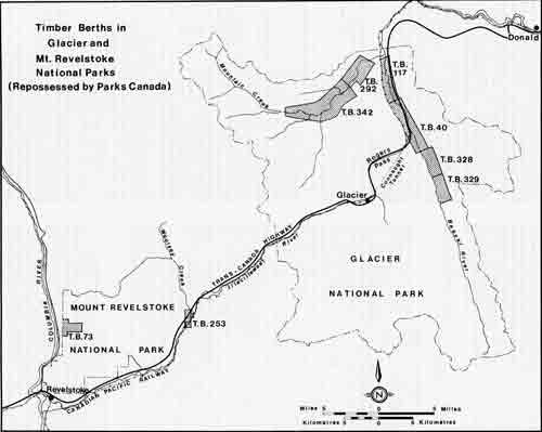
Timber Berths in Glacier and Mt. Revelstoke National Parks (repossessed by Parks Canada)
Early Timber Rights
Within 10 years of the completion of the Canadian Pacific Railway from Montreal to Vancouver, timber cutting rights on hundreds of square miles had been disposed of in Manitoba, portions of the Northwest territories now forming Saskatchewan and Alberta, and in the railway belt of British Columbia. During the year 1896, 34,817,909 board feet were cut, from which the Department received $69,646 in dues.76 Up to January 1, 1897, the total revenue received by the department from timber sales had exceeded $1,422,000. By the end of the fiscal year ending June 30, 1903, total revenue from timber in the areas mentioned above amounted to $2,427,685. During the same year, 458 timber licences were issued covering 6,347 square miles of forested land.77
When the first timber berths were licensed by the Department of the Interior, national parks had not yet been established. During the debate in the House of Commons on the Rocky Mountains Park Act, which created Canada's first national park in 1887, the existence of timber berths within the proposed park was acknowledged by the Minister of the Interior, Thomas White. He explained that cutting rights on three areas, containing altogether 99 square miles had been sold by public competition before the Banff Springs reservation had been made in 1885. Similarly, areas believed to contain coal and other minerals had been disposed of, some of which lay within the proposed park area. During the debate, the minister promised "that if we can arrange to exchange these (timber) limits for others, or in some other way release the park altogether from the presence of these leases, that course may hereafter be considered necessary." Although rights to timber within the original hot springs reservation later were cancelled, the Eau Claire Lumber Company operated timber berths up the Spray River in Banff National Park for many years thereafter.
Some of the licensed timber berths consisted of several blocks, usually not more than a few miles apart. When Glacier, Yoho and Mount Revelstoke National Parks were established between 1911 and 1914, the park boundaries enclosed a number of timber berths, or portions of timber berths which extended outside park boundaries. These berths, both outside and inside national parks, were administered by a branch of the Department of the Interior known in later years as the Timber and Grazing Lands Branch. In 1930, when title to all natural resources passed to the western provinces under the Transfer of Natural Resources Acts, the timber berths within national parks remained under federal government jurisdiction. Between June and October of that year, numerous files, documents and other records were transferred to provincial administration. Timber berths situated within national park boundaries were administered by the Dominion Lands Board until 1936, when they came under the jurisdiction of the Lands, Parks and Forests Branch of the Department of Mines and Resources. After the transfer of resources was effected, 17 licensed timber berths still existed in the National Parks — three in Jasper Park, Alberta, two in Riding Mountain Park, Manitoba and the remainder in Yoho, Glacier and Mount Revelstoke Parks, British Columbia.
Parks Branch Takeover
When the National Parks Act became law in 1930, section (9) provided that all national park regulations made by the Governor in Council under the provisions of the Rocky Mountains Park Act and the Dominion Forest Reserves and Parks Act would continue in force until rescinded. The Rocky Mountains Park Act had been repealed in 1910 and those sections of the Dominion Forests Reserves and Parks Act relating to national parks had been repealed in 1930. However, the Dominion Lands Act, under which regulations respecting timber berths had been made, was not repealed until June 1, 1950. The 1950 legislation permitted a transfer of administration of the timber berths remaining in the national parks. Effective January 31, 1951, the director of the National Parks Branch of the Department of Resources and Development became responsible for their administration. By that time, through cancellations and forfeitures, the number of berths remaining in the national parks was believed to be eight — all in British Columbia. Later in 1951 the existence of part of another berth in Mount Revelstoke Park was discovered. The revenue from all berths for the fiscal year 1950-51 amounted to $531.07.78 Their combined area was about 43 square miles.
New Timber Legislation
To provide statutory authority for the administration of timber berths remaining in the national parks, the National Parks Act was amended by Parliament in June, 1950, by the repeal of sections 9 and 10 of the act, and their replacement by new section 9 which read as follows:
9. All timber berths in National Parks that were disposed of prior to the thirtieth day of May, 1930, shall remain subject to the same obligations, terms and conditions as were in force prior to that date and nothing in this Act shall be construed to interfere with, prejudice or take away any rights granted to the holders of such berths but such obligations, terms and conditions shall be subject, at the date of each yearly renewal, to such changes as the Governor in Council may prescribe and shall be subject to all regulations made by the Governor in Council under this Act.79
Later, the annual rental, fireguarding charges and royalties which had been payable under regulations established by authority of the Dominion Lands Act were reviewed and found to be substantially less than those prevailing in areas subject to provincial regulations governing the harvesting of timber. Consequently, the National Parks Timber Regulations were amended on April 22, 1952, to provide for an annual ground rent of $50 for each square mile occupied instead of $10. In addition to an annual license fee of $2 which had been payable, a fireguarding charge of six cents for each acre in the berth was imposed, together with an increase in dues or royalties payable on timber harvested.80
By 1961 the construction of the Trans-Canada Highway through Glacier and Mount Revelstoke National Parks was nearing completion. As the surveyed right of way crossed lands situated within three timber berths, the National Park Timber Regulations were amended on January 26, 1961, to help preserve the aesthetic aspects of the adjoining forests, should timber cutting be resumed or undertaken. The amendment provided that no tree within 200 feet of the right of way of any public road might be cut, except a tree designated by the park superintendent. It also provided for the inclusion of a similar restriction in the annual timber berth licence.81 Licensees of timber berths from which lands were deleted for highway construction purposes were later compensated for the timber withdrawn.
Changes in Policy
Logging and the operation of sawmills in national parks have always conflicted with basic national parks policy. A vested interest in licence timber berths had preceded, in most instances, the establishment of the national parks concerned. Fortunately, few of the timber berths or portions of berths within park boundaries were subjected to logging, and the parks were spared the crash of falling trees, the whine of sawmills, and the ensuing slash and debris which accompany the despoliation of magnificent examples of alpine forest species.
The adoption of a firm national park policy in 1964 confirmed the long-held view that only forest operations which are primarily concerned with the management of the forests for the protection and the maintenance of national park values should be permitted. The policy statement also recommended the extinguishing of existing rights of prime forested land. This aspect was summarized as follows:
17. The existence of licensed timber berths is not consistent with the purposes of National Parks and cutting rights presently held should be extinguished. Where it is practicable to do so, timber berths should be acquired by negotiation, but failing this the holders should be notified to complete their operations so that the berths can be extinguished as soon as possible. No further timber cutting rights of this type will be granted in any National Park.
Licensees Ordered to Operate
Four years before the administration of the licensed timber berths was turned over to the National Parks Service, an attempt was made by the director of the Lands, Parks and Forests Branch of the Department of Mines and Resources to end the seemingly perpetual renewal of the annual licences that provided the basis of timber ownership. In the course of an inspection of the national parks in western Canada, the director, R.A. Gibson, in August 1947, discussed the status of the existing berths with the superintendent of Yoho, Glacier and Mount Revelstoke Parks, G.H.L. Dempster, and Chief Park Warden Dick Langford. At that time, one timber berth, No. 73, was held under license in Mount Revelstoke Park; six berths, Nos. 40, 117, 292, 328, 329 and 342, existed in Glacier Park; and one, No. 406, remained in Yoho Park. Only Timber Berth 117 in the Beaver River valley had been logged during and after World War II. The operator, Rogers Lumber Company of Rogers, British Columbia was reported to be considering the acquisition of licenses covering other berths in Glacier Park.
In October, 1947, the Lands Division of the branch prepared for the signature of the deputy minister a formal notice to the licenses of berths 40, 73, and 406, requiring them to have in operation, within a period of one year, and keep in operation for six months in each year, a sawmill in each berth capable of cutting 1,000 board feet per day of every 2-1/2 square miles licensed. In the letters forwarded, the attention of each licensee also was drawn to a clause of his license which provided for forfeiture of the license for noncompliance with the order respecting a sawmill operation.82
Timber Berth 406
In December, 1947, the department received, through a member of the Canadian Senate, an offer from the licensee of Timber Berth 406 to surrender his interest in the licence for $60,000. Later a representative of the licensee, Berpall Lumber Company of Milwaukee, Wisconsin, visited Ottawa and informed the chief of the National Parks Bureau that the company's estimate of the merchantable timber available was 80 million board feet. A few days later, Berpall Lumber Company submitted by telegram an offer to sell its interest in the timber berth for $35,000.
Logging Operation Approved
Meanwhile, arrangements had been made by the director of the Lands, Parks and Forests Branch for an examination of the timber resources of the berth. This was undertaken by Harry Holman, the district forestry officer for the Dominion Forest Service at Calgary. Holman reported on August 27, 1948, that the timber stands in the three blocks comprising the timber berth were overmature, and estimated the merchantable timber would not exceed 60 million feet.83 He also advised that the current owner was making every effort to sell the berth to an operator who would commence logging operations within the time limit set by the department. This berth had been granted in 1905, had never been logged, and the license had been assigned eight times in 42 years.
In his report, Holman also offered the opinion that a timber operation would not be detrimental to the interests of park administration, and stated that the area of Yoho Park under review — the Amiskwi River Valley — was urgently in need of a sanitary cutting of major proportions. Before the receipt of Holman's report the controller of the National Parks Bureau, James Smart, had recommended buying back the rights to cut timber on the berth. However, the contents of the forester's report altered the views of the controller and acting director, and a decision was made that the purchase of the berth be declined. The only alternative, the sale of the timber licence to an operator who was prepared to harvest the timber, was then recommended and approved by the deputy minister.
In September 1948, Berpall Lumber Company entered into an agreement for sale with W.T. Squelch and Son of Tulameen, British Columbia, to assign the licence in consideration of a payment of $30,000, spread over five years. The construction of an access road up the Amiskwi River valley was begun in the autumn of 1948 by the Squelch Company, and sites for a mill and campsite were selected. Actual logging operations were launched in 1951, and in later years they provided a classic example of how the primitive landscape and natural resources of a national park could be impaired for years to come by the impact of resource extraction, particularly if poorly managed.
Timber Rights Sold
Under the terms of the agreement for sale between Berpall Lumber Company and W.T. Squelch and Son, the latter were responsible not only for retiring indebtedness to Berpall, but also for the entire cost of providing access to the timber berth, and for developments necessary to carry on logging and milling. Evidently Squelch and Son were unable to meet their commitments, and in December 1950 they entered into a sale agreement with G.C. Elliott of Vancouver. By later agreements concluded in May, 1951, December 1953 and February 1954, Paul E. Moseson of Wetaskiwin, Saskatchewan, obtained an interest in the timber license, reported to be 25 percent. Later, by separate agreements, dated December 21, 1954, (a) Moseson relinquished all rights to the timber license held by Berpall Lumber Company; (b) Squelch and Son assigned all their interest in the licence to Berpall Lumber Company; and (c) Berpall Lumber Company assigned the licence to George C. Elliott of Vancouver.
For the next eight years Elliott held the annual timber license for Berth 406. He conducted no operations, but entered into logging agreements with various operators to carry on the actual harvesting of timber. Logging practices of the operators, however, fell far below the standards required by the terms of the license, and before a license for the year 1955-56 was issued, Elliott was obliged to post a performance bond in the amount of $6,000. In October 1956 the assistant deputy minister notified Elliott by registered letter of the minister's intention to forfeit rights conferred by the licence, and to claim the indemnity. Elliott, however, was successful in obtaining a reprieve. With financial assistance he provided a new performance bond in the amount of $30,000, and was given a renewal of the timber license. Commencing in 1955, the licence had contained additional clauses requiring the licensee to remove all merchantable timber from the portion of the timber berth cut over; to pay the dues owing; and to clear up and dispose of all tops, branches and debris of logging and milling operations to the satisfaction of the minister. Operations were subject to the inspection of the park superintendent and it was evident that the logging practices of Elliott's contractors and subcontractors fell short of requirements.
Fire on Timber Berth
In July 1960 a disastrous fire occurred on Berth 406 through the carelessness of an employee of a subcontractor. The millsite and a large area of timbered land were burned before the fire was extinguished by national park forces at a cost of $70,000, for which the licensee, Elliott, was held responsible. At the time outstanding timber dues and interest were owing to the department by the licensee, who was unable to pay, and renewal of the timber license accordingly was withheld for the year 1961-62. Finally, in June 1962, the department consented to a renewal of the license and its assignment from Elliott to Lee St. Clair of Calgary, following a negotiated settlement. It called for payment over a five-year period of half the cost of suppressing the fire of 1960, $35,000, together with a satisfactory cleanup of previously logged-over land. A performance bond, in the form of a mortgage on property, buildings and equipment in the town of Cochrane, Alberta, also was furnished by St. Clair.
Late in 1962, it was established by the park superintendent that previous incompetent and wasteful logging procedures were being continued. Included were high-grading (cutting only choice timber), leaving high stumps in winter operations, maintaining a dirty millsite and failure to dispose properly of slash and tops from operations. Logging carried on outside the berth accounted for more than one million board feet before the illegal cutting was discovered. St. Clair's operations were closed down in 1962 and again in 1963, but on promises to improve the operation and pay arrears of timber dues he was permitted to continue logging. Between 1963 and 1967, St. Clair operated the berth through several subcontractors who cut about 18 million board feet of timber. He failed, however, to meet his commitments, including the retirement of the debt due under the mortgage which on April 1, 1967, amounted to $32,700. Before the issue of the license for the year, 1966-67, Block "A" had been withdrawn from the berth.
License is Forfeited
On April 4, 1967, the timber berth license was declared forfeited by the minister, Arthur Laing, because of failure to pay monies owing under the mortgage bond. Any rights formerly held by St. Clair no longer existed, although logging could still be authorized by the minister under permit. With the prospect of obtaining a cleanup of timber from the berth and the payment of arrears, the minister consented in October 1967 to a continuance of operations on the berth by Charles W. Moar, St. Clair's contractor since 1964. This permission was granted on the understanding that operations would be completed and outstanding indebtedness would be paid by April 30, 1968. On compliance with these conditions, Moar would then have the privilege of logging under permit until April 30, 1969. Moar paid off the outstanding mortgage with interest on July 9, 1968, and on August 2 he completed an agreement with the director of the western region of the National and Historic Parks Branch, which set out in detail the terms under which the operation would be conducted.
Later that month, Moar suffered a setback, when a sawmill set up in 1964 burned after catching fire during a welding operation. Moar was insured and claimed a loss of $275,000. The insurance company refused to honor the claim because of an alleged violation of the provincial Welders Act. By early October 1968 it was evident to park authorities that the expected cleanup and the posting of a performance bond by Moar in accordance with his agreement would not be completed. Consequently, on October 16, Moar was notified by the regional director that his privilege of logging the berth under permit had been terminated.
Final Extension Granted
Later, following representations by the member of Parliament for Kamloops-Cariboo, the minister, Jean Chr�tien, reviewed the matter and authorized the director of National Parks for the Western Region to give Moar an extension in which to meet his commitments. Under a new agreement dated December 3, 1968, Moar was required to clean up, to the satisfaction of the superintendent, all logs and lumber from operations on Blocks "B" and "C" of the berth by June 30, 1969. Logging under permit might then be continued until October 31, 1969, provided a new performance bond in the amount of $10,000 was posted. The agreement also stipulated that all logging must be terminated on or before October 31, and a complete cleanup of all operations made by November 30, 1969.
By December 1969 it was found that Moar had made a creditable effort to comply with the terms of his agreement. There remained, however, over a dozen loads of logs to be removed, some cleanup work to be completed, and miscellaneous equipment and buildings to be disposed of. By December 30, 1969, most of the conditions of the latest agreement had been complied with, but some fuel tanks and a tractor blade remained on the berth. Moreover, a substantial sum representing dues on timber removed had not been paid. In October 1970 a Vancouver lawyer was appointed receiver and manager of the Wolverine Valley Lumber Company Limited. This company, in which C.W. Moar had a substantial interest, had been engaged in logging operations on Timber Berth 406. The receiver subsequently paid the timber dues outstanding and requested the return of bonds held by the department pending completion of all conditions of the operator's logging agreement. By March 1972 all requirements had been met either by the former operator, C.W. Moar, or the receiver of his bankrupt company, and all performance bonds held by the department were released.84
The foregoing outline of logging operations on Timber Berth 406 indicates that the decision made in 1948 to permit a forestry management operation instead of reclaiming the timber licence by purchase turned out to be monumental error. During the 20 years or more in which logging operations were carried on, the three individuals or companies that held the license either lost money or were forced into bankruptcy. Few of the 20 or more persons who obtained cutting rights as contractors or subcontractors benefited financially, and much of the Amiskwi River Valley in Yoho National Park was subjected to forest impairment for years to come. Through carelessness, the timber berth sustained one major fire and two others in which a sawmill, its equipment and an auxiliary building were destroyed. Only half the department's cost of suppressing the 1960 fire — $70,000 — was recovered, and substantial additional expenditures were made in supervising and controlling the logging operation. How much better it would have been for the park, its environment and all operators concerned had the department accepted the offer of Berpall Lumber Company to sell its interest in the berth for $35,000.
Timber Berth 253
When the administration of timber berths within national parks was transferred to the National Parks Branch early in 1951, it was believed that only eight timber licenses existed in the national parks. However, in April that year, Chief Park Warden Mann of Mount Revelstoke Park brought to the attention of Park Superintendent Steeves the existence of one block of Timber Berth 253 within the southeastern limits of that park.85 Correspondence with the Department of Forests of British Columbia revealed that when the timber berth, consisting of several blocks, was transferred to British Columbia in 1930, federal and provincial departments both overlooked the fact that Parcel "C" of Block 1 lay almost entirely within the park. Consequently, the British Columbia Forest Service had collected rental and forest protection tax on the area within the park from May 1, 1931 to April 20, 1952. Information obtained also revealed that the timber berth license was held by Toronto General Trusts Corporation in trust for the estates of William Irwin and R.R. Hall of Peterborough, Ontario, and R.B. Whiteside of Duluth, Minnesota.
Later that year, in the course of an inspection of western national parks, the writer visited Victoria and discussed with the chief forester, Dr. C.D. Orchard, the status of the timber berth and the dues payable on timber berths and timbered lands administered by British Columbia. As a consequence, the province remitted to the federal Department of Resources and Development in May, 1952, rental in the amount of $137.50 which had been collected inadvertently by the province for Parcel "C", Block 1, over a period of 22 years.
Timber License Reinstated
Steps to reinstate the timber license under federal government jurisdiction were initiated in May, 1952, but several years elapsed before such action was possible. Before issuing a timber license to the Toronto General Trusts Corporation as executor of the estates of the former license holders, the National Parks Branch required, for its records, certified copies of letters probate of the last will and testament of each of the parties concerned, proved in the province of British Columbia. The beneficiaries of one estate were reluctant to meet the charges for resealing letters probate in British Columbia, but by July 1958 the required documentation had been completed. A timber license for the year 1958-59 was then issued to the Toronto General Trusts Corporation as executor of the estate of William Irwin, and to the accredited representatives of the other estates concerned. Completion of the license permitted its assignment to A.O. Woolsey of Albert Canyon, British Columbia. Under the terms of a logging agreement with the executors, Woolsey had assumed for several years, the payment of rental and other charges payable under the terms of the license.
License is Surrendered
Meanwhile it had been determined in 1957 that a right of way for the Trans-Canada Highway across the timber berth would be required. Following cruises of the area undertaken by Woolsey and by a national park forest officer, agreement was reached on the value of the timber that would be cut in highway clearing operations. Later, with the approval of Treasury Board, Woolsey was paid $900 for approximately 256,000 board feet of timber.
During its negotiations with Woolsey in 1958 about compensation for timber removed, the department intimated that it would be prepared to purchase the license rights to the timber remaining in the portion of the timber berth within the park. By the end of February 1959 Woolsey had acquired the license, and in November 1960 he offered to dispose of all his interest in return for a payment of $8,775. The offer was accepted, and the surrender of the timber berth license was obtained in May 1961.86
Other Licensees Notified
In October 1947 the Royal Trust Company, licensee of Timber Berth No. 73 in Mount Revelstoke Park and Timber Berth No. 40 in Glacier Park, also was notified by the Deputy Minister of Mines and Resources that it must, within a period of one year, put into operation on each berth a sawmill capable of cutting 1,000 board feet in one day for every 2-1/2 square miles licensed. As the trust company held the licence as security for a mortgage from the actual owners, the Canadian Western Lumber Company Limited of Vancouver, the communications were passed on to this company.
Later a representative of Canadian Western Lumber Company visited Ottawa, and discussed with the deputy minister and his assistant the proposed operation of Berths 73 and 40. In November 1948 the company's chief forester advised the controller of the National Parks Bureau that arrangements were under way to start operations as soon as physically possible.87 On the strength of this assurance, the issue of timber licenses for both berths for the fiscal year 1949-50 was approved. A review of relevant files, however, later disclosed that no operations were undertaken and, for unexplained reasons, the department continued to issue annual timber licenses to the Royal Trust Company. On August 12, 1959, both licenses were assigned, with the consent of the department, back to Canadian Western Lumber Company Limited.
Highway Rights-of-Way Required
In November 1956 it was ascertained from surveys made by the Department of Public Works that rights-of-way for the Trans-Canada Highway through Timber Berths 40 and 117 in Glacier Park would be required. The department's legal adviser confirmed that withdrawals of the land required could be made by preparing a new description of the area covered by the timber license. The legal ruling, however, also called attention to the need for providing compensation to the licensee for the value of the timber deleted from existing rights. Following a cruise undertaken by the national parks forest officer, S.F. Kun, it was determined that 100 acres in Timber Berth 40 and 128 acres in Timber Berth 117 would be required for the highway right of way. The land requirements for highway purposes in Timber Berth 253 in Mount Revelstoke Park were reviewed in previous paragraphs.
When the annual licenses for the year 1958-59 were prepared, the lands occupied by the rights-of-way were deleted from the descriptions of the licensed areas. Estimates of the value of the timber affected by the withdrawal of land from Berth 40, compiled separately by the National Parks Branch and by Canadian Western Lumber Company Limited, differed by several thousands of dollars. A compromise, however, was reached by splitting the difference between valuations, and the lumber company was paid approximately $8,500 for the loss of timber in Berth 40. Before the actual settlement, Canadian Western Lumber Company Limited had as signed on November 18, 1959, its interest in both Timber Berth 40 and Timber Berth 73 in Mount Revelstoke Park, to Kicking Horse Forest Products Limited of Vancouver.
Other Licensees Exempted
Although the deputy minister had notified the licensees of three timber berths in British Columbia in October, 1947, that the erection of sawmills and the commencement of cutting operations were obligatory, the licensees of five other berths in Glacier National Park escaped such notification. These berths, 117, 328 and 329, all in Beaver River valley, and Berths 292 and 342 in the valley of Mountain Creek, were held in the names of several members of the Leuthold family of Deer Park in the state of Washington, trading under the name of Deer Park Lumber Company. The licenses had been issued in the names of the four partners, W.M. Leuthold, Grace H. Leuthold, John H. Leuthold and Caroline Leuthold Fitzgerald. The last-named partner had died in February 1947, and the issue of the annual licenses was withheld that year pending the submission of legal documents concerning the distribution of her estate. Documentation was cleared in February 1952, and on March 2, 1952, the minister consented to the assignment of the license for Timber Berth 117 to Selkirk Spruce Mills Limited of Donald, British Columbia. Annual licenses for this berth were subsequently issued to this company from 1952-53 onwards.
Further Assignments
Additional assignments submitted by members of the Leuthold family in 1952 and 1954 had the effect of vesting the rights to licenses for Timber Berths 292, 328, 329 and 342 in the name of John H. Leuthold as guardian of a minor, Caroline E. Leuthold. In 1959, John H. Leuthold obtained an order from the Superior Court of Washington empowering him to enter into an option agreement with Cyprus Mines Corporation or with an affiliated or subsidiary corporation, to sell with the consent of the Minister of Northern Affairs and National Resources of Canada the interest of Caroline E. Leuthold in the four timber berth licenses. Assignments dated January 18, 1960, from John Leuthold on behalf of Caroline E. Leuthold, to Kicking Horse Forest Products Limited, a subsidiary of Cyprus Mines Corporation, subsequently were submitted to the department and approved by the deputy minister on March 20, 1960.
On May 1, 1960, nine timber berths remained in Yoho, Glacier and Mount Revelstoke National Parks. Events leading to the purchase in 1961 of the license covering Timber Berth 253 in Mount Revelstoke Park and the forfeiture in 1967 of rights to Timber Berth 406 in Yoho Park already have been described. Of the seven berths remaining, Selkirk Spruce Mills Limited held a license for Timber Berth 117 in Glacier Park and Kicking Horse Forest Products Limited held licenses for Timber Berth 73 in Mount Revelstoke Park and Berths 40, 292, 328, 329 and 342 in Glacier Park. Timber Berth 117 contained an area of 3.17 square miles and the remaining six berths controlled by Kicking Horse Forest Products Limited contained approximately 30 square miles.
Negotiations for Berth 117
The impending completion of the Trans-Canada Highway through Glacier National Park, along the original route followed by the Canadian Pacific Railway up Beaver River Bailey and over Roger Pass, brought into focus the incongruity of lumbering operations being carried on adjacent to a major scenic parkway. At the same time, the construction of the highway enhanced the market value of a virgin timber reserve which previously had been nearly inaccessible. Timber Berth 117, granted in 1893, had been logged for about five years prior to 1948, during which about eight million feet board measure of timber had been removed. The new highway traversed the berth from north to south for five miles, and 128 acres had been withdrawn in 1959 for highway right of way purposes. In October, 1959, the licensee Selkirk Spruce Mills Limited was in serious financial straits, and officers of the National Parks Branch were hopeful that the berth could be purchased for a reasonable sum. The maximum value of the timber remaining on the berth was believed to be $30,000.88
In March 1961 the National Parks Branch opened negotiations with Selkirk Mills with a view to having the rest of the timber harvested, or alternatively purchasing the timber rights. The company had been paid $1,869 for the timber on the high allowance withdrawn from the berth. In the course of negotiations between S.F. Kun, regional forester of western national parks, and Vice-President E.J. Gondek of Selkirk Spruce Mills Limited, the company suggested $25,000 as a satisfactory price for the surrender of its license.89 This offer was conveyed to the director of the National Parks Branch at Ottawa, but acceptance was deferred. Meanwhile, both park authorities and Selkirk Mills officials were considering an appraisal of the merchantable timber remaining on the berth. In June 1964, Vice-President Gondek suggested the engagement of a consultant and offered to pay half the cost of the survey. Before this offer was accepted, Selkirk Mills hired Gormely Forestry Service of Vancouver to undertake a cruise and submit a valuation of Timber Berth 117. This was completed in December 1964, and a value of $115,028 was placed on the timber in the berth, then believed to be 11,581,000 board feet. A separate calculation was made for timber in the buffer zone bordering the highway on which cutting was not permitted. The additional timber was valued at $10,201, bringing the total valuation to $125,431.90 Failure to conclude a settlement with the licensee on this valuation was to be costly for the National Parks Branch, for in 1966 Selkirk Mills engaged Gormely to revaluate the timber on its berth. The revaluation was based on increased logging costs and lumber sale prices, although the timber inventory reported in the 1964 report was retained. The 1966 survey placed a valuation of $255,373 on the timber in the berth, and $23,408 on that in the buffer zones bordering the highway. The new combined total, $278,781, exceeded that of 1964 by more than 100 percent. On December 28, 1966, Selkirk Mills made a formal offer to sell all its rights in Berth 117 for $280,000.
Berth Valuation Escalated
During 1967 extensive studies of the timber berth's value were carried out under the direction of the regional forester of the National Parks Branch, and the possibility of exchanging Berth 117 in Glacier Park for Berth 406 in Yoho Park was considered. By this time the department also was engaged in discussions relating to the extinguishment, by purchase or land exchanges, of other timber rights in Glacier National Park held by Kicking Horse Forest Products Limited. On November 6, 1968, the Vancouver Province carried a news item which reported Vice-President Gondek of Selkirk Mills Limited as stating that negotiations had broken off as far as he was concerned. He was quoted as saying, "I want to get my crews in as soon as possible and get as much cleaned up as possible before the spring thaw starts."
This statement precipitated a decision by the department to acquire all timber berths remaining in the western parks. Steps were initiated to expropriate not only Timber Berth 117, but also other timber berths in Glacier and Mount Revelstoke parks. On being informed of the department's intention, Gondek advised the director of the National Parks Branch that his company was prepared to withhold logging operations on Berth 117 while negotiations for its purchase by the Crown were continued. Gondek also forwarded to the minister, Jean Chr�tien on December 3, 1968, a report from its consultant, Gormely Forestry Service, which had reviewed its 1966 valuation of the timber on the berth and increased its former figure to $385,698.
Purchase Completed
In April 1969 the Minister of Indian Affairs and Northern Development obtained authority from Treasury Board to negotiate the purchase of timber rights on Berth 117 for an amount not exceeding $300,000.91 Bargaining then began in earnest. The department engaged a firm of chartered accountants to review the evaluations placed on the merchantable timber remaining on the berth, and received advice that the actual value ranged from $226,656 to $374,478. A specialist in the department's Economic Development Branch also was consulted, and recommended a maximum purchase price of $290,491. Negotiations reached a climax when E.J. Gondek, vice-president of Selkirk Spruce Mills Limited, accompanied by staff members, met with Assistant Deputy Minister Digby Hunt and officers of the National and Historic Parks Branch at Ottawa on October 8, 1969. After a review of various aspects of the timber berth, including its potential yield, prevailing prices of lumber and other matters, Gondek agreed, on behalf of his company, to surrender all rights to the timber license in consideration of a payment of $193,032. Later the department confirmed acceptance of this offer by letter. Unfortunately, title to the timber rights had been affected by certain transactions made by members of the Leuthold family while they were the licensees, and legal documentation satisfactory to the department was delayed. Eventually, obstacles to the settlement were cleared by the expropriation of all rights to the lands concerned, and a formal surrender of the timber license, including cutting rights, was obtained on April 24, 1970.
Kicking Horse Forest Products Berths
Before consent to the transfer of timber licenses from Canadian Western Lumber Company and from the Leuthold family to Kicking Horse Forest Products Limited was granted by the department, damage to the environment was foreseen. Three of the berths — 40, 328 and 329 — lay within the valley of the Beaver River, through which the Trans-Canada Highway was being constructed. During its negotiations for the Leuthold berths, Kicking Horse Forest Products obtained assurance from the National Parks Service at Ottawa that logging would be permitted, provided harvesting of the timber was completed as fast as possible. Later, on December 21, 1959, Deputy Minister R.G. Robertson informed the Ottawa solicitors of Kicking Horse Forest Products that the minister, Alvin Hamilton, was reluctant to approve the transfer of cutting rights before the terms and conditions under which the berths would be worked had been considered.92
Of primary concern was Timber Berth 40, which would be traversed throughout much of its length by the new highway. Not only were administrative problems likely to arise, but logging operations and the denuded forest could create an eyesore for park visitors using the highway. As Hamilton remarked to his deputy Minister: "I just hate to see an area of this size cut. It would spoil for 25 or 30 years the view coming out of the (Rogers) pass."93 The minister later concurred in a suggestion by the director of the National Parks Branch, that the licensee be asked to quote a price for which it would be willing to sell its rights. Eventually, on the understanding that additional restrictions to protect the appearance and character of the park would be imposed, consent to the assignment of the licenses was granted. As already reported, amendments to the National Parks Timber Regulations made in 1961 established protective zones along the highways where timber cutting was prohibited.
Restrictions Laid Down
A few months after cutting rights on six berths had been acquired by Kicking Horse Forest Products Limited, the company requested copies of the original survey notes for these areas. This request was met and in a letter confirming their dispatch, B.I.M. Strong, chief of the National Parks Service at Ottawa, wrote to the vice-president, J.D. Sigalet, outlining the department's policy respecting the operation of licensed timber berths. It was explained that although the existence of the timber berths on national park lands was not consistent with the purposes of the parks, the right of the licensee to operate the berths was recognized. While it was not planned to place unnecessary restrictions on the licensee's operations, certain requirements in the course of logging operations were obligatory. These included a high standard of fire protection and slash disposal; a minimum disturbance to park land and physical features outside the boundaries of the berth; and a good cleanup of logging and milling debris, old mill sites, camps and other structures as operations progressed.94
The company also was informed that plans for any access roads must be approved by the National Parks Service before construction commenced. Reference also was made to additional restrictions proposed, to protect the appearance of the lands along the route of the Trans-Canada Highway. These restrictions had been forecast when the minister's consent to the assignment of the cutting rights had been granted. In conclusion, the chief's letter suggested that a solution to difficulties which might arise from park policy and regulations might be the purchase of the cutting rights by the department; and he asked if the company would consider disposing of its interest in the berths.
Timber Exchange Explored
Additional correspondence revealed that the company had no plans for logging during 1960, although preliminary investigations were planned. In July 1960, Vice President Van de Mark of the Kicking Horse Forest Products Limited head office in Los Angeles advised the chief of the National Parks Service that his company wished to maintain a long-lived operation, and would not willingly sell Timber Berth 40. On the other hand, the company rejected buy-back discussions, but was prepared to explore the possibility of an exchange of the berths for timber outside Glacier Parks if it would provide comparable volumes by species, quality and proximity to the Canadian Pacific Railway. Alternatively, a trade of Berths 40, 328 and 329 for other timber in the park, as suggested by the park administration, would be considered. This letter was acknowledged with the advice that the company's proposals would be examined.
In September, 1960, S.F. Kun, regional forester for the western parks, accompanied by two park wardens, examined timber stands in Mountain Creek valley as a possible exchange for those in Beaver River valley. Kun reported that timber in Berth 342 contained some remarkable stands, with trees ranging from 130 to 165 feet in height, and having an age of 230 to 275 years. Compared to that in Beaver River valley, the timber in the Mountain Creek berths appeared sound throughout, with little butt rot.95 In March, 1961, the deputy minister approved a proposal from National Parks Director Coleman that Kicking Horse Forest Products be informed that the department would consider an exchange of timbered lands in the Mountain Creek area adjacent to two berths in that valley — already held by Kicking Horse — for existing berths in Beaver River valley.
Later in the month, Park Superintendent Styles discussed exchange proposals with officers of Kicking Horse Forests Products. The company officials revealed that cutting and removal of timber from Berth 40 was not proposed until 1963. As planned, logs would be trucked to the company's mill at Golden, British Columbia, where they would be processed. The company officers also expressed an interest in timber adjoining Timber Berth 406 in Yoho Park, which they hoped could be exchanged for that in Berth 40. This proposal was not entertained.
Correspondence and discussions on possible exchanges of land continued in 1962. In June the company's general manager advised Director Coleman that a forestry consultant had been engaged by the company to evaluate exchange proposals. In July Coleman, Regional Forester Kun and Regional Supervisor Dempster met with company officials for discussions.
The park officers were informed that logging on Berth 40 in Glacier Park was not proposed until 1964, and that the berths acquired by Kicking Horse Forests Products were expected to support a very large lumber operation at Golden. it also was learned that the company had timber holdings in the Columbia River valley on provincial lands, which later would be flooded by the construction of a dam on the river at Mica Creek. It was agreed that the services of federal Department of Forestry officers in assessing timber values in the Mountain Creek area of the park would be acceptable to all concerned.
By September 1962 Department of Forestry officers were able to report that most of the accessible stands of timber near but outside Berths 292 and 342 were on steep hillsides, and would be difficult to remove. It was also disclosed that although the area of merchantable timber adjoining Berth 342 in Mountain Creek Valley was about double that in the three Beaver River valley berths, timber values per acre were less than those along Beaver River. In July 1963, Kicking Horse agreed to a list of five professional forest consultants from whom technical advice might be obtained by the Department of Northern Affairs under contract. The department subsequently obtained authority to enter into a contract with Gormely Forestry Service of Vancouver, but Kicking Horse then rejected this consultant because it was proposed to issue the contract without calling for tenders. Arrangements for the appraisal of timber were then dropped, but were revived in 1964.
Kicking Horse Forests Products Limited was requested on April 2, 1964, to provide a list of forestry consultants who would be acceptable. The company complied with this request, and among the four consultants they suggested was Gormely.96 On July 24, 1964, Gormely was engaged under contract by the department to report on the three berths in Beaver River valley and the two on Mountain Creek. The field work was completed in September and the report was received by the director at Ottawa in December, 1964. The report covered the results of field examination, compilation of field data, timber valuation and comparison of values, with the aid of available maps and aerial photographs. Timber values and volumes in Mountain Creek valley were found ample to offset those of timber in Beaver River valley. The total volume of timber in Berths 40, 328 and 329 in Beaver River valley amounted to 64,753,000 board feet measure with an estimated conversion return of $299,554. The volume of timber in Mountain Creek valley outside existing timber berths was estimated to be 162,490,000 board feet with an estimated conversion return of $427,194.97 The consultant received $43,507 for his work under the contract.
Negotiations Revived
Negotiations between National Parks personnel and those of Kicking Horse Forest Products remained dormant throughout 1965, but were revived in 1966 after the lumber company had been forwarded a copy of the Gormely report. At a meeting held on October 27, 1966, in Calgary between the regional director of national parks, D.B. Coombs, and P.R. Walsh, vice-president and general manager of the parent Cyprus Mines Corporation, the purchase of the berths by the Crown was discussed. Walsh indicated that the department would be receiving a sale offer by mid-December. However, by August 1, 1967, no offer had been received. Meanwhile the park superintendent had been advised by Kicking Horse Forest Products of Golden that the company was planning to commence operations on Berth 40 in the near future.
On August 30, 1967, the forest manager of Kicking Horse Forest Products requested the regional director of national parks to obtain the department's position on alternatives proposed by the company. These were (a) an exchange of timber in Mountain Creek valley for that in the Beaver River valley berths, or (b) liquidation of the Glacier Park berths as they existed. After consultation with the director of National Parks at Ottawa, the regional director requested Kicking Horse for its opinion on the cash value of all timber berths held by the company in Glacier and Mount Revelstoke National Parks, and also that of the timber berths situated only in Beaver River valley.
In reply, resident manager R.E. Davis at Golden advised that his company valued the Beaver River block at $2,380,664, the Mountain Creek block at $2,188,848, and Timber Berth 73 in Mount Revelstoke Park at $144,900. Altogether the company's price for its timber berths was $4,714,412, which Davis stated represented their replacement value.98 This communication was acknowledged with the observation that, quite obviously, the company's calculations had not been based on the Gormely report, which had been agreed upon as a basis of negotiation. Early in 1968, Kicking Horse obtained a revaluation of its timber holdings in the parks from Forestal Forestry and Engineering Limited of Vancouver. Following a review of the Gormely report, this company placed the aggregate value of the berths at $4,716,215.99
Further consultations were undertaken during 1968 involving Gormely Forestry Service, officers of Cyprus Mines Corporation, the western regional director of National Parks and the National Parks regional forester. Officers of the National Parks Branch reached the conclusion that the figures quoted by Kicking Horse Forest Products Limited for relinquishing all its timber cutting rights in the national parks represented a gross inflation of their actual value. Gormely submitted his revaluation of the Kicking Horse berths, stating that a figure of $3,194,337 should be sufficient to satisfy an arbitration board if this should be required.
On September 16, 1968, the Minister of Indian and Northern Affairs made a submission to Treasury Board requesting approval of a proposal to extinguish timber cutting rights in Glacier and Mount Revelstoke Parks at a cost of $2,500,000, of which $1,500,000 would be made available from the appropriations of the current fiscal year and the balance from those for 1969-70 when available. This submission was returned by the board with the suggestion that approval in principle be sought for the proposal, with proposed expenditures withheld until the following fiscal year, after budgeting priorities were reviewed.100
Expropriation Recommended
Before the alternative proposal had been fully considered, the attention of the acting director of the National Parks Branch was drawn to an item which appeared in the November 6, 1968 issue of the Vancouver Province. This said logging crews of both Kicking Horse Forest Products Limited and Selkirk Spruce Mills Limited were preparing to move into Glacier Park timber berths and commence logging operations. This information led the minister to request the return of his submission to Treasury Board. He then forwarded a revised submission requesting approval for the expropriation of all the interest of both Kicking Horse Forest Products Limited and Selkirk Spruce Mills Limited in national park timber berths. This submission received the approval of Treasury Board on December 17, 1968,101 and the accompanying order-in-council was approved by the Governor General on December 20.102 The board also directed that in negotiations with the companies concerning remuneration, the top limit must not exceed $2,200,000.
Both Kicking Horse Forest Products and Selkirk Spruce Mills had been advised of the proposal to expropriate their holdings, and both companies had agreed to suspend any timber operation while negotiations continued. At a meeting in Ottawa on January 15, 1969, J.M. Klein, senior vice-president of Cyprus Mines Corporation, engaged in further negotiations with National Parks Director J.I. Nicol and members of his Ottawa staff. Before the meeting ended, Klein had tentatively agreed to accept $2,750,000 for a surrender of all cutting rights held by Kicking Horse Forest Products Limited, subject to the approval of his board of directors.
Financial Consultant Engaged
Later in 1969, following discussions between officers of the National Parks Branch and those of the department's economic development group, it was decided to have relevant reports and records of Kicking Horse Forest Products examined by a financial consultant. It was believed that this action, for which permission had been obtained from Vice-President Klein, would permit the department to have a sound submission made to Treasury Board respecting the outcome of negotiations with the lumber company, and also to recommend the maximum expenditure necessary to complete the purchase of the company's interest in the timber berths. Price Waterhouse and Company of Vancouver was selected to evaluate the cutting rights held by Kicking Horse Forest Products Limited. After interviewing the company's officers and its auditor, and examining the company's records, the consultants reported that a discounted value of $2,750,000 for the lumber in the timber berths was reasonable, having regard to the escalating prices of lumber. After consideration, the minister forwarded to Treasury Board on April 15, 1969, a revised submission, accompanied by supporting data, recommending that authority be granted to negotiate a settlement with Kicking Horse Forest Products for the sum of $2,750,000. The submission received approval on May 8, 1969.103
Meanwhile, Vice-President Klein had confirmed that his company would accept this amount for a surrender of all timber rights in the national parks, and action to complete the transaction was initiated by the appointment of an agent of the Department of Justice. Considerable delay occurred, however, in completing the formal surrender. A search of title by the solicitor of the Department of Justice revealed that Kicking Horse Forest Products had not received a clear title to the four berths it had purchased from the Leuthold family. As noted in previous paragraphs about the surrender of rights to Timber Berth 117 by Selkirk Spruce Mills Limited, the title was affected by an assignment of interest in the timber berths by John H. Leuthold to a minor, Caroline E. Leuthold, under authority of a court order issued in the state of Washington. Consequently, it was decided to register in the British Columbia Land Titles office at Nelson the expropriation of all rights in the timber berths concerned. This action was completed on July 14, 1970. Meanwhile a surrender of all rights to cut timber on five berths in Glacier Park and one in Mount Revelstoke Park effective October 31, 1969, had been obtained from Kicking Horse Forest Products Limited. Payment in full of the agreed upon compensation was completed on April 30, 1970. This transaction, together with that relating to Timber Berth 117, also in Glacier Park, and the cancellation earlier of Timber Berth 406, had the effect of extinguishing all timber cutting rights formerly held under license in the mountain national parks.
Purchase Aftermath
As a postscript to the successful deletion of all timber cutting rights in the British Columbia national parks, it can be added that the Government of British Columbia in 1972 levied a logging tax of $341,798 against Kicking Horse Forest Products Limited. This tax was based on an amount representing the difference between the purchase price of the timber cutting rights — believed to be about $663,000 and the amount received as compensation for their loss, $2,750,000. The province argued that Kicking Horse Forest Products Limited knew, when buying the timber berths, that the Department of Northern Affairs and National Resources would not permit logging to be undertaken. Consequently, the acquisition of the cutting rights was a successful speculation. Although the federal department had in fact agreed to logging operations, before the acquisition was completed, it had later reversed its policy. The company successfully appealed the assessment in the British Columbia Court of appeal, taking the stand that its sale of the berth to the Crown in right of Canada was involuntary under the threat of expropriation, and was finally closed out by expropriation. This judgment was appealed by the province in the Supreme Court of British Columbia; and the defendant, Kicking Horse Forest Products Limited, again had its position sustained by the court in May 1975.
Timber at Waterton Lakes
Within the boundaries of Waterton Lakes National Park there remained in 1977 a timber limit which was different in character from those which had existed in Yoho, Glacier and Mount Revelstoke Parks. Blood Indian Reserve Timber Limit A, containing about 7-1/2 square miles, was held by the Department of Indian Affairs and Northern Development in trust for the Blood Indian Band at Macleod, Alberta. It was one of several land reserves set apart in Manitoba and the Northwest Territories by Order-in-Council of May 17, 1889, pursuant to Indian Treaties 4, 6, 7, and part of Treaty 2.104
Timber Limit A, as originally surveyed by J.C. Nelson, D.L.S., in August, 1888, was on the west bank of the Belly River, about a mile and a half north of the international boundary, and then contained an area of 6.5 square miles. The Order-in-Council described the limit as heavily wooded, containing chiefly dry standing spruce, eight to ten inches in diameter, suitable for house building and fencing. Its creation preceded the establishment of the Kootenay or Waterton Lakes Forest Park in 1895, and when the boundaries of Waterton Lakes National Park were extended in 1914 they enveloped Timber Limit A.
For many years officers of the National Parks Branch considered the timber limit to be a constituent portion of the park, in which members of the Blood Indian band could obtain dry timber for domestic use, but would not have the privilege of hunting or trapping. Under prevailing timber regulations, the cutting of green timber in parks under permit was prohibited, except for park management purposes or making roads. However, in December 1928, at the request of the Department of Indian Affairs, the Commissioner of Parks authorized the cutting by Indians of green timber on the limit, on the understanding that slash and debris from operations would be cleaned up in a manner satisfactory to the park superintendent.
Ownership in Doubt
In January 1934 the status of Timber Limit A came under review following discussions between officers of the Department of Indian Affairs and those of the National Parks Branch, after a park warden laid charges against a Blood Indian for a breach of the National Parks Game Regulations. National Parks officers held the opinion that the timber limit was part of the park and that Indians entering the area with unsealed rifles were in fact violating park regulations. These views later were conveyed by letter to the Assistant Deputy Superintendent of Indian Affairs with the advice that if accepted, the Commissioner of Parks would have the charges against the Indian hunter withdrawn. Alternatively, if the national park position was not accepted, it was suggested that the matter of jurisdiction be referred to the Department of Justice for an interpretation. In reply, the secretary of the department of Indian Affairs advised that after considering the national parks representations it was agreed that the Indians were subject to the park regulations, and that the Indian agent had been so advised. Withdrawal of the charge against the accused also was requested on the understanding that he was acting under a misapprehension of his rights. This request was honored and the park superintendent notified accordingly.
Later, dissatisfaction among the Blood Indians over the National Parks position led to discussions between the local Indian agent and the park superintendent concerning a possible exchange of land. During their talks, the Indian agent indicated that the Indians might seek compensation for the loss of land used by the Department of the Interior in the construction of the Belly River Road, later known as the Chief Mountain International Highway. This road, which connects Waterton Lakes Park with Glacier National Park in Montana, was built without reference to the Indian administration between 1932 and 1936 as an unemployment relief project, and the right of way traversed the timber limit for a distance of about three miles.
Legal Opinion Obtained
Commissioner Harkin's suggestion that the status of Blood Indian Timber Limit A be determined by a reference to the Department of Justice was implemented on February 1, 1936, when the Deputy Superintendent of Indian Affairs made a formal submission to the Deputy Minister of Justice. The submission requested an opinion as to whether or not Blood Indian Timber Limit A and Peigan Indian Timber Limit B — outside Waterton Lakes Park — should be regarded as Indian reserves under the Indian Act. The submission included a detailed history of the timber limits prepared by the chief surveyor of the Department of Indian Affairs, with the information that the lands included in them had been withdrawn from the jurisdiction of the Dominion Lands Act by order in council on May 17, 1889. On February 25, 1936, the Deputy Minister of Justice replied that "the tracts of land described in the attachment to order-in-council of 17th May, 1889, including the so-called Timber Limits A and B, should be held to be Indian Reserves within the meaning of the Indian Act."105
Land Exchange Sought
This decision precipitated another attempt to effect an exchange of lands involving those occupied by Timber Limit A, for a portion of Waterton Lakes Park east of the Belly River. F.H.H. Williamson, controller of the National Parks Bureau, discussed the matter of land exchange with M. Christianson, general superintendent of Indian agencies at Ottawa, and on July 3, 1937, forwarded to Christianson plans and background material on Timber Limit A. Later, in a followup communication, Williamson explained that any exchange of land would require the consent of the Province of Alberta, because any land withdrawn from the park would, under the Transfer of Natural Resources Act (Alberta), automatically become vested in the right of the province.106
In reply, Christianson stated that although the Blood Indians had appeared to be receptive to an exchange earlier in the year, a change of attitude had occurred, and they now were opposed to giving up their reserve. A further exchange of letters between the director of the Lands, Parks and Forests Branch and the Director of the Indian Affairs Branch of the department failed to bring about any change in the attitude of the Indians.
From 1938 onwards throughout the duration of World War II, no further negotiations towards effecting a land exchange were undertaken, and in July, 1947, a block of land containing sixteen square miles was withdrawn from Waterton Lakes National Park by an amendment to the National Parks Act. This block contained the land which had been offered to the Blood Indians in exchange for Timber Limit A.
Compensation for Encroachment
Late in April, 1949, D.M. Mackay, director of the Indian Affairs Branch, revived the matter of compensation to the Blood Indians for land utilized in the construction of the Chief Mountain Highway. In a memorandum to R.A. Gibson, Mackay suggested the transfer to the Indian Affairs Branch, for incorporation in the timber reserve, of an area of some 700 acres situated between the northern boundary of the timber limit and the northern boundary of the park.107 As part of the transaction, the area forming the highway right of way would be formally transferred to the National Parks Branch. Acceptance of this proposal, Mackay stated, would obviate the sealing by park wardens of the guns and traps carried by the Indians crossing this narrow section of the park on their way to and from their reserve.
Before recommending acceptance of Mackay's proposal, Gibson requested the Dominion Forester to provide an evaluation of the timber contained in (a) the area north of Timber Limit A which lay within the park; (b) the northern portion of the timber limit crossed by the Chief Mountain Highway; (c) the southern portion of the timber limit, which might be offered as an extension.
The evaluation was delegated to Harry L. Holman, the district forest officer of the department at Calgary. Holman examined the areas under review and provided statistical data on the timber in the various areas. He observed: "The point at issue is not timber or grazing or any other thing, but the right to hunt and trap in this area and the right of access without interference by the park wardens...What they want is a corridor for access, without the silly procedure of sealing guns for the half-mile trip across the park area. They believe that this should be given to them in return for an easement on the highway, certain trails, telephone lines, and one warden cabin, all of which were constructed without proper authority."108 Holman wound up his report by stating that the matter should be settled as soon as possible by giving the Indians the northern strip of park land bordering the reserve, surveying the entire block and marking the boundaries so that they would be unmistakable.
In July 1949 the Forest Service provided a map and a statement of timber volumes in the various areas under review. This statement indicated that the small area north of the timber reserve contained no merchantable timber. On the other hand, the existing timber limit or reserve, both north and south of the highway, contained 25,610 cords of timber, and the area south of the reserve contained 22,260 cords. These figures incorporated timber having a diameter of four inches or more at the butt.
Action leading to settlement of the Blood Indian band's claim for compensation arising from encroachments made by the national park administration was suspended until July, 1952, when the Surveyor General was requested to supply copies of the original field notes of the survey of the reserve made in 1888. These were forwarded to the park superintendent with instructions to have the location of the original survey posts found if possible. Survey work undertaken that summer by the superintendent, his engineer and a surveyor in the employ of the department's engineering service established boundary lines but failed to disclose any of the original survey markers.
In August 1953, H.M. Jones, director of the Indian Affairs Branch, by then a component of the Department of Citizenship and Immigration, informed the director of the National Parks Branch that, in an endeavor to settle long-standing problems, his branch had requested the Surveyor General to have the boundaries of the Indian reserve timber limit retraced.109 In addition, a survey would be made of a right-of-way, 100 feet wide, of the Chief Mountain Highway through the reserve, together with a suitable area to form a permanent site for the existing park warden station in the reserve. On completion of the survey, it was proposed to reopen with the National Parks Branch the matter of compensation due the Indians for the loss of lands occupied by the highway and the warden station.
A survey of the reserve or timber limit was made in December, 1953, by G.E. LeSueur, D. and A.L.S., and a survey of the Chief Mountain Highway and the warden station was completed in June 1954. The plan of survey of the highway included an area, designated Parcel "X", comprising about half an acre surrounding the buildings comprising the warden station. The area of the timber reserve, as shown on the plan, was computed as 4,050 acres or 6.3 square miles, and the area of the highway and warden station site was 41.3 acres. Later, the park superintendent cleared strips 10 feet wide along the northern, western and southern boundaries of the reserve. Its eastern boundary was formed by the Belly River.
Exchange is Made
Final steps to implement a settlement of the claims of the Blood Indians were begun in July 1954. On July 26, the Deputy Minister of Northern Affairs and Natural Resources made a formal offer to the Deputy Minister of Citizenship and Immigration to surrender the strip of land north of the Indian reserve in return for title to the highway right-of-way and the warden station site. Alternatively, the Department of Northern Affairs was prepared to offer the strip north of the reserve, together with an area east of Belly River and the Chief Mountain Highway, if the Blood Indians would surrender that portion of the reserve lying south of the highway. After the alternative proposals were brought to the attention of the Indians, the Deputy Minister of Northern Affairs was informed on October 19, 1954, by his counterpart in Citizenship and Immigration, that the Blood Band Council had unanimously approved the offer of the land lying north of and adjoining the reserve.
Negotiations were opened with the Minister of Lands and Forests for Alberta in November 1954, to ensure that any portion of Waterton Lakes National Park withdrawn by act of Parliament would be revested by the province in the name of Her Majesty in right of Canada. As the Blood Indians would be surrendering, in addition to surface rights, all mines and minerals, assurance also was sought from the province that the same interest would accrue to the Indians in respect of the park land so surrendered.
Legislation to effect the land exchange was prepared and passed after Alberta was assured that lands withdrawn from the park, which automatically would become the property of the province, would be revested in right of Canada on behalf of the Blood Indians. By amendment to the National Parks Act, assented to on June 28, 1955, an area of 753 acres was withdrawn from Waterton Lakes Park. By Order in Council of June 19, 1956, the Province of Alberta transferred the administration and control of the lands withdrawn from the park to Her Majesty the Queen in right of Canada. Duplicate certificates of title were subsequently received and deposited with the Indian Affairs Branch. One certificate of title covered the surface rights of the lands described, and the other covered title to all mines and minerals. Subsequently, by Order in Council of January 24, 1957, the surrender by the Minister of Citizenship and Immigration of part of the Indian reserve containing the highway right of way and warden site was accepted, and its administration, management and control transferred to the Department of Northern Affairs and National Resources for national park purposes.110
Later, a compiled plan of the Blood Indian Reserve Timber Limit A dated January 17, 1957, which incorporated the addition obtained from Waterton Lakes Park, was prepared by the Surveyor General of Canada. The plan showed the location and area of the lands transferred to national park administration. The area of the timber limit was calculated to be 4,754 acres and that of the road and warden site as 41.4 acres.111
The formal exchange of lands not only compensated the Blood Indians for the loss of land through encroachements inadvertently made many years before, but also provided ready access to the Indian reserve Timber Limit A from the north. The exchange also had the effect of restoring goodwill between the Indians and the park administration. Checking of firearms and traps carried into the reserve by members of the band no longer was necessary, and the full use of the reserve was possible, including the development of natural resources by the Blood Indian band council.
Highway Reconstruction
Before the reconstruction of the Chief Mountain International Highway, which occurred between 1961 and 1965, an effort was made to obtain a wider right of way through the Indian reserve, to ease some of the curves and improve the gradient. Negotiations carried on with the Blood Indian band through the Indian Affairs Branch of the Department of Citizenship and Immigration proved ineffectual, although compensation either in the form of a cash payment or an exchange of land was offered. Eventually, the reconstruction was completed within the existing right of way at additional cost by the judicious use of the bin-wall method of construction. The cost of rebuilding the highway, including the stretch through the Indian reserve, was approximately $1,500,000.
New Boundary Proposed
In 1964 legislation that would have had the effect of withdrawing the enlarged Indian Reserve from within the outer boundaries of the park was included in proposed amendments to the National Parks Act. A heavy legislative program, however, prevented the bill from receiving the necessary attention from Parliament. A similar provision was included in national park legislation prepared for the consideration of Parliament at later sessions, but it suffered the same fate. Although some amendments to the act were passed in 1974, for reasons of policy other amendments which would have altered the boundaries of Waterton Lakes and several other parks were postponed.
C.P.R. Timbered Lands
Although Parks Canada has extinguished all cutting rights on licensed timber berths in the mountain national parks, a substantial area of land supporting stands of timber remains in Banff National Park under private ownership. Title to this area, comprising 10 sections or approximately 6,400 acres, was granted to the Canadian Pacific Railway Company between May 1907 and August 1908 as part of its mainline subsidy from the Government of Canada. The subsidy was related to the terms of the company's contract with the Government of Canada covering the construction of the first transcontinental railway. The land under review is situated in the valley of the Cascade River northwest of Lake Minnewanka, and presumably was acquired to ensure a source of timber for railway ties and other requirements. The patents conveyed to the company the mineral as well as the surface rights, and included title to an immense deposit of coal.
In March 1925 Commissioner Harkin brought to the attention of the deputy minister, W.W. Cory, the existence of land grants to Canadian Pacific which constituted portions of Rocky Mountains (now Banff) Park, under the provisions of the Rocky Mountains Park Act of May 15, 1902.112 Harkin questioned the validity of these grants, in view of the wording of Section 1 of the 1902 act which read in part:
. . .so far as the title to the said tract of land, in whole or in part, is now vested in the Crown, (it) is hereby withdrawn from sale, settlement and occupancy under the provisions of the Dominion Lands Act, and any regulations made under the said Act or any other Act with respect to mining or timber licences or any other matter.
The deputy minister referred Harkin's memorandum to the departmental solicitor, K.R. Daly, who offered the opinion that the word "settlement" was sufficient to make the grants null and void from the beginning. He also believed that if title to the land remained with the railway company, the department had the right to cancel the grants and provide other land to make up a subsidy land account.113
In April 1927 Commissioner Harkin, with the assistance of the Ordnance, Admiralty and Railway Lands Branch of the Department of the Interior, obtained on an exchange basis, title to a little more than 4,000 acres of land in the vicinity of Canmore and Exshaw, which had been held by the Canadian Pacific Railway Company within Rocky Mountains Park. This, however, was the last large area exchanged voluntarily. In June, 1929, John Harvie, then director of the Ordnance, Admiralty and Public Lands Division of the department, informed the acting Commissioner of Lands at Ottawa that before patents were issued to the railway company, the Department of Justice had been consulted.114 Apparently it had been ruled that nothing in existing legislation respecting Rocky Mountains Park took away the right of the company to include in its land subsidy the odd-numbered sections in the railway belt within the limits of the park. So far as available records disclose, the national parks administration subsequently accepted the validity of the subsidy land grants in Banff National Park.
Ways of repossessing title to lands held by the railway company in Banff National Park as part of its main line subsidy were discussed from time to time by officers of Parks Canada with railway officials. Some of the railway lands have been purchased, others exchanged, and still others expropriated and payment therefor subsequently negotiated. No firm negotiations respecting the lands in the Cascade River valley have yet developed. During an exchange of correspondence between the director general of Parks Canada and Canadian Pacific Investments Limited in 1974 respecting renewal of townsite leases in Banff, Executive Vice-President W.J. Stenason set out the company's policy: "The Cascade Mountain property contains significant tonnages of bituminous and anthracite coal, which our geologist has established at some 20 million tons. In addition, there is valuable timber on the land. If the federal government has coal and timber lands outside the park, we would be happy to consider it on an exchange basis but if, as seems likely, this is not the case, we would prefer to hold onto this property for subsequent technological development in coal mining and recovery."115
Volume of Cascade Timber
The park fire road up Cascade River valley crosses some of the timbered sections of land held by Canadian Pacific, and permission to clear the right of way of green and dead timber was obtained from the railway company in January, 1944. In December, 1948, a timber cruise of the Canadian Pacific holdings in the valley was undertaken by the Dominion Forest Service at the request of the director of the Lands, Parks and Forests Branch of the Department of Mines and Resources.
The cruise was carried out by J. Quaite, a forester on the staff of the District forester at Calgary. His report was received by the controller of the National Parks Bureau in March, 1949, and revealed that the volume of merchantable timber existing on seven of the sections cruised totaled 37,858,532 board feet. Of this timber, comprising spruce, pine and balsam fir, 23,075,031 board feet fell within a measurement of from 6 to 10 inches breast high. Timber measuring 11 inches and over totalled 14,783,000 board feet.116
Most of the merchantable timber was concentrated within three sections situated at elevations of from 5,000 to 6,000 feet above sea level. The two most northerly sections in the valley had been burned over and supported only scattered patches of second growth pine and spruce. An area of about 920 acres located above timber line contained only scrub spruce, pine and balsam fir. Second growth timber, ranging in diameter from one to eight inches had a volume of 1,404,026 cubic feet.
During the intervening period of more than 30 years since the 1948 cruise was made, it is probable that both the volume and the quality of the existing timber have changed. Consequently, should negotiations for the acquisition of the land be initiated, an up-to-date cruise of the timber would be necessary. The purchase of subsurface mineral rights would also have to be considered.
Wood Buffalo Park Timber
Volume I of this history contained a brief account of resource exploitation in Wood Buffalo National Park, which involved the harvesting of mature and overmature timber in the valleys of the Peace and Athabasca Rivers. Of several operators who originally held cutting right under special agreements authorized by the Governor in Council, only one — Swanson Lumber Company Limited of Edmonton — managed to achieve a practical operation. This company at one time had three sawmills in operation on Peace River, and had enlarged its holdings by acquiring, through assignment, cutting rights granted to others under agreements which, in effect, served as licences.
In 1971, the Swanson Company held the right to cut timber on four berths in Wood Buffalo Park which contained a total area of 289.4 square miles. That year, authority was granted by the Governor in Council to the Minister of Indian Affairs and Northern Development to accept the surrender of two berths, Nos. 378 and 296, together with 24 square miles of a third berth, No. 408, in exchange for a block of timber located along the Athabasca River in the southeast corner of the park, containing an area of 55 square miles. Following the exchange, the Swanson Company entered into a new agreement with the minister effective August 1, 1972, covering operation of the new area known as the Athabasca Block.
During the following year, 1972, the agreement covering Swanson's rights on a fourth timber berth, No. 367, expired and was not renewed. By 1973, the company held an interest in only two berths — that constituting the Athabasca Block, and the remaining portion of berth 408 situated west of Peace Point on Peace River. An amendment to the original agreement covering the operation of berth 408 was authorized by Order in Council on October 12, 1977, which provided for the adjustment of timber dues payable on timber cut on this berth to the rates prescribed and revised from time by the Province of Alberta. The amendment also permitted the scaling of timber cut in the park at a place or places situated outside the park.
In September 1978 the park superintendent was notified by the forester of Swanson Lumber Company Limited that the company had been unable to carry on timber cutting operations in the Athabasca Block during the past two years, owing to the high costs of operation and the difficulty in obtaining skilled labor. Consequently, the sawmill in the block had been dismantled and removed from the area. The letter also indicated that the company wished to relinquish its interest in the Athabasca Block.117
Under the terms of its agreement, the right of Swanson Lumber Company to occupy and remove timber from the Athabasca Block expired on July 3, 1980. Through failure to cut at least one million feet board measure of timber in each of every two consecutive years, the company was in default of its obligations and the agreement subject to cancellation. Officers of the prairie region of Parks Canada, however, decided that it would be preferable to have the company's rights extinguished through the effiuxion of time. Consequently, the right to cut and remove timber from Wood Buffalo National Park after July 3, 1980, would be confined to Timber Berth 408, The company's interest in this berth would expire on May 31, 1981. Provision was contained in the agreement, however, for an extension of 21 years, provided all terms and conditions outlined therein had been met. It therefore appeared that complete extinguishment of timber cutting rights in the national park might not be possible until the year 2002.
References
1 Dick, W.J. Conservation of Coal in Canada. Commission of Conservation, Ottawa, 1914
2 Dawson, George Mercer. Preliminary Report of the Physical and Geological features of that part of the Rocky Mountains between latitudes 49° and 51°50' (International Boundary to the headwaters of upper Red Deer River).
3 Order in Council P.C. 1687, December 17, 1881
4 Order in Council P.C. 2424, December 26, 1882
5 Order in Council P.C. 572, March 26, 1884
6 Order in Council P.C. 948, May 13, 1884
7 Order in Council P.C. 2670, October 12, 1892
8 Order in Council P.C. 1042, June 12, 1902
9 Calgary Herald, November 12, 1926
10 Order in Council P.C. 1115, June 15, 1887
11 Annual Report, Department of the Interior, Ottawa, 1903-04
12 Ibid.
13 Dick, W.J. Conservation of Coal in Canada
14 National Parks Branch file B.17-CP-5, Vol. 1. Letter, L. Crockett to Park Superintendent S.J. Clarke
15 Ibid. March 20, 1917
16 Ibid. Telegram, December 12, 1925
17 Ibid. Memorandum December 19, 1925, J.B. Harkin to W.W. Cory
18 Ibid. Memorandum March 4, 1915, H.H. Rowatt to J.B. Harkin
19 Ibid.
20 Ibid. (Vol. 2). Letter, January 14, 1935, James McCaig to P.J. Jennings
21 National Parks Branch file B. 16-123 (Vol. 1) Letter, April 21, 1915 from Supt. S.J. Clarke to J.B. Harkin
22 Ibid. Letter, October 7, 1939, Deputy Minister of Justice to Deputy Minister of Mines and Resources
23 Banff Crag and Canyon, August 17, 1928
24 National Parks Branch file B. 16-123 (Vol. 1). Letter, May 4, 1955, from German and McLeod, Calgary, to Deputy Minister of Justice
25 Ibid. Report of B.A. Latour, Geological Survey of Canada, on the estimated tonnage of coal underlying property of Frank Wheatley and Sons, Banff National Park. October, 1953
26 Order in Council P.C. 1239, March 14, 1950
27 National Parks Branch file B. 16-123 (vol. 2). Letter, October 15, 1951 from W.R. Jackett to Deputy Minister of Resources and Development
28 Ibid. (Vol. 3). Letter, June 3, 1955, from German and McLeod to Deputy Minister of Justice
29 Ibid. (Vol. 5). Order in Council P.C. 1958-21/1421, October 16, 1958
30 Order in Council P.C. 1959-8/1209, September 24, 1959
31 National Parks Branch file B. 16-133 (Vol. 1). News story in Banff Crag and Canyon, May 30, 1952
32 Ibid. (Vol. 2). Letter, November 10, 1958, C.O. ffrench to Hon. Alvin Hamilton
33 Ibid. Order in Council P.C. 1959-17/249, March 5, 1959
34 National Parks Branch file B. 16-123-5 (Vol. 1). Memorandum of B.R. Styles which accompanied letter, June 5, 1957, Supt. Banff National Park to Chief, National Parks Service
35 National Parks Branch file J. 32 (Vol. 3). Memorandum December 27, 1960, R.G. Robertson to J.R.B. Coleman
36 Ibid. Letter, March 10, 1961, Hon. Walter Dinsdale to V.C. Hamilton
37 Ibid. Memorandum for file (M.M. Kelly) June 24, 1964
38 National Parks Branch file C-8616/B2-106
39 National Parks Branch file 62/5L 3.1 (Market). Order in Council P.C. 1971-4/267, February 9, 1971
40 Order in Council P.C. 1885, August 15, 1916
41 Banff-Windermere Highway Agreement, May 12, 1919. (Authorized by Order in Council P.C. 612, March 20, 1919
42 National Parks file K. 31-3 (Vol. 1) Letter, August 11, 1930, Howard Sibbald to Commissioner of Dominion Parks
43 Ibid. Letter, November 12, 1932, Robert Dunn to J.B. Harkin
44 Ibid. (Vol. 2) Order in Council P.C. 3862, May 8, 1942
45 Ibid. Memorandum August 26, 1942 W.B. Timm, Director, Mines and Geology Branch to R.A. Gibson, Director, Lands, Parks and Forest Branch, Department of Mines and Resources
46 National Parks Branch file K.31, (Vol. 1). Statement of mining claims in and around the Vermilion and Simpson Rivers prepared by the government agent at Wilmer, British Columbia, June 10, 1918
47 National Parks Branch file K. 31-2
48 National Parks Branch file K. 31 (Vol. 2). Letter J.F. Walker to R.A. Gibson
49 Ibid. Letter, May 14, 1963, B.I.M. Strong to Superintendent, Kootenay National Park
50 Spence, H.S. Talc, Steatite and Soapstone Pyrophyllite. Bulletin 803, Mines and Geology Branch, Dept. of Mines and Resources, Ottawa, 1940.
51 National Parks Branch file K. 31-4 (Vol. 1) Letter, Oct. 11, 1927, J.M. Wardle, Banff, to J.B. Harkin
52 Ibid. Letter, August 1, 1928, J.M. Wardle to J.B. Harkin
53 Ibid. July 30, 1930, D.L. Redman to Hon. Charles Stewart
54 National Parks Branch file K. 31-1, Letter, Oct. 8, 1931, E.T. Bartlett to J.B. Harkin
55 National Parks Branch file K. 31-4, (Vol. 1) Order in Council P.C. 8219, October 22, 1943
56 National Parks Branch file K. 31-1 (Vol. 1). Letter, June 8, 1921, H. Cathcart to J.B. Harkin
57 Ibid. Letter, May 13, 1931, E.T. Bartlett to J.B. Harkin
58 The Palliser Papers. Dr. James Hector's journal, August 21, 1858. Queen's Printer, London, 1863. p. 301
59 National Parks Branch file K. 31 (Vol. 1). Report of Mining Recorder, Windermere Mining Division, Wilmer, B.C., June 10, 1918
60 National Parks Branch file K. 31-5. Letter, R.W. McDonald to R. Stronach
61 Scace, Robert C. A Historical-Geographical Study of the Paint Pots and Ochre Beds in Kootenay National Park, B.C., Oct. 1971. National Parks Documentation Centre, Parks Canada, Ottawa
62 National Parks Branch file U. 31 (Vol. 2) Memorandum Jan. 11, 1943, L.F. Howard to J.E. Spero
63 National Parks Branch file M.R. 31 (Vol. 1). Letter, August 11, 1959, Supt. Glacier and Mount Revelstoke Parks to Chief, National Parks Service
64 National Parks file M.R. 31-7 (Vol. 4). Letter, Jan. 6, 1950, Mining Recorder, Revelstoke, B.C., to Park Warden R.H. Mann
65 National Parks file M.R. 31-7 (Vol. 1). Public Archives of Canada
66 Ibid. Report of H.L. Batten, Vancouver, B.C., dated April 15, 1929
67 National Parks file M.R. 31-7 (Vol. 4). Report of Examination of Round Hill Mineral Claim. K.J. Christie, Sept. 29, 1950
68 Parks Canada file C 7700 - 2/M3-100. Memorandum, August 27, 1968, Director, National Parks Branch to Deputy Minister
69 Order in Council P.C. 1969-797, April 22, 1969
70 R.W. Hiebert. Preliminary Report on Fish (Incomappleux) River silver deposit at Southwest Boundary of Glacier National Park, B.C., National Parks Branch file M.R. 31 (Vol. 3) June 7, 1963
71 Ibid.
72 National Parks Branch file M.R. 31, (Vol. 3). Memorandum September 5, 1963, J.R.B. Coleman to Deputy Minister
73 Kanik, S.A. and Jordan, A.T. Restricted Evaluation of Gypsum Deposits — Peace Point, Wood Buffalo National Park, June 1, 1964. National Parks Documentation Centre, Parks Canada, Ottawa
74 Parks Canada file C 8500/W3-100. Statement on Indian Land Claims, May 13, 1979
75 Dominion Lands Act, 1883. 46 Victoria, Chapter 17
76 Department of the Interior, Ottawa. Annual Report for 1896, p. xxix
77 Ibid. Year ending June 30, 1903
78 Department of Resources and Development, Ottawa. Annual Report 1950-51, p. 103
79 National Parks Amendment Act, Jan. 30, 1950. 14 George VI, Chapter 45
80 Order in Council P.C. 2312, April 22, 1952
81 Order in Council P.C. 1961 - 105, January 26, 1961
82 National Parks Branch file G. 206-40 (Vol. 4). Letter, H.L. Keenleyside to Royal Trust Company, Vancouver, October 29, 1947
83 National Parks Branch file Y. 206-406. Letter, Harry Holman to James Smart, August 27, 1948
84 Parks Canada file 70/5-T4.2/406 (Vol. 3)
85 National Parks Branch file M.R. 206-253. Letter, R.H. Mann to R. J.J. Steeves, April 5, 1951
86 Ibid. Letter, H.S. McFadden to Deputy Minister of Justice, Ottawa, May 15, 1961
87 National Parks file G.206-40. Letter, Nov. 23, 1948, F.D. Mulholland to James Smart
88 National Parks Branch file M.R. 206-117 (Vol. 4) Memorandum for file, October, 1959
89 Ibid. Letter, August 26, 1963, G.H. L. Dempster to Chief, National Parks Service
90 Ibid. Letter, December 22, 1964, M.W. Gormely to Selkirk Spruce Mills Limited
91 Treasury Board Minute 688378, April 15, 1969
92 National Parks Branch file U.206 (Vol. 3) Memorandum, Dec. 17, 1959, R.G. Robertson to J.R.B. Coleman
93 National Parks Branch file G.206-40, (Vol. 4). Memorandum, March 2, 1960, Alvin Hamilton to R.G. Robertson
94 National Parks Branch file M.R. 206, (Vol. 2). Letter, B.I.M. Strong to J.D. Sigalet, May 16, 1960
95 Ibid. Report dated Sept. 20, 1960, of inspection of S.F. Kun of Timber Berths 292 and 342
96 National Parks Branch file M.R. 206-40 (Vol. 4). Letter, April 6, 1964, E.A. Morrow to B.I.M. Strong
97 Ibid. Gormely Forestry Service Limited. Timber Valuation Project in Glacier National Park for Department of Northern Affairs and National Resources, November, 1964
98 Ibid. Letter, October 30, 1967, R.E. Davis to D.B. Coombs
99 Ibid. (Vol. 5). Copy of letter, April 22, 1968, I.C. MacQueen to Kicking Horse Forest Products Limited, Los Angeles, Cal.
100 Ibid (Vol. 6). Letter, Oct. 24, 1968, Sylvain Cloutier to Deputy Minister J.A. MacDonald
101 Treasury Board Minute 684922, Dec. 23, 1968
102 Ibid. Order in Council P.C. 1968-2335, 20 December, 1968
103 Parks Canada file 64/5-T4 (Vol. 1) Treasury Board Minute 688678, May 8, 1969
104 Order in Council P.C. 1151, May 17, 1889
105 National Parks Branch file W.206-776 (Vol. 2). Letter from W. Stuart Edwards to the Deputy Superintendent-General of Indian Affairs, Ottawa
106 Ibid. (Vol. 3). Letters of July 3, and Nov. 12, 1937, from F.H.H. Williamson to M. Christianson
107 Ibid. Letter, April 27, 1949, D.M. Mackay to R.A. Gibson
108 Ibid. Letter, June 4, 1949 from H.L. Holman to R.A. Gibson
109 Ibid. Letter, August 17, 1953, from H.N. Jones to J.A. Hutchison
110 Ibid. (Vol. 4). Order in Council P.C. 1957, January 24, 1957
111 Indian Affairs Survey Records Plan 4513
112 National Parks Branch File U.5-4 (Vol. 1). Memorandum, March 24, 1925, J.B. Harkin to Deputy Minister W.W. Cory
113 Ibid. Memorandum, K.R. Daly to the Deputy Minister, June 15, 1925
114 Ibid. Memorandum, J. Harvie to J.W. Martin. June 6, 1929
115 Parks Canada file C-8595/B2-105. Letter, W.J. Stenason to J.I. Nicol, May 8, 1974
116 National Parks Branch file U.5-4 (Vol. 2). Report enclosed with letter, March 11, 1949, H. Holman to James Smart
117 Parks Canada file C-6282 - 2/W3-100. Letter, September 26, 1978, N.R. Denney to Superintendent, Wood Buffalo National Park
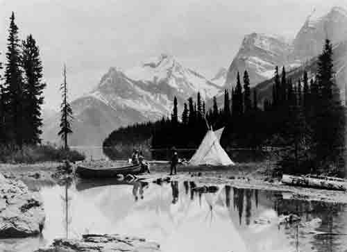
Maligne Lake in Jasper National Park is the largest and one of the most beautiful of the glacial-fed bodies of water in the Canadian Rockies. Originally barren of game fish, it was successfully stocked with eastern brook trout between 1928 and 1931. The success of the experiment later attracted anglers from wide-spread points on the North American continent.