 |
|
Canadian Historic Sites: Occasional Papers in Archaeology and History No. 5
by James V. Chism ExcavationsPrincipal Residence During the 1965 field season, tests were initiated along the west wall and annex of the principal residence (Fig. 2; item 26; Fig. 4; item 1) or "Big House" at the request of the restoration architect. The main structure had been built in 1831-32 and the annex in 1840. The structural and functional history of the house was complex (Ingram 1970a). The most obvious changes to the outside of the house in 1965 were the addition of a kitchen at the north end of the main structure and the building of a wide veranda, all by the Motor Country Club in the 20th century.
The house and annex were still standing structures and archaeological research was requested to determine original ground level and to investigate the possibility of basement window and stair wells. Tests carried out in 1965 and follow up excavations in 1966 led to unanticipated results. An open areaway was discovered to have paralleled the west wall of the Big House. This in turn was paralleled by a driveway or apron with a dolomitic limestone rubble base and a crushed brick and dolomitic limestone surface. The driveway also paralleled the north wall of the annex. Salvage excavations were carried out in 1966 when it was decided to place a steel-reinforced concrete collar around the entire house and annex. This led to a brief and largely inadequate investigation of earlier veranda alterations, drainage systems, and the discovery of an outhouse built into the veranda and against the house wall of the north end of the main structure. Work directed by Peter Priess subsequent to that reported here has added considerable detail to the nature of the open areaway, the driveway, ground levels, fencing and another possible outhouse associated with the Big House. Areaway Excavation along the west wall of the Big House revealed a highly disturbed, stone-lined areaway paralleling and contiguous with the west wall of the main structure (Fig. 6). It was interrupted by the annex and an L-shaped retaining wall which may have housed a stairwell into the link between the main structure and the annex proper. The probability is very high that the open areaway ran the entire length of the structure prior to the 1840 construction of the annex. In apparent support of this, the arrangement of doors and windows near the south end of the wall is similar to that at the north end.
The general configuration of the areaway was only approximately apparent. It was roughly 14 ft. wide, as much as 6.5 ft. below original surface and 7 ft. below 1966 surface. It was thought that a slope led into a 4 ft. wide gravel walkway along the house wall. It was further thought that construction of this slope had begun with an unnecessarily elaborate mortared stone fill at the north end, and was quickly abandoned for a more practical shallow rubble riprapping as work proceeded south. Later work which will be reported by Priess showed this to be in error, a fact attributable to the placement of our profile trenches and to our fallacious attribution of all red crushed brick scattered over the surface of the slope to the driveway parallel to and contiguous with the areaway. Priess found that one concentration of red brick rubble was associated with an oven which had been neatly missed by our trenches. He also found that rather than a riprapped slope, the original areaway probably consisted of a series of stepped retaining walls. In all likelihood the end wall of the areaway consisted of a single stone thick, steeply sloped retaining wall. No such stone wall remained. Evidence of the end wall was only an earthen cut bank with an 80° slope which had a slight flare along its upper margin. This would have been impossible to maintain as an earthen slope. This situation was similar to retaining walls at the distillery, the L-shaped latrine behind the fur loft-store and the store on the left bank of the creek. In all instances, stone was laid against an almost perpendicular slope. The lowest layer of fill in the areaway was an angular gravel and clay mixture. Its thickness and slope varied according to the configuration of the underlying rubble bordering the house. This fill was roughly level and approximately 0.1 ft. thick and 4 ft. wide. A ceramic drain 0.62 ft. in diameter covered loosely with dolomitic limestone was found in this strip. A trench for this drain cut through the ground outside the north end of the areaway. Drain tiles of this style would probably not have been locally available until the last quarter of the 19th century. The body of the tile is strikingly similar to material recovered for the project by James Henderson at the site of the 1879 to 1910 Doidge Pottery in East Selkirk, Manitoba some 8 miles from Lower Fort Garry (Henderson 1970). The 1969 discovery of a dolomitic limestone slab with a 0.1 ft. wide, 0.2 ft. deep cut channel and another by Priess in 1968 indicate that an earlier and very different drainage system was in use while the areaway was open. Priess has been able to uncover more details of the earlier system and suggests that it connected to a system which ran under the Big House itself. The remainder of the fill consisted of patches of black and grey clays, sometimes with angular and rounded gravels. The angular gravel was crushed dolomitic limestone which was probably produced at the fort quarries, and the rounded gravel probably came from the gravel ridge north of the fort enclosure. Flower beds placed on the filled areaway contained a mixture of fill and post-fill material to a depth of 1.5 ft. One can presume on structural grounds that the areaway was constructed in 1831 and 1832 at the same time as the Big House. If the installation of a new drainage system was the first stage of filling the areaway and if ceramic tile was not locally available until 1879, then archaeological evidence indicated that the areaway was filled after 1879. This has now been confirmed by Ingram, who has found documentary evidence for the filling of the areaway soon after 1885. Because of the mixed nature of the fill, artifacts found in it can only be said to be pre-1885 material from unspecified areas of the site, some possibly being from the gravel ridge north of the enclosure. The only datable artifact from the fill below flower bed level was a single hard paste earthenware sherd, datable in manufacture from 1867 to 1890. Stairwell The stairwell which led into the link between the main structure and the annex had a 1.6 ft. thick, 6.0 ft. high mortared rubble north wall with an exterior length of 16.7 ft. set on a 0.5 ft. plank footing. There was a 0.6 ft. wide, 0.6 ft. high ledge running along the interior base of this wall. The east end of this wall abutted the main structure at a filled-in basement window. The west wall was 2.1 ft. wide, had an exterior length of 6 ft., had no shelf and its base no plank footing, and abutted the north wall of the annex at a filled-in basement window. The original height of these walls was not detectable although a post-1885 photograph of this area indicates that they might have stood two feet above the ground level of that time. The west wall of the main structure served as the east wall of the stairwell and the 7.8 ft. of annex wall between the outside of the west stairwell wall and the northeast corner of the annex served as the only archaeologically detectable portion of the south wall of the stairwell. An old partition line was found by the restoration architect on the west wall of the main structure 9.3 ft. from the abutment at the stairwell wall. A 2 ft. wide stone slab footing was found centered on this wall line and extending 9 ft. to the east wall of the annex. A 0.5 ft. footing corresponding to the 0.6 ft. shelf on the north stairwell wall ran along the south stairwell wall and bridged the 9 ft. gap to the main structure. Possibly, the stairwell had north-south running floor boards and these shelves and footings acted as joists. The slab footing possibly supported another wall linking the annex to the main structure as well. This would mean that the floor plan enclosed by the walls would have been L-shaped. Portable artifacts recovered from within the stairwell and link included several 20th-century pharmaceutical bottles made by a post-1904 fully automatic process. There would have been access to the link through the open areaway until the mid 1880s: therefore the assumption is that the stairwell was probably made of pirated areaway stone at the time of its filling. Driveway and Fences A 17-ft. wide dolomitic limestone and brick driveway bordered the upper margin of the areaway. The surface of the roadway was 0.66 ft. to 0.83 ft. below present ground level and appeared to be continuous with the upper edge of the slope, although a 20th-century sidewalk constructed along the upper edge made the determination of this condition difficult. At the corner of the annex, the limestone rubble was continuous with that observed along the annex wall in 1965. This suggests the possibility that an earlier brick driveway had a surface which was below window level at the annex. Later, a more substantial limestone rubble base may have been added and brick spread over this. Since a profile has not been cut at a point more distant from the annex, it is also possible that one may find the limestone rubble to have been the earliest base but to have stopped short of the annex. Brick rubble observed under limestone next to the annex in 1965 tests could have been the tailings of the overcoat at the sides of the road, and the overlying limestone rubble could have been a later levelling fill after the basement windows of the annex had been blocked off. The driveway curved to the west and paralleled the north wall of the annex and probably extended to the west gate. The present driveway follows the annex wall without paralleling the west wall of the main structure. A photograph taken about 1881 (Fig. 7) showed the west leg of the driveway. An 1871 drawing (Fig. 8) indicates the west leg but not the north leg of the driveway. Instead, it shows around the Big House a solid fence broken only by the front and back gates. Additionally, it depicts a fence running from the north fence toward the northwest corner of the Big House. Another drawing of 1873 (Fig. 9) differs from Figure 9 only by showing no extra fence running toward the corner of the Big House. The 1881 photo and another dating from sometime shortly before 1920 (Fig. 10) both show a fence running north-south in this approximate position, although by 1920, the style of fencing appears to have changed from an elaborate open style to a simple picket fence. The combined implication of these historical clues could be that fencing divided the front and back yards of the Big House. It could also mean that an extension of the fencing bordered the areaway along its western margin either to prevent accidental falls or easy access, or both. If a driveway was extended to the north, such a fence would have bordered its eastern margin. Later work by Priess has hopefully clarified some of these possibilities.
The above-mentioned 1965 tests concerned with the annex indicated that dressed stone at the northwest corner extended only 0.85 ft. below the extant surface. A 0.25 ft. layer of grey clay covered the lower 0.16 ft. of this dressed stone and the base of a post extended through this layer and the outer margin of a builder's trench and penetrated 9.21 ft. into the underlying undisturbed yellowish grey clay. This was interpreted as indicating a former ground level of 0.5 ft. to 0.61 ft. below the 1965 surface. This level was approximately even with the top of the sealed annex basement window sill. After the windows had been sealed this level was overlain by a 0.33 ft. layer of limestone rubble mixed with clay which extended outward from the annex wall for two to three feet. Underlying the northern margins of the limestone rubble was a 0.16 ft. layer of bright orange brick rubble. A 0.5 ft. dark soil layer used as a flower bed was over these layers in the test area. The brick and limestone rubble did not extend further west than the post near the corner of the annex. It may be that these rubble layers were associated with the driveway and that a fence associated with the post would shielded this spot from scatterings of road surfacing. In 1965, there was no historical data available to the archaeologist to confirm this. Photos showing the Big House in 1881 (Fig. 7), before 1911 (Fig. 11), and in the 1920s (Fig. 10) respectively show this segment of fence. The 1881 photograph indicates that the fence is made of approximately 6 ft. high pickets and probably functioned as a screen for the privy. The same photograph appears to confirm the ground level striking the basement window sills.
Veranda Explorations on the east, south and north sides of the Big House revealed stone and wooden porch supports pre-dating the veranda built by the Motor Country Club. All measurements along the east wall were taken from a chalk line running the full length of the east wall which had been set up to compensate for the concave nature of the wall. Five dressed and eight undressed stones, ranging in distance from 5.4 ft. to 6.6 ft. east of the chalk line, interpreted as part of a veranda support system, were found along the east wall. The veranda represented would not have been narrower than the maximum measurement. Some portions of the upper stone surfaces were showing above the thin layer of rubble covering the area. A profile was cut from the east wall of the Big House to six feet beyond the fourth stone from the north. A layer of mixed fill and rubble overlying black earth containing some limestone and wood chips from construction activity was found to be 0.62 ft. thick at the stone and to dip toward the Big House foundation. A sharp dip within 1.5 ft. of the foundation was interpreted as the upper margin of the builders' excavation. A stone-bottomed trench was found paralleling the east wall of the house three feet east of the veranda stone. The walls of this trench did not appear to cut through the fill, suggesting that the trench might have been contemporary with house construction. The support stone appeared to have been set into the fill. Either the stone was added as a later improvement to the veranda or it was simply set into construction spoil when the veranda was added after the main structure had been completed. The former alternative has been favoured because of the discovery of 14 timbers 0.4 ft. by 0.8 ft. set perpendicular to the east wall of the Big House and underlying the fill. These timbers were also thought to be veranda supports. If so, then the fill was clearly spread over the area after the veranda was built and the stones would have been associated with a later construction phase. The distributional patterns of the stones and timbers have no direct relation to each other; however, they do both have several instances of approximately 8-ft. spacings. This would suggest that they represent an earlier and a later veranda with wooden and stone supports respectively. Because an upright could be set anywhere on a long timber footing, it is not safe to estimate veranda width from the timber length. Three timbers lying against the east house wall and set into the uppermost level of fill may be associated with the stone supports. The northernmost was a roofing collar 0.18 ft. by 0.55 ft. by 16.4 ft. The other two, along with several other timbers running east-west, were discovered during new construction and exact dimensions were not obtained. A similar situation of stones and timbers was found along the south wall of the Big House, where stones were recorded ranging 5.70 ft. to 7.74 ft. from the wall. The veranda would have been at least 7.74 ft. wide on this side. Seven timbers set at right angles to the south wall were excavated from under the fill and two timbers were found lying against the wall in the upper fill. Two timbers parallel to the south wall were found below the fill at the southwest corner of the Big House main structure where a link between it and the 1840 annex had been built. There were no timbers where early photographs showed stairs. Two timbers perpendicular to the north wall were uncovered near the northeast corner. One measured 0.16 ft. by 0.4 ft. and the other, 0.2 ft. by 0.6 ft. Both extended northward for an indeterminate distance below surface rubble at a depth of 0.62 ft. Attempts to uncover any veranda foundations which might be present on the north side of the Big House were largely unsuccessful. A summer kitchen had been built by the Motor Country Club on this location and the ground was heavily disturbed. A post measuring 0.3 ft. by 0.3 ft. was found at the intersection of lines paralleling the north and east walls at a distance of six feet from these walls. It had been sunk 3.1 ft. into the underlying clay. If this was a fence post, then either one of several verandas was only six feet wide or else it pre-dated any veranda. The same is true if it was a post for a horse rail. The width of the earlier veranda on wooden supports could have been six feet wide or less. In contrast to this figure, Ingram (1970a) has noted that in 1851 orders for veranda timbers specified that no major timbers be cut shorter than 8.5 ft. The accumulated evidence seems to indicate that a narrower than six foot veranda with wooden supports was rebuilt to a no less than 8.5 ft. wide veranda with stone supports in 1851. Portable artifacts found had a dating range overlapping the entire period, and so contribute nothing to the question. Veranda Privy A pit cribbed with tamarack was discovered against the south wall by construction workmen in 1966. Three walls were of log and the main structure of the Big House formed the fourth. The pit's east wall was set flush against the east wall of a chimney and its dimensions were approximately 8 ft. by 8 ft. by 6 ft. deep. The cribbing displayed tenoned ends on horizontal members and mortising on vertical members at the northeast and northwest corners. It was not possible to determine whether construction had been post-on-sill or post-in-ground. However, a concentration of artifacts near the bottom along with a lime concentration and the presence of certain unmistakable signs made it very easy to determine the pit's function as a privy. Its incorporation into porch construction may have been unique. Certainly its proximity to the open areaway to the immediate west and its abutment against the house would have raised certain drainage problems. Of course, it is possible that it post-dated the filling of the areaway. Portable artifacts from the pit were numerous and at least provide some clues for dating. Although most of the ceramic material is datable in manufacture between 1847 and 1867, at least two hard paste earthenware vessels were datable in manufacture to 1873. One also presumes that tableware would be used as long as possible before discarding it, limiting its usefulness for precise dating. Several ceramic fragments were from dolls and toy tea sets suggesting that a little girl was among the occupants of the house during the period represented by the pit fill. Glass containers, the other major category of artifact from the pit, suggested that not only was there a little girl living in the house, but that a baby was there as well and that the period represented by the fill was late despite the early clustering of ceramic dates. Several Mellin's Food Company baby food bottles were found, datable between 1884 and 1928. There is some confusion about changes in the company name and it is possible that 1899 might have been the earliest that the company used the "Mellin's" name. A "Conrad Budweizer" (1877 to 1890) and a "Lee and Perrins" bottle with "JDS" on the base (1877 to 1920) also supported a late terminal date for the pit. Therefore, it cannot be assumed that the earlier ceramics mixed throughout suggest an earlier use for the pit. The suggestion would be that in the late 19th century one kept ceramics but threw away glass containers much more readily as their manufacture had become inexpensive. Ingram (1970a) noted that there was considerable alteration and construction around this general part of the house in 1874 anticipating the arrival of the Hamilton family. He noted that Company officers from Winnipeg used the house as a summer residence for their families in 1879, 1880, 1888, and throughout the 1890s, dates and circumstances which fit the nature and dates of artifacts in the fill. One might argue that it would not be expected that anyone would dig an outhouse so near an open areaway, and that it was dug after 1885. The proximity of the post-1885 drainage tile suggests that this was the anticipated drainage for the privy to keep moisture away from the basement wall. Ingram noted that it had been recommended that an "old lean-to and shed" at the north end of the Big House should be torn down in 1911, but there is no record that this was done. The fact that detailed records kept by the Motor Country Club did not mention the destruction of this structure after 1911 might be viewed as negative evidence for a 1911 filling of the privy. Annex Basement Floor Limited investigation was carried out to determine the nature of the original flooring in the Big House annex basement. When workmen removed the recent flagstone flooring, wood fragments indicated the possibility of wooden floor joists. Careful clearing of this surface near the southeast corner indicated that the fragments were oriented north-south and were spaced 1.5 ft. apart. It was difficult to judge joist width, but it appeared to be somewhere between 0.4 ft. and 0.6 ft. The south wall had been notched to accommodate these joists; these notches were 0.5 ft. deep, were on a 2 ft. centre and were directly in line with joists from the floor above. No portable artifacts were recovered.
A portion of the prison yard and palisade directly east of the penitentiary was excavated in 1965 (Fig. 4; item 2). The palisade was reportedly built after June, 1870, to enclose the exercise yard when this stone storehouse was being used as Manitoba's first provincial prison from 1871 to 1877 (Miquelon 1970). The palisade and yard are listed on the Watson map (Fig. 2) as item 6. The excavation was an attempt to determine the construction and state of preservation of the palisade and to confirm its location. On the ground, a low ridge could be seen in the approximate position indicated by Watson. A trench and the below-ground portions of the pickets were found as well as some evidence of the exercise yard enclosed by the palisade (Fig. 12). The trench varied in width from 2 ft. to 5 ft. and was 4 ft. to 4.4 ft. deep with slightly sloping sides and a flat bottom. It had branches with no pickets and slightly shallower lobes extending laterally from the main trench line at irregular intervals. The trench cut through the lower portion of a dark top soil with considerable limestone gravel near its base; a gravelly clay stratum which contained lime and sand which was often but not always at its bottom, and finally through a black undisturbed soil. The trench contained mixed gravelly fill. Although one was sure that some of the uppermost portions of the soil was a sod dressing, a clear delineation could not be made. Because the trench cut through all except the uppermost part of the dark top soil, all layers except the top one may be interpreted as clearly pre-dating June, 1870.
The second layer from the surface contained mixtures of clay and mortar and may be interpreted as a mortar puddle. This probably reflects the relative dating of nearby construction sites pre-dating the palisade. The underlying undisturbed soil exhibited the characteristic natural profile for the site. Pickets found in the main trench appeared to consist primarily of round and quadrilateral timbers, but some appeared to be planks. It was not always possible to be confident of measurements reflecting original dimensions; however, the few "planks" were approximately 0.1 ft. by 0.5 ft.; round pickets ranged between 0.3 ft. and 0.75 ft. in diameter, and the quadrilateral pickets, while irregular in shape, were in the same range of size. They extended to a depth of 4 ft. where excavated. A sample of the wood was identified as white oak. The palisade line had a different configuration than was expected. This can be seen by a comparison of Figures 2 and 14. Two right angles exist which were not indicated by Watson in 1926. It is interesting to note, however, that there was an empty trench in the position indicated by Watson for that section of the palisade which he misdrew. In general, a heavy limestone gravel layer directly under the sod abuts the palisade from the inside of its enclosure. This may reflect (1) an attempt to make digging out difficult; (2) a desire to minimize muddy conditions; (3) debris from a prisoners' stone-breaking operation, or (4) all three. Although recent historic evidence brought to light by Ingram (1968) indicates that a palisade was erected (or repaired) for a mental asylum in 1885, there was no indication of more than one construction phase noted in excavations. "Empty" trench lines were checked at their point of juncture in an attempt to find whether they were dug at different times, but no indication of such was found. Limestone slabs turned on edge near the penitentiary appeared to retain gravel within the enclosure at that point. It was originally thought to be the edge of a gravelled prison yard. Based on later observations of gravel walkways this particular arrangement might suggest a walkway with containment of the gravel by upturned slabs set into the ground. Such a walkway may be seen at the west end of this same still-standing stone building. The palisade is shown in an 1873 drawing (Fig. 9) and a photograph dated between 1871 and 1880 (Fig. 14). The height of the palisade was clearly no less than 10 feet. The palisade has a gable-like addition to offset the height of the north wall of the fort where the two intersect northeast of the penitentiary.
There were few portable artifacts found at this location, and of the four datable ceramic fragments found, only one had a manufacturing date range which fell within the prison or even later asylum period. The other dated fragments had earlier date ranges. The material does not assume much importance when one realizes that both the trench fill and other fill was probably brought in from other areas. Certainly the gravel in the fill suggests that these contexts are not to be trusted, since gravel would have to be from outside the enclosure.
Watson (1928) suggests that the storehouse near the east wall of the enclosure (Fig. 4; item 3) was used as a barracks by troops of the 1870 Wolseley Expedition. Its use as a storehouse (warehouse) was described by Robinson in 1879 (Miquelon 1970), and Ingram (1970b) noted that Company correspondence refers to it as a storehouse. Both Watson and Ingram indicate that it was moved to Colvile Landing in 1881. The date and technique of construction of this building are a problem. It has been assumed that it was the structure referred to in Miquelon as being built in 1870 for accommodation of troops; however, the dimensions cited for that building were 24.5 ft. by 50 ft. and do not conform by any standard with findings described below. Watson described the structure as "frame," but this was also of little assistance since several techniques may be described by this term including the so-called "Red River frame" which is a general term for several varieties of post-on-sill log construction. On the ground, the building was indicated by shallow linear depressions forming a large rectangle bisected lengthwise by another shallow linear depression. It was in the general area indicated by Watson's 1928 map. Photographs show the building clearly. A photograph of 1871-80 vintage (Fig. 14) and another taken in 1880 (Fig. 15) show a two and one half storey structure with weatherboard siding and distinctive half windows under the eaves. Two drawings, one of 1871 (Fig. 8) and another of 1873 (Fig. 9), relate the same information.
Excavations were oriented toward determination of accurate location, dimensions, and construction details. It was also hoped to recover artifacts, stratigraphic information, or both which might help clarify its age. The structural remains found (Fig. 16) were those of the main building and a more lightly constructed porch-like structure at the south end. In terms of location and dimensions, the Watson map was in close agreement with the in-ground situation with regard to the main building, which consisted of a 32 ft. by 72 ft. foundation with a stone central footing bisecting the structure along its long axis. This foundation varied in width from 2.2 ft. to 2.6 ft. and was constructed with a 3.5 ft. deep trench.
Physical stratigraphy was consistent throughout the area. A thin sod with dark humus covered the operation to a depth of 0.2 ft. At the base of this level was a great deal of fragmented wood. The grain of the wood fragments was primarily parallel to the long axis of the building and was probably from flooring. Deteriorated mortar of the foundation began directly beneath this flooring at an average depth of 0.2 ft. and cut through a thin layer of scattered mortar and gravel. Beneath this appeared a level of dark loam which was 0.5 ft. thick mixed with occasional sand. This was underlain by a second thin layer of scattered mortar, which became thicker at the north end and indicated that a mortar-mixing area was located north of the structure. Signs of heat were noted near the north end of the building on both sides of the central support foundation. The area noted in the northeast quadrant was a circular grey discolouration 3 ft. in diameter which began in the second layer and extended downward to the bottom of the third layer. The area in the northwest quadrant was fired red, but was below the lowermost mortar and must have pre-dated the building. The final area of heat noted was another circular grey area 3.3 ft. in diameter occupying the same stratigraphic position as the one in the northeast quadrant. The two grey areas probably indicate stove positions. The red area was more likely the result of an open fire. The porch-like extension at the south end of the building proper added another 12 ft. to the over-all length of the structure. It consisted of a thin rubble and mortar footing which overlapped the edges of the main foundation. The width of the footing was the same as the foundation except along their common wall along the south end of the main building foundation. Here the mortar and rubble footing ranged in width from 1.0 ft. to 1.5 ft. In this small rectangle were two heavy limestone blocks set into holes dug 1.7 ft. deep. The 1880 photograph and the two drawings discussed above indicate that stairs might have gone from both ends of this porch to an upstairs door. A number of large limestone blocks was found near the north end of the building apparently associated with the third layer. Although this stone suggested a porch at this end of the building, no clear indication of such a structure was found. One of the empty trenches associated with the neighboring prison palisade passed through the extreme northwest corner of this excavation. It was outside the building and cut through the mortar levels, as had the palisade trench, which would support the above interpretation as to the relative ages of these features. A pre-June, 1871 date of construction for the barracks-storehouse was suggested by relative dating. While excavation demonstrated that the structure was supported by a stone foundation with a central footing for supporting floor joists, that a lighter structure existed at the south end, and that floor joisting would probably have had an east-west orientation to support north-south oriented floorboards, there was nothing in the archaeological record which would have argued for a log superstructure as opposed to a lighter form of frame construction. If the building was approximately ten years old when it was moved away, it must have been reasonably solid, and no traces of decomposed lower margins were left behind to provide the needed clues. All dated ceramics found pre-dated the period of the building unless it was built considerably before 1870. An 1849 to 1877 Lee and Perrins bottle with "ACB" on its base was the only dated glass noted. Again, it appears that the glass container might be a more sensitive time indicator than ceramics. A preliminary nail count has indicated that of a total of 1,213 nails, 4.95 per cent were wire, 75.10 per cent were cut and 19.95 per cent were wrought. As other structures are discussed, the reader will see that these are generally consistent percentages for a building put up in the late 1860s and taken down in 1881.
In 1967, testing and excavation was carried out in the area surrounding the extant fur loft-retail store located inside the fort enclosure and near the south defense wall (Fig. 4; item 4). Work here pre-dated the planned restoration of that stone structure. The structure was believed by Ingram to have been built in 1832 while Governor Simpson was still living on the site. Basement Stairwell An 1871 drawing (Fig. 9) and a sketch of 1857 or 1858 (Fig. 17) show an off-centre basement entrance in the east end of the loft-store which could be seen as a partially filled door from inside the basement of the structure in 1967.
A stone-lined stairwell of dolomitic limestone was found 7.8 ft. south of the northwest corner of the fur loft-retail store. In plan view, the outside dimensions were 7.3 ft. north-south by 10 ft. east-west. The lateral retaining walls were 2 ft. wide, 3.2 ft. deep at its maximum depth at the base of its steps, and consisted of mortared, split-faced stone and rubble set in a random pattern and resting on the underlying steps and on the stone landing at the bottom of the steps. Height of the remaining walls was 3.2 ft. The 1857-58 drawing shows an inclined entranceway cover sloping upward toward the building, standing well above ground level. Clearly, then, much of the lateral wall had been removed. The landing was a 4.5 ft. square area immediately outside of and centered on the filled doorway. It was paved with a double thickness of limestone slabs, each being 0.4 ft. thick. As indicated above, the slabs extended under the lateral retaining walls, and under at least the lowermost of three stone-based steps descending into the entranceway from the east. It also extended into the stone filled doorway for an indeterminable distance. The outside opening for the doorway was 5.2 ft. from the surface of the stone floor to the bottom of the outside lintel. The inside opening was 6 ft. from the bottom of the doorway to the bottom of the inside lintel. The outside lintel was 0.22 ft. lower than the inside lintel, making the bottom of the inside doorway opening 0.58 ft. below the bottom of the outside doorway opening. This suggested that a step was involved within the doorway fill. No dressed stonework was found in either the interior or exterior faces of the opening. The entranceway steps were represented by two reasonably discernible mortared stone step bases and one badly disturbed base for the head step. The stones extended under the lateral walls. The lower two steps had a rise of 0.9 ft. including the stone base, a layer of levelling mortar and a wooden tread. The wooden tread would not have been more than 0.19 ft. thick. Tread width was more of a problem. Lowest base was 0.7 ft. and the middle was 1.5 ft. while no meaningful measurement could be made on the top step. Horizontal pressures including frost action might have affected tread width. A 2.2 ft. wide by 4.5 ft. deep rubble-bottomed drainage trench running east toward the river bank had been cut by the construction of the entranceway or was in use at the same time. Immediately datable portable artifacts were not recovered from deposits below a flower bed at this location. Covered Winter Entrance Ingram reported verbally that his researches indicated a covered entrance door to the main floor at the west end. The door was still extant in 1967 and paint traces on the wall indicating the height and width of a covered storm entrance were recorded in an architectural survey of the structure by Mr. Richard Fairweather of the Department of Indian Affairs and Northern Development. A test at the doorway revealed no archaeological evidence of the covered storm or winter entrance.
The Dominion Survey of 1874 (Fig. 3), a sketch of 1871 (Fig. 8) and a sketch of 1873 (Fig. 9) show a small building directly south of the fur loft-retail store which was not present in 1967 (Fig. 4; item 5). Negative photographic evidence can at least add one detail about the structure itself; it did not stand any higher, and probably not as high as the defense wall, since it does not show over the wall in photographs of the fort taken from the south in 1858 (Fig. 18) or 1880 (Fig. 15).
A slight depression in this area between the building and the south defense wall indicated the presence of a filled and settled pit. The depression was found to have been a narrow L-shaped dolomitic limestone lined pit (Fig. 19). The early illustrations gave no indication of an L-shape, suggesting that the stone-lined pit was enclosed within a rectangular structure. The long leg of the pit ran parallel to the south defense wall and the short leg was at right angles to and abutting the defense wall. Evidence of the building's superstructure was missing. However, the pit had two major structural subdivisions. The first was a heavily built section occupying the western end of the long leg. The second and more lightly built section occupied the remainder of the long leg and the entire length of the short leg.
The western section of the structure had outside dimensions of 10 ft. by 16.5 ft. The foundation was 2.2 ft. to 2.7 ft. thick, and was composed of rubble, split faced and squared stone set in uneven coursing but with considerable inbowing due to horizontal pressure. At a point 4 ft. from the inside margin of the west wall, a row of pickets formed a partition wall. Brown and black fill with heavy building stones near its bottom extended downward to a depth of 2 ft. to 3.5 ft. Underlying this was a layer of ash and general refuse to a depth of 5.5 ft. This was in turn underlain by a 0.3 ft. to 0.6 ft. brown layer, a 0.4 ft. to 0.8 ft. layer of lime, and a 0.45 ft. to 1.15 ft. brown organic layer for a total depth of 7.35 ft. A builder's trench along the foundation went down to a total foundation depth of 8.2 ft. below the present surface. The pickets had been driven into the bottom three layers of fill but not into undisturbed clay below the pit. The picket partition was clearly an addition made sometime during the deposition of the thick ash-refuse layer. The eastern section consisted of the remaining portion, of the long leg and the entire short leg. The north foundation was 11 ft. to the turn and the south foundation was 5.5 ft. long to where it turned. The east foundation was then 15.5 ft. and the west foundation 9.1 ft. The nature of stonework changed from the wide and mortared vertical wall of the western section to an unmortared or perhaps lightly mortared retaining wall with an 85° slope and a fine rubble fill between the stone facing and the earth behind. The facing consisted of a single thickness of squared and splint-faced limestone set in uneven coursing which approached random coursing when large or small inclusions were made. The rubble placed behind this facing was to bring unlike-sized facing stones into line. Also unlike the other section, slump from horizontal pressures was practically non-existent. Seepage of groundwater limited excavation into the fill; however, the same layer of brown fill that was found in the top of the western section was traced to a depth of 5.5 ft. next to the defense wall before excavation was discontinued. The bottom 1.5 ft. to 2 ft. of this stratum contained a mixture of wood fragments, granite boulders and limestone blocks. It was found that the defense wall was only 4 ft. deep where it was abutted by the pit. Park staff reported that the wall was normally 6 ft. deep. In addition, it was found that the retaining walls had wedge-shaped openings beginning at a depth of 4 ft. where they abutted the defense wall. Presumably these continued to the bottom of the walls and may have been for drainage. A 0.2 ft. to 0.5 ft. thick layer of mortar and rubble was found under the sod in the area between the long leg and the defense wall. This would have been the area included in the structure if it was rectangular. At the angle between the defense wall and the east edge of the east retaining wall, it could be seen that the two walls shared a common builder's trench, indicating that the L-shaped trench was dug at the time of defense wall construction. This would have been sometime about 1845 (Miquelon 1970). The structure most probably functioned as a latrine and refuse pit. The nature of the organic layer in the western section indicated the latrine function most unmistakably. The shallowness of the defense wall at this point and the wedge-shaped openings also speak for drainage systems. No immediate and necessary rationale occurs to the author for the two construction types involved in the two separate sections of the pit. Possibly the thick mortared rectangle replaced a collapsed section of earlier wall. It may have been necessary to build the wall separating the two sections simply to add strength to the construction. The size and nature of the superstructure was only generally indicated in the early drawings. A rectangular single-storied building of uncertain height with gable ends was indicated, but clear evidence reflecting on superstructure was not noted in the archaeological record, although the presence of considerable mortar and rubble in the angle between the pit and the defense wall would suggest that a stone or "half-timbered" building may have been involved. Seemingly, however, if that were the case, a foundation beyond the pit would also be expected. A light stone footing with a rubble-filled, post-on-sill superstructure might explain the presence of the stone detritus without the additional requirement of a foundation. Such a footing could have been removed, although a slight rubble-filled depression would then have been expected. Such a depression was not noted but its absence would be less disturbing than the absence of a stone foundation from an all stone structure. A large number of portable artifacts were recovered from excavations of this "latrine." Mr. H.S. Sprong of Selkirk recollected placing at least portions of the dark top layer into a depression in this area when he was employed by the Motor Club as a gardener, and 20th-century material was expected in that layer. The dated ceramic objects from layers below the dark upper layer were all of patterns and companies with manufacturing date ranges which could be consistent with almost any period of the fort's history, with dates clustering in the 1846 to 1867 period and no known 20th-century marks or patterns which could not also have been earlier. However, glass containers were often clearly 20th century, including a bottle made by Dominion Glass with April, 1931, registration date on it from the brown layer beneath the thick ash-refuse layer. It was only in the bottommost brown organic layer, which was not fully excavated, that no machine-made bottles were found; however, glass from that layer may still have only dated back to the 1880s or 1890s. Glass was less plentiful from outside the pit and did not present a basis for dating the rubble found in the angle of the "L." Logic would suggest that a prestigious organization such as a country club would not have an uncovered outhouse pit on its grounds. Since there is material deeply deposited in this pit dating around 1930, some 16 years after the club was established, it follows that this structure or a later structure over the same pit was still standing in 1930. Because it was an elaborate stone-lined pit, it would have been cleaned out whenever it was full rather than being abandoned for a slightly new location, a pattern which is still considered standard today for more simple facilities. Earlier material from this elaborate pit is probably lining the river bottom.
In 1967, excavations were conducted within and around the extant southwest bastion (Fig. 4; items 6, 7) preparatory to planned restoration of this structure. The bastion was built about 1845 (Miquelon 1970). A drawing of 1846 (Fig. 20) showed the bastion to have three chimneys. Standing to the north of the bastion in the same drawing was a complex of three small structures. The largest appeared to have been a rectangular, single-storied, gabled wooden building. Next to it was a small rounded structure and an equally small square or rectangular stone structure. Each of the two small structures had a chimney. It appeared that the rounded one was an oven while the square or rectangular one had the appearance of a small smokehouse although it might have been a second oven. There was no documentary evidence bearing on these three buildings. Research by Ingram indicated that a large oven was inside the bastion (Ingram: personal communication). Excavation was oriented toward investigation of the interior oven and the nearby buildings with general testing of the area likely to be disturbed in restoration activities.
Smokehouse-Oven Complex The area within the angle of the southwest corner of the defense walls was excavated (Fig. 4; item 7). The stone foundation of a 12.8 ft. by 7.8 ft. structure with a north-south long axis was located 46.7 ft. north of the bastion (Fig. 21). The west and south foundations were 1.4 ft. wide by 0.1 ft. deep and the east and north were 2 ft. wide by 1.0 ft. deep. A layer of yellow clay had been packed into the area enclosed by the foundations. No other evidence of flooring was found. This was probably the small stone "square or rectangular" structure in the 1846 drawing.
Immediately to the east of the foundation was a concentration of rubble and mortar. This may have been destruction rubble from the stone building, from the chimneys, or even from the ovenlike structure in the drawing. Scattered patches of mortar, rock and wood fragments could have been debris from the larger building; however, no clear pattern emerged. Bastion Interior The recent flooring placed inside the bastion by the Department of Indian Affairs was partially removed in the west room, in the location of two chimneys in the 1846 drawing. No evidence beyond a single, loose, blackened stone was found which might have related to an oven or chimney. However, highly decomposed joists of an earlier floor were found 1.2 ft. below the surface of the recent floor. Traces of six east-west running, 0.7 ft. wide joists set on 3.3 ft. centres were resting in irregularly shallow 0.7 ft. wide notches on a 3 ft. wide stone apron ringing the inside of the circular bastion wall. The apron was only one stone or 0.4 ft. thick as found, although it might have been disturbed when the new floor was put in. Datable portable artifacts were not observed in a brief survey of the small collection from either the bastion or the small complex of buildings: however, in a universe of 1,016 nails from the location where the complex of buildings should have been, 55.20 per cent were cut, 30.90 per cent were wrought and 13.90 were wire. This sample would be more consistent with construction in the 1850s rather than the pre-1846 date shown by the drawing. The shallowness of material in what was probably a heavily travelled area may account for this inconsistent impression.
A building south of the fort enclosure thought to have been a troop canteen (Fig. 4; item 8) was partially excavated in 1965 and 1967. Watson identified it on his 1928 map (Fig. 2; item 122) as a log men's house and canteen which was torn down around 1884. Ingram (1965) reflected Watson's opinion, but discovered data in 1968 which suggested that the log structure might have been built for the Canadian government in 1870 (Ingram 1968). The same data referred to a building built for the government being sold and moved in 1877 but might not have been this specific one. No illustrative material was available which clearly related to this structure. On the ground, a long, narrow, raised outline with undulations perpendicular to the long axis could be seen in the location indicated by Watson. Excavation uncovered a very fragmentary situation (Fig. 22). The north and south walls were missing and a 22 ft. to 23 ft. portion of the west wall was also gone. Measurements taken on the remaining wood gave a length of 82.5 ft. for the east wall and 60.3 ft. for the west wall. The building was 15 ft. wide. The oak sills were 0.7 ft. to 0.9 ft. square. As was so often the case, these figures represented the logs' deteriorated and compressed dimensions rather than original size.
The northern end of the structure had been built on a layer of fill composed for the most part of a mixed clay. Variations in thickness of this fill suggested that the northern part of the building was built over what had been a natural depression running toward the river. This depression had been filled with clay to provide a level construction surface. Thickness of the fill was greatest at the northeast corner: it decreased to the west and eventually disappeared toward the south. The sills and sub-sill supports had been laid on this levelled floor. Notches were cut in the inside edge of the sills apparently to hold the floor joists, which were set on 3.3 ft. to 10 ft. centres. They were fastened by clasp-headed wrought nails. The notches were 0.38 ft. to 0.4 ft. wide and 0.2 ft. to 0.3 ft. deep. The joists were probably larger than the above dimensions which might represent only the size of the tenon. No joists were found. The sills had been packed with clay to hold them in place. This clay appeared in profile as a distinct yellowish layer easily separated from other layers. The sills had been provided with support in the form of either a short piece of timber or a block of limestone. Toward the northern half of the structure, these two were alternated with the first one on the north end being of wood. Location of these supports was near but never under the notches for the joists. Toward the south end of the structure, there was a breakdown in the alteration between wood and stone and a decrease in spacing between them. The sills were mounded over with a combination of mortar and grey clay, which overlaid the yellowish clay. This sill covering may have been chinking or mud plastering left behind when the logs of the superstructure were removed, or some of it may have been banked against the sill to help seal the building against severe winter temperatures. These mounds aided in approximating the ends of the building. Perpendicular to the long axis of the building at about 10 ft. intervals was a series of six ridges of this same destruction debris which probably represented partitions since they overlaid the artifact-littered surface of the yellowish clay. A wooden stoop was found along the exterior of the east wall. It consisted of north-south running plank fragments laid on two 0.22 ft. wide by 0.2 ft. thick and 3.5 ft. long east-west running joists spaced 3.2 ft. apart. Details of construction gleaned from the archaeological investigations were few. The orientation of the structure's long axis was north-south and thus the floor joists would have been east-west. The sub-sill timber and stone supports suggested a post-on-sill type of construction with each support being under an upright post. The lack of mortar and stone detritus further suggested a structure largely of wood. The building may have been divided by a series of seven 10 ft. x 15 ft. rooms, if the ridges inside the building represent partitions. Entrance to the structure was on the east side where the stoop was uncovered. Other stoops may have existed but did not survive; or only one entrance may have been used in order to conserve heat in the winter. If the building was post-on-sill, then there was probably a series of windows associated with the uprights, but indicative glass concentrations were absent from the archaeological record. A heavy concentration of artifacts, mostly of a highly miscellaneous nature was found under the destruction debris. Again, the dated ceramics predated the suspected period of occupation. A "Davis Painkiller" bottle with a high mould line to the "finish" may date to the 1880s plus or minus a few years. This might support the original Watson and Ingram proposal that the structure was removed in the 1880s. Datable clay smoking pipes included two "Dixon-Montreal" (1877 to 1894) pipes which would indicate that the deposition of material was at least as late as 1877 but most probably later. If this building was built in the same year as the troop barracks-storehouse, then one might expect the two buildings to have similar nail percentages. This suggestion is apparently borne out, for a total of 1,811 nails from the canteen was made up of 1.05 per cent wire, 23.52 per cent wrought and 75.43 per cent cut while the barracks-storehouse had 4.95 per cent wire, 19.95 per cent wrought and 75.10 per cent cut nails.
An excavation was oriented toward recovery of structural, functional and dating information at the location of the blacksmith shop south of the fort enclosure (Fig. 4; item 9; Fig. 23). Work was begun here in 1965 and continued in 1966.
Miquelon (1970) and Ingram (1970b) both repeatedly discuss activities at Lower Fort Garry which would require a blacksmith. Nevertheless, Ingram (1968) reported that little new structural evidence of a blacksmith shop beyond window pane size (7-1/4 in. by 8-1/4 in.) had been found to extend the data gathered from local informants by Watson (1928). Watson reported the position of the blacksmith shop (Fig. 2; item 123) and recollected that it was log. He also noted an explosion at (accounts do not say in) the blacksmith shop in 1877, which has been interpreted by both Watson and Ingram (1970b) as indicating that the shop was destroyed at that time. Ingram was more cautious and allowed for the possibility of it having been rebuilt. On the ground observations indicated a low mound in the approximate position indicated by Watson. Excavation revealed two shops, a small earlier shop separated by a layer of rubble from a larger, later shop and annex. The earlier shop has been designated blacksmith shop I and the later shop, blacksmith shop II. Blacksmith Shop I Excavation clearly indicated that blacksmith shop I was an 18 ft. by 20 ft. log structure (Fig. 24). There was no direct historical evidence found by Ingram which bears on the beginning or end date of this earlier structure. Certainly, the activity at the fort of the middle 1840s would have been impossible without the aid of a blacksmith: however, it also seems likely that there would have been a blacksmith shop from the earliest period of the fort.
Disaster or rotting of the lower logs would have been necessary to have forced the razing of blacksmith shop I before the construction of blacksmith shop II, for had it been a simple matter of needing more room, the Company could have accomplished this without dismantling the old shop. The sleepers and joists of shop I were below ground level and had clay banked against the outside. So a combination of rot and expanded activity at the fort might have been the factors leading to its end. On the basis of activity at the fort, a date of between 1857 and 1865 is suggested for its replacement. This was when large-scale farming, ship building and steam equipment were introduced. This is also the period in which Ingram (1970b) notes that work was being done in the shop for the upper fort as well. The west or back wall sill was approximately one foot below the original ground surface. A contour drop of between 0.6 ft. and 0.8 ft. occurs from the back to the front or east wall. This meant that as a levelling device, the front sill was probably set into the ground less than 0.5 ft. The sills were squared-off oak timbers. They displayed an excavated width of 0.85 ft. but decomposition and compression made the thickness difficult to measure. One presumes that an original size would have approximated one foot. The sills were lapped at the corners, right over left. It could not be determined whether the sills were fitted into each other with square saddles although comparative architecture would suggest this to be the case. Underlying the corners were diagonally oriented planks 0.7 ft. wide, 0.2 ft. thick and 5 ft. long. They did not appear to be rounded on the underside. Again, one should suggest that compression and decomposition would have reduced the thickness of these corner supports. Fragments of planking underlaid the east and south sills at irregular intervals. Floor joists ran north and south, or the long way of the building which was not the case with larger or more rectangular structures on the site. The joists had excavated dimensions of 0.5 ft. to 0.6 ft. wide and 0.1 ft. to 0.2 ft. thick. The easternmost joist would apparently have been long enough to span the building and was set on a 2.8 ft. centre with the east sill. The second joist line required two sections to span the structure, the south section being at least 11.5 ft. long, its centre 4 ft. from the centre of the easternmost joist, and the north section being 12 ft. long and on a 3.2 ft. centre with the easternmost joist. The third joist line was similar to the second in requiring two sections to make a complete span. The south section was at least 10.4 ft. long and centred 3.8 ft. with the south section of the second joist line. The north section of the third joist line was on a 4.2 ft. centre with the north section of the second joist line. The fourth joist line was interrupted by the forge. The south span must have been a 6 ft. board running between the south wall and the southern edge of the forge. The north board was completely missing. Logically, there would have been a 4.8 ft. long board running between the north wall and the northern edge of the forge. A thin layer of crushed brick was found under and particularly between these thin joists. Two limestone slabs measuring roughly 2 ft. by 1 ft. by 0.5 ft. were found approximately 2 ft. south of the north wall and on either side of the north section of the second joist line. These have been interpreted as anvil supports. They were probably not used as such for the later shop as they were overlain by rubble which would have created instability in a later anvil. Also, the westernmost of the two stones was partially overlaid by a joist of the later shop. Flooring consisted of east-west running planks of from 0.5 ft. to 0.6 ft. in width with the bottom rounded in cross section. Such planks reached a thickness of 0.1 ft. to 0.15 ft. and could be the by-product of squaring timbers by sawing. Rosehead and clasp head wrought nails secured them in place with a pattern of two nails per board at a joist. A stone forge was built against the west wall of the shop, its intended size clearly 8 ft. by 6 ft. A 3.25 ft. deep ash box was built into it one foot off centre to the north. The base was 0.5 ft below and 1.5 ft. above the floor level of blacksmith shop I. In general, masonry was random coursed from carefully cut but irregularly sized squared and faced limestone with a rubble-filled interior. Dressed stone was used occasionally as general building stone in the forge base. This was first thought to have indicated the re-use of stone from another building, but it is also possible that a mason dressing stone on the spot for trimming the forge openings would have been likely to utilize a reject in the base. A number of manually mixed, wire-cut burned clay bricks of slightly different sizes centreing around 0.73 ft. by 6.37 ft. by 0.21 ft. were found. Their location near the forge suggested that they had been used in the construction of the forge. Their presence could be taken to suggest a brick chimney; however, due to the small number found, it is possible that they only lined the breast of the forge. The detection of the area of greatest heat for the forge allowed us to make several conclusions. Although the ash box was off-centre, the fire was centred on the forge, and so, also, must have been the breast. The proximity of the forge to the west wall also suggested that a stone backing probably separated the fire from the log wall, meaning that this was an all-purpose rather than a farrier's forge. A 5 ft. wide door at the approximate centre of the east wall may have been indicated by three closely spaced supports under that sill. These supports and those under the corners suggested that the superstructure may have been post-on-sill construction. As one would expect, there were many portable artifacts reflecting the general function of the structure as a blacksmith shop: however, we will reserve further specific comment on the functional aspect of the material for the artifact reports. The ceramic range of manufacture fell within or included the predicted period for the structure. The presence of one hard paste earthenware object with a registration date of 1865 strongly supports the hypothesis that shop I was used until the great increase in industrial and agricultural activity in the mid 1860s. Glass containers were not plentiful; however, one champagne bottle appears to have been mould turned suggesting that it could be dated to the latter part of the 1880s or even in the 1870s. In a collection of 233 nails, a surprisingly small sample, wrought nails were 80.70 per cent of the total and cut nails were 19.30 per cent. There were no wire nails. Blacksmith Shop II Blacksmith shop II was a log structure and must have been the shop referred to by Watson in 1928. This later shop (Fig. 25) was clearly an expanded facility built over the rubble of the earlier shop and utilizing the same forge for its operation. The later structure, measuring 26 ft. by 18 ft. lay directly over the west, south and east walls of the earlier shop, but was 6 ft. longer on the north side. It also included a 21 ft. by 14 ft. annex, its east wall being flush with the east wall of the main structure.
As in the case of the earlier shop, there is no direct historical evidence of construction details for blacksmith shop II. The explosion at the blacksmith shop in 1877 might have spelled the end of the later shop, but there is no way of determining this satisfactorily. Certainly excavation provided no convincing signs of such a disaster. From documentary evidence we can only say that there was a shop which lasted until at least 1877. As with the earlier shop, the sills of the main structure were lapped at the corners, with extra planking reinforcing the corners as well as the walls at regular intervals. The joists also ran under the sills to act as bearing supports. It appeared that after levelling the rubble of shop I, the first stage of construction for the new shop was to set the joists and plank supports into trenches and set the sills over them. A similar "entrenched" effect might have been gained by settlement into the unstable rubble construction surface. The joists ranged in size from 0.5 ft. to 0.65 ft. wide and from 0.09 ft. to 0.15 ft. thick. In a few instances, the original outside surface of the tree could be detected, suggesting that untrimmed logs have been sawn into planks. The orientation of shop II floor joists and flooring was at right angles to that of shop I. Also in contrast to the earlier shop, the entire distance between the east and west sills was spanned by a single plank for each joist. Spacing of the joists was irregular. From north to south the relation of joists to sills and to each other may be expressed as the approximate distance from centre to centre. The first joist had a 2 ft. centre with the north sill. The second joist had a centre of 3 ft. with the first joist The third joist had a centre of 3 ft. with the second joist. The fourth had a centre of 2.5 ft. with the third. The fifth had a 2.5 ft. centre, with the fourth. The sixth had a centre of 2.5 ft. with the fifth. The seventh had a 4.5 ft. centre with the sixth, and the eighth a 4 ft. centre with the seventh, leaving a centre of less than 2 ft. between the south wall sill and the eighth joist. There were only the slightest hints that additional joists might possibly have existed between the sixth, seventh and eighth joists. Extra supports ran under the fifth and sixth joists where they ended in front of the forge. The sub-sill supports ranged in size from 2.5 ft. to 4.5 ft. in length, 0.5 ft. to 0.8 ft. in width, and 0.2 ft. to 0.5 ft. in thickness. The corner supports bisected the angle formed by the lapped sills. From north to south, the east and west wall sill supports were set at a 7 ft. centre to the north sill; the second set of supports was at a 9.5 ft. centre to the first set of supports, leaving a measurement of 9.5 ft. to the centre of the south wall sill. The supports under the north and south wall sills were in the approximate centre of those sills, the north one being less than 0.5 ft. west of centre and the south one being directly centred. The sills were depressed over these sub-sill supports, suggesting that upright structural members bearing weight were resting on them. Sill dimensions as found ranged from 0.75 ft. to 0.95 ft. in width and 0.5 ft. in thickness. Ignoring the thinness of the decomposed sills, reconstructed dimensions clustering around the one foot mark would not be unreasonable for the sills. The sills extended beyond the corners for an estimated distance of 1.5 ft. to 3 ft. This overlap, also present at other excavated log structures at Lower Fort Garry, is somewhat puzzling. The most simple explanation would be that clay banked against the outside wall for weatherproofing might have covered such an otherwise awkward protrusion. If these long ends were protruding above ground at the corners, then they were not only a constant hazard to walking but were also unusual. To the author's knowledge, no standing structures of the period in the Red River area display such unusual corners. Archaeologically, there was no clear indication that the bottom sills were set below ground level and that the overlapped corners were concealed. However, it would be difficult to support the proposition that blacksmith shop II was of simple lapped-corner construction because of the upright mortise and tenon found protected by its proximity to the forge. The author has seen log structures using combinations of post-on-sill and dovetail corners, and while a combination of post-on-sill and lapped-corner construction is not impossible, the remains of what might have been a mortise in the southwest corner would mitigate against such a combination. It is also possible that the original thicknesses of the sills were nearer to their present 0.5 ft., thereby presenting less of a stumbling block, but this seems unlikely too. In such an event, the mortise would have gone completely through both sill members at the corner and such a hole would have been archaeologically apparent. It is possible that the extensions themselves were thinned, leaving the sills thick, but there is no evidence to back this proposal. The north-south oriented flooring of the main structure was 0.5 ft. to 0.8 ft. wide and had a found thickness of 0.05 ft. to 0.09 ft. Floorboards were nailed to the joists with two nails at each joist using chisel-pointed rosehead and clasp head wrought nails. Only the sixth joist was noted to have four nails holding single boards to the joist. There was no sign of extra wood at the north and south ends of the floor for nailing, nor was there any indication that the floor did any more than abut the north and south sills. There appeared to have been some patching between the first and second joists from the north. Although there was a heavy concentration of iron oxide scales southeast of the forge, there was no clear indication as to the location of the anvil or anvils of blacksmith shop II. Possibly a stone base was present, but the fallen stone from the destroyed forge might have concealed its presence so it was inadvertently removed as rubble. There might not have been a base except a tree stump as often noted in comparative blacksmith shops. Although hinges, locks, and other metal artifacts occurred in the ruins, their numbers indicated that many were being made or repaired, so it is not practical to comment on what ones might have been used in this building. The annex to blacksmith shop II appeared to have been much more lightly constructed than the main shop structure. The sills for this 21 ft. by 14 ft. addition were quite thin as measured. Again, one is unsure as to just how much thinness is a result of decomposition and being so near the surface that all traffic compacted and scattered it. The oak sills ranged in width from 0.6 ft. to 1.0 ft. and were as thick as 0.4 ft. along the west wall. The east sill in particular appeared to be little more than a plank with an excavated thickness not exceeding 0.2 ft. At the corners there was no extra support, nor was there a sign of depression of the corners from any super-structural weight stress. Rather than a pattern of right sill overlying left sill, the long wall sills overlaid the short wall sills. There was some indication that the corners were half-lapped. The northern sill at the two northern corners was longer than the building was wide, which could mean that there may have been extensions of this sill similar to those in the main structure. The southern corners abutted the main structure and showed no extensions. There were no sub-sill supports at any point, nor did the joists extend under the sills. This situation would not provide any support for a post-on-sill superstructure. Joist and flooring were both about 0.09 ft. to 0.1 ft. thick and were 0.5 ft. to 0.85 ft. wide with most being about 0.7 ft. It would appear that only planks were used for joists and flooring. From the juncture of the main structure to a point 13 ft. north, the relation ship of joist and floorboard was a normal one with spacings between centres of east-west-running sub-floor members being 3.5 ft., 3.5 ft., 2 ft. and 2.5 ft. from south to north respectively. The remainder of the floor area consisted of sub-floor members set edge to edge with the normal flooring over them. This double flooring must have been relatively strong and would have borne considerable weight. The north-south running flooring clearly lapped over the thin sill abutting the main structure and might have been lapped similarly at other sills as well, although this was not clearly preserved. Interpretation of the annex in terms of superstructure was very difficult. In contrast to the main structure there was practically no mortar debris associated with destruction. The foundations had no characteristics which suggested a post-on-sill structure. A dove-tailed or saddled log structure might have been possible. It is also possible that it was an open-sided shed, with a light roof and simple plank walls nailed to light studding. With the plank-thin sill along the east (front) wall it might have been open on that side and enclosed on the others. However, there were no angled nails at the sills to suggest studding for a light frame construction. Negative evidence at least suggests that it was not post-on-sill, leading one to an interpretation of light framing for the annex. A great deal of "spill-over" of slag and charcoal at the west end of the north wall might have indicated a door at that location. As in blacksmith shop I, many portable artifacts reflected the function of the building. However, the ceramics found either predated or represented the earliest few years of the shop. One can be reasonably sure that blacksmith shop II postdates 1865 and 26 out of 28 datable ceramic objects were made between 1847 and 1867. Very heavy based "black" glass bottles may date from the 1860s, but other dating help from glass was lacking. A single crown bottle cap (post-1892) was noted as being from the shop, but it must be made clear that much of the flooring for this shop was in the grass roots, therefore contamination from surface material would be easier than in the earlier, deeper shop. In a total of 1,567 nails, 33.20 per cent were cut, 65.20 per cent were wrought and 1.60 per cent were wire. This suggests that the very high percentage of wrought nails for both shops somehow reflects the function of the buildings while the increase in cut nail percentage from the earlier shop reflects the dimension of time as does the appearance of wire nails in the later shop.
In 1967, the project excavated a structure south of the fort enclosure which was thought to have been the farm manager's residence (Fig. 4; item 10). Its identification as such had been made by Watson in 1928 (Fig. 2; item 124). This may well have been a function of the structure. However, farming began at the fort in 1857 while a drawing of 1847 (Fig. 26) indicated that a structure might have stood there at that date. A "small house" was noted to have been built "near the forge" in 1870 (Miquelon 1970), but this has been taken to mean the troop canteen discussed above. No direct documentary evidence bearing on either date of construction or date of destruction was available.
Evidence recovered in excavation indicated a small log structure with either a porch or an additional room, two cellars and a chimney, possibly with a fireplace (Figs. 27, 28). The actual evidence consisted of wood flooring, timbers for the base of a wall, two depressions considered to be cellars, a stone apron and a chimney base.
The structure uncovered was 12 ft. by 30 ft. with a north-south long axis. The squared oak wall sills which were 0.5 ft. to 0.65 ft. wide by 0.3 ft. to 0.5 ft. thick had been lapped and pinned at the corners with the sills extending beyond the corners. The east and west sills were resting on the ends of the 0.4 ft. to 0.5 ft. wide by 0.3 ft. thick east-west running floor joists. From north to south and beginning immediately inside the sill, these joists were set on 4.5 ft., 4.5 ft., 5 ft., 5.5 ft., 4 ft. and 4.5 ft. centres. The north cellar was situated between the second and third joists and was bordered by them while the south cellar, similar to the north, was between the fifth and sixth joists. Because the joists began immediately inside the sills, the north-south running 0.4 ft. to 0.8 ft. wide by 0.1 ft.to 0.15 ft. thick flooring was supported where it abutted the north and south walls. This flooring was pinned to the joists by what had probably been a pattern of two rose-head or clasp headed wrought nails per board at a joist. The joists were sitting partially buried in a bed of clinkers, charcoal and other debris, which appeared to have come from the neighbouring blacksmith shop and may have served to improve the drainage under and around the residence. Some mixed clay, possibly spoil from cellar excavations, was also scattered under the flooring system. The south cellar had an east-west log axis and was 3 ft. deep. It appeared to have been disturbed more than the north cellar and length was difficult to determine. It was 4 ft. wide and probably had an original length of 7 ft., but may have been as long as 8 ft. Wood sheeting on the sides and near the floor suggested that this cellar may have been wood lined as well. The north cellar was 4 ft. by 7 ft. with an east-west long axis and was 3.25 ft. deep. It also had thin sheets of wood which appeared to have fallen away from the side of the pit. The undressed stone apron located against the west wall was 2.85 ft. by 4.04 ft. with a north-south long axis. A chimney base of the same size abutted it to the east. Possibly a fireplace faced onto the apron but no burned area was detected. This appeared to be an unusual heating arrangement because the apron was against the wall with the chimney base interior to it. Although somewhat scattered, joists and fragments east of the east wall probably indicated a porch. The area was 7.5 ft. to 10 ft., by 9 ft. to 10 ft., as found and probably represented a porch of 8 ft. by 10 ft. with a north-south orientation and floorboards 0.8 ft. wide by 0.1 ft. thick. A layer of destruction rubble, much of it chinking from log walls, sealed off the structure and the refuse-filled cellars. Excavation did not uncover any notches for securing uprights for post-on-sill construction. Although there was sufficient sub-sill support of the east and west walls, no such supports were found under the end walls. There was no clear evidence for location of doors and windows. The portable artifacts demonstrate that the floor and cellar were still open to deposition at least until the turn of the century. Dated ceramic manufacturing ranges were 1833 to 1847 and 1847 to 1867 with clustering overwhelmingly in the 1847 to 1867 range. No later ceramic material has been identified from the building. Glass containers with post-1892, semi-automatic early crown lips and a Ponds Extract (sometime in the 1890s) bottle dated the deposits on the floor and all but the very bottom layer of the cellar to the 1890s. The presence of tin containers with double crimped seams would be post-1900, according to our present understanding of tin container manufacturing history. It would appear that the superstructure may have been torn down in the 1880s if one can assume the glass containers were thrown away soon after use in at least the last quarter of the 19th century. If such was the case, then large areas of the flooring and the cellar pits had to remain open until at least the turn of the century. Considering that this part of the fort grounds was used as a cavalry encampment about 1911 and was used as a golf course after 1913, it may be feasible to suggest that a log superstructure was torn down in the 1880s, but that the chinking was allowed to rest over the wall sill rather than be levelled immediately. Later debris, including perhaps that of a post-1900 military encampment, was allowed to gather around and in the cellars. When the ground was levelled and sodded for a golf course, the mortar ridges on the sills were used to level the cellars and cover the wooden flooring. Despite later deposition, the nail type ratios were consistent with a mid-century construction date at Lower Fort Garry. Of 712 nails, 25.60 per cent were cut, 73.70 per cent were wrought and 0.70 per cent were wire. The wire nails were consistent with a date of destruction in the last quarter of the 19th century or later. The extremely high percentage or wrought nails would tend to support the proposition that the building was already standing in the mid-1840s as was suggested above. Of course it is always possible that some quirk of historical events led to the use of so many wrought nails at a later date.
One excavation in 1967 was on the foundation and floor area of a building thought to have been the grain-flailing barn (Fig. 4; item 11). Watson's map showed a building in the area between the fort enclosure and the creek area with an east-west long axis (Fig. 2; item 126), and described it as a log grain-flailing barn. He also declared 1911 as its date of destruction. Two photographs (Figs. 29, 30) dating sometime between 1883 and 1911 showed a gabled, wooden, barn-like building with vertical siding in this location but unlike Watson's plan it had a north-south long axis. A large door was shown on the north end and a smaller door appeared midway along the east wall.
On the ground it was not possible to see where the building had stood; however, excavations uncovered an almost completely destroyed stone footing (Fig. 31). The estimated building size was 81.5 ft. by 23.5 ft. with a north-south long axis. The foundation was approximately 2 ft. wide and no more than one course as indicated by the one small patch of mortared stone still remaining on the south end.
There was no sign of flooring other than two patches of charred logs, one of which was lying diagonally to the long axis. The diagonally lying wood was in a burned area which suggested that refuse from the building had been piled here and burned. The other patch was oriented parallel to the barn's long axis but was in no pattern suggestive of flooring. A thin, intermittent layer of manure was found overlying the destroyed footing and over much of the floor area, while a thick lens of it was found outside the west wall. It is possible that the flailing barn was later used for housing stock. There was no indication of superstructure found during excavations. The building could have been of either log or light frame construction, although a cache of framing pins found near the southwest corner suggested only that construction had utilized heavy timber. Portable artifacts were not numerous: however, tin containers with soldered seams (pre-1900) and with double crimped seams (post-1900) along with crown lip bottles (post-1892) suggest a late context in keeping with the photographic evidence. Percentages of nail types on the other hand suggest a construction date in the 1860s with considerable alteration in the last quarter of the 19th century or later. A recovered sample of 582 nails showed 55.20 per cent cut, 34.70 per cent wrought and 10.10 per cent wire.
In 1966, it was decided to trace and test the road system south of the fort enclosure (Fig. 4; items 12, 13; Fig. 32). This system, roughly paralleling both sides of the creek south of the fort, was first detected from aerial photographs where the roads were shown as lines of indentation.
One line, running in a northeasterly direction, began near the present Highway No. 9 on the south bank of the creek, ran across the creek, and swung east toward the Red River. Another line branched off from this road shortly before it crossed the creek and ran along the south bank of the creek. From this latter road another branch swung uphill toward the miller's residence. What might have been another road branched off from the first road shortly after it had crossed the creek, but this feature could not be observed from aerial photographs because it ran through a wooded area. This slight linear depression may have extended as far as the storehouse which is known to have stood on the north bank of the creek. It was thought that another road may have formed an arc close to the south wall of the troop canteen, blacksmith shop and farm manager's residence and joined the first road midway between the crossing and the river. This road was faintly detectable from aerial photographs. An examination of the 1874 Dominion survey map (Fig. 3) showed a dashed line in the approximate position of the road leading to the storehouse on the left bank of the creek. On the ground, all routes except the one past the blacksmith shop could be seen with varying clarity as linear depressions. Test trenches were laid across them with hopes of confirming their construction. Corduroy, gravel and dirt roads were considered to be possible choices. Loading Area On the north bank of the ravine near the river was a gravelled surface (Fig. 4; item 13;). It covered a wide general area and appeared to be a large loading area rather than a road as such. It was thought there might have been a gravel surface over the road leading from this area; however, further excavation showed that the heavy gravel existed only in this area. In this gravelled area, a linear depression was noted running north and south. This depression contained heavy gravel and small limestone cobble and may have been some sort of drain. No logs were found beneath the gravel and there was no evidence of corduroy road construction. It is possible that this area could have been a loading area servicing the nearby milling-brewing complex. To the east of this drainlike depression, excavation revealed a roughly rectangular patch of brickwork overlain by crushed brick. There was no indication of wall construction; thus the brick may have formed the floor of a lightly constructed shed. In the same area randomly scattered stones, some of which were much larger than those to the west, were of sufficient size to have been used in construction and may have been associated with the brickwork. The third feature in this same area was a 33.0 ft. line of large stones oriented northwest-southeast extending to where it was possibly cut off by a post-1883 road on the river bank. The average width of this stone feature was 2 ft., and it was two to three stones wide and one stone deep. Although the path was first thought to be a retaining wall to prevent soil erosion, excavation at the brewery below this point uncovered what was undoubtedly a retaining wall built at the foot of the slope, and because of the difference in construction between the two features, a stronger case could be made for the interpretation that the path of stones was a sidewalk. In their excavated condition the stones were too irregular and rough for walking. Directly north of this area was a possible refuse pit. Excavation was carried out in about one-quarter of a circular depression 3 ft. in diameter. The resulting pit measured 4.6 ft. by 3.5 ft. with a depth of 3.6 ft. Fill at all levels was mixed with varying amounts of mortar. Tested Roads Two trenches were put across the road running west from the loading area at 20 ft. intervals but this served only to demonstrate that the road itself was not gravel led. Another test where the road turned to go down into and across the ravine uncovered only a small amount of gravel. A further test on the slope demonstrated that a cut-and-fill construction technique was used on the slope. In the profile, the black soil of the downhill end was found to be almost twice as thick as that on the higher end. Soil was clearly cut from the slope and used as fill adjacent to the cut, a standard technique for present road construction. Across the creek, where the road began to go uphill, the road indentation was the most conspicuous of all parts of the road system. The track varied in width from 6 ft. to 14 ft. while the total depression was as much as 19 ft. wide. Here a trench showed that again the topsoil at the downslope end of the trench was twice as thick as that of the upslope end. The final test was laid out at the top of the slope where the road entered level ground. Nothing of note was detected. Beyond this point the road indentation faded away. On the roadways tested, crushed limestone surfacing was found only in the area above the industrial complex at the mouth of the creek. Where roads had been run diagonally across steep slopes to lessen the grade, cut and fill construction techniques had been used. It would appear that the system was a branch of the main river road indicated on the Dominion survey map. A small number of portable artifacts was found but datable ceramics ranged from 1847 to 1904 in possible manufacture and could only be considered as general sheet midden. Additional excavation in what was apparently a refuse pit might have indicated its period; however, it was not practical at the time to proceed with its examination.
In 1966 and 1967, the project excavated a multi-purpose structure identified on Watson's 1928 map (Fig. 2; item 131) as the grist mill (Fig. 4; item 14). Miquelon (1964) indicated that two grist mills might have stood on this location and agreed with Watson that a sawmill had probably straddled the creek next to one or the other of the grist mills. Ingram (1965) questioned the possibility of two mills and suggested that a malt barn had stood on or very near this location prior to the construction of a grist mill. The author felt that an 1847 drawing (Fig. 33), an 1851 painting (Fig. 34), an 1851 photograph (Fig. 35) and an 1879-83 photograph (Fig. 36) demonstrated that only one building was ever in the location in question. All functions in question were housed in the same building. Since the excavations, Ingram (1970b) has obtained data which suggest that metal lathing may have been added to the impressive list of activities carried out in this one structure, although the reference may also be seen as being to a separate building or addition.
Although several dates are in question relative to different functions, Ingram demonstrated that the date of construction was most probably 1845. It appeared to be a matter of demonstrating that only one building had stood on that spot, and that it had been altered for the various functions. There was no information in the documents pertaining to construction technique nor were the drawings or photographs available made near enough the structure, or structures, to show the specific nature of construction. Surface inspection showed a deep cut had been made into the north bank of the creek, and several lines indicated possible building foundations. Because of alluvial deposits these lines were not as distinct as could be hoped for. Another feature which could be seen was a line of stones level with the ground midway up the creek bank above the flat formed by cutting the bank. It was thought that this line might have represented the top of some sort of foundation. It was not clear from surface evidence how many buildings might be represented, although from the configuration of the artificial creek flat the long axis of a large building would have had to be east-west. Two seasons work revealed what might have been a half-timbered building with an associated retaining wall, stone gutters and paving (Figs. 37, 38).
A stone retaining wall lined the north slope bordering the depression. This had been the line of stone noted on the slope. It consisted of a single thickness of lightly mortared, unevenly coursed, split-faced and square-cut limestone blocks with rubble filling the space between the facing stone and the slope. The eastern end of the wall was badly disturbed where it turned north to become associated with the neighboring brewery-distillery. Bordering the base of the retaining wall was a stone-lined gutter 1 ft. wide and 0.3 ft. deep. This gutter began 11.5 ft. south of the west end of the retaining wall, and extended eastward into the area considered to be associated with the neighbouring brewery-distillery. There it joined with the gutter from that structure to share a common gutter running south to the creek. The gutter had a 1 ft. drop from its west end to its confluence with the second gutter. A paving of limestone rubble and crushed brick was set between the gutter and the foundation of the building. In general, the paving was so constructed that larger limestone rubble formed a base on which had been spread a mixture of fine to coarse crushed limestone and brick. It appeared that some mortar either had been poured over this gravel layer and allowed to work into the layer, or mortar had been poured over the larger rubble and the finer material was spread over it. West of the structure the paved area was 1.4 ft. thick and 1.4 ft. above the foundation and was 1 ft. wide near its western end, but north of the structure it was 1.3 ft. thick and 3 ft. wide. Near its eastern end, it was so badly disturbed that one could only tell that it had widened to 4 ft. One might have judged from the level of the gutter that it would have been roughly 0.3 ft. above the top of the foundation. The paving between the east foundation and the north-south running section of gutter paralleling it was 6.5 ft. wide. A 30 ft. by 60 ft. rectangular limestone foundation with an east-west long axis was uncovered. The southeastern corner of the structure had been heavily damaged by water action and was almost a total loss in terms of recoverable detail. The foundation wall was 2.3 ft. to 2.5 ft. wide. Along its north, east and west sides it was 1.75 ft. deep, but was 5.9 ft. deep along its south side along the creek. The south wall clearly functioned as a retaining wall bordering the creek. Additional stones were detected to the east and west of the ends of the building which suggested that the retaining wall had extended beyond the limits of the building walls. Along the interior edge of the western 50 ft. of the north foundation and the western 16 ft. of the south foundation was a series of notches 0.9 ft. to 1.2 ft. wide by 0.7 ft. to 1 ft. deep by 1.3 ft. to 1.8 ft. long, set on 2 to 2.5 ft. centres. These notches were for keying north-south running floor joists. Lying on the exterior edge of the foundation at the northwest corner and the southern half of the west foundation were sections of compressed, square-cut log sills. As found, width was 0.7 ft. to 1.0 ft.; however, none was more than 0.4 ft. thick. Alone, these sills could have indicated either a completely log or a rubble-filled superstructure. However, at the northwest corner of the building was found the base of an upright timber with two diagonally set iron braces and impressions in the silt of two 0.9 ft. thick sills converging on the corner. This type of braced corner construction was identical with the rubble-filled Big House annex. It is possible that such a brace is not exclusive to rubble-filled or "half-timbered" construction. The identification of two sections of still mortared rubble wall filling along the north wall appeared to support an interpretation of a building using rubble-filled post-on-sill construction in the superstructure. One fallen patch was in the profile and appeared to be in the proper position to have been part of the wall. The second section was standing between two floor joist notches. This would not appear to have been the proper location for such a patch if it was associated with a wall, as it is the author's understanding that such a patch should have been standing on the sill. Its location adjacent to the boiler platform discussed below may suggest that this patch of stone was associated with a partition rather than the outside wall. The building interior appeared to be divided into at least three areas. The western 19 ft. of flooring was characterized by north-south joists 0.7 ft. to 1 ft. wide by 0.4 ft. to 0.6 ft. thick by 17 ft. to 20 ft. long, keyed into the notches described above, set on the cut and clay filled floor, and packed in with gravelly clay. The joists were overlapped side by side in the centre of the building without benefit of being supported by a central footing. The floor boards ran east-west, were 0.6 ft. to 0.8 ft. wide by 0.1 ft.to 0.15 ft. thick, and were secured to the underlying joists by one or two rosehead wrought nails. The floor boards rested on the west foundation and abutted the sill. On the south, at least two boards rested on the foundation. It was probable that the flooring had similarly rested on the north foundation as well. The next 10 ft. of flooring was separated from the first 20 ft. by what appeared to have been a stone threshold centred between the north and south foundations. Operational requirements necessitated leaving this critical border zone between the two floor areas unexcavated. Upon destruction of the building, debris appeared to have been piled and burned in the centre of the ruin, creating considerable ash and largely destroying this section of flooring. Nevertheless, from the tracing of burned fragments and due to the builder's practice of spreading extra gravelly clay between joists, it was possible to determine that this area of flooring was characterized by a system of double joisting. The regular north-south oriented joists were underlaid by east-west running joists with their centres set 4.5 ft., 3.25 ft. and 5.75 ft. proceeding from south to north. Floor boards were oriented east-west where found. Despite heavy water damage in its southern and southeastern portions, the outermost 29 ft. of floor space could be identified as an area of stone platforms and patches of flagstone and rubble paving built up over remnants of wooden flooring. A stone feature 7.5 ft. wide by 23.2 ft. long paralleled the north foundation wall. This platform appeared to have been the remains of a boiler foundation. The east end was occupied by what was obviously a 4.2 ft. by 4.2 ft. firebox with firebrick lining still on its side walls. The iron firebox door was indicated by a rust-filled groove cut into the flagstone flooring across the mouth of the firebox. Flagstone 0.4 ft. to 1 ft. thick formed the firebox floor and it displayed signs of burning. It also formed an apron in front of the firebox measuring 6.8 ft. east-west by 8 ft. north-south. The platform had a 3.8 ft. by 8 ft. hollow which was possibly designed to hold a horizontal boiler. The westernmost 3 ft. of the feature stood above the rest of the platform. This might have been part of a balk to reduce heat going to waste or simply a section of the platform that was not destroyed to the same degree as the remainder. The remainder was 0.5 ft. above the rubble paving and 1.0 ft. above the remnants of wooden flooring under the paving. The base of the platform was 0.5 ft. below the wood fragments. The notches built into the north foundation wall bordering the platform were devoid of joist ends and were so close to the platform and flagstone flooring that joists could not have been resting in these notches while those features were present. Notches adjacent to the flagstone floor were filled with mortared rubble. This might have been accidental or to increase floor space. Directly south of the platform were found the remnants of a smaller platform of irregular shape. It was only 0.5 ft. above the rubble flooring. To the east of this feature and under the rubble flooring were fragments of north-south oriented wooden joists 0.7 ft. to 1 ft. wide by 0.3 ft. thick, and fragments of what were probably east-west oriented floorboards 0.6 ft. to 0.8 ft. wide by 0.1 ft. thick. Details of the southern edges of the second platform and areas to its south and southeast were obscured by damage from moving water; however, it appeared that a machinery platform had stood here, with rubble flooring around it and the neighbouring boiler platform, and with remnants of wooden flooring below the rubble. A combination of slope-washed and flood-deposited sediments covered the structural remains and the destruction debris of the building. Additional rubble from the collapsed retaining wall covered the eastern end of the north foundation. Rubble from a thick deposit between this building and the neighbouring malt kiln to the west covered portions of the west foundation. A probable interpretation of this structure would be that a rubble- or horizontal log-filled, post-on-sill malt barn with a full wooden floor built in 1845 was converted to a multi-purpose building in 1865 or 1866. Among the changes made were the removal of portions of the wooden flooring at the east end of the building and the construction of stone platforms for steam equipment. This equipment may have included both flour and sawmill facilities. Sometime later, about 1871, when the construction and maintenance of steamships were undertaken, further alterations were probably necessary to accommodate a heavy metal lathe. This might have included the strengthening of flooring directly west of the source of steam power, the construction of a balk to protect the lathe from the head of the steam engine and the erection of a partition to form a room at the west end of the building which could still have been a malting room. One might well be disturbed by a failure to find the malt pit referred to by Ingram (1970b). Such a pit could have been near the creek in the disturbed area. Hindsight would suggest deeper cuts through such disturbed areas of the building in an attempt to locate such a pit. Portable artifacts were relatively plentiful. Pieces of rubberized steam pipe, machinery and boiler parts, hard coal, locally made grating and the broken section of a flour grindstone of apparently local manufacture all reflect proposed functions of the building. Eleven out of seventeen ceramic objects datable by period of manufacture fall within the 1847 to 1867 period and no range fails to fall within the period proposed for the building. All dated glass falls within the admittedly long period during which the building was said to have stood, with the exception of two bottle necks, one made by means of a 20th-century fully automatic process and the other with a post-1892 crown lip. The author considers these occurrences spurious in light of the later flood deposits over the site. It was not always clear to excavators what material was stirred up from the floor by early post-destruction floods and what fell into the mud of the same floods. This was also true for some metal objects, particularly crown bottle caps (post-1892) and for the occurrence of one tin container which presented the not uncommon feature of being both soldered and crimped along different seams. The place of such cans in manufacturing history is not clear. In a sample of 3,864 nails, 46.9 per cent were cut, 57.43 per cent were wrought and 0.70 per cent were wire. The slightly higher percentage of wrought over cut fits into the pattern one might predict for a slightly pre-middle 19th-century structure on this site, and the very few wire nails could reflect either some 1870s or 1880s repairs to the building, or could of course represent later deposit in the flood sediment just above the floor.
A structure identified on Watson's 1928 map as the malt kiln (Fig. 2; item 130) was excavated in 1966 (Fig. 4; item 15). If it was built at the same time as other buildings of the brewing-distilling complex, then a date of 1845 to 1846 could be assigned to it. A clear depression with a mound in it was noted in the area. Excavation revealed a highly disturbed 2.4 ft. wide stone foundation 18 ft. by 19 ft. (Figs. 47, 50). The southern wall along the creek clearly served also as a retaining wall, and the northwest and northeast corners were reasonably intact. The remaining height of the north wall was 2.2 ft.
It is logical that a paved area may have existed between the malt kiln and the malt barn to the east of the kiln; however, it was not practical to expand excavation into that area at the time. A burned clay floor with some ash was found under a massive heap of dolomitic limestone rubble. Some medium to hard coal was found in adjoining areas. Traces of darker creek bank soils were found under the first clay near the creek. Cut and fill operations must have produced the marked depression in the creek bank occupied by this structure. Logic would suggest that a large, hot fire on a clay floor would have required a largely stone building with metal screening holding the green malt some distance above the flames. Hard coal would also have been necessary in order to avoid undesirable fumes according to Mr. Robert Parker, a Toronto brewmaster. The presence of hard coal and sections of screening in the rubble appeared to be in keeping with these requirements. Other portable artifacts were not found.
In 1967, the project excavated the building constructed in 1845 to 1846 on the north bank of the creek near its mouth which according to Miquelon (1970) and Ingram (1970b) was probably a distillery (Fig. 4; item 16). For reasons discussed by Ingram, the building served several functions, none of which was evidently distilling or if so, not on a commercial scale. His evidence indicated that brewing and general storage were its primary uses. In 1928, Watson described it as a dwelling as well as a brewery (Fig. 2; item 133). Miquelon and Ingram both noted its use for the general company activities which were displaced by the arrival of the military in 1846. According to Ingram (1970b) the structure was taken down in 1880: It may be that the malt barn-grist mill-sawmill-lathe room was taken down at this time as well, but documentation is lacking on this point. When Ingram's sources refer to demolishing the brewery, they may have meant the entire complex. Some details of the superstructure were to be seen in the figures discussed above for the malt barn and in an additional 1847 drawing (Fig. 26). The structure was rectangular with a north-south long axis, had two stories and possibly a half, was hip-roofed at the north and probably the south ends, and had at least three chimneys but possibly four at various periods. Construction technique was not clearly visible, but Watson indicated that it was a log building and the one corner showing in Figure 36 might confirm this and suggest post-on-sill construction. If so, a strong argument could be made that both this structure and its sister building built as a malt barn were of post-on-sill construction. If so, then both mortared stone patches found in the malt barn might have been associated with internal construction rather than external walls. On the ground, a depression could be seen cutting into the river bank at the point indicated in Watson's map and the illustrations. A technique of cut and fill had probably been employed to create this depression. The creek took a sharp cut into the southern end of the area and the eastern edge was clearly open to erosional action from the river. A roadway bordering the river bed had also been built into the depression's northwest corner. It could not be determined whether this was a road built to service the distillery or was a post-destruction feature. Excavation (Figs. 40, 41) showed that the retaining wall which was described for the malt barn continued into this operation and followed the west and north walls of the depression, including the point where the road entered the depression. The limestone and crushed brick paving extended into this depression although the major material was now clearly limestone and the use of mortar to hold it together was more clearly evident. The paving was 15.8 ft. to 16 ft. wide west of the distillery and 10.2 ft. to 10.5 ft. wide along the north side. Although less obvious due to disturbance from the creek, patches of paving were found south of the southwest corner of the foundation. A stone-lined gutter system bordered the edge of the building's north foundation and then made a sharp turn into the paved area and paralleled the west foundation at a distance of 7 ft. until it joined the gutter from the malt barn and disappeared into a disturbed situation along the creek.
Two large flat stones were found in the paving. One was set against the building foundation near its northwest corner and the other was set against the retaining wall near where it turned west along the malt barn. These were possibly stone stoops, the former probably being for a door and the latter possibly indicating the foot of a set of steps into the depression. The eastern and southeastern margins of the structure were missing due to creek and river damage. There was enough left, however, to determine that it had been 42.5 ft. long north to south and at least 26 ft. wide. The foundations were 2.2 ft. to 2.3 ft. wide and 1.8 ft. deep. The inside edge of the west foundation contained a series of notches 0.9 ft. to 0.95 ft. wide by 0.9 ft. deep, for keying joists on a 2.5 ft. centre. The north foundation had a longitudinal groove 0.5 ft. wide by 0.4 ft. deep for holding a joist. Along the outside margin of the foundations were the remains of squared timbers 0.4 ft. to 0.6 ft. wide by 0.5 ft. thick. They were secured at the northwest corner by two pins. No mortared rubble from the wall was found to suggest rubble filling between upright timbers as one would expect, were the building of half timbered construction. From the evidence of floor construction, the building interior had at least three subdivisions. The northwestern section of flooring 13.5 ft. north-south by 13.0 ft. east-west was characterized by east-west running joists 0.55 ft. to 0.7 ft. wide by 0.52 ft. thick, keyed into the notches and groove described above. The northeastern section, 13.5 ft. north-south by at least 12.5 ft. east-west, was covered with a double layer of boards. The floor boards, 0.6 ft. wide by 0.05 ft. thick, were secured with two 0.25 ft. to 0.42 ft. cut nails and some clasp-headed wrought nails at a joist. This upper layer, whose boards had the same dimensions, had been secured to the lower, which it overlaid at right angles, with clasp-headed wrought nails set in a random pattern. The joists apparently spanned slightly more than half of the building width and lapped each other side by side at the middle of the floor. There was no central footing to support these overlapping ends. However, the northernmost joist was imbedded in the foundation and the next three joists were imbedded in a layer or puddle of mortar. A fireplace 3 ft. north-south by 4 ft. east-west was located on the southeast corner of the northwest section. It opened to the north and had an apron with a dressed border 3 ft. north-south by 4 ft. east-west. A trapezoidal area with a 2 ft. base, a 1.2 ft. height and a 1.5 ft. side parallel to the base displayed exposure to great heat and was probably the area of the single hearth. The remaining floor area was characterized by a similar joist situation, except that a mixed clay fill was found between them, and the lapped ends at the centre were supported by two north-south oriented timbers which acted as a central footing. A single thickness of north-south planks 0.6 ft. wide by 0.05 ft. to 0.08 ft. thick was evidently secured by two clasp-headed wrought nails per board on a joist. It was disturbing not to have found evidence of stone platforms for boilers or larger sources of heat needed in commercial distilling and brewing. One suggestion would be that such facilities were removed when the building was converted into a storehouse in 1880. However, conversion should have been detectable. The question will require study of the 19th century processes involved. Fewer machine parts were found here than in the nearby grist mill building; however, rubberized cloth found in this structure may be associated with functions attributed to the building. Thirteen ceramic objects were broadly datable to range of manufacture and all ranges had some segment which fell within the attributed date range of the building. Two glass containers could be given approximate dates. One bottle neck with a mould line ending at a hand tooled lip most probably dates from the 1890s but could conceivably date from the 1880s, and a Blackwoods Beverage bottle has a Hutchinson stopper (1879 to 1912) which could fall into the proper date range but requires research on the company involved. Tin containers are mostly the pre-1900 soldered seam type but some combine a soldered end seam with a double-crimped side seam. Logic would suggest that these, too, are post-1900. The significance of their occurrence is not clear but it should be mentioned that flood deposits cover the distillery just as they did the malt barn with the same possibility of occasional scouring action as well as deposition.
In 1967, the project carried out the partial excavation of a structure identified as a storehouse on the north bank of the creek south of the fort enclosure (Fig. 4; item 17). Watson's 1928 map identified the building at this location as a log storehouse which was moved into the fort for a sales shop (Fig. 2; item 129). Ingram (1965) agreed that this might have been the log "Red Store" moved inside the fort enclosure in 1873. He also cited evidence which dated the construction of the storehouse to June, 1847. Because it was built near the distilling complex at this date, it might have been designed to store the production of planned commercial distilling and brewing. A drawing and a photograph (Figs. 34, 35) of 1851 showed a building in the area indicated by Watson. They showed a hip-roofed, east-west oriented building with two and a half stories and dormer windows. An examination of the area revealed a major depression in the creek bank (Fig. 42). The south wall of the former building was seen as a low ridge bordering the creek side of the depression and a central footing was represented as a shallow linear depression bisecting the depression along its long axis. A low mound was to be seen in the structure's southwest quadrant.
Partial excavation disclosed the widely scattered remains of a building approximately 29 ft. by 67 ft. with an east-west long axis. It had an exterior drainage system and retaining wall around its three uphill sides. The retaining wall consisted of lightly mortared, random and unevenly coursed split-faced dolomitic limestone with a loose rubble backing between smaller stones and the slope. A limestone gravel paving, 0.9 ft. to 1.5 ft. wide and showing occasional mortar, had been built at the base of the retaining wall and extended to the creek side edge of the building at its east and west ends. Remnants of wooden planking were found on this paving. At the southeast corner of the building, the paving gave way to a covered plank drain which in turn gave way to a line of limestone rubble extending down the creek bank. A wooden gutter may have bordered the building on the north, east and west sides and then may have been covered for a short distance to accommodate foot traffic. It may have then given way to a stone drain. The walls of the building had been set on a light, approximately 2 ft. wide stone footing which had been completely destroyed, leaving only a shallow rubble-and clay-filled linear depression where the footing must have been. With additional documentary references to this having been a log building, it was thought that an additional clue for log construction in the distillery and malt barn might lie in shallow foundations. Comparative architecture demonstrated this to be unreliable. Half-timbered buildings can have light foundations. No traces of wooden flooring were found in the building interior. However, a 0.4 ft. wide by 0.4 ft. deep linear depression down the centre of the building's long axis contained fragments of wood and was probably a wooden central footing for floor joists. The flooring could have been in good enough condition to salvage when the building was moved. A 14.8 ft. by 17.5 ft. room was discovered in the southwest corner of the building. Linear depressions suggested that it might have had a stone footing under its partition walls. Two stone slabs were set into an otherwise yellow clay floor and could have been the base for a piece of heavy machinery such as a fur press. It is also possible that similar slabs originally formed the entire floor of this small room or structure. A mound of limestone and mortar over the area of this room indicated that considerable stone work had been associated with the area. This could have indicated that it was a special strongroom for the storage of valuable merchandise or cash. Datable ceramics were not found among the portable artifacts in a preliminary survey of the collection. Glass containers appeared to range in date of possible manufacture from the 1850s to the 1890s. The early end of the range was indicated by the presence of a bottle marked "Amsterdam" which had a dimpled base similar to the style of well-known Ricketts bottles of Bristol made after the 1850s until near the turn of the century. This date may not be a good one for the Amsterdam bottle and perhaps we should ignore it for the present. The date range suggested by the remaining glass containers is 1860 to 1890. The floor of this excavation was right at the surface and in general, the context appeared to be a poor one. Post-1900 tin containers with double-crimped seams were lying on the rubble paving. The nail sample, nevertheless, proved to be consistent with an 1847 construction date and with a building lasting until 1873. In a total sample of 360 nails, 73.33 per cent were wrought, 14.17 per cent were cut and 12.50 per cent were wire. There seemed to be too many wire nails to have been associated with the 1847-73 date range suggested above. Noteworthy in this respect is that 44 out of the 45 wire nails found were associated with the small stone room at the southwest corner. It is therefore possible that this feature was not directly related to the storehouse but was a later structure.
In 1967, a building identified as a beer and spirits cellar was partially excavated in the north bank of the creek south of the fort enclosure (Fig. 4; item 18). There was no documentary or illustrative information available beyond Watson's 1928 identification of the structure as a log beer cellar torn down about 1884 (Fig. 2; item 128). A deep depression was to be seen at the indicated location. Partial excavation revealed a 40.8 ft. by 20 ft. semi-subterranean frame structure with a north-south orientation and a small off-centre door stoop at the downhill or south end (Fig. 43).
The walls were 0.4 ft. by 6 ft. studs toenailed onto 0.65 ft. to 0.8 ft. wide by 0.3 ft. thick plank sills with cut nails. The studs were normally on 1.7 to 2 ft. centres. However, at the stoop along the south wall, a 3.4 ft. centre left an apparent doorway opening. The 0.38 ft. wide by 0.18 ft. thick floor joists were set on a 3.1 ft. to 3.5 ft. centre and extended beneath and slightly beyond the east and west sills. Floor boards were 0.41 ft. to 0.5 ft. wide by 0.1 ft. thick as found. They were oriented north-south and were secured by cut nails which protruded up to 0.22 ft. above the floor. This protrusion may have represented the board thickness lost due to the combined compaction of the joist and floorboard. At the point along the south wall where a doorway was found, not only was there a 3.7 ft. gap in the studding, but the sill in that gap showed greater wear and compaction than other sections of sill. The wooden door stoop outside of the wall at this point was 5 ft. by 6.5 ft. with an east-west long axis. The floor boards were 0.3 ft. by 0.6 ft. wide and were oriented parallel to the south sill. Three joists 0.4 ft. by 0.8 ft. wide were underlying the others at right angles to the wall. All wood was less than 0.1 ft. thick and highly deteriorated. It appeared that the feature was a doorway and stoop. The other walls were probably surrounded by clay fill, making the south wall the most likely place for an entrance. The walls appear to have been covered with plaster. The finished surface of the plaster was smooth and cream-coloured, likely due to flotation of finer particles during trowelling at the time of application. The rough side of the plaster had indentations showing contact with wood lath. This crumbled plaster was found over much of the excavated floor area, and no evidence was found outside of the wall with the exception of a concentration of finely crumbled mortar near the doorway, which may have been deposited on the clay to make the walking area less muddy. Three lenses of manure were found in the clay overlying the floor. The two lower lenses were found within the bottom few tenths of a foot of the clay fill and did not extend outside of the building interior. This suggested that the structure may have been used as a barn before its collapse or destruction. The third layer of manure was thicker and found at a much higher level, and extended beyond the outside edges of the wall. It would seem that this layer had been deposited at a later period when livestock wandered over the surface of the depression, or that it was deposited there by people tending the livestock. At some later date when the superstructure had collapsed and clay had been deposited upon the original floor, a stone wall on a plank footing was built across the depression near its north end. A layer of refuse had been deposited upon the wood and had mixed with the lower level of stone making up the wall. The wall was constructed of split-faced dolomitic limestone rocks piled without mortar. A mortared dolomitic limestone slope extended from the north edge of the retaining wall up the end slope of the depression. This sloping wall was found only in the northeast corner of the depression while the vertical retaining wall stretched across the entire depression. It is possible that this feature might have been a loading platform, although the steepness and depth of the depression slope would seem to argue against this. The evidence was limited for the wooden flooring or footing upon which the wall (platform?) had been built. Planking parallel to and under the retaining wall did not extend beyond the stone. Several planks extended perpendicularly to the retaining wall in a southerly direction. Portable artifacts lying on the floor of the structure included glass flasks finished with a lipping tool which could place them in the 1880s or 1890s. and some ceramics may have been post-1890 as well. Nails associated with the structure appeared to indicate a construction date in the 1870s. In a total sample of 412 nails, 95.90 per cent were cut, 3.91 per cent were wrought and 0.20 per cent were wire. This suggestion of a late construction date for the cellar may be supported by an 18 April 1871 reference quoted by Ingram (1970): "Put the first (italics mine) beer in the cellar, 228 gallons strong beer and 60 galls., small beer." This appears to have been associated with a recent expansion in brewing for the purpose of supplying a new troop population. This expansion could also have included a new cellar. Linoleum, oil cloth and other material probably dating from the last years of Company activity and the country club period were found in association with the later stone retaining wall.
The west lime kiln (Fig. 4; item 19) was shown as a 10 ft. circular structure on the Watson map (Fig. 2; item 137). On the ground, this structure was distinguishable as the westernmost of two deep depressions cut into the right bank of the ravine south of the fort enclosure. The kiln can be seen in Figure 36. The upper margins of the kiln were deteriorated, but from what was left one could determine that the kiln was 18 ft. in diameter and at least 8 ft. deep. Where measurable, the basin-shaped mortar and granitic boulder lining was 0.4 ft. to 0.7 ft. thick. The earth outside the lining was baked red. The fill consisted of pure lime on the bottom. Above this were slumped or washed-in layers of clays mixed with lime, sand, mortar, rocks and baked earth (Fig. 44). Some of the larger granitic rocks had fused surfaces, demonstrating exposure to intense heat. A stone-lined service aperture 2.0 ft. wide and between 3.5 ft. and 4.0 ft. high opened toward the creek (north). Probably originally a tunnel, the top of this aperture extended at least 5.0 ft. outside the sloping interior surface of the kiln and had a maximum length of 8.0 ft. at its bottom.
Commercial lime burning in "hand-fired" kilns ceased in Manitoba in 1966 and had already stopped in most other parts of Canada and the United States. The project observed the last year of commercial hand burning and recorded some of the now abandoned kilns. There is still at least one private kiln in Garson, Manitoba, of the type excavated. It has been loaded for several years but is unfired. We also recorded an interview with the last man associated with lime burning at Lower Fort Garry, the late Mr. Frank Philpott. From him we learned that the type of lime kiln excavated at the fort is generally referred to as a "pot" kiln because it resembles a large caldron or pot in shape. This variety of pot kiln had no depression in the floor to act as a firebox so a fire tunnel had to be constructed above the floor. This was accomplished in a number of ways. Mr. Philpott stated that he and his father used steel rails to hold the stone above the fire, but the last commercial operation as well as the loaded kiln in Garson built by Mr. F. Fredrickson in 1931 both had barrel-vaulted fire tunnels constructed of the limestone blocks being burned, requiring that the next stones be lowered carefully from the top so as not to destroy the fire tunnel. Finer limestone was spread on the top of the loaded kiln to prevent the rapid loss of heat. In the excavated kiln, there was a slight constricting of the walls toward the top. According to Mr. Philpott, this was to deflect heat into the loaded kiln. Fuel was then fed through the service aperture. The burning took several days and had to be tended the full time. The much weakened arch was broken down with a long rod, if it had not fallen down on its own, and the lime was unloaded through the service aperture. Gravity fed the aperture and long handled hooks and shovels were used for unloading. The individual burned stones were then struck with a hammer to remove the powdered lime from any unburned "hearts." Pot kilns are top loading so it is likely that any kilns used at the fort were built into the river or creek bank or both. In 1831, the "new" Lower Fort Garry was to be built of stone. It is likely that a lime kiln or kilns, though not necessarily the one excavated, were the first things to be built at Lower Fort Garry. There were no kiln tools recovered in the excavations, although an occasional golf ball in the fill gave evidence of the 20th-century context of the slumped and washed fill.
A depression of unknown function on the right bank of the ravine south of the fort enclosure was excavated in 1965 (Fig. 4; item 20). It was considered likely that this extra and undocumented depression was either an additional lime kiln or a storage cellar. A set of narrow steps led from the north end of this depression into the ravine. Test trenches showed no more than an irregular contact between a thick humus and a very heavy, mottled, grey clay. Wood fragments were encountered in the bottom of the humus but it could not be determined whether they were associated with a function such as pit or mill-sawing. Clearly it was not a third lime kiln. A sawpit or storage cellar are possible functions with storage being the more likely interpretation, on no better evidence than general appearance. A very small collection of portable artifacts included golf balls and a single datable (1847 to 1867) hard paste earthenware vessel.
Tests were carried out in 1965 and 1966 to locate a building thought to be related to shipping or boat building (Fig. 4; item 21). A photograph dating between 1879 and 1883 (Fig. 36) shows a small building near the mouth of the creek. A photograph taken between 1883 and 1911 (Fig. 30) shows a stone footing or foundation low on the river bank north of the creek mouth. Alluvial deposits up to 6 ft. deep covered the underlying dolomitic limestone foundation. A few artifacts occurred throughout the deposit, but there was no sign of timbering, foundations or distinctive artifacts which might indicate boat construction or storage, perhaps because it was disturbed through human activity or flooding.
In 1966, excavation was undertaken at a small residence referred to on the 1928 Watson map (Fig. 2; item 138) as the log house for the miller. The residence was located near the river bank south of the creek (Fig. 4; item 22). If Watson attributed the proper function to the structure, then it should have been built sometime after 1865. This structure can be seen beyond the creek in Figure 46. It was clearly a single storied post-on-sill building. On the ground, evidence of the structure was indicated by a slight mound with a depression in the centre. Excavation uncovered a pattern of square-cut timbers outlining a wooden-floored log structure 16.5 ft. by 22.5 ft. with a shallow, basin-shaped central cellar (Figs. 45, 46). The structure had a north-south long axis.
The north and south wall sills and the six east-west running joists underlaid the east and west wall sills. In addition, the corners were clearly half-lapped while the joists appeared to be set in shallow depressions so they passed completely under the wall sills. The widest space between any joists was the space between the joists running north and south of the cellar where a 5 ft. gap was left. Extra support timbers had been set diagonally under the northwest, southwest and southeast corners and under the centre of the north wall. One can only surmise that similar supports had originally existed under the northeast corner and the centre of the south wall. A vertical post would have stood at each corner, in the centre of the shorter north and south walls and at approximately 7 ft. to 8 ft. intervals along the east and west walls. The extra supports under the corners as well as under the north and south wall sills would have taken the stress for these uprights, and the extension of the joists under the long wall sills would have served the same purpose. All timber dimensions ranged from 0.3 ft. by 0.4 ft. to 0.9 ft., often within the same timber. In profile, one could see that a thin sod layer was generally underlain by a 0.1 ft. to 0.5 ft. layer of mortar rubble, marking the building's destruction. This layer had sealed off the basin-shaped cellar depression which measured approximately 1.5 ft. deep by approximately 6 ft. across. A layer of grey clay with a maximum thickness of 0.4 ft. was usually under the mortar and may have represented a slight artificial mounding raising the entire structure above the surrounding ground level, its purpose possibly being to divert surface drainage from the residence. The timbers had been set into this grey layer. The normal black earth lay under the grey clay away from the cellar. It was thought that the sealed-off cellar had been used as a refuse pit prior to final destruction and had been sealed neatly by debris during destruction. It contained a quantity of artifacts and a number of mostly granitic, melon-sized boulders. Although there were some dark stains at the edges of the depression, it was not clear whether the cellar had a bark lining. Several boards of no more than 0.1 ft. thickness outside of the east wall suggested that a porch extended along part or all of the east wall. Evidence seemed clearest near the centre of the wall where east-west running boards were nailed on a plank paralleling the east wall sill. It appeared possible that at least a stoop was located at that point. There were approximately 36 ceramic objects found with a manufacturing date range of between 1833 and 1904. One of two ceramic objects which could have been manufactured in the 20th century had a manufacturing date range of 1880 to 1904. This material was from below destruction rubble, suggesting that either the residence was still standing at least as late as 1880, or that it had been torn down but the mortar had not been levelled over the floor until later. This impression is deepened by the presence of a bottle with a baffle mark on its base probably placing it in the first quarter of the 20th century. The presence of tin containers with double crimped seams (post-1900) under the rubble adds yet more evidence for at least a turn-of-the-century date for the final sealing of the artifact sample by destruction rubble. In this respect, it is a bit puzzling to note that not one wire nail was recovered. In a total of 548 nails, a fair sample for such a small structure, 70.62 per cent were cut and 29.38 per cent were wrought, making it apparently consistent with a construction date in the 1860s and early 1870s. It is possible that it was destroyed earlier than the turn of the century. Destruction debris could have been a high ridge following the former wall lines which was levelled into the cellar to convert the site into a proper golf course.
An unsuccessful attempt was made to locate the stableman's residence north of the fort enclosure (Fig. 4; item 23). The area tested was the location indicated on the Watson map (Fig. 2; item 112). The stableman's residence was not found, although the 1874 Dominion survey map (Fig. 3) and photographs of about 1871 (Fig. 14) and 1880 (Fig. 15) confirmed Watson's location. It can be assumed that either bulldozer and plowing activity have scattered evidence of this structure, or that trenching was not the proper searching technique.
In 1966, an excavation was oriented toward investigation of the structure situated north of the fort enclosure (Fig. 4; item 24) identified as a stone horse stable by Watson (Fig. 2; item 106). There is no direct historical evidence bearing on the date of construction for this building, but a date soon after 1857 when large-scale farming operations were undertaken would be logical. It was torn down sometime after 2 May 1920, on the evidence of a photograph taken during the Hudson's Bay Company's 250th anniversary celebrations (Fig. 47). Since the same photograph shows no other large stables in the area north of the fort at that time, this must have been the stable for which Ingram (1965) found a 1920 description. 60' x 30' with 10' wall. Oak uprights 6" x 6" about 2' apart, stone and mortar fill in. Oak beams (ceiling) 5' apart with a center stringer running lengthwise. Inch lumber nailed for floor, 3 partitions running across inside made of 3" oak planks all sound but inch lumber worthless. Roof shingled, leaks like a sieve.
Since Watson described the building as stone a very few years later, one may consider that either the recollection of his informant was poor or that for him, "stone" included "rubble-filled" or "half-timbered" construction as exemplified by the annex of the Big House, as well as solid stone construction. A photograph dating from 1880 (Fig. 7) confirmed the rubble-filled nature of this stable's superstructure and along with another photograph of 1871 to 1881 (Fig. 14), indicated leantos against the east, west and north walls. On the surface, one could see the remnants of a rectangular stone foundation with an east-west long axis, with basal stone showing in places. Park staff indicated that the eastern end of this foundation had been disturbed recently by a bulldozer. Here the stones were scattered to a much greater extent and the surface indication of the foundation was less distinct. At the northwest corner of the foundation, within the structure, was a stone feature which protruded above the foundation level. It was thought that this might represent a section of the fallen stone wall. Mr. Henry Sprong of Selkirk informed the author that considerable amounts of stone from the building had been utilized in the construction of the bell tower of St. Clement's church in the town of Selkirk. Excavations (Figs. 48, 49) revealed that the stable only approximated the dimensions described above. Outside measurements on each foundation were as follows: south 60.7 ft.; north 61.5 ft.; east 31.2 ft., and west 31.0 ft. The structure thus did not have perfectly square corners. Width of the top of the foundation was consistent at 2.1 ft. It was 2.5 ft. to 3 ft. deep and there was an interior and an exterior shelf on the north foundation so the base was 3 ft. wide.
An examination of the north-south profile revealed that the area enclosed by the foundation had been stripped of gravel. The foundation was set into a trench and the enclosured filled with limestone boulders and clay. At the point where this profile was drawn, this layer of fill was only one foot thick, but further north an area of apparently less disturbed flooring displayed a thickness of up to 2 ft. of boulders packed in clay. This layer was on top of a black earth. Clay had been laid over the boulders to form a level surface. A thin layer of sand had been laid on the clay as a base for the limestone blocks which formed the floor of the stable. Sand had then been used to fill the interstices between the blocks. These rectangular limestone blocks ranged in size from 0.8 ft. to 1.1 ft. high, 0.4 ft. to 0.8 ft. wide and 0.8 ft. to 3.0 ft. long. These stones had been fitted side by side on edge. The majority of the stones were laid parallel to the long axis of the structure but at every 6 ft. to 7 ft. this arrangement was interrupted by a single row of blocks running at right angles to the rest. Only the northwest corner of the building retained a 14.6 ft. east-west by 6.3 ft. north-south area of this layer of flooring. Where the stones had been removed, depressions corresponding to the north-south oriented rows could be seen near the west end of the building. Some clay was to be found between the stones but it could not be determined whether this was packing or incidental deposition. In total, the stable had a floor in excess of 3 ft. in thickness; an elaborate floor, apparently designed for maximum drainage. There was no indication of additional levels of flooring over the cut-stone paving. The 1920 description quoted earlier referred to wooden flooring at that time; however, it could have been referring to the loft floor or to a temporary arrangement of that period. The wall foundation near the remaining patch of cut-stone flooring was 0.2 ft. above the floor, indicating that one or more courses of stonework have been pirated from other portions of the wall. This also indicated that the wall sills were placed at a level above the cut-stone floor. Outside of the north and south foundation walls some gravel could still be seen overlying the natural black soil. Deposits of limestone rubble and clay were banked against the building. Possibly this was for drainage around the edge of the building or it may have just been construction debris. Overlying and somewhat mixed into this rubble outside the north foundation was a 0.4 ft. to 0.8 ft. thick deposit of manure with a covering of sod, suggesting that the animal yard was on the north, but not on the south side of the stable. Efforts to locate the lean-tos noticed on the photographs was concentrated in the areas east and west of the structure. At the east end a thick concentration of manure was found under the sod such as had been found elsewhere. This was underlaid by an outward or eastward sloping floor of clay, with a concentration of rubble directly against the foundation, presumably to provide a drainage slope. Two areas with large fragments of wood were uncovered. None of these fragments were oriented in such a way as to indicate that they were in an undisturbed situation. In addition, nails were found in the wood with their points up. Possibly it was part of the destruction debris. On the east end of the structure there was no archaeological evidence for a lean-to. At the west end there was also some wood. A plank was found lying roughly in line with the north wall, but it could not be considered firm evidence of a lean-to. The plank was lying in the upper portion of a loosely compacted clay and boulder layer, which was 2.2 ft. thick at the foundation and sloped westward for 20 ft. There was a small tightly packed lens of stone and clay at the bottom of this level, close to the structure. Underlying the rubble and clay was undisturbed black soil. While existence of subsidiary structures was indicated by photographs and the nature of the superstructure was known through both photographs and written description, excavation alone did not reveal any evidence of lean-tos or of rubble-filled construction. One must presume that lean-tos were carried away completely for construction material and that some detail of stable superstructure had been lost for the same reason. The spectacular nature of the flooring was nevertheless worth the effort spent on the building. Portable artifacts were predictably late. Material came from floor contexts which were open to deposition in the 20th century and the area north of the fort enclosure has been used throughout this century as a refuse dump and was still being used as such in 1967. Artifacts included Motor Country Club (post-1914) table service, post-1892 purple manganese glass and 20th century glass containers with the Dominion Glass Company "D" in a diamond trademark patented in the 1920s. The nail sample was very small which might be a result of the way in which the structure was torn down and removed. In a universe of 107 nails, 41.11 per cent were cut, 34.58 per cent were wrought and 24.31 per cent were wire. Despite its small size, the sample falls into a pattern of progressively reduced use of wrought nails through time and reflects the structure's late persistence by a relatively high percentage of wire nails.
An excavation in 1966 was oriented toward the investigation of a building on the gravel ridge north of the fort enclosure identified on Watson's 1928 map (Fig. 2; item 105) as an ox stable (Fig. 4; item 25). Watson stated that construction was of stone which suggested to the author that it, like the horse stable, was of rubble-filled construction. Primary documentation of its construction and razing is lacking but presumably it was built soon after the horse stable (post-1857). On his map, Watson indicated that this structure was "pulled down" about 1894; however, Ingram (1968) presented evidence that a stable was being torn down in 1898. Admittedly this reference could have been to a set of cow barns also located north of the fort. While photographs showed the nearby horse stable in considerable detail, the ox stable was never more than a roof in the distance (Figs. 8, 16). One could only see that the two buildings were of approximately the same size and style of gabled roof. On the ground, a rectangle with an east-west long axis could be seen in the form of linear depressions with some stone showing. The resultant archaeological record was of a 31 ft. by 61.5 ft. structure (Figs. 50, 51). A 1.8 ft. to 3.2 ft. wide, 3 ft. deep limestone foundation with some granitic inclusions had been laid in a trench which extended 2 ft. through the gravel ridge until it reached the underlying black earth (Fig. 68). Because the foundation was composed of relatively small stones and was above the surface in many places, it was evident that many details of its upper surface were missing.
In ten instances it could be seen that notches had been built into the north and south walls to key the north-south running joists which were 0.45 ft. to 0.6 ft. thick by 0.5 ft. to 1.0 ft. wide. These joists appear to have had an original centre to-centre interval of from 2 ft. to 4 ft. and were set on strip-like beds of sand which were spread on the underlying gravel. In addition, it appeared that limestone rubble had been scattered between the joists. Presumably, the sand and rubble were designed to provide both additional strength and better drainage for the east-west oriented 0.1 ft. by 0.5 ft. floor boards of which a few fragments and patches were found. Overlying the floor as well as the gravel outside the stable was a layer of manure ranging in thickness from 0.2 ft. to 1.0 ft. Outside the foundation an accumulation of burned wood, manure and destruction rubble overlaid the thick layer of gravel. It is probable that this was a rubble-filled, post-on-sill building. Watson's reference to a stone building, especially in view of the shallow foundation and the proximity of a sister structure which was also labelled stone but was clearly rubble-filled, all points toward a similar superstructure for the ox stable. The notched foundation was identical to that of the Big House annex, which was rubble-filled construction. Near the northeast corner, it was felt that the impression of a sill could be seen on the outside edge of the foundation. If that was what the impression was, and not the impression of a missing course of stone, then little doubt could be entertained as to the nature of the building's superstructure being rubble-filled post-on-sill. Portable artifacts were plentiful from the ox stable; however, deposition of material on the floor has been possible into the 20th century even though the superstructure was removed in the last quarter of the 19th century. Tin containers with post-1900 double-crimped seams and a "D" in a diamond (1920s) Dominion Glass trademark scattered over all parts of the "floor" attest to this all too clearly. Ceramic objects had a very wide range of dating but also included several objects from the 20th century. Of a total of 543 nails, 69.32 per cent were cut, 14.36 per cent were wrought and 16.32 per cent were wire. Despite late dumping contaminating the context and the relatively small size of the sample, the high percentage of cut nails fits the general pattern for the 1860s at this site.
In 1967, the project excavated a building located north of the fort enclosure which was thought to be a cow barn (Fig. 4; item 26). It was identified as a cow byre (barn) by Watson in 1928 (Fig. 2; item 108). It had been his understanding that it was a log structure on a stone foundation. There were no drawings, photographs nor documentary evidence to confirm or disprove this proposal. He also indicated on his map that it had been taken down about 1887. Presumably his information was based on oral tradition. The building may have been built about 1857 when according to Miquelon (1970) and Ingram (1970b), animal husbandry was intensified with the establishment of farming operations at the fort. A long narrow rectangle with a north-south long axis could be seen on the ground in the area indicated by Watson. Excavations disclosed a stone foundation outlining a structure 68 ft. by 16.2 ft. and patches of a 10 ft. wide lean-to along its east wall. Although the barn was built on the western margin of the gravel ridge extant in this area, the gravel on the building site appeared to have been removed and the stone foundation set on the black soil beneath (Fig. 52). The foundation was built to a height of 2.5 ft., a width of 2 ft. to 3 ft., and consisted of random coursed, split-faced stone and rubble.
Dolomitic limestone boulders had been dumped into the interior and covered with a yellow clay fill to a total depth of 1.85 ft. This formed a very solid base for heavy livestock but may have been done with insulation or even drainage in mind although the latter is open to question considering the poor drainage qualities of the clay. The surface of the clay fill was level at the centre of the building, although a linear depression had formed near the outside edges which sloped sharply upward to overlap the top of the foundation. There was evidence indicating a north-south running log floor over the boulders and clay fill. These logs were 0.5 ft. to 0.9 ft. in diameter and showed no clear evidence of having been squared, although one could not be sure that they had not been flattened on top. Wood fragments were found lying on the floor but were at right angles to the long axis of the building. This orientation may have been spurious. Other fragments were found on top of the foundation where a wall would have been; however, they were not considered good evidence of a log wall. Fill consisting of dolomitic limestone rocks and clay was found outside of the foundations as well. Outside of the east foundation, the layer of rocks and clay was banked up to the top of the foundation and sloped downward rapidly away from the building. Outside of the west foundation about half a foot of mixed gravel, stone and loam was piled along the wall. This layer sloped gently away from the building. The boulder fill outside of the south wall was built up almost to the top of the foundation and sloped downward gently. Boulders formed a level floor between this stable and another one directly to its north. There was some evidence for a doorway at the north end of the building. The north foundation had a depression in the limestone that appeared to have been done purposely, rather than formed as a result of crumbling. The lean-to had a log floor oriented at right angles to the long axis of the barn. The eastern boundary of the floor consisted of a north-south running timber 0.4 ft. by 0.8 ft. It had no notches and showed no evidence of having had toe-nailed uprights. The west ends of the logs, 0.3 ft. to 0.8 ft. in diameter, were imbedded in the clay along the outside of the foundation and some had warped upward, following the surface of the clay that rose sharply to the top of the foundation. The lean-to could be traced for a distance of 26 ft. from the southeast corner, after which recent bulldozer disturbance had destroyed evidence of earlier features. As might be expected, there was considerable evidence of manure on the flooring of both the main structure and the lean-to. The manure on the flooring of the lean-to was widespread and deep, except where fire had consumed some of it. Members of the park staff reported that when the area was burned off in the spring, fires often smouldered underground. This was the probable explanation for burned manure found in excavations of the area north of the fort enclosure. Manure was also found in a thin layer outside the west wall. A thick lens of manure was found outside the structure's south wall. The manure indicated that the building's identification as a barn had been a correct one. The general lack of manure west of the barn as well as the unexpected discovery of the lean-to indicated that the barn opened to the east. The main structure was probably not open-sided since the east foundation would have been unnecessary. The great amount of boulder fill used outside the main structure may have served as an effective drainage device since there was less clay used than with the barn's interior fill. Presumably, because the barn faced on the gravel ridge, drainage of the cow lot was excellent. Portable artifacts did not occur in what might be considered a sealed context as there was apparently little or no chinking in what was probably a log superstructure. Had there been either a significant amount of chinking or had the superstructure been stone, there would probably have been a layer of destruction rubble sealing material under it. Ceramics consisted of one undated object. Glass was identified tentatively as being 20th century, and all tin containers had post-1900 doublecrimped seams. Although these might seem to be little reason to look further, in a sample of 357 nails, 39.50 per cent were cut, 59.38 per cent were wrought and 11.20 per cent were wire, suggesting a mid-19th century date with some later wire nails used in repairs or included with other late refuse thrown out in the powdery manure covering.
In 1967, a building was excavated which was considered to be a cow barn in the area north of the fort enclosure (Fig. 4; item 27). This building was a companion structure to the barn to its immediate south and the same documentary and pictorial evidence was available for its location, function, construction, and dates of building and destruction. It was listed in 1928 by Watson as a cow byre (Fig. 2; item 107). Excavation revealed a somewhat longer structure than its companion barn. A stone foundation was found which outlined a building 98.6 ft. north-south by 15.6 ft. to 15.8 ft. east-west, and evidence also indicated a 12 ft. to 13 ft. wide lean-to along the main structure's east wall (Fig. 53).
The 2.5 ft. wide by 2.35 ft. high foundation had been constructed directly on a black soil. The interior was filled with boulders and then yellow clay. The floor of the main structure was uncovered intact (Fig. 54). It was constructed of unsquared but possibly flattened logs, 0.5 ft. to 1.0 ft. in diameter, laid directly on the clay fill and parallel to the long axis of the structure. It filled the entire interior of the building. There were no nails found in the logs, nor was the recovery of nails from the fill adequate to indicate that they had in any way been associated with holding the floor in place or of securing boards to the logs. The floor apparently had been put in loose with traffic expected to keep it in place.
A similar situation relative to rubble and clay fill outside the main structure existed as for the south cow barn. A thin layer of rubble, gravelly grey clay and manure was found outside the west foundation. Within the foundation enclosure, a boulder and grey clay fill came within 0.5 ft. of the top of the west foundation, but considerable gravel was found mixed into the fill. Perhaps because the profile trench was cut near the north end, there appeared to be fewer boulders in the fill and much more gravel than was expected. A gravel fill with very few boulders was found at the north foundation and as was described for the southern barn, a level boulder floor filled the space between the north and south cow barns. Evidence for the lean-to included a log floor with underlying joists. The 0.3 ft. to 0.7 ft. diameter flooring had been laid at right angles to the long axis of the main structure. The three north-south oriented joists found consisted of 0.4 ft. to 0.6 ft. diameter flattened timbers placed at 4.7 ft. and 2.7 ft. intervals. The patch of remaining lean-to began 28.4 ft. south of the northeast corner of the main structure. From this point it extended southward for a distance of 41.5 ft. For the south end, the last evidence of wood was very fragmentary with nothing to suggest that the end would have necessarily been at this point. No direct evidence for the superstructure was recovered. Overburden on the floor of the main structure consisted of a layer of manure overlaid by a layer of mortar and limestone chips. It must be assumed that the manure is associated with the occupation of this structure whereas the rubble above it results from the destruction or removal of the structure. The presence of limestone even if only as small fragments, could be taken to represent a half-timbered wall constructed at least partially of stone. It could also represent a destroyed course of stone foundation. For the lean-to, the lack of mortar and rubble could be taken to mean a wall completely, or almost completely, of wood. The portable artifacts were primarily of 20th-century manufacture. Again this parallels the situation of the southern cow barn. The percentages of nail types within this poor artifact situation are not inconsistent with a mid-19th century building at Lower Fort Garry which stood until the 1880s. In a sample of only 184 nails, 29.30 per cent were cut, 69 per cent were wrought and 1.60 per cent were wire. These figures are similar to those from the south barn but are more consistent with a construction date in the 1840s. One could suggest that these are (1) inadequate samples; that (2) these two locations are more contaminated than their immediate neighbors; that (3) unique circumstances led to the use of more wrought nails at the particular time these barns were built in the 1860s, or that (4) they were built in the 1840s. The author would prefer either the first or fourth choices, on the grounds of least complexity, and of these two, would prefer the fourth on the strength of the two buildings' closeness in location, function and nail percentages.
An attempt was made in 1967 to locate a "lime house" north of the fort enclosure (Fig. 4; item 28). In 1928, Watson (Fig. 2; item 101) identified a structure directly north of the ox stable as a lime storage house which had been pulled down about 1879. A moundlike lime deposit could be seen in this area. A series of test trenches revealed only a 2.25 ft. deep, 0.9 ft. by 0.9 ft. fence post, a 0.3 ft. by 0.1 ft. by 4 ft. long board fragment under a 0.8 ft. thick layer of pure lime which lensed out at the edges of the deposit. The lime house that was mentioned in Watson may be nearby but this seems unlikely. The lime concentration that we excavated may have been a stockpile or even a surface kiln. It seems unlikely that a structure of any permanence had been there.
In 1967, archaeological investigation was carried out on a structure built into the river bank north of the fort enclosure which was known as the "prison root house" (Fig. 4; item 29). Its identification as a storage house for root crops appeared on Watson's map (Fig. 2; item 109). If correct, this identification would suggest that the house was probably built shortly after 1871 and certainly before 1877, the period during which the first provincial prison was located at the fort (Miquelon 1970). No evidence was cited for an end date. Nevertheless, a photograph probably dating shortly after 1871 (Fig. 14) showed a gabled structure built into the river bank with a fresh spoil pile indicating recent construction activity. A doorway could be seen. Observations on the ground in 1967 revealed a deep depression in this area which had been used as a 20th-century garbage dump. Partial excavation of this building revealed that a dolomitic limestone building was still present in its near entirety The gable end noted in the photograph had been damaged; however, the walls, floor and other gable were intact, protected by a clay fill which could have been insulation clay from the collapsed roof. The structure was semi-subterranean (Fig. 55), with outside dimensions of 17 ft. by 14 ft. The walls were 2 ft. thick and constructed of random-coursed, split-faced dolomitic limestone, except where noted. The walls were finished at the top with mortar. Gable height was at least 9 ft., but closer determination of its height was made difficult by a notch at the gable peak which might have been either intended for a ridge pole or was the result of damage. A thin layer of bark lined the outside of the west gable, possibly to absorb moisture. The lateral walls were 7 ft. high and had a 1.0 ft. by 1.0 ft. ledge running along the interior margin at their top.
Fragments of wood with north-south running grain were found lying on these inward-facing ledges. Rafter heels and joists had probably rested on this ledge. A doorway, 2.8 ft. wide and 5.2 ft. high, was set into the front (east) wall. This doorway was offset from the centre of the wall toward the southeast corner of the structure. The section of the wall above the doorway was 1.5 ft. thick as opposed to 2 ft. for the rest of the front wall and the other walls. A single rectangular cut stone comprised the lintel. The flooring within the building consisted of east-west running planks 0.3 ft. to 0.6 ft. wide by 0.05 ft. thick, secured with cut nails to north-south running joists, 0.6 ft. wide. An entranceway with two 9 ft. long lateral walls met the front (east) wall at right angles on either side of the doorway. The tops of these entrance walls were 7 ft. high nearest their point of contact with the door. Three feet from the door they sloped downward for the remainder of their length. Their level sections near the door also had the mortar-topped, inward-facing ledges exhibited by the side walls of the main structure. The inclined attitude of the lateral walls may have been recent destruction, as was suggested by the absence of mortar on the inclined surfaces. Wood fragments were found on the ledges which suggested that there had been a "porch" outside the doorway. This tunnel-like entranceway had not been built when the 1871 photograph was taken. Another feature outside the main structure was a stone-lined, semi-circular gutter, 1.5 ft. to 2.5 ft. wide by 0.3 ft. deep, resting on the bank above the house. This was probably intended to divert rainwater away from the root house. The gutter ran to a point midway around the sides of the root house where erosion had apparently disturbed it. The only portable artifacts found below the modern dump were 49 nails on and in the floor. Only one loose nail of this collection was wrought and the other 48 were cut. No explanation for this ratio is offered other than that it was a small stone, relatively late, structure. The only nails used were in the flooring and it is logical that one small requisition of nails would have completed the task. Possibly it could just as easily have been an all wrought nail floor at that date and circumstance. The exclusive use of cut nails is reminiscent of the treatment of the flooring and wall studding at the beer cellar with a proposed date of 1871.
Thirteen general tests were made throughout the area south of the fort enclosure where no buildings were specifically documented. Widely scattered surface refuse was found over the whole area; however, no structures were encountered. A 0.4 ft. deep midden found immediately south of the farmer's residence was probably associated with that structure. A small refuse-filled depression was encountered 200 ft. south of the southwest bastion. A group of archaeology students from United College under the supervision of Mr. Jack Steinbring found that a midden near the wall just east of the southwest bastion was confined to a stratum of dark soil beginning immediately under the sod line and extending to a depth of 0.7 ft. Material found included much "black" bottle glass and several Selkirk, Manitoba, post office seals (post-1870?). This may indicate that midden material was cast over the defense wall during the later period of the fort. A midden was also found in water deposits at the bottom of the ravine and west of the storehouse. Four small tests were dug into the river bank directly east of the fort enclosure. Because of oral tradition connected with the Motor Country Club throwing "old" artifacts over the bank, it was proposed to test the theory that this would have been a natural midden area throughout the site's historic occupation. All four tests showed similar stratigraphy. A thin layer of dark soil was underlain by a thick stratum of sandy clay and gravel at least one foot thick. Underlying this stratum was a clay, gravel and soil deposit extending for an unknown depth. Much cultural material was recovered from the top two strata including ceramics ranging in manufacturing dates from 1814 to 1867. Manufacturing date ranges for pipes were 1826 to 1907, and a lampwick holder might have been post-1860. Country Club material was not present in the tests. A series of tests was made between the agricultural complex north of the fort enclosure and the northern park boundary. Material was not found below sod level; however, refuse was recovered from the surface of depressions in the area, all of which appeared to be related to the occupation of the site by the Motor Country Club and later. It would appear that although no structures were found, middens may be expected over the general area. Midden material from south of the enclosure appears to have a specific nature which bears noting. Any ceramic material recovered to date was 19th century although no tests were near the still standing stone cottage (1845?) which has been occupied throughout the 20th century. On the other hand, post-1892 crown beverage bottles and post-1904 crown beverage bottles made with a fully automatic machine and crown caps are found especially in the area between the cottage and the fort walls. Containers with double crimped seams (post-1900) were also found, especially in the fill of slight depressions. One cannot help but wonder if the occurrence of late beverage and food containers could be associated with either the military encampment seen in a probably pre-1911 photograph (Fig. 30) or the large (refreshment?) tent located south of the enclosure for the Hudson's Bay Company 250th anniversary celebration in 1920 (Fig. 47). General 20th-century material seemed to be more abundant north of the enclosure, although late material of a specifically refreshment and canned food nature was found south of the fort. Earlier material was generally found over all, but appeared to be absent in the area directly north of the agricultural complex north of the fort enclosure. |
||||||||||||||||||||||||||||||||||||||||||||||||||||||||||||


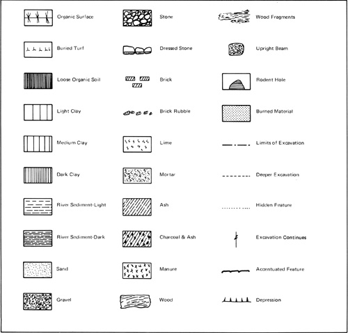

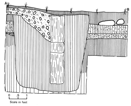


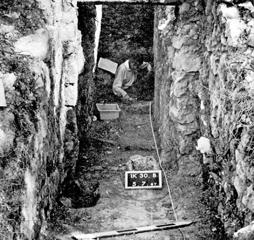
|
||||||||