|
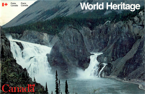
Canada's World Heritage Sites
Globally, UNESCO's World Heritage Sites include places such as the Egyptian
Pyramids, Australia's Great Barrier Reef and the Great Wall of China. There are
18 World Heritage sites located in Canada, Parks Canada is responsible, in whole
or in part, for the conservation and protection of 12 of those sites. There are
another six sites on Canada's Tentative List of World Heritage Sites. On
behalf of Canada, Parks Canada is responsible for the implementation of the
World Heritage Convention in Canada.
More information on World Heritage Sites can be found in the
following brochures.
1983 |
2005 |
All text and photos are copyrighted by Parks Canada and were
extracted from Parks Canada's World
Heritage Sites Website, or from several Backgrounders (dated
08-Aug-2016). Sites with a grey background are managed by Parks Canada.
©Parks Canada Agency / Agence Parcs Canada |
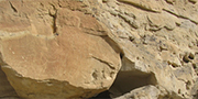
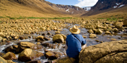
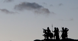
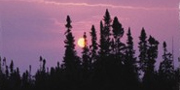
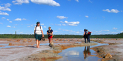
Áísínai'pi National Historic Site
Writing-On-Stone Provincial Park
Alberta
Tentative World Heritage List
Lying within the traditional territory of the Niitsítapi (Blackfoot:
Kainai, Piikáni and Siksika), Áísínai'pi ("it is
pictured/written") is a sacred place where geological formations house spirit
beings, and more than 50 rock art sites record the "writings" of the spirits.
Writing-On-Stone Provincial Park (Áísínai'pi) in the Milk
River Valley is a spectacular pocket in the mixed grass prairie landscape
sweeping through south-central Alberta to the powerful Kátoyissiksi
(Sweetgrass Hills, Montana, USA). Defined by the valley's eroded ancient
sandstone cliffs, it is characterized by dramatic views, eerie light and sounds,
hoodoo formations, adjacent coulees and prairie habitats rich in mammal, bird
and plant species. For at least 4 000 years, Aboriginal people have stopped here
in the course of their seasonal round. The petroglyph and pictograph sites on
the valley walls include several thousand motifs in hundreds of scenes,
predominantly anthropomorphs, zoomorphs and material object motifs. Ceremonial
and ritual figures, exploits of hunters and warriors, and diverse animals are
depicted among the images. New motifs created after European contact in the
early 18th century include guns, horses and dynamic human figures, the
instruments of Aboriginal-White contact and cultural change. Burial places,
vision quest locations and a medicine wheel on the rim of the valley also mark
the spirituality of the landscape. Traditional knowledge describes the origins
and history. A reconstructed Royal Canadian Mounted Police post sits on the site
of the original post.
Note: These criteria were identified during the Tentative List process; the
criteria used might change as the nomination is developed.
|
©Parks Canada Agency / Agence Parcs Canada |
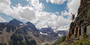
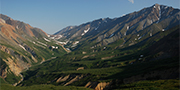
Canadian Rocky Mountain Parks
Alberta and British Columbia
First inscribed on the World Heritage List in 1984 and expanded in 1990
Renowned for their scenic splendor, the Canadian Rocky Mountain Parks are
comprised of Banff, Jasper, Kootenay and Yoho national parks and Mount Robson,
Mount Assiniboine and Hamber provincial parks in British Columbia. Classic
illustrations of glacial geological processes — including mountain peaks,
icefields, remnant valley glaciers, lakes, waterfalls, canyons and limestone
caves — are found throughout the area. The Burgess Shale Cambrian and
nearby Precambrian sites are renowned worldwide for their remains of soft-bodied
marine animals.
Some of the best-known mountain scenery on Earth is concentrated in a
set of seven parks in the Canadian Rocky Mountains. Indeed, in much of
the world, mention of Canada evokes images of snow-capped peaks and
chateauesque hotels in parks named Banff or Jasper. More than nine
million people annually visit the seven preserves along the
Alberta-British Columbia border.
There are four national parks in the ensemble — Banff, Jasper, Yoho and
Kootenay. They account for most of the World Heritage property's 23,600
square kilometres. Adjoining them are three British Columbia provincial
parks — Mount Robson, Mount Assiniboine and Hamber. Banff, built around
the Cave and Basin Hot Springs found by CPR workers building the
transcontinental railway in the early 1880s, became Canada's first park
preserve in 1885, and the birthplace of Canada's national park system.
In the following half-century, the park was expanded to encompass a
wealth of natural wonders: jagged peaks and conifer-clad slopes,
silt-laden glacial streams and turquoise lakes, the vast Columbia
Icefield and the complex Castleguard Caves. The Burgess Shale, in Yoho,
contains one of the world's most significant finds of soft-bodied,
Middle Cambrian-age marine fossils, with about 150 species, including
some bearing no resemblance to known animals.
|

©Parks Canada Agency / Agence Parcs Canada |
Dinosaur Provincial Park
Alberta
Inscribed on the World Heritage List in 1979 and expanded in 1992
Dinosaur Provincial Park in the heart of Alberta's Badlands contains some of
the most important fossil specimens discovered from the "Age of Dinosaurs." The
site is unmatched in terms of the number and variety of high quality dinosaur
specimens, which date back 75-77 million years.
Seventy-five million years ago, what is now eastern Alberta was a
low-lying coastal plain at the edge of a large shallow sea. The climate
was subtropical, similar to northern Florida today. Countless creatures
flourished there — fish, amphibians, reptiles, birds, primitive mammals
and about 35 species of dinosaur. When some of these animals died, they
lay in river channels and mud flats so their bones were buried in new
layers of sand and mud. Over time, a combination of pressure, lack of
oxygen and deposition of minerals produced fossils — impressions of the
bones, teeth and skin of those creatures that once roamed ancient
Alberta. Over more time, new layers of sediments covered the fossils and
preserved them.
And so it was until the end of the latest Ice Age, 13,000 years ago, a
mere wink in geological time, when glacial ice scraped off the upper
layers of rock. Huge volumes of meltwater carved deep into the soft
sandstone and mudstone strata, exposing the fossil-bearing sediments
and, in the process, creating the Red Deer River Valley. Its haunting
hoodoos, isolated mesas and low-lying coulees are at the heart of
Alberta's badlands and contain the greatest concentration of Late
Cretaceous dinosaur fossils yet found on Earth.
More than 300 first-quality dinosaur skeletons have been pulled from a
27-kilometre stretch along the Red Deer River since digging began there
in the 1880s. And dozens of these now grace museum space in 30 cities
around the world. Since 1985 the largest collection of treasures from
the park has been housed in the Royal Tyrrell Museum of Palaeontology,
in Drumheller, a two-hour drive northwest of the park.
|
©Parks Canada Agency / Agence Parcs Canada |
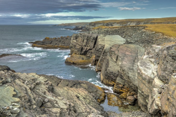
Gros Morne National Park
Newfoundland and Labrador
Inscribed on the World Heritage List in 1987
The magnificent Gros Morne National Park, on the west coast of the island of
Newfoundland, is a rare example of the process of continental drift, where deep
ocean crust and the rocks of the earth's mantle lie exposed. Gros Morne National
Park presents the complete portrayal of the geological events that took place
when the ancient continental margin of North America was modified by tectonic
plate movement, as a large portion of oceanic crust and ocean floor sediments
was relocated above sea level. The spellbinding scenery of Gros Morne National
Park, complete with coastal lowland, alpine plateau, fjords, glacial valleys,
sheer cliffs, waterfalls and many pristine lakes produces a landscape of high
scenic value.
The scenery at Gros Morne ranks among the most spectacular in Eastern
Canada: sharp ridges and huge cliffs, coastal bogs and highland tundra,
dramatic ocean inlets and lakes. And yet it is not primarily this
exceptional natural beauty that has earned the park a spot on the World
Heritage List, but rather its remarkable geology.
The park is considered a textbook illustration of plate tectonics, the
theory that suggests continent-sized plates of the Earth's crust have
collided and separated repeatedly over geological time, opening and
closing oceans between them.
Six hundred million years ago, Europe and North America were joined but
were starting to pull apart. Magma from the lower crust welled up and
filled the gap between them — the solidified magma is now visible in the
cliffs of Gros Morne's Western Brook Pond. From 570 to 420 million years
ago, there was an ocean between the two continents called the Iapetus
Sea. Sedimentary strata in the park preserve fossils of almost every
phylum known to exist during that time — a virtual catalogue of
evolution. By 460 million years ago, North America and Europe were
pressing together, raising the Appalachian Mountains and closing the
Iapetus Sea. Some blocks of oceanic crust and mantle were transported
west and raised to the surface of the earth. Eons later, glacial ice
scoured the area, creating fiords and cutting transects of the mountains
that reveal their geological past.
|
©Parks Canada Agency / Agence Parcs Canada |
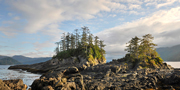
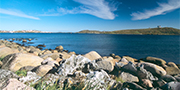
Gwaii Haanas National Park Reserve
British Columbia
Tentative World Heritage List
The Gwaii Haanas National Park Reserve and Haida Heritage Site covers
about 15 percent of the Queen Charlotte Islands, an archipelago 80 km
off the northwest coast of mainland British Columbia that separates
Hecate Strait from the Pacific Ocean. The size of the terrestrial area,
which consists of 138 islands, is 1,495 km², with a surrounding marine
conservation area (proposed) of 3,400 km². The park reserve includes
SGang Gwaay World Heritage Site, a 3 km² island inscribed in
1981. Two other remarkable former Haida villages, Tanu and Skedans, are
located within the park reserve. As well, more than 600 archaeological
features in the park reserve give.evidence of Haida occupation and
activities in the region. Traditional narratives, songs, places names
and language relate the park reserve area intimately to Haida history
and way of life. The rich and living culture of the Haida people
permeates the area. The natural resources of the area, with their
abundance of essential ingredients for sustenance and growth, are an
integral part of Haida traditional culture, and life with the land and
sea. Natural features of Gwaii Haanas range from the highly dissected
San Christoval Mountains, which form the backbone of the area, to
fiords, 40 freshwater lakes, old-growth temperate rainforests and a rich
diversity and abundance of wildlife. The proposed marine conservation
area lies along one section of the Queen Charlotte tectonic plate, and
includes highly diverse living intertidal and sub-tidal marine
communities. It is also strategically located along the Pacific flyway,
hosting huge seabird breeding colonies as well as being an important
migrant stopover. Marine mammals are also abundant, including sea lions,
porpoises, killer whales and migrating grey whales.
Note: These criteria were identified during the Tentative List process; the
criteria used might change as the nomination is developed.
|
©Parks Canada Agency / Agence Parcs Canada |
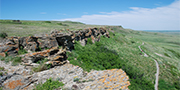
Head-Smashed-In Buffalo Jump
Alberta
Inscribed on the World Heritage List in 1981
The significance of Head-Smashed-In Buffalo Jump lies in its cultural,
archaeological, and scientific attributes. Using their excellent knowledge of
bison behaviour for millennia, the Blackfoot killed their prey by chasing them
over a precipice. Carcasses were later carved up in the camp below. The remains
of marked trails and of an Indigenous camp can still be found. Huge burial
mounds containing deep layers of bison bones below the cliff represent nearly
6000 years of use of the buffalo jump by Indigenous people of the Northern
Plains. This site throws valuable light on the way of life and practices of
traditional hunting cultures worldwide.
For thousands of years, the bison provided the Aboriginal peoples of
North America's Great Plains with many of life's requirements - meat for
food, hides for clothing and shelter, sinew, bone and horn for tools,
and dung for fires. The principal means of killing large numbers of
bison was the buffalo jump, where herds were stampeded over cliffs and
butchered at the bottom. Buffalo jumps were common on the northern
Plains. But the biggest, oldest and best-preserved buffalo jump in North
America is the Head-Smashed-In (or estipah-skikikini-kots in Blackfoot)
Buffalo Jump in the Porcupine Hills of southwestern Alberta.
Countless thousands of bison were herded over the edge of the 10- to
18-metre-high cliffs, beginning perhaps 5,700 years ago and continuing
until the middle of the 19th century. At the base of the cliff today are
skeletal remains, in some places 11 metres deep. Close by is the site of
the butchering camp, a kilometre-wide expanse pocked with the remnants
of meat caches and cooking pits, and itself underlain with up to a metre
of butchered bison bones. The area on top of the cliff was (and still
is) a wide reach of prime grazing range. A system of more than 500 stone
cairns, at which people built fires or waved blankets, begins 10
kilometres west of the cliff. The cairns helped direct the bison into
drive lanes approaching the precipice.
|
©Parks Canada Agency / Agence Parcs Canada |
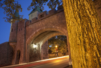
Historic District of Old Québec
Québec
Inscribed on the World Heritage List in 1985
Founded in the 17th century, the city of Québec illustrates one
of the major stages in the European settlement of the Americas. It was
the capital of New France and, after 1760, of the new British
colony.
The Historic District of Old Québec is made up of two parts: the
Upper Town, defended by a fortified citadel and ramparts, together with
numerous bastions, gates and other defensive works; and the Lower Town,
which developed around the Place Royale and the harbour. A
well-preserved integrated urban ensemble, the historic district is a
remarkable example of a fortified city of the colonial era, and unique
north of Mexico.
Close to half the buildings in the Historic District of Old Québec were
built before 1850. Although the city itself has grown into a modern
metropolis of some 600,000 people, the historic district, covering 135
hectares (about five percent of the city total) remains among the most
coherent such areas in North America. Moreover, Québec is unique among
cities on the continent in having retained almost all its
fortifications, and la vieille capitale may claim for itself the honour
of being the only walled city in North America.
Champlain built his original habitation on the shore of the St. Lawrence
River, near the site of the former Iroquois village of Stadacona, at the
foot of a great promontory called Cap Diamant. Settlement grew first
along the river, and later, following the lead of military and religious
institutions, on the promontory itself. The river bank, or Lower Town,
remained residential and commercial, and Upper Town became the seat of
administration and religion.
In the 1820s, when Québec was Canada's leading seaport, the British army
built a substantial citadel atop Cap Diamant and improved the wall
around Upper Town. In the 1870s, Governor General Lord Dufferin, in an
early example of urban heritage conservation, persuaded the city not to
demolish the fortifications, by then strategically useless, thus
defining the historic character — and tourist potential — of Old
Québec.
|
©Parks Canada Agency / Agence Parcs Canada |
Ivvavik National Park
Vuntut National Park
Herschel Island (Qikiqtaruk) Territorial Park
Yukon
Tentative World Heritage List
Together, Ivvavik National Park of Canada, Vuntut National Park of Canada, and
Herschel Island (Qikiqtaruk) Territorial Park comprise 15 500 km2 of wilderness
on the Yukon coastal plain, Richardson Mountains, a portion of the Old Crow
Flats wetlands and an arctic island in the Beaufort Sea. Together, these parks
comprise a land rich in wildlife, in variety of landscape and in vegetation.
This area was not glaciated, and forms part of the Beringia corridor as
evidenced in its rich assemblage of archeological and palaeontological deposits.
Major rivers flow through the coastal plain, cutting spectacular canyons on
their way to the Beaufort Sea. Part of the area, the Old Crow Flats, is a Ramsar
site internationally recognized for breeding and migratory water howl. Three
species of bear are found in parts of the area, along with a host of other
wildlife, including Dall sheep and moose. The area supports close to 10 percent
of the world's caribou population, with the Porcupine Herd numbering close to
123 000 animals. A portion of the calving grounds for the herd is located in
Ivvavik National Park of Canada. This is the land of the Inuvialuit and Vuntut
Gwitchin, who have hunted, fished and traded in the region for thousands of
years. The cultural landscape's rich and complex human history is expressed
through archaeological evidence and oral history. A key area to the peopling of
North America, it illustrates successive occupations over thousands of years of
adaptation to evolving climatic episodes. During preparation of nomination
documentation, careful consideration will be given to final proposed boundaries
to include all of parts of nearby protected areas, for example Fishing Branch
Ni'iinlii'njik Territorial Park (7 000 km2), which is located south of Vuntut
National Park of Canada.
Note: These criteria were identified during the Tentative List process; the
criteria used might change as the nomination is developed.
|
©Parks Canada Agency / Agence Parcs Canada |
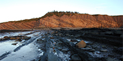
Joggins Fossil Cliffs
Nova Scotia
Inscribed on the World Heritage List in 2008
The Joggins Fossil Cliffs on Nova Scotia's Bay of Fundy are the world
reference site for fossils of the Pennsylvanian (or Carboniferous) period. Their
complete and accessible fossil-bearing rock exposures tell the stories of some
of the earliest animals on earth. The origin of amniotes, the first vertebrates
to achieve the capacity to reproduce on land, can be found at Joggins.
Approximately 300 million years ago, what is now the eastern shore of
Chignecto Bay, on the northern arm of the Bay of Fundy, was a tropical
wetland forest located near the equator. Known as the "Coal Age
Galapagos," the Joggins Fossil Cliffs provide an outstanding example of
the evolution of life on Earth in the Pennsylvanian Period (the "Coal
Age").
The Joggins Fossil Cliffs reveal the most complete record in the world
of terrestrial life in the Pennsylvanian "Coal Age" of Earth history.
The site includes the world's most important fossil record of the two
iconic elements of the "Coal Age": terrestrial tetrapods, including the
first reptiles and amniotes; and the "coal swamp" forests in which they
lived. The origin of amniotes, the first vertebrates to achieve the
capacity to reproduce on land, was one of the most significant events in
the history of life on Earth, and this evolutionary milestone is first
recorded with certainty in the fossils at Joggins. The cliffs,
continually exposed by the world's highest tides, and the approximately
200 fossilized species of animals and plants found there have long been
and continue to be a cornerstone in the development of our understanding
of the evolution of life and Earth's history.
Rich coal deposits drew miners to Joggins from the 17th century on. The
Joggins site has been studied by geologists for well over 150 years and
discoveries made here have helped shape our understanding of evolution
and geology. Sir Charles Lyell, known as the father of modern geology,
explored the cliffs at Joggins in 1842 and 1852 with Nova Scotia-born
Sir William Dawson, later principal of McGill University. Through them,
Joggins found its way into Darwin's Origin of Species. Abraham Gesner,
also Nova Scotia-born, the inventor of coal oil (or kerosene), and Sir
William Logan, who established the Geological Survey of Canada,
scrutinized the Joggins cliffs as well.
Today the Joggins Fossil Centre, with interpretation of the finest
collection of carboniferous fossil specimens in the world and how they
shaped our ideas of Earth history and evolution, occupies the site of
the old Joggins No. 7 Mine. The cliffs of Joggins are accessible to the
public and guided tours of the site are provided.
|
©Parks Canada Agency / Agence Parcs Canada |
Kluane National Park
Wrangell-St. Elias National Park (U.S.)
Glacier Bay National Park (U.S.)
Tatshenshini-Alsek Provincial Park
Yukon, British Columbia and Alaska
First inscribed on the World Heritage List in 1979, then expanded in 1992 and 1994
The Kluane/Wrangell-St. Elias/Glacier Bay/Tatshenshini-Alsek national and
provincial parks along the boundary of Canada and the United States of America
contain the largest non-polar icefield in the world and examples of some of the
world's longest and most spectacular glaciers.
Characterized by high mountains, icefields and glaciers, the area has a high
biodiversity with plant and animal communities ranging from marine, coastal
forest, montane, sub-alpine and alpine tundra, all in various successional
stages. The Tatshenshini and Alsek river valleys allow ice-free linkages from
coast to interior for plant and animal migration. The parks demonstrate some of
the best examples of glaciation and modification of landscape by glacial action
in a region still tectonically active, spectacularly beautiful, and where
natural processes prevail.
An empire of mountains and ice. Here, in a vast international preserve,
are most of the tallest peaks in North America and the largest icefields
outside the polar caps. Half the land mass is permanently draped in snow
and ice — the other half fosters forests and tundra and stable
populations of eagles, grizzlies and other species often at risk
elsewhere.
Kluane National Park and Reserve in the Yukon and British Columbia's
Tatshenshini-Alsek Park (which is managed in co-operation with the
Champagne and Aishihik First Nations) are the Canadian components of a
vast, unbroken ecological unit that covers 97,000 square kilometres and
is untouched but for a historic Aboriginal presence. Wrangell-St. Elias
National Park and Glacier Bay National Park, both in Alaska, complete
the first bi-national entry on the World Heritage List.
The St. Elias Mountains extend over most of the preserve area, hosting
the largest group of great peaks on the continent, including massive
5,959-metre Mount Logan, the highest mountain in Canada. Moist air blown
in from the Pacific Ocean makes for tremendous snows in the area,
creating a massive icefield and producing hundreds of glaciers; among
them some of the world's largest and fastest-moving. Three dozen major
rivers drain the region. Carrying immense loads of silt and rock, they
are continually reshaping the landscape.
Vegetation ranges from coastal and valley forests to alpine tundra,
nurturing, among other fauna, the largest concentration of Dall sheep in
the world.
|
©Parks Canada Agency / Agence Parcs Canada |
Landscape of Grand Pré
Nova Scotia
Inscribed on the World Heritage List in 2012
The Landscape of Grand Pré is a dynamic agricultural landscape
bordering on the Bay of Fundy, home of the world's highest tides. The
area's cultural landscape bears testimony to the inventive use of dykes
and aboiteaux to develop farmland, and to its community-based
management system, established by the Acadians and later used by the
Planters and their modern-day successors. Inhabited for thousands of
years by the Mi'kmaq, the area is a symbolic landscape for Acadians,
reflecting their 17th and 18th century history and their deportation.
Grand-Pré National Historic Site, owned and managed by Parks
Canada, is a key component of the World Heritage Site and encompasses
slightly under two percent of the Landscape of Grand Pré. It was
an important Acadian settlement from 1682 to 1755, and today is a place
where the stories of the Deportation of the Acadians and their
accomplishments are told, and to which Acadians continue to have a
strong attachment.
The Landscape of Grand Pré tells a remarkable story about human
interaction with the environment and about how the connection between
people and place can define a collective identity.
Situated on Nova Scotia's southern Minas Basin, an inlet of the Bay
Fundy, the Landscape of Grand Pré is subjected to the most extreme tides
in the world; the tidal range averages 11.6 metres. It was under these
conditions three centuries ago that French (Acadian) settlers set about
transforming the harsh coastal environment of salt marsh into fertile
farmland. The agricultural landscape they claimed from the sea is
considered an exceptional example of adaptation by European settlers to
the conditions of the North American Atlantic coast.
Starting in the late 17th century — an era which predates the
introduction of engineered drainage systems — the Acadian settlers
applied an inventive and ingenious system of earthen dykes, ditches and
aboiteaux, or wooden sluices, to hold back the formidable tides. They
also began a tradition of collective management that was
community-based. Today, the agricultural landscape is still protected
and drained by the same system, still exhibits distinctive field
patterns, and is still managed through the same community approach.
Enduring as one of the most intact agricultural polders in the world, it
is a testimony to the original Acadian settlers as well as to the New
England Planters and the present day farmers who subsequently further
developed and maintained the system.
As an important Acadian settlement from 1682 to 1755, Grand Pré is not
only directly associated with the emergence of their new identity in
their new land, but also with their tragic, forced removal from it. The
Deportation of Acadians, known as the Grand Dérangement, started in
1755. As their single most important lieu de mémoire, the Landscape of
Grand Pré is an evocative example of a homeland symbolically and
peacefully reclaimed by a diaspora that has triumphed over hardships.
Here, Acadians celebrate their common heritage and reaffirm their
collective identity. They are proud to share the site with the world as
a symbol of perseverance and hope.
|
©Parks Canada Agency / Agence Parcs Canada |
L'Anse aux Meadows National Historic Site
Newfoundland and Labrador
Inscribed on the World Heritage List in 1978
This archaeological site at the northern tip of Newfoundland contains the
excavated remains of an 11th-century Viking settlement consisting of
timber-framed peat-turf buildings (houses, workshops, etc.). These are similar
to those found in Norse Greenland and Iceland at the same period. The site is
thus unique evidence of the earliest known European presence on the American
continent. Some buildings have been reconstructed and interpreters recount tales
from the past.
The remains of the 1,000-year-old Viking colony at L'Anse aux Meadows
mark the site of the First known European settlement in North America.
It was here that the Vikings built three timber-and-sod longhouses and
five smaller buildings — and here that the first iron working in the New
World began.
Sailors aboard an Icelandic trading ship blown off course en route to
Greenland around 985 were the first to report new lands to the west.
Fifteen years later, Leif Eiriksson wintered at a settlement called
Straumfiord - also known as Leif's Camp - on a grassy terrace near
present L'Anse aux Meadows. In the years following, members of his
family and a group of colonists visited the camp and ventured possibly
as far southwest as New Brunswick. But conflict with Aboriginal people
apparently obliged them to withdraw from the area and they returned to
Greenland within a decade.
In 1960, the Norwegian team of Helge Ingstad and Anne Stine Ingstad,
following Viking sagas recorded in medieval Icelandic manuscripts,
located the ruins of Straumfiord. Excavation by the Ingstads and, later,
by Parks Canada, unearthed the remains of eight buildings and hundreds
of Viking artefacts, mostly of wood but also of iron, stone, bronze and
bone. Norse contacts with the New World continued sporadically until at
least the mid-14th century, and knowledge of the new lands likely
remained among European sailors, facilitating the reopening of the
Atlantic sea lanes in the 1490s.
|

©Parks Canada Agency / Agence Parcs Canada |
Miguasha National Park
Québec
Inscribed on the World Heritage List in 1999
The palaeontological site of Miguasha National Park, on the southern coast of
the Gaspé Peninsula in the province of Quebec, is considered to be the
world's most outstanding illustration of the Devonian Period known as the "Age
of Fishes." Dating from 370 million years ago, the Miguasha formation contains
five of the six fossil fish groups associated with this period. Its significance
stems from the presence of the highest number and best-preserved fossil
specimens of the lobe-finned fishes that gave rise to the first four-legged,
air-breathing terrestrial vertebrates. For more than a century, the flora and
fauna fossils of Miguasha have been recognized as unique and numerous scientists
and collectors from Europe and America have visited the site.
Some 370 million years ago, what is today the austere coast of the Gaspé
Peninsula was a tropical estuary. The craggy peaks of the Appalachians
lined the horizon. Primitive trees, scorpions and spiders covered the
land. In the warm tidal waters, an astonishing variety of fish thrived.
Some were spiny, some armour-plated. Others had lungs and pairs of
lobe-like fins that enabled them to crawl across mud flats- and enact
one of the major steps in evolution, when fish evolved into four-limbed
animals.
We know this today because a two-million-year snapshot of life at the
time is preserved in the remarkably rich fossil beds of the Escuminac
Formation, which is exposed in a seaside cliff at Miguasha, on the south
shore of the Gaspé facing Baie des Chaleurs. There are some 60 such
Devonian period fossil sites around the world. But none matches Miguasha
in abundance of specimens, quality of fossil preservation and
representation of evolutionary events for vertebrates. It is the only
Devonian site on the World Heritage List.
There is sufficient biodiversity at Miguasha — scores of species of
vertebrates, invertebrates, plants, algae and micro-organisms — for
scientists to have constructed an almost complete picture of Devonian
life. But it is the 21 species of fish fossils that made Miguasha
famous, none more so than Eusthenopteron foordi, the "Prince of
Miguasha," whose limb-like fins and two-way gills-and-lungs respiratory
system gave rise to the modern conception of evolution from fish to
four-limbed, land-dwelling vertebrates, or tetrapods.
The Miguasha fossil beds were discovered in 1842. Starting in the 1880s,
thousands of fossil specimens were collected and shipped to museums and
universities around the world, helping to confirm the site's scientific
importance.
|
©Parks Canada Agency / Agence Parcs Canada |
Mistaken Point
Newfoundland and Labrador
Inscribed on the World Heritage List in 2016
Mistaken Point is an Ediacaran fossil site located on the southern tip of
Newfoundland's Avalon Peninsula. The fossils found at Mistaken Point date to the
Middle Ediacaran Period (580 to 560 million years ago) and represent the first
appearance in the fossil record of large, complex, multicellular, animal-like
organisms — i.e. "when life got big" — a pivotal event in the
evolution of life on Earth.
Mistaken Point is a globally significant fossil site on the southeastern
tip of the island of Newfoundland. The World Heritage site is almost
entirely located within Mistaken Point Ecological Reserve, where more
than 10,000 fossil impressions, ranging from a few centimetres to nearly
2 metres in length, are readily accessible for scientific study and
supervised viewing by visitors to the scenic, rugged Atlantic coastline.
The fossils at Mistaken Point illustrate a critical time in the history
of life: the first appearance of large, biologically complex organisms,
including the first ancestral animals. These soft-bodied creatures lived
during the middle Ediacaran Period (580 to 560 million years ago) and
inhabited the deep sea floor of an ancient ocean where they were buried
and preserved in exceptional detail by influxes of volcanic ash. The
animals died where they lived, and after being hidden for hundreds of
millions of years, were gradually exposed by the forces of modern
erosion revealing more than 100 fossil sea-floor surfaces, ranging from
small beds with single fossils to tennis-court-sized surfaces adorned
with up to 4,500 megafossils.
The exquisitely preserved fossils at Mistaken Point make up the most
abundant and diverse assemblage of large Ediacaran fossils of deep
marine origin known anywhere in the world and provide a detailed
chronology for 20 million years in the early evolution of complex
life.
|
©Parks Canada Agency / Agence Parcs Canada |
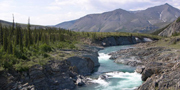
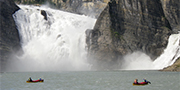
Nahanni National Park Reserve
Northwest Territories
Inscribed on the World Heritage List in 1978
Nahanni National Park Reserve is an undisturbed natural area of deep river
canyons cutting through mountain ranges, with huge waterfalls, hotsprings and
complex cave systems. Within the park are examples of almost every distinct
category of river or stream that is known, along with one of North America's
largest waterfalls, Virginia Falls, which is twice the height of Niagara
Falls.
The Flat and South Nahanni rivers are older than the mountains they dissect
and have produced the finest examples of river canyons in the world with their
spectacular granitic peaks. Animals of the boreal forest, including wolves,
grizzly bears and caribou, live throughout the park.
Prospectors started searching the South Nahanni River in the Northwest
Territories for gold a century ago. They found little. But they did
encounter vast reaches of the most varied and spectacular environment
imaginable - towering mountains and tundra plains, wetlands and sand
dunes, badlands and luxuriant forests, grizzly bears and trumpeter
swans. There are steaming hot springs and complexes of caves, some lined
with ice crystals, others with colourful stalagmites and stalactites.
And everywhere rivulets and streams and rushing rivers, all feeding the
restless, prodigious South Nahanni, alive with frenzied rapids and
whirlpools, with meanders and braids, crashing over the cataract of
Virginia Falls, twice the height of Niagara Falls, cutting for
kilometres through canyons 1,000 metres deep, then bending through a
tortuous constriction called Hell's Gate.
Today, remarkably, nothing has changed. The South Nahanni still swirls
and crashes, the hot springs steam, the grizzlies prowl. This is a
wilderness largely unmodified by humans. Indeed, running water remains
the major agent of change. Rivers cut canyons through the Mackenzie
Mountains and spread alluvial fans. And since the region escaped
glaciation during the last Ice Age, canyon walls remain sharp and deep,
neither widened nor smoothed by grinding ice.
|
©Parks Canada Agency / Agence Parcs Canada |
Old Town Lunenburg
Nova Scotia
Inscribed on the World Heritage List in 1995
Old Town Lunenburg is the best surviving example of a planned British
colonial settlement in North America. Established in 1753, it has retained its
original layout and overall appearance, based on a rectangular grid pattern
drawn up in the home country. The inhabitants have safeguarded the town's
identity throughout the centuries by preserving many of its houses and public
buildings, some of which date from the 18th century. Their spirit is captured in
the wooden architecture, built in a distinctive tradition that evokes the town's
European roots and shipbuilding heritage.
Old Town Lunenburg, where all streets are straight and all corners
square, is the best surviving example of a British colonial policy of
creating new settlements by imposing a pre-designed "model town" plan on
whatever tract of wilderness it was the King's pleasure to colonize. At
least 21 North American settlements, from Cornwall and
Niagara-on-the-Lake in Ontario to Savannah, Georgia, and Philadelphia,
Pennsylvania, benefited from this policy. But none has survived in such
pristine condition as the town of Lunenburg on the south coast Nova
Scotia.
The settlement was created in June 1753 as a home for 1,453 mostly
German-speaking Protestant German, Swiss and Montbéliardian French
colonists. The townsite, true to then-current convention, consisted of
seven north-south streets, 48 feet wide (with the exception of King
Street, which is 80 feet), intersected at right angles by nine east-west
streets, each 40 feet wide, creating blocks that were further divided
into 14 lots of 40 by 60 feet each. Each family received one town lot.
The London-based Board of Trade and Plantations developed the plans
without regard to local topography, which is why Lunenburg's streets are
never less than straight but sometimes dizzyingly steep.
There are some 400 major buildings within the old town, 70 percent of
them from the 18th and 19th centuries, almost all of them wood, and many
colourfully painted.
|
©Parks Canada Agency / Agence Parcs Canada |
Pimachiowin Aki
Manitoba and Ontario
Tentative World Heritage List
Formerly known as: Atikaki/Woodland Caribou/Accord First Nations
First Nations in Manitoba and Ontario with the support of both provincial
governments have proposed creating an internationally recognized network of
protected areas and managed landscapes on their ancestral lands and to seek
UNESCO designation of the area as a World Heritage Site. Set in the boreal
shield, the project is known as Pimachiowin Aki. Encompassing 33,400 km² of
boreal forest, the area includes First Nations' traditional lands and contiguous
protected areas on both sides of the provincial border. The majority of the area
is comprised of the First Nations' traditional lands. The parklands include
Atikaki Park in Manitoba and Woodland Caribou Provincial Park and the Eagle —
Snowshoe Conservation Reserve in Ontario. These parks and protected lands
represent an area of natural and wilderness values covering over 8,500 km². The
First Nations' traditional lands and provincially designated lands together form
part of the continuous coniferous boreal forest that extends across northern
Canada.
The forest is dominated by stands of black spruce and jack pine, with a shrub
layer of ericaceous shrubs, mosses and lichens. Secondary tree species include
aspen, white birch, white spruce and balsam fir, with some species from the
prairies and the eastern deciduous regions. Four major rivers carve through the
area, with associated cliffs, waterfalls and rapids. One of these rivers, the
Bloodvein, has been recognized and designated as a Canadian Heritage River. Also
found are typical landforms of the shield region, including glacial striae, till
deposits and evidence of glacial Lake Aggasiz. The area provides an essential
habitat for a segment of the threatened woodland caribou, and also protects
habitat for the chestnut lamprey, a species of special concern. Other wildlife
representative of the region includes black bears, wolves, lynx and owls, as
well as lake trout, pike and walleye. Numerous archeological sites exist,
helping to demonstrate that the area has long been of special significance to
First Nations. The site was one of several protected areas in the circumpolar
region recommended at the October 2003 Boreal forest workshop held in Russia for
consideration as possible World Heritage nominations. This project area is
considered part of the Midwestern Canadian Shield ecoregion, which is in turn
part of the Canadian Taiga Biogeographical Province (Udvardy
classification).
Note: These criteria were identified during the Tentative List process; the
criteria used might change as the nomination is developed.
|

©Parks Canada Agency / Agence Parcs Canada |
Quttinirpaaq National Park
Nunavut
Tentative World Heritage List
Encompassing the northernmost lands in Canada, only 720 km from the North Pole,
Quttinirpaaq National Park of Canada (37,775 km²) covers the northern portion of
Ellesmere Island. The park consists of sedimentary mountains, ice caps,
glaciers, ice shelves and fiords. The park borders on the Arctic Ocean and rises
to Mount Barbeau (a nunatak), at 2,616 m the highest mountain in eastern North
America. Much of the park, including the Hazen Plateau, is a polar desert
receiving less than 2.5 cm of annual precipitation. Some areas of highly
productive sedge grasslands occur, which support a range of Arctic wildlife
including muskox, arctic hare, wolves and the endangered Peary caribou. Lake
Hazen is one of the largest freshwater lakes in the circumpolar region, and has
attracted great scientific interest as a thermal oasis in a polar desert. Unique
physical features are the ancient deposits of 80 m-thick freshwater ice shelves
that extend several kilometres out over the Arctic Ocean. The major valleys of
the park are central to one of the routes by which early Aboriginal peoples
moved from the Canadian Arctic to Greenland. The route contains three major axes
of contact during the early Palaeo-Eskimo period (4500-3000 years ago). All
pre-contact cultural groups known to have occupied High Arctic Canada, including
Independence I (4500-3000 years ago) and Independence II (ca. 3000-2500 years
ago), Late Dorset (ca. 1300-800 years ago) and Thule (ca. 900-300 years ago),
are represented by archaeological sites in the park. The park has one of the
highest concentrations of pre-contact sites surveyed in the High Arctic,
including sites associated with the earliest documented human inhabitants of
this remote region.
Note: These criteria were identified during the Tentative List process; the
criteria used might change as the nomination is developed.
|
©Parks Canada Agency / Agence Parcs Canada |
Red Bay Basque Whaling Station
Newfoundland and Labrador
Inscribed on the World Heritage List in 2013
Red Bay is an exceptional example of the Basque whaling tradition
overseas and, at its peak in the 16th century, was the largest and most
important port in the world associated with the initial phase of
international whaling. Through its extensive archaeological remains, it
presents the most outstanding and complete evidence of the origins of
the large-scale commercial whaling industry and of the associated
traditions and techniques that developed and thrived globally for three
centuries.
The Basque Whaling Station at Red Bay is the most outstanding example of
land and sea use associated with early industrial-scale commercial
whaling and whale oil production. The archaeological resources found at
Red Bay provide unprecedented insights into the adaptation of the 16th
century Basques to the harsh terrestrial and marine environment of
Labrador as they became world leaders in the hunting of whales and the
processing of whale oil more than four centuries ago.
Every year from the 1540s to the early 1600s, as many as two thousand
Basque men and boys left their home in southern France and northern
Spain and sailed across the North Atlantic Ocean. Their lucrative
destination was some four thousand kilometres away in eastern Canada,
along Labrador's Strait of Belle Isle and Quebec's Lower North Shore.
Backed by ship owners and outfitters, the aim of their voyages was to
hunt for North Atlantic and Greenland Right whales, render the blubber
into oil on site, package it for transport, and bring it back home for
market. Whale oil was a commodity highly prized in Europe as a brighter
burning lamp oil and as a serviceable lubricant for leather products and
an additive for paints, varnishes, and soap. The story of this
industrial-scale whaling activity is thoroughly documented as an early
example of economic exploitation of rich North American natural
resources by European commercial interests.
Archaeological excavations carried out on land and underwater show that
during the peak whaling periods of the 1580s upwards of a thousand men
were working out of the whaling station at Red Bay, Labrador alone. This
port, known to the Basques as Butus or Grand Bay, would have been the
largest in the world at that time. The extensively used site contains
all of the major elements associated with Basque whaling activity
overseas; its traditions and techniques. (It is an industry the Basque
would thrive in globally for three centuries). Uncovered remains include
a network of more than a dozen shore stations which typically were
comprised of rendering ovens, where whale fat was rendered into oil in
copper cauldrons over fire pits, cooperages, workshops, temporary
dwellings, and wharves. A cemetery and lookout sites are also present.
Period artefacts and a massive assemblage of bowhead and right whale
bones complete the collections. Also discovered in the Red Bay harbour
itself, were the well-preserved remains of a number of vessels that
provide an unparalleled illustration of 16th century Iberian
shipbuilding technology, including four whaling ships (galleons) and a
number of smaller boats used in the whale hunt.
After several decades of prosperity, Basque whaling in Canada began to
decline in the final years of the 16th century. Many factors led to this
decline, among them, overhunting, discovery of new whaling grounds
elsewhere, climatic change, and changing political circumstances. The
collective body of knowledge gained from years of terrestrial and
underwater research at Red Bay has dramatically changed the
understanding of the beginning of large-scale and overseas whaling, as
well as the knowledge of the early European history of North America,
particularly the role that the Basque played in it.
|
©Parks Canada Agency / Agence Parcs Canada |
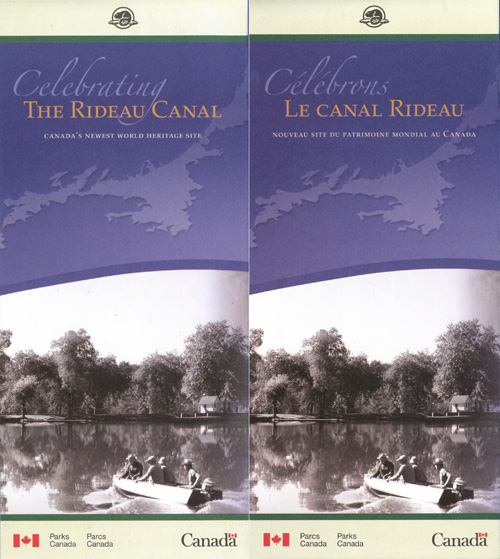
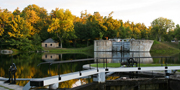
Rideau Canal
Ontario
Inscribed on the World Heritage List in 2007
The Rideau Canal is a monumental early 19th century canal covering 202 km of
the Rideau and Cataraqui rivers from Ottawa to Kingston. This large strategic
canal was constructed for military purposes at a time when Great Britain and the
United States vied for control of the region. It is the best preserved example
of a slackwater canal in North America and the only North American canal from
the early 19th century to remain operational along its original line with its
original structures intact.
The Rideau Canal is a recreational paradise, attracting visitors from
across North America and beyond to travel its 202 km length and explore
its historic engineering and military feats at 24 unique lockstations.
Consisting of a series of beautiful lakes and rivers connected by
canals, it stretches from Kingston to Ottawa, Canada's capital, and is
the oldest continuously operated canal in North America.
This engineering marvel and the fortifications built at Kingston to
protect it were constructed at a time when Great Britain and the United
States of America vied for control of the north of the American
continent. Conceived in the wake of the War of 1812, it was to be a
war-time supply route providing a secure water route for troops and
supplies from Montreal to reach the settlements of Upper Canada and the
strategic naval dockyard at Kingston. Through a stroke of brilliance,
Lt. Col. John By of the British Royal Engineers envisioned and built a
canal that would join the Cataraqui and Rideau Rivers. Thousands of
Irish immigrants, French Canadians and Scottish stonemasons were among
the labourers who helped push the canal through the rough bush, swamps
and rocky wilderness of Eastern Ontario. Opened in 1832, the Rideau
Canal was one of the greatest engineering feats of the 19th century, and
today is the best-preserved 'slackwater' canal in North America, and the
only canal from the great 19th-century canal-building era that still
operates along its original route and with most of its original
structures intact.
When the fear of war passed, the canal soon became a major artery for
regional commerce. Today, the log rafts, barges and steamers have given
way to pleasure boats and paddlers, while scenic driving, cycling and
hiking routes along the waterway provide easy access to the lockstations
by land.
|
©Parks Canada Agency / Agence Parcs Canada |
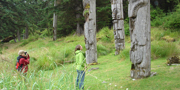
SGang Gwaay
British Columbia
Inscribed on the World Heritage List in 1981
At the 19th century village of SGang Gwaay llnagaay (Nan Sdins), remains
of large cedar longhouses together with a number of carved mortuary and memorial
poles illustrate the power and artistry of Haida society. These tell the story
of the culture of the Haida people and their relationship to the land and sea
and offer a visual key to their oral traditions. The village was occupied until
shortly after 1880.
What was once a vigorous Haida community of 300 people is today a
haunting assemblage of weathered and fragmented house frames and
mortuary and memorial poles. By the 1880s, disease had decimated the
population of Nan Sdins village on SGang Gwaay, an island at the
southern tip of the Haida Gwaii (Queen Charlotte Islands) archipelago,
and by the turn of the century only remnants of the houses and poles
remained.
Fifteen poles were moved to museums in the 1930s and 1950s. More of the
village has been taken by nature, consumed by age and the elements, and
returned to the forest. What remains is unique in the world, a
19th-century Haida village where the ruins of 10 houses and 32 memorial
or mortuary poles bespeak the power and artistry of a rich and
flamboyant society.
The Haida have always thrived on the wealth of both the sea and the
forest. Shellfish and salmon were staple foods. Giant Western red cedars
were the raw material of ocean-going canoes, vast post and plank houses,
and great poles bearing both symbols of family history and, holding
inside, the bones of ancestors. The Haida lived on SGang Gwaay for
thousands of years (as two-metre-thick refuse heaps of shells attest).
The remnants of the village represent an ongoing chapter in an epic
story of human settlement and artistry.
|

©Parks Canada Agency / Agence Parcs Canada |
Tr'ondëk Klondike
Yukon
Tentative World Heritage List
This cultural landscape in First Nations traditional territory, including the
Tr'ochëk fishing camp the Klondike gold fields and the historic district of
Dawson, illustrates life before, during and after the Klondike Gold Rush of
1896-1898, the last and most renowned of the world's great 19th century gold
rushes. First Nations story cycles and languages articulate this environment,
which reflects centuries of continuing indigenous use as well as the physical
and cultural transformations wrought by a half-century of corporate mining. At
the confluence of the Klondike and Yukon rivers, is the Tr'ochëk fishing camp,
the centre of the Tr'ondëk Hwëch'in traditional territory. Dawson sits opposite.
Its hastily constructed, false-fronted wooden buildings, with some relicts and
open spaces amid them, illustrate life during the gold rush and after. More
opulent administrative and institutional buildings speak to the one-time
prosperity of this former territorial capital. Beyond lie the Klondike gold
fields centred on Rabbit (later Bonanza) Creek, site of the 1896 discovery of
gold by James "Skookum Jim" Mason (Keish), sites of the labour-intensive
individual miner society, the gigantic Dredge No. 4, and massive tailing piles
left by corporate mechanized mining. Nearby are the relict mining camp
headquarters at Bear Creek. Small-scale mining operations continue in the gold
fields today. First Nations and newcomers continue an ongoing cultural
accommodation, including negotiated land settlement agreements.
Note: These criteria were identified during the Tentative List process; the
criteria used might change as the nomination is developed.
|

©Parks Canada Agency / Agence Parcs Canada |
Waterton-Glacier International Peace Park
Alberta and Montana
Inscribed on the World Heritage List in 1995
The world's first International Peace Park, comprised of Waterton Lakes and
Glacier national parks, is situated on the border between Canada and the United
States, where the mountains meet the prairies. This area of significant scenic
value occupies a pivotal position in the continent, resulting in unique plant
communities and spectacular landscapes found nowhere else in the world.
It was the Rotary Clubs of Alberta and Montana that proposed, in 1931,
uniting Waterton Lakes National Park in Alberta and Glacier National
Park in Montana as the Waterton-Glacier International Peace Park, the
first such park in the world. It was intended not just to promote peace
and goodwill between nations, but also to underscore the international
nature of wilderness and the co-operation required in its protection.
And certainly within the two parks, 526-square-kilometre Waterton Lakes
and 4,051-square-kilometre Glacier, nature has provided much that is
worthy of protection: high mountains and deep canyons, forest belts and
prairie grasslands, deep glacial-trough lakes and rivers that feed three
oceans. Indeed, few areas can claim as much diversity within such a
concentrated area. Not least, the abrupt rise of the Rockies from the
prairie flatlands has made the twin parks the place "where the mountains
meet the prairie."
Matching the range of ecoregions is a corresponding diversity of
wildlife — mountain goats, bighorn sheep, coyotes, grizzly bears, scores
of birds, and a celebrated "international" herd of elk that migrates
annually between summer mountain habitat in Glacier and winter prairie
ranges in Waterton.
An Aboriginal presence in the region goes back 12,000 years, and there
remain places in both parks that hold deep significance for First
Nations peoples. Indeed, the International Peace Park has grown to
become a park of three nations: Canada, the United States and the
Blackfoot Confederacy.
|
©Parks Canada Agency / Agence Parcs Canada |
Wood Buffalo National Park
Alberta and Northwest Territories
Inscribed on the World Heritage List in 1983
Wood Buffalo National Park is an outstanding example of ongoing ecological
and biological processes, encompassing some of the largest undisturbed grass and
sedge meadows left in North America. Along with huge tracts of boreal forest,
the park provides crucial habitat for concentrations of migratory wildlife of
world importance. The continued evolution of a large inland delta, salt plains
and gypsum karst are also internationally significant. In Wood Buffalo, the
world's largest herd of wood bison can be found and the predator-prey
relationship between wolves and bison has continued, unbroken, over time.
Wood Buffalo is Canada's largest national park, and the very embodiment
of the space and wilderness that symbolize Northern Canada. Its 44,807
square kilometres include huge tracts of boreal forest and plains, and
some of the largest undisturbed grass and sedge meadows left in North
America. Those meadows sustain the largest free-roaming herd of bison,
commonly known as buffalo, in the world.
Great rivers grace the park as the mighty Peace flows through the heart
of the park and the Slave and Athabasca form the eastern border. Where
the Peace and Athabasca issue into Lake Athabasca is the world's largest
inland freshwater delta. The endless streams and wetlands of the delta
accommodate countless waterfowl, including ducks, geese, swans, loons
and grebes.
The park was established in 1922, largely as a home for the remnant
population of bison that escaped the slaughter in the late 19th century
that reduced the monarch of the plains from 60 million to a relative
handful. The plains in the park are on the historic northern limit of
the bison's range, and several thousand plains bison were shipped north
to join the native wood bison herd already there. The park is also home
to the world's last remaining wild flock of endangered whooping
cranes.
|
|